Upgrade to Pro — share decks privately, control downloads, hide ads and more …

SOC 4650/5650 - Lecture-11

SOC 4650/5650 - Lecture-11

Christopher Prener

March 25, 2019
Tweet

More Decks by Christopher Prener

Other Decks in Education

Transcript

  1. AGENDA INTRO TO GISC / WEEK 11 / LECTURE 11

    1. Front Matter 2. Spatial Joins 3. Select by Location 4. Back Matter
  2. Lab-10 is due next lecture, PS-04 is due in two

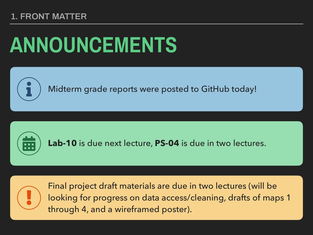
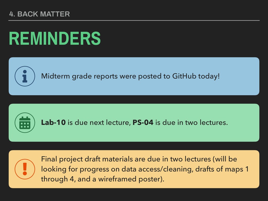
    lectures. 1. FRONT MATTER ANNOUNCEMENTS Final project draft materials are due in two lectures (will be looking for progress on data access/cleaning, drafts of maps 1 through 4, and a wireframed poster). Midterm grade reports were posted to GitHub today!
  3. KEY TERM The spatial joins 
 operation is used to

    apply 
 identifiers from a higher order polygon to data or to aggregate data to that higher order polygon.
  4. SPATIAL JOINS - IDENTIFY Target Layer ID Shape 104 Point

    105 Point 106 Point 107 Point 108 Point 109 Point 110 Point 111 Point 112 Point 113 Point 114 Point 23 ID Shape 23 Polygon Source Layer
  5. SPATIAL JOINS - IDENTIFY Target Layer ID Shape Tract 104

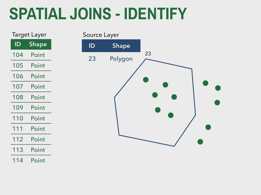
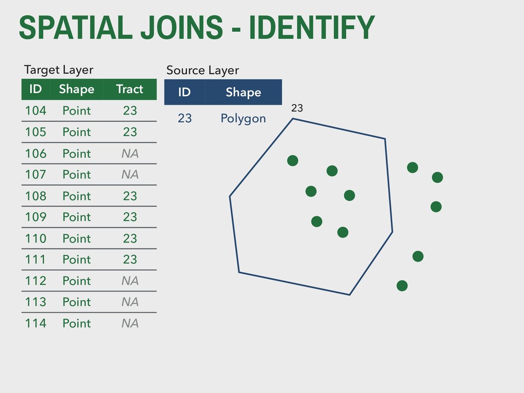
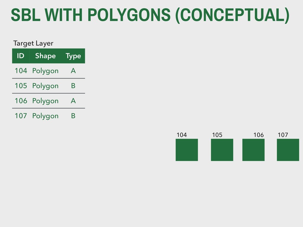
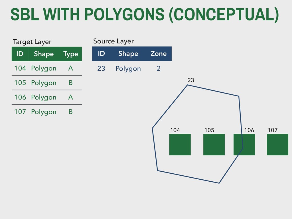
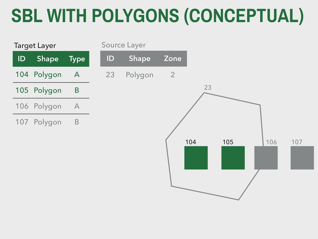
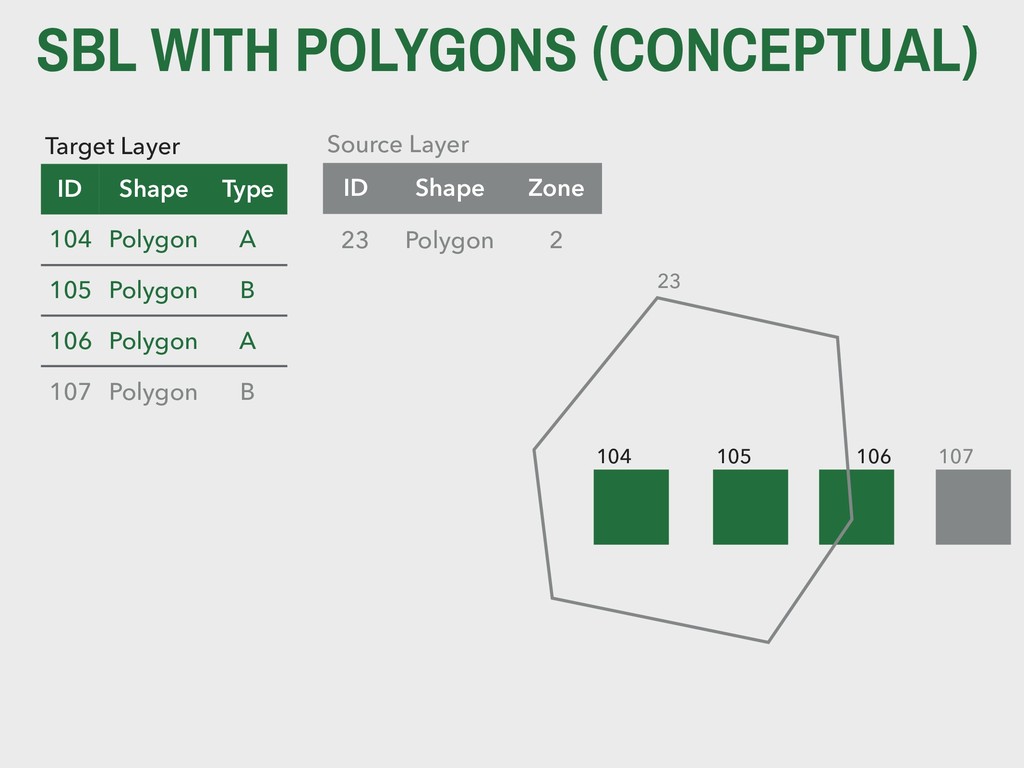
    Point 23 105 Point 23 106 Point NA 107 Point NA 108 Point 23 109 Point 23 110 Point 23 111 Point 23 112 Point NA 113 Point NA 114 Point NA 23 ID Shape 23 Polygon Source Layer
  6. SPATIAL JOINS - AGGREGATE Source Layer ID Shape 104 Point

    105 Point 106 Point 107 Point 108 Point 109 Point 110 Point 111 Point 112 Point 113 Point 114 Point 23 ID Shape 23 Polygon Target Layer
  7. SPATIAL JOINS - AGGREGATE Source Layer ID Shape 104 Point

    105 Point 106 Point 107 Point 108 Point 109 Point 110 Point 111 Point 112 Point 113 Point 114 Point 23 ID Shape Count 23 Polygon 6 Target Layer
  8. EXAMPLE We have point data for 
 homicides in the

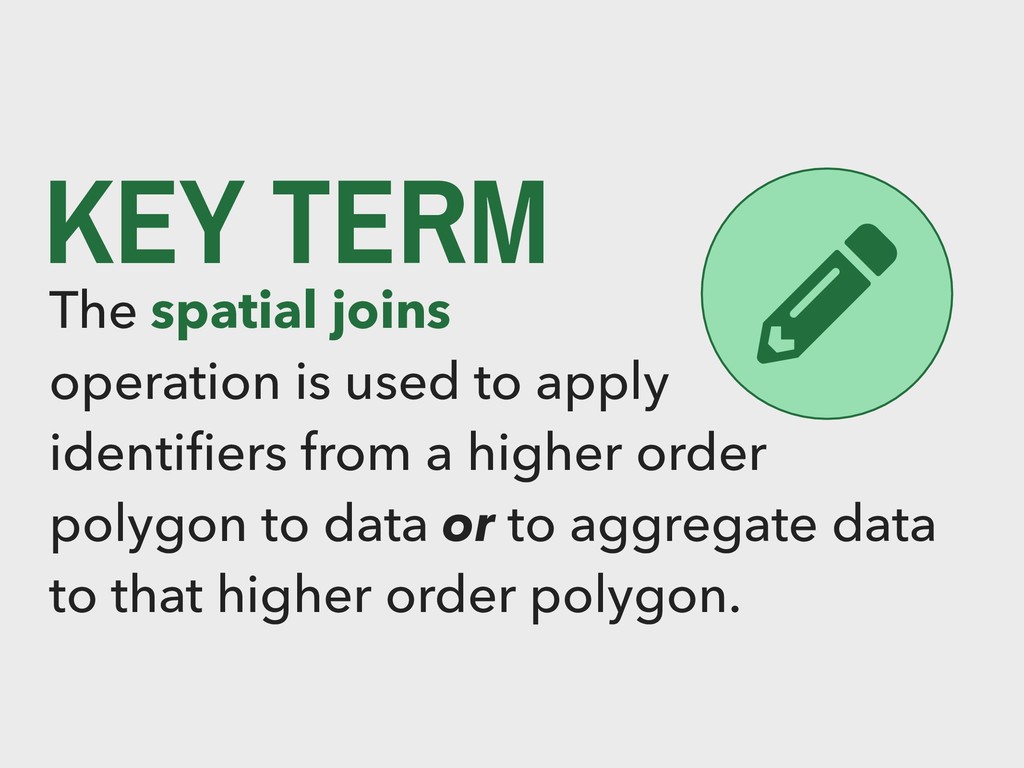
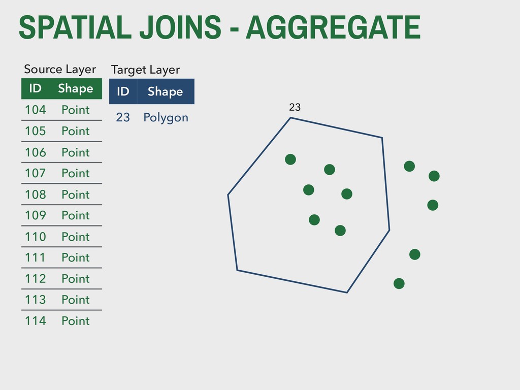
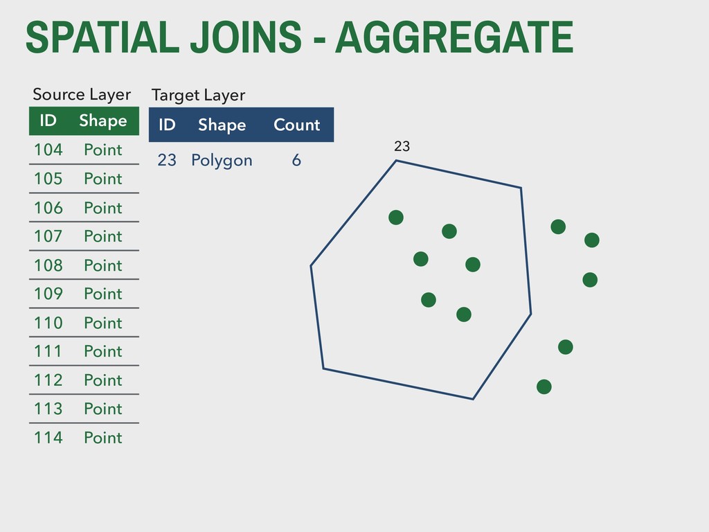
    City of
 St. Louis. We also have a data 
 set of census tracts. A spatial join can tell us (a) which tract each murder occurred in and (b) how many murders occurred in each tract.
  9. KEY TERM The select by location 
 operation is used

    to subset 
 geometric data based on spatial relationships. It works like the filter() function from dplyr, but based on space instead of attributes.
  10. SBL WITH POINTS (CONCEPTUAL) Target Layer ID Shape 104 Point

    105 Point 106 Point 107 Point 108 Point 109 Point 110 Point 111 Point 112 Point 113 Point 114 Point
  11. SBL WITH POINTS (CONCEPTUAL) Target Layer ID Shape 104 Point

    105 Point 106 Point 107 Point 108 Point 109 Point 110 Point 111 Point 112 Point 113 Point 114 Point 23 ID Shape 23 Polygon Source Layer
  12. SBL WITH POINTS (CONCEPTUAL) Target Layer ID Shape 104 Point

    105 Point 106 Point 107 Point 108 Point 109 Point 110 Point 111 Point 112 Point 113 Point 114 Point ID Shape 23 Polygon Source Layer 23
  13. EXAMPLE We have point data for 
 homicides in the

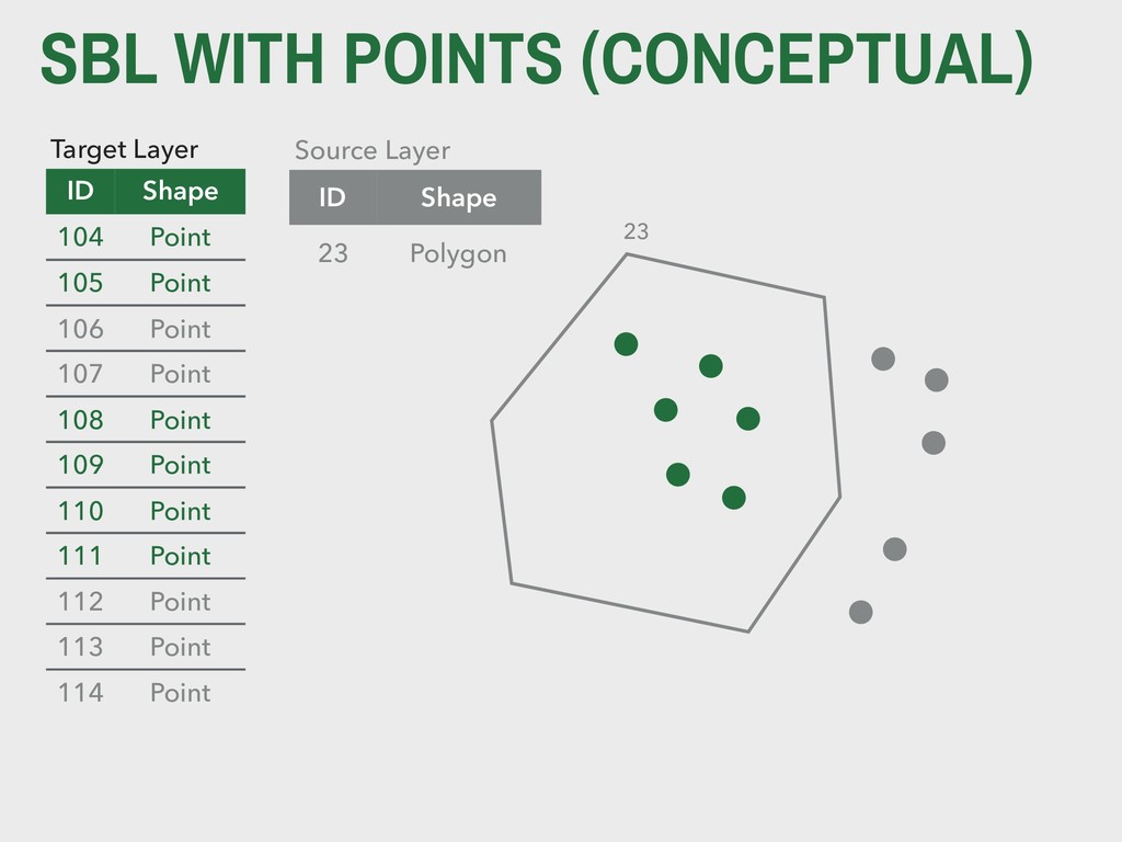
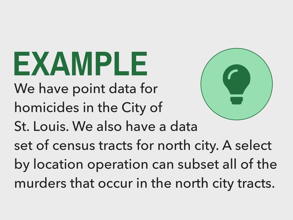
    City of
 St. Louis. We also have a data 
 set of census tracts for north city. A select by location operation can subset all of the murders that occur in the north city tracts.
  14. SBL WITH POLYGONS (CONCEPTUAL) Target Layer ID Shape Type 104

    Polygon A 105 Polygon B 106 Polygon A 107 Polygon B 104 105 106 107
  15. SBL WITH POLYGONS (CONCEPTUAL) Target Layer ID Shape Type 104

    Polygon A 105 Polygon B 106 Polygon A 107 Polygon B 104 105 106 107 ID Shape Zone 23 Polygon 2 Source Layer 23
  16. SBL WITH POLYGONS (CONCEPTUAL) Target Layer ID Shape Type 104

    Polygon A 105 Polygon B 106 Polygon A 107 Polygon B 104 105 106 107 23 ID Shape Zone 23 Polygon 2 Source Layer
  17. SBL WITH POLYGONS (CONCEPTUAL) Target Layer ID Shape Type 104

    Polygon A 105 Polygon B 106 Polygon A 107 Polygon B 104 105 106 107 ID Shape Zone 23 Polygon 2 Source Layer 23
  18. EXAMPLE We have polygon data for 
 building footprints in

    the City 
 of St. Louis. We also have a data 
 set of neighborhoods for midtown. A select by location operation can subset all of the building that occur in the midtown neighborhoods.
  19. SBL WITH LINES (CONCEPTUAL) Target Layer ID Shape Type 104

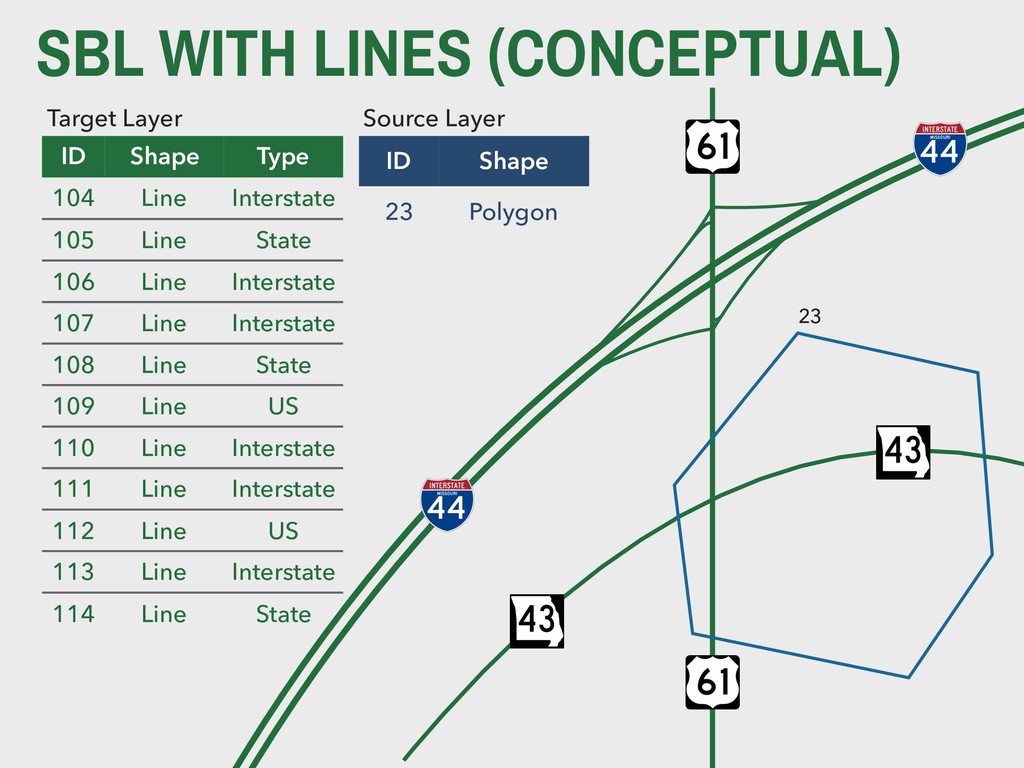
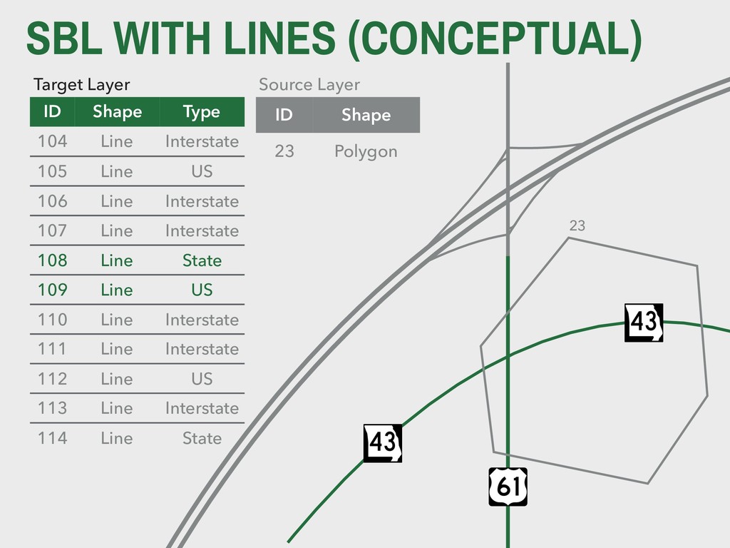
    Line Interstate 105 Line State 106 Line Interstate 107 Line Interstate 108 Line State 109 Line US 110 Line Interstate 111 Line Interstate 112 Line US 113 Line Interstate 114 Line State ID Shape 23 Polygon Source Layer 23
  20. SBL WITH LINES (CONCEPTUAL) Target Layer ID Shape Type 104

    Line Interstate 105 Line US 106 Line Interstate 107 Line Interstate 108 Line State 109 Line US 110 Line Interstate 111 Line Interstate 112 Line US 113 Line Interstate 114 Line State ID Shape 23 Polygon Source Layer 23
  21. EXAMPLE We have line data for street 
 centerlines in

    the City of St. 
 Louis. We also have a data set of neighborhoods for south city. A select by location operation can subset all of the street centerlines that cross through south city neighborhoods.
  22. REMINDERS 4. BACK MATTER Midterm grade reports were posted to

    GitHub today! Lab-10 is due next lecture, PS-04 is due in two lectures. Final project draft materials are due in two lectures (will be looking for progress on data access/cleaning, drafts of maps 1 through 4, and a wireframed poster).