America using joint geologic-geodetic block modeling Richard Styron, Tiegan Hobbs, Zach Lifton, Nick Harrichhausen, Murray Journeay [email protected] Seismological Society of America April 2021
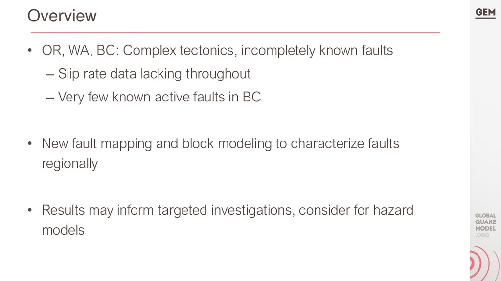
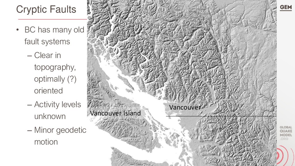
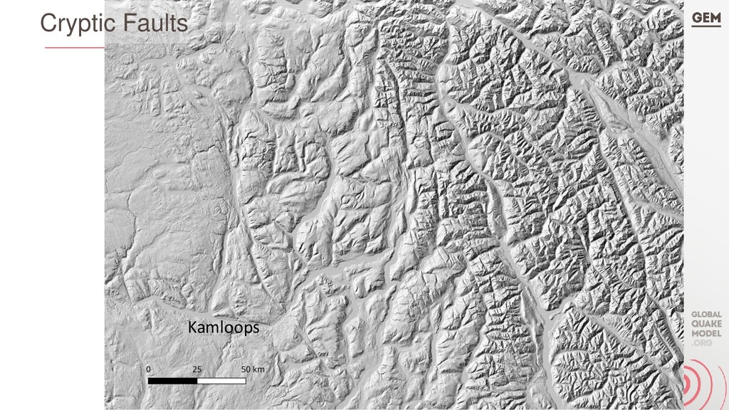
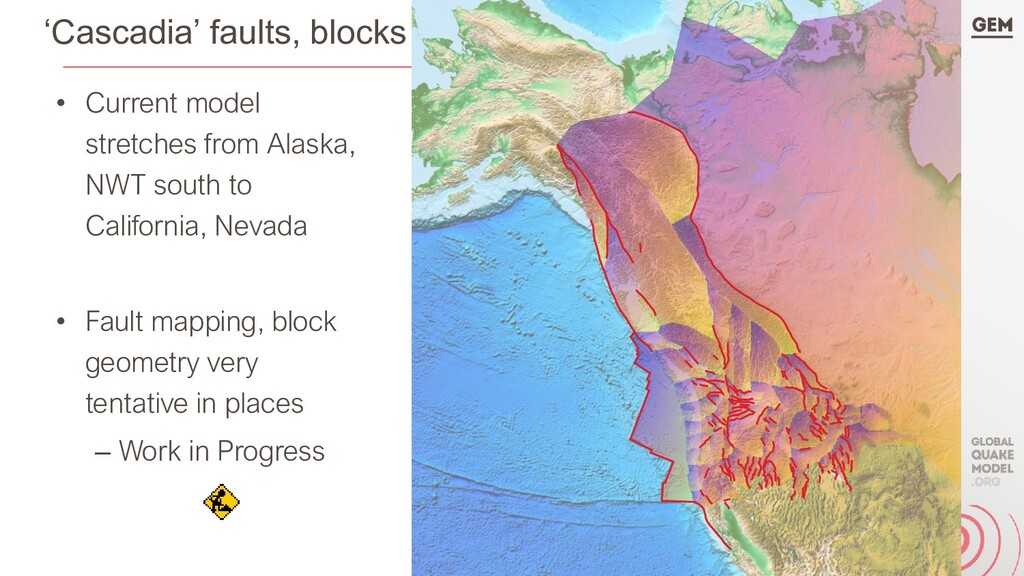
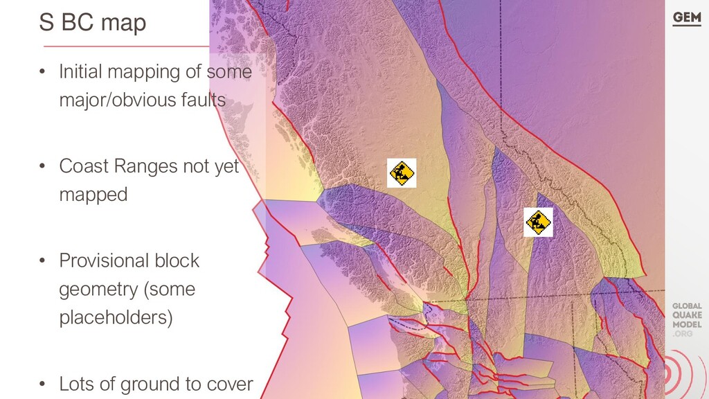
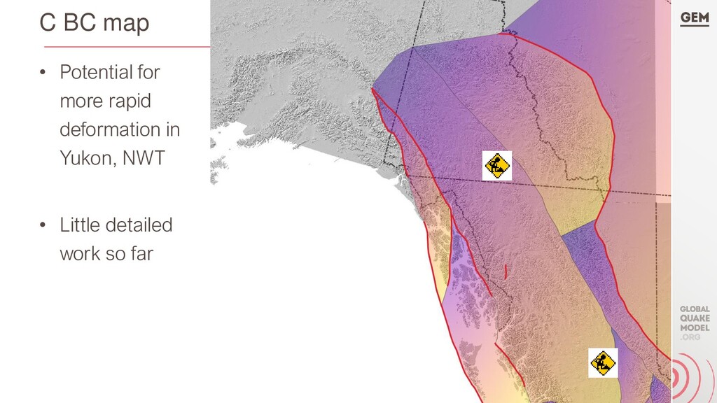
– Slip rate data lacking throughout – Very few known active faults in BC • New fault mapping and block modeling to characterize faults regionally • Results may inform targeted investigations, consider for hazard models
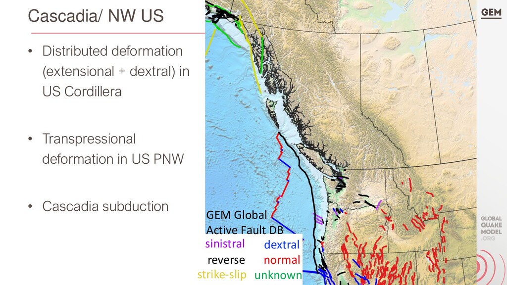
US Cordillera • Transpressional deformation in US PNW • Cascadia subduction sinistral dextral reverse normal strike-slip unknown GEM Global Active Fault DB
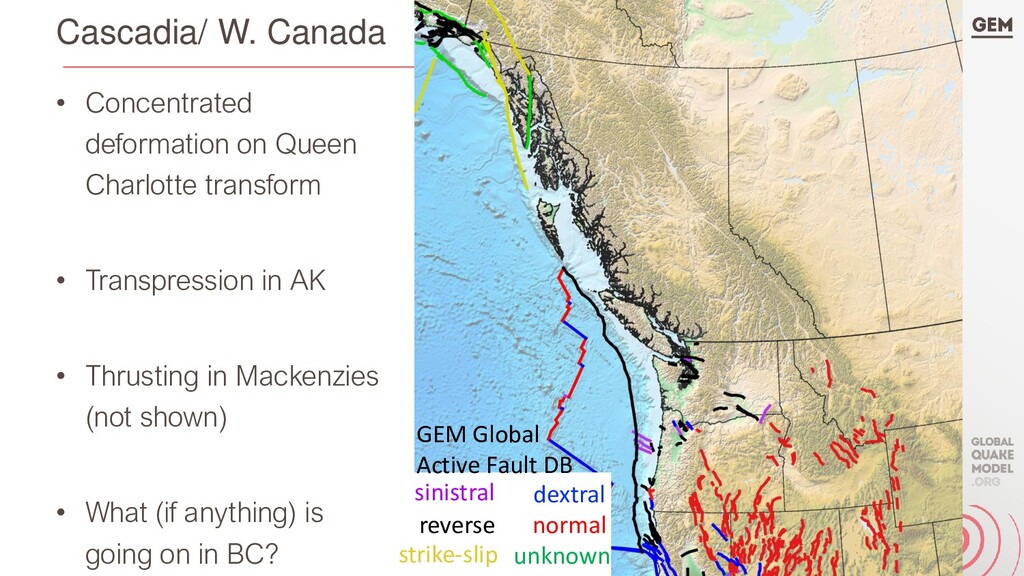
• Transpression in AK • Thrusting in Mackenzies (not shown) • What (if anything) is going on in BC? sinistral dextral reverse normal strike-slip unknown GEM Global Active Fault DB
context that (independent) geologic fault studies do not – Integration of different data sets, types that may be sparse – Kinematic consistency, fault linkages – Deformation budget • Can be thought of as fault network models
can integrate many types of deformation data – Geologic slip rates: neotectonic/geomorphic, x-sec balancing, … – GNSS, InSAR, VLBI, optical surveys, … – Paleomagnetic data – Paleoseismology (discrete earthquakes)? (not done yet AFAIK) • 2 data points from *any* combo of data types can fully characterize deformation all along block boundary (and faults) • Have to assume deformation rates constant through time (data duration) or explicitly model temporal changes
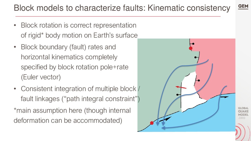
is correct representation of rigid* body motion on Earth’s surface • Block boundary (fault) rates and horizontal kinematics completely specified by block rotation pole+rate (Euler vector) • Consistent integration of multiple block / fault linkages (“path integral constraint”) *main assumption here (though internal deformation can be accommodated)
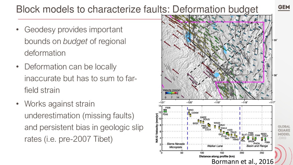
important bounds on budget of regional deformation • Deformation can be locally inaccurate but has to sum to far- field strain • Works against strain underestimation (missing faults) and persistent bias in geologic slip rates (i.e. pre-2007 Tibet) Bormann et al., 2016
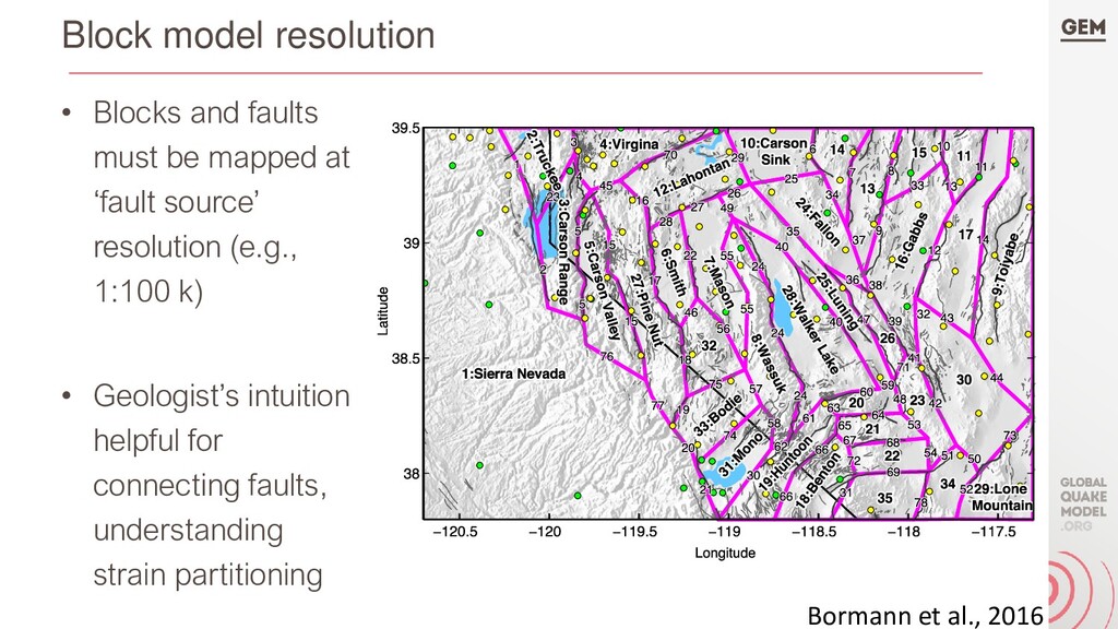
Block model yields relative motions of blocks -> kinematics and slip rates of block-bounding faults • Mapped faults used both as block boundaries, and as seismic sources in PSHA (same geometries) • Other seismic source types (e.g., smoothed instrumental seismicity) account for distributed seismicity in PSHA model • Internal/ off-fault strain could be incorporated as well
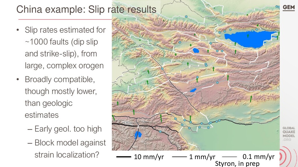
strike-slip), from large, complex orogen • Broadly compatible, though mostly lower, than geologic estimates – Early geol. too high – Block model against strain localization? 10 mm/yr 1 mm/yr 0.1 mm/yr Styron, in prep China example: Slip rate results
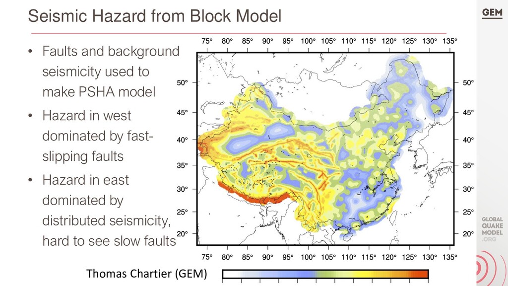
used to make PSHA model • Hazard in west dominated by fast- slipping faults • Hazard in east dominated by distributed seismicity, hard to see slow faults Thomas Chartier (GEM)
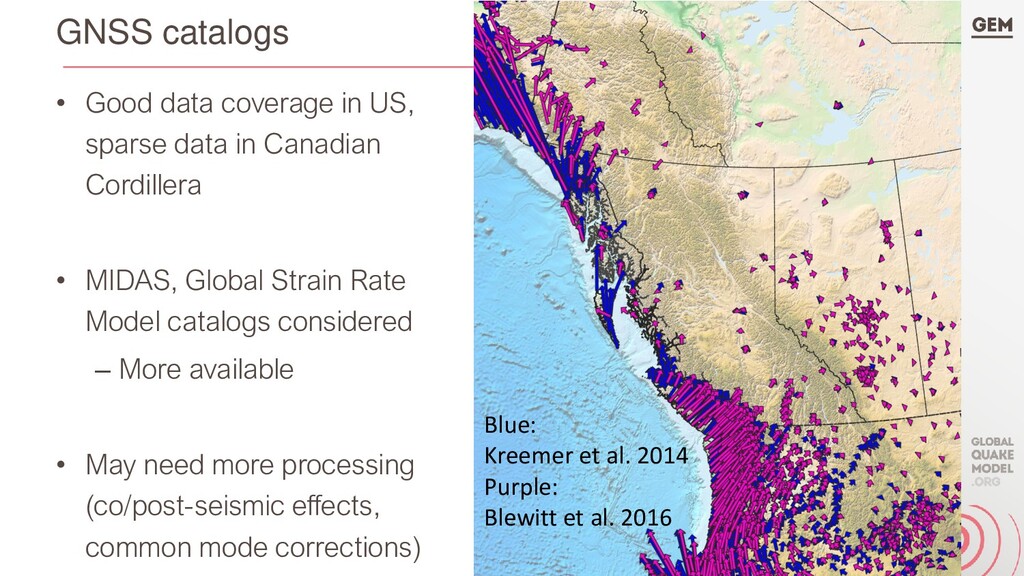
in Canadian Cordillera • MIDAS, Global Strain Rate Model catalogs considered – More available • May need more processing (co/post-seismic effects, common mode corrections) Blue: Kreemer et al. 2014 Purple: Blewitt et al. 2016
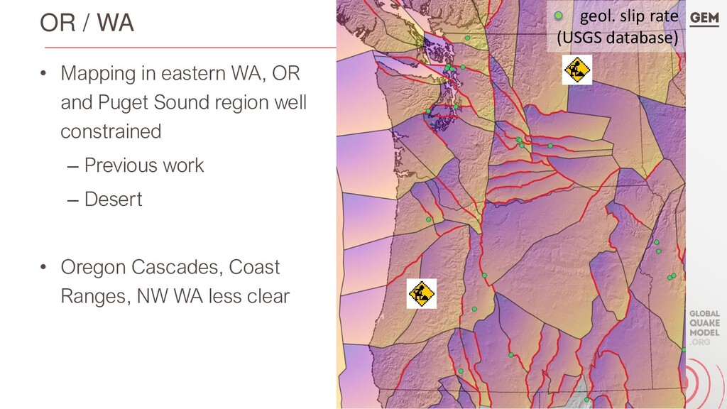
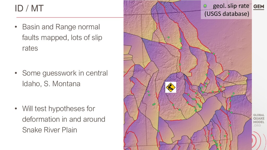
lots of slip rates • Some guesswork in central Idaho, S. Montana • Will test hypotheses for deformation in and around Snake River Plain geol. slip rate (USGS database)
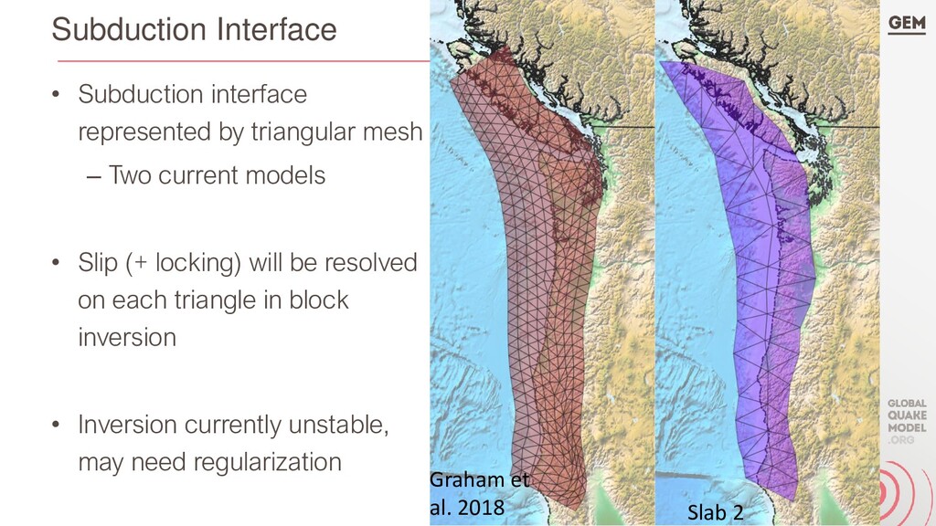
Two current models • Slip (+ locking) will be resolved on each triangle in block inversion • Inversion currently unstable, may need regularization Graham et al. 2018 Slab 2
faults, Canadian faults, Cascadia subduction interface – First of its scale and resolution (?) • Model can identify structures for more in-depth characterization (i.e., paleoseismology) • Test possible impact of faults on seismic hazard and risk (particularly in Canada)
geologic and geophysical data types • Block / fault network model provides context to characterize poorly known structures • With higher-resolution fault + block mapping, block model results used directly as input for PSHA model