Upgrade to Pro — share decks privately, control downloads, hide ads and more …

Presenting the 2018 Gem Global Seismic Hazard Map and Global Active Faults Database

Presenting the 2018 Gem Global Seismic Hazard Map and Global Active Faults Database

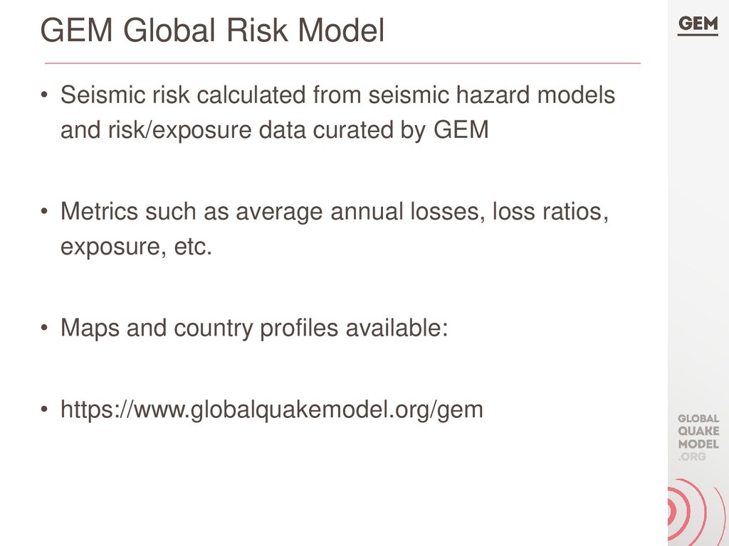
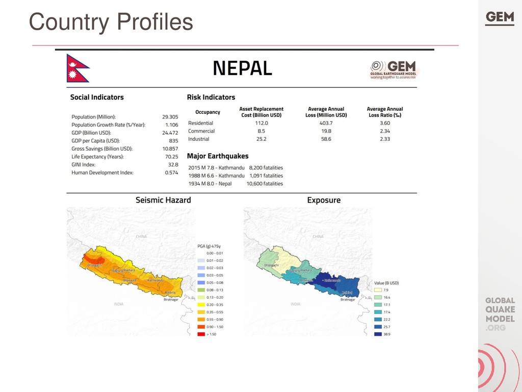
The Global Earthquake Model (GEM) Foundation has the mission to promote earthquake resilience worldwide by creating and maintaining earthquake hazard and risk models, and associated datasets and software for probabilistic seismic hazard and risk analysis. In late 2018, GEM released the first versions of several of these products, including the Global Seismic Hazard Map, the Global Seismic Risk Map, and the Global Active Faults Database.

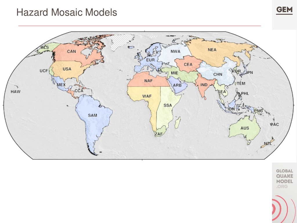
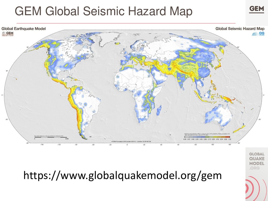
The Global Seismic Hazard Map (version 1.0- 2018) is based on a mosaic of 30 national or regional PSHA models developed by various institutions including the GEM Secretariat; each model is implemented in the OpenQuake engine (regardless of the original format). The map describes the spatial distribution of the peak ground acceleration with an annual probability exceedance of 10% in 50 years on an (almost) global equally spaced grid. It is the combination of 30 hazard maps computed for each individual model included in the mosaic. Unlike previous global hazard maps, the GEM Global Seismic Hazard Map (and underlying Model) is a dynamic, evolving product that will be updated regularly as the regional models are updated.

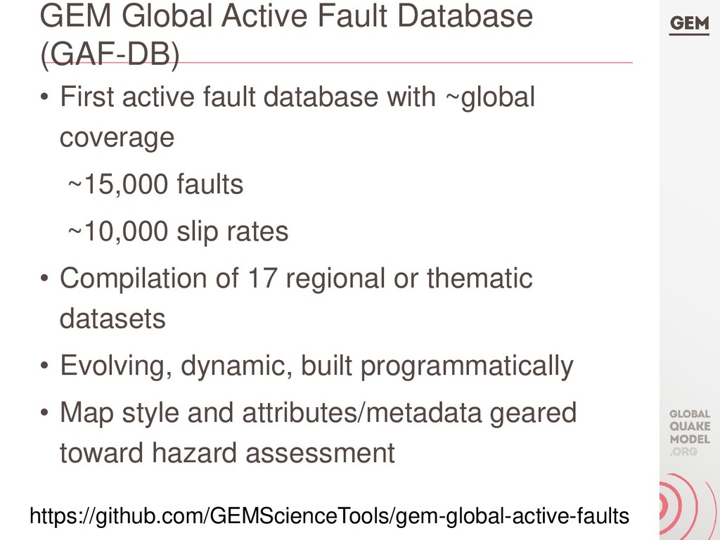
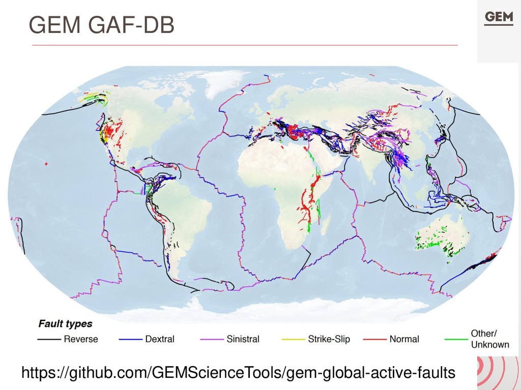
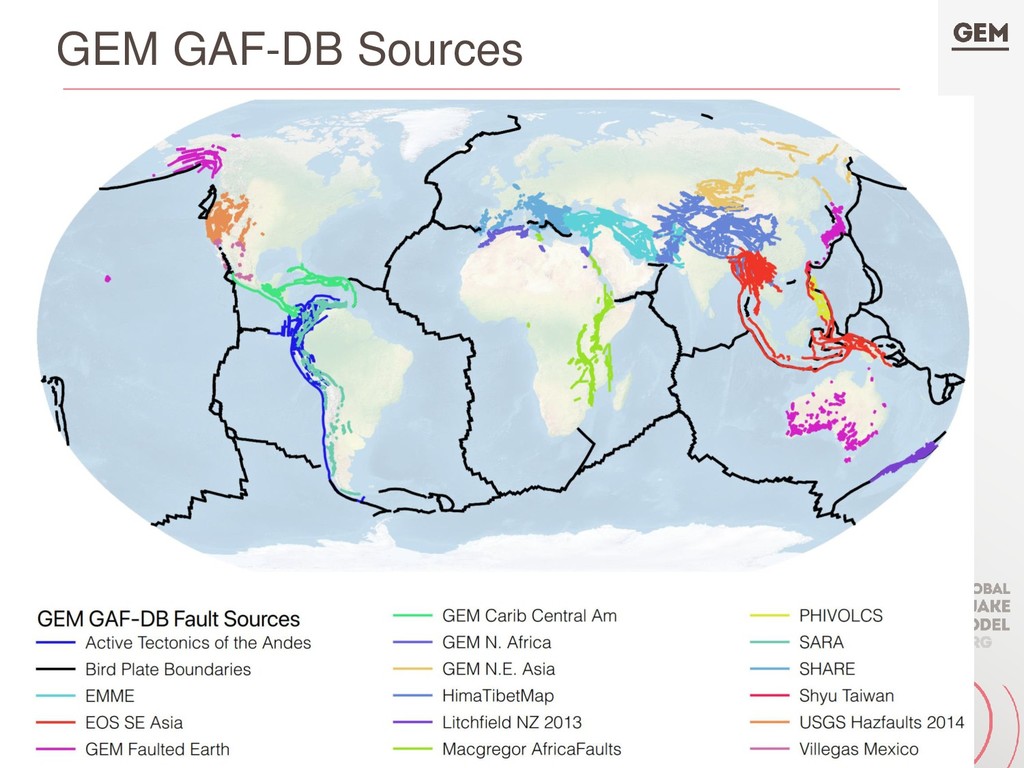
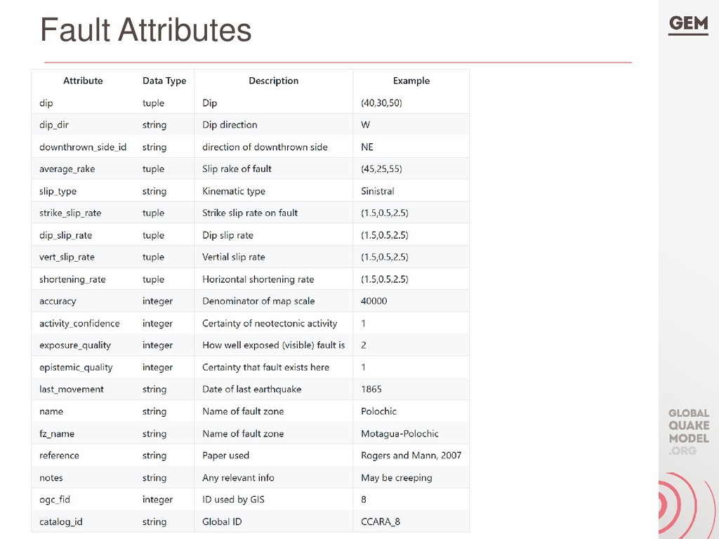
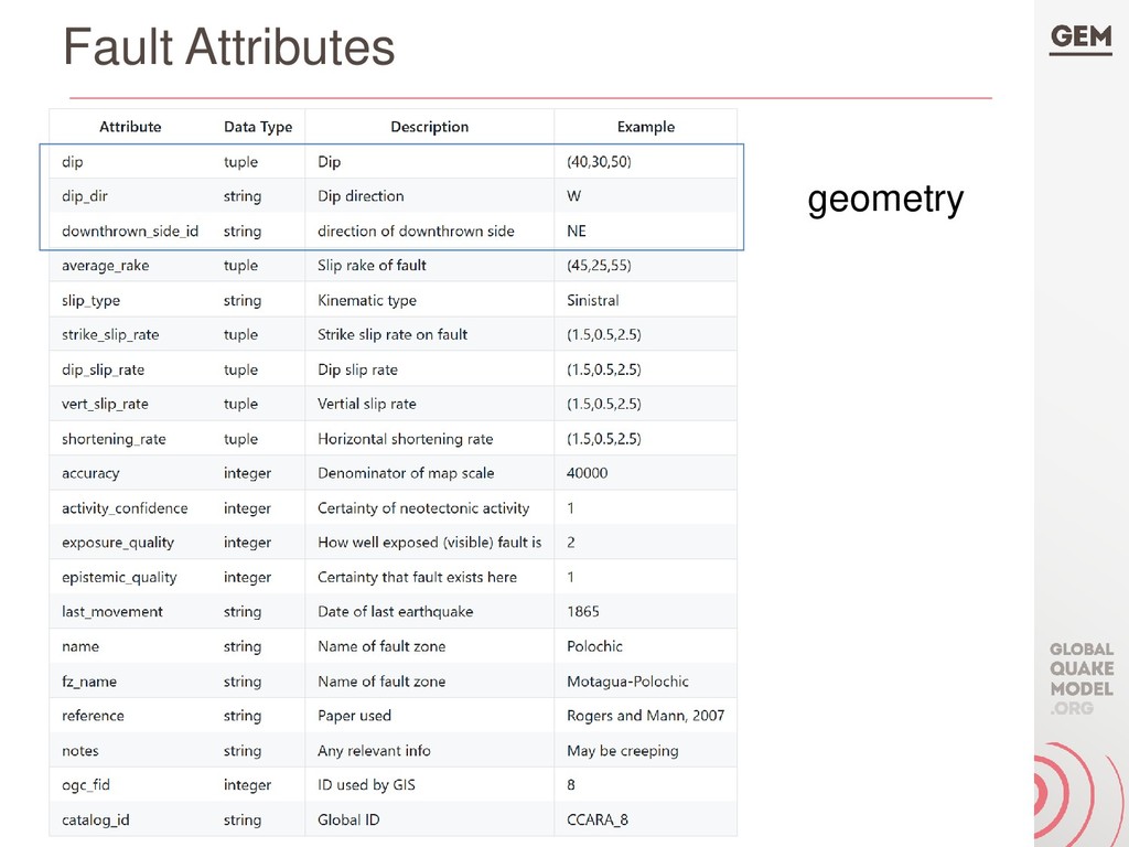
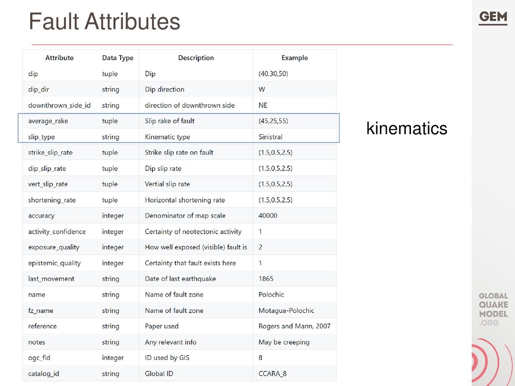
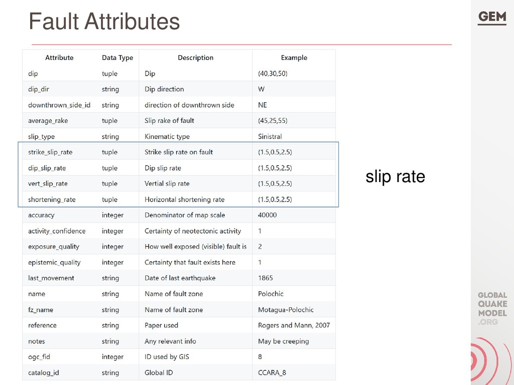
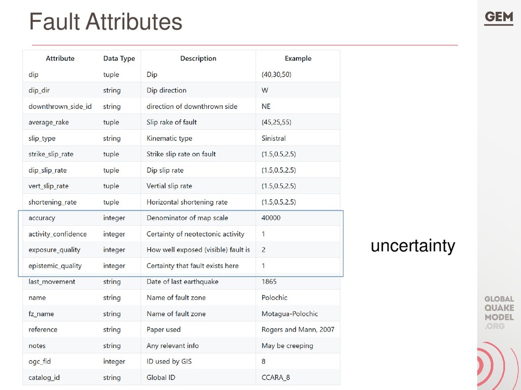
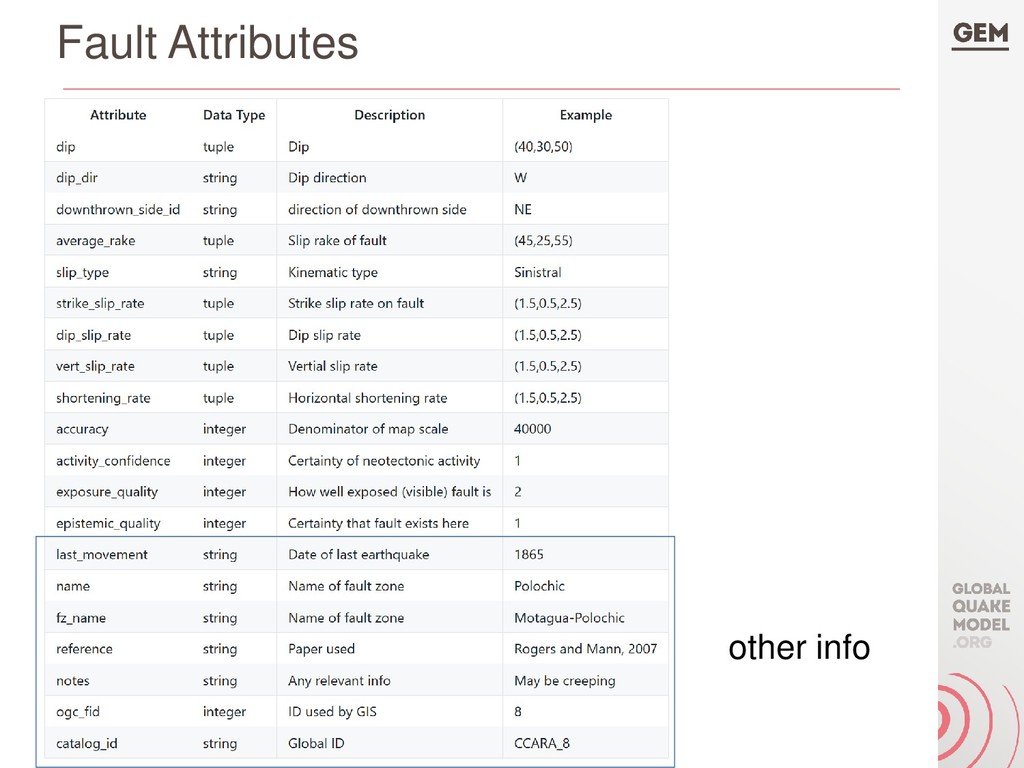
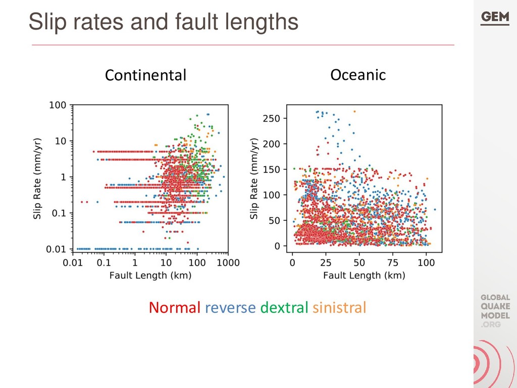
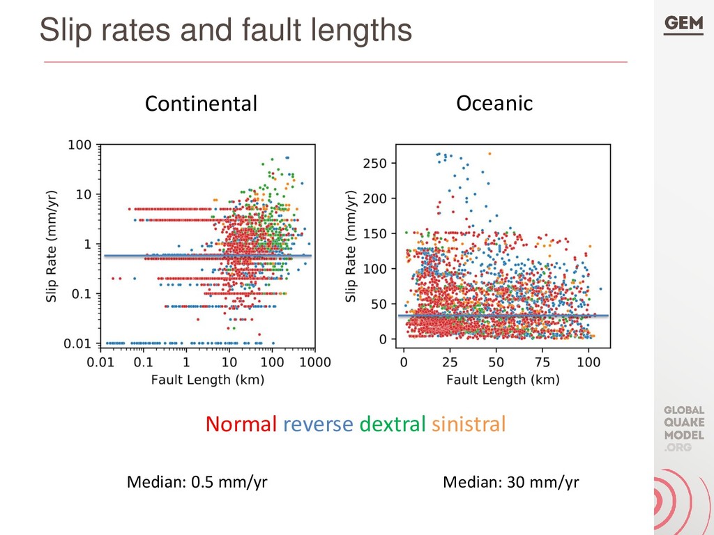
The GEM Global Active Faults database is similarly an evolving mosaic of regional catalogs of active fault traces and metadata describing the geometry, kinematics, slip rates, and other relevant parameters of each fault, and released as a vector GIS dataset. Fault catalogs developed for seismic hazard as well tectonic research have been included, with preference for hazard sources. New catalogs have been mapped by GEM for North Africa, Central America and the Caribbean, and northeastern Asia, with ongoing mapping in Canada and East Africa. Currently the database contains ~15,000 faults. Catalog assembly and harmonization are done programmatically whenever new data are available. These data products are free and released under a Creative Commons open license, and available at globalquakemodel.org.

Richard Styron

April 25, 2019
Tweet

More Decks by Richard Styron

Other Decks in Science

Transcript

  1. Presenting the 2018 GEM Global Seismic Hazard Map and Global

    Active Faults Database Richard Styron and Marco Pagani Global Earthquake Model (GEM) Foundation
  2. Introduction to GEM and 2018 Releases • Global Earthquake Model

    (GEM) is an Italian-based seismic hazard and risk analysis nonprofit • We create and curate datasets, software, models • 2018 marks the release of the Global Seismic Hazard Model (and Map), Global Seismic Risk Model (and Map), Global Active Faults database
  3. GEM Hazard Product Philosophy • Data and models are dynamic,

    evolving • Databases and models built programmatically • Philosophy (and technical implementation) follows from software engineering best practices as well as scientific theory and practice
  4. GEM Global Hazard Mosaic • Global hazard compilation made from

    30 constituent models • Models implemented in, or converted to, the OpenQuake format and run on OpenQuake at GEM • Individual models updated and re-run regularly as new info available –Mosaic is dynamic, always up-to-date, reproducible
  5. GEM Global Seismic Hazard Map • Hazard results computed from

    each model on a uniform grid • Metric: PGA at 10% probability of exceedance in 50 years • ~3.5 million hazard sources producing ~1.8 billion distinct ruptures, ~90 ground motion prediction equations
  6. Hazard Mosaic Documentation and Release • Brief documentation and OQ

    input files released throughout 2019 (quarterly) –Underlying datasets not all public • https://hazard.openquake.org/gem/models/
  7. GEM Global Risk Model • Seismic risk calculated from seismic

    hazard models and risk/exposure data curated by GEM • Metrics such as average annual losses, loss ratios, exposure, etc. • Maps and country profiles available: • https://www.globalquakemodel.org/gem
  8. GEM Global Active Fault Database (GAF-DB) • First active fault

    database with ~global coverage ~15,000 faults ~10,000 slip rates • Compilation of 17 regional or thematic datasets • Evolving, dynamic, built programmatically • Map style and attributes/metadata geared toward hazard assessment https://github.com/GEMScienceTools/gem-global-active-faults
  9. Map style Where possible, • Each fault trace is an

    independent seismic source • Traces should represent full-fault, Mmax rupture* • Different than USGS Qfaults mapping style *yeah yeah Kaikoura I know
  10. Acknowledgements • Huge thanks to data providers!! • Thanks to

    GNS for the Faulted Earth project • Thanks to USAID for funding • Thanks to colleagues at GEM for feedback and support If you have contributions, comments or criticism, please let me know! [email protected]