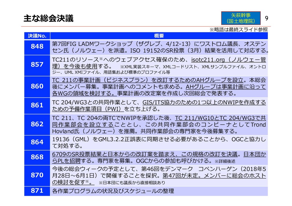
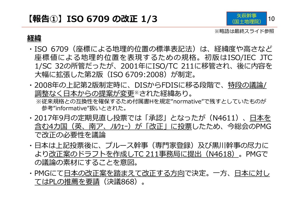
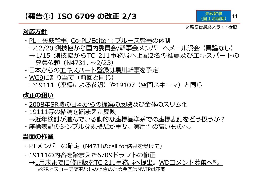
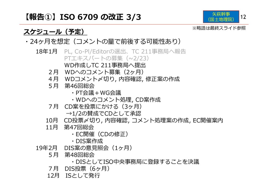
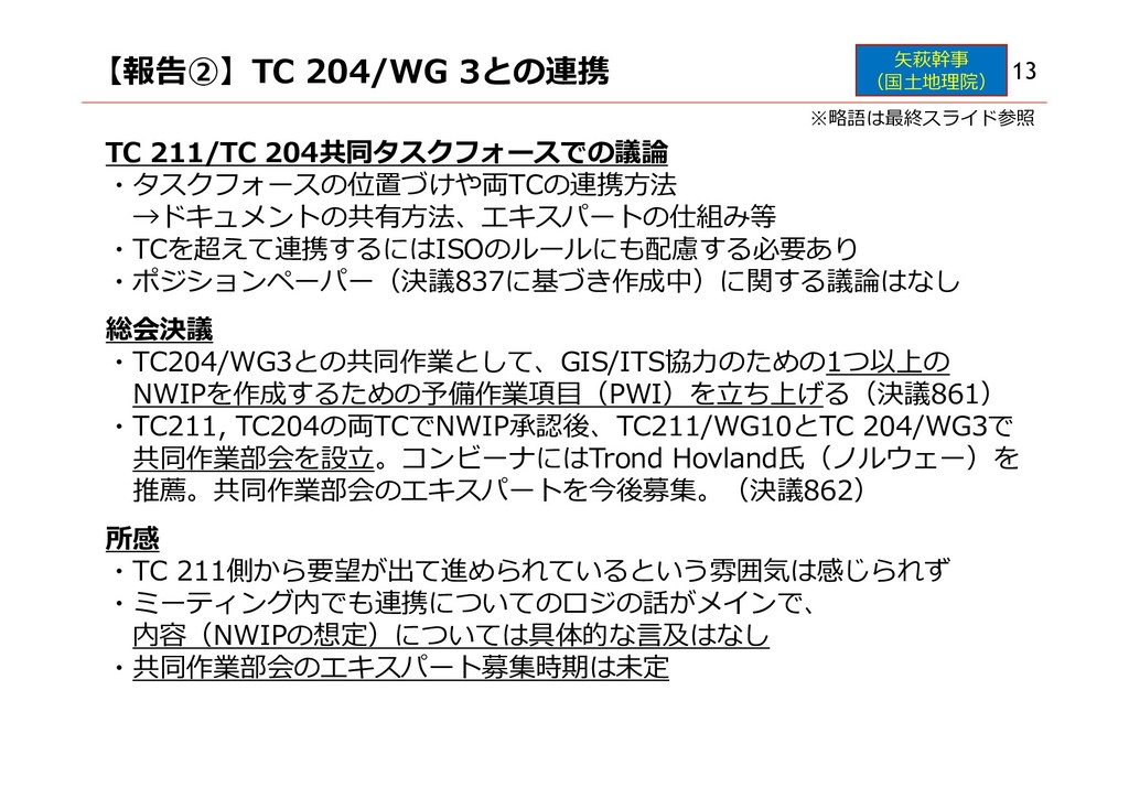
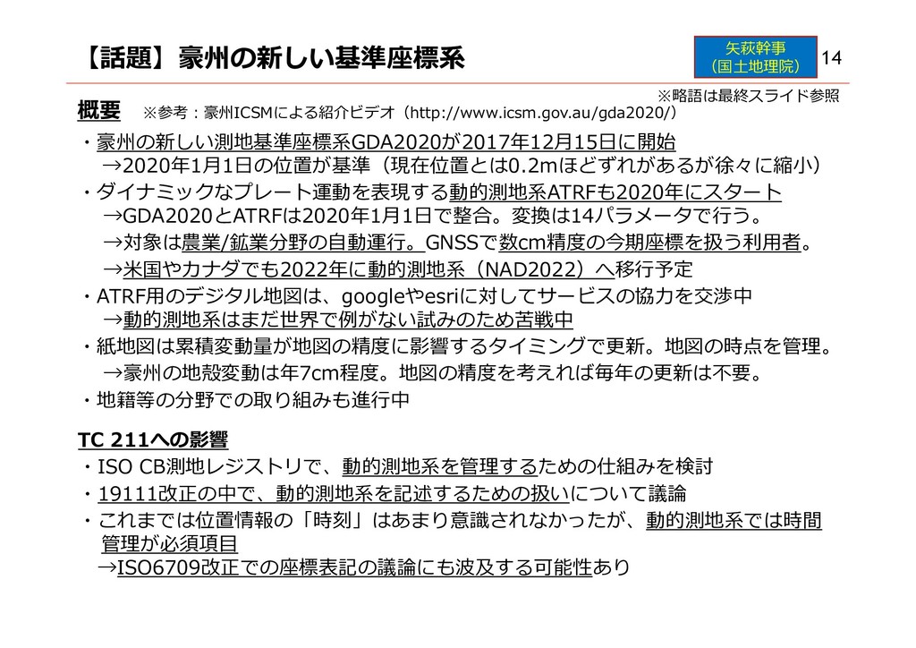
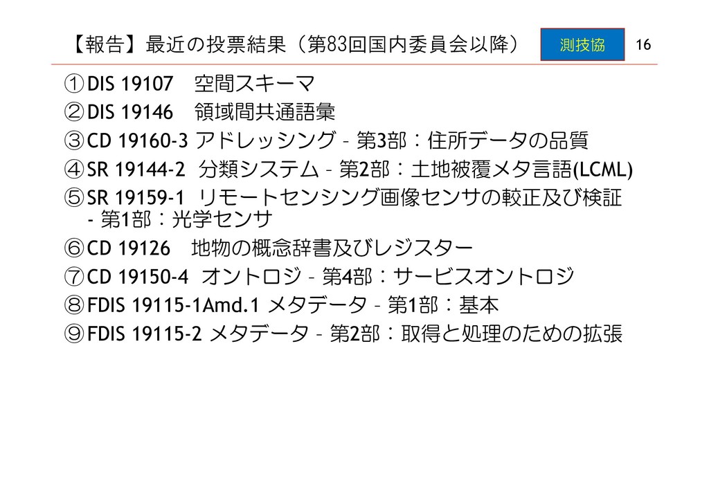
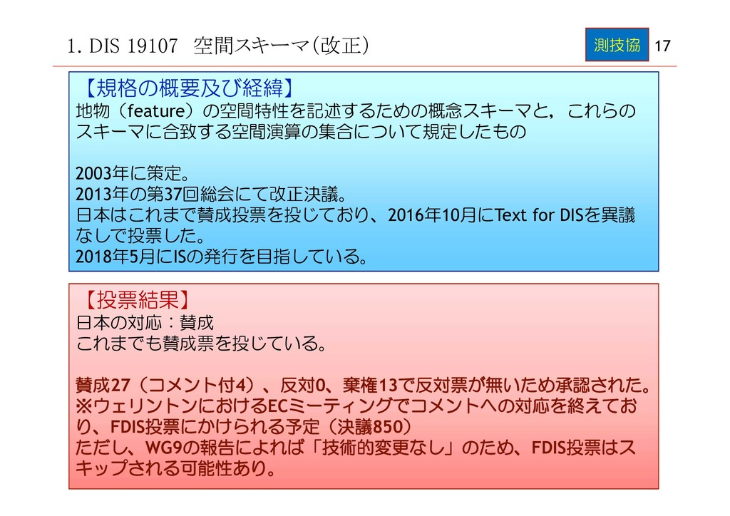
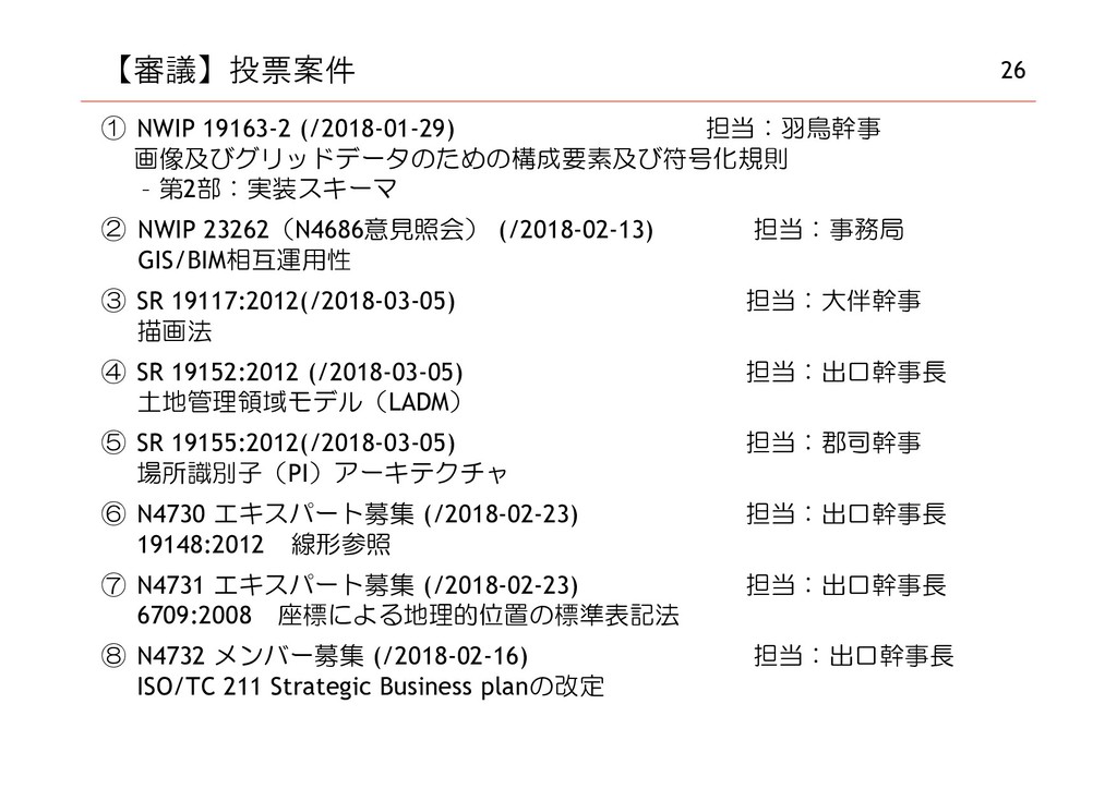
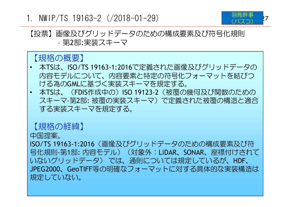
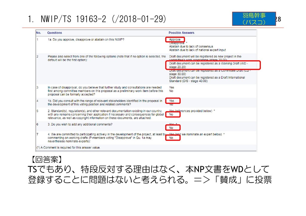
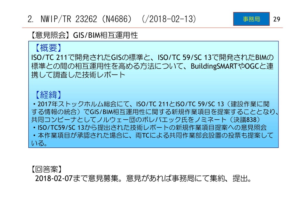
Center for Spatial Information ):空間情報共同研究センター(豪州) DIS(Draft International Standard):国際規格案 EC(Editing Committee):編集会議 FDIS(Final Draft IS):最終国際規格案 FIG(International Federation of Surveyors):国際測量者連盟 GML(Geography Markup Language):地理マークアップ言語 HoD(Head of Delegation):団長 IAG(International Association of Geodesy):国際測地学協会 ICSM(Intergovernmental Committee on Surveying and Mapping):測量及び地図分野の政府間委員会(豪州) IS(International Standard):国際規格 ITS(Intelligent Transport System):高度道路交通システム JPGIS(Japan Profile for Geographic Information Standards):日本地理情報標準プロファイル LADM(Land Administration Domain Model):土地管理領域モデル NWIP(New Work Item Proposal):新規作業項目提案 O member(Observer Member):Oメンバー OGC(Open Geospatial Consortium):地理情報システム標準化団体 PL(Project Leader):プロジェクトリーダー PMG(Program Maintenance Group):プログラム管理グループ P member(Participating Member):Pメンバー(投票権有) PTM(Project Team Meeting):プロジェクトチーム会議 PWI(Preliminary Work Item):予備作業項目 SDGs(Sustainable Development Goals):(国連)持続可能な開発目標 SR(Systematic Review):定期修正 TR(Technical Report):技術報告書 TS(Technical Specification):技術仕様書 WD(Working Draft):作業原案 WG(Working Group):作業グループ 矢萩幹事 (国土地理院) 15
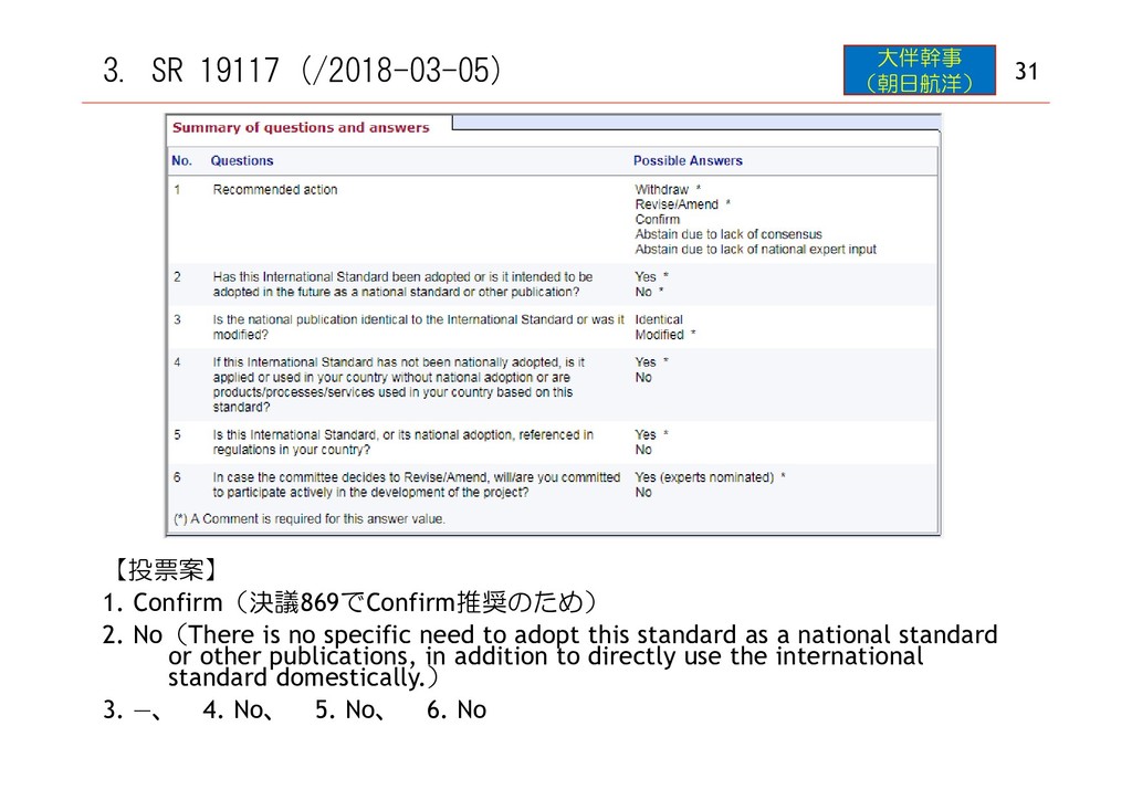
2. No(There is no specific need to adopt this standard as a national standard or other publications, in addition to directly use the international standard domestically.) 3. ―、 4. No、 5. No、 6. No
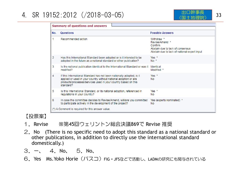
2.No (There is no specific need to adopt this standard as a national standard or other publications, in addition to directly use the international standard domestically.) 3.ー、 4.No、 5.No、 6.Yes Ms.Yoko Horie(パスコ)FIG・JFSなどで活動し、LADMの研究にも関与されている 出口幹事長 (国土地理院)
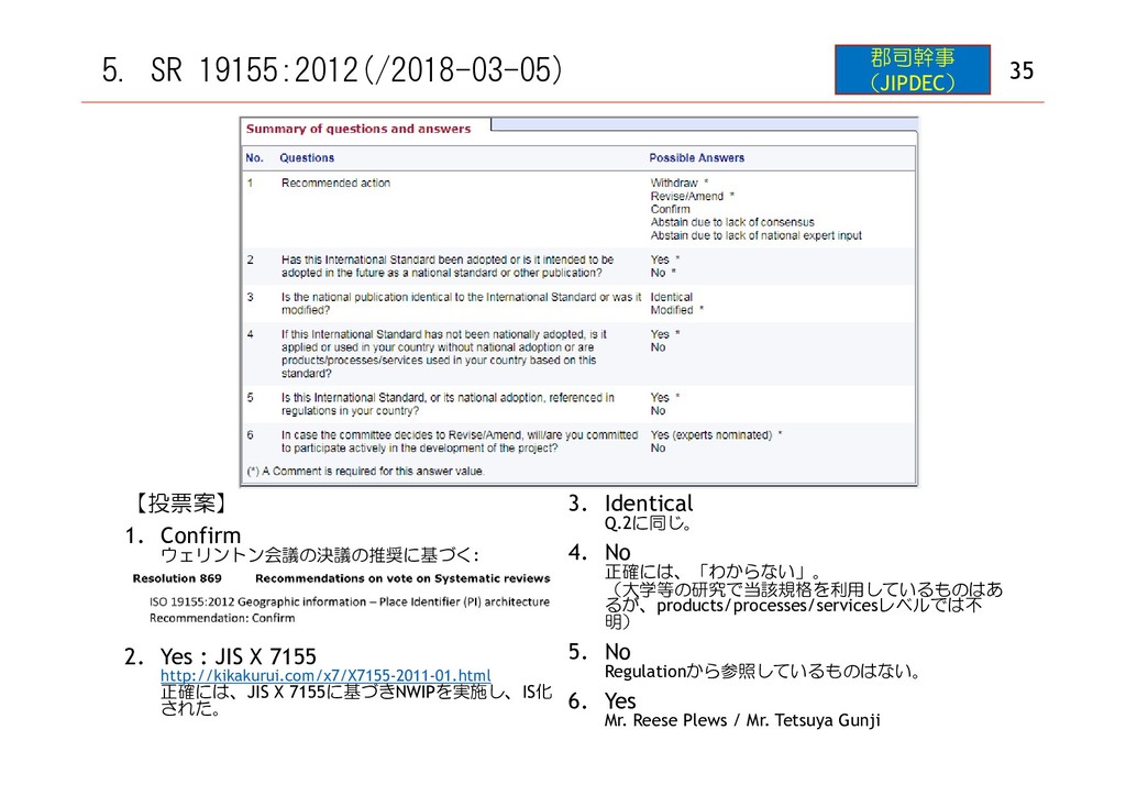
2. Yes : JIS X 7155 http://kikakurui.com/x7/X7155-2011-01.html 正確には、JIS X 7155に基づきNWIPを実施し、IS化 された。 3. Identical Q.2に同じ。 4. No 正確には、「わからない」。 (大学等の研究で当該規格を利用しているものはあ るが、products/processes/servicesレベルでは不 明) 5. No Regulationから参照しているものはない。 6. Yes Mr. Reese Plews / Mr. Tetsuya Gunji