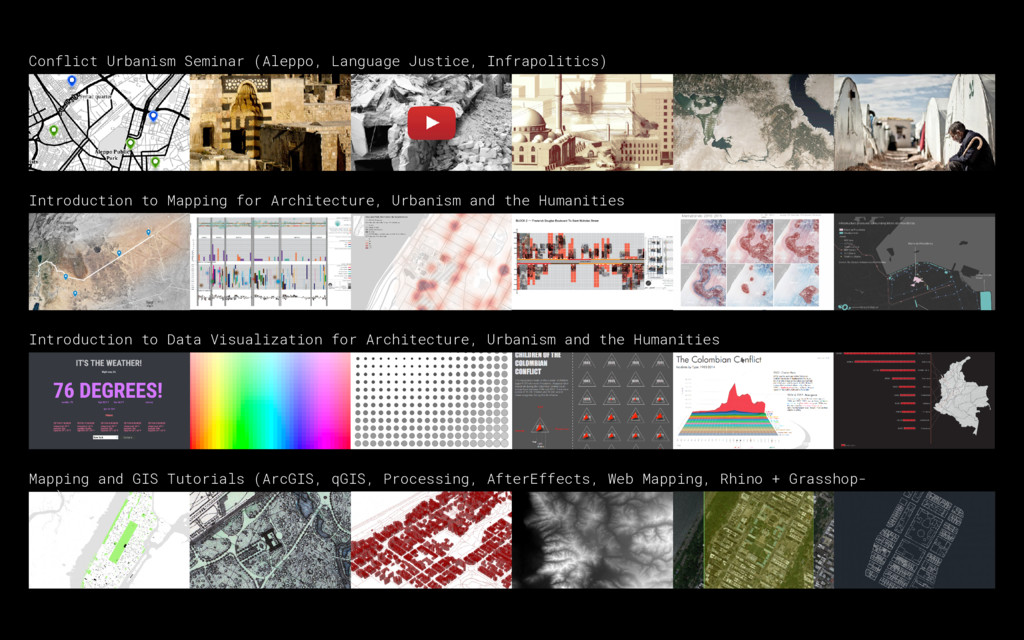
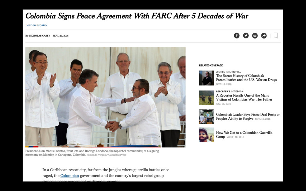
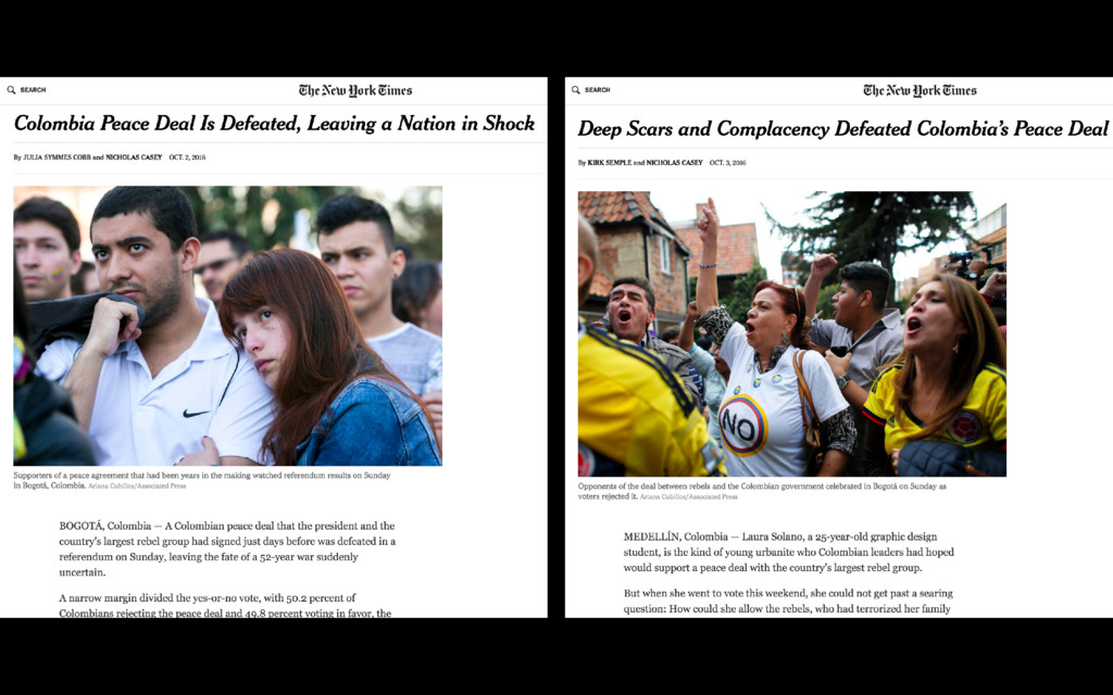
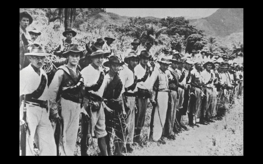
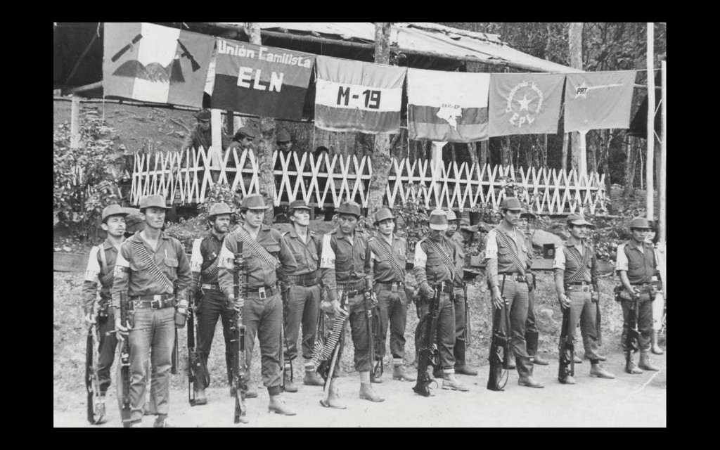
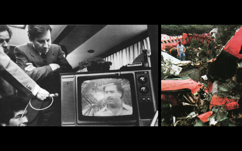
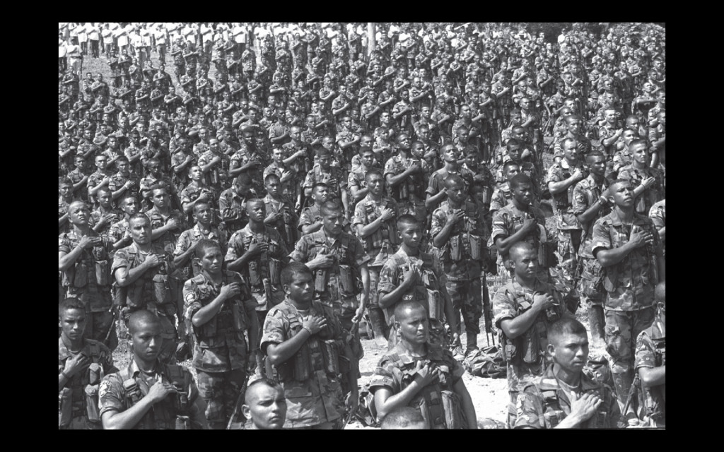
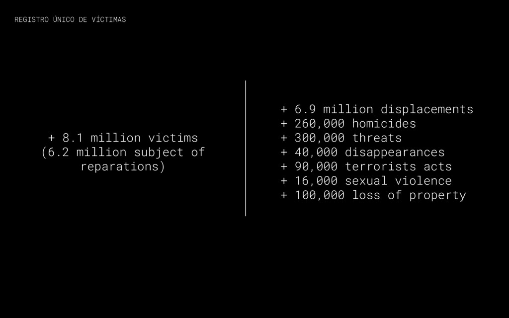
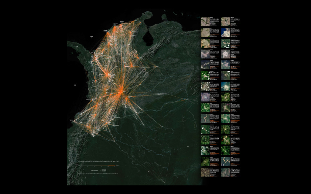
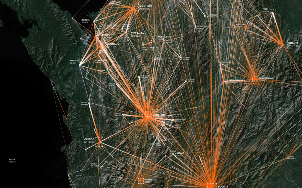
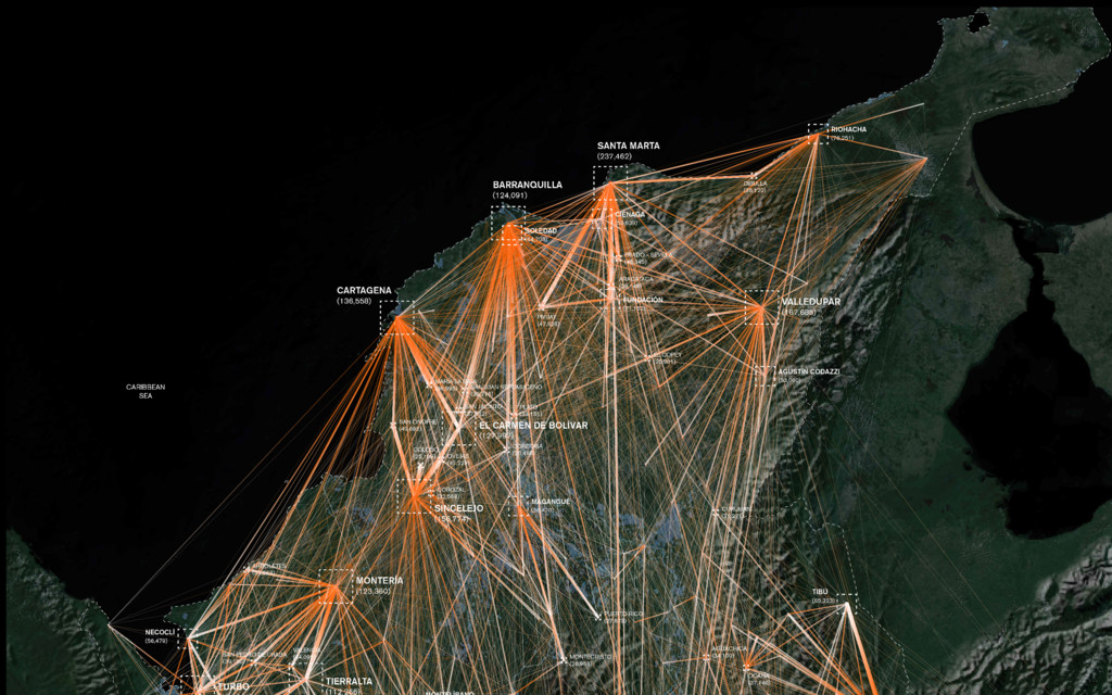
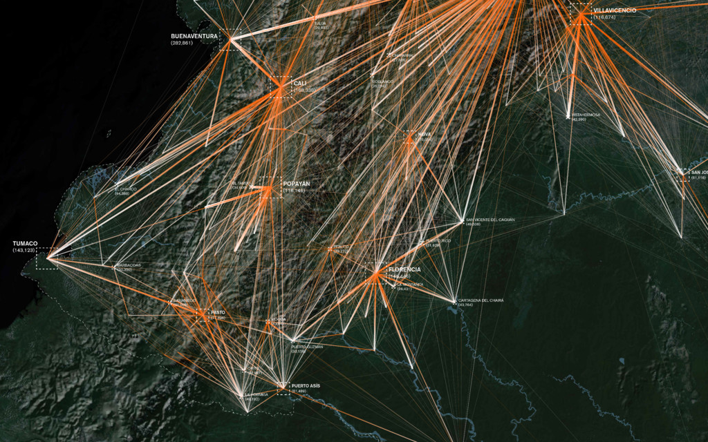
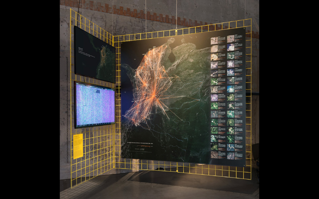
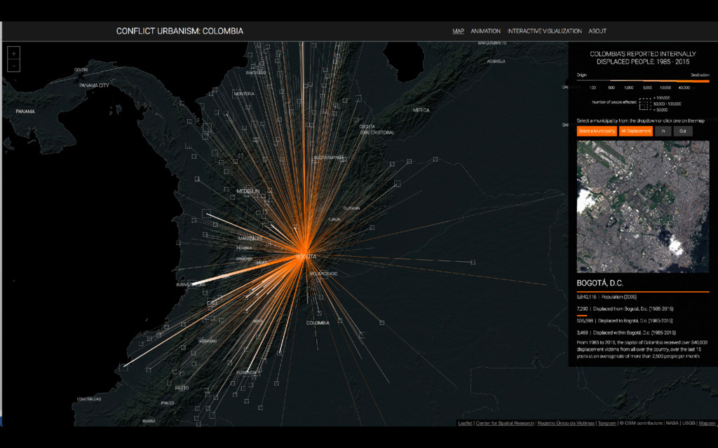
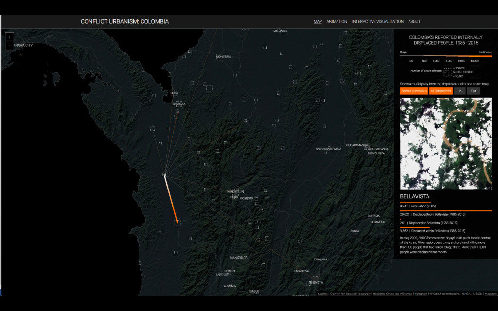
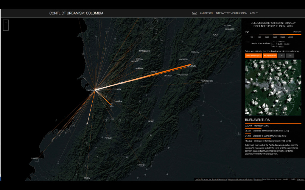
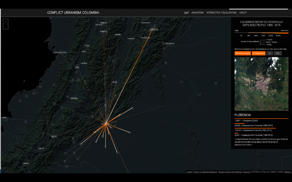
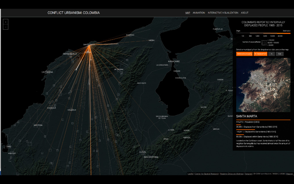
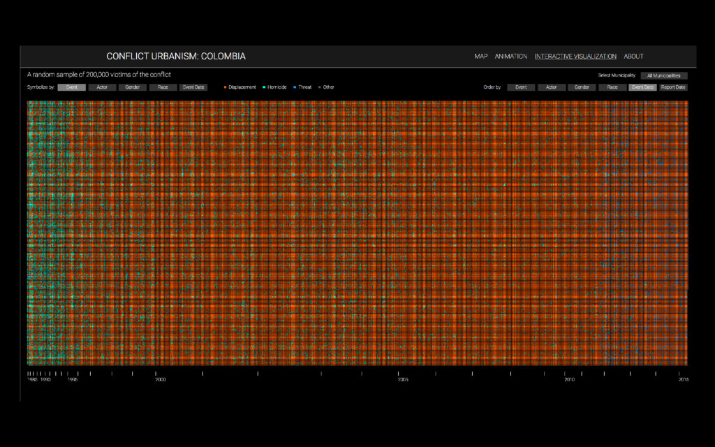
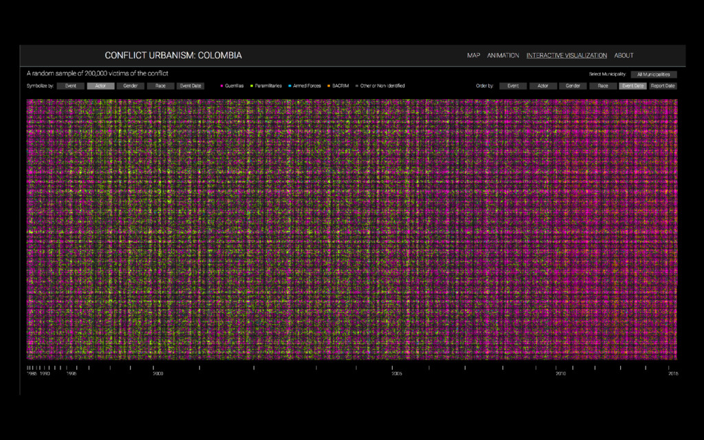
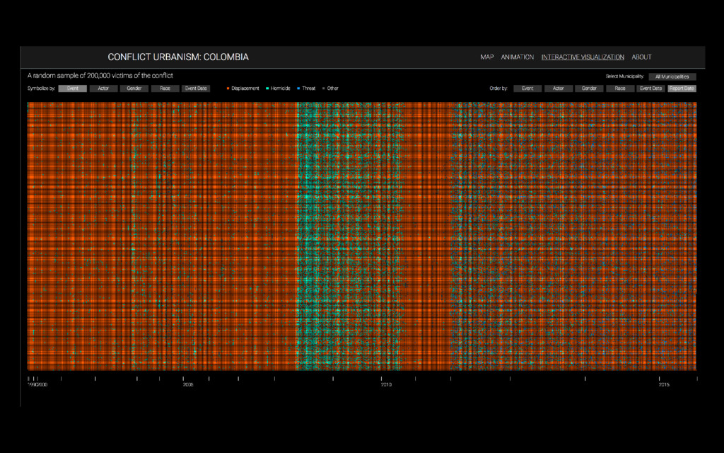
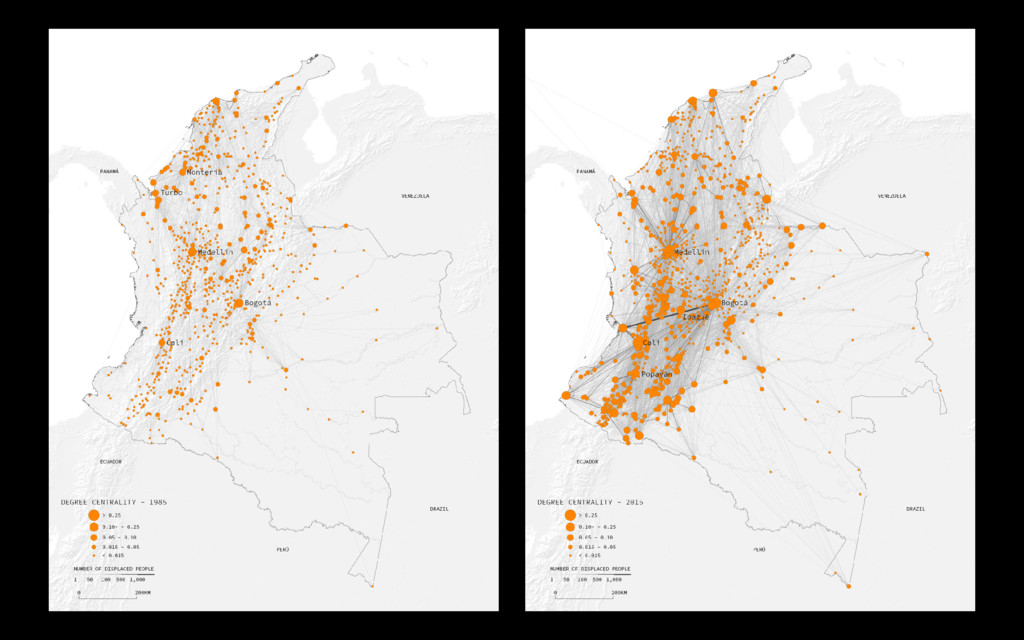
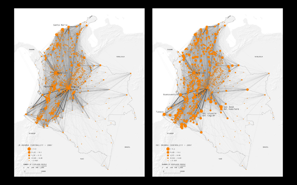
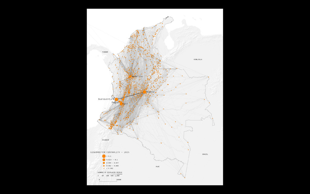
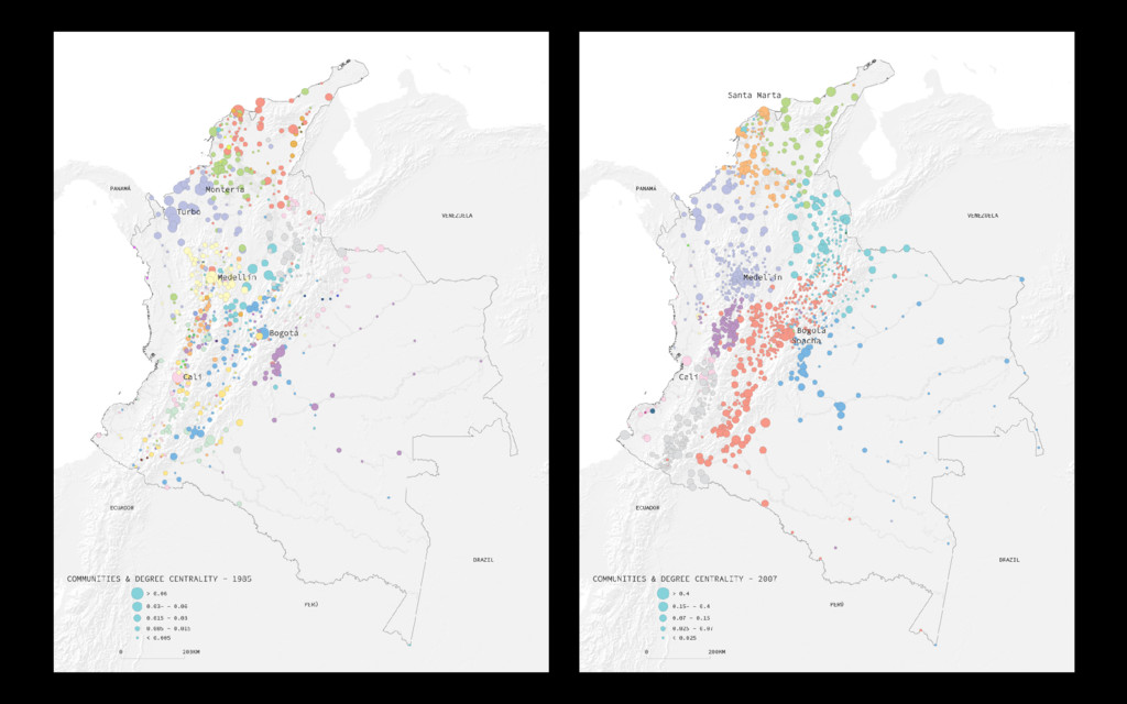
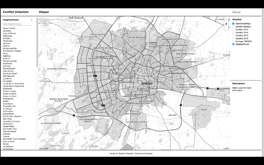
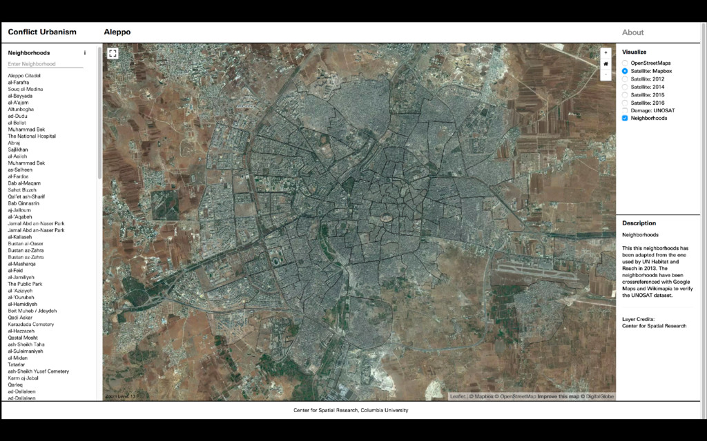
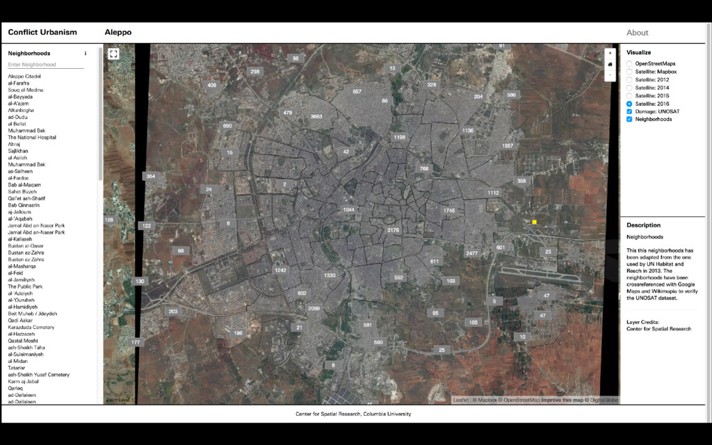
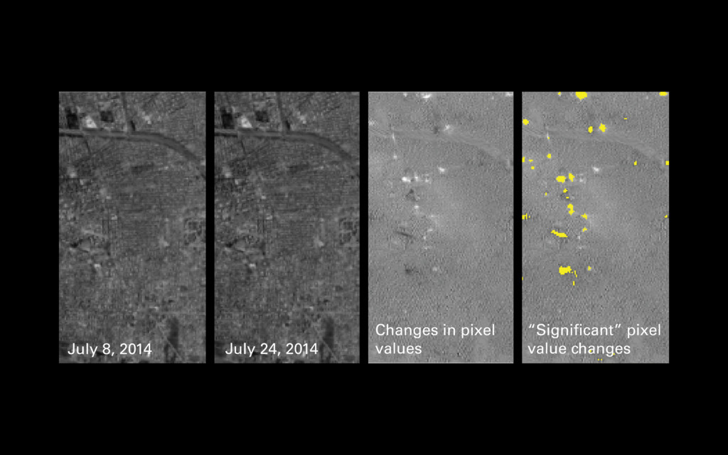
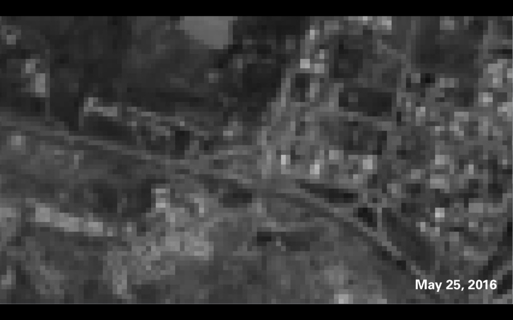
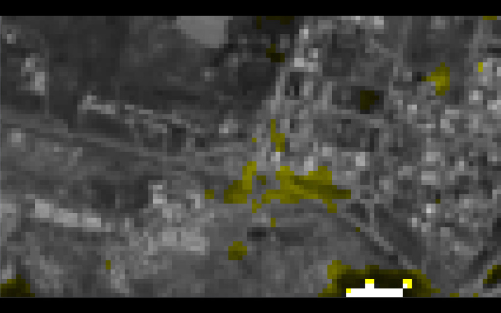
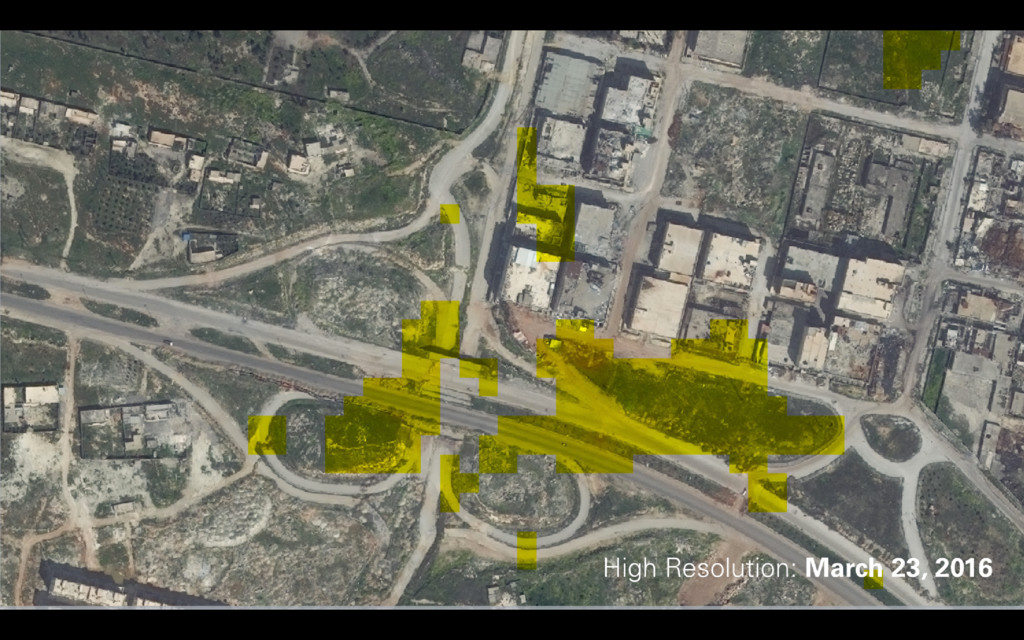
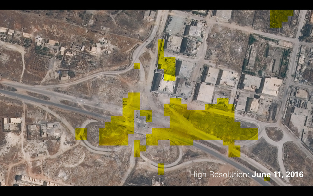
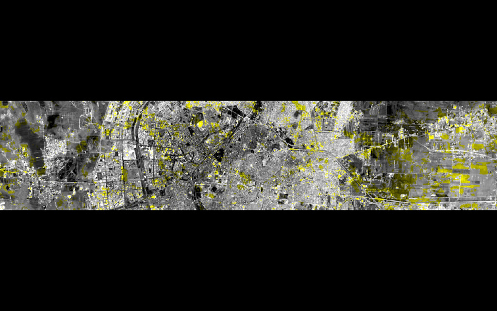
Mapping conflict is extremely difficult: data is hard to collect, realities on the ground change constantly, and the intricacies of each conflict are difficult to understand and even more difficult to explain through simple maps. Our Conflict Urbanism: Aleppo and Conflict Urbanism: Colombia projects grapple with these issues while still trying to map and analyze the destruction of Aleppo and more than 30 years of conflict in Colombia. Through the use of satellite images, crowd-sourced data and web-mapping tools we attempt to create a spatial record of these two conflicts. our work is part historical memory and part analysis and tries to set the basis for further studies that might inform nuanced transitional justice policies that are responsive to local needs and cognizant of socio-spatial phenomena.