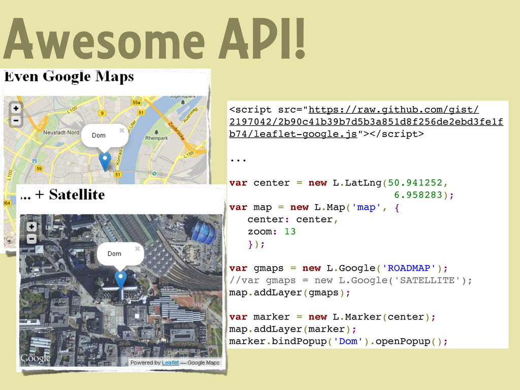
We love Open Source but still use Google Maps for our mapping needs
Talk for Cologne.rb (www.colognerb.de) about using the OSM database to grap neccessary GeoData for your app and use the Leaflet.js (cloudmade.leaflet.com) API to display it on your page
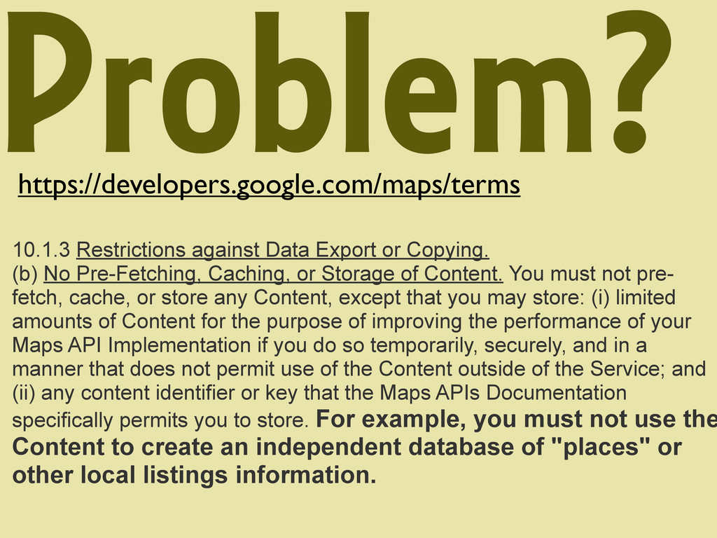
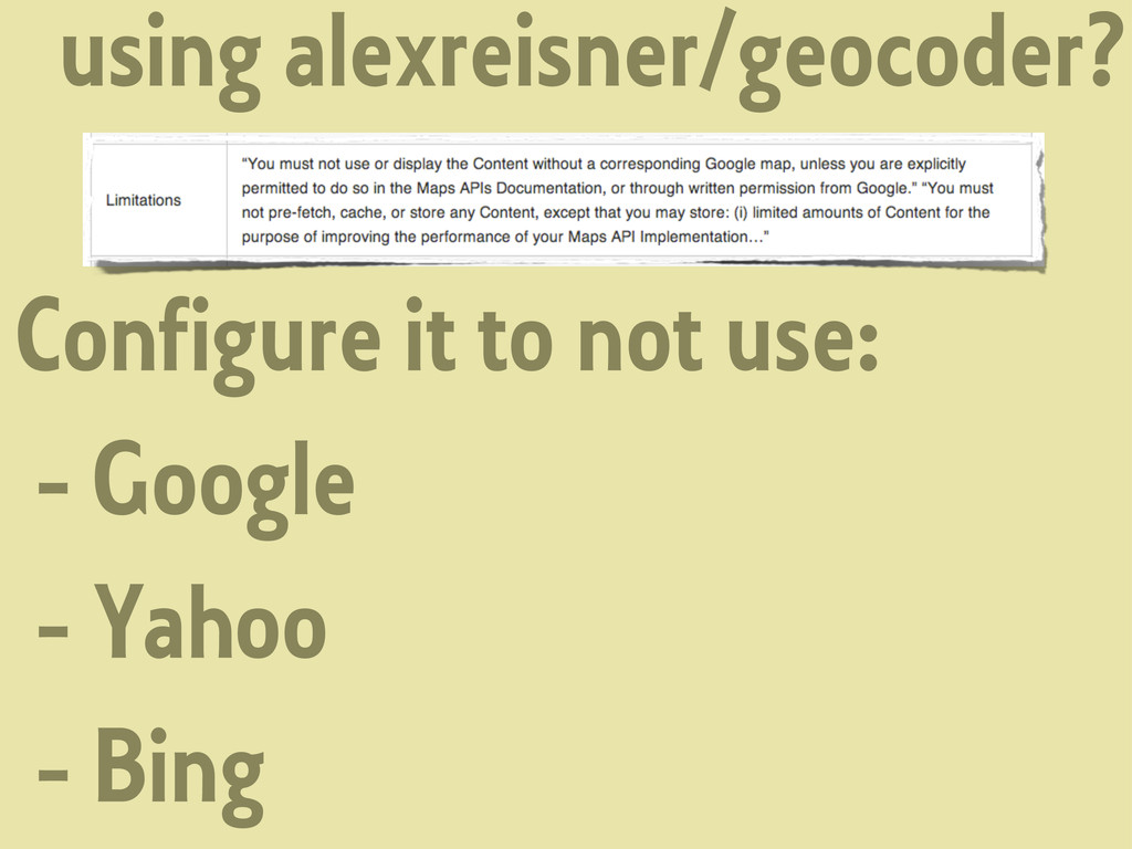
No Pre-Fetching, Caching, or Storage of Content. You must not pre- fetch, cache, or store any Content, except that you may store: (i) limited amounts of Content for the purpose of improving the performance of your Maps API Implementation if you do so temporarily, securely, and in a manner that does not permit use of the Content outside of the Service; and (ii) any content identifier or key that the Maps APIs Documentation specifically permits you to store. For example, you must not use the Content to create an independent database of "places" or other local listings information.
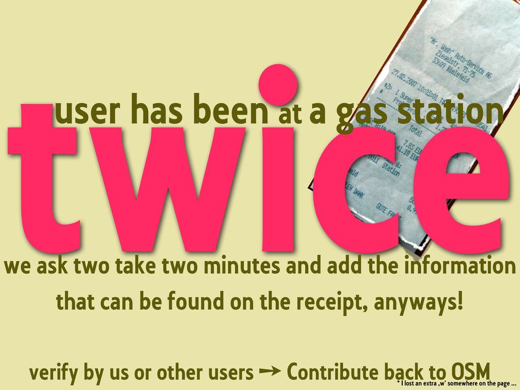
two take two minutes and add the information that can be found on the receipt, anyways! verify by us or other users ➙ Contribute back to OSM * I lost an extra ,w‘ somewhere on the page ...
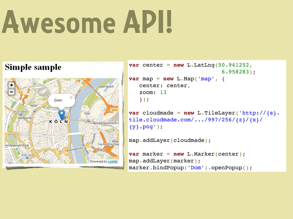
= new L.Map('map', { center: center, zoom: 13 }); var cloudmade = new L.TileLayer('http://{s}. tile.cloudmade.com/.../997/256/{z}/{x}/ {y}.png'); map.addLayer(cloudmade); var marker = new L.Marker(center); map.addLayer(marker); marker.bindPopup('Dom').openPopup();
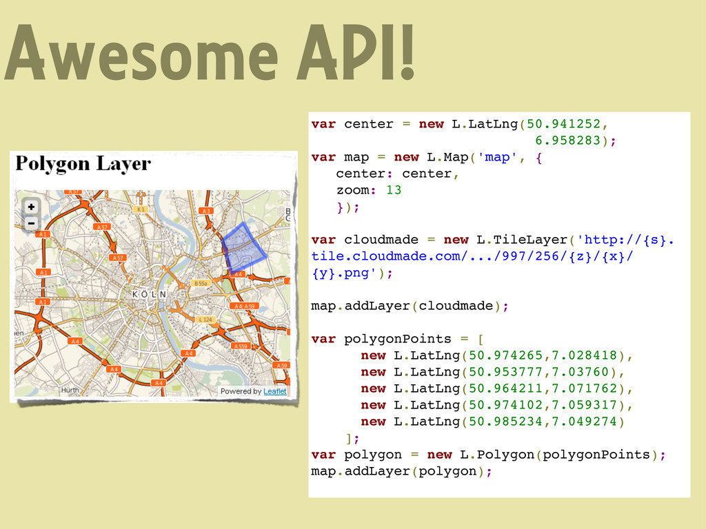
= new L.Map('map', { center: center, zoom: 13 }); var cloudmade = new L.TileLayer('http://{s}. tile.cloudmade.com/.../997/256/{z}/{x}/ {y}.png'); map.addLayer(cloudmade); var polygonPoints = [ new L.LatLng(50.974265,7.028418), new L.LatLng(50.953777,7.03760), new L.LatLng(50.964211,7.071762), new L.LatLng(50.974102,7.059317), new L.LatLng(50.985234,7.049274) ]; var polygon = new L.Polygon(polygonPoints); map.addLayer(polygon);
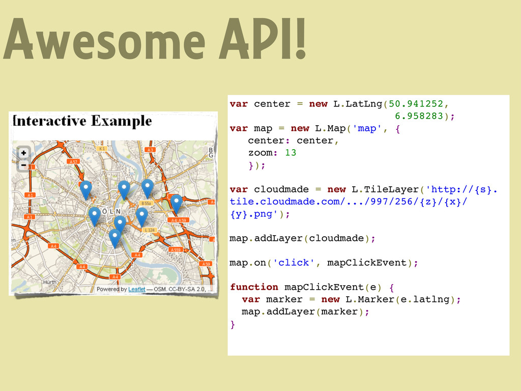
= new L.Map('map', { center: center, zoom: 13 }); var cloudmade = new L.TileLayer('http://{s}. tile.cloudmade.com/.../997/256/{z}/{x}/ {y}.png'); map.addLayer(cloudmade); map.on('click', mapClickEvent); function mapClickEvent(e) { var marker = new L.Marker(e.latlng); map.addLayer(marker); }
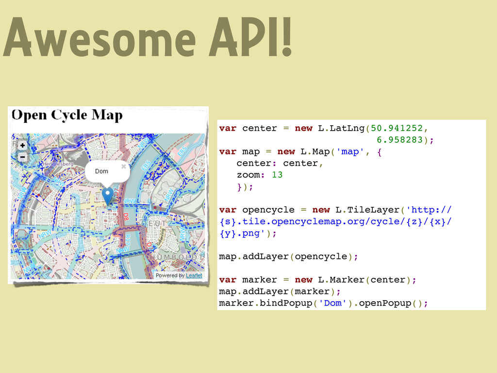
= new L.Map('map', { center: center, zoom: 13 }); var opencycle = new L.TileLayer('http:// {s}.tile.opencyclemap.org/cycle/{z}/{x}/ {y}.png'); map.addLayer(opencycle); var marker = new L.Marker(center); map.addLayer(marker); marker.bindPopup('Dom').openPopup();
new L.LatLng(50.941252, 6.958283); var map = new L.Map('map', { center: center, zoom: 13 }); var gmaps = new L.Google('ROADMAP'); //var gmaps = new L.Google('SATELLITE'); map.addLayer(gmaps); var marker = new L.Marker(center); map.addLayer(marker); marker.bindPopup('Dom').openPopup();
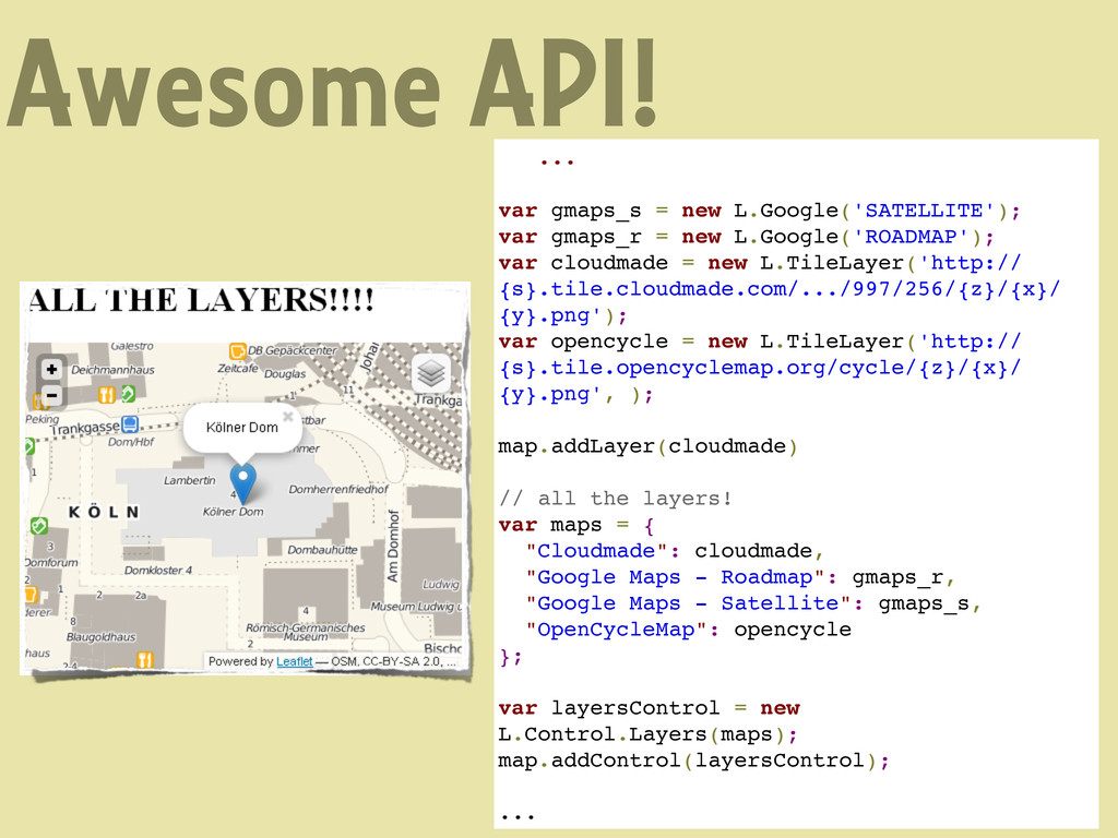
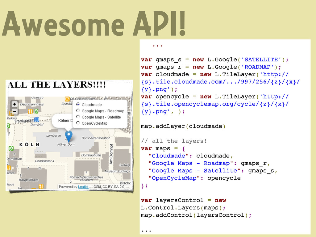
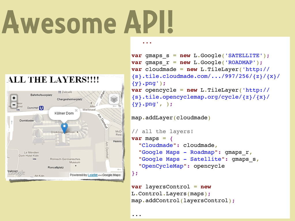
= new L.Google('ROADMAP'); var cloudmade = new L.TileLayer('http:// {s}.tile.cloudmade.com/.../997/256/{z}/{x}/ {y}.png'); var opencycle = new L.TileLayer('http:// {s}.tile.opencyclemap.org/cycle/{z}/{x}/ {y}.png', ); map.addLayer(cloudmade) // all the layers! var maps = { "Cloudmade": cloudmade, "Google Maps - Roadmap": gmaps_r, "Google Maps - Satellite": gmaps_s, "OpenCycleMap": opencycle }; var layersControl = new L.Control.Layers(maps); map.addControl(layersControl); ...
= new L.Google('ROADMAP'); var cloudmade = new L.TileLayer('http:// {s}.tile.cloudmade.com/.../997/256/{z}/{x}/ {y}.png'); var opencycle = new L.TileLayer('http:// {s}.tile.opencyclemap.org/cycle/{z}/{x}/ {y}.png', ); map.addLayer(cloudmade) // all the layers! var maps = { "Cloudmade": cloudmade, "Google Maps - Roadmap": gmaps_r, "Google Maps - Satellite": gmaps_s, "OpenCycleMap": opencycle }; var layersControl = new L.Control.Layers(maps); map.addControl(layersControl); ...
= new L.Google('ROADMAP'); var cloudmade = new L.TileLayer('http:// {s}.tile.cloudmade.com/.../997/256/{z}/{x}/ {y}.png'); var opencycle = new L.TileLayer('http:// {s}.tile.opencyclemap.org/cycle/{z}/{x}/ {y}.png', ); map.addLayer(cloudmade) // all the layers! var maps = { "Cloudmade": cloudmade, "Google Maps - Roadmap": gmaps_r, "Google Maps - Satellite": gmaps_s, "OpenCycleMap": opencycle }; var layersControl = new L.Control.Layers(maps); map.addControl(layersControl); ...