Stephen Bathgate from Forest research on how implementing a GIS delivered savings and efficiencies to a small workforce. Presented at 6th Scottish QGIS UK user group meeting.
selecting tree species 2. Decision Support Systems for Forestry 3. Ecological Site Classification (ESC) 4. ESC4 Decision Support System 5. Conclusions and Questions
70s the principle of matching species to site was turned around, and some sites were matched to species with ploughing and fertiliser. • The advent of Sustainable Forest Management, coupled with increasing costs, led to a reduction in fertiliser use in the 90s. Objectives changed away from production. • Skills and staff were lost. • Land available for afforestation was often degraded, poor choices about species potential arose. • The range of site types, tree species and potential future climates a forester might need to analyse required digital data and computer processing.
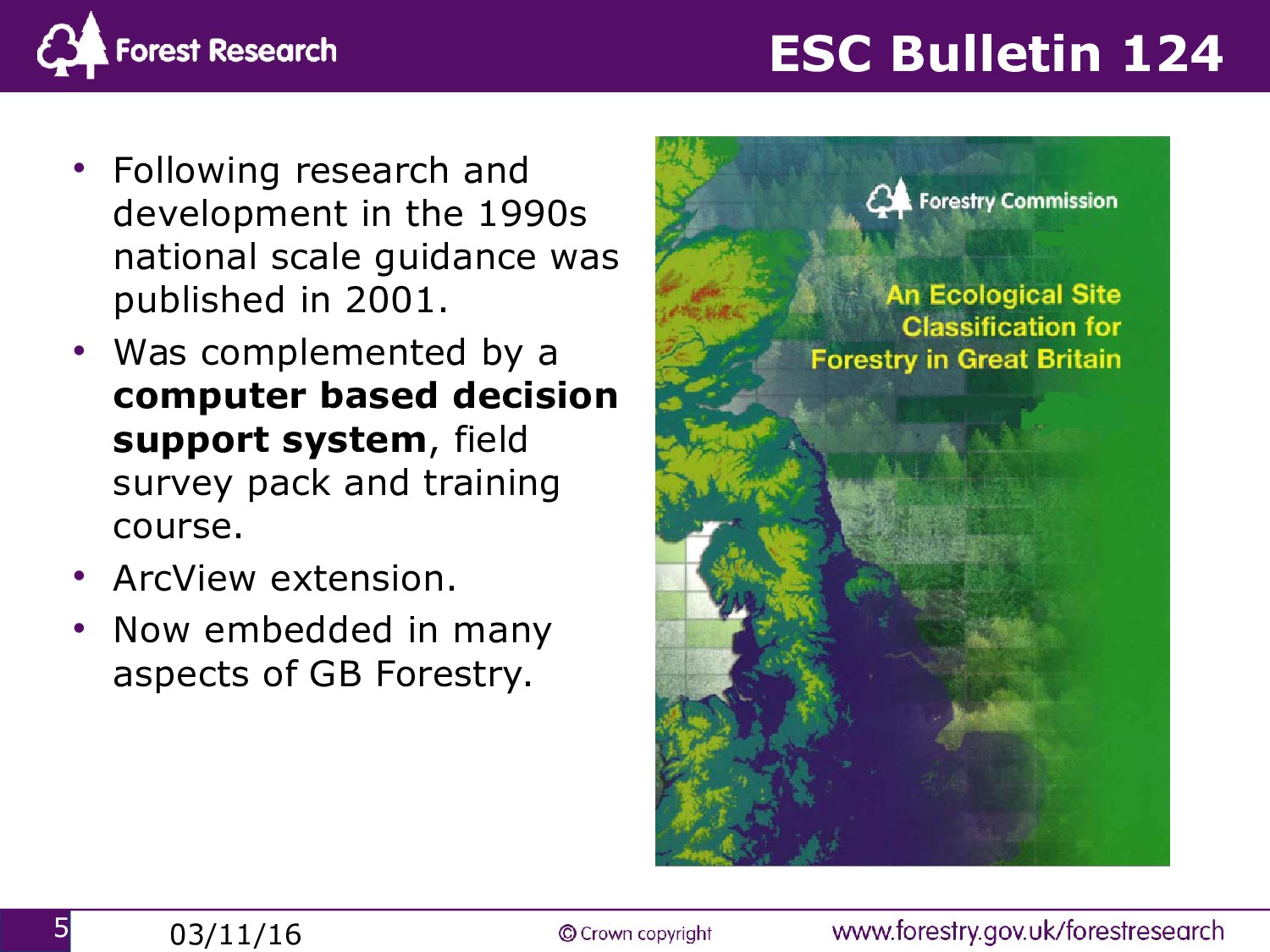
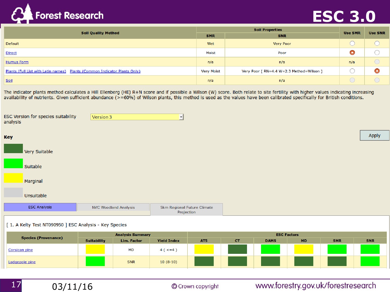
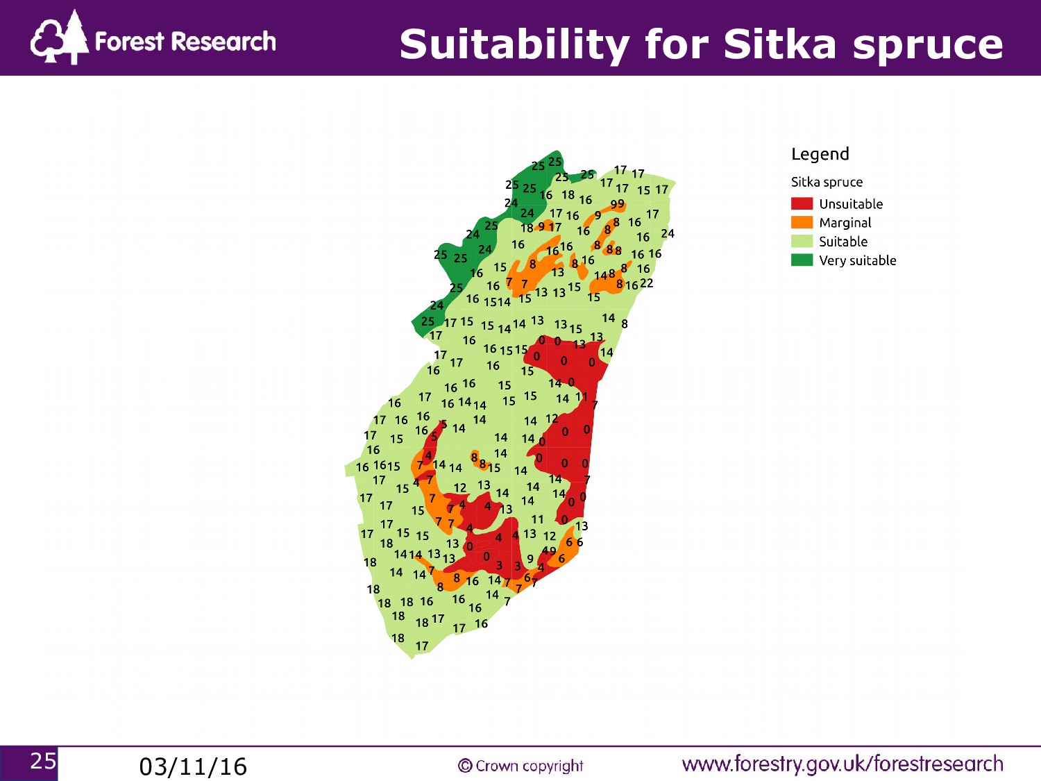
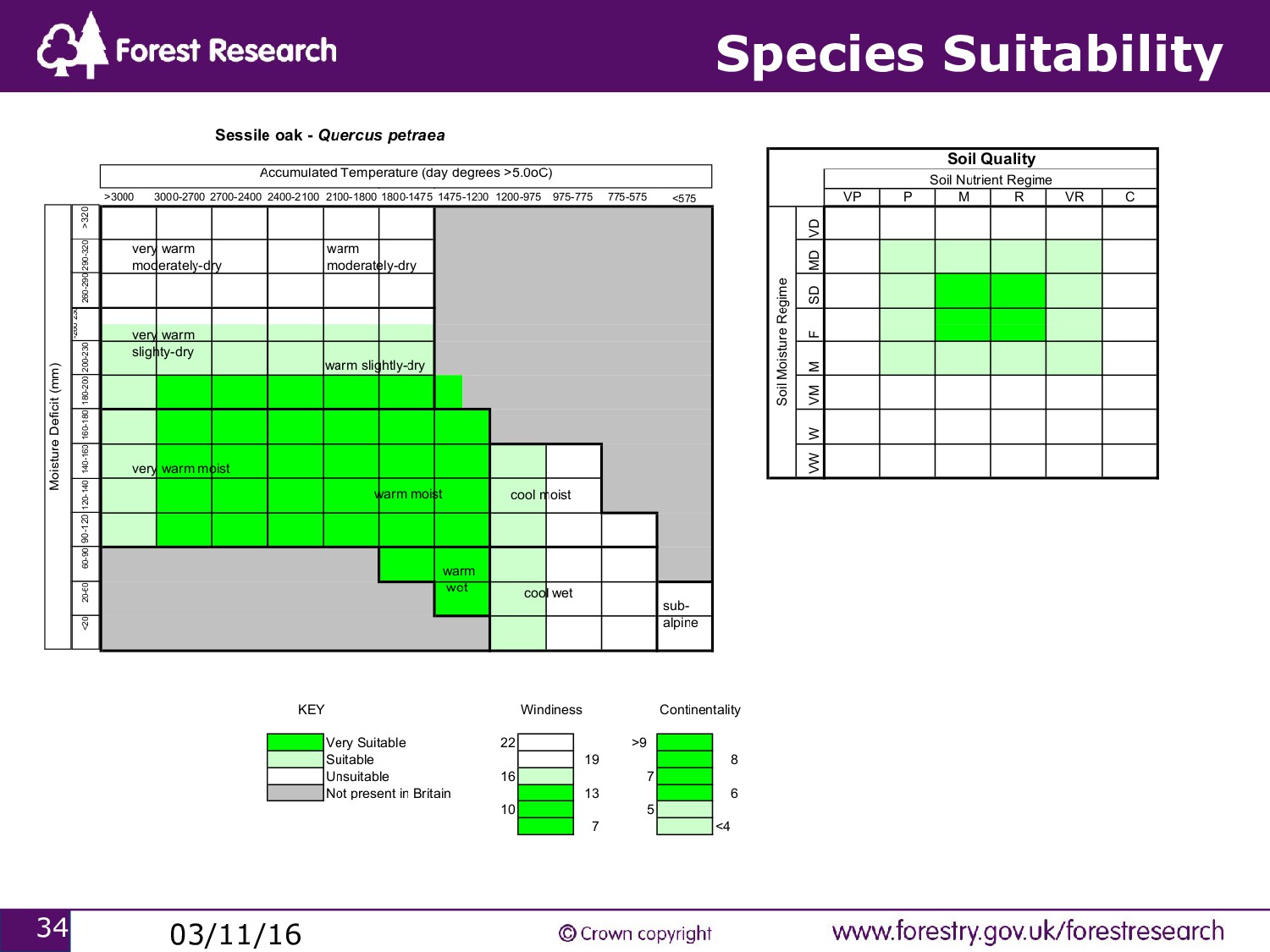
in the 1990s national scale guidance was published in 2001. • Was complemented by a computer based decision support system, field survey pack and training course. • ArcView extension. • Now embedded in many aspects of GB Forestry.
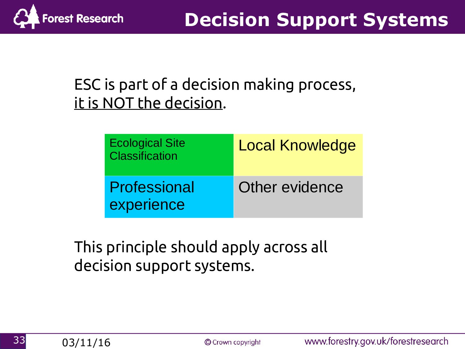
problem so that users can evaluate the relative merits of different management actions. 2. Intended to complement, not replace, expert/local knowledge. 3. Rubbish in, rubbish out. 4. Uncertainty/error/assumptions in models/data.
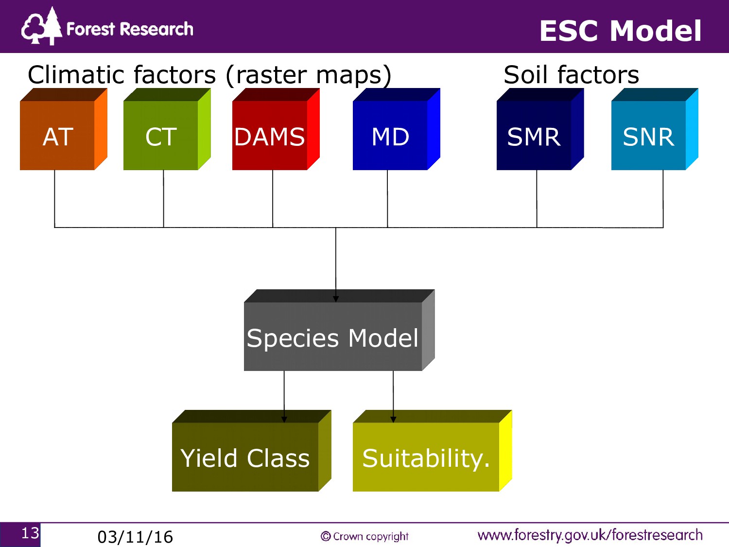
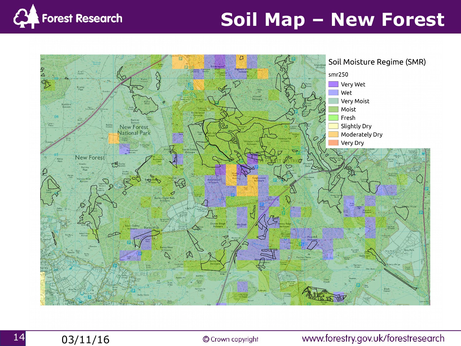
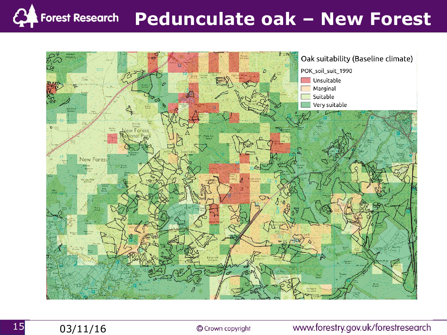
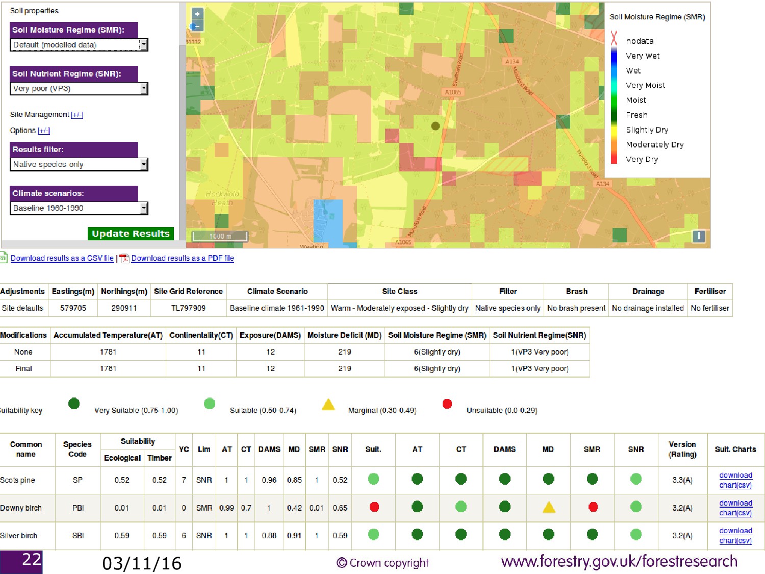
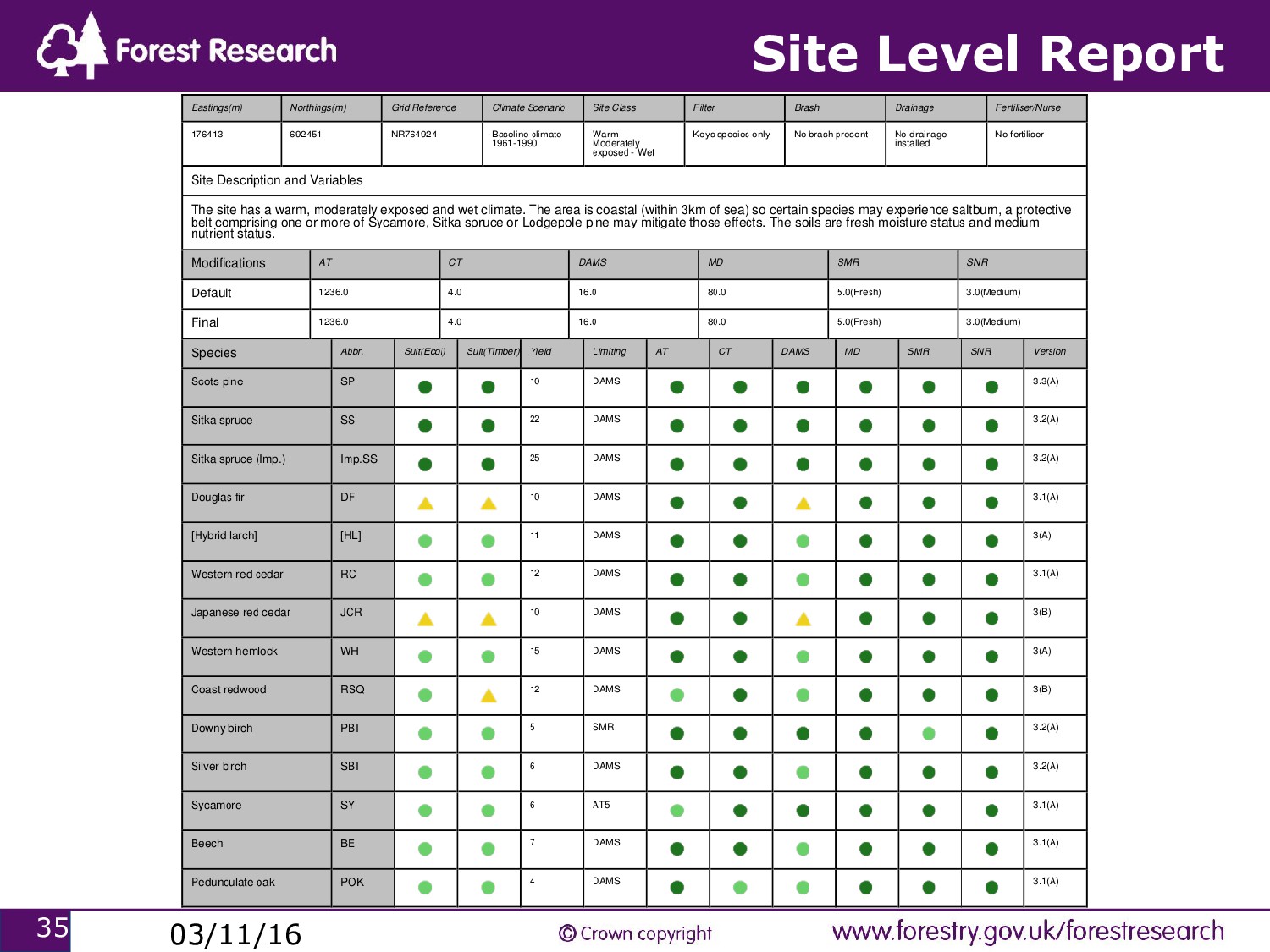
context 1. query the properties of a site (climate/soil) 2. analyse those properties with a scientific model 3. return the results to the user. • The climatic data is usually in raster format (250mx250m pixels). • Some models have spatial interactions (e.g. insects move according to their preferences for certain sites).
forestry • Public sector forestry (operational/policy) With such a broad spectrum of users ESC tools have to be relatively agnostic to technology – web based tools and paper based systems.
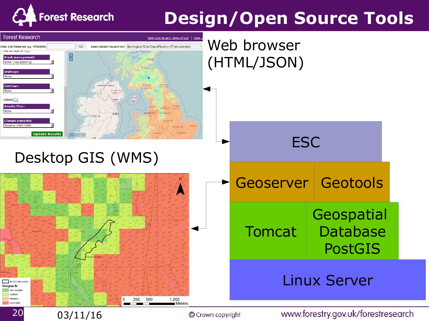
imposing technical requirements (and costs) upon end users (e.g. Windows only desktop tools). - ensure interoperability of geospatial data and services across platforms. • In ESC4 we use web map services (WMS), GeoJSON, CSV and other open data formats.
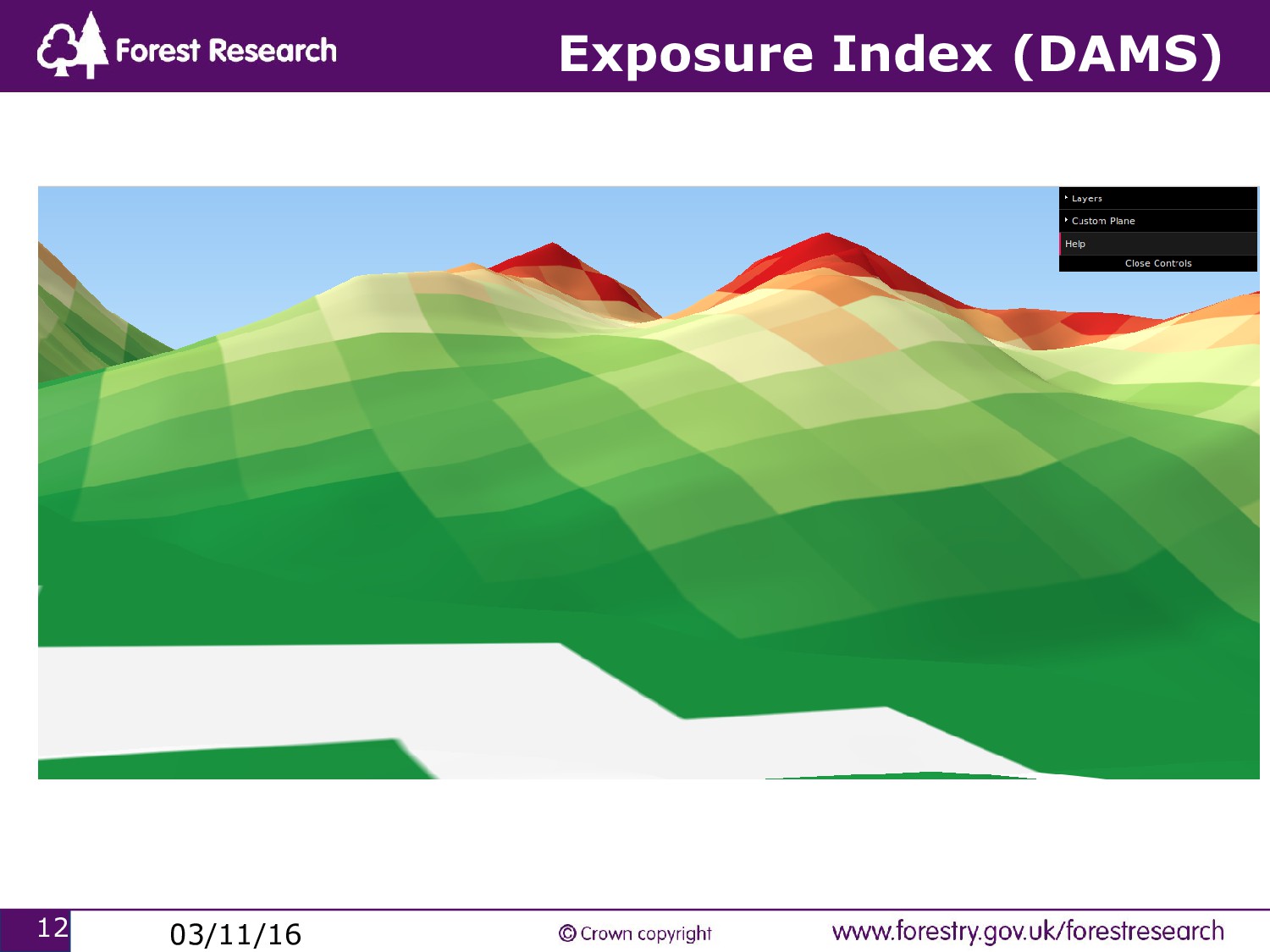
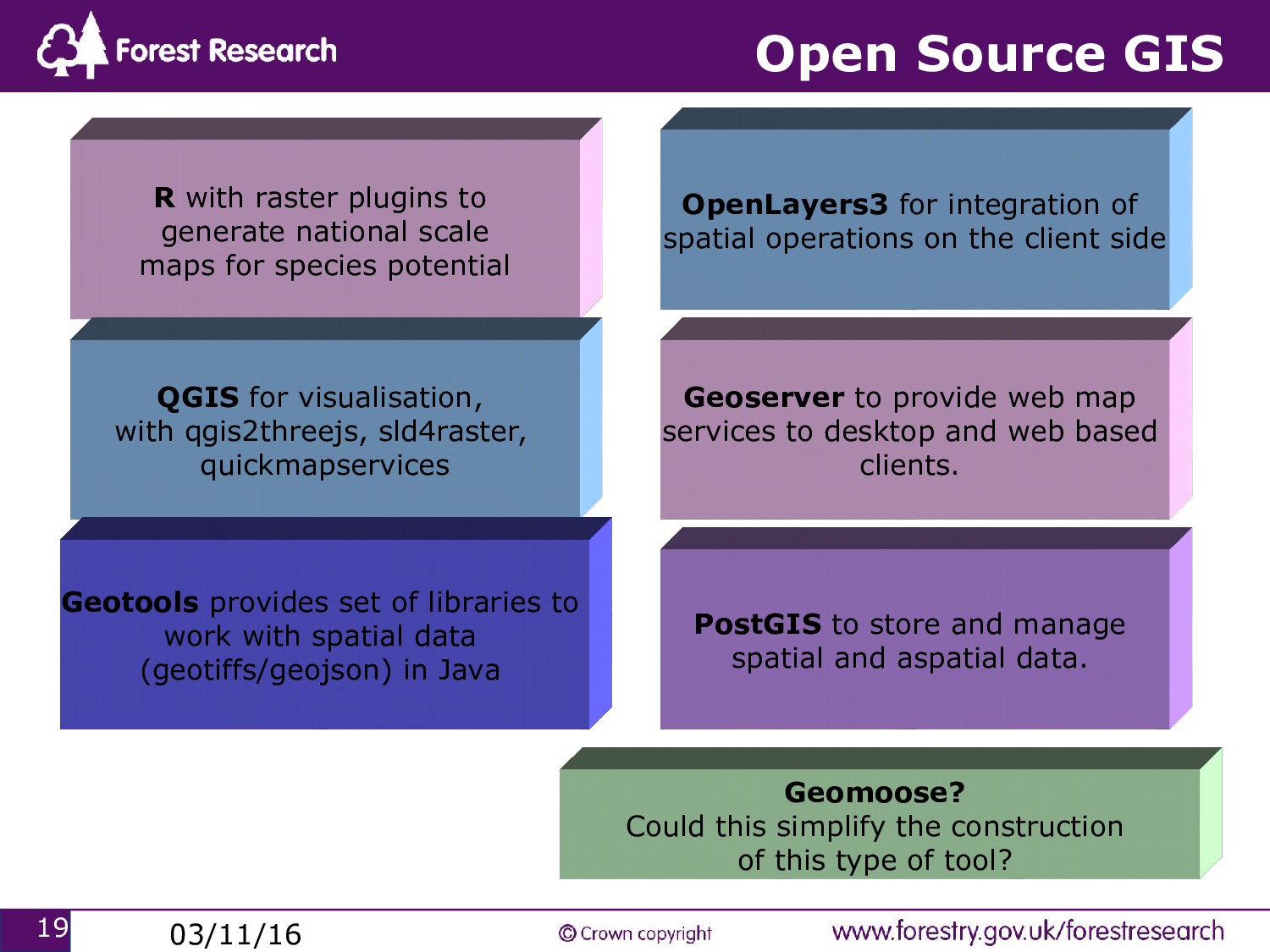
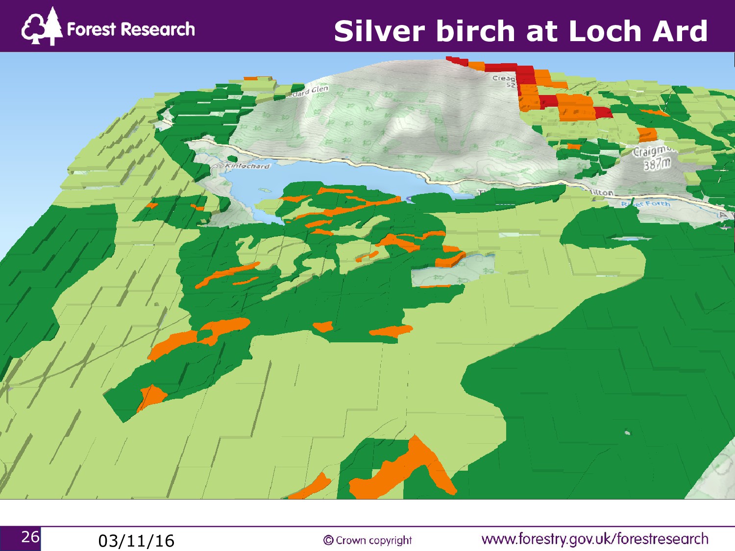
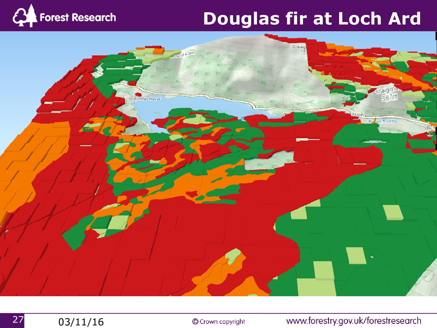
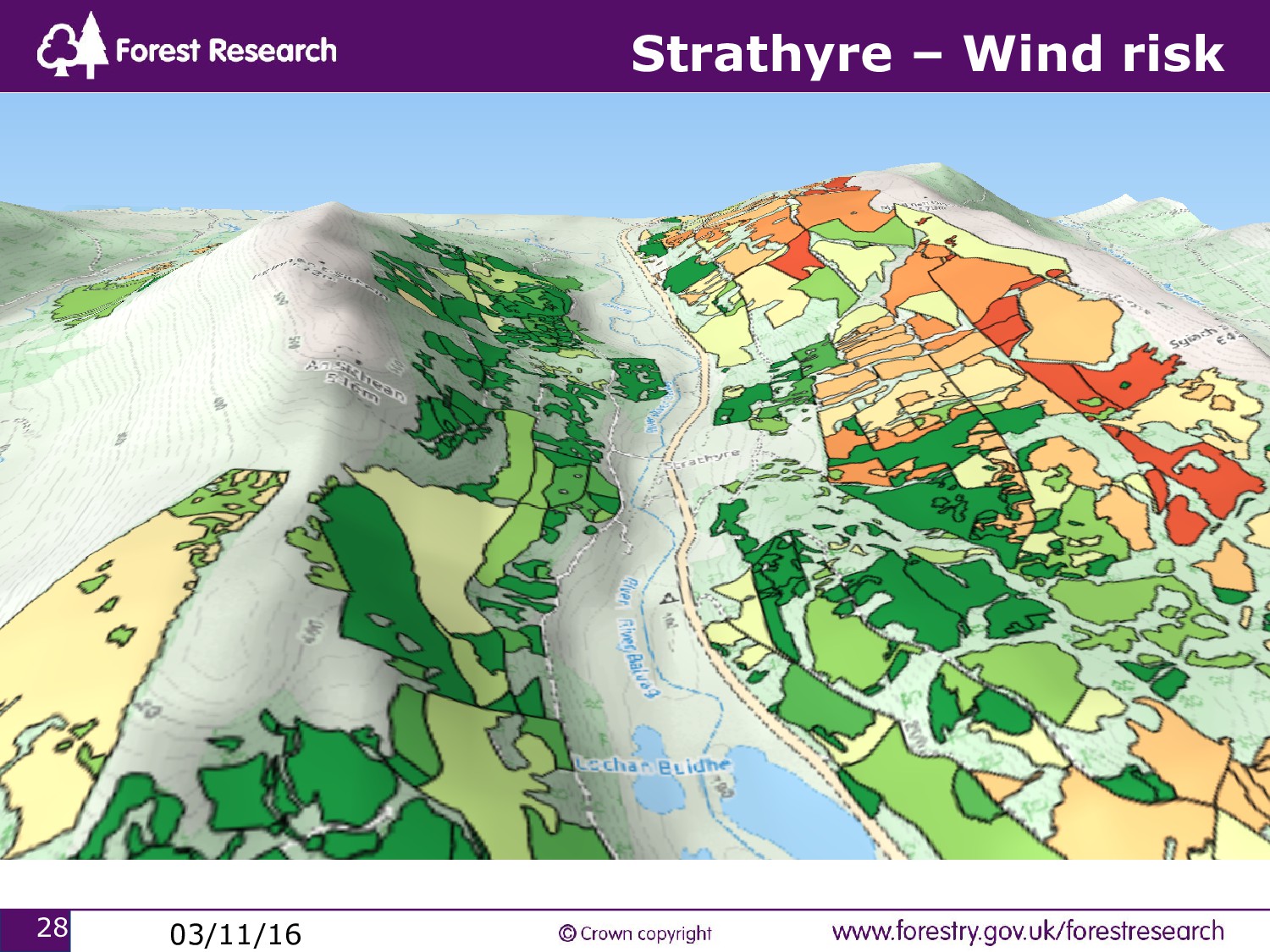
generate national scale maps for species potential QGIS for visualisation, with qgis2threejs, sld4raster, quickmapservices Geotools provides set of libraries to work with spatial data (geotiffs/geojson) in Java OpenLayers3 for integration of spatial operations on the client side Geoserver to provide web map services to desktop and web based clients. Geomoose? Could this simplify the construction of this type of tool? PostGIS to store and manage spatial and aspatial data.
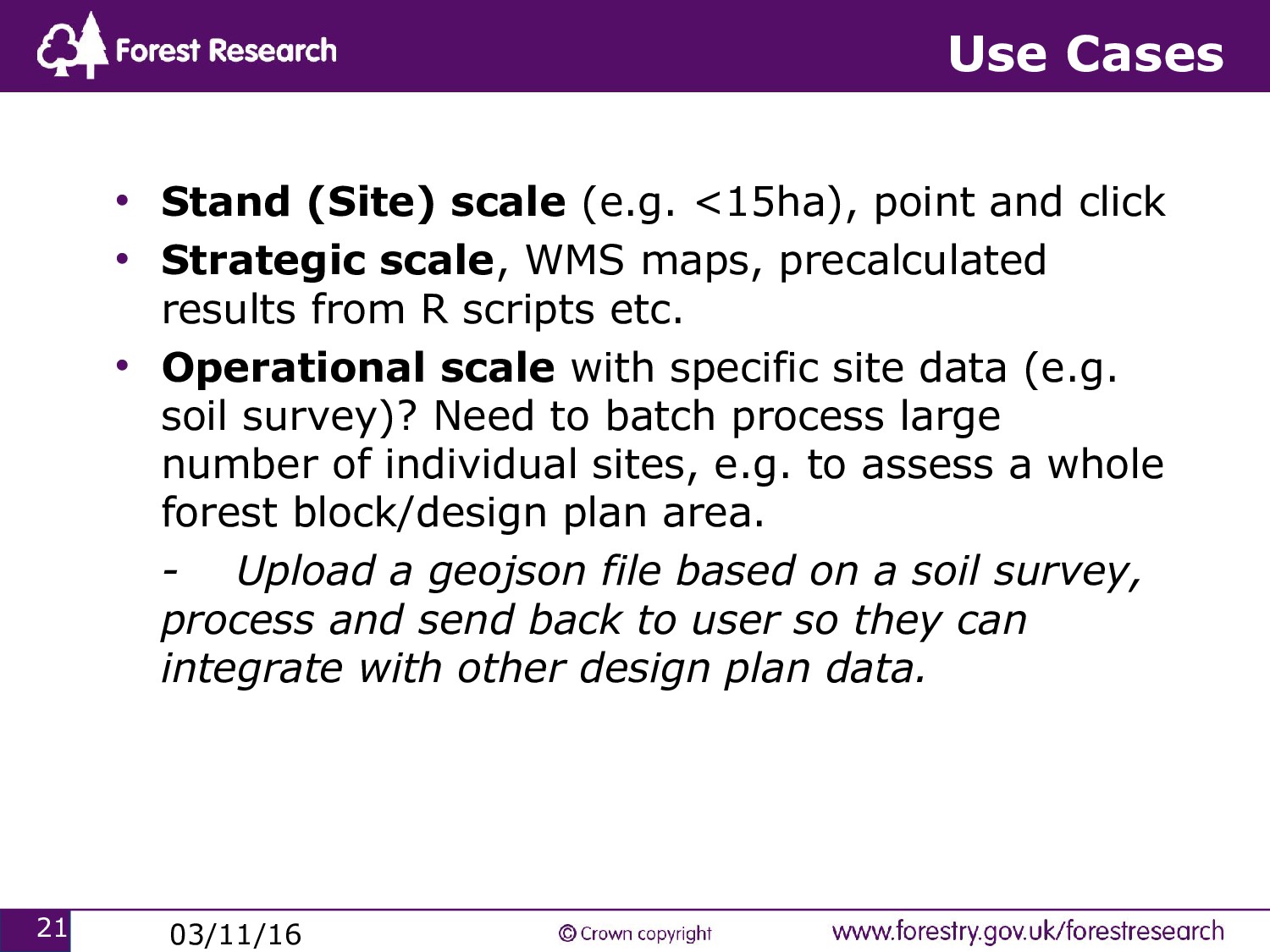
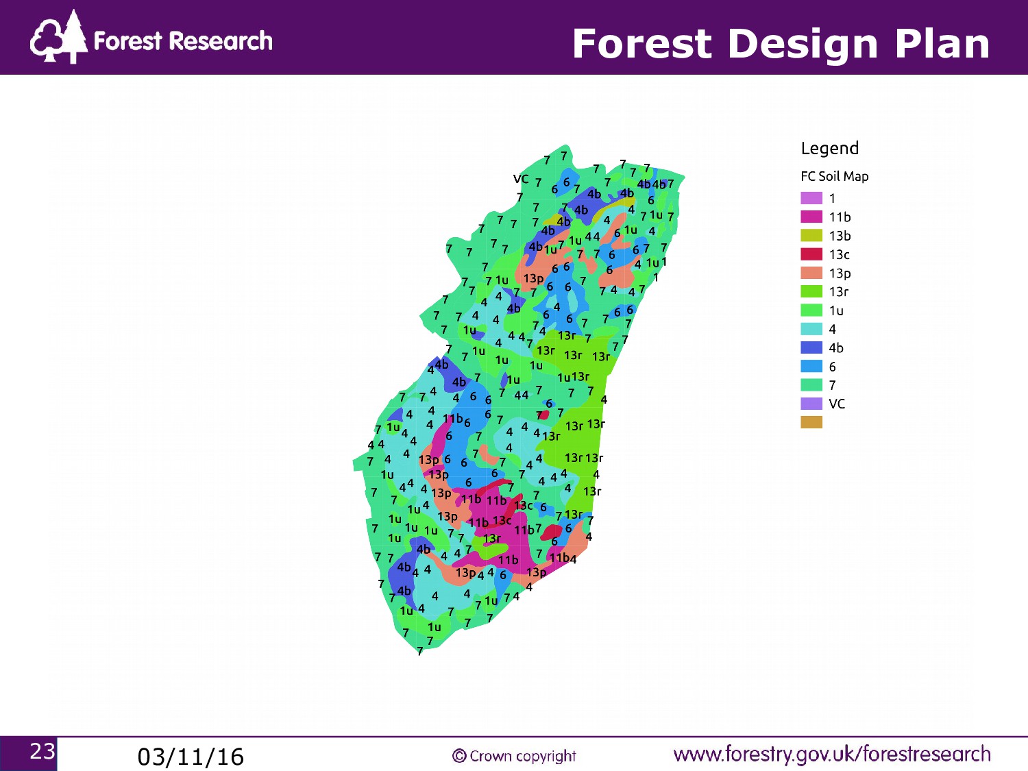
point and click • Strategic scale, WMS maps, precalculated results from R scripts etc. • Operational scale with specific site data (e.g. soil survey)? Need to batch process large number of individual sites, e.g. to assess a whole forest block/design plan area. - Upload a geojson file based on a soil survey, process and send back to user so they can integrate with other design plan data.
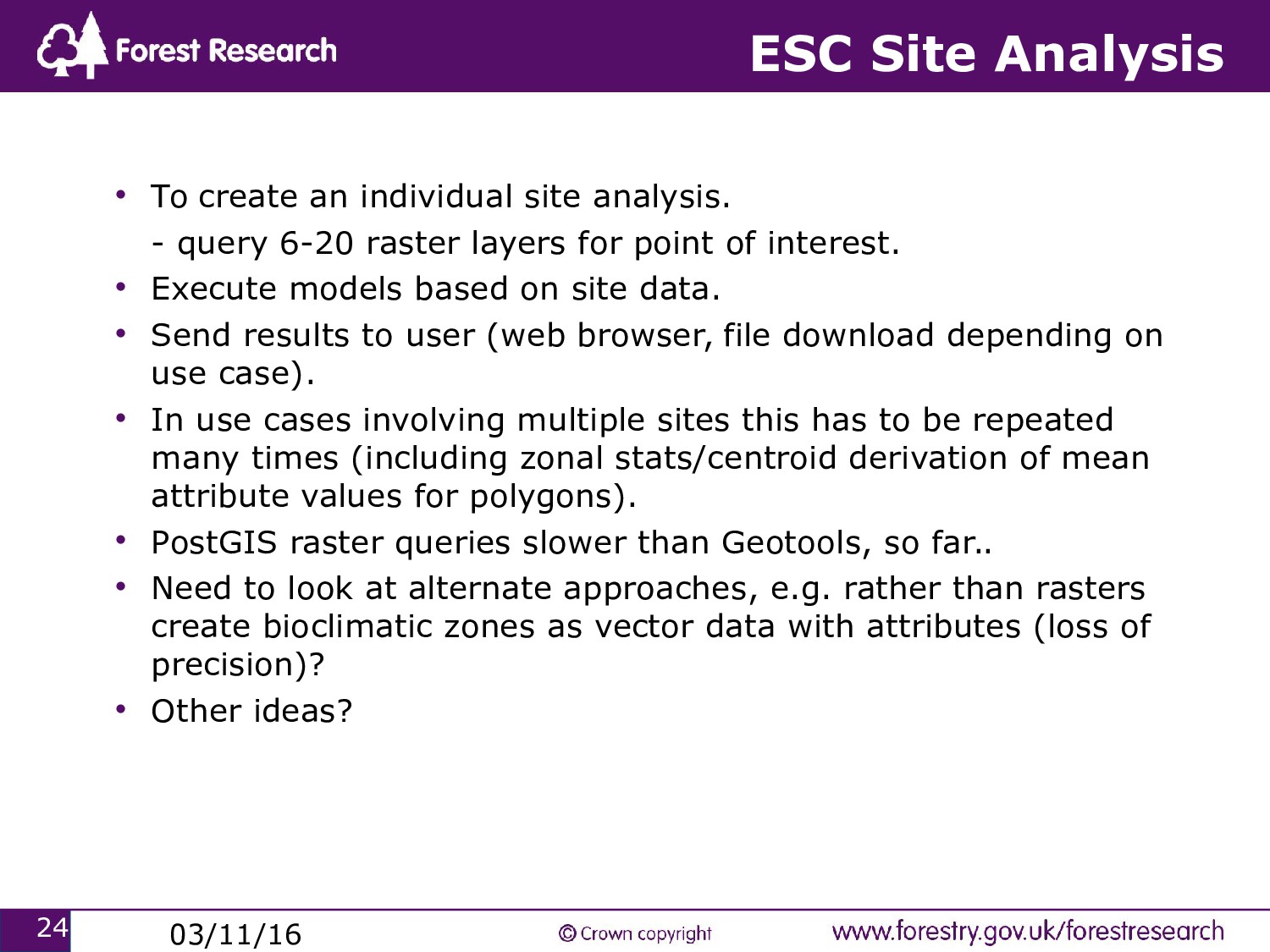
site analysis. - query 6-20 raster layers for point of interest. • Execute models based on site data. • Send results to user (web browser, file download depending on use case). • In use cases involving multiple sites this has to be repeated many times (including zonal stats/centroid derivation of mean attribute values for polygons). • PostGIS raster queries slower than Geotools, so far.. • Need to look at alternate approaches, e.g. rather than rasters create bioclimatic zones as vector data with attributes (loss of precision)? • Other ideas?
in progress. • Refining user interface and working with user groups. • Adding other decision tools. • Optimisation of operational applications. • Looking at options for open source survey data collection e.g. QGIS extension. http://www.forestdss.org.uk/geoforestdss/esc4.jsp [email protected]
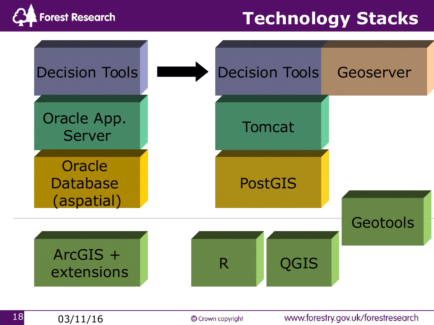
based on Oracle technology and proprietary GIS. • Learning curve and range of open source GIS tools e.g. GRASS, Gvsig, QGIS + many others, Mapserver/Geoserver. What to choose? • Licensing constraints around certain tools and data. • Developing capacity/capability to support an open source infrastructure. • Range of user communities and their expectations. • Resistance to open source(or change). Security constraints, one tool per business requirement, concerns over integration and support. The creation of parallel open source environments was necessary to workaround certain barriers and prove the merits of open source.
Professional experience Other evidence ESC is part of a decision making process, it is NOT the decision. This principle should apply across all decision support systems.


 mixedbredie
 riyaamemiya
 iktakahiro
 kenichiodo
 takanorip
 kaminashi
 teamlab
 keeg
 koukihosaka
 daidaidai
 hiracky16
 ezaki
 gogutan
 brettharned
 chriscoyier
 jcasabona
 helmedeiros
 aarron
 morganepeng
 deanohume
 aleyda
 addyosmani
 sachag
 cassininazir
 codingconduct