Upgrade to Pro — share decks privately, control downloads, hide ads and more …

Creating a web map of Russian natural reserves

Creating a web map of Russian natural reserves

English version of the workshop given at GISconf 2012 in Moscow, Russia on 18.11.2012

Nick Lebedev

November 18, 2012
Tweet

More Decks by Nick Lebedev

Other Decks in Programming

Transcript

  1. MAP THEME TASK: Create an interactive web map of Russian

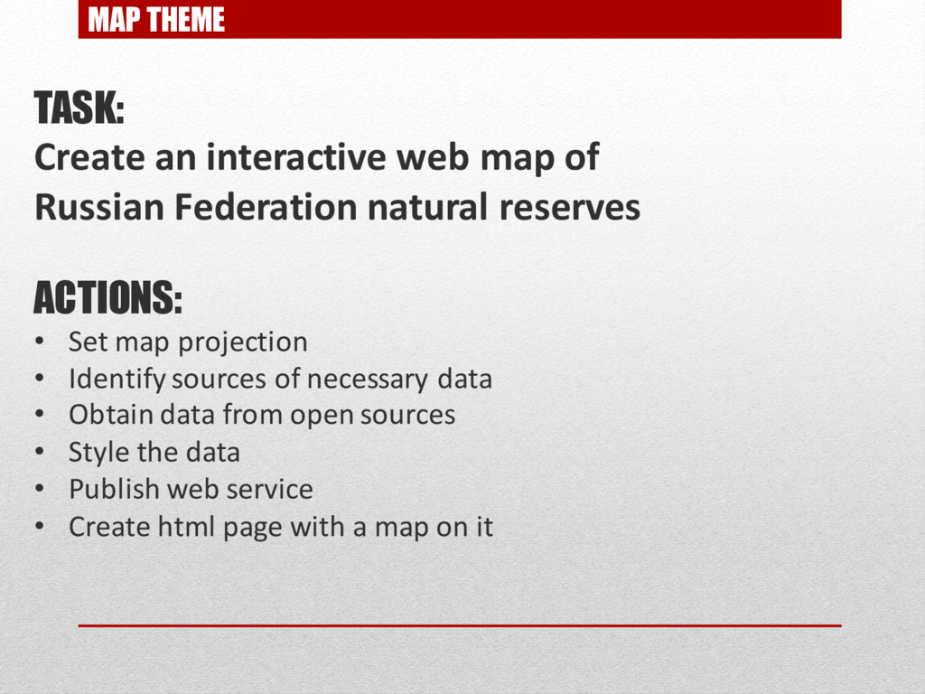
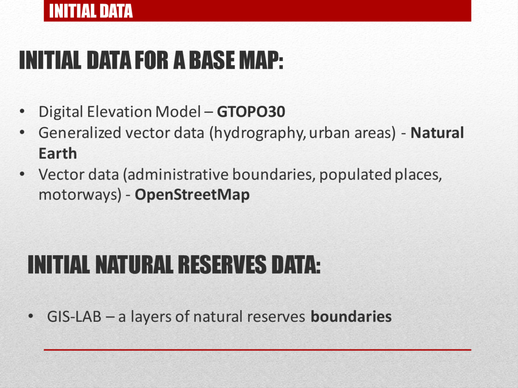
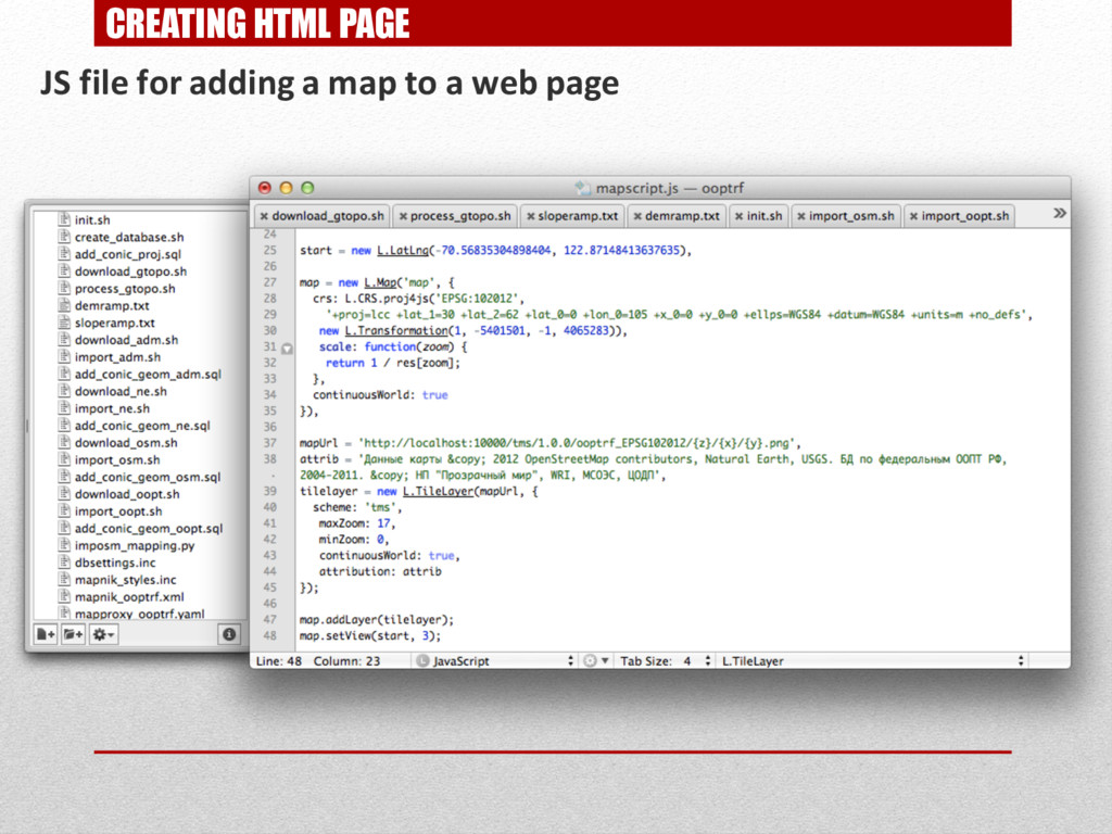
    Federation natural reserves ACTIONS: • Set map projection • Identify sources of necessary data • Obtain data from open sources • Style the data • Publish web service • Create html page with a map on it
  2. MAP PROJECTION PECULIARITIES OF RUSSIAN FEDERATION TERRITORY: • Crosses 180

    meridian (dateline) • Lies completely in northern hemisphere • Very wide by longitude spatialreference.org– catalog of map projection parameters
  3. MAP PROJECTION RUSSIA IN DIFFERENT PROJECTIONS: EPSG:4326 EPSG:3857 (WEB MERCATOR)

    +proj=merc +a=6378137 +b=6378137 +lat_ts=0.0 +lon_0=0.0 +x_0=0.0 +y_0=0 +k=1.0 +units=m +nadgrids=@null +no_defs
  4. MAP PROJECTION RUSSIA IN DIFFERENT PROJECTIONS: EPSG:4326 EPSG:3857 (WEB MERCATOR)

    ECKERT VI +proj=eck6 +lon_0=0 +x_0=0 +y_0=0 +ellps=WGS84 +towgs84=0,0,0,0,0,0,0 +units=m +no_defs
  5. MAP PROJECTION RUSSIA IN DIFFERENT PROJECTIONS: EPSG:4326 EPSG:3857 (WEB MERCATOR)

    ECKERT VI LAMBERT CONFORMAL CONIC +proj=lcc +lat_1=30 +lat_2=62 +lat_0=0 +lon_0=105 +x_0=0 +y_0=0 +ellps=WGS84 +towgs84=0,0,0,0,0,0,0 +units=m +no_defs
  6. INITIAL DATA INITIAL DATA FOR A BASE MAP: • Digital

    Elevation Model – GTOPO30 • Generalized vector data (hydrography, urban areas) - Natural Earth • Vector data (administrative boundaries, populated places, motorways) - OpenStreetMap INITIAL NATURAL RESERVES DATA: • GIS-LAB – a layers of natural reserves boundaries
  7. USED TOOLS STORAGE AND DATA FORMATS: • Raster data– GeoTiff

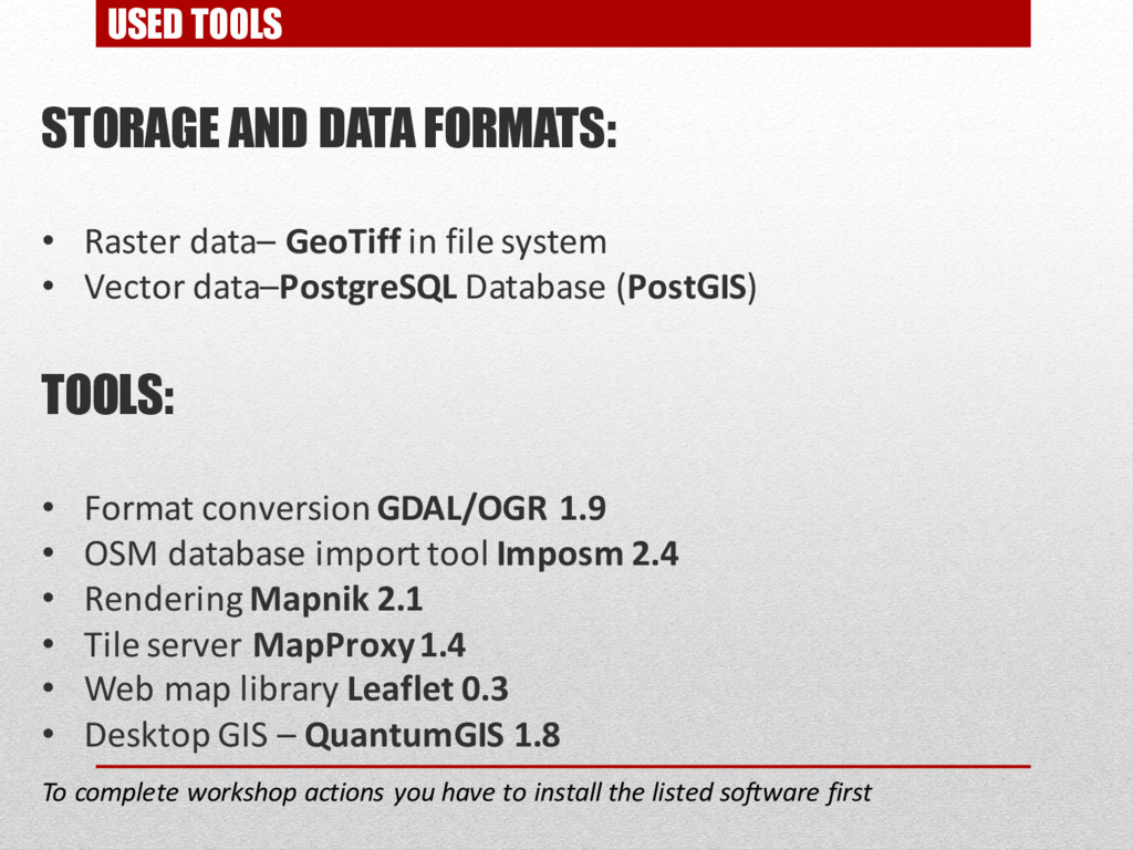
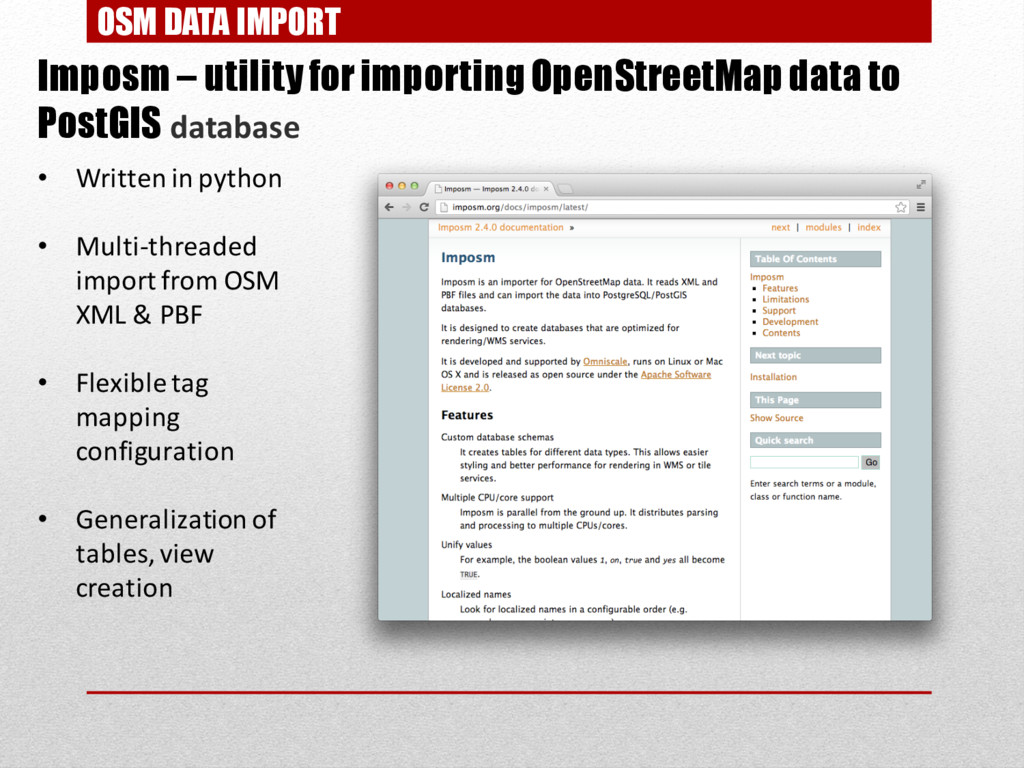
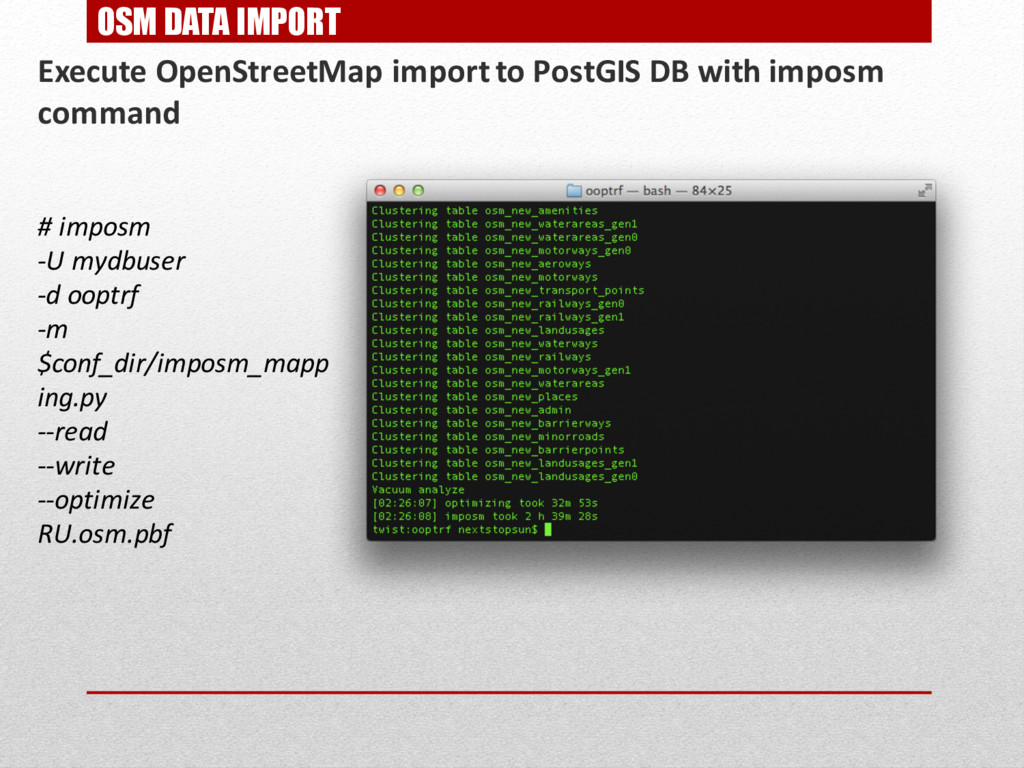
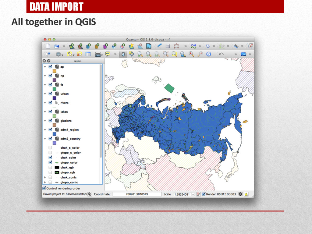
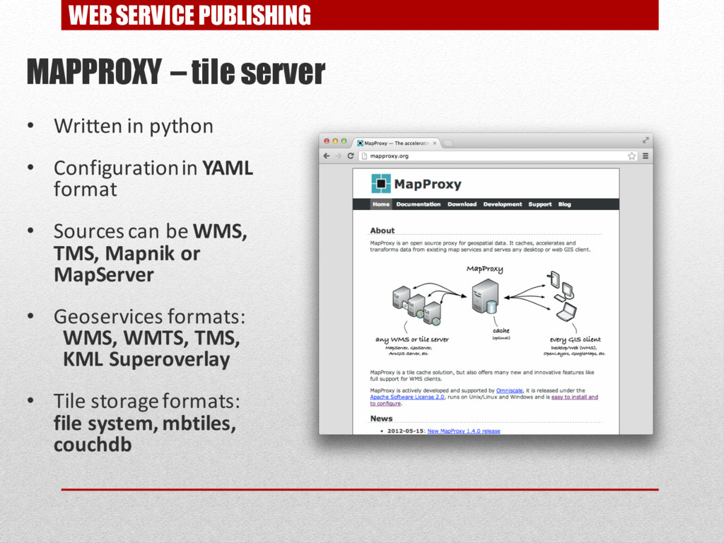
    in file system • Vector data–PostgreSQL Database (PostGIS) TOOLS: • Format conversionGDAL/OGR 1.9 • OSM database import tool Imposm 2.4 • Rendering Mapnik 2.1 • Tile server MapProxy1.4 • Web map library Leaflet 0.3 • Desktop GIS – QuantumGIS 1.8 To complete workshop actions you have to install the listed software first
  8. INITIAL DATA GTOPO30 – DEM raster data Coverage: world Resolutin:

    30 arcseconds in a pixel (~1km) Vertical resolution: 1m Data format: HDR Dataset can be downloaded in parts by 40x50 degrees
  9. GTOPO DATA PROCESSING Merging to single coverage with gdal_merge #

    gdal_merge.py -o gtopo_merged.tif E020N90.DEM E060N90.DEM E100N90.DEM E140N90.DEM
  10. GTOPO DATA PROCESSING Cutting by Russian Federation boundaries and reprojecting

    to conic projection # gdalwarp -s_srs EPSG:4326 -t_srs EPSG:102012 -srcnodata -9999 -dstnodata - 9999 -r lanczos -of GTiff -co TILED=YES -overwrite -cutline $adm_dir/adm2_country.shp gtopo_merged.tifgtopo_conic.tif
  11. GTOPO DATA PROCESSING Cutting by Russian Federation boundaries and reprojecting

    to conic projection # gdalwarp -s_srs EPSG:4326 -t_srs EPSG:102012 -srcnodata -9999 -dstnodata - 9999 -r lanczos -of GTiff -co TILED=YES -overwrite -cutline $adm_dir/adm2_country.shp gtopo_merged.tifgtopo_conic.tif <102012> +proj=lcc +lat_1=30 +lat_2=62 +lat_0=0 +lon_0=105 +x_0=0 +y_0=0 +ellps=WGS84 +datum=WGS84 +units=m +no_defs <>
  12. GTOPO DATA PROCESSING Cutting by Russian Federation boundaries and reprojecting

    to conic projection after dateline # gdalwarp -s_srs EPSG:4326 -t_srs EPSG:102012 -srcnodata -9999 -dstnodata - 9999 -r lanczos -of GTiff -co TILED=YES -overwrite -cutline $adm_dir/adm2_country.shp W180N90.DEM chuk_conic.tif <102012> +proj=lcc +lat_1=30 +lat_2=62 +lat_0=0 +lon_0=105 +x_0=0 +y_0=0 +ellps=WGS84 +datum=WGS84 +units=m +no_defs <>
  13. GTOPO DATA PROCESSING Mapping RGB color values from color ramp

    to DEM heights # gdaldem color-relief gtopo_conic.tif $conf_dir/demramp.txt gtopo_rgb.tif # gdaldem color-relief chuk_conic.tif $conf_dir/demramp.txt chuk_rgb.tif
  14. GTOPO DATA PROCESSING Setting NODATA for color 0 0 0

    (making transparent background) # gdal_translate -a_nodata "0 0 0" gtopo_rgb.tif gtopo_color.tif # gdal_translate -a_nodata "0 0 0” chuk_rgb.tif chuk_color.tif
  15. GTOPO DATA PROCESSING Creating hillshades from DEM # gdaldem hillshade

    -of GTiff-compute_edges gtopo_conic.tif gtopo_hs.tif # gdaldem hillshade -of GTiff-compute_edges chuk_conic.tif chuk_hs.tif
  16. GTOPO DATA PROCESSING Creating and colouring slopeshade from DEM #

    gdaldem slope chuk_conic.tif chuk_slope.tif # gdaldem slope gtopo_conic.tif gtopo_slope.tif # gdaldem color-relief gtopo_slope.tif$conf_dir/sloperamp.txt gtopo_scolor.tif # gdaldem color-relief chuk_slope.tif $conf_dir/sloperamp.txt chuk_scolor.tif
  17. GTOPO DATA PROCESSING Speeding up data reading on different scales.

    Adding pyramid layers (overviews) # gdaladdo gtopo_color.tif 2 4 8 16 32 # gdaladdo gtopo_hs.tif 2 4 8 16 32 # gdaladdo gtopo_scolor.tif 2 4 8 16 32
  18. INITIAL DATA NATURAL EARTH – datasets of global generalized geodata

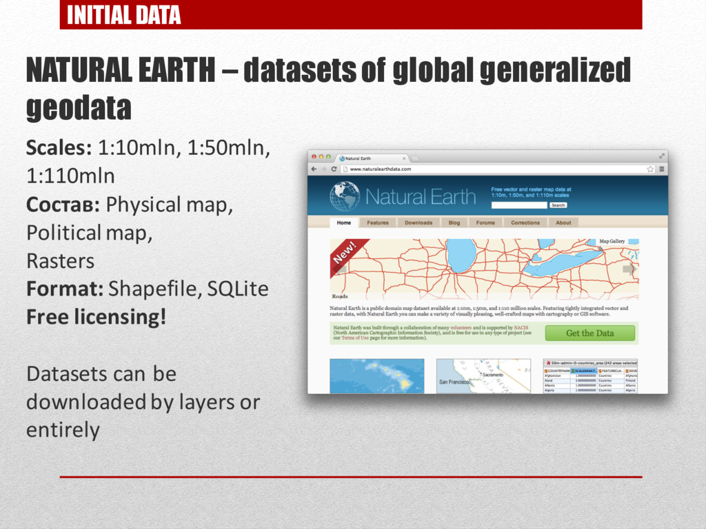
    Scales: 1:10mln, 1:50mln, 1:110mln Состав: Physical map, Political map, Rasters Format: Shapefile, SQLite Free licensing! Datasets can be downloaded by layers or entirely
  19. NATURAL EARTH DATA IMPORT Importing Natural Earth data to PostGIS

    database Cutting imported data with Russian Federation borders #Importing urban areas ogr2ogr -a_srs EPSG:4326 -wrapdateline -clipsrc $adm_dir/adm2_country.shp -f "PostgreSQL" "$dbsettings" ne_10m_urban_areas.shp -nln "ne.urban" -nlt MULTIPOLYGON -overwrite -lco ENCODING=UTF-8 #Importing rivers cd $ne_dir/10m_physical ogr2ogr -a_srs EPSG:4326 -wrapdateline -clipsrc $adm_dir/adm2_country.shp -f "PostgreSQL" "$dbsettings" ne_10m_rivers_lake_centerlines_scale_rank.shp -nln "ne.rivers" -nlt MULTILINESTRING -overwrite -lco ENCODING=UTF-8 #Importing glaciers ogr2ogr -a_srs EPSG:4326 -wrapdateline -clipsrc $adm_dir/adm2_country.shp -f "PostgreSQL" "$dbsettings" ne_10m_glaciated_areas.shp -nln "ne.glaciers" -nlt MULTIPOLYGON -overwrite -lco ENCODING=UTF-8 #Importing lakes ogr2ogr -a_srs EPSG:4326 -wrapdateline -clipsrc $adm_dir/adm2_country.shp -f "PostgreSQL" "$dbsettings" ne_10m_lakes.shp -nln "ne.lakes" -nlt MULTIPOLYGON -overwrite -lco ENCODING=UTF-8 PostgreSQL and PostGIS libraries should be installed to perform this tasks!
  20. INITIAL DATA OPENSTREETMAP – open map of the world, created

    by community of enthusiasts Coverage: non-uniform Format: XML Free licensing Dataset can be downloaded entirely (planet.osm) or by extracts
  21. OSM DATA IMPORT Imposm – utility for importingOpenStreetMapdata to PostGIS

    database • Written in python • Multi-threaded import from OSM XML & PBF • Flexible tag mapping configuration • Generalization of tables, view creation
  22. OSM DATA IMPORT Execute OpenStreetMap import to PostGIS DB with

    imposm command # imposm -U mydbuser -d ooptrf -m $conf_dir/imposm_mapp ing.py --read --write --optimize RU.osm.pbf
  23. NATURAL RESERVES BOUNDARIES DATA Data format: Shapefile Data contains: •

    Federal reserves • National parks • Local nature reserves The cartographic database of federal protected areas in Russia © World Resources Institute © International Socio-Ecological Union © Conservation Center © Transparent World
  24. NATURAL RESERVES BOUNDARIES DATA IMPORT Importing natural reserves boundaries to

    PostGIS database # wget http://gis-lab.info/data/oopt/pa_russia_utf8.7z # ogr2ogr -a_srs "+proj=longlat +ellps=krass +towgs84=23.92,-141.27,-80.9,- 0,0.35,0.82,-0.12 +no_defs" -t_srs EPSG:4326 -wrapdateline -f "PostgreSQL" "$dbsettings" $oopt_dir/fz-bcc.shp -nln "oopt.fz" -nlt MULTIPOLYGON - overwrite -lco ENCODING=UTF-8 # ogr2ogr -a_srs "+proj=longlat +ellps=krass +towgs84=23.92,-141.27,-80.9,- 0,0.35,0.82,-0.12 +no_defs" -t_srs EPSG:4326 -wrapdateline -f "PostgreSQL" "$dbsettings" $oopt_dir/np-bcc.shp -nln "oopt.np" -nlt MULTIPOLYGON - overwrite -lco ENCODING=UTF-8 PostgreSQL and PostGIS libraries should be installed to perform this tasks!
  25. NATURAL RESERVES BOUNDARIES DATA Adding a new geometry field with

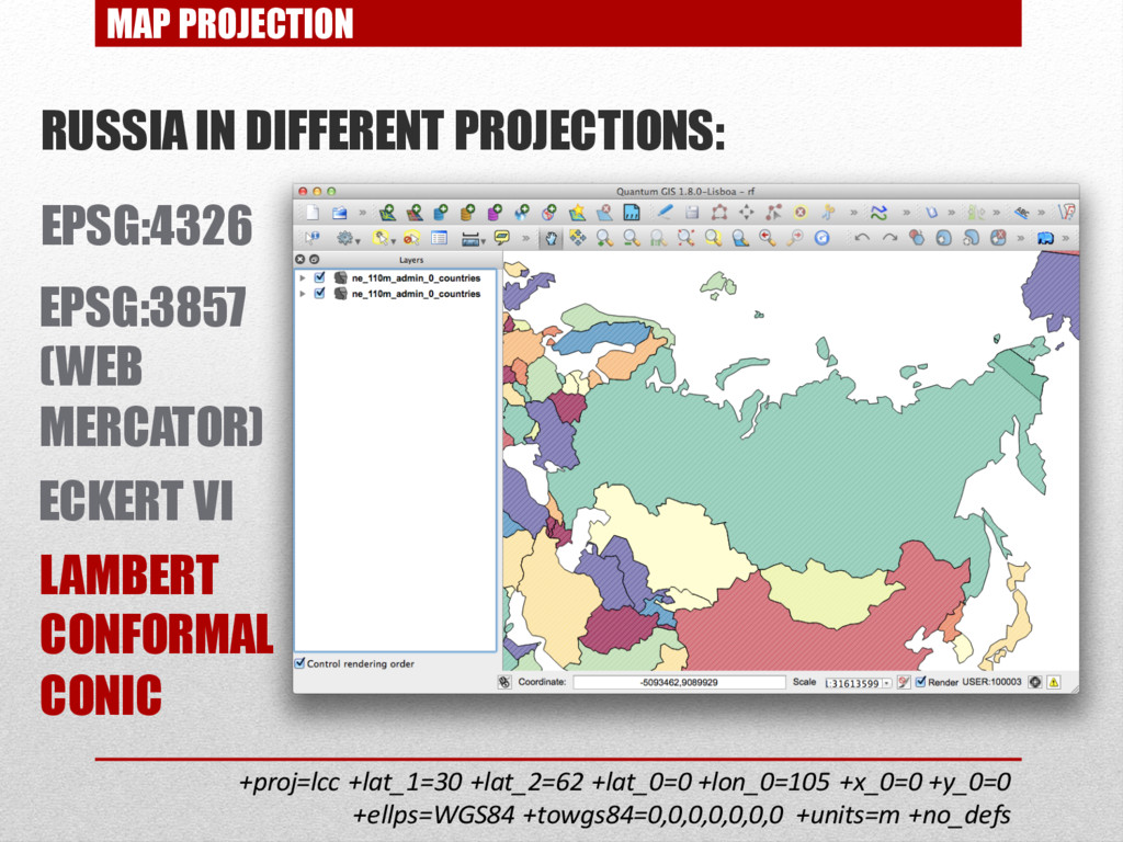
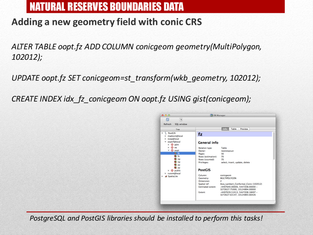
    conic CRS ALTER TABLE oopt.fz ADD COLUMN conicgeom geometry(MultiPolygon, 102012); UPDATE oopt.fz SET conicgeom=st_transform(wkb_geometry, 102012); CREATE INDEX idx_fz_conicgeom ON oopt.fz USING gist(conicgeom); PostgreSQL and PostGIS libraries should be installed to perform this tasks!
  26. DATA STYLING MAPNIK – a library of choice for map

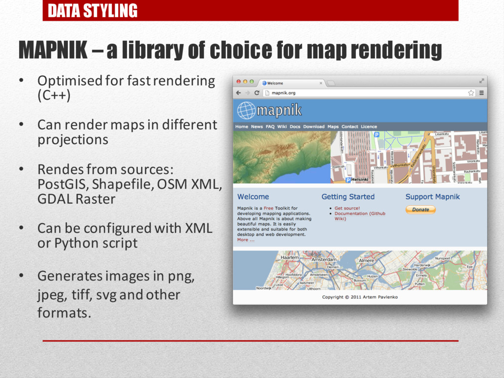
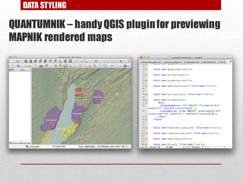
    rendering • Optimised for fast rendering (С++) • Can render maps in different projections • Rendes from sources: PostGIS, Shapefile, OSM XML, GDAL Raster • Can be configured with XML or Python script • Generates images in png, jpeg, tiff, svg and other formats.
  27. WEB SERVICE PUBLISHING MAPPROXY – tile server • Written in

    python • Configuration in YAML format • Sources can be WMS, TMS, Mapnik or MapServer • Geoservices formats: WMS, WMTS, TMS, KML Superoverlay • Tile storage formats: file system, mbtiles, couchdb
  28. CREATING HTML PAGE LEAFLET – JavaScript library for interactive web

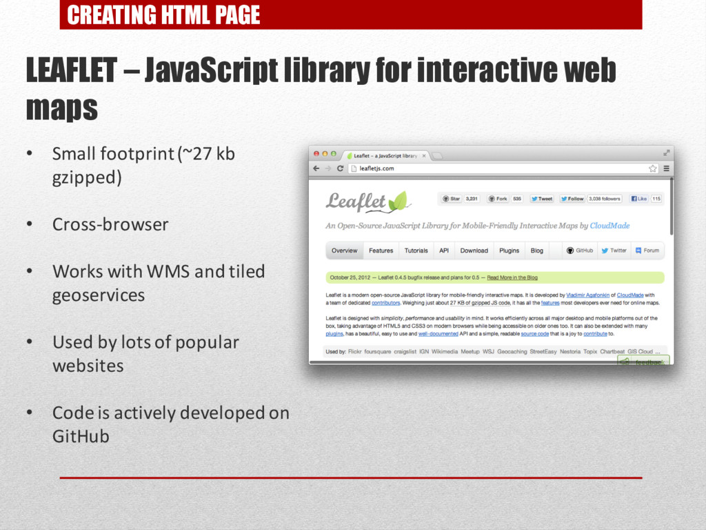
    maps • Small footprint(~27 kb gzipped) • Cross-browser • Works with WMS and tiled geoservices • Used by lots of popular websites • Code is actively developed on GitHub