Upgrade to Pro
— share decks privately, control downloads, hide ads and more …
Speaker Deck
Features
Speaker Deck
PRO
Sign in
Sign up for free
Search
Search
検証!会津は本当に地盤が硬いのか?
Search
noharu36
December 01, 2025
Programming
27
0
Share
Embed
Copy iframe code
Copy JS code
Copy link
Start on current slide
検証!会津は本当に地盤が硬いのか?
noharu36
December 01, 2025
More Decks by noharu36
See All by noharu36
皆さんはHaskellをご存知です_しかし皆さんはHaskellが読めません_.pdf
noharu36
0
42
自作オブジェクトストレージをRustで
noharu36
0
64
ファミコンに思いを馳せる〜エミュレータ自作を添えて〜
noharu36
0
34
shell自作した話
noharu36
0
29
Rustを布教したい
noharu36
0
29
neofetchよ、永遠に
noharu36
0
32
ISSの軌道計算をRustで
noharu36
0
26
Other Decks in Programming
See All in Programming
OSINT for SRE: 学術論文とポストモーテムから探る システム障害の共通パターン / SRE NEXT 2026
tomoyk
1
2.3k
キャリア迷子上等 ─ "ない道"は自分で作ればいい
16bitidol
3
2.8k
Contextとはなにか
chiroruxx
1
390
トークンをケチるな、設計しろ:GitHub Copilotを賢く使うコンテキスト戦略
ochtum
0
300
Go1.27で導入されるジェネリクスメソッドでできること
mackee
0
250
Vue × Nuxt × Oxc どこまで使える?実運用の現在地
andpad
0
360
Haskell/Servantを通してWebミドルウェアを捉え直す
pizzacat83
0
410
例外の正しい扱い方 そのエラー try-catchして大丈夫?
jinwatanabe
0
340
はてなアカウント基盤 State of the Union
cockscomb
1
1.3k
ECSアプリログをFireLensでコスト削減しようとしたけど諦めた話 in Fargate×Node.js
akihisaikeda
2
4.2k
【やさしく解説 設計編 #0】DDDのコード、読めるのに分からない人へ
panda728
PRO
1
230
Strategic Design in the Frontend: Moduliths & Micro Frontends @DDDEurope
manfredsteyer
PRO
0
140
Featured
See All Featured
How to Talk to Developers About Accessibility
jct
2
280
SERP Conf. Vienna - Web Accessibility: Optimizing for Inclusivity and SEO
sarafernandez
2
1.5k
The Art of Delivering Value - GDevCon NA Keynote
reverentgeek
16
2k
AI: The stuff that nobody shows you
jnunemaker
PRO
8
770
How People are Using Generative and Agentic AI to Supercharge Their Products, Projects, Services and Value Streams Today
helenjbeal
1
230
Leading Effective Engineering Teams in the AI Era
addyosmani
9
2.1k
Docker and Python
trallard
47
3.9k
Leadership Guide Workshop - DevTernity 2021
reverentgeek
1
320
Beyond borders and beyond the search box: How to win the global "messy middle" with AI-driven SEO
davidcarrasco
3
180
Test your architecture with Archunit
thirion
1
2.3k
Refactoring Trust on Your Teams (GOTO; Chicago 2020)
rmw
35
3.5k
The #1 spot is gone: here's how to win anyway
tamaranovitovic
3
1.1k
Transcript
検証!会津は本当に地盤が硬いのか? 学部2年 harukun
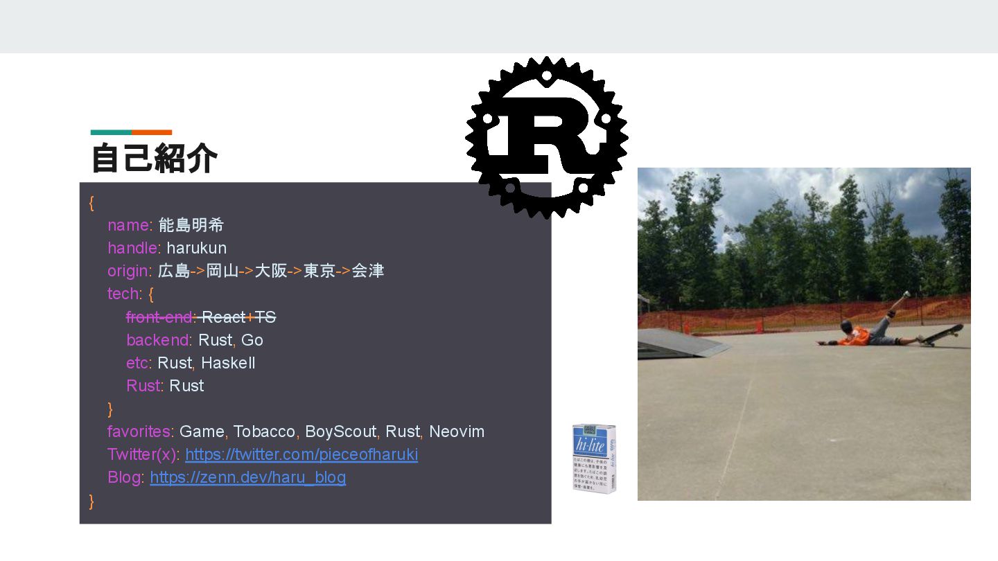
自己紹介 { name: 能島明希 handle: harukun origin: 広島->岡山->大阪->東京->会津 tech: {
front-end: React+TS backend: Rust, Go etc: Rust, Haskell Rust: Rust } favorites: Game, Tobacco, BoyScout, Rust, Neovim Twitter(x): https://twitter.com/pieceofharuki Blog: https://zenn.dev/haru_blog }
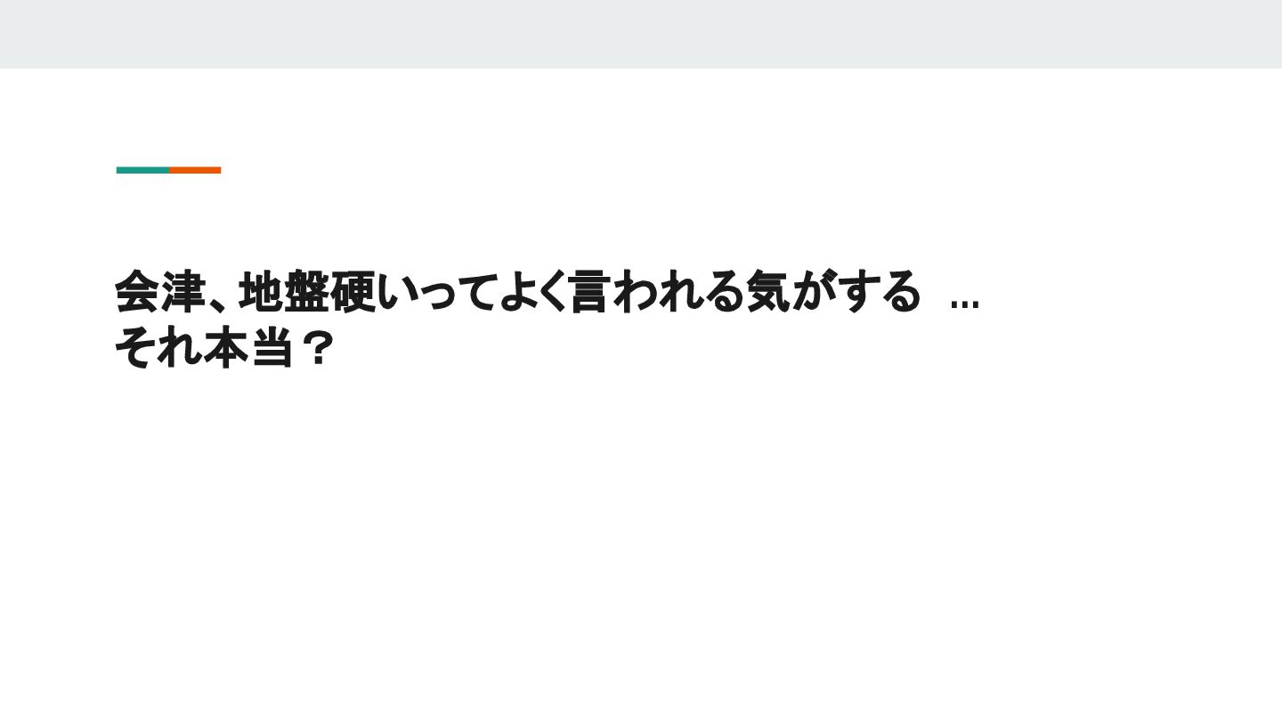
会津、地盤硬いってよく言われる気がする ... それ本当?
技術スタック
[dependencies] reqwest = { version = "0.12.9", features = ["json"]
} tokio = { version = "1.41.1", features = ["full"] } serde = { version = "1.0.215", features = ["derive"] } serde_json = "1.0.133" chrono = {version = "0.4.38", features = ["serde"] } scraper = "0.21.0" plotters = "0.3.7" geojson = "0.24.1" geo-types = "0.7.14" 使用した外部クレート
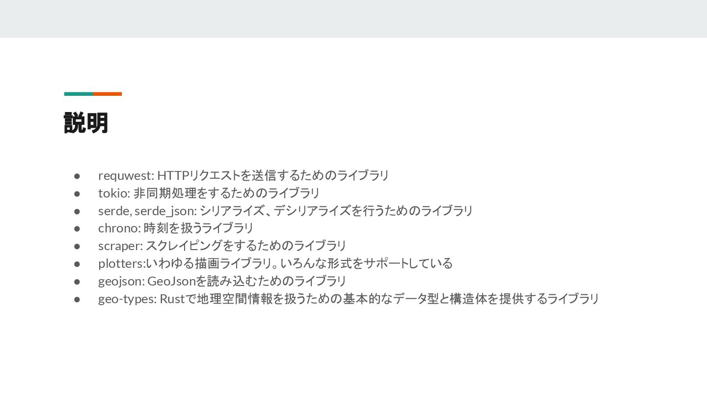
説明 • requwest: HTTPリクエストを送信するためのライブラリ • tokio: 非同期処理をするためのライブラリ • serde, serde_json:
シリアライズ、デシリアライズを行うためのライブラリ • chrono: 時刻を扱うライブラリ • scraper: スクレイピングをするためのライブラリ • plotters:いわゆる描画ライブラリ。いろんな形式をサポートしている • geojson: GeoJsonを読み込むためのライブラリ • geo-types: Rustで地理空間情報を扱うための基本的なデータ型と構造体を提供するライブラリ
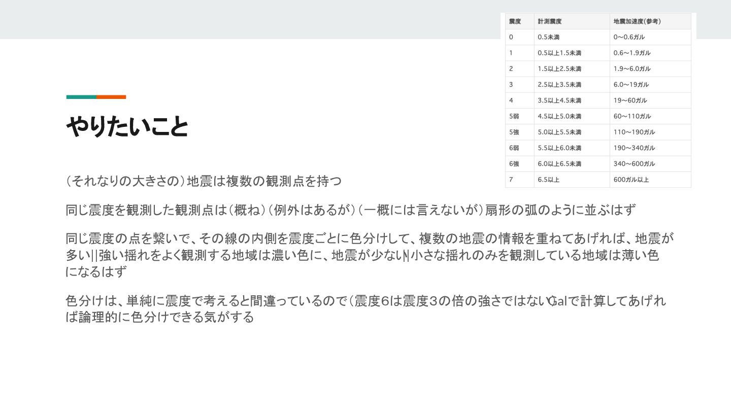
やりたいこと (それなりの大きさの)地震は複数の観測点を持つ 同じ震度を観測した観測点は(概ね)(例外はあるが)(一概には言えないが)扇形の弧のように並ぶはず 同じ震度の点を繋いで、その線の内側を震度ごとに色分けして、複数の地震の情報を重ねてあげれば、地震が 多い||強い揺れをよく観測する地域は濃い色に、地震が少ない ||小さな揺れのみを観測している地域は薄い色 になるはず 色分けは、単純に震度で考えると間違っているので(震度6は震度3の倍の強さではない) Galで計算してあげれ ば論理的に色分けできる気がする
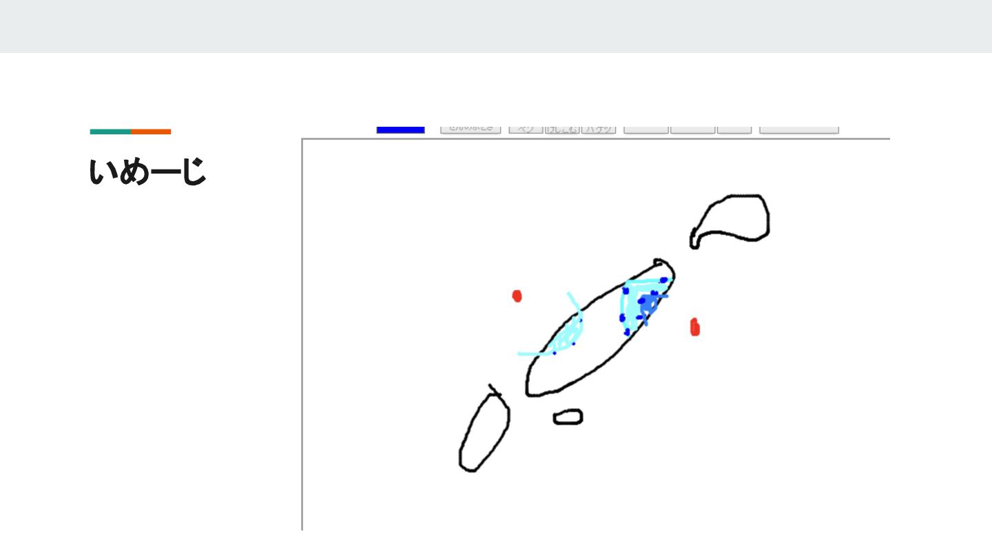
いめーじ
が... 扇形の弧、どうやって求めんねん! 作れたとしても、その弧どうやって描画すんねん! 弧の内側どうやって描画すんねん! となったので一旦断念 とりあえず都道府県ごとに色付けしてみることにする
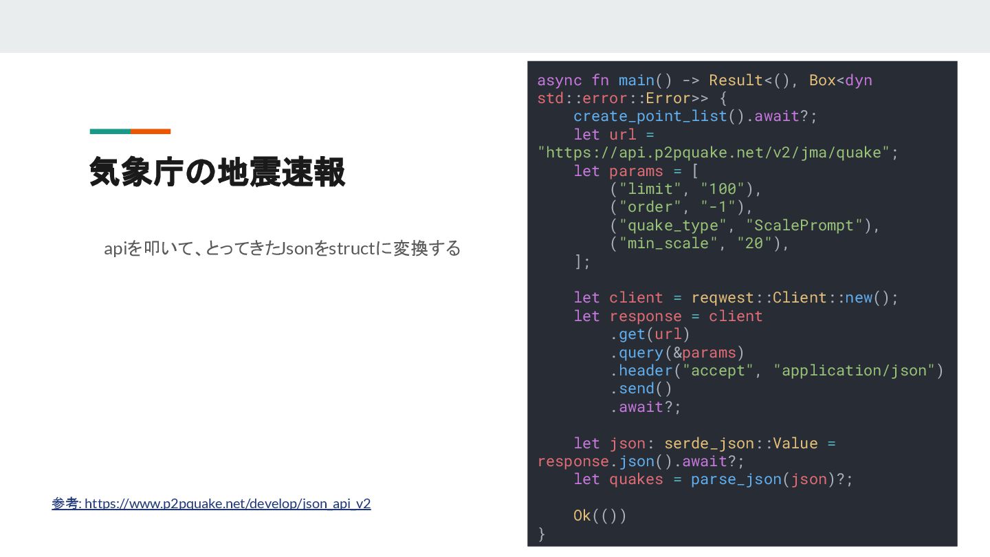
気象庁の地震速報 参考: https://www.p2pquake.net/develop/json_api_v2 async fn main() -> Result<(), Box<dyn std::error::Error>>
{ create_point_list().await?; let url = "https://api.p2pquake.net/v2/jma/quake"; let params = [ ("limit", "100"), ("order", "-1"), ("quake_type", "ScalePrompt"), ("min_scale", "20"), ]; let client = reqwest::Client::new(); let response = client .get(url) .query(¶ms) .header("accept", "application/json") .send() .await?; let json: serde_json::Value = response.json().await?; let quakes = parse_json(json)?; Ok(()) } apiを叩いて、とってきたJsonをstructに変換する
震度観測点と座標の変換 地震速報では震度観測点名称しかわからないので、気象庁のサ イトをスクレイピングして震度間測定名と座標を対応づける 変換した値はグローバル変数で保持 #[derive(Debug, Default, Deserialize, Clone)] pub struct
Addr { pub addr: String, pub latitude: f64, pub longitude: f64, } pub static POINT_MAP: OnceLock<HashMap<String, Addr>> = OnceLock::new();
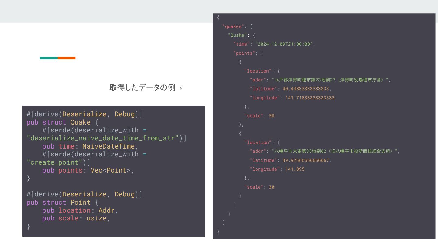
{ "quakes": [ "Quake": { "time": "2024-12-09T21:00:00", "points": [ {
"location": { "addr": "九戸郡洋野町種市第23地割27(洋野町役場種市庁舎)", "latitude": 40.40833333333333, "longitude": 141.71833333333333 }, "scale": 30 }, { "location": { "addr": "八幡平市大更第35地割62(旧八幡平市役所西根総合支所)", "latitude": 39.92666666666667, "longitude": 141.095 }, "scale": 30 } ] } ] } #[derive(Deserialize, Debug)] pub struct Quake { #[serde(deserialize_with = "deserialize_naive_date_time_from_str")] pub time: NaiveDateTime, #[serde(deserialize_with = "create_point")] pub points: Vec<Point>, } #[derive(Deserialize, Debug)] pub struct Point { pub location: Addr, pub scale: usize, } 取得したデータの例→
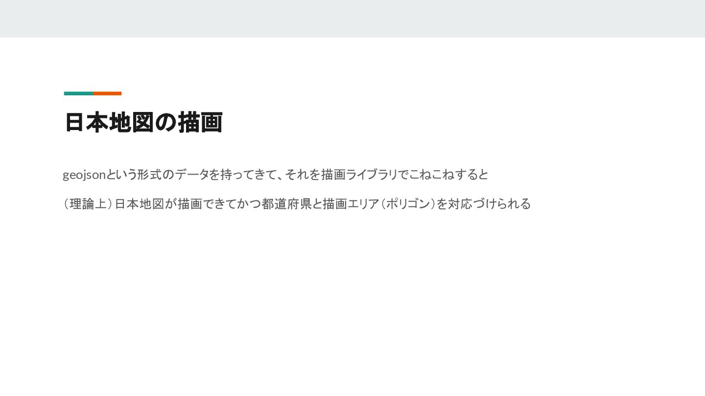
日本地図の描画 geojsonという形式のデータを持ってきて、それを描画ライブラリでこねこねすると (理論上)日本地図が描画できてかつ都道府県と描画エリア(ポリゴン)を対応づけられる
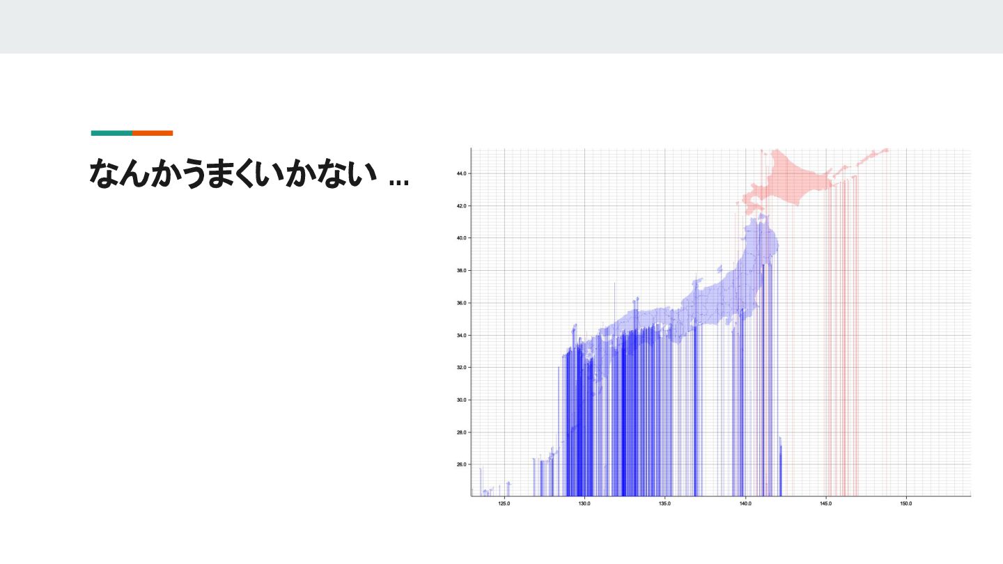
なんかうまくいかない ...
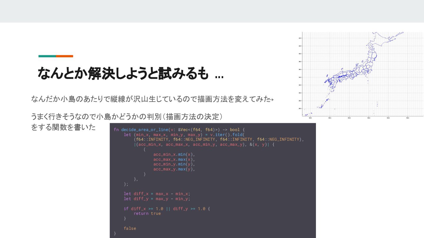
なんとか解決しようと試みるも ... なんだか小島のあたりで縦線が沢山生じているので描画方法を変えてみた → うまく行きそうなので小島かどうかの判別(描画方法の決定) をする関数を書いた fn decide_area_or_line(v: &Vec<(f64, f64)>)
-> bool { let (min_x, max_x, min_y, max_y) = v.iter().fold( (f64::INFINITY, f64::NEG_INFINITY, f64::INFINITY, f64::NEG_INFINITY), |(acc_min_x, acc_max_x, acc_min_y, acc_max_y), &(x, y)| { ( acc_min_x.min(x), acc_max_x.max(x), acc_min_y.min(y), acc_max_y.max(y), ) }, ); let diff_x = max_x - min_x; let diff_y = max_y - min_y; if diff_x >= 1.0 || diff_y >= 1.0 { return true } false }
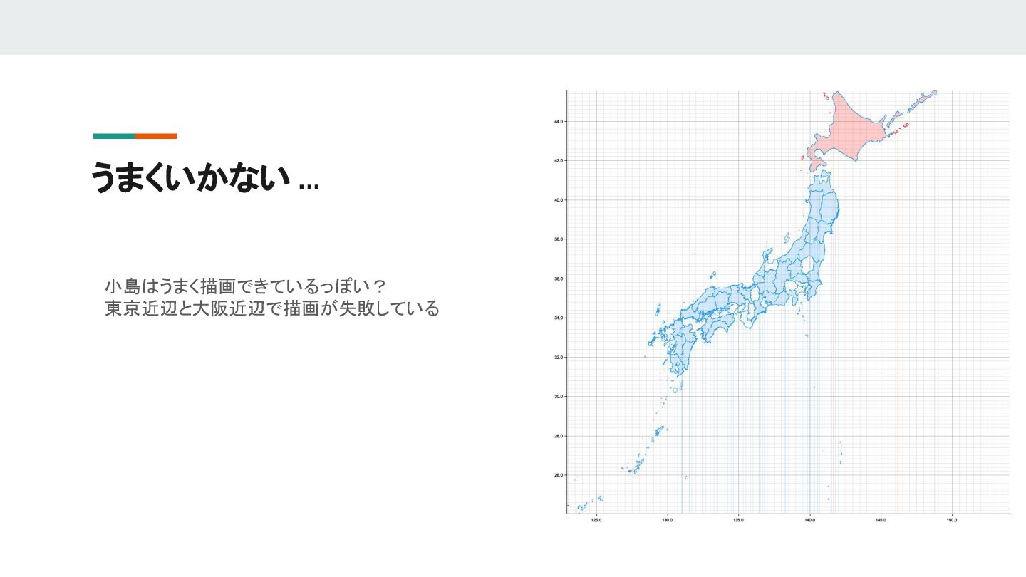
うまくいかない ... 小島はうまく描画できているっぽい? 東京近辺と大阪近辺で描画が失敗している
今後の展望 なんとかうまいこと日本地図を描画できるようにしたい →それができればとってきた地震のデータを描画して、都道府県に紐づけるのは簡単 とりあえず都道府県ごとに色分けして表示できるようにしたい 大LTまでに完成させるかも。でも浮気して別のことやるかも
![[dependencies] reqwest = { version = "0.12.9", features = ["json"]](https://files.speakerdeck.com/presentations/449263e6e01f4c23b00ac780194f1b88/slide_4.jpg)
![震度観測点と座標の変換 地震速報では震度観測点名称しかわからないので、気象庁のサ イトをスクレイピングして震度間測定名と座標を対応づける 変換した値はグローバル変数で保持 #[derive(Debug, Default, Deserialize, Clone)] pub struct](https://files.speakerdeck.com/presentations/449263e6e01f4c23b00ac780194f1b88/slide_10.jpg)