Upgrade to Pro
— share decks privately, control downloads, hide ads and more …
Speaker Deck
Features
Speaker Deck
PRO
Sign in
Sign up for free
Search
Search
Pictorial Maps In The Clark Library, University...
Search
Nathaniel V. KELSO
October 17, 2013
100
1
Share
Embed
Copy iframe code
Copy JS code
Copy link
Start on current slide
Pictorial Maps In The Clark Library, University of Michigan
Tim Utter
Nathaniel V. KELSO
October 17, 2013
More Decks by Nathaniel V. KELSO
See All by Nathaniel V. KELSO
Back to the Desktop
nvkelso
2
640
Who's On First Overview
nvkelso
1
250
Who's on First: Administrative Boundaries & Localities
nvkelso
1
230
Who ARE the People in your Neighborhood? Developing Mapzen’s Neighborhood Database
nvkelso
2
380
Introducing Web Mapping to Writing Studies and Journalism Classes at the University of Minnesota Duluth
nvkelso
0
150
A Jobs Panel: How to Hire or Be Hired
nvkelso
0
310
Big History, Little History: Cartography in the Twentieth Century
nvkelso
0
190
Displaying Change Data on a US Topo Map
nvkelso
0
130
UAEU Employees' Social Impact Assessment in Urban Development in Al Ain City
nvkelso
0
240
Featured
See All Featured
AI: The stuff that nobody shows you
jnunemaker
PRO
8
770
SEOcharity - Dark patterns in SEO and UX: How to avoid them and build a more ethical web
sarafernandez
0
220
Why You Should Never Use an ORM
jnunemaker
PRO
61
9.9k
Deep Space Network (abreviated)
tonyrice
0
220
The Illustrated Guide to Node.js - THAT Conference 2024
reverentgeek
1
410
How to Talk to Developers About Accessibility
jct
2
280
Fantastic passwords and where to find them - at NoRuKo
philnash
52
3.8k
Color Theory Basics | Prateek | Gurzu
gurzu
0
380
brightonSEO & MeasureFest 2025 - Christian Goodrich - Winning strategies for Black Friday CRO & PPC
cargoodrich
3
750
Save Time (by Creating Custom Rails Generators)
garrettdimon
PRO
32
3.6k
Dominate Local Search Results - an insider guide to GBP, reviews, and Local SEO
greggifford
PRO
0
200
Refactoring Trust on Your Teams (GOTO; Chicago 2020)
rmw
35
3.5k
Transcript
Pictorial Maps In The Clark Library, University of Michigan Presented
at NACIS 2013 Tim Utter
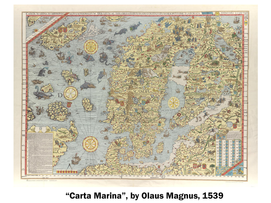
“Carta Marina”, by Olaus Magnus, 1539
[Europe as a Woman], by Sebastian Munster ca. 1550
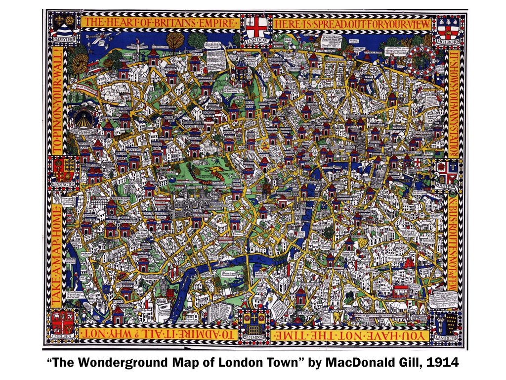
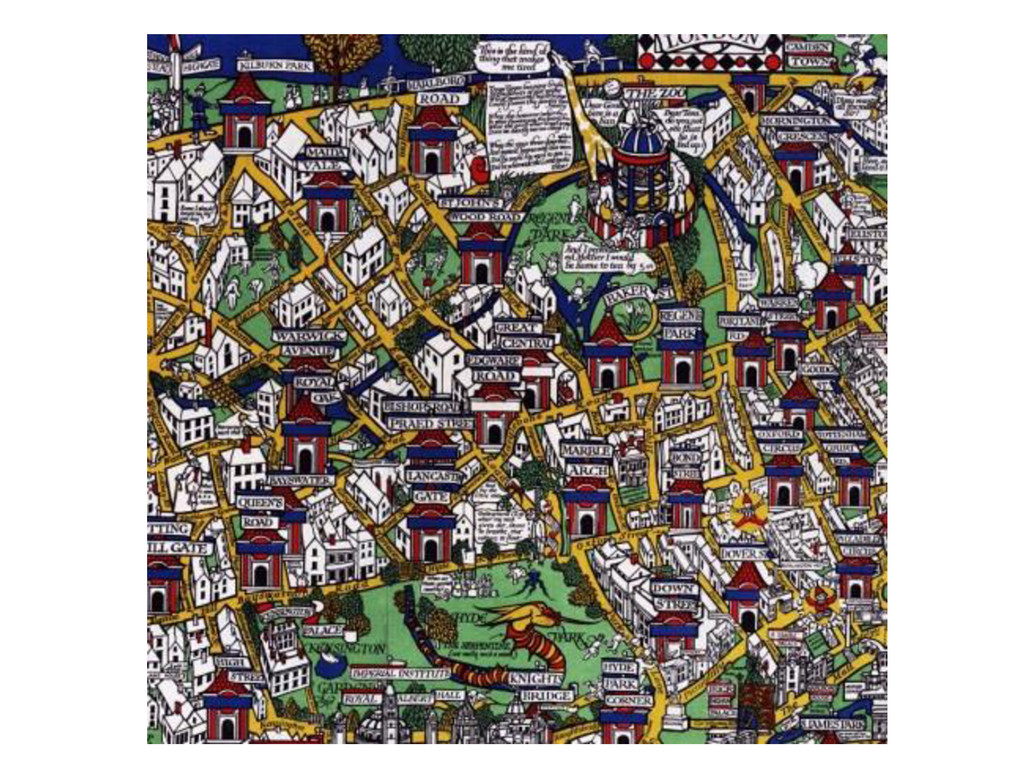
“The Wonderground Map of London Town” by MacDonald Gill, 1914
None
“Down in Ann Arbor Town” by Gertrude A. Strickler, 1926
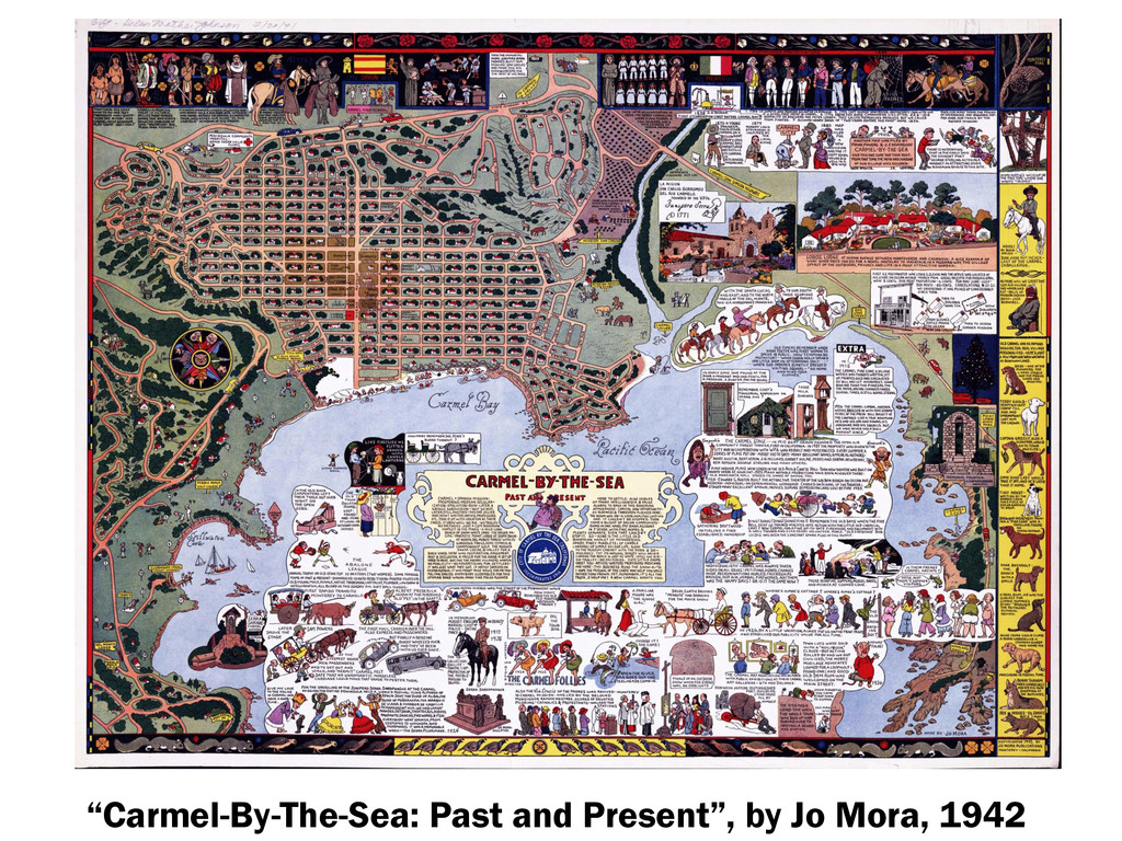
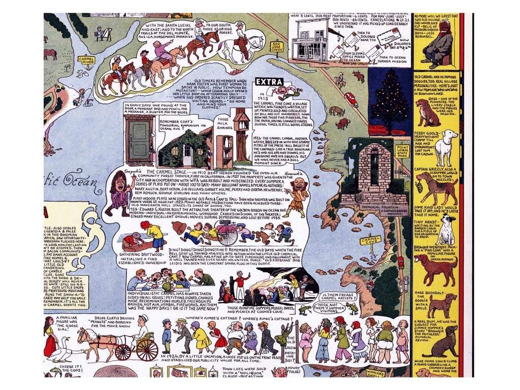
“Carmel-By-The-Sea: Past and Present”, by Jo Mora, 1942
None
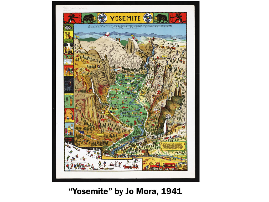
“Yosemite” by Jo Mora, 1941
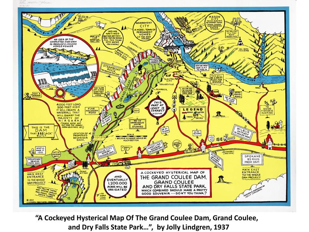
“A Cockeyed Hysterical Map Of The Grand Coulee Dam, Grand
Coulee, and Dry Falls State Park…”, by Jolly Lindgren, 1937
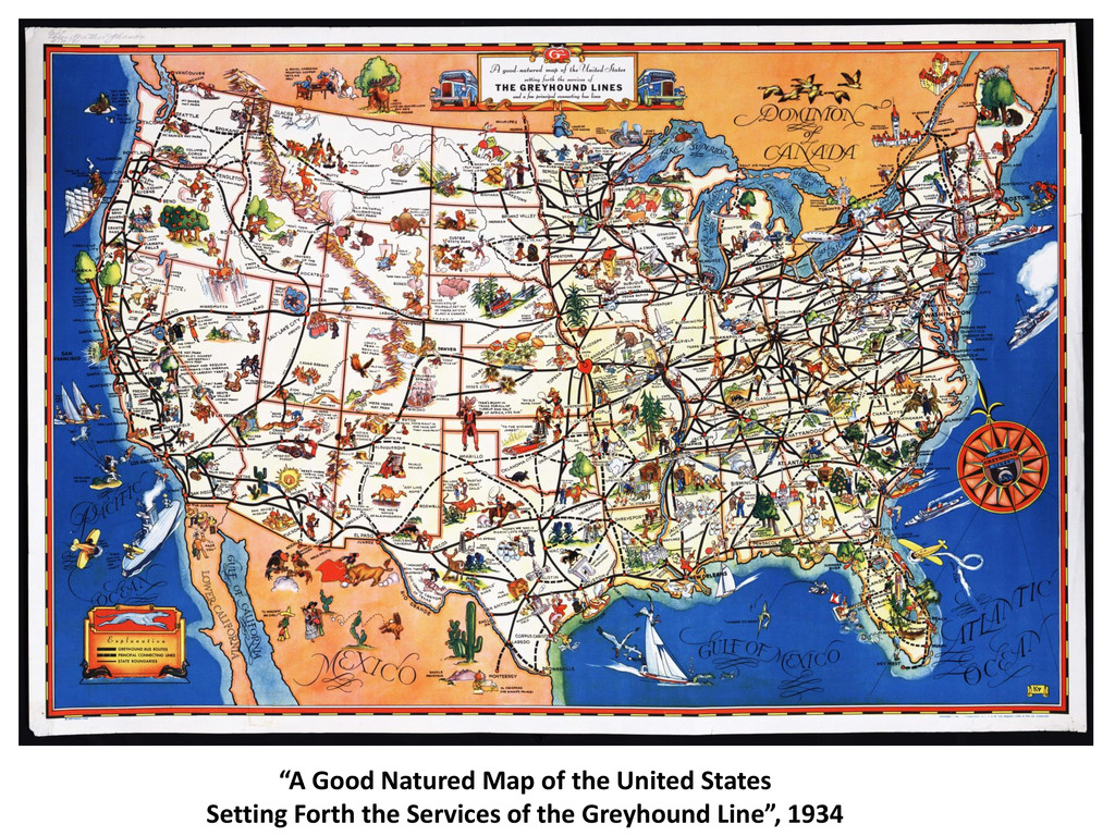
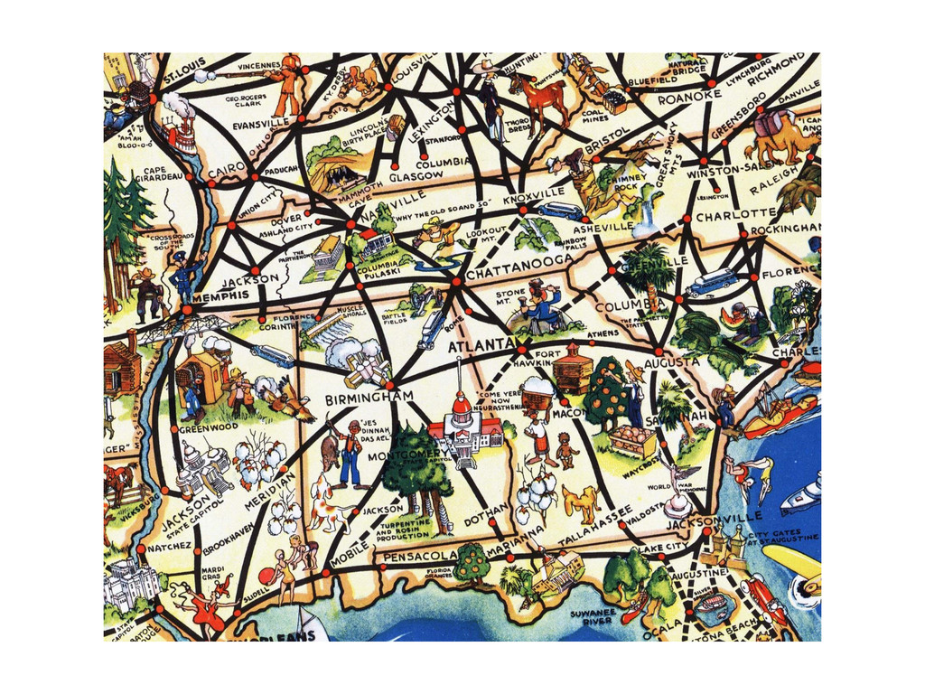
“A Good Natured Map of the United States Setting Forth
the Services of the Greyhound Line”, 1934
None
“Downtown District of Manhattan” by Arthur Zaidenburg, 1938
“A Pictorial Map of That Portion of New York City
known as Manhattan” by Ernest Dudley Chase, 1939.
None
“The United States as viewed from California” by Ernest Dudley
Chase , 1940
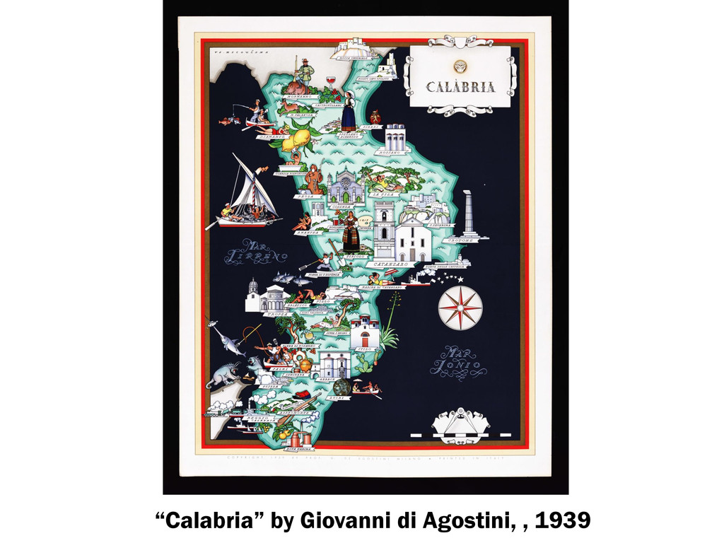
“Calabria” by Giovanni di Agostini, , 1939
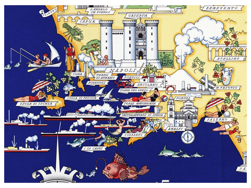
“Campania” by Giovanni di Agostini, 1939
None
“Economy of the Pacific” by Miguel Covarrubias, 1940
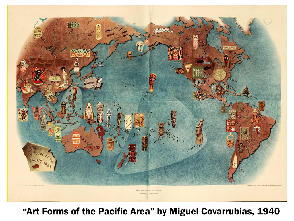
“Art Forms of the Pacific Area” by Miguel Covarrubias, 1940
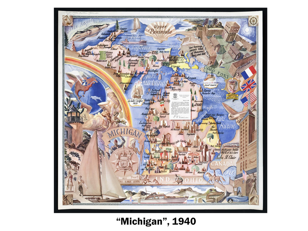
“Michigan”, 1940
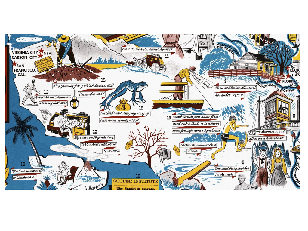
“The Adventures of Mark Twain” by Robert Blattner, 1944
None
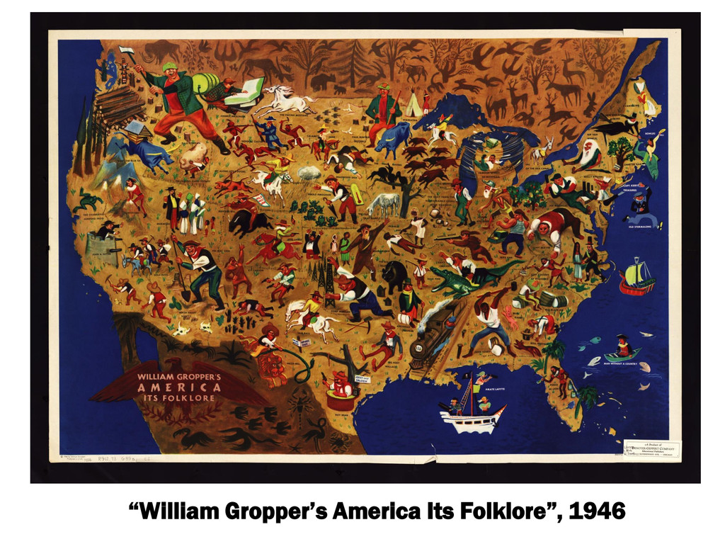
“William Gropper’s America Its Folklore”, 1946
“National Parks of the United States and Southern Canada”, by
Maurice Freed, ca. 1950
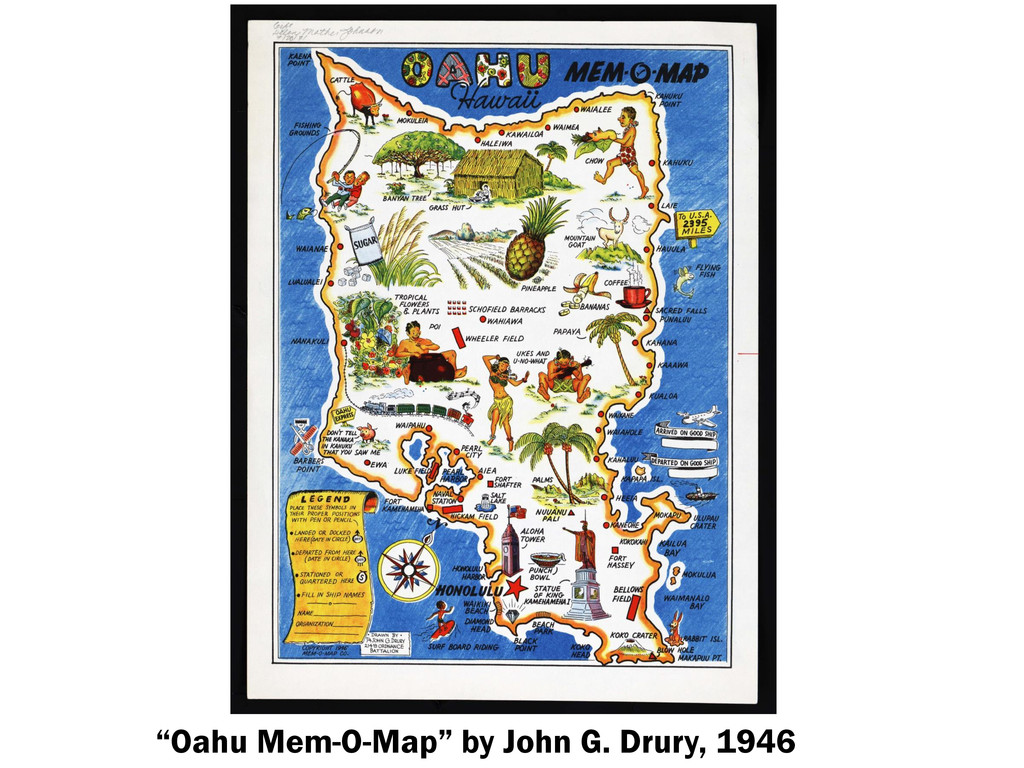
“Oahu Mem-O-Map” by John G. Drury, 1946
“Folklore Music Map of the United States” by Dorothea Dix
Lawrence, 1946
None
![[Europe as a Woman], by Sebastian Munster ca. 1550](https://files.speakerdeck.com/presentations/c6501ac01916013119bf0e0427ef48c2/slide_2.jpg)