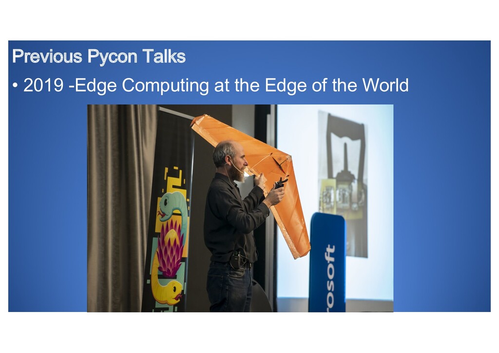
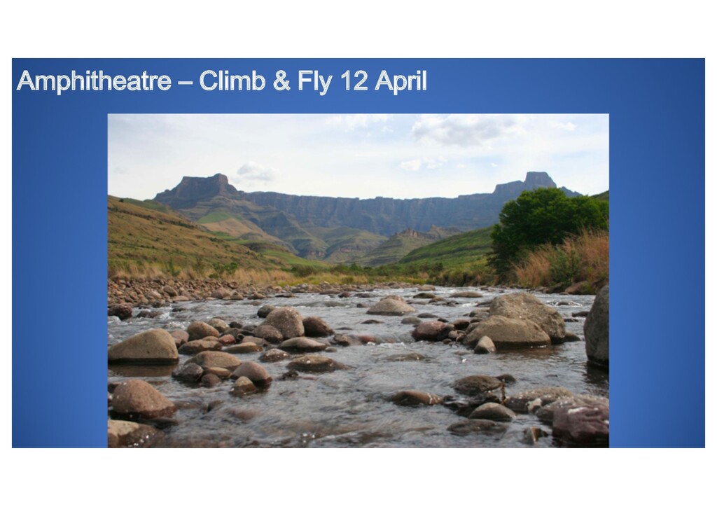
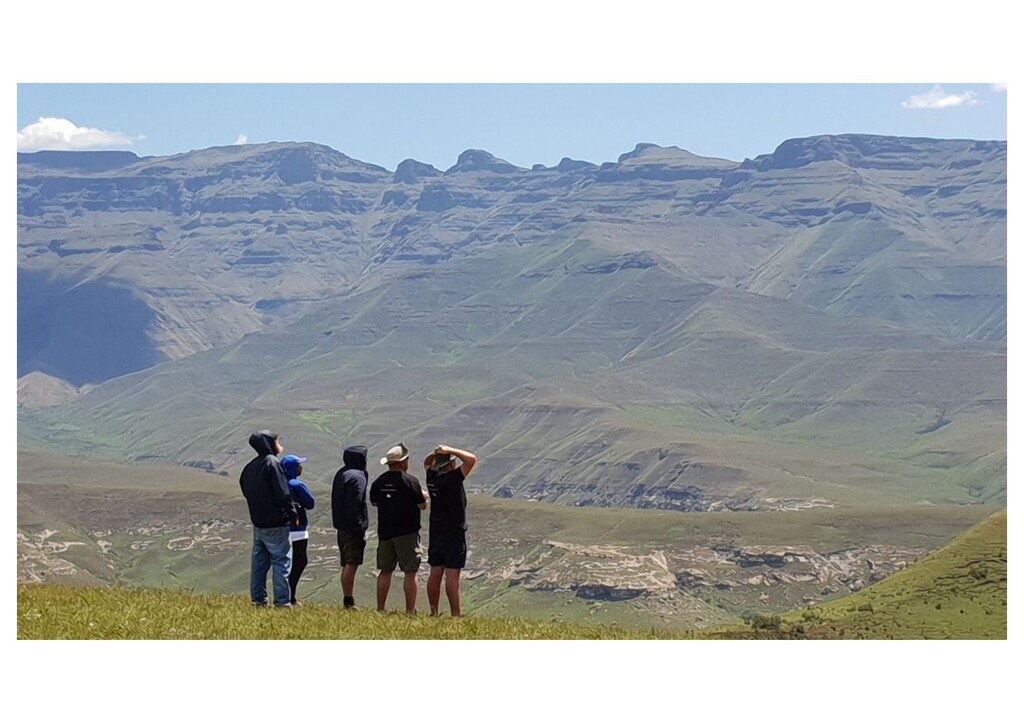
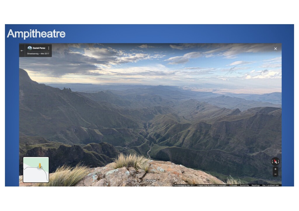
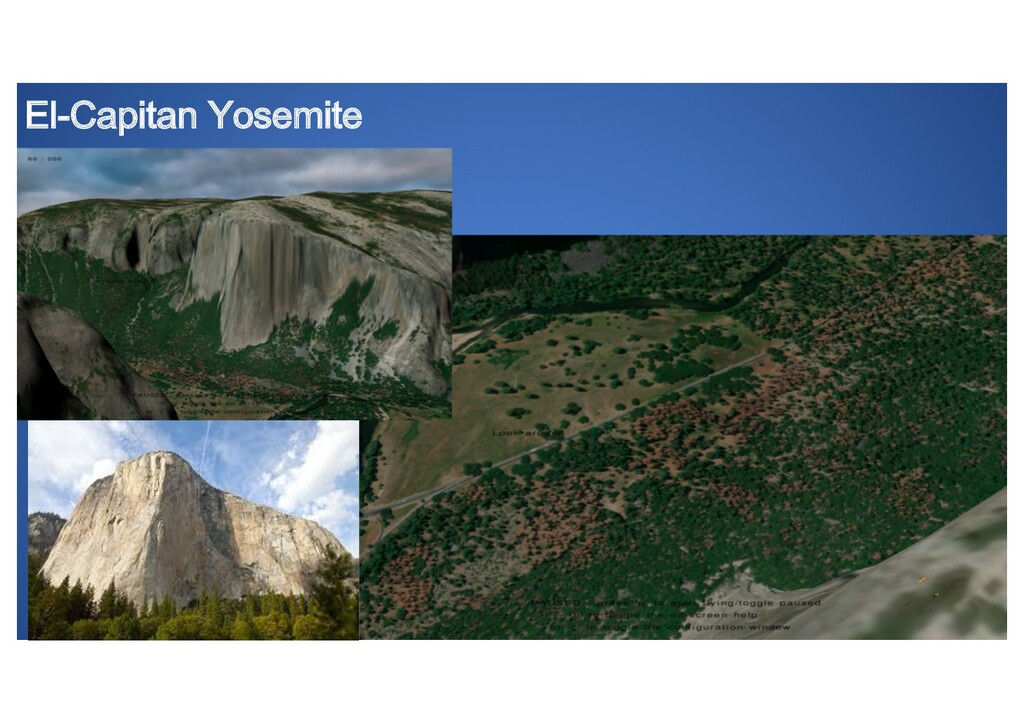
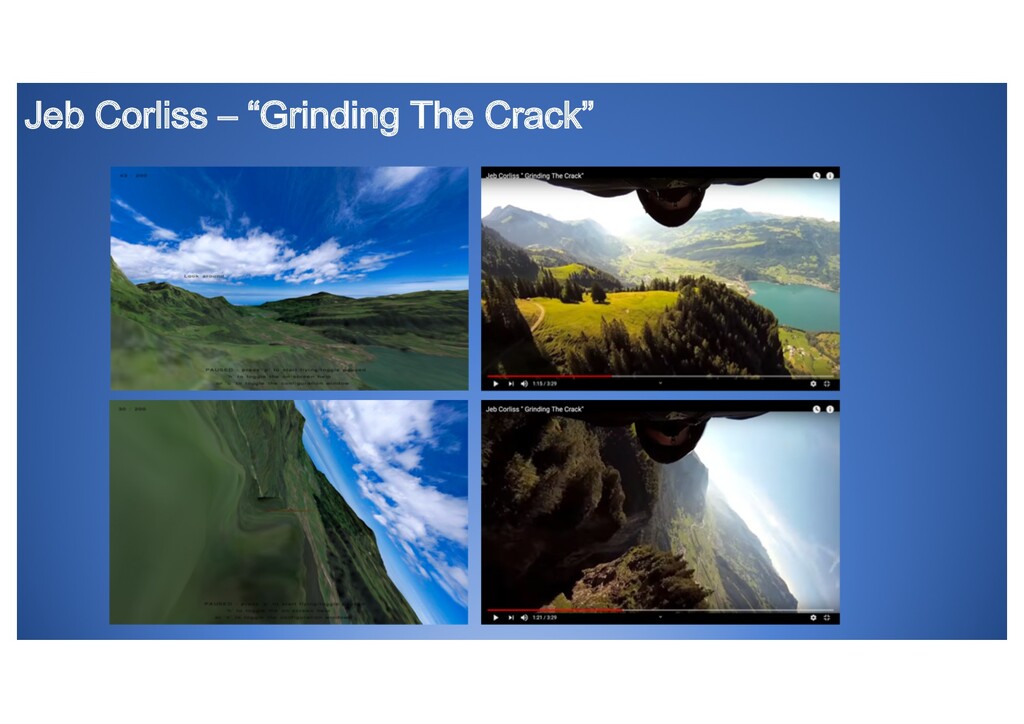
Imagine soaring the slopes of el-Capitan in Yosemite, Rainbow mountain in Peru or even replicating the wingsuit glide path of Jeb Corliss! And doing it under lockdown
Slope soaring requires one to go outside and spend time with friends which was not possible during lockdown, so the next best thing is a simulator.
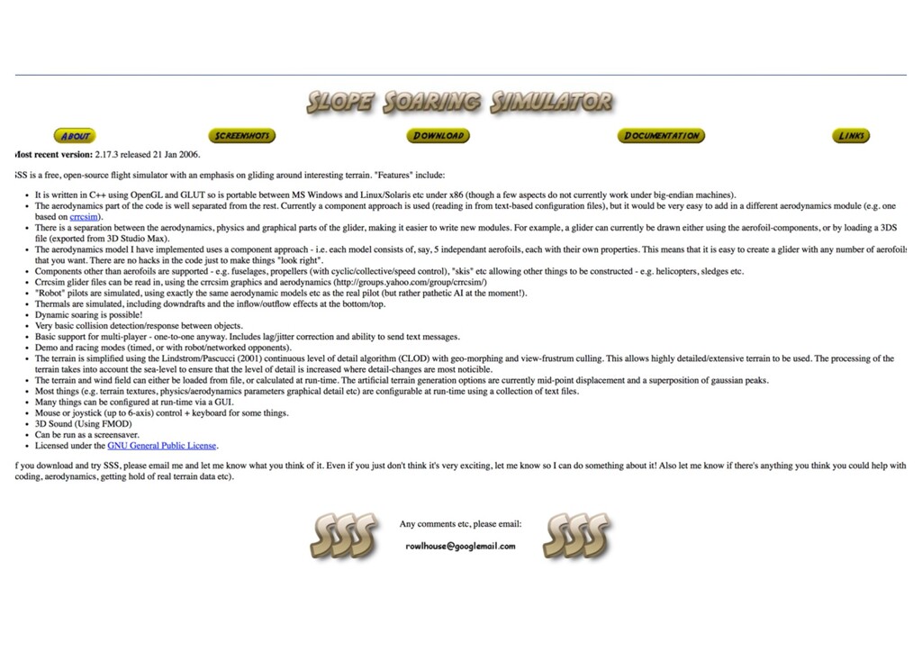
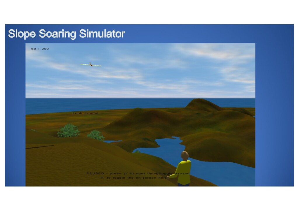
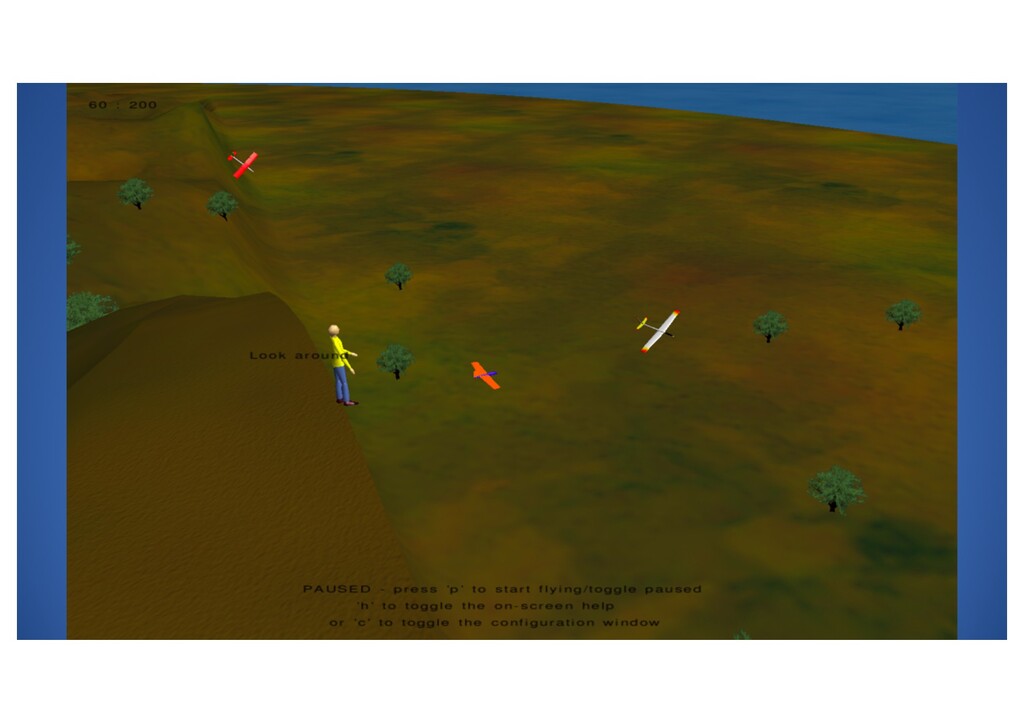
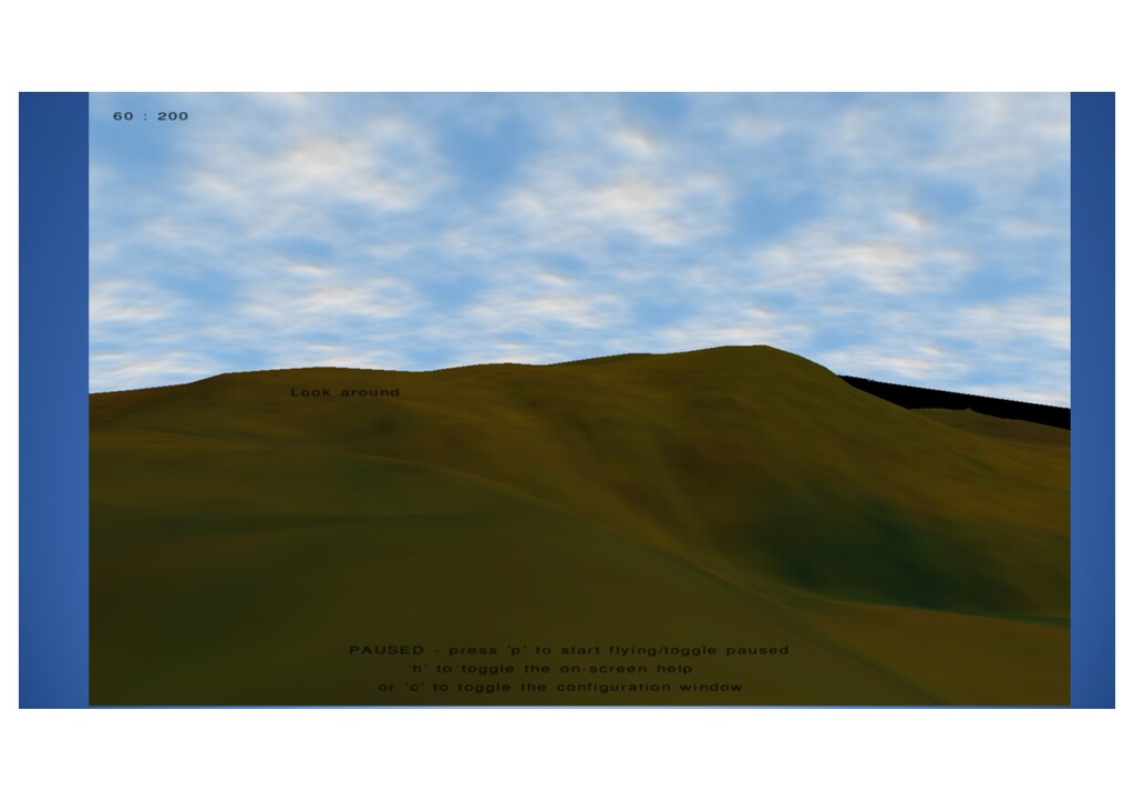
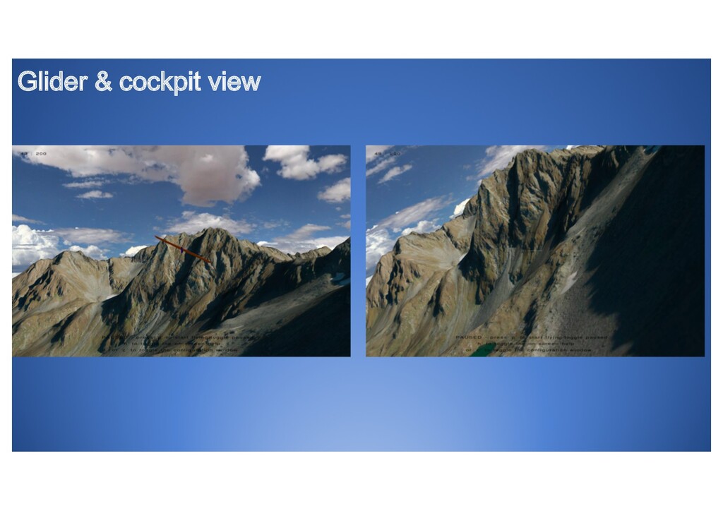
This talk will cover how a 10 year old, abandoned open source simulator (SSS - http://www.rowlhouse.co.uk/sss/index.html) was enhanced using Python with:
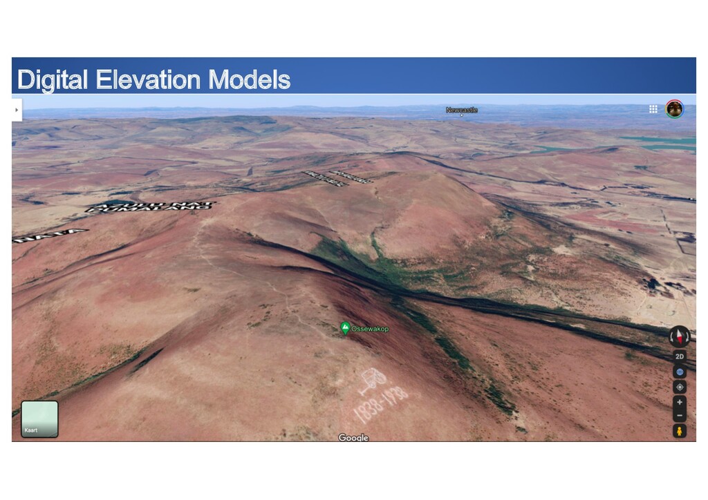
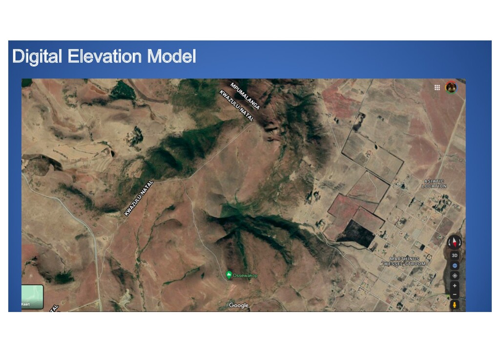
* Digital Elevation Models from Google Earth Engine
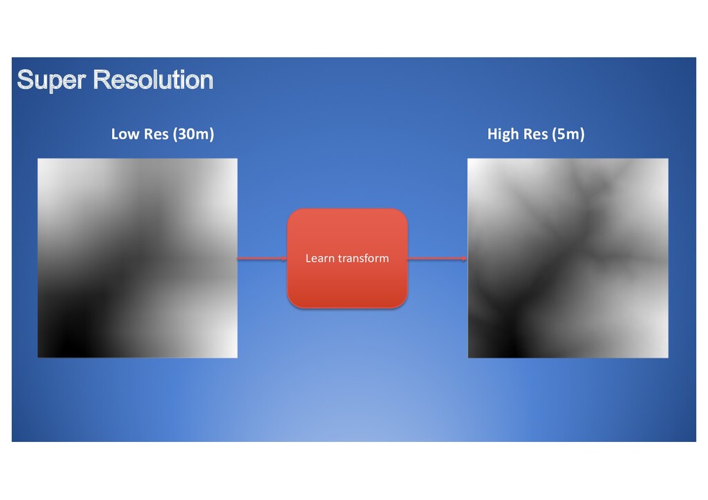
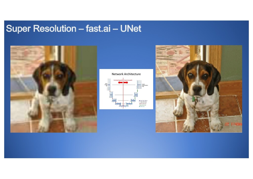
Enhancing Elevation Model Super Resolution using Deep Learning
* Satellite imagery as scenery from anywhere in the world courtesy of Bing
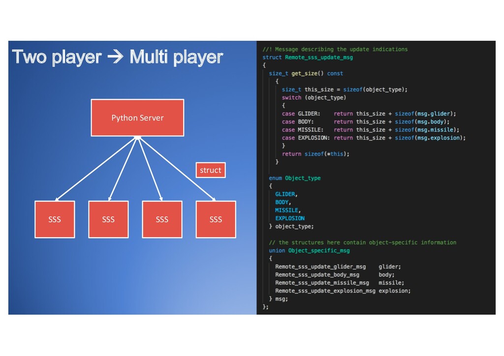
* Multi-player networking
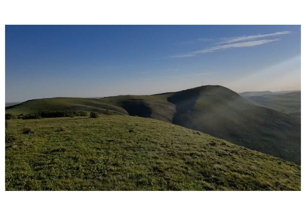
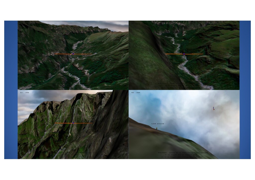
The result is stunning scenery and the ability to fly any slope you can dream of.
The talk will cover:
* Introduction to the slope soaring simulator (SSS) and motivation for the wanting to use this under COVID'19 lockdown
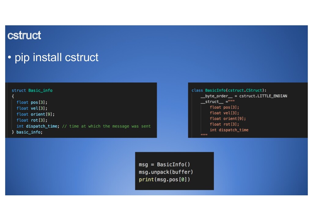
* Multi-player networking using Python cstruct and socket libraries
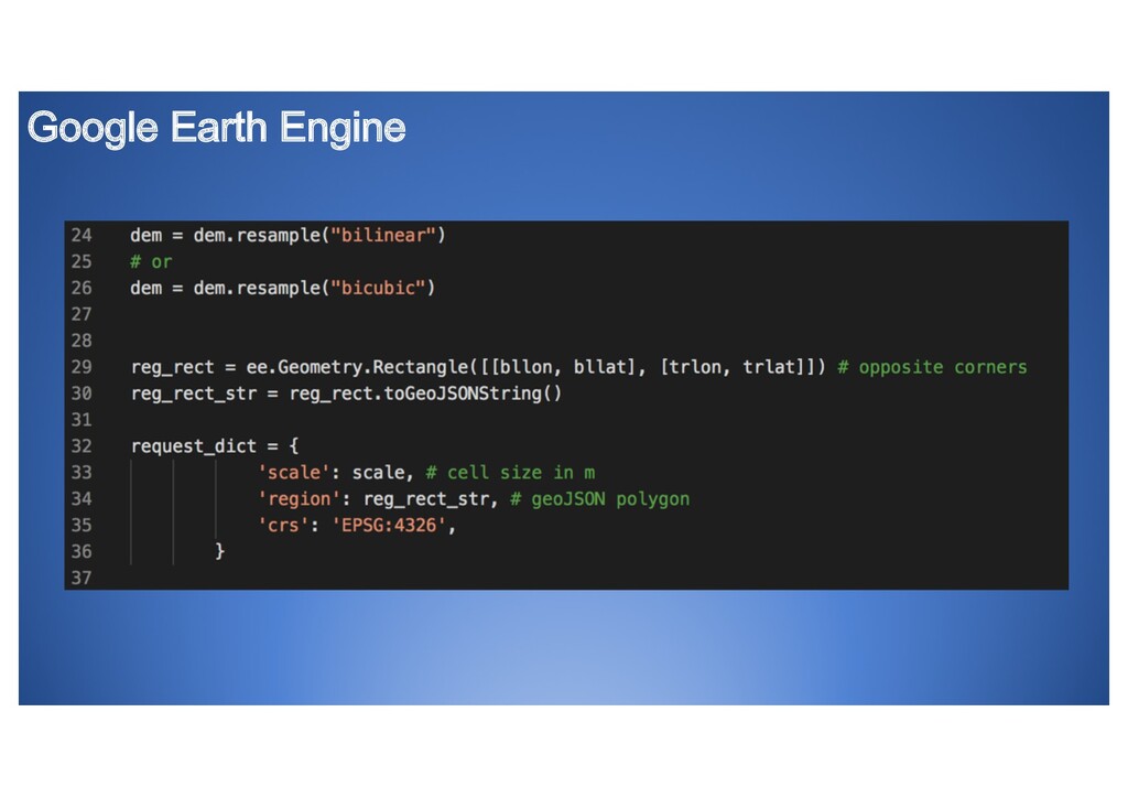
* Extracting digital elevation models (DEM) and satelite data using Google Earth Engine Python API
* Downloading aerial photography from Bing using Python and mapping it to the DEM
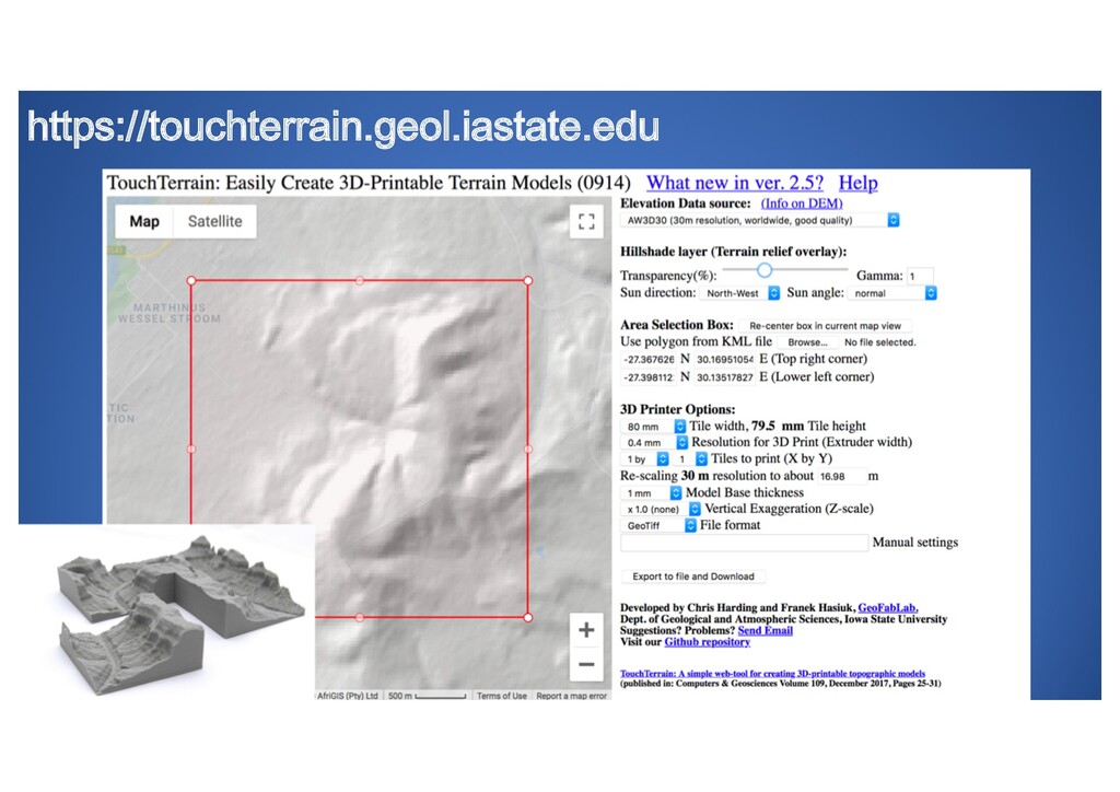
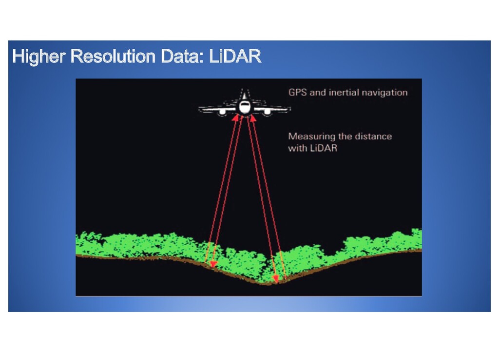
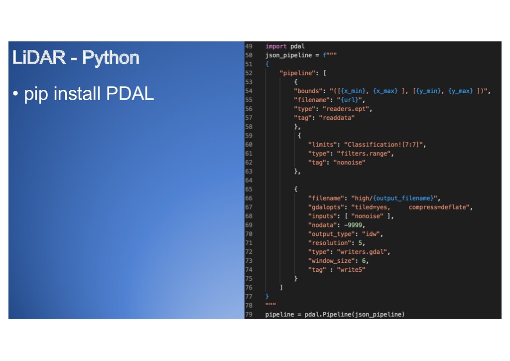
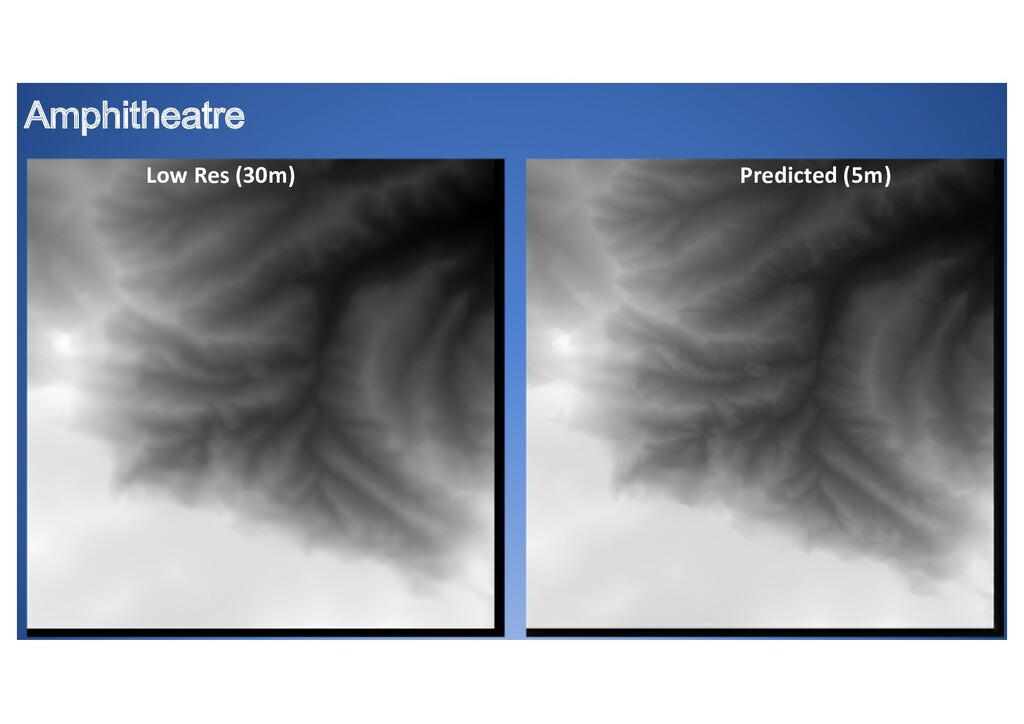
* Downloading Hi-res LIDAR point cloud data and processing as target for Super Resolution using PDAL Python API
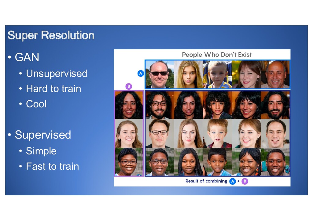
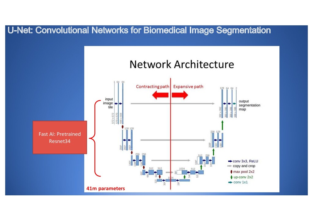
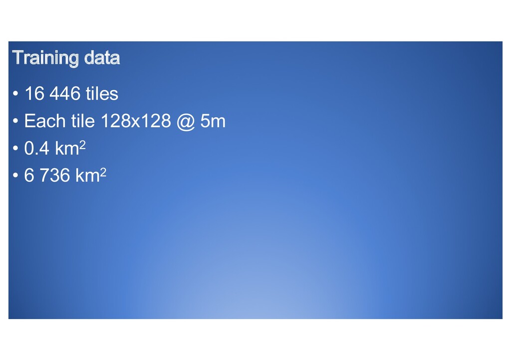
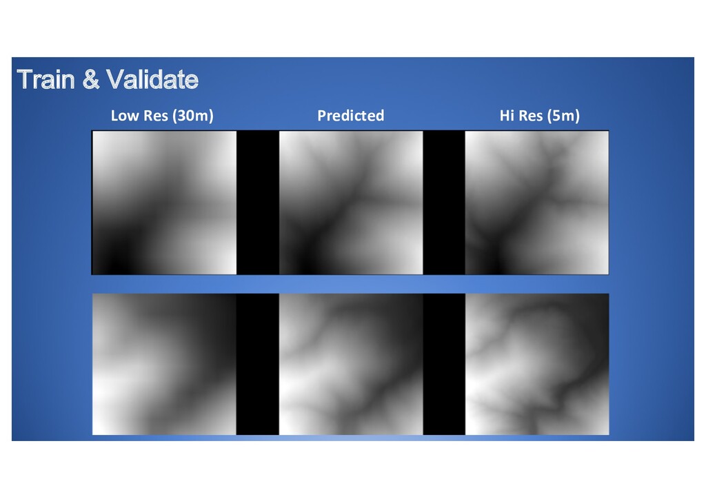
* Enhancing the elevation model using Deep Learning Super Resolution from 30m to 5m accuracy
* Adding skybox scenery to complete the picture
This talk is for anyone interested in working with satellite data, super-resolution and slope soaring simulations