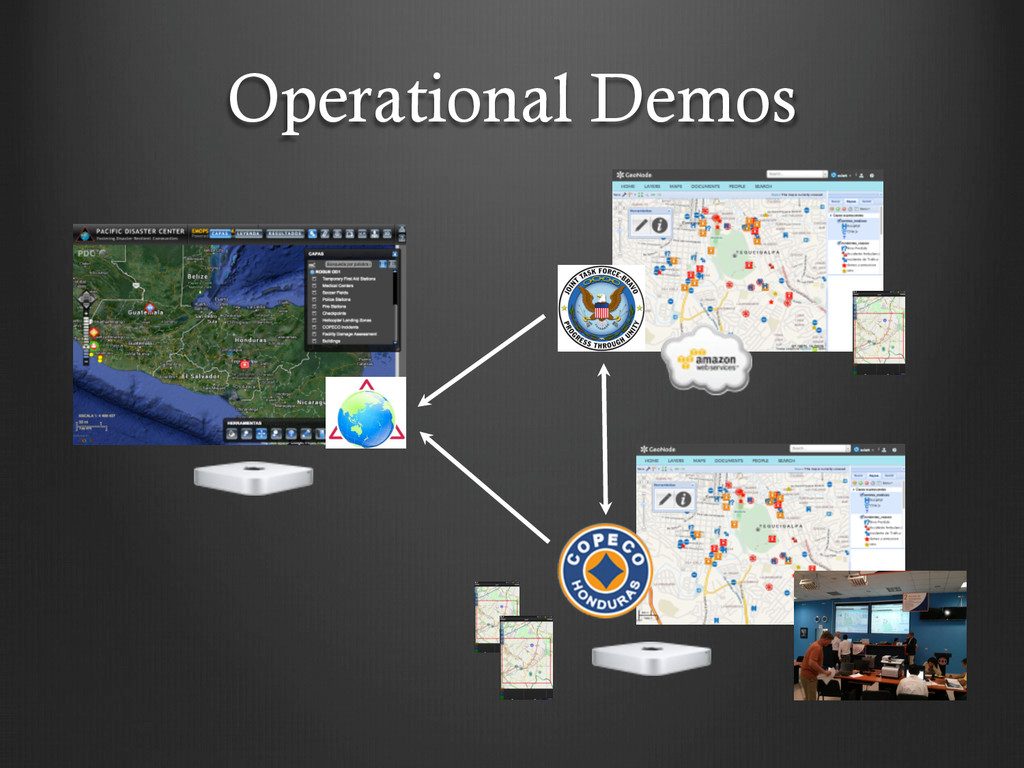
(JCTD) ! Two Year effort (Aug 2012 – Aug 2014) ! JCTDs introduce new concepts to solve operational problems ! ROGUE focused on supporting Humanitarian Assistance & Disaster Response
including military, inter- agency, national partners, & NGOs ! Common situational awareness is needed by all partners ! Responding organizations both need, & can provide a great deal of information ! Partners are distributed & sometimes disconnected ! Partners should have direct access to the technology itself The goal is to deliver dynamic, collaborative maps
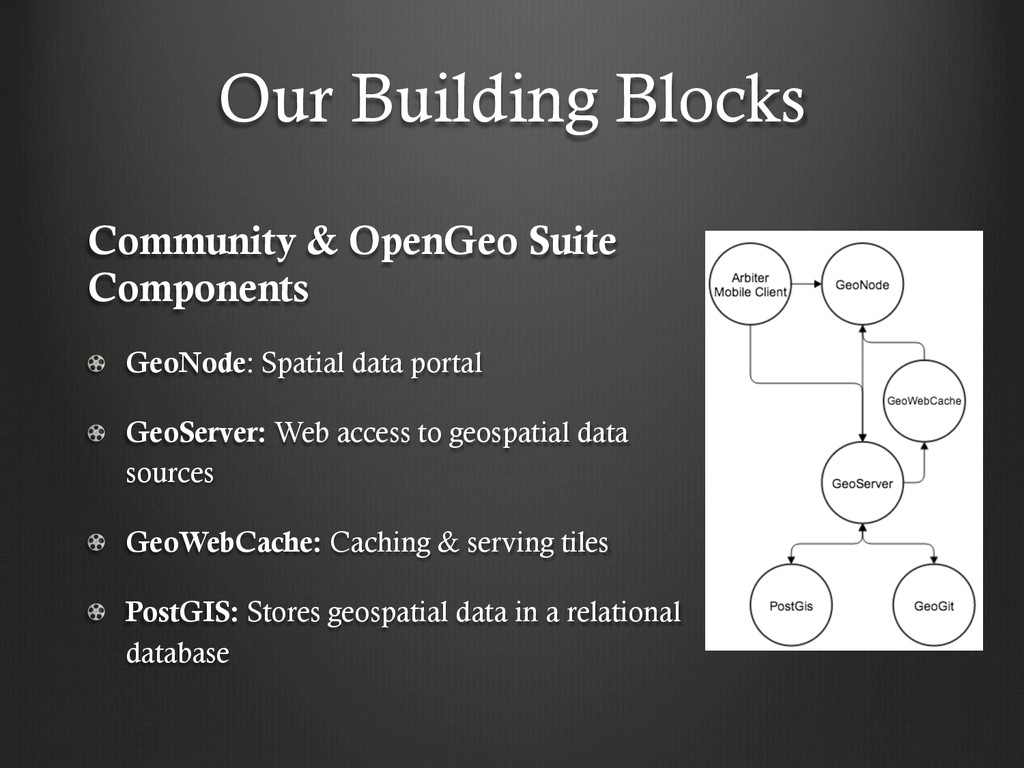
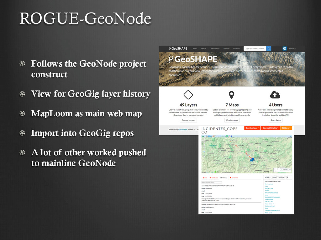
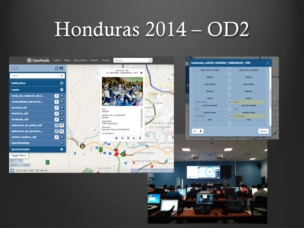
GeoNode: Spatial data portal ! GeoServer: Web access to geospatial data sources ! GeoWebCache: Caching & serving tiles ! PostGIS: Stores geospatial data in a relational database
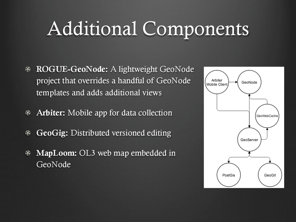
overrides a handful of GeoNode templates and adds additional views ! Arbiter: Mobile app for data collection ! GeoGig: Distributed versioned editing ! MapLoom: OL3 web map embedded in GeoNode
collaboration ! Provenance ! Synchronization & Conflict Resolution ! Lets you ! Import geospatial data: Shapefile, PostGIS, OpenStreetMap, SQLite… ! Branch and merge data ! Clone a repository ! View history for a repository, FeatureType (layer) or feature ! Tag a version ! Export & more GeoGig
! Built using OpenLayers 3, Bootstrap, & Angular ! View history of layers & features in GeoGig ! Conflict resolution ! Export commit history to a .csv file MapLoom
the field ! Create & edit point, line, polygon features ! Link photos to a feature ! Cache basemap tiles & layers ! Work disconnected ! Sync over 3G or WiFi Arbiter
existing projects ! Open Source Community ! Continuous Integration, GitHub & Dev Ops ! Government team – USACE ERDC & SOUTHCOM S&T ! Transition team – Pacific Disaster Center, Department of State Humanitarian Information Unit ! Translation support
integration using Sphinx ! Schema accessibility in GeoServer ! Provisioning between servers ! Data, Styles, Schemas ! Better workflows (UI implementation) for branching & merging ! Easy install on top of existing OpenGeo Suite install ! Current process is manual ! Using SLD with KML & GeoServices REST