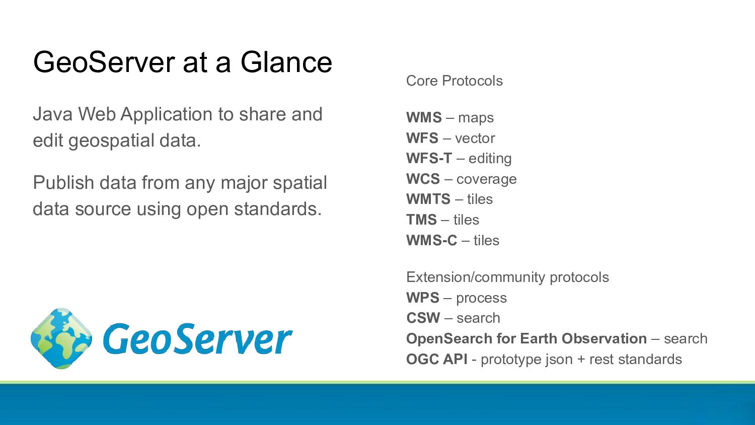
In this presentation, our GeoServer Lead Andrea Aime walks us through the key points of the GeoServer release 2.22 covering also what to expect for the next release.
Aime Technical Lead [email protected] @geowolf GeoSolutions Innovative, robust, cost-effective solutions leveraging best-of-breed Open Source products. This presentation is brought to you by
the ability to approve pull-requests. We also support community commit access by request (often to work on a specific research and development topic): • 22 committers New committer this week: Joseph Miller! Project Steering Committee serves to guide the project drawing from the various groups with a stake in the success of the project. • Alessio Fabiani • Andrea Aime • Ian Turton • Jody Garnett • Jukka Rahkonen • Kevin Smith • Nuno Oliveira • Simone Giannecchini • Torben Barsballe GeoServer Team
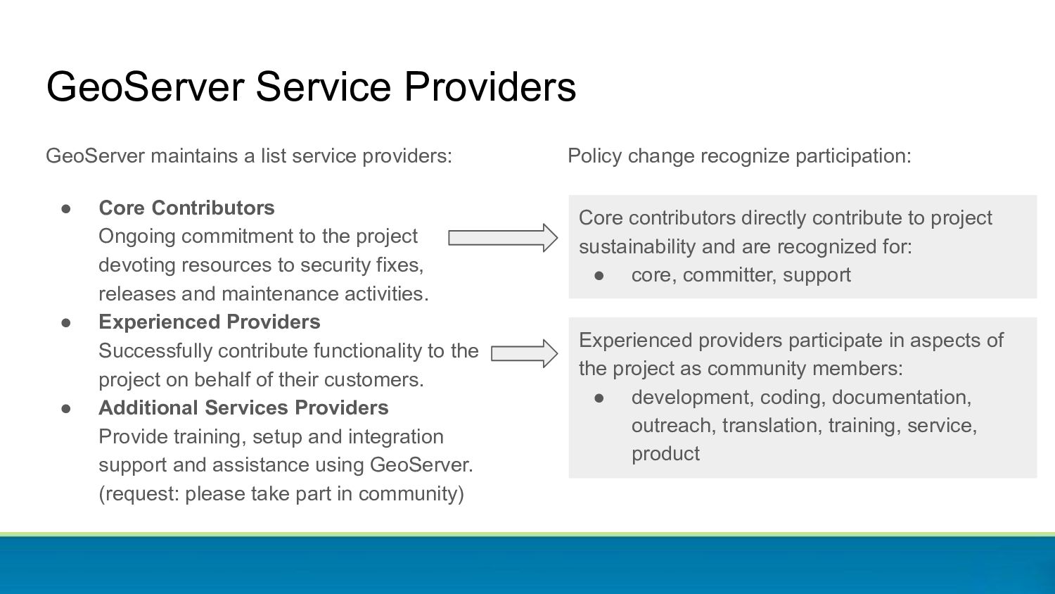
commitment to the project devoting resources to security fixes, releases and maintenance activities. • Experienced Providers Successfully contribute functionality to the project on behalf of their customers. • Additional Services Providers Provide training, setup and integration support and assistance using GeoServer. (request: please take part in community) GeoServer Service Providers Policy change recognize participation: Core contributors directly contribute to project sustainability and are recognized for: • core, committer, support Experienced providers participate in aspects of the project as community members: • development, coding, documentation, outreach, translation, training, service, product
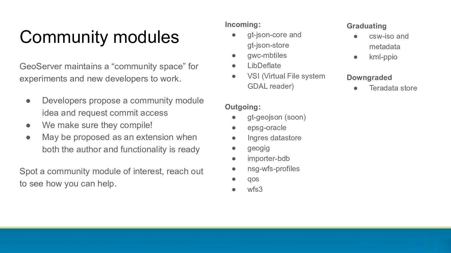
VSI (Virtual File system GDAL reader) Outgoing: • gt-geojson (soon) • epsg-oracle • Ingres datastore • geogig • importer-bdb • nsg-wfs-profiles • qos • wfs3 Community modules GeoServer maintains a “community space” for experiments and new developers to work. • Developers propose a community module idea and request commit access • We make sure they compile! • May be proposed as an extension when both the author and functionality is ready Spot a community module of interest, reach out to see how you can help. Graduating • csw-iso and metadata • kml-ppio Downgraded • Teradata store
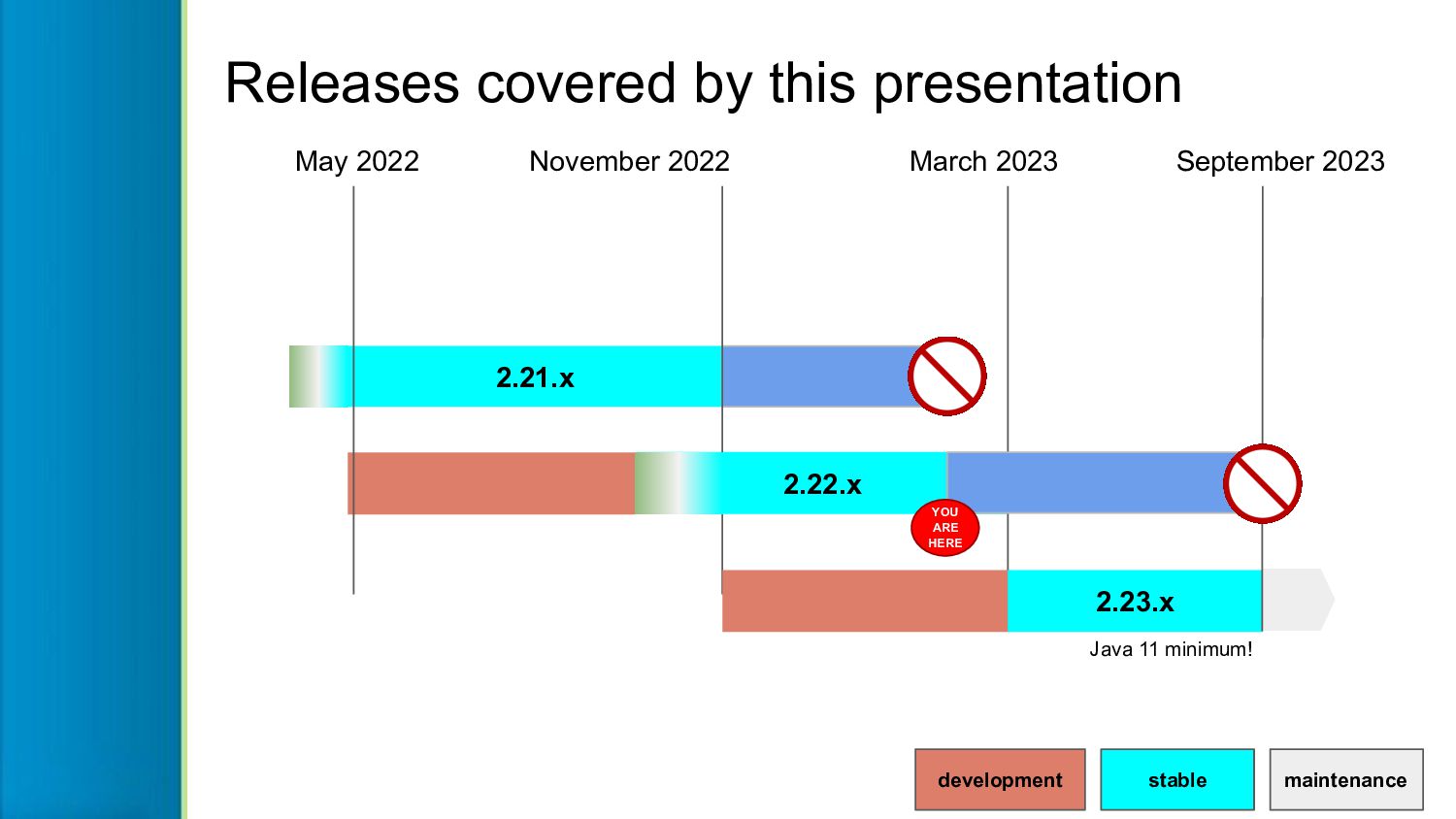
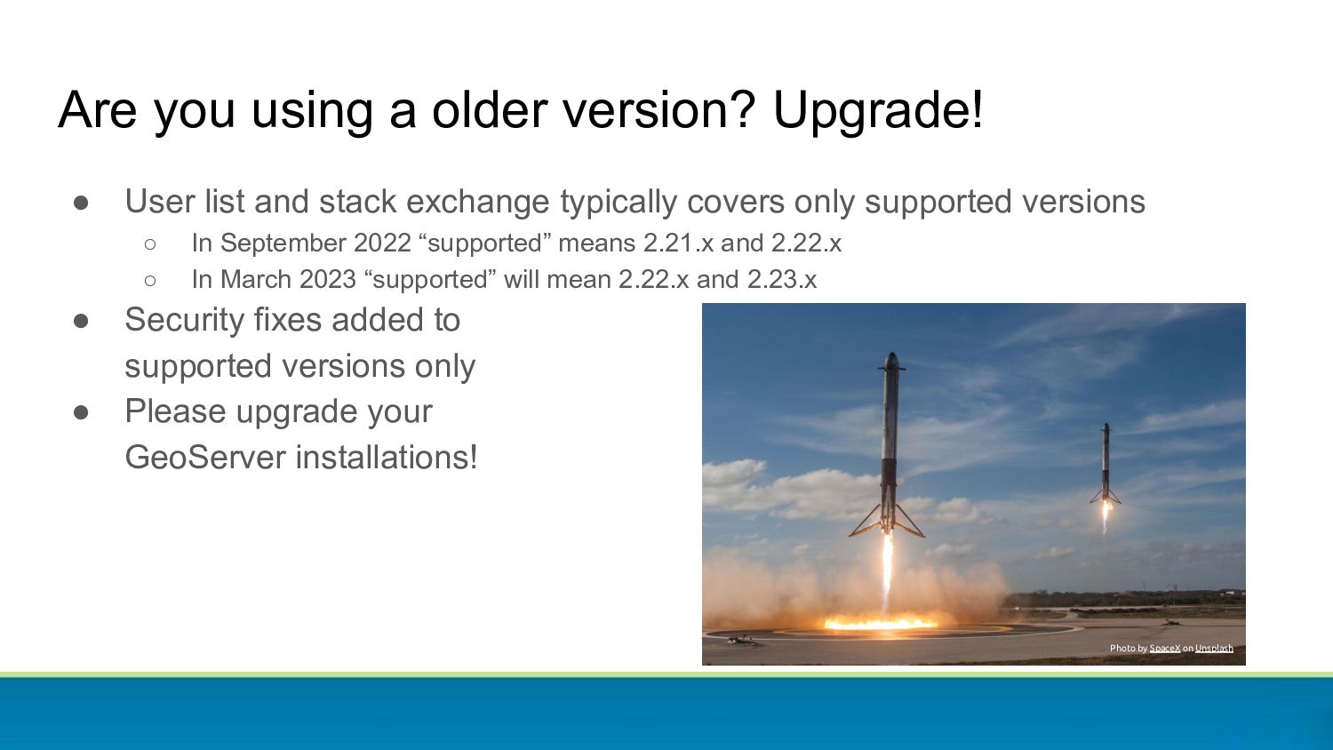
and stack exchange typically covers only supported versions ◦ In September 2022 “supported” means 2.21.x and 2.22.x ◦ In March 2023 “supported” will mean 2.22.x and 2.23.x • Security fixes added to supported versions only • Please upgrade your GeoServer installations! Photo by SpaceX on Unsplash
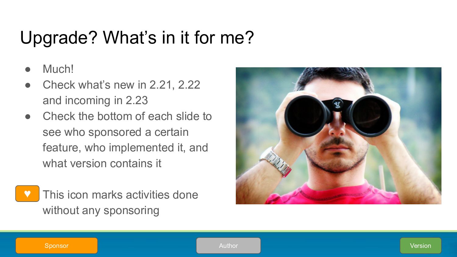
what’s new in 2.21, 2.22 and incoming in 2.23 • Check the bottom of each slide to see who sponsored a certain feature, who implemented it, and what version contains it • This icon marks activities done without any sponsoring Version Author Sponsor ♥
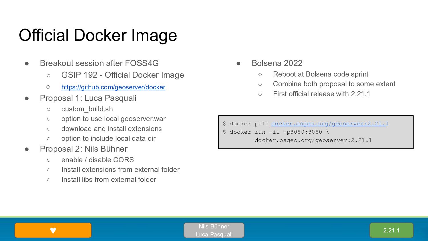
192 - Official Docker Image ◦ https://github.com/geoserver/docker • Proposal 1: Luca Pasquali ◦ custom_build.sh ◦ option to use local geoserver.war ◦ download and install extensions ◦ option to include local data dir • Proposal 2: Nils Bühner ◦ enable / disable CORS ◦ Install extensions from external folder ◦ Install libs from external folder • Bolsena 2022 ◦ Reboot at Bolsena code sprint ◦ Combine both proposal to some extent ◦ First official release with 2.21.1 2.21.1 Nils Bühner Luca Pasquali ♥ $ docker pull docker.osgeo.org/geoserver:2.21.1 $ docker run -it -p8080:8080 \ docker.osgeo.org/geoserver:2.21.1
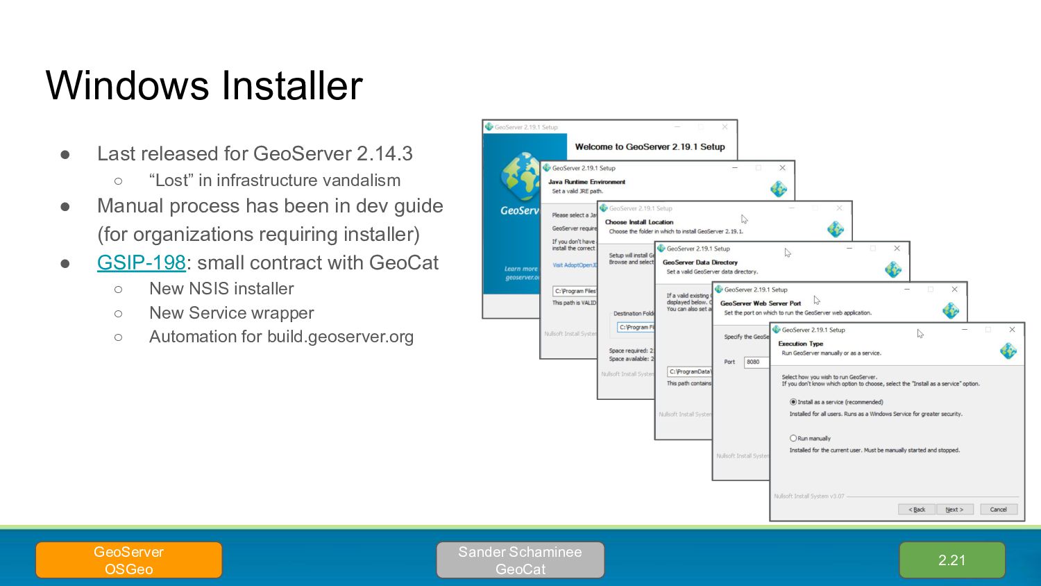
in infrastructure vandalism • Manual process has been in dev guide (for organizations requiring installer) • GSIP-198: small contract with GeoCat ◦ New NSIS installer ◦ New Service wrapper ◦ Automation for build.geoserver.org 2.21 Sander Schaminee GeoCat GeoServer OSGeo
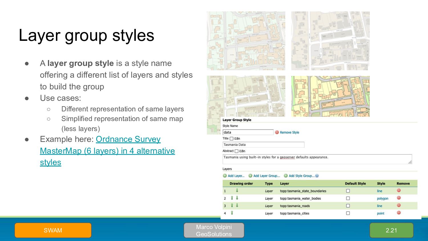
style name offering a different list of layers and styles to build the group • Use cases: ◦ Different representation of same layers ◦ Simplified representation of same map (less layers) • Example here: Ordnance Survey MasterMap (6 layers) in 4 alternative styles 2.21 Marco Volpini GeoSolutions SWAM
from “mark factories” • Control order of execution and availability in styles • For complex point maps, big speed improvements by putting the most used factories first 2.21 Fernando Mino EMSA Above: EMSA, real time tracking of 150k ships in the EU area
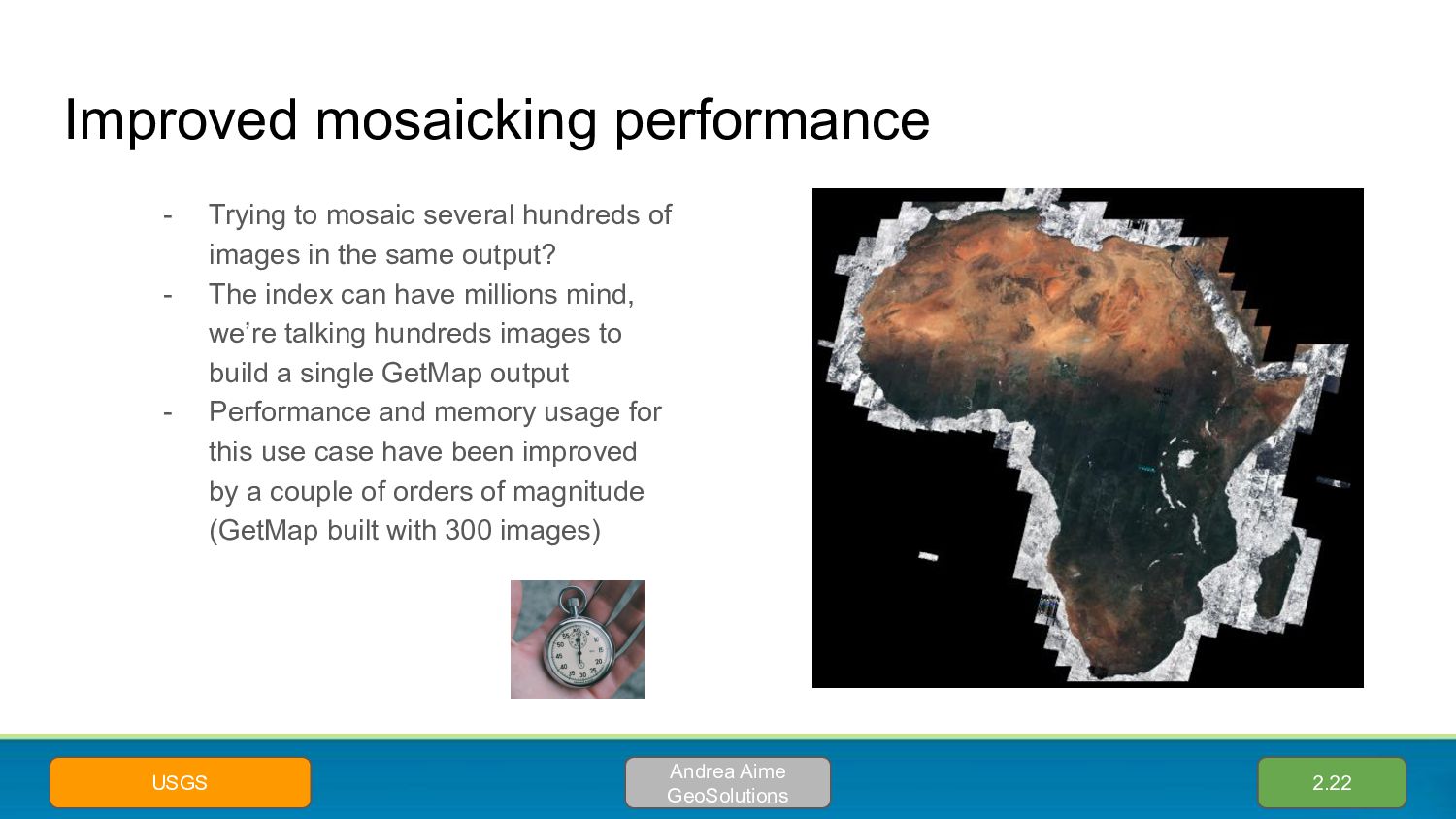
images in the same output? - The index can have millions mind, we’re talking hundreds images to build a single GetMap output - Performance and memory usage for this use case have been improved by a couple of orders of magnitude (GetMap built with 300 images) 2.22 Andrea Aime GeoSolutions USGS
bands - Typically stored in band-interleaved structure (one data bank for all pixels in the same tile) - GS is now orders of magnitude faster at reading them 2.22 Andrea Aime GeoSolutions DLR Rows Cols Bands
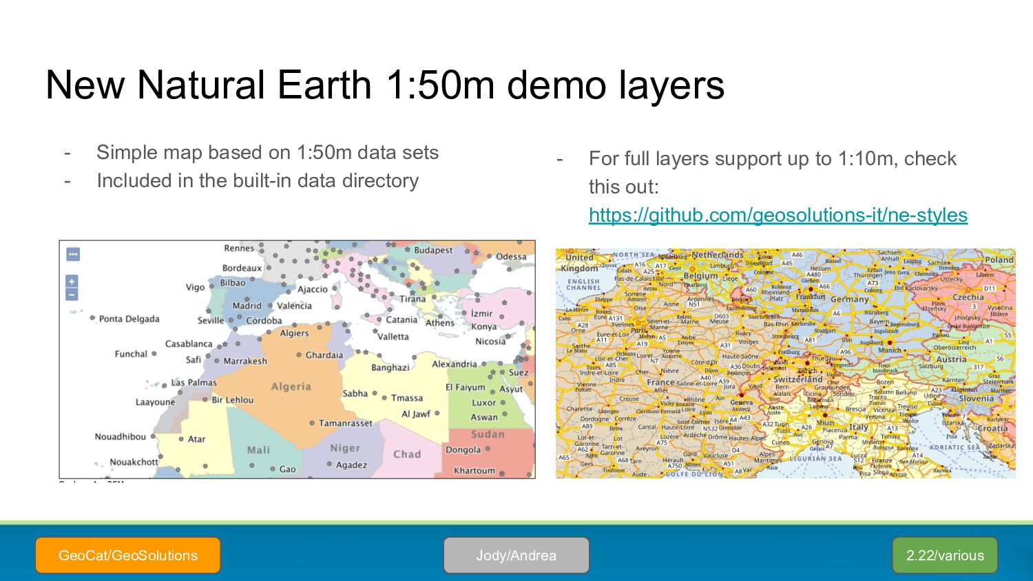
on 1:50m data sets - Included in the built-in data directory 2.22/various Jody/Andrea GeoCat/GeoSolutions - For full layers support up to 1:10m, check this out: https://github.com/geosolutions-it/ne-styles
3.x Series ◦ GDAL 3.2 and 3.4 tested ◦ (GDAL 3.5 build was not yet stable) • Primarily update to ImageIO-EXT GDAL 3.x Support 2.21 David Blasby GeoCat Rijkswaterstaat
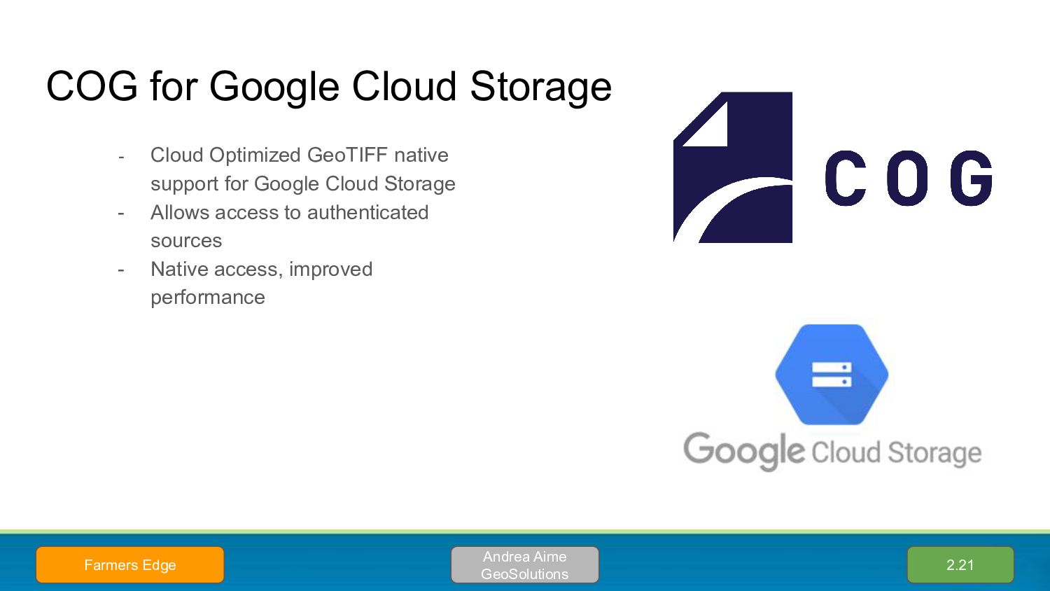
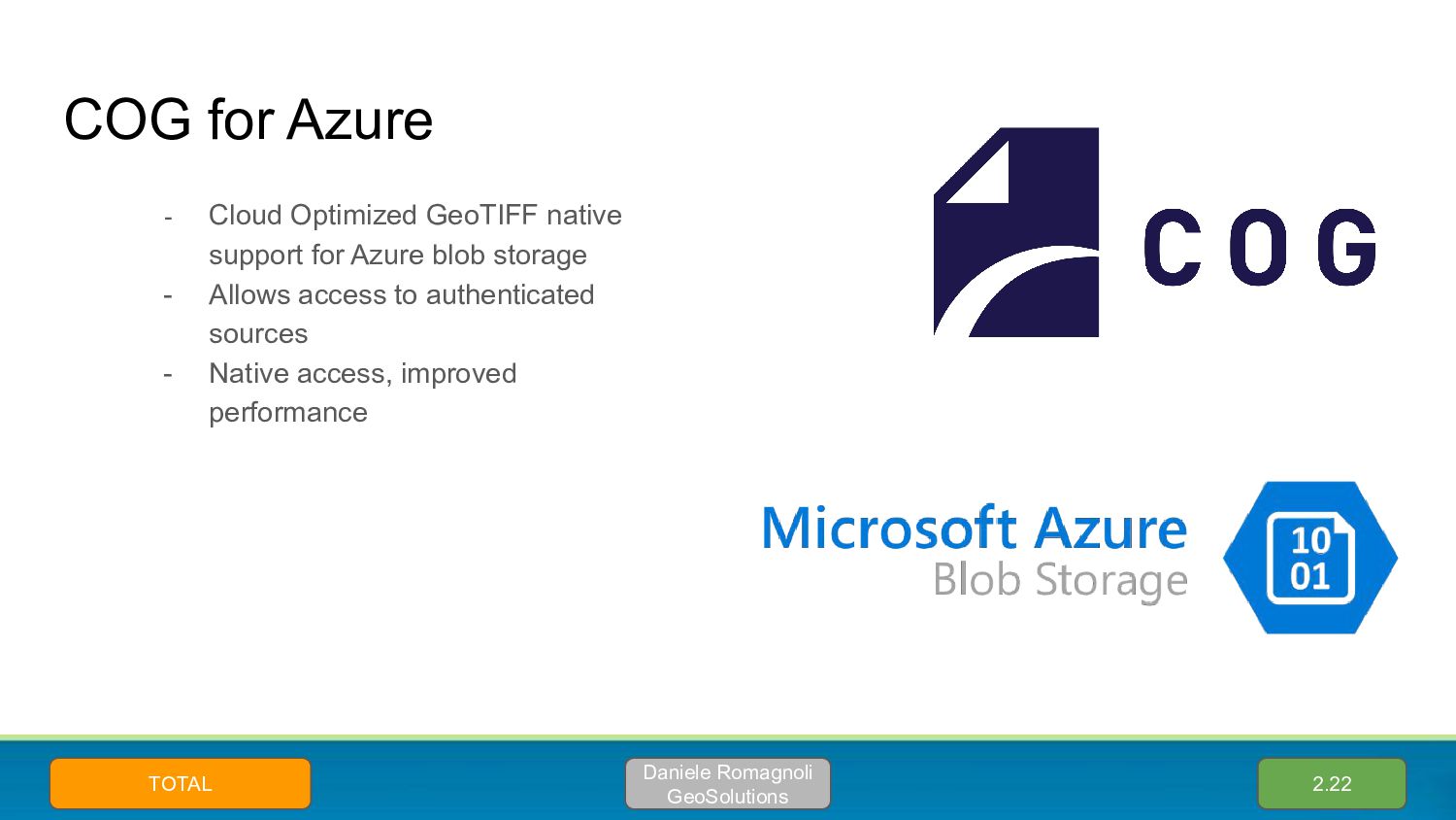
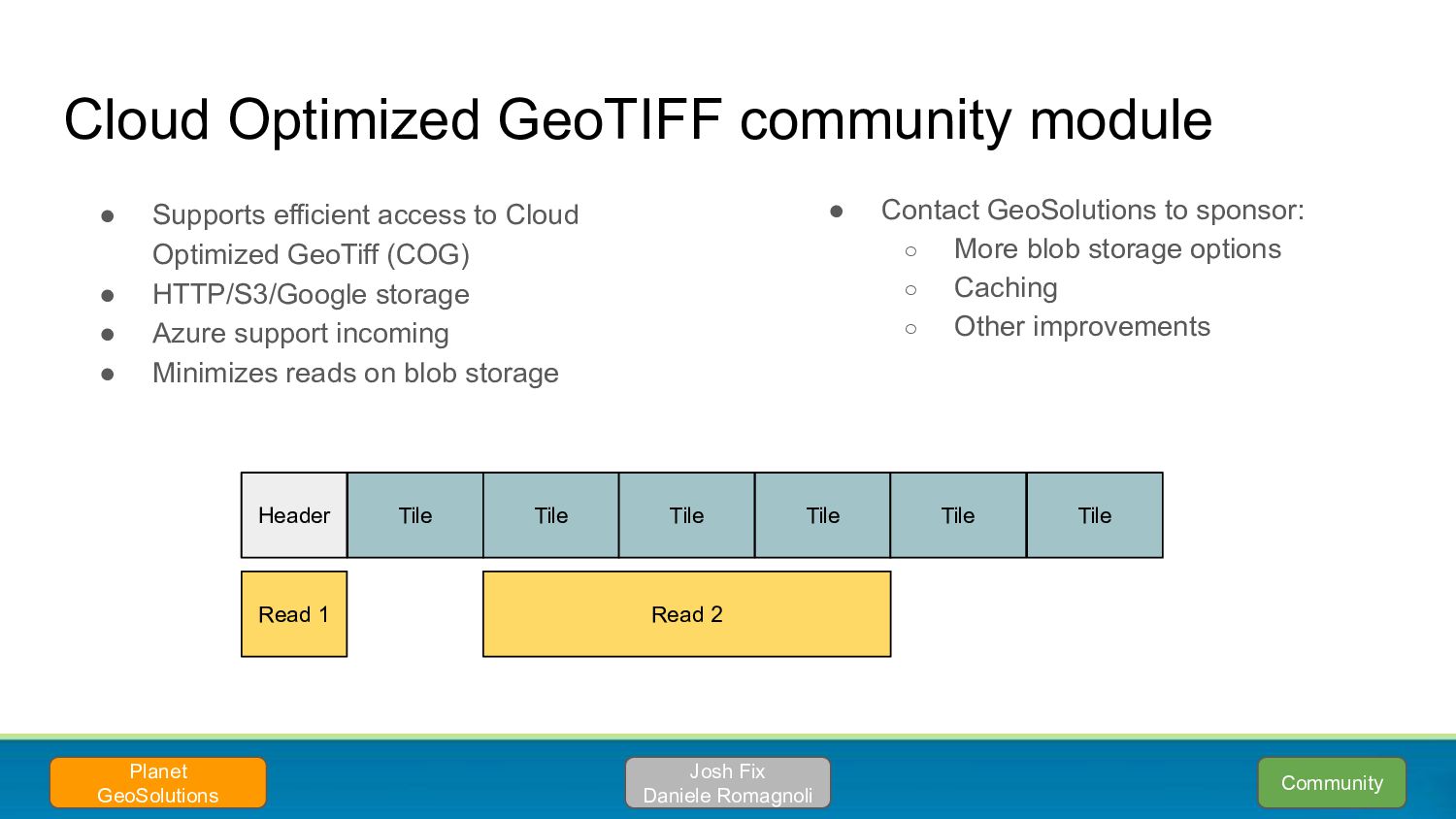
support for Google Cloud Storage - Allows access to authenticated sources - Native access, improved performance 2.21 Andrea Aime GeoSolutions Farmers Edge
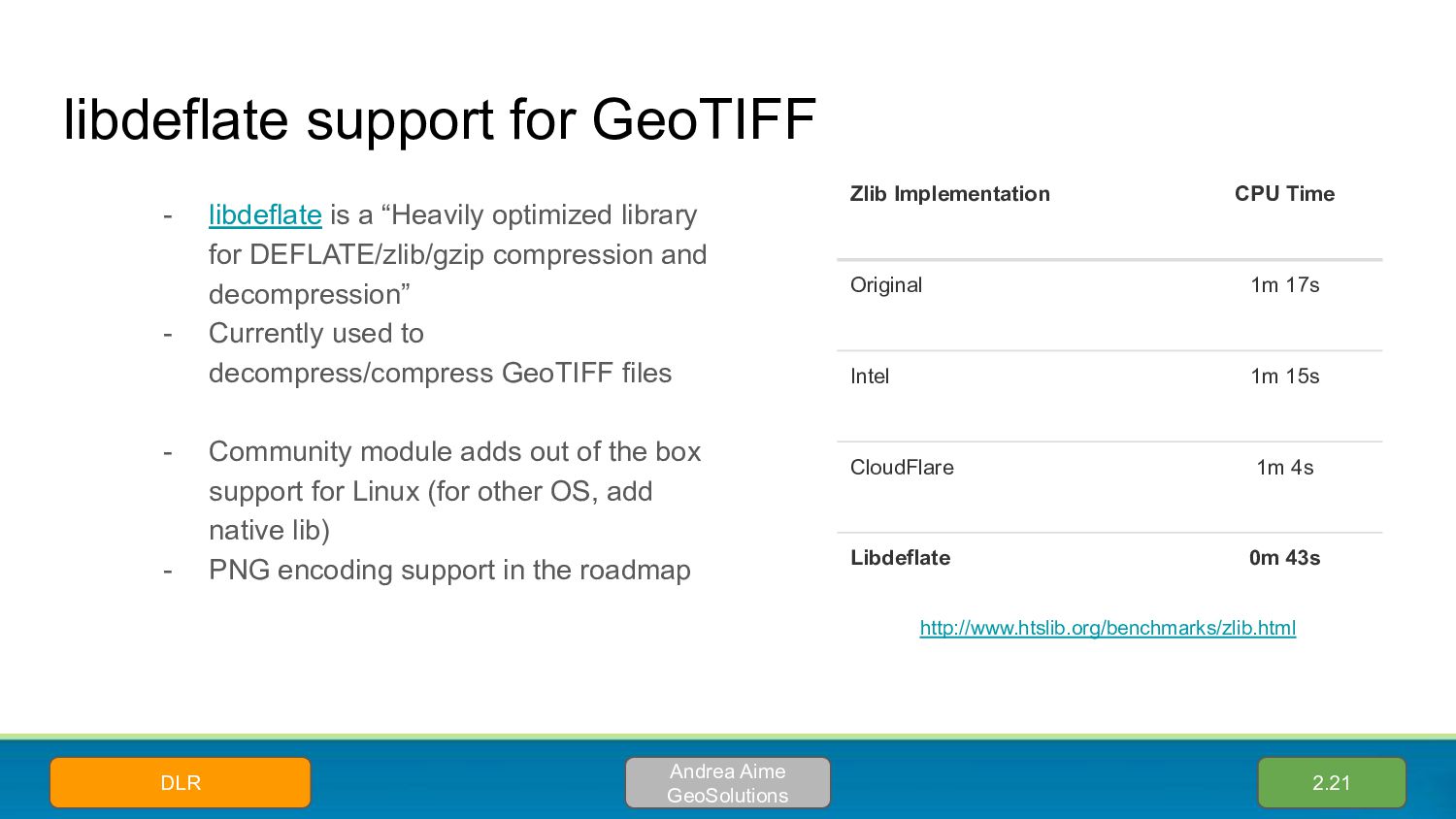
library for DEFLATE/zlib/gzip compression and decompression” - Currently used to decompress/compress GeoTIFF files - Community module adds out of the box support for Linux (for other OS, add native lib) - PNG encoding support in the roadmap 2.21 Andrea Aime GeoSolutions DLR Zlib Implementation CPU Time Original 1m 17s Intel 1m 15s CloudFlare 1m 4s Libdeflate 0m 43s http://www.htslib.org/benchmarks/zlib.html
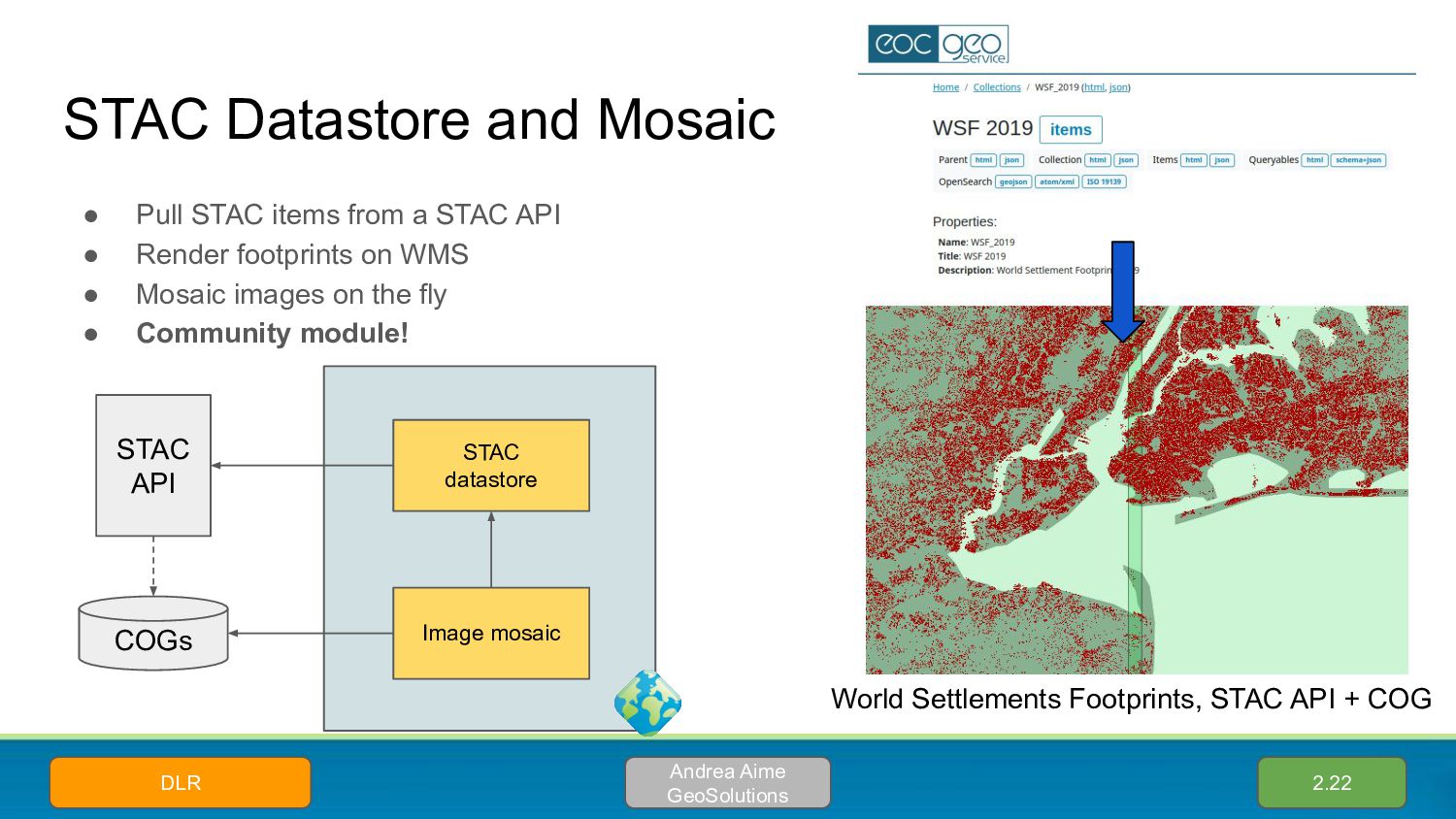
STAC API • Render footprints on WMS • Mosaic images on the fly • Community module! 2.22 Andrea Aime GeoSolutions DLR STAC API STAC datastore COGs Image mosaic World Settlements Footprints, STAC API + COG
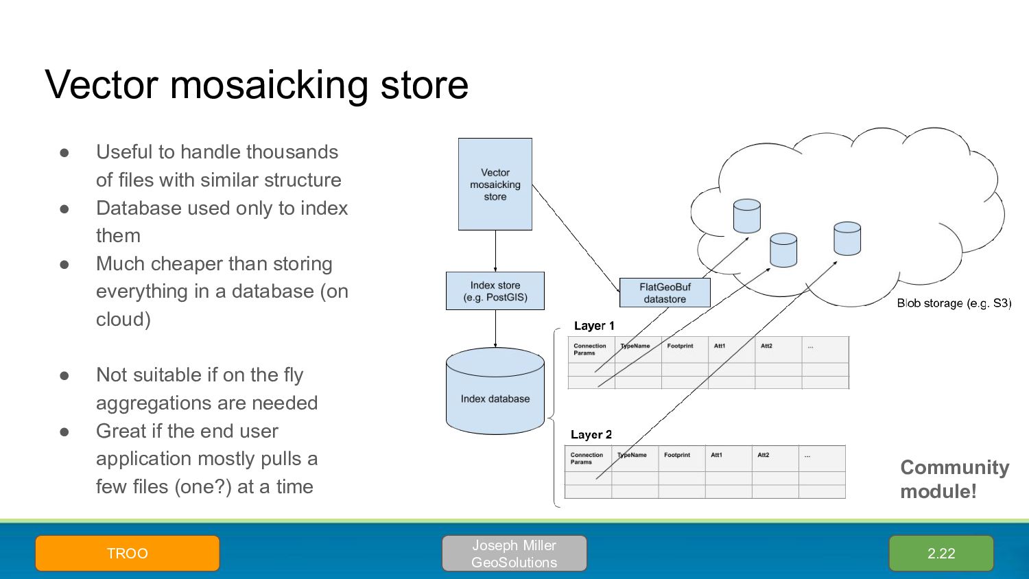
with similar structure • Database used only to index them • Much cheaper than storing everything in a database (on cloud) • Not suitable if on the fly aggregations are needed • Great if the end user application mostly pulls a few files (one?) at a time 2.22 Joseph Miller GeoSolutions TROO Community module!
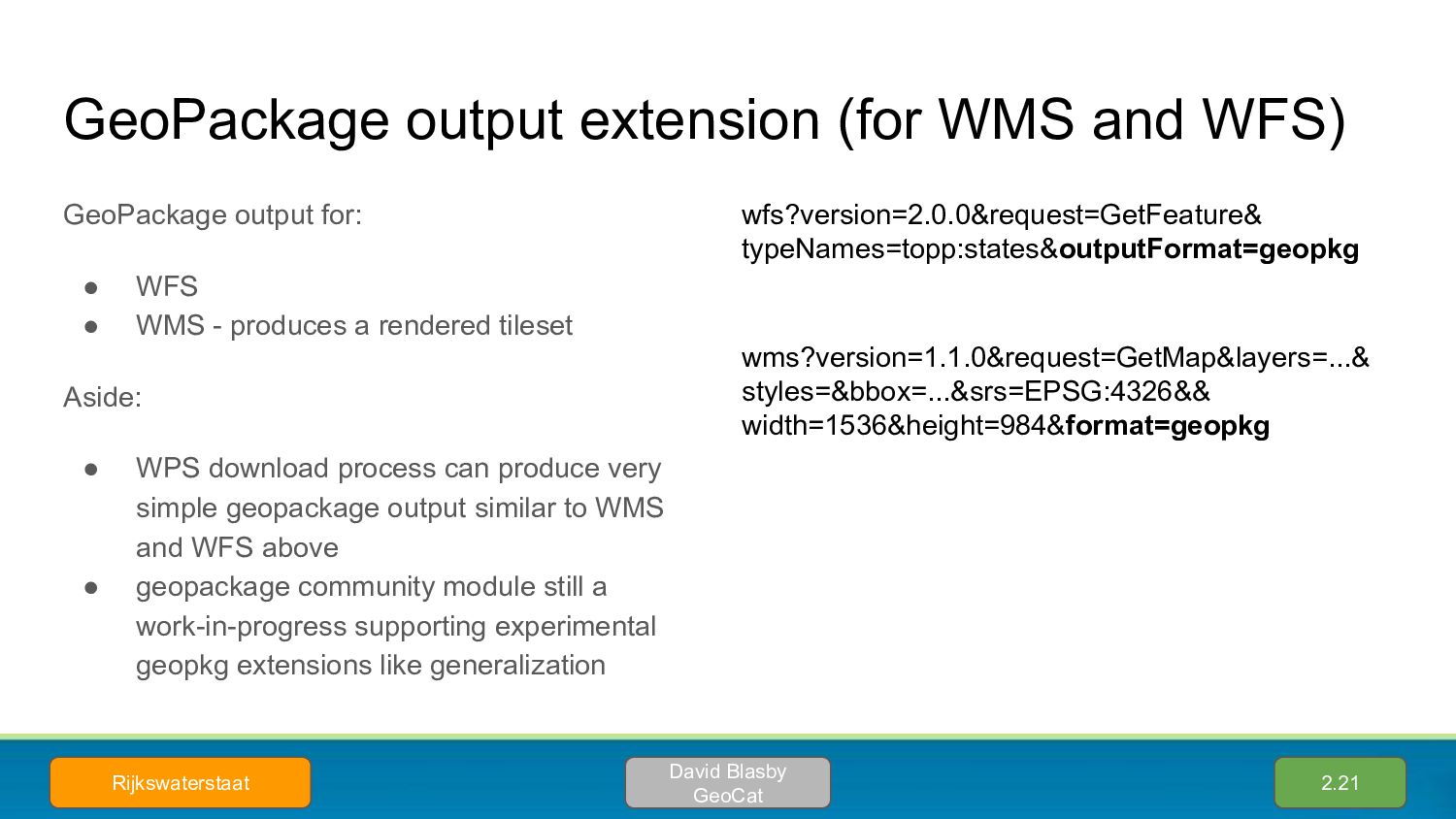
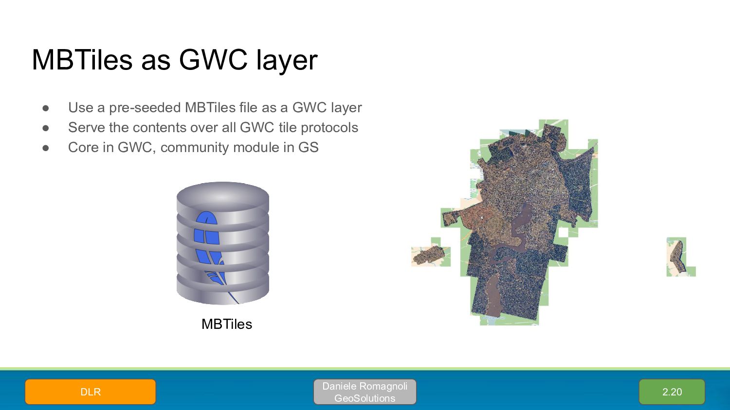
• WFS • WMS - produces a rendered tileset Aside: • WPS download process can produce very simple geopackage output similar to WMS and WFS above • geopackage community module still a work-in-progress supporting experimental geopkg extensions like generalization 2.21 David Blasby GeoCat Rijkswaterstaat wfs?version=2.0.0&request=GetFeature& typeNames=topp:states&outputFormat=geopkg wms?version=1.1.0&request=GetMap&layers=...& styles=&bbox=...&srs=EPSG:4326&& width=1536&height=984&format=geopkg
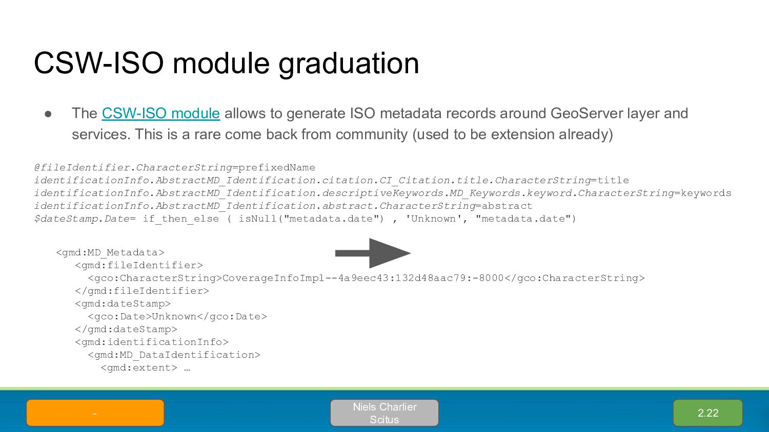
ISO metadata records around GeoServer layer and services. This is a rare come back from community (used to be extension already) 2.22 @fileIdentifier.CharacterString=prefixedName identificationInfo.AbstractMD_Identification.citation.CI_Citation.title.CharacterString=title identificationInfo.AbstractMD_Identification.descriptiveKeywords.MD_Keywords.keyword.CharacterString=keywords identificationInfo.AbstractMD_Identification.abstract.CharacterString=abstract $dateStamp.Date= if_then_else ( isNull("metadata.date") , 'Unknown', "metadata.date") <gmd:MD_Metadata> <gmd:fileIdentifier> <gco:CharacterString>CoverageInfoImpl--4a9eec43:132d48aac79:-8000</gco:CharacterString> </gmd:fileIdentifier> <gmd:dateStamp> <gco:Date>Unknown</gco:Date> </gmd:dateStamp> <gmd:identificationInfo> <gmd:MD_DataIdentification> <gmd:extent> … Niels Charlier Scitus -
for extra metadata information (to be used in CSW-ISO) The editor structure can be customized using YAML configs 2.22 Niels Charlier Scitus - attributes: - key: metadata-identifier fieldType: UUID - key: metadata-datestamp label: Date fieldType: DATETIME - key: data-language fieldType: DROPDOWN values: - dut - eng - fre - ger - key: topic-category fieldType: SUGGESTBOX occurrence: REPEAT values: - farming - …
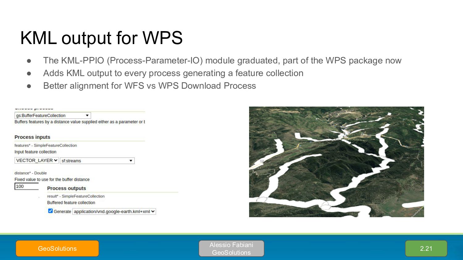
part of the WPS package now • Adds KML output to every process generating a feature collection • Better alignment for WFS vs WPS Download Process 2.21 Alessio Fabiani GeoSolutions GeoSolutions
with comments, they can be advertised in the WFS XML schema returned by DescribeFeatureType • They will be soon also editable from GUI as well (for all vector data sources) • PR in review today! 2.22.3 Joseph Miller GeoSolutions GeoScience Australia
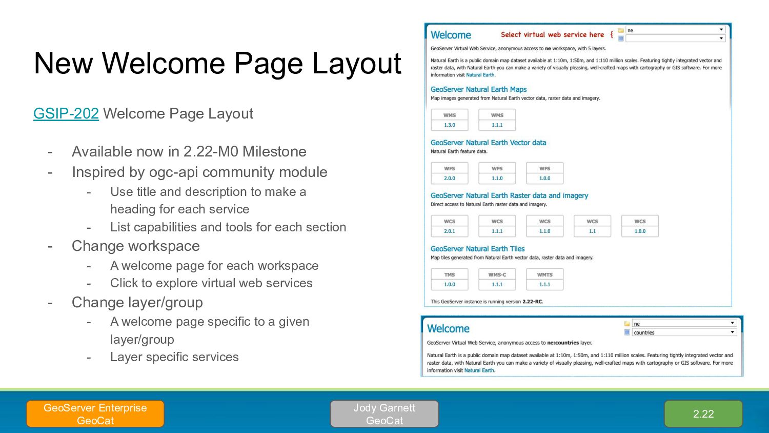
now in 2.22-M0 Milestone - Inspired by ogc-api community module - Use title and description to make a heading for each service - List capabilities and tools for each section - Change workspace - A welcome page for each workspace - Click to explore virtual web services - Change layer/group - A welcome page specific to a given layer/group - Layer specific services 2.22 Jody Garnett GeoCat GeoServer Enterprise GeoCat
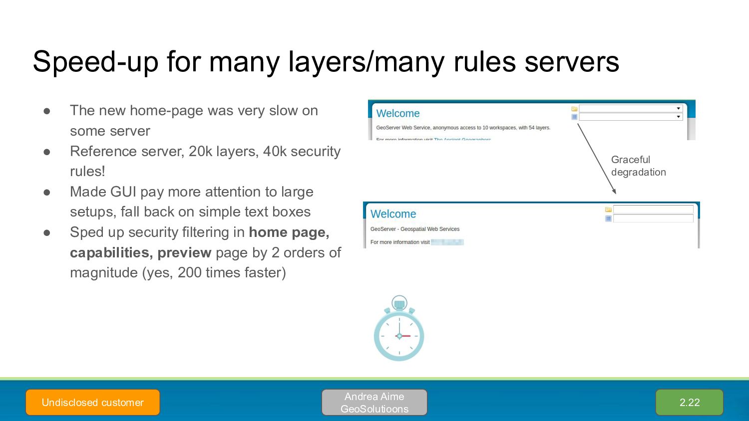
was very slow on some server • Reference server, 20k layers, 40k security rules! • Made GUI pay more attention to large setups, fall back on simple text boxes • Sped up security filtering in home page, capabilities, preview page by 2 orders of magnitude (yes, 200 times faster) 2.22 Andrea Aime GeoSolutioons Undisclosed customer Graceful degradation
• Service descriptions • In multiple languages • Support INSPIRE “LANGUAGE” request parameter (e.g. GetMap with language specific labels) • Drive styles using the “language” function 2.20 Marco Volpini Provincia di Bolzano
styling languages? • SLD 1.0, SLD 1.1, CSS, YSLD, MBStyles, oh my • The styles page now indicates the format for each style 2.22 Mohammad Mohiuddin Ahmed
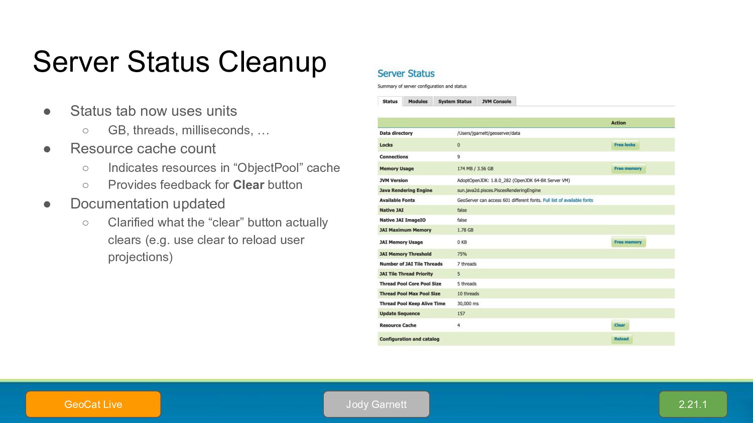
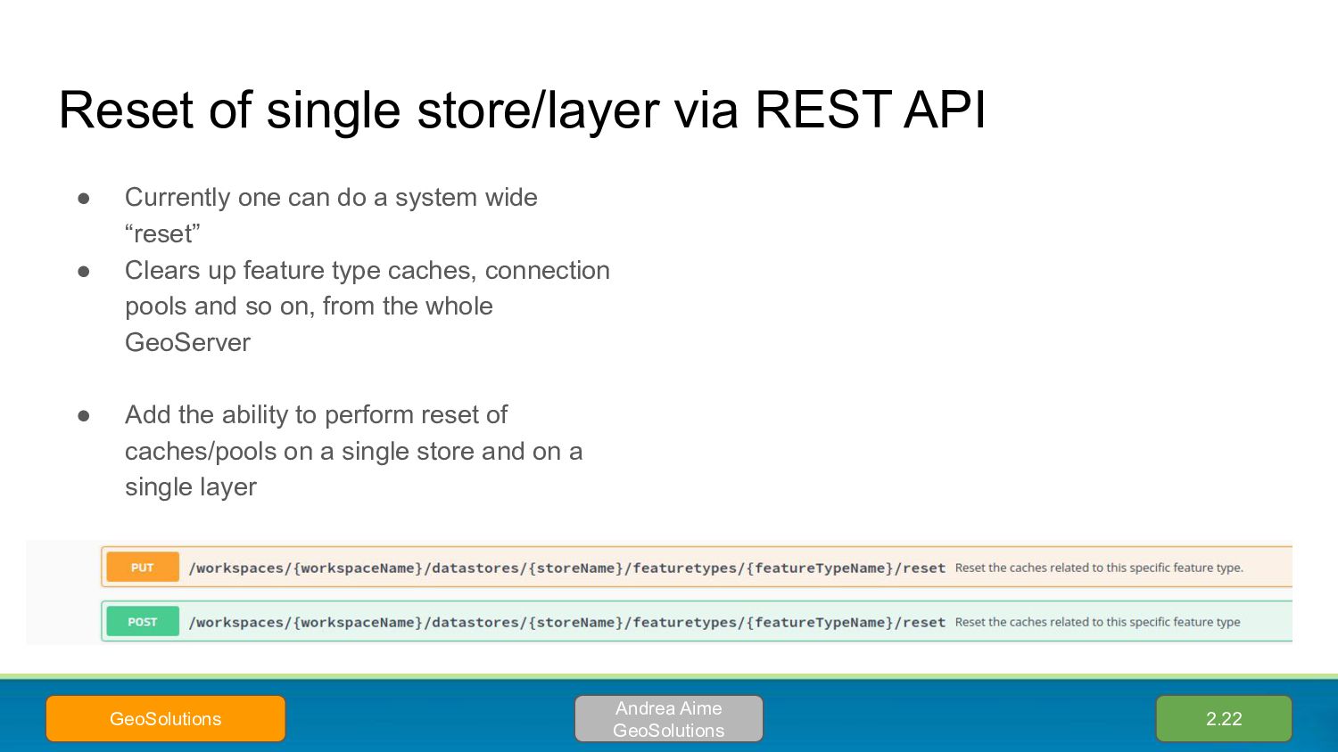
can do a system wide “reset” • Clears up feature type caches, connection pools and so on, from the whole GeoServer • Add the ability to perform reset of caches/pools on a single store and on a single layer 2.22 Andrea Aime GeoSolutions GeoSolutions
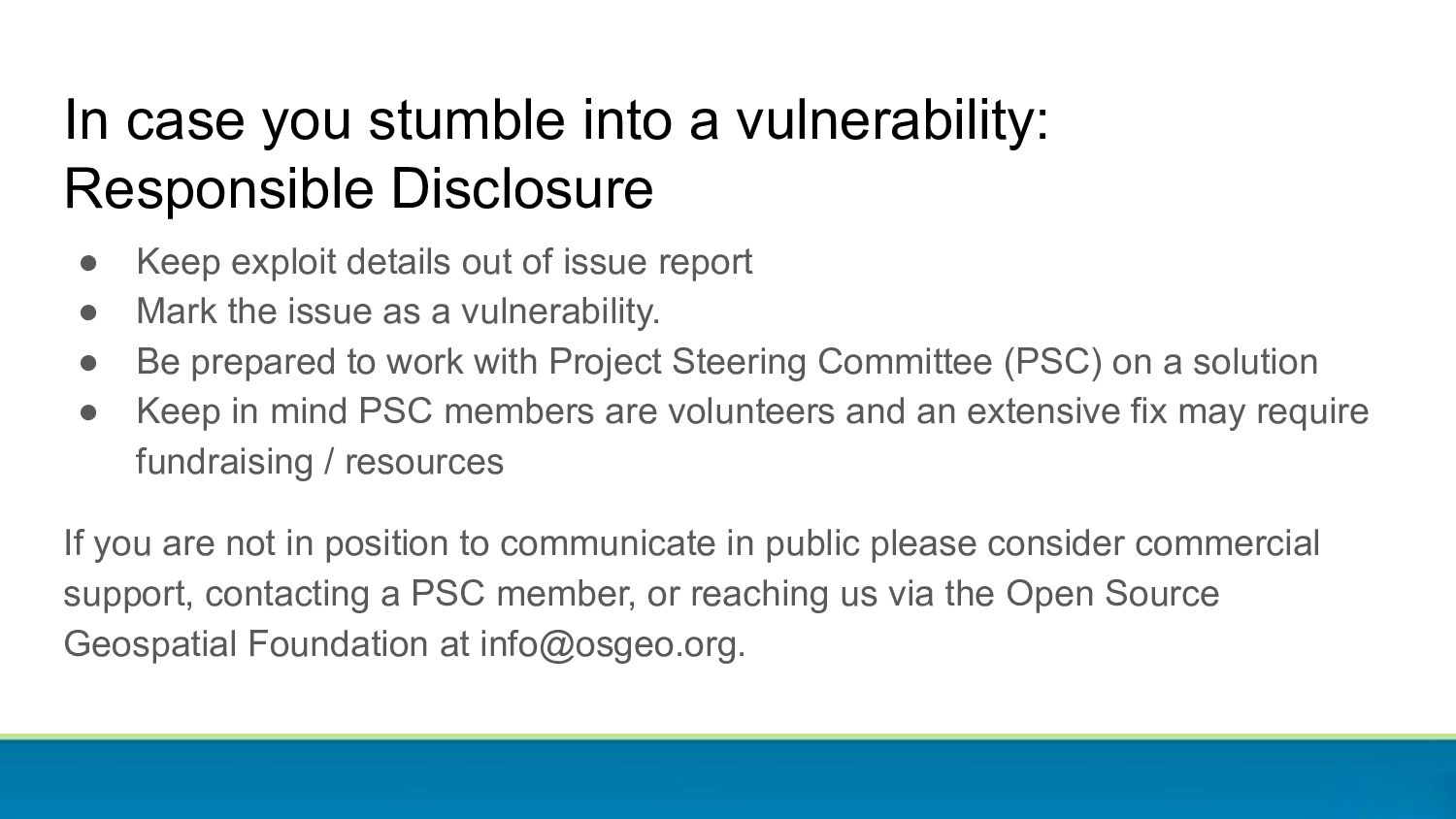
the issue as a vulnerability. • Be prepared to work with Project Steering Committee (PSC) on a solution • Keep in mind PSC members are volunteers and an extensive fix may require fundraising / resources If you are not in position to communicate in public please consider commercial support, contacting a PSC member, or reaching us via the Open Source Geospatial Foundation at [email protected]. In case you stumble into a vulnerability: Responsible Disclosure
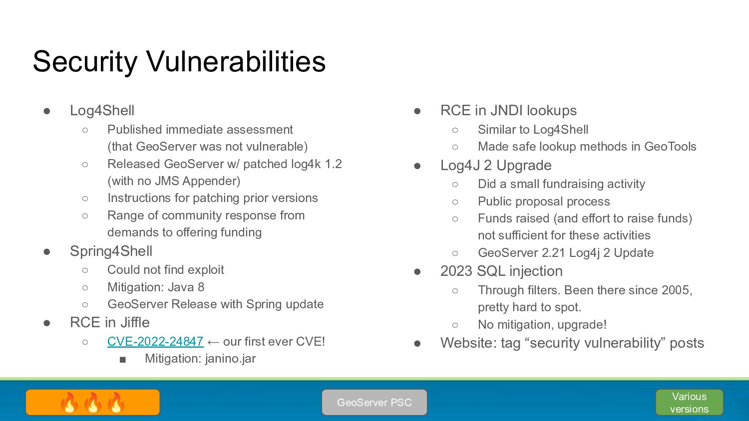
vulnerable) ◦ Released GeoServer w/ patched log4k 1.2 (with no JMS Appender) ◦ Instructions for patching prior versions ◦ Range of community response from demands to offering funding • Spring4Shell ◦ Could not find exploit ◦ Mitigation: Java 8 ◦ GeoServer Release with Spring update • RCE in Jiffle ◦ CVE-2022-24847 ← our first ever CVE! ▪ Mitigation: janino.jar Security Vulnerabilities • RCE in JNDI lookups ◦ Similar to Log4Shell ◦ Made safe lookup methods in GeoTools • Log4J 2 Upgrade ◦ Did a small fundraising activity ◦ Public proposal process ◦ Funds raised (and effort to raise funds) not sufficient for these activities ◦ GeoServer 2.21 Log4j 2 Update • 2023 SQL injection ◦ Through filters. Been there since 2005, pretty hard to spot. ◦ No mitigation, upgrade! • Website: tag “security vulnerability” posts GeoServer PSC 🔥🔥🔥 Various versions
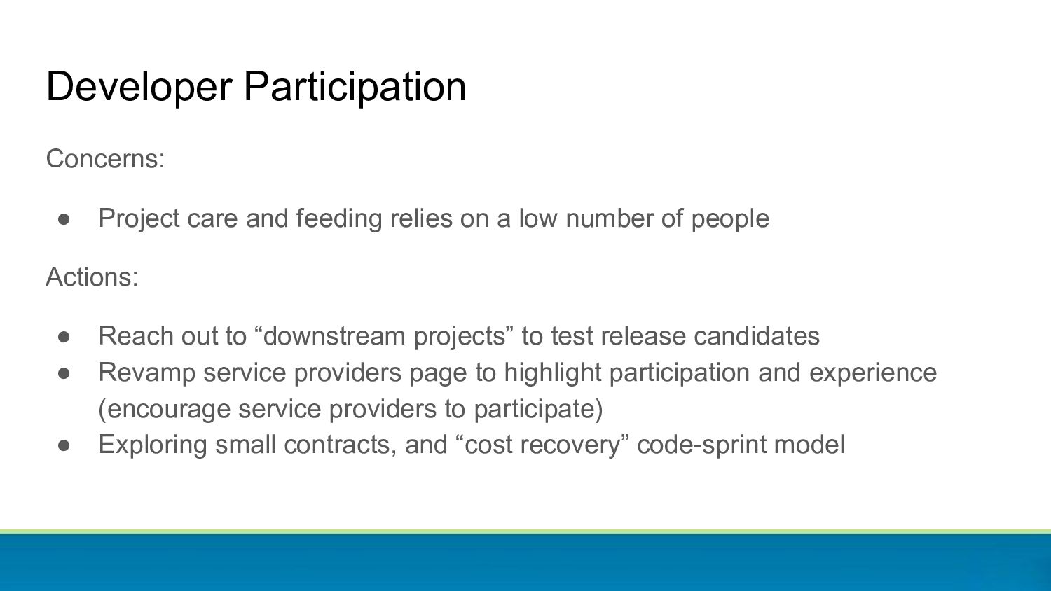
a low number of people Actions: • Reach out to “downstream projects” to test release candidates • Revamp service providers page to highlight participation and experience (encourage service providers to participate) • Exploring small contracts, and “cost recovery” code-sprint model
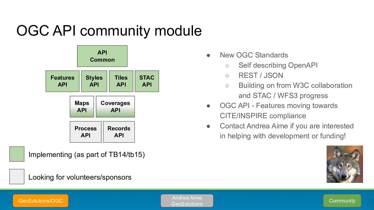
/ JSON ◦ Building on from W3C collaboration and STAC / WFS3 progress • OGC API - Features moving towards CITE/INSPIRE compliance • Contact Andrea Aime if you are interested in helping with development or funding! OGC API community module Andrea Aime GeoSolutions GeoSolutions/OGC API Common Maps API Coverages API Implementing (as part of TB14/tb15) Looking for volunteers/sponsors Process API Records API Features API Tiles API Styles API STAC API Community
while as a community module • Core specification (space/time filtering) and CRS support finalized • Advanced filtering (CQL2) still in progress • Fully customizable appearance • Moving towards graduation of the core portion 2.23 Andrea Aime GeoSolutions Geonovum Various others
• geopkg output extension: WFS and WMS • geopkg community module: WPS • Reading grids other than png/jpeg tiles: TBD • Extending GeoPackage - yes you can ◦ Include in-line linked metadata ◦ Include styles ◦ Included generalized tables (store pre-simplified geometries) • Contact Andrea Aime if you are interested in helping with time or funding! Community Andrea Aime GeoSolutions GeoSolutions/OGC
supported across modern browsers • Compared to PNG ◦ Up to 2 times smaller file ◦ Up to 3 times slower to produce on topp:states (this can be improved) • The actual speed difference depends on the map production time (less noticeable on more complex maps with rich symbology) • For now, best suited for tile caches Community OpenDEM ♥
map” • The core developers are mostly employed in companies providing commercial services for GeoServer, or using it in some hosting solution → customer driven (no other significant source of funding) • Other developers pop up occasionally to provide improvements, fixes and new features they need Whatever else you want to push for Community
![Jody Garnett [email protected] @jodygarnett GeoCat Government Geographic Data publishing Andrea](https://files.speakerdeck.com/presentations/7b215907d2114e1191487024d8883f02/slide_1.jpg)
![Thanks! [email protected]](https://files.speakerdeck.com/presentations/7b215907d2114e1191487024d8883f02/slide_63.jpg)