Upgrade to Pro
— share decks privately, control downloads, hide ads and more …
Speaker Deck
Features
Speaker Deck
PRO
Sign in
Sign up for free
Search
Search
Cartography 101
Search
Sumin Byeon
March 21, 2013
Science
61
1
Share
Embed
Copy iframe code
Copy JS code
Copy link
Start on current slide
Cartography 101
Sumin Byeon
March 21, 2013
More Decks by Sumin Byeon
See All by Sumin Byeon
Big Data in Action
suminb
1
81
Git with Bitbucket
suminb
0
94
RNA Secondary Structure Prediction
suminb
0
170
Memory Management in iOS App Development
suminb
0
130
Other Decks in Science
See All in Science
機械学習 - SVM
trycycle
PRO
2
1.2k
データベース08: 実体関連モデルとは?
trycycle
PRO
0
1.2k
データベース04: SQL (1/3) 単純質問 & 集約演算
trycycle
PRO
0
1.5k
Conversation is the New Dashboard: 属人性を排除する第4世代BIツールの勢力図
shomaekawa
1
610
Distributional Regression
tackyas
0
550
KISHIMOTO Atsuo
genomethica
0
170
Van Dare naar Durf
voginip
0
250
AI bij literatuuronderzoek in de wetenschap
voginip
0
210
J-STAGE全文XML登載必須化について
xspa2012
0
1.1k
[NLP2026 参加報告会] AI for Science まとめ / NLP2026
lychee1223
0
1.9k
TypeScript で WebAssembly を用いた 型安全なプラグイン設計
nagano
2
560
フィードフォワードニューラルネットワークを用いた記号入出力制御系に対する制御器設計 / Controller Design for Augmented Systems with Symbolic Inputs and Outputs Using Feedforward Neural Network
konakalab
0
160
Featured
See All Featured
So, you think you're a good person
axbom
PRO
2
2.1k
Prompt Engineering for Job Search
mfonobong
0
370
Bioeconomy Workshop: Dr. Julius Ecuru, Opportunities for a Bioeconomy in West Africa
akademiya2063
PRO
1
170
No one is an island. Learnings from fostering a developers community.
thoeni
21
3.8k
How Software Deployment tools have changed in the past 20 years
geshan
0
34k
Being A Developer After 40
akosma
91
590k
The Pragmatic Product Professional
lauravandoore
37
7.4k
DBのスキルで生き残る技術 - AI時代におけるテーブル設計の勘所
soudai
PRO
67
56k
Building Better People: How to give real-time feedback that sticks.
wjessup
370
20k
The Illustrated Children's Guide to Kubernetes
chrisshort
51
52k
The untapped power of vector embeddings
frankvandijk
2
1.8k
Between Models and Reality
mayunak
4
360
Transcript
Cartography 101 Sumin Byeon University of Arizona
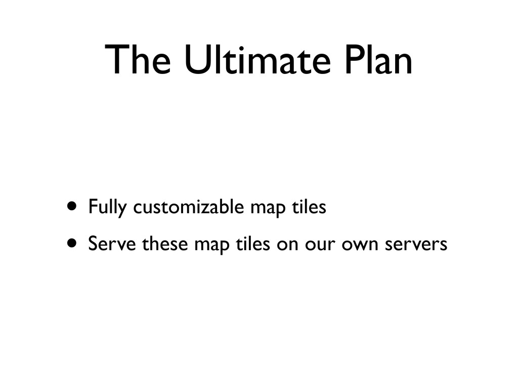
The Ultimate Plan • Fully customizable map tiles • Serve
these map tiles on our own servers
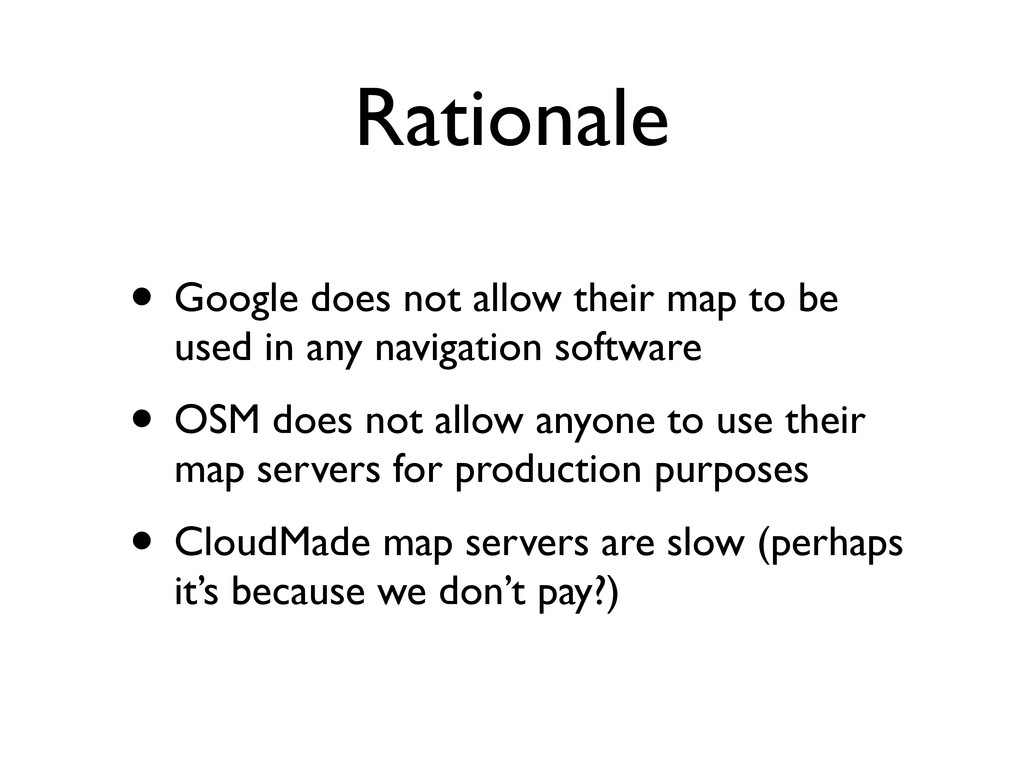
Rationale • Google does not allow their map to be
used in any navigation software • OSM does not allow anyone to use their map servers for production purposes • CloudMade map servers are slow (perhaps it’s because we don’t pay?)
Cartography • Study and practice of making maps[1] • Projection
of a 3D world onto a 2D plane • Simplified view of the real world, selectively displaying different features depending on the purpose of the map
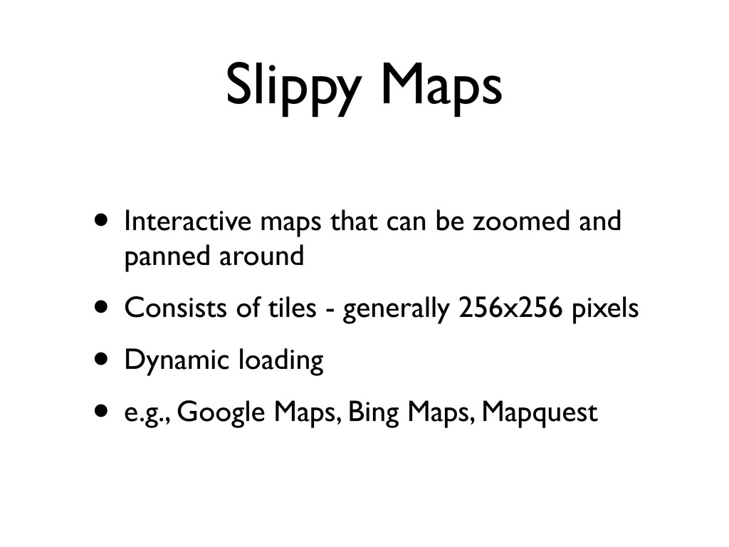
Slippy Maps • Interactive maps that can be zoomed and
panned around • Consists of tiles - generally 256x256 pixels • Dynamic loading • e.g., Google Maps, Bing Maps, Mapquest
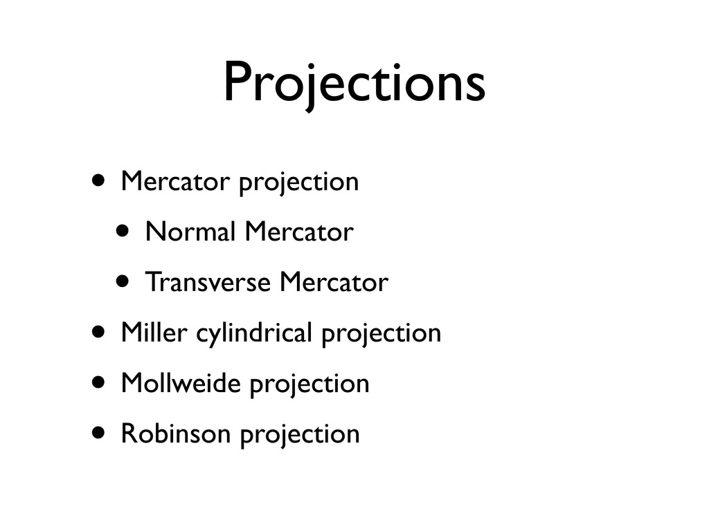
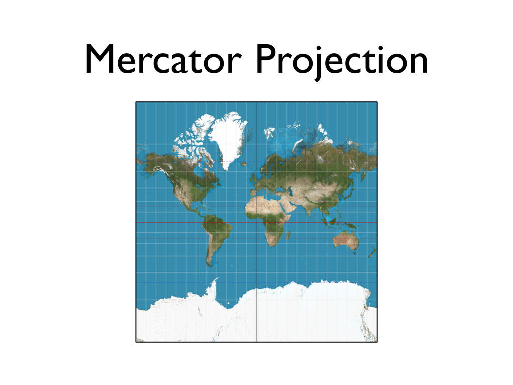
Projections • Mercator projection • Normal Mercator • Transverse Mercator
• Miller cylindrical projection • Mollweide projection • Robinson projection
Mercator Projection
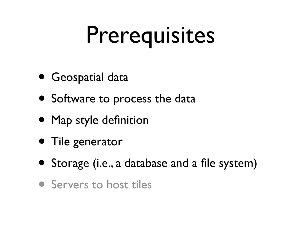
Prerequisites • Geospatial data • Software to process the data
• Map style definition • Tile generator • Storage (i.e., a database and a file system) • Servers to host tiles
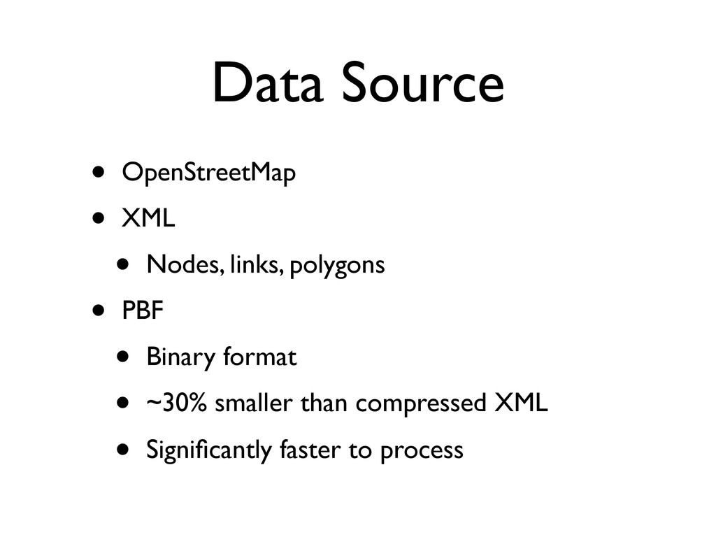
Data Source • OpenStreetMap • XML • Nodes, links, polygons
• PBF • Binary format • ~30% smaller than compressed XML • Significantly faster to process
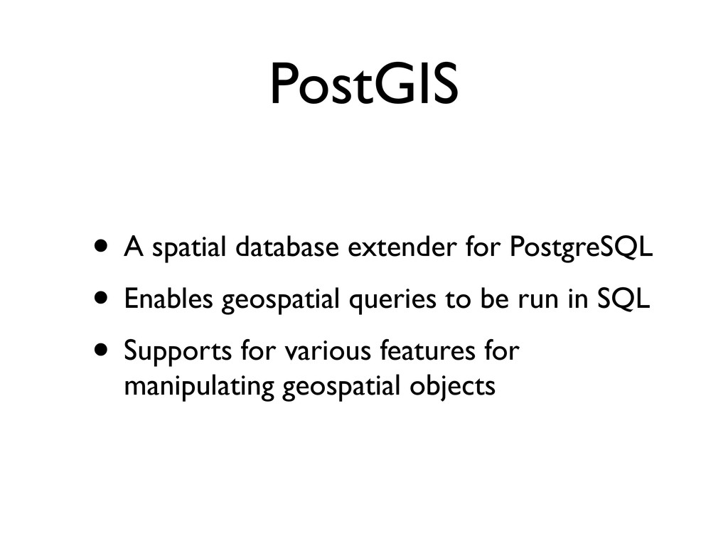
PostGIS • A spatial database extender for PostgreSQL • Enables
geospatial queries to be run in SQL • Supports for various features for manipulating geospatial objects
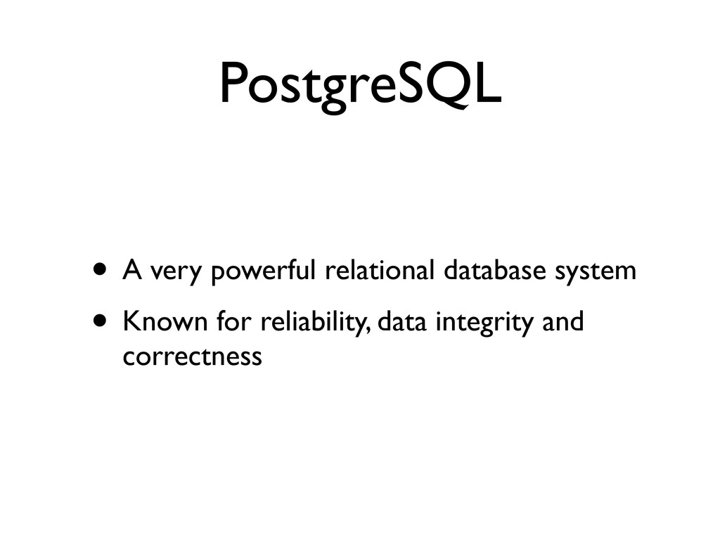
PostgreSQL • A very powerful relational database system • Known
for reliability, data integrity and correctness
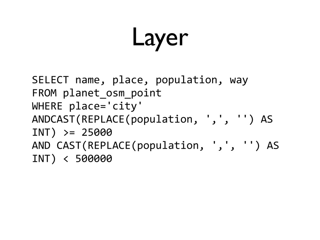
Layer • Generally, a map is consist of multiple layers
• A layer is a subset of geospatial data that can be fetched by a single query
Layer SELECT name, place, population, way FROM planet_osm_point WHERE place='city'
ANDCAST(REPLACE(population, ',', '') AS INT) >= 25000 AND CAST(REPLACE(population, ',', '') AS INT) < 500000
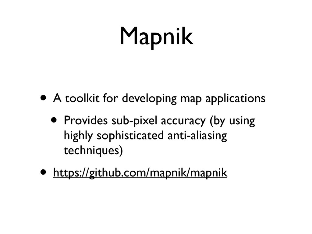
Mapnik • A toolkit for developing map applications • Provides
sub-pixel accuracy (by using highly sophisticated anti-aliasing techniques) • https://github.com/mapnik/mapnik
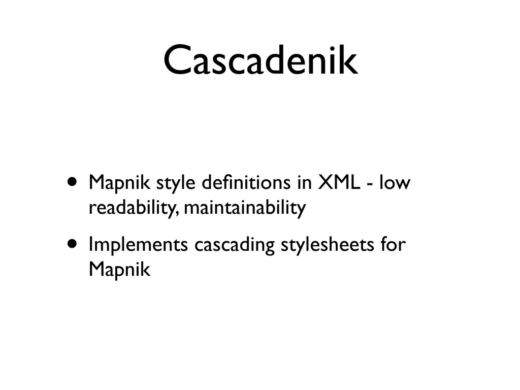
Cascadenik • Mapnik style definitions in XML - low readability,
maintainability • Implements cascading stylesheets for Mapnik
Cascadenik • (Demo)
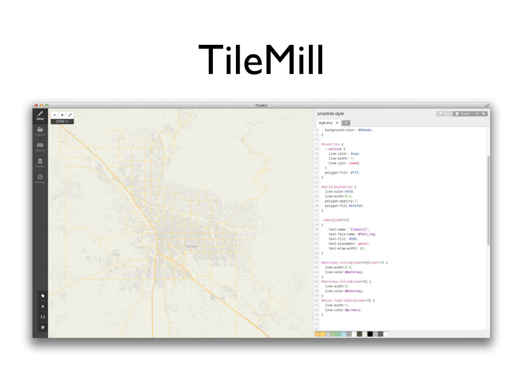
TileMill
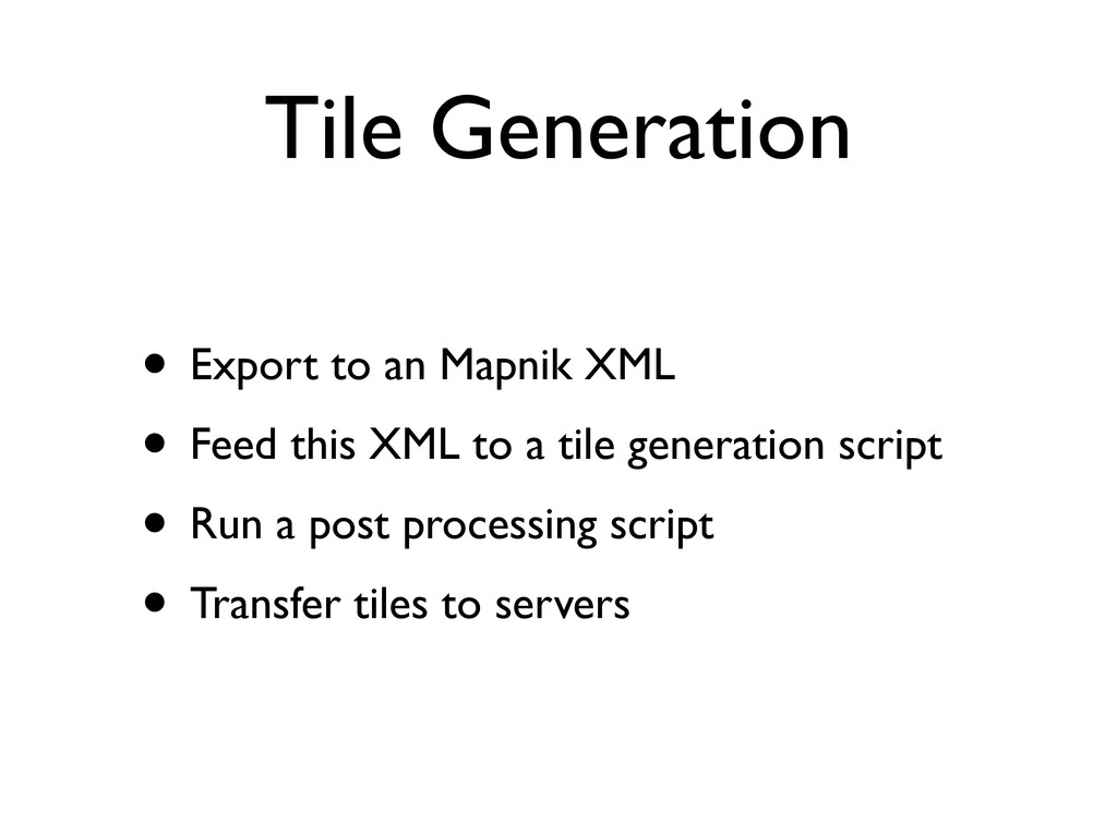
Tile Generation • Export to an Mapnik XML • Feed
this XML to a tile generation script • Run a post processing script • Transfer tiles to servers
Questions?
![Cartography • Study and practice of making maps[1] • Projection](https://files.speakerdeck.com/presentations/eb73dcf07a92013029a522000a1c45f1/slide_3.jpg)