modeling, or modeling the flow of water across the landscape using ArcGIS A hands-on exercise in using provided data (i.e., canned, not all sorts of screwed up) to walk through watershed delineation in ArcGIS and an introduction to USGS StreamStats Hydrologic Modeling, Part 1 A hands-on exercise in using freely-available data (i.e., probably just full of errors and weird stuff) to perform watershed delineation and hydrologic modeling in QGIS. TODAY NEXT LECTURE Like much of our terrain modeling work, hydrologic modeling begins with a digital elevation model THIS WEEK’S LAB
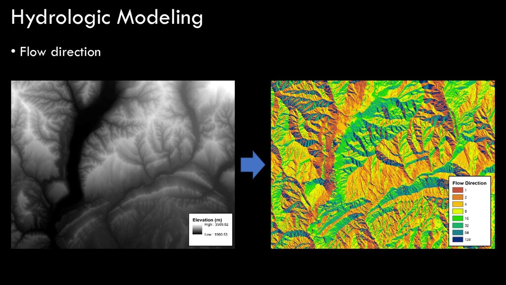
Hydrologic Modeling, Defined [anytime we say modeling, people tend to freak out] simplification of a real-world system (e.g., surface water, soil water, wetland, groundwater, estuary) that aids in understanding, predicting, and managing water resources. For GEOG 400, hydrologic modeling is predicting the flow of water, the locations of streams, and the size of watersheds from terrain data (DEMs)
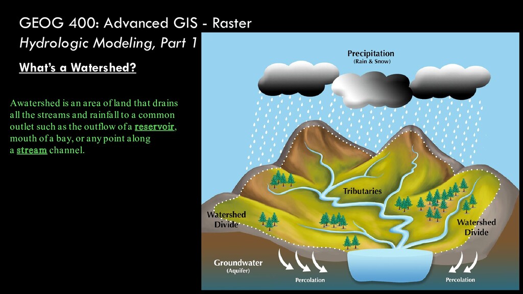
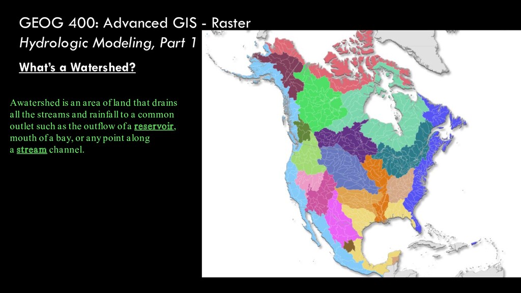
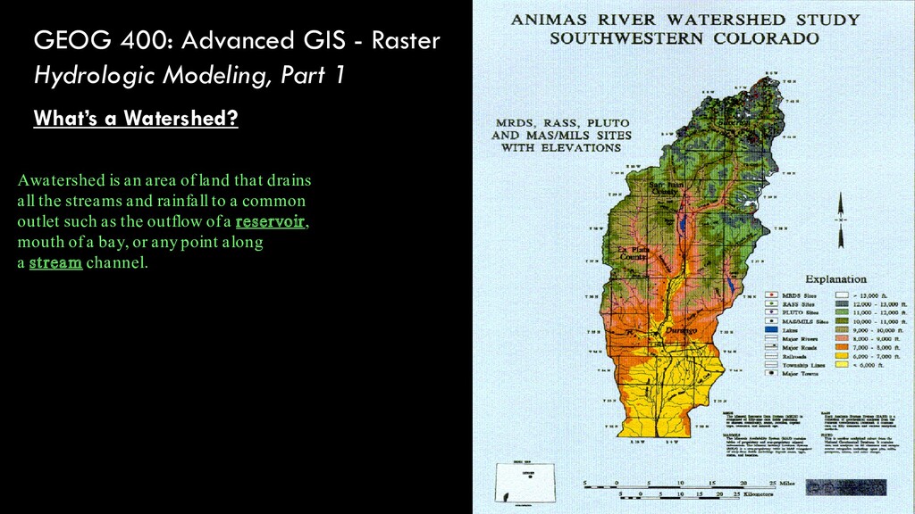
What’s a Watershed? A watershed is an area of land that drains all the streams and rainfall to a common outlet such as the outflow of a reservoir, mouth of a bay, or any point along a stream channel.
What’s a Watershed? A watershed is an area of land that drains all the streams and rainfall to a common outlet such as the outflow of a reservoir, mouth of a bay, or any point along a stream channel.
What’s a Watershed? A watershed is an area of land that drains all the streams and rainfall to a common outlet such as the outflow of a reservoir, mouth of a bay, or any point along a stream channel.
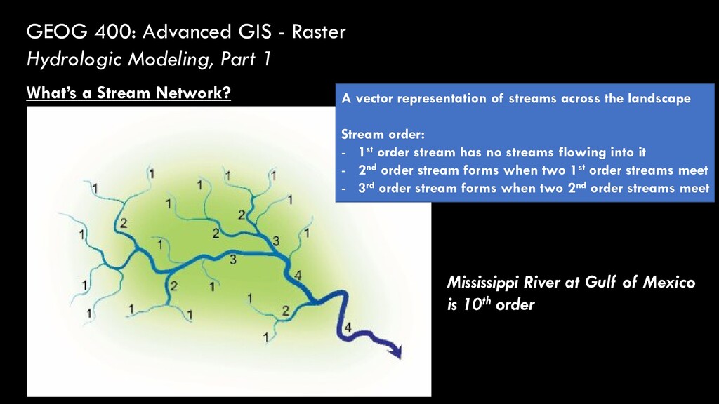
What’s a Stream Network? A vector representation of streams across the landscape Stream order: - 1st order stream has no streams flowing into it - 2nd order stream forms when two 1st order streams meet - 3rd order stream forms when two 2nd order streams meet Mississippi River at Gulf of Mexico is 10th order
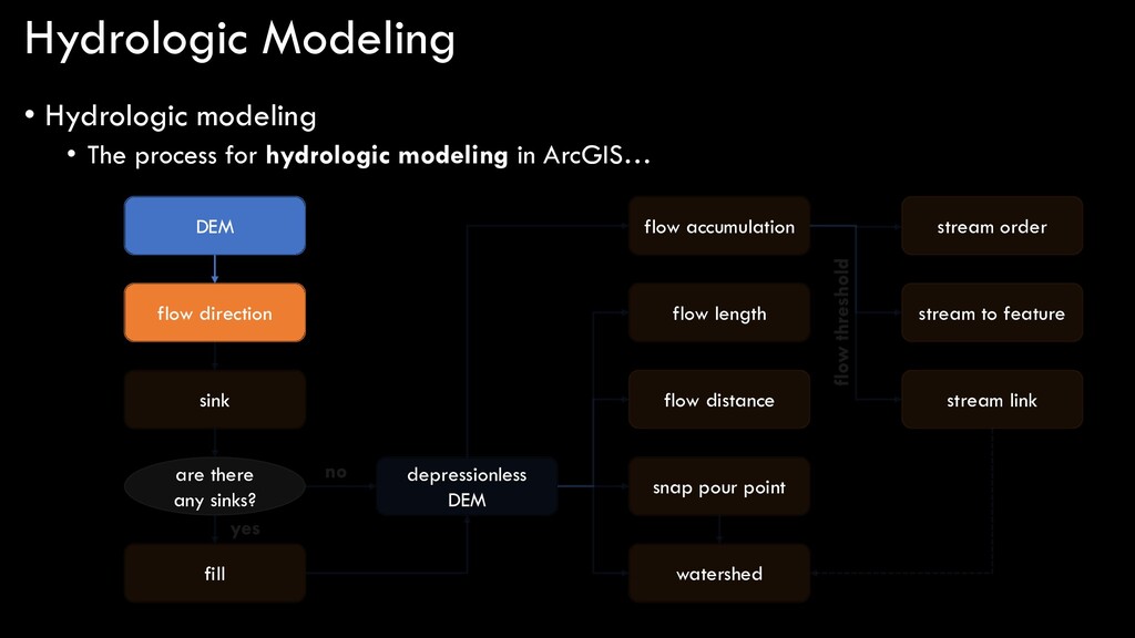
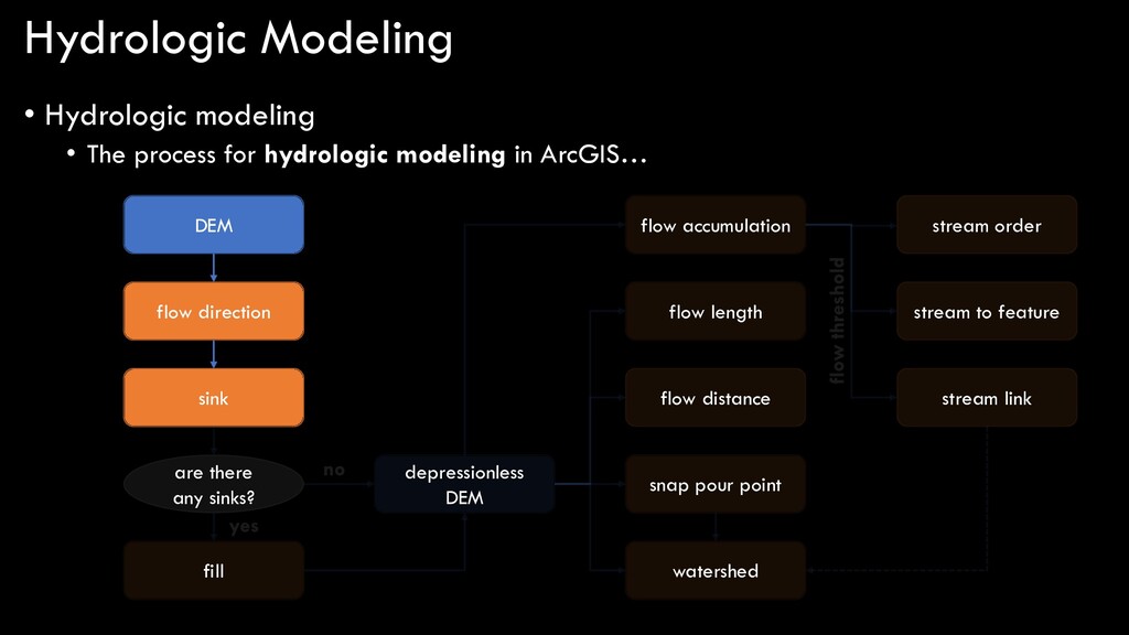
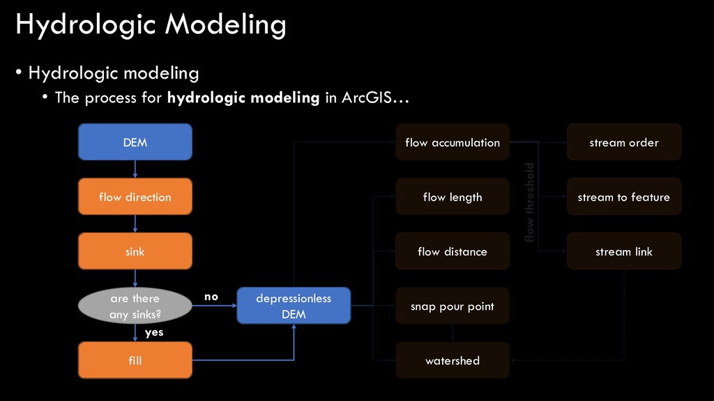
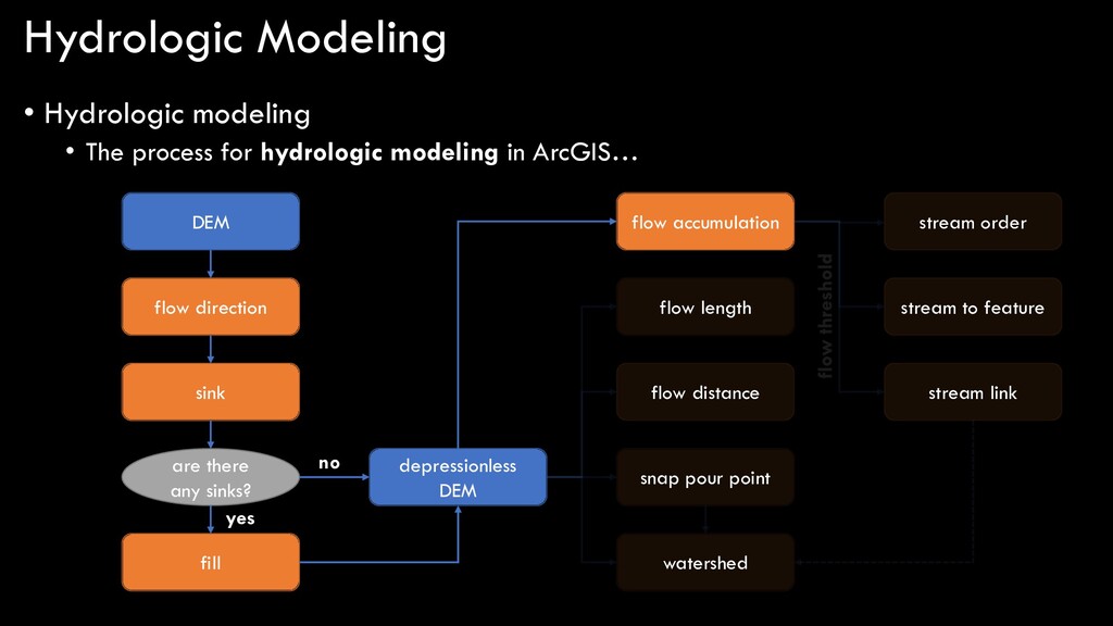
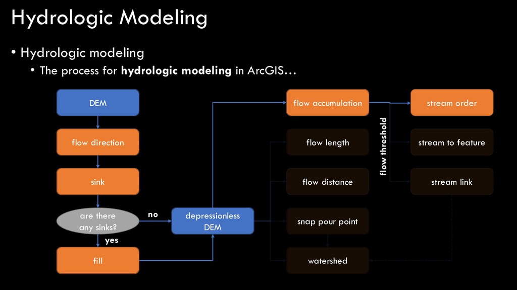
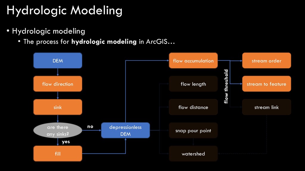
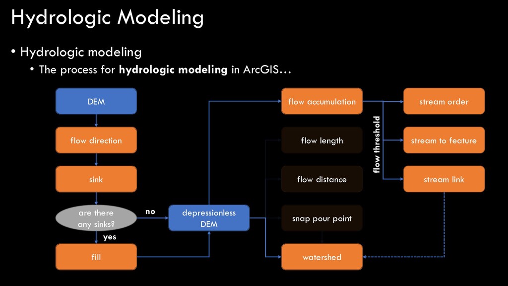
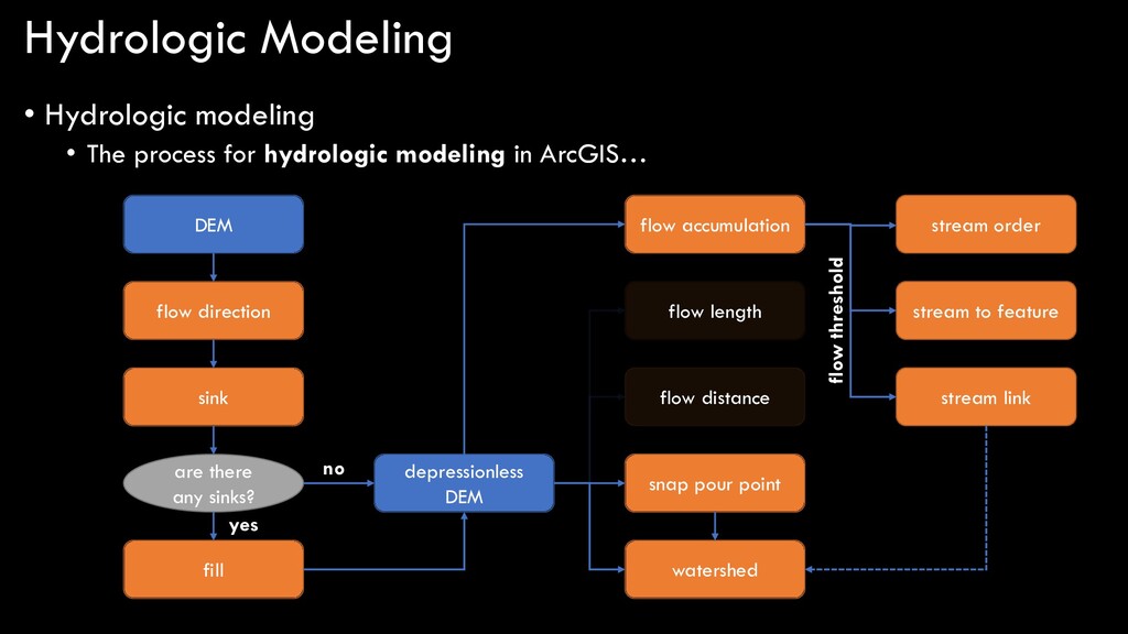
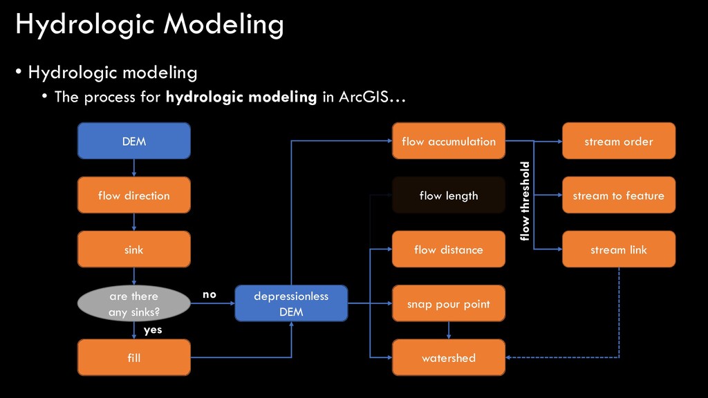
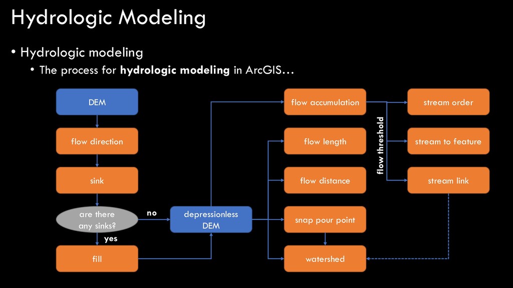
modeling in ArcGIS… DEM flow direction sink are there any sinks? fill depressionless DEM flow accumulation stream order stream to feature stream link flow length snap pour point watershed flow distance yes no flow threshold
modeling in ArcGIS… DEM flow direction sink are there any sinks? fill depressionless DEM flow accumulation stream order stream to feature stream link flow length snap pour point watershed flow distance
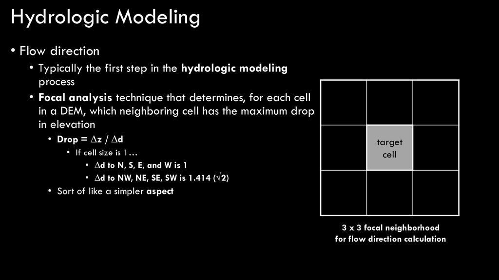
in the hydrologic modeling process • Focal analysis technique that determines, for each cell in a DEM, which neighboring cell has the maximum drop in elevation • Drop = ∆z / ∆d • If cell size is 1… • ∆d to N, S, E, and W is 1 • ∆d to NW, NE, SE, SW is 1.414 (√2) • Sort of like a simpler aspect NW N NE W target cell E SW S SE 3 x 3 focal neighborhood for flow direction calculation
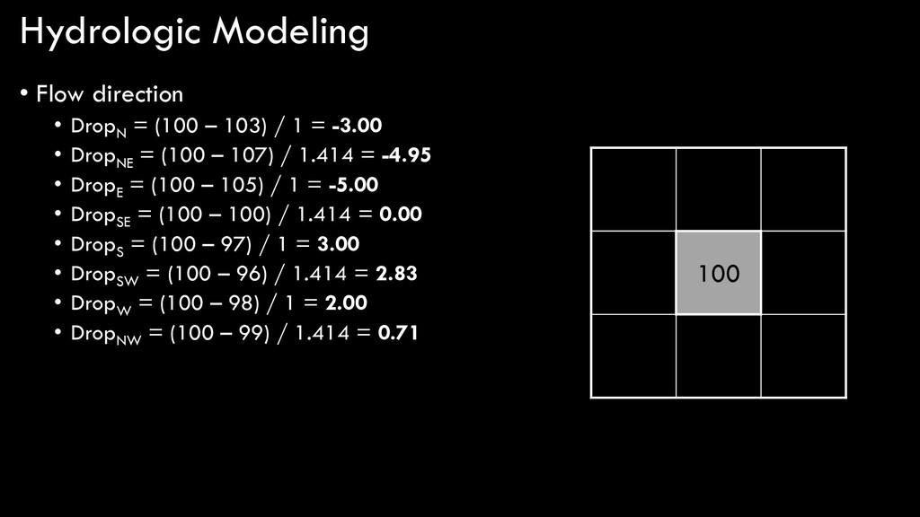
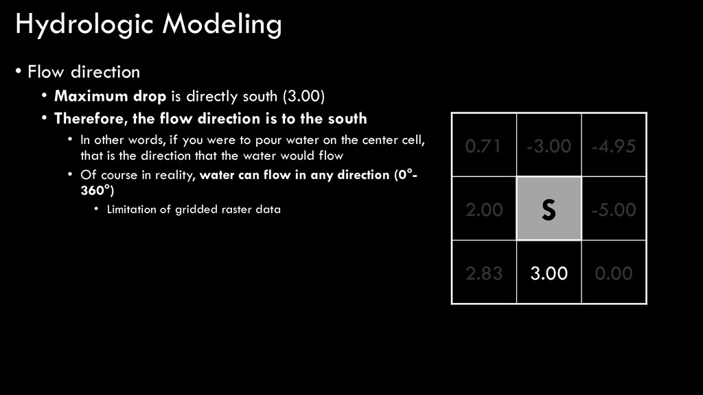
south (3.00) • Therefore, the flow direction is to the south • In other words, if you were to pour water on the center cell, that is the direction that the water would flow • Of course in reality, water can flow in any direction (0°- 360°) • Limitation of gridded raster data S 3.00
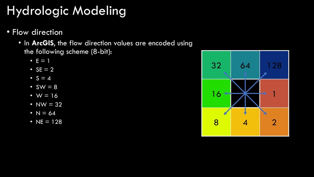
direction values are encoded using the following scheme (8-bit): • E = 1 • SE = 2 • S = 4 • SW = 8 • W = 16 • NW = 32 • N = 64 • NE = 128 32 64 128 16 1 8 4 2
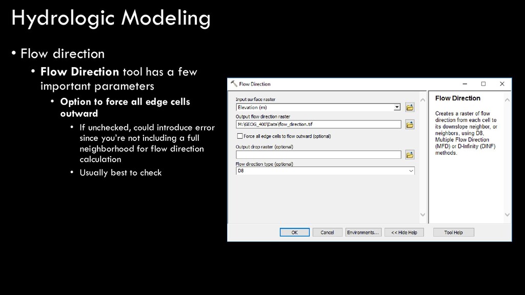
a few important parameters • Option to force all edge cells outward • If unchecked, could introduce error since you’re not including a full neighborhood for flow direction calculation • Usually best to check
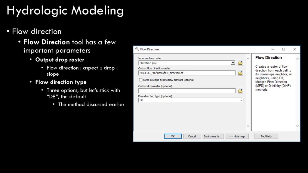
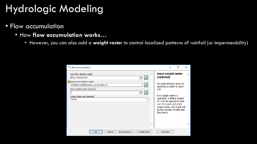
a few important parameters • Output drop raster • Flow direction : aspect :: drop : slope • Flow direction type • Three options, but let’s stick with “D8”, the default • The method discussed earlier
modeling in ArcGIS… DEM flow direction sink are there any sinks? fill depressionless DEM flow accumulation stream order stream to feature stream link flow length snap pour point watershed flow distance
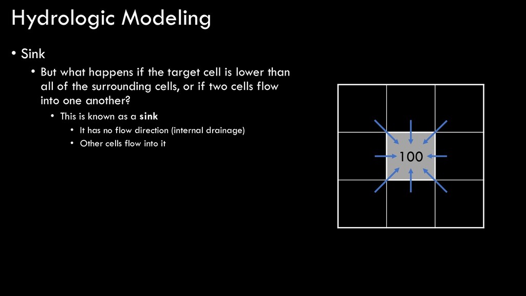
target cell is lower than all of the surrounding cells, or if two cells flow into one another? • This is known as a sink • It has no flow direction (internal drainage) • Other cells flow into it 105 103 107 102 100 105 103 101 104
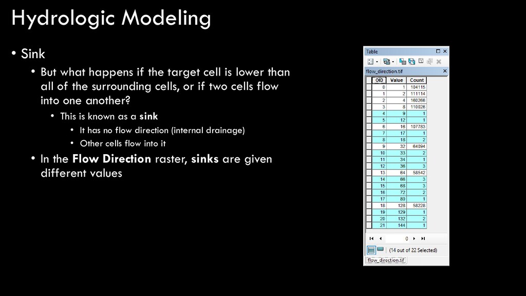
target cell is lower than all of the surrounding cells, or if two cells flow into one another? • This is known as a sink • It has no flow direction (internal drainage) • Other cells flow into it • In the Flow Direction raster, sinks are given different values
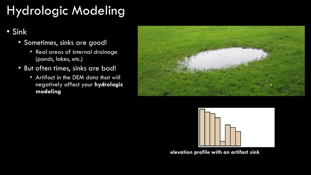
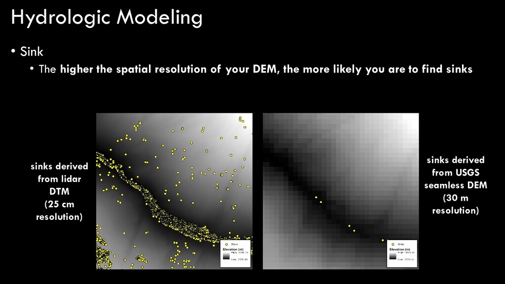
Real areas of internal drainage (ponds, lakes, etc.) • But often times, sinks are bad! • Artifact in the DEM data that will negatively affect your hydrologic modeling elevation profile with an artifact sink
of your DEM, the more likely you are to find sinks sinks derived from lidar DTM (25 cm resolution) sinks derived from USGS seamless DEM (30 m resolution)
modeling in ArcGIS… DEM flow direction sink are there any sinks? fill depressionless DEM flow accumulation stream order stream to feature stream link flow length snap pour point watershed flow distance yes no
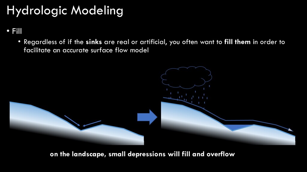
are real or artificial, you often want to fill them in order to facilitate an accurate surface flow model on the landscape, small depressions will fill and overflow
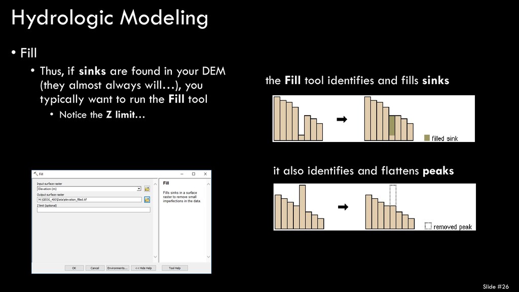
in your DEM (they almost always will…), you typically want to run the Fill tool • Notice the Z limit… Slide #26 the Fill tool identifies and fills sinks it also identifies and flattens peaks
modeling in ArcGIS… DEM flow direction sink are there any sinks? fill depressionless DEM flow accumulation stream order stream to feature stream link flow length snap pour point watershed flow distance yes no
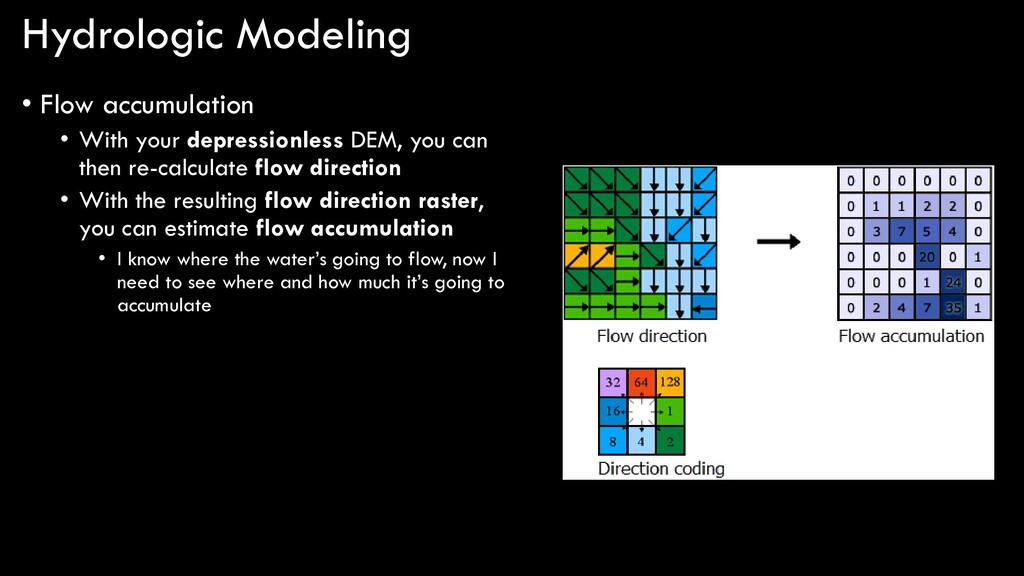
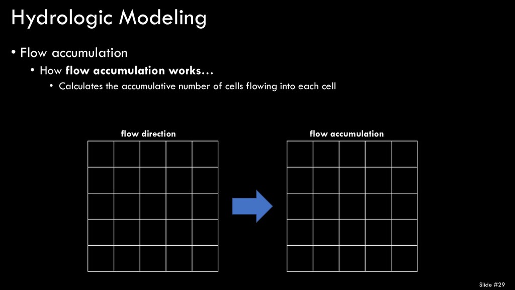
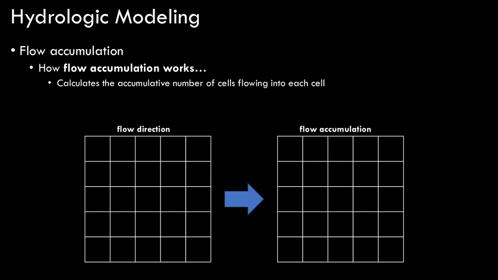
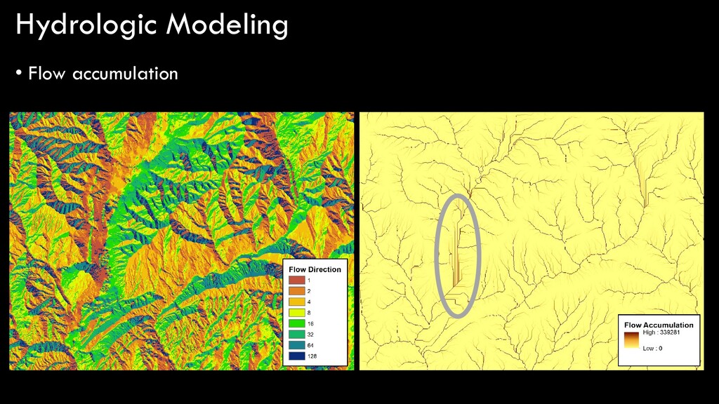
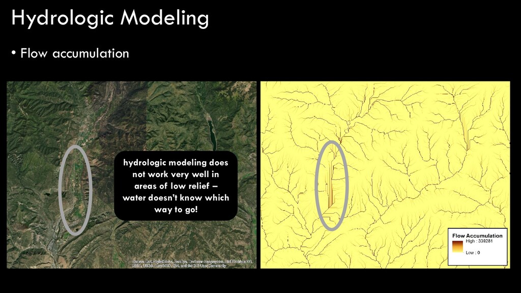
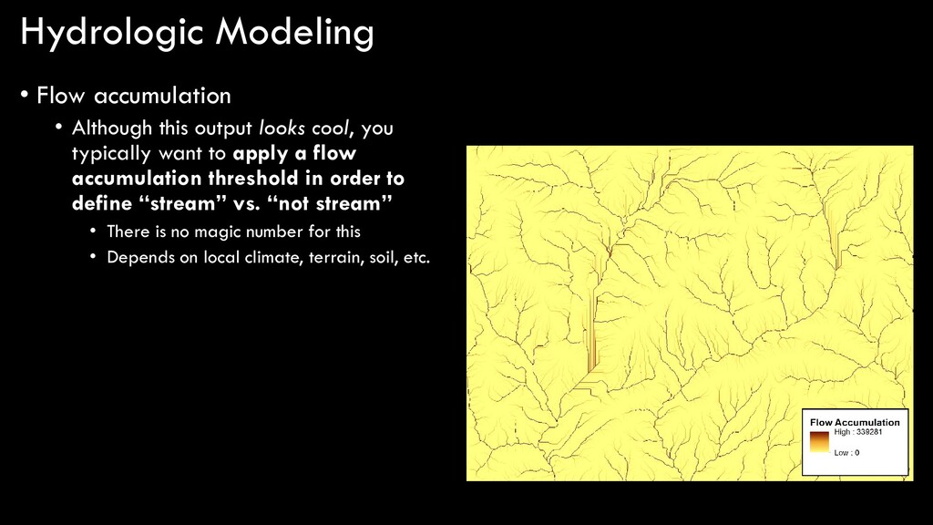
you can then re-calculate flow direction • With the resulting flow direction raster, you can estimate flow accumulation • I know where the water’s going to flow, now I need to see where and how much it’s going to accumulate
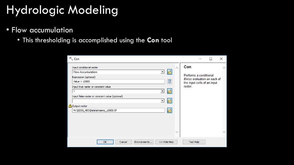
cool, you typically want to apply a flow accumulation threshold in order to define “stream” vs. “not stream” • There is no magic number for this • Depends on local climate, terrain, soil, etc.
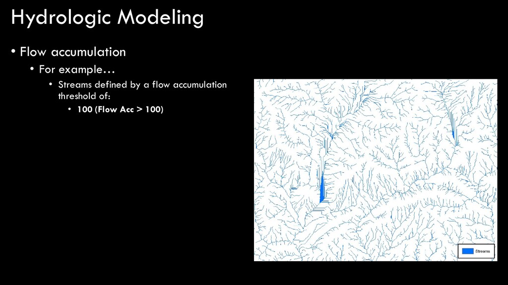
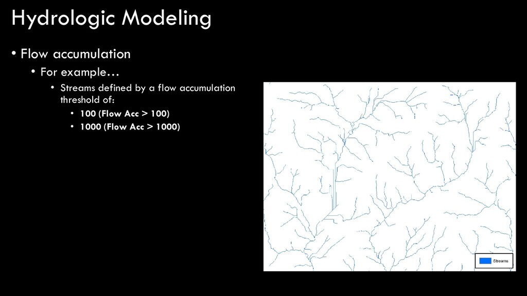
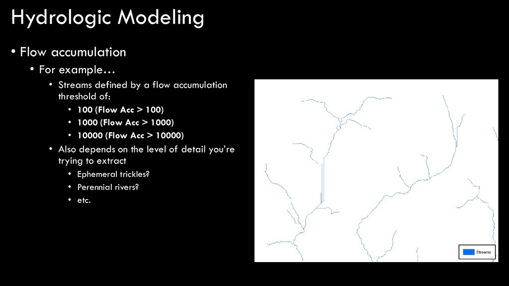
defined by a flow accumulation threshold of: • 100 (Flow Acc > 100) • 1000 (Flow Acc > 1000) • 10000 (Flow Acc > 10000) • Also depends on the level of detail you’re trying to extract • Ephemeral trickles? • Perennial rivers? • etc.
modeling in ArcGIS… DEM flow direction sink are there any sinks? fill depressionless DEM flow accumulation stream order stream to feature stream link flow length snap pour point watershed flow distance yes no flow threshold
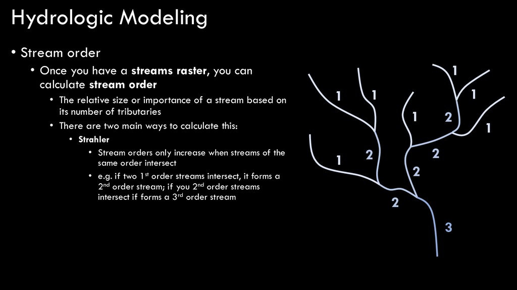
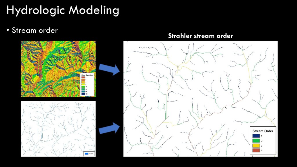
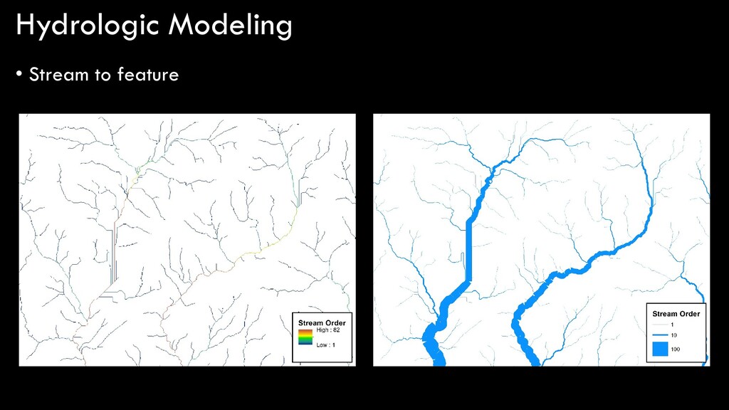
streams raster, you can calculate stream order • The relative size or importance of a stream based on its number of tributaries • There are two main ways to calculate this: • Strahler • Stream orders only increase when streams of the same order intersect • e.g. if two 1st order streams intersect, it forms a 2nd order stream; if you 2nd order streams intersect if forms a 3rd order stream 1 1 1 1 1 1 1 2 2 2 2 2 3
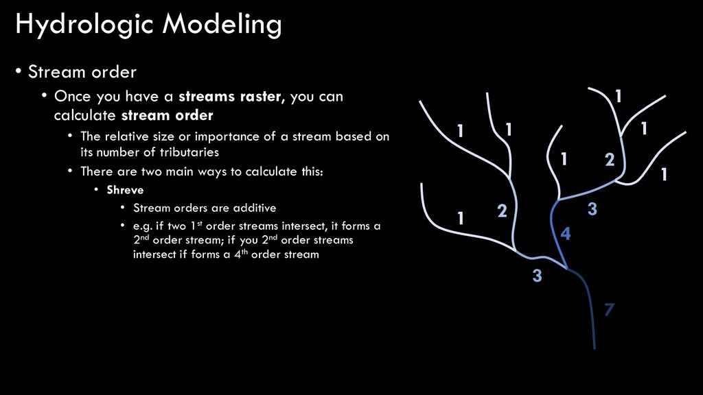
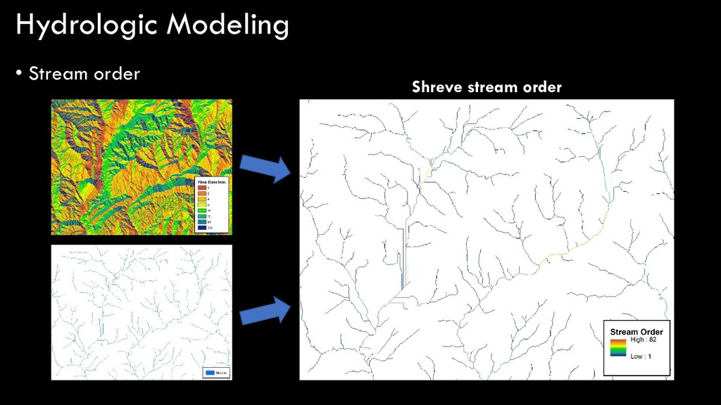
streams raster, you can calculate stream order • The relative size or importance of a stream based on its number of tributaries • There are two main ways to calculate this: • Shreve • Stream orders are additive • e.g. if two 1st order streams intersect, it forms a 2nd order stream; if you 2nd order streams intersect if forms a 4th order stream 1 1 1 1 1 1 1 2 3 4 2 3 7
modeling in ArcGIS… DEM flow direction sink are there any sinks? fill depressionless DEM flow accumulation stream order stream to feature stream link flow length snap pour point watershed flow distance yes no flow threshold
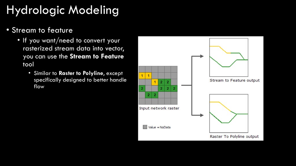
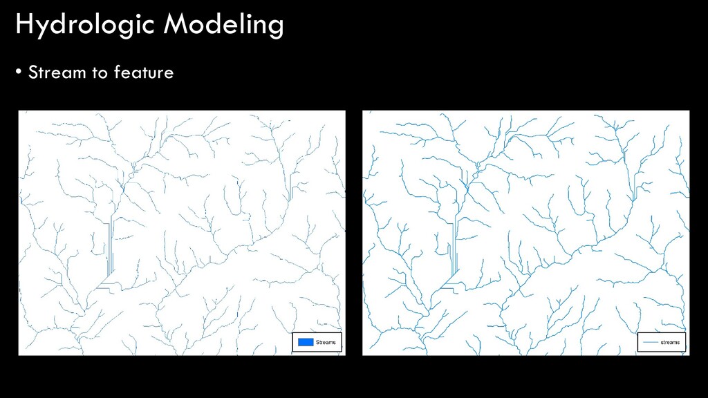
to convert your rasterized stream data into vector, you can use the Stream to Feature tool • Similar to Raster to Polyline, except specifically designed to better handle flow
modeling in ArcGIS… DEM flow direction sink are there any sinks? fill depressionless DEM flow accumulation stream order stream to feature stream link flow length snap pour point watershed flow distance yes no flow threshold
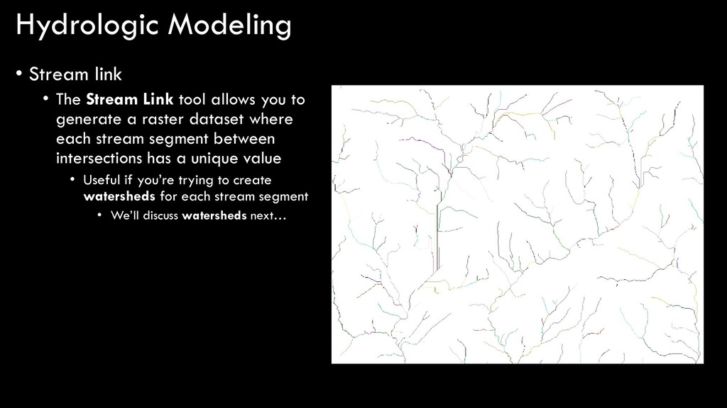
allows you to generate a raster dataset where each stream segment between intersections has a unique value • Useful if you’re trying to create watersheds for each stream segment • We’ll discuss watersheds next…
modeling in ArcGIS… DEM flow direction sink are there any sinks? fill depressionless DEM flow accumulation stream order stream to feature stream link flow length snap pour point watershed flow distance yes no flow threshold
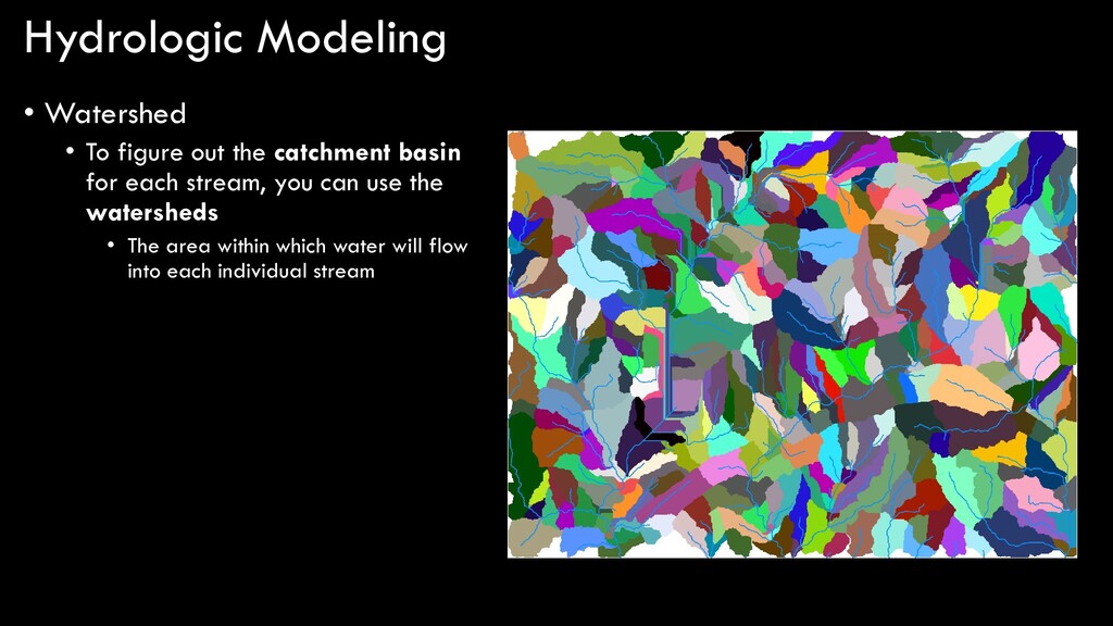
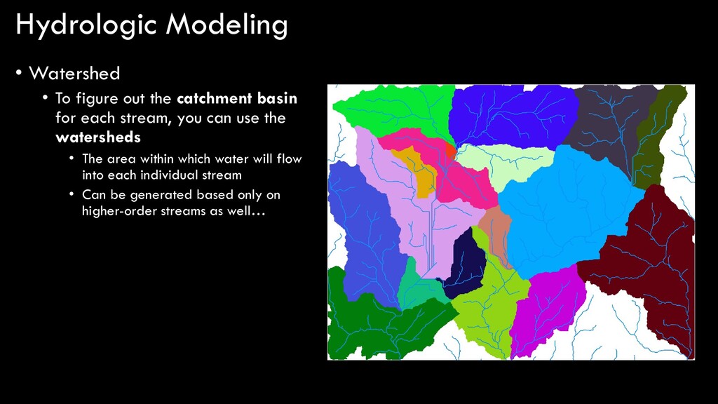
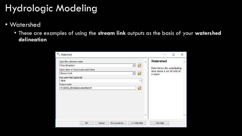
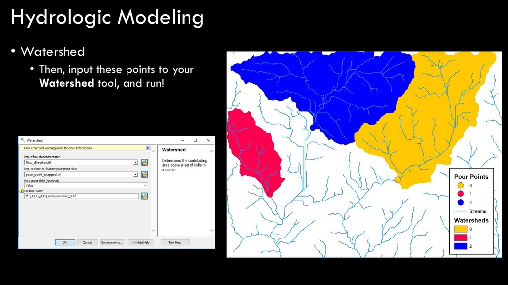
basin for each stream, you can use the watersheds • The area within which water will flow into each individual stream • Can be generated based only on higher-order streams as well…
modeling in ArcGIS… DEM flow direction sink are there any sinks? fill depressionless DEM flow accumulation stream order stream to feature stream link flow length snap pour point watershed flow distance yes no flow threshold
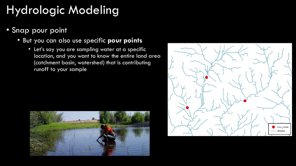
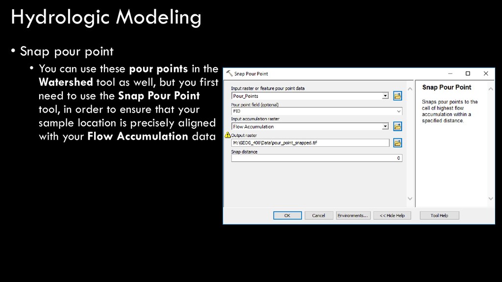
also use specific pour points • Let’s say you are sampling water at a specific location, and you want to know the entire land area (catchment basin, watershed) that is contributing runoff to your sample
these pour points in the Watershed tool as well, but you first need to use the Snap Pour Point tool, in order to ensure that your sample location is precisely aligned with your Flow Accumulation data
modeling in ArcGIS… DEM flow direction sink are there any sinks? fill depressionless DEM flow accumulation stream order stream to feature stream link flow length snap pour point watershed flow distance yes no flow threshold
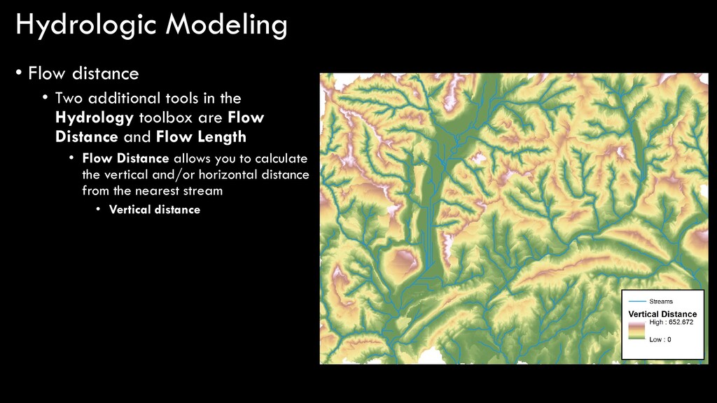
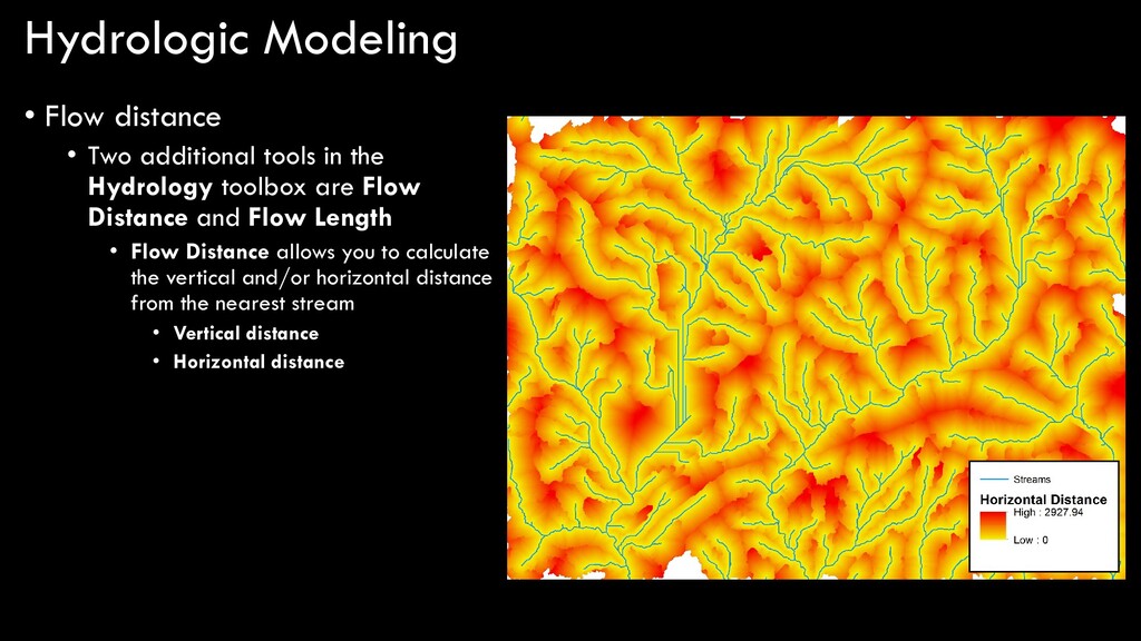
the Hydrology toolbox are Flow Distance and Flow Length • Flow Distance allows you to calculate the vertical and/or horizontal distance from the nearest stream • Vertical distance
the Hydrology toolbox are Flow Distance and Flow Length • Flow Distance allows you to calculate the vertical and/or horizontal distance from the nearest stream • Vertical distance • Horizontal distance
modeling in ArcGIS… DEM flow direction sink are there any sinks? fill depressionless DEM flow accumulation stream order stream to feature stream link flow length snap pour point watershed flow distance yes no flow threshold
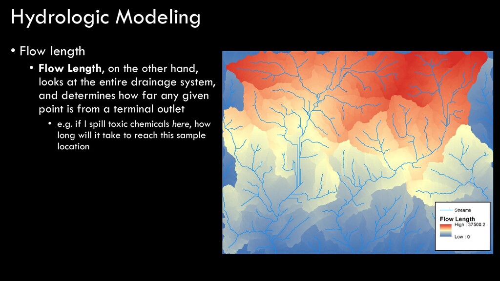
other hand, looks at the entire drainage system, and determines how far any given point is from a terminal outlet • e.g. if I spill toxic chemicals here, how long will it take to reach this sample location