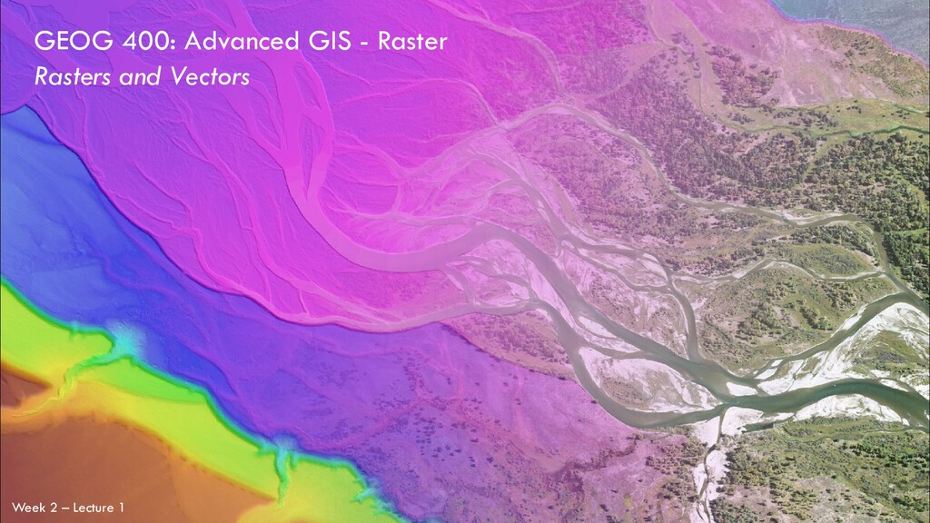
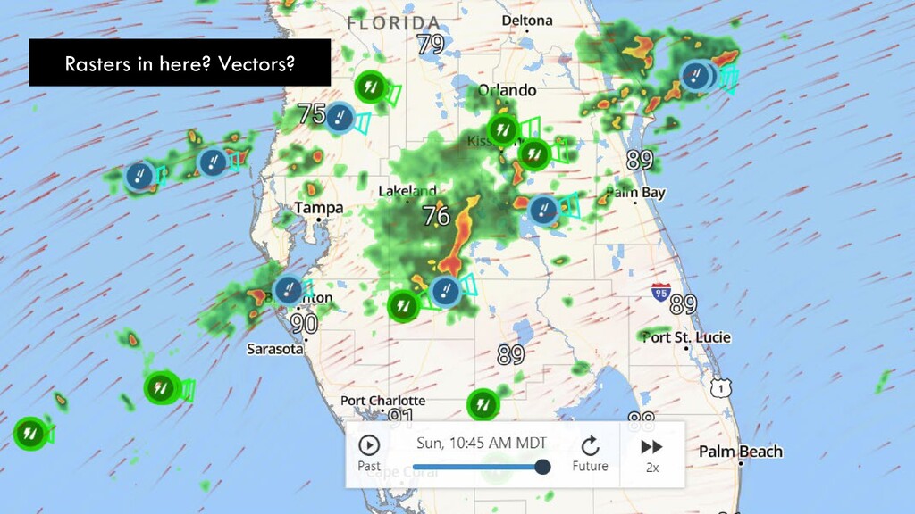
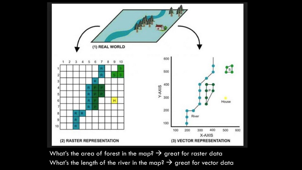
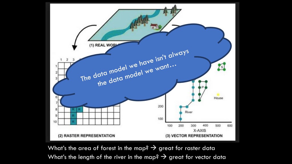
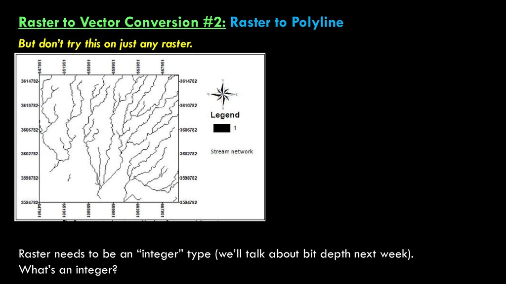
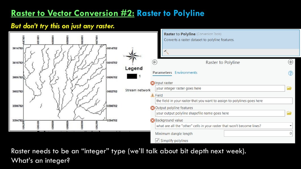
and vector data… 1. Vector Data Models Shapefiles (.shp) or feature classes: Points, Lines, Polygons 2. Raster Data Models .tif, .jpg, .pdf, .img, .png, GRID, .asc, .txt Some key differences between the two data models Composed of points, or nodes, that have exact locations in space Nodes can be singular (points), or can be connected to form polylines or polygons Vectors will not distort or pixelate, no matter how far we’re zoomed in Composed of cells, or pixels, that have a constant resolution Great for representing continuous or discrete spatial data across larger regions Because cell sizes are constant, rasters will become pixelated when zoomed-in to very close range
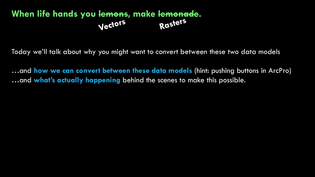
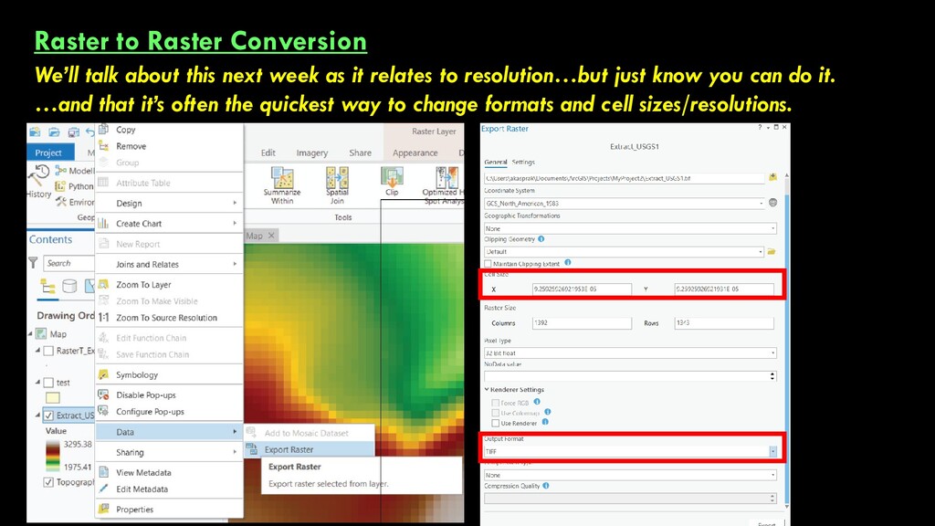
about why you might want to convert between these two data models …and how we can convert between these data models (hint: pushing buttons in ArcPro) …and what’s actually happening behind the scenes to make this possible.
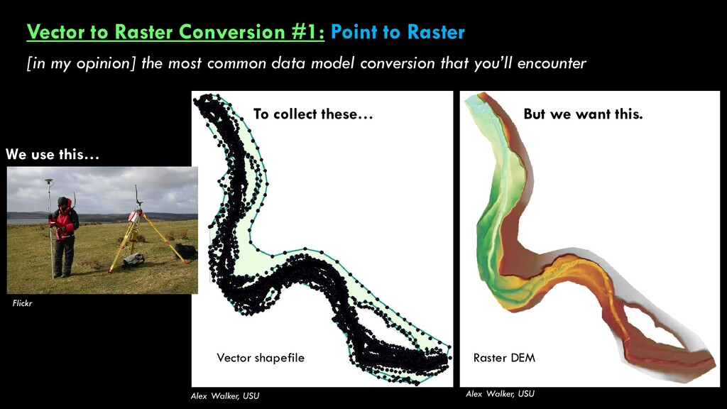
opinion] the most common data model conversion that you’ll encounter Alex Walker, USU Alex Walker, USU Flickr We use this… To collect these… But we want this. Vector shapefile Raster DEM
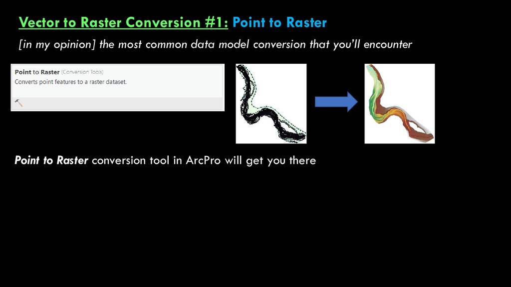
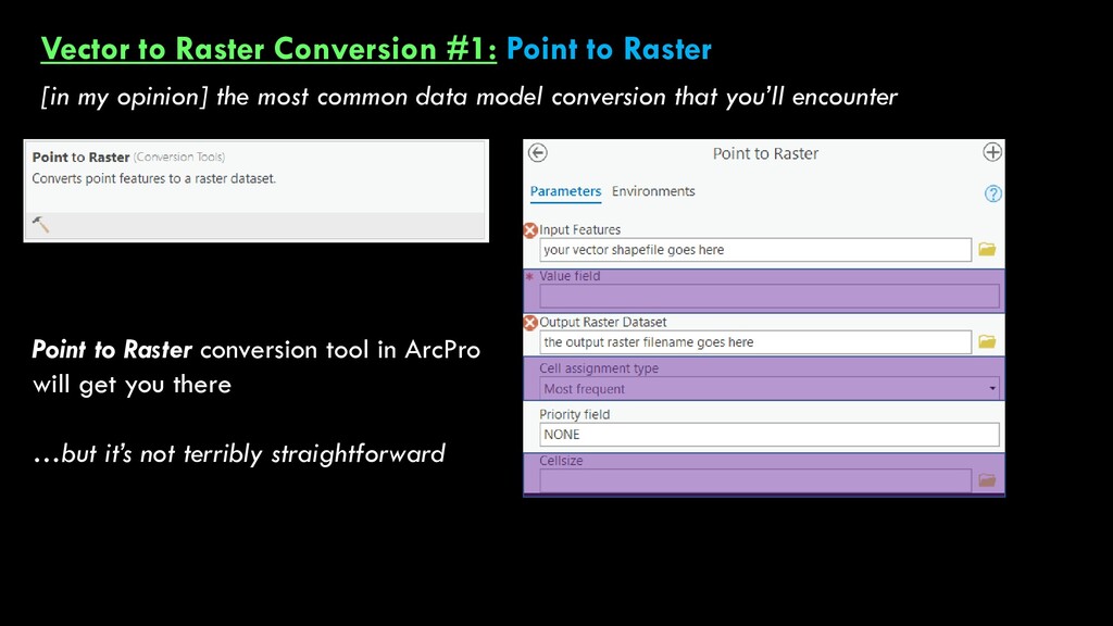
opinion] the most common data model conversion that you’ll encounter Point to Raster conversion tool in ArcPro will get you there …but it’s not terribly straightforward
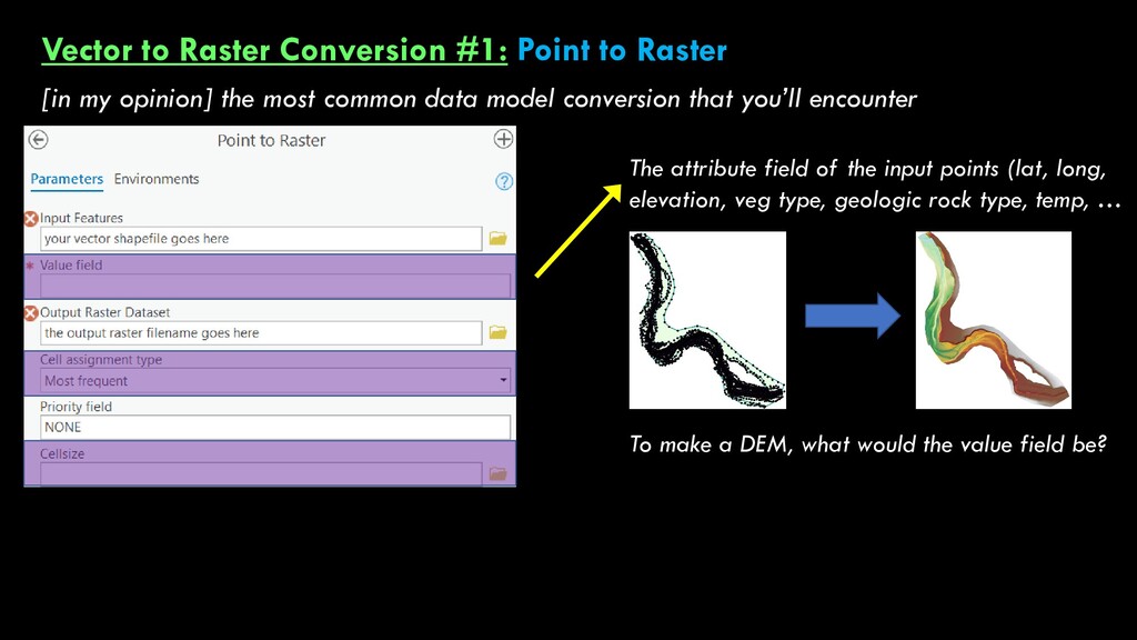
opinion] the most common data model conversion that you’ll encounter The attribute field of the input points (lat, long, elevation, veg type, geologic rock type, temp, … To make a DEM, what would the value field be?
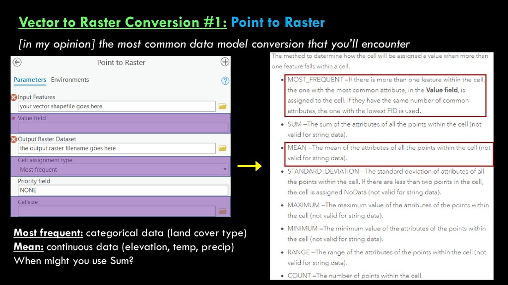
opinion] the most common data model conversion that you’ll encounter What if there are multiple points within an output cell?! Most frequent: categorical data (land cover type) Mean: continuous data (elevation, temp, precip) When might you use Sum?
opinion] the most common data model conversion that you’ll encounter What if there are multiple points within an output cell?! Most frequent: categorical data (land cover type) Mean: continuous data (elevation, temp, precip) When might you use Sum?
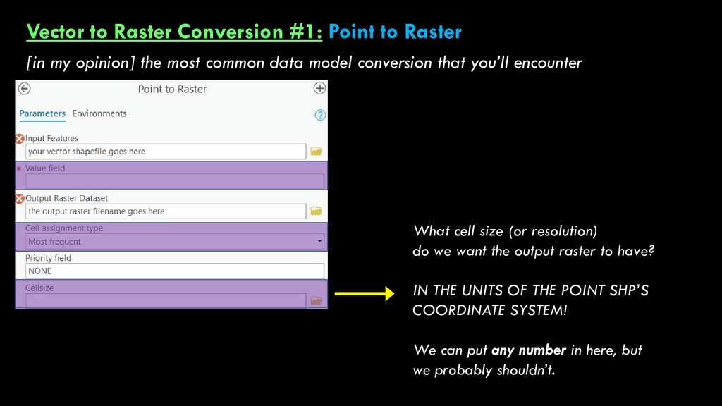
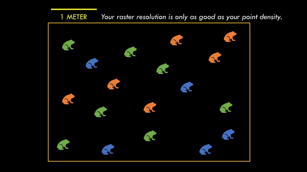
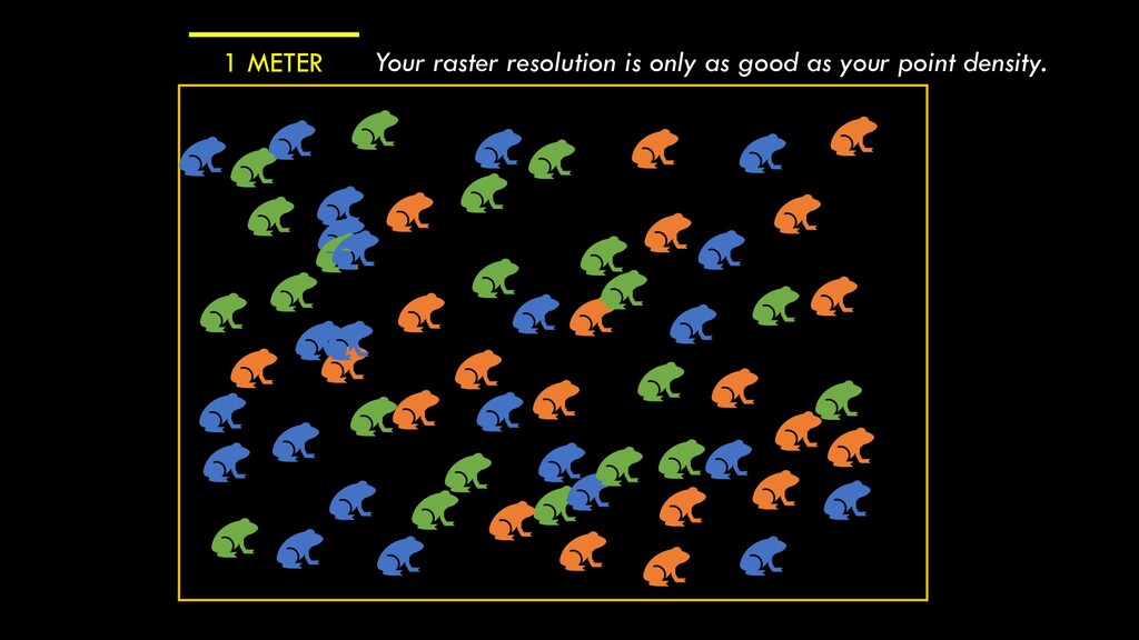
opinion] the most common data model conversion that you’ll encounter What cell size (or resolution) do we want the output raster to have? IN THE UNITS OF THE POINT SHP’S COORDINATE SYSTEM! We can put any number in here, but we probably shouldn’t.
act between the information you want to convey and the size (and processing time) of the file you’re dealing with. “1 m resolution” “0.5 m resolution” 1 m 1 m 1 m 1 m To DOUBLE the resolution, we have to QUADRUPLE the cells So be very careful, because files can get really big, really fast.
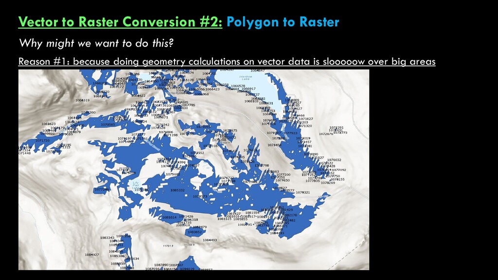
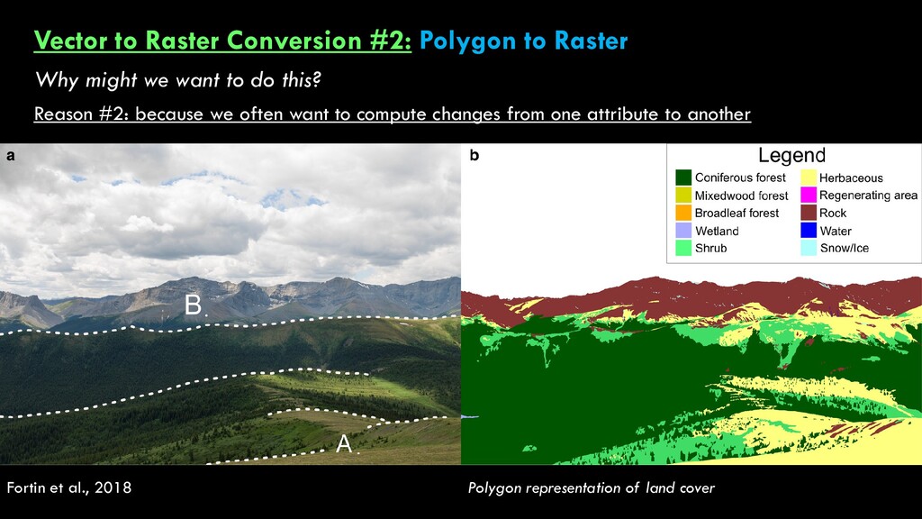
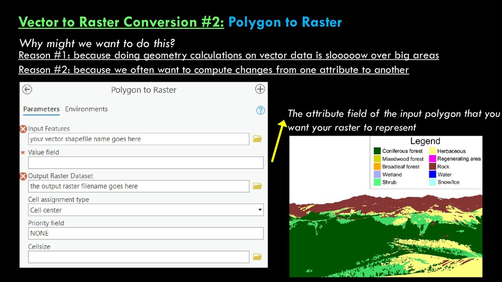
we want to do this? But we want this. Reason #2: because we often want to compute changes from one attribute to another Fortin et al., 2018 Polygon representation of land cover
we want to do this? But we want this. Reason #2: because we often want to compute changes from one attribute to another Reason #1: because doing geometry calculations on vector data is slooooow over big areas The attribute field of the input polygon that you want your raster to represent
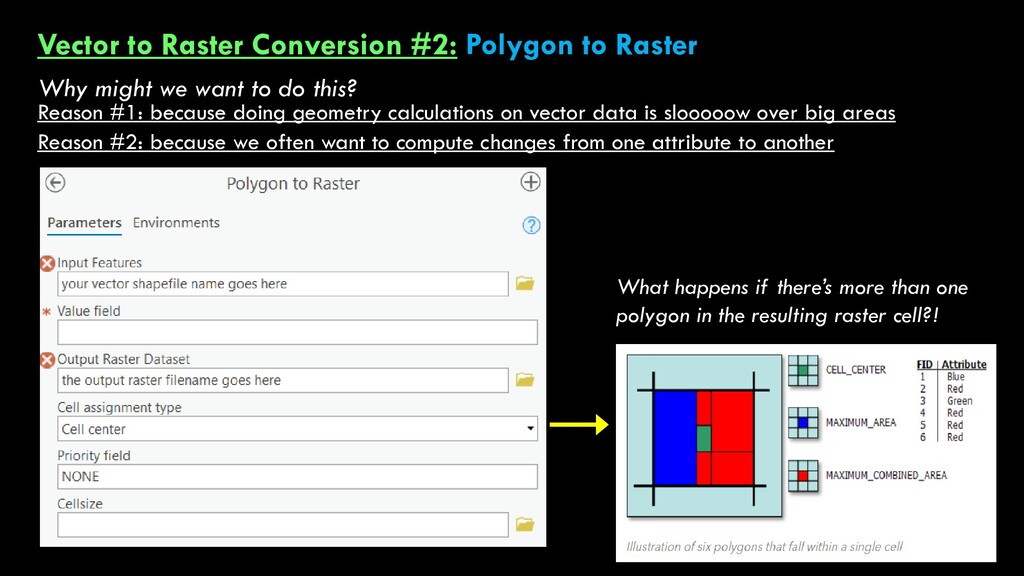
we want to do this? But we want this. Reason #2: because we often want to compute changes from one attribute to another Reason #1: because doing geometry calculations on vector data is slooooow over big areas What happens if there’s more than one polygon in the resulting raster cell?!
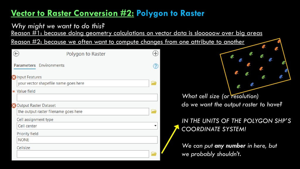
we want to do this? But we want this. Reason #2: because we often want to compute changes from one attribute to another Reason #1: because doing geometry calculations on vector data is slooooow over big areas What cell size (or resolution) do we want the output raster to have? IN THE UNITS OF THE POLYGON SHP’S COORDINATE SYSTEM! We can put any number in here, but we probably shouldn’t.
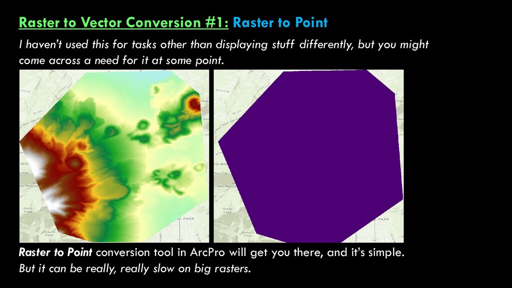
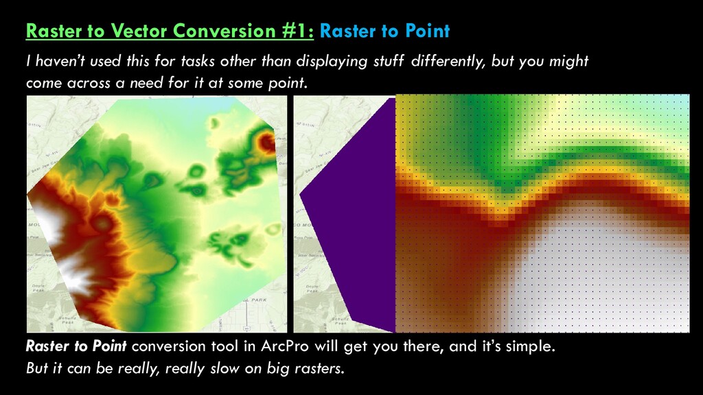
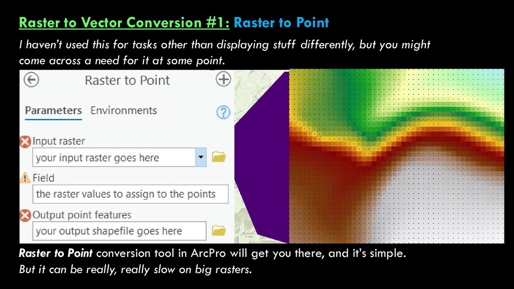
used this for tasks other than displaying stuff differently, but you might come across a need for it at some point. Raster to Point conversion tool in ArcPro will get you there, and it’s simple. But it can be really, really slow on big rasters.
used this for tasks other than displaying stuff differently, but you might come across a need for it at some point. Raster to Point conversion tool in ArcPro will get you there, and it’s simple. But it can be really, really slow on big rasters.
used this for tasks other than displaying stuff differently, but you might come across a need for it at some point. Raster to Point conversion tool in ArcPro will get you there, and it’s simple. But it can be really, really slow on big rasters.
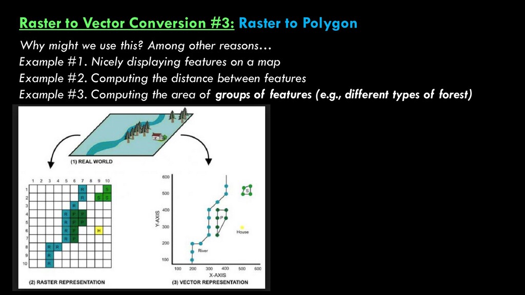
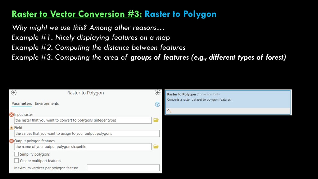
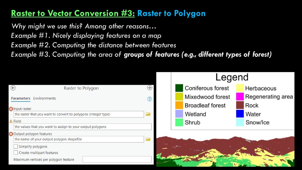
we use this? Among other reasons… Example #1. Nicely displaying features on a map Example #2. Computing the distance between features Example #3. Computing the area of groups of features (e.g., different types of forest)
we use this? Among other reasons… Example #1. Nicely displaying features on a map Example #2. Computing the distance between features Example #3. Computing the area of groups of features (e.g., different types of forest)
we use this? Among other reasons… Example #1. Nicely displaying features on a map Example #2. Computing the distance between features Example #3. Computing the area of groups of features (e.g., different types of forest)
we use this? Among other reasons… Example #1. Nicely displaying features on a map Example #2. Computing the distance between features Example #3. Computing the area of groups of features (e.g., different types of forest)
we use this? Among other reasons… Example #1. Nicely displaying features on a map Example #2. Computing the distance between features Example #3. Computing the area of groups of features (e.g., different types of forest)
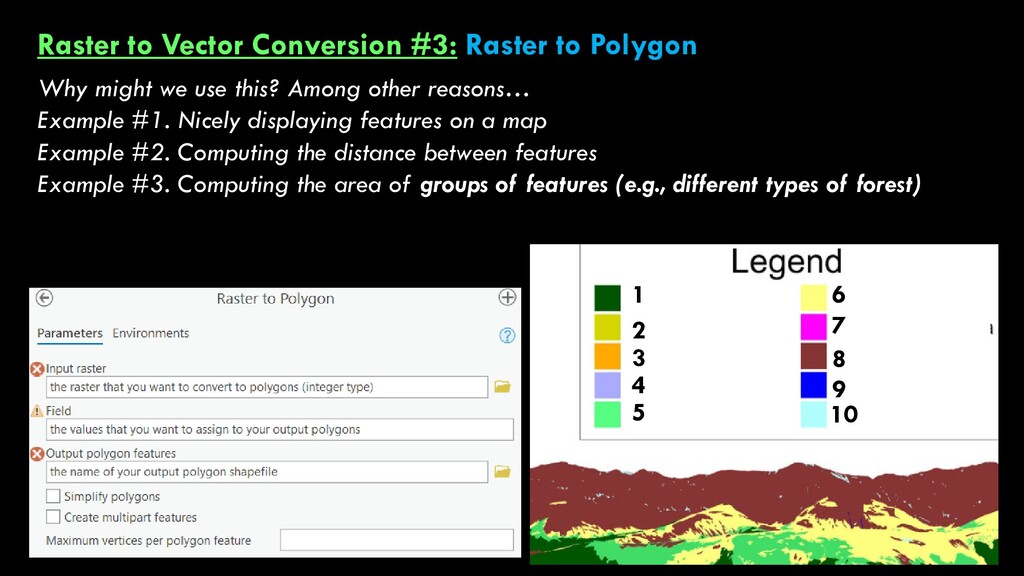
we use this? Among other reasons… Example #1. Nicely displaying features on a map Example #2. Computing the distance between features Example #3. Computing the area of groups of features (e.g., different types of forest) 1 2 3 4 5 6 7 8 9 10