•Spatial Engineer (in GIS field since 2007) •Programming since 1993 •Open Source Enthusiast & Life long learner •Loves Lean, Agile, TTD, XP & doing things „right“
database design, PL/SQL, Java, ... • unfamiliar with spatial data or GIS •a technical user of Oracle • interested in advanced features of database technology •a GIS programmer
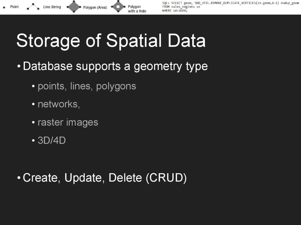
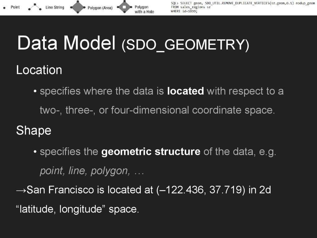
located with respect to a two-, three-, or four-dimensional coordinate space. Shape • specifies the geometric structure of the data, e.g. point, line, polygon, … →San Francisco is located at (–122.436, 37.719) in 2d “latitude, longitude” space.
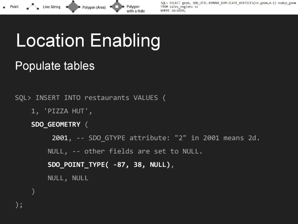
1, 'PIZZA HUT', SDO_GEOMETRY ( 2001, -- SDO_GTYPE attribute: "2" in 2001 means 2d. NULL, -- other fields are set to NULL. SDO_POINT_TYPE( -87, 38, NULL), NULL, NULL ) );
schema storing the geocoder data SDO_KEYWORDARRAY -- address components ( '3746 CONNECTICUT AVE NW', 'WASHINGTON, DC 20008' ), 'US' -- Name of the country ) geom FROM DUAL ;
SELECT poi_name, SDO_GEOM.SDO_DISTANCE(P.location, I.geom, 0.5) distance FROM interstates I, restaurants P WHERE I.interstate = 'I795' ORDER BY distance ) WHERE ROWNUM <= 5;
restaurants(location) INDEXTYPE IS mdsys.spatial_index; SQL> SELECT poi_name FROM interstates I, restaurants P WHERE I.interstate = 'I795' AND SDO_NN(P.location, I.geom) ='TRUE' AND ROWNUM <= 5;
FROM interstates I, restaurants P WHERE SDO_ANYINTERACT ( P.location, SDO_GEOM.SDO_BUFFER(I.geom, 50, 0.5, 'UNIT=KM') ) ='TRUE' AND I.interstate='I795' ;
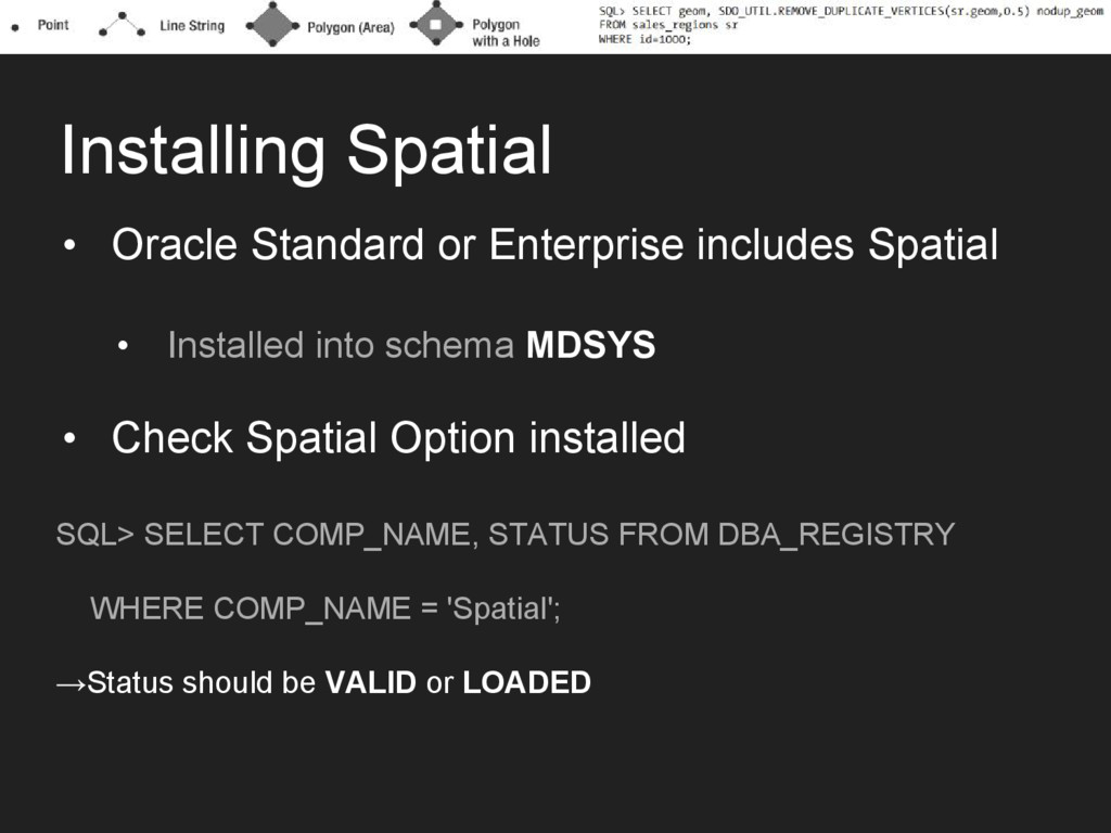
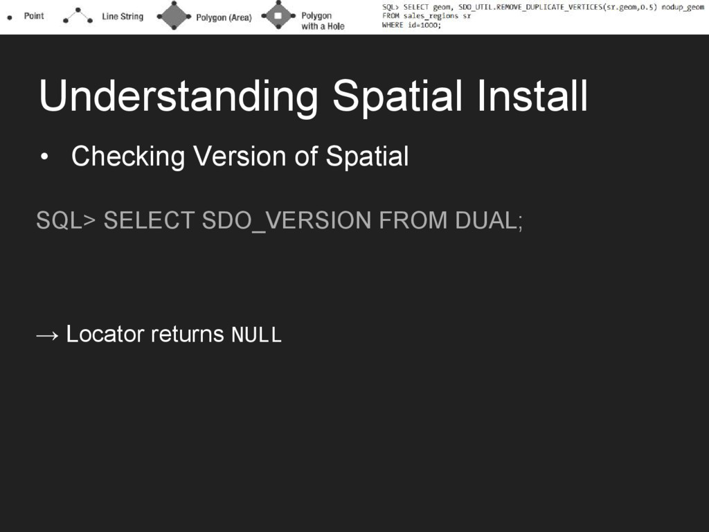
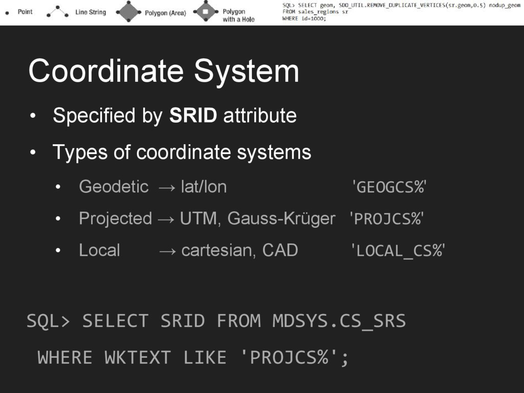
Installed into schema MDSYS • Check Spatial Option installed SQL> SELECT COMP_NAME, STATUS FROM DBA_REGISTRY WHERE COMP_NAME = 'Spatial'; →Status should be VALID or LOADED
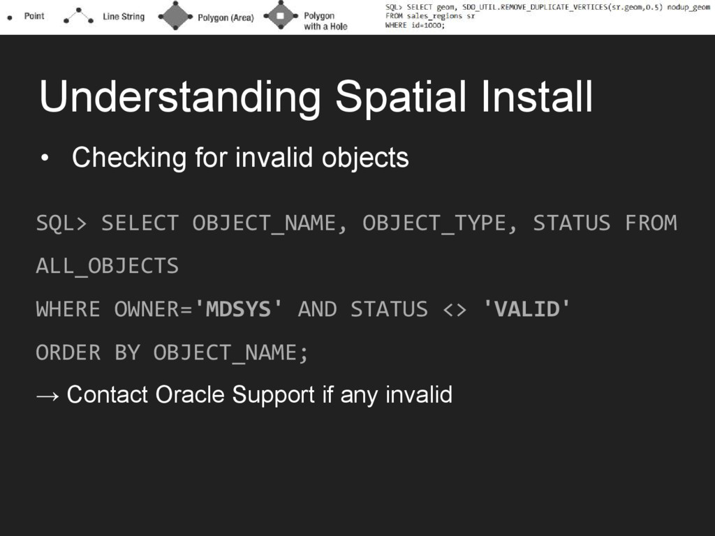
OBJECT_NAME, OBJECT_TYPE, STATUS FROM ALL_OBJECTS WHERE OWNER='MDSYS' AND STATUS <> 'VALID' ORDER BY OBJECT_NAME; → Contact Oracle Support if any invalid
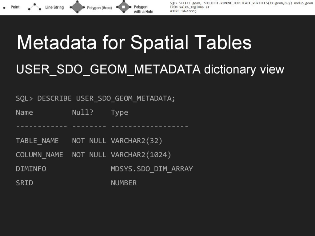
Name Null? Type ------------ -------- ------------------ TABLE_NAME NOT NULL VARCHAR2(32) COLUMN_NAME NOT NULL VARCHAR2(1024) DIMINFO MDSYS.SDO_DIM_ARRAY SRID NUMBER
Name Null? Type ------------ -------- ------------------ TABLE_NAME NOT NULL VARCHAR2(32) COLUMN_NAME NOT NULL VARCHAR2(1024) DIMINFO MDSYS.SDO_DIM_ARRAY SRID NUMBER
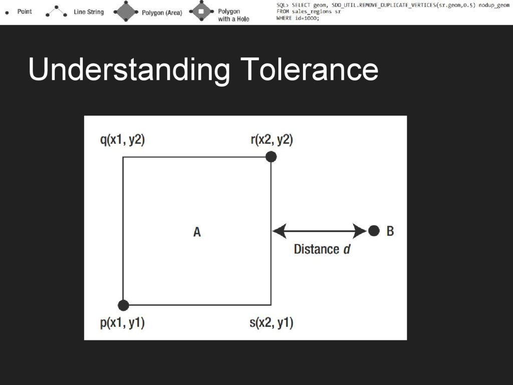
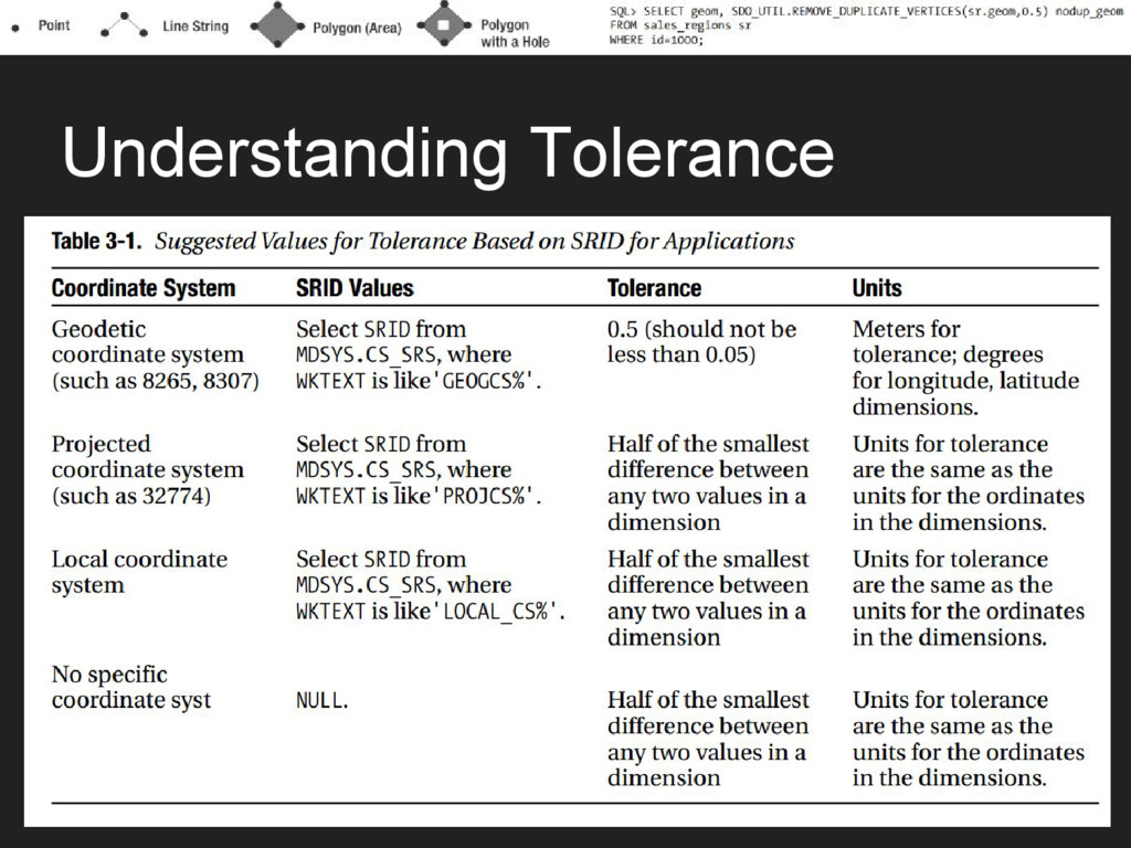
VARRAY(4) OF MDSYS.SDO_DIM_ELEMENT Name Type ------------- ----------- SDO_DIMNAME VARCHAR2(64) -- e.g. ‘X’, ‘lon’, … SDO_LB NUMBER -- lower bound SDO_UB NUMBER -- upper bound SDO_TOLERANCE NUMBER -- epsilon
![From G[is] to g[IS] •GIS • Specialized applications for storing,](https://files.speakerdeck.com/presentations/6719a1f86ceb4c9d9025450997ef11d4/slide_5.jpg)