Upgrade to Pro
— share decks privately, control downloads, hide ads and more …
Speaker Deck
Features
Speaker Deck
PRO
Sign in
Sign up for free
Search
Search
GIS Desktop Comparison
Search
CartoLab
December 03, 2012
Education
59
0
Share
Embed
Copy iframe code
Copy JS code
Copy link
Start on current slide
GIS Desktop Comparison
Comparison of Open Source Desktop GIS Packages: QGIS, gvSIG and ArcGIS
CartoLab
December 03, 2012
More Decks by CartoLab
See All by CartoLab
OSM and National Parks
cartolab
1
100
UAV for PAs - Orthophoto
cartolab
2
170
GIS and NPs for Education
cartolab
0
58
OSM for Conservation
cartolab
1
130
GIS for PAs
cartolab
0
68
GIS-Narach-2014 - OSM
cartolab
0
86
OSM for PAs
cartolab
0
110
OSM for PAs
cartolab
0
75
ArcGIS for Mobile
cartolab
0
220
Other Decks in Education
See All in Education
Course Review - Lecture 13 - Next Generation User Interfaces (4018166FNR)
signer
PRO
0
2.3k
Implicit and Cross-Device Interaction - Lecture 10 - Next Generation User Interfaces (4018166FNR)
signer
PRO
2
2.3k
Public Space Is Not For Sale
drikkes
0
100
AWS Certified Generative AI Developer - Professional Beta 不合格体験記
amarelo_n24
1
330
Managing Complexity: India’s Semiconductor Ambitions & New Industrial Policy
vyadav
0
170
[2026前期火5] 論理学(京都大学文学部 前期 第6回)「かつとまたはの規則」
yatabe
0
270
Catecismo 26 #1 - Aula inaugural
cm_manaus
0
170
Curso de Consagração ao Sagrado Coração de Jesus - O Sagrado Coração na História (Aula 01)
cm_manaus
0
220
Data Processing and Visualisation Frameworks - Lecture 6 - Information Visualisation (4019538FNR)
signer
PRO
1
3.1k
Protecting Patrons with Digital Vendors
dsalo
0
200
0506
cbtlibrary
0
190
Human-AI Interaction - Lecture 11 - Next Generation User Interfaces (4018166FNR)
signer
PRO
0
1.1k
Featured
See All Featured
Design of three-dimensional binary manipulators for pick-and-place task avoiding obstacles (IECON2024)
konakalab
0
450
How To Speak Unicorn (iThemes Webinar)
marktimemedia
1
480
Applied NLP in the Age of Generative AI
inesmontani
PRO
4
2.3k
Chrome DevTools: State of the Union 2024 - Debugging React & Beyond
addyosmani
10
1.2k
The MySQL Ecosystem @ GitHub 2015
samlambert
251
13k
Music & Morning Musume
bryan
47
7.2k
I Don’t Have Time: Getting Over the Fear to Launch Your Podcast
jcasabona
34
2.8k
Reality Check: Gamification 10 Years Later
codingconduct
0
2.2k
DBのスキルで生き残る技術 - AI時代におけるテーブル設計の勘所
soudai
PRO
65
55k
Save Time (by Creating Custom Rails Generators)
garrettdimon
PRO
32
3.4k
The B2B funnel & how to create a winning content strategy
katarinadahlin
PRO
1
380
The Art of Programming - Codeland 2020
erikaheidi
57
14k
Transcript
Сравнительный анализ настольных ГИС Олег Селивёрстов GIS-Lab, Харьков
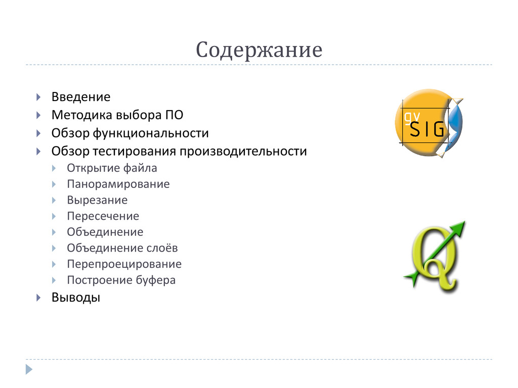
Содержание Введение Методика выбора ПО Обзор функциональности
Обзор тестирования производительности Открытие файла Панорамирование Вырезание Пересечение Объединение Объединение слоёв Перепроецирование Построение буфера Выводы
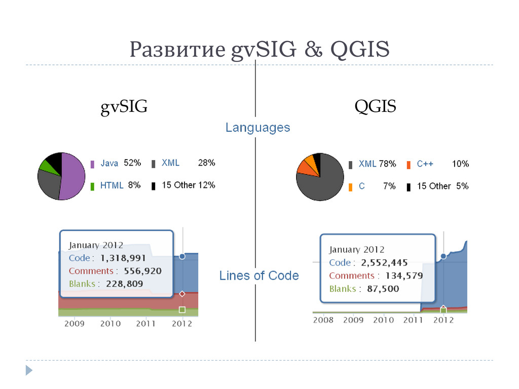
Развитие gvSIG & QGIS gvSIG QGIS
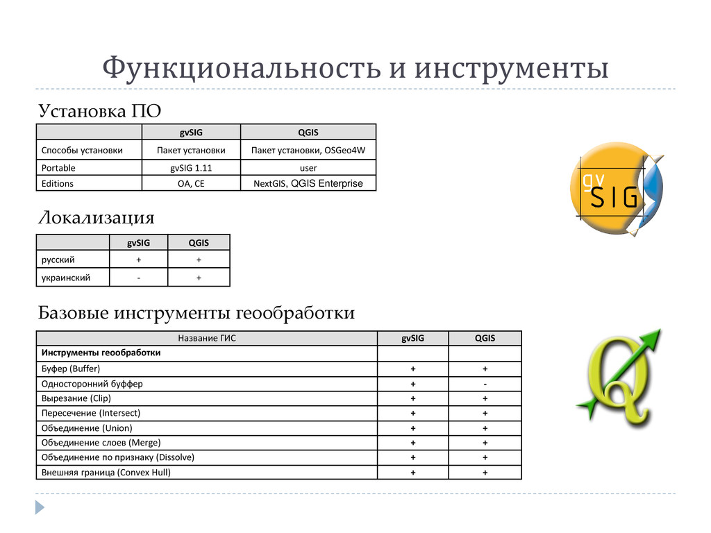
Функциональность и инструменты Установка ПО gvSIG QGIS Способы установки Пакет
установки Пакет установки, OSGeo4W Portable gvSIG 1.11 user Editions OA, CE NextGIS, QGIS Enterprise Локализация gvSIG QGIS русский + + украинский - + Название ГИС gvSIG QGIS Инструменты геообработки Буфер (Buffer) + + Односторонний буффер + - Вырезание (Clip) + + Пересечение (Intersect) + + Объединение (Union) + + Объединение слоев (Merge) + + Объединение по признаку (Dissolve) + + Внешняя граница (Convex Hull) + + Базовые инструменты геообработки
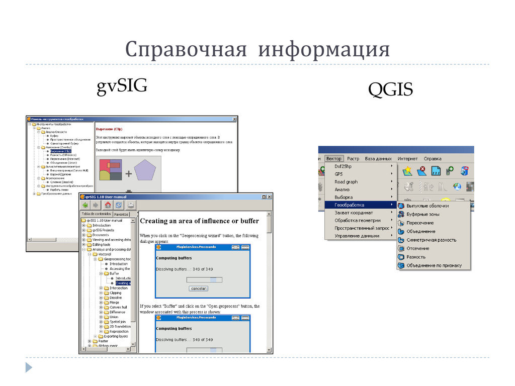
Справочная информация gvSIG QGIS
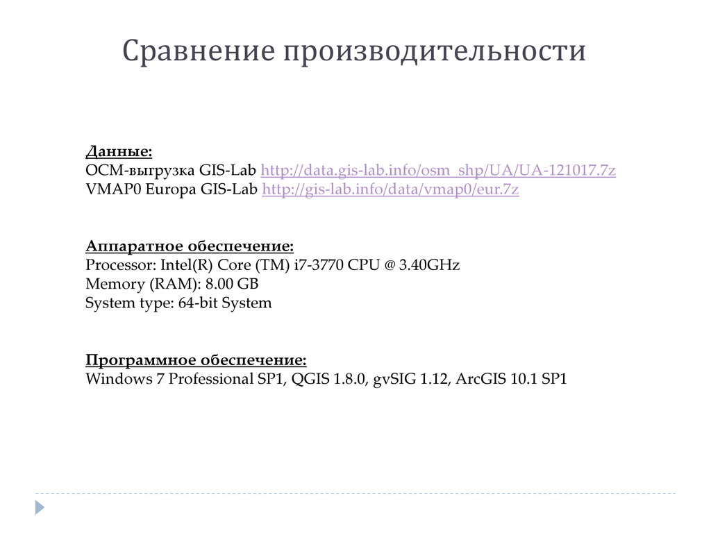
Сравнение производительности Данные: ОСМ-выгрузка GIS-Lab http://data.gis-lab.info/osm_shp/UA/UA-121017.7z VMAP0 Europa GIS-Lab http://gis-lab.info/data/vmap0/eur.7z
Аппаратное обеспечение: Processor: Intel(R) Core (TM) i7-3770 CPU @ 3.40GHz Memory (RAM): 8.00 GB System type: 64-bit System Программное обеспечение: Windows 7 Professional SP1, QGIS 1.8.0, gvSIG 1.12, ArcGIS 10.1 SP1
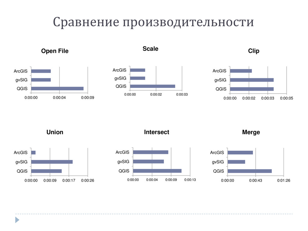
Сравнение производительности 0:00:00 0:00:04 0:00:09 QGIS gvSIG ArcGIS Open File
0:00:00 0:00:02 0:00:03 QGIS gvSIG ArcGIS Scale 0:00:00 0:00:02 0:00:03 0:00:05 QGIS gvSIG ArcGIS Clip 0:00:00 0:00:09 0:00:17 0:00:26 QGIS gvSIG ArcGIS Union 0:00:00 0:00:04 0:00:09 0:00:13 QGIS gvSIG ArcGIS Intersect 0:00:00 0:00:43 0:01:26 QGIS gvSIG ArcGIS Merge
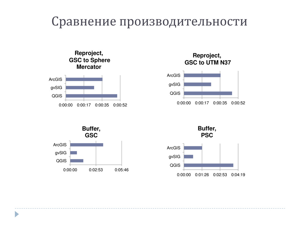
Сравнение производительности 0:00:00 0:00:17 0:00:35 0:00:52 QGIS gvSIG ArcGIS Reproject,
GSC to Sphere Mercator 0:00:00 0:00:17 0:00:35 0:00:52 QGIS gvSIG ArcGIS Reproject, GSC to UTM N37 0:00:00 0:02:53 0:05:46 QGIS gvSIG ArcGIS Buffer, GSC 0:00:00 0:01:26 0:02:53 0:04:19 QGIS gvSIG ArcGIS Buffer, PSC
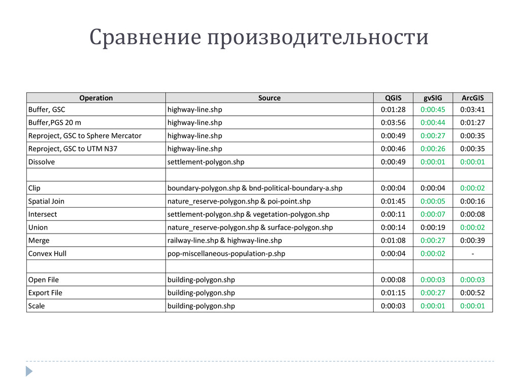
Сравнение производительности Operation Source QGIS gvSIG ArcGIS Buffer, GSC highway-line.shp
0:01:28 0:00:45 0:03:41 Buffer,PGS 20 m highway-line.shp 0:03:56 0:00:44 0:01:27 Reproject, GSC to Sphere Mercator highway-line.shp 0:00:49 0:00:27 0:00:35 Reproject, GSC to UTM N37 highway-line.shp 0:00:46 0:00:26 0:00:35 Dissolve settlement-polygon.shp 0:00:49 0:00:01 0:00:01 Clip boundary-polygon.shp & bnd-political-boundary-a.shp 0:00:04 0:00:04 0:00:02 Spatial Join nature_reserve-polygon.shp & poi-point.shp 0:01:45 0:00:05 0:00:16 Intersect settlement-polygon.shp & vegetation-polygon.shp 0:00:11 0:00:07 0:00:08 Union nature_reserve-polygon.shp & surface-polygon.shp 0:00:14 0:00:19 0:00:02 Merge railway-line.shp & highway-line.shp 0:01:08 0:00:27 0:00:39 Convex Hull pop-miscellaneous-population-p.shp 0:00:04 0:00:02 - Open File building-polygon.shp 0:00:08 0:00:03 0:00:03 Export File building-polygon.shp 0:01:15 0:00:27 0:00:52 Scale building-polygon.shp 0:00:03 0:00:01 0:00:01
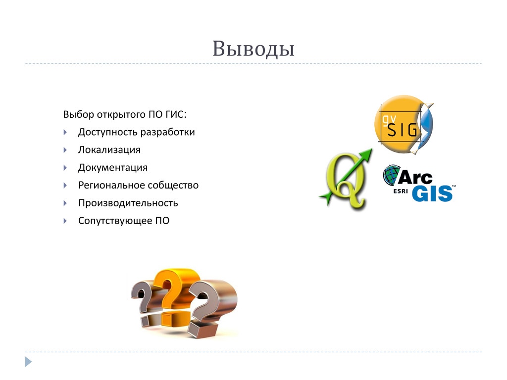
Выводы Выбор открытого ПО ГИС: Доступность разработки Локализация
Документация Региональное собщество Производительность Сопутствующее ПО