Upgrade to Pro — share decks privately, control downloads, hide ads and more …

TOWARDS A GEO-ENABLED AGRICULTURE DEVELOPMENT IN GHANA: THE ROLE OF CERSGIS 

CGIAR-CSI
September 23, 2014
58

TOWARDS A GEO-ENABLED AGRICULTURE DEVELOPMENT IN GHANA: THE ROLE OF CERSGIS 

CGIAR-CSI

September 23, 2014
Tweet

Transcript

  1. TOWARDS A GEO-ENABLED AGRICULTURE DEVELOPMENT IN GHANA: THE ROLE OF

    CERSGIS ! Centre for Remote Sensing and Geographic Information Services University of Ghana Legon-Accra
  2. SUPPORT FOR AGRO-RELATED SPATIAL DATA COLLECTION ❖ GIS/GPS training for

    farmers and other stakeholders ! ! ❖ Farm boundary mapping for some agriculture projects (e.g. Cocoalife) ! ! ❖ Creating national agriculture database with specific farmland under cultivation !
  3. Conceptual Overview National Agriculture Database Project data GPS Mapping of

    farm location ! WEB PORTALS/MOBILE APPS FOR DATA DISSEMINATION Farmer data e-Extension Platform Collaborate with most content producers and stakeholders Building national agriculture spatial database Online GIS for Ghana’s Agriculture www.gis4ghagric.net GhanaMappr IFPRI/CGIAR Collaboration Mobile App solutions Using both RS and GIS Open source and Proprietary Software
  4. The portal: Accessed by value chain actors Actors include: Investors,

    agri-input dealers, aggregators, researchers, commercial farmers, financial institutions etc Quick and Easy Decision Making
  5. CLEARING HOUSE FOR AGRICULTURE SPATIAL DATASETS ❖ Development of Online

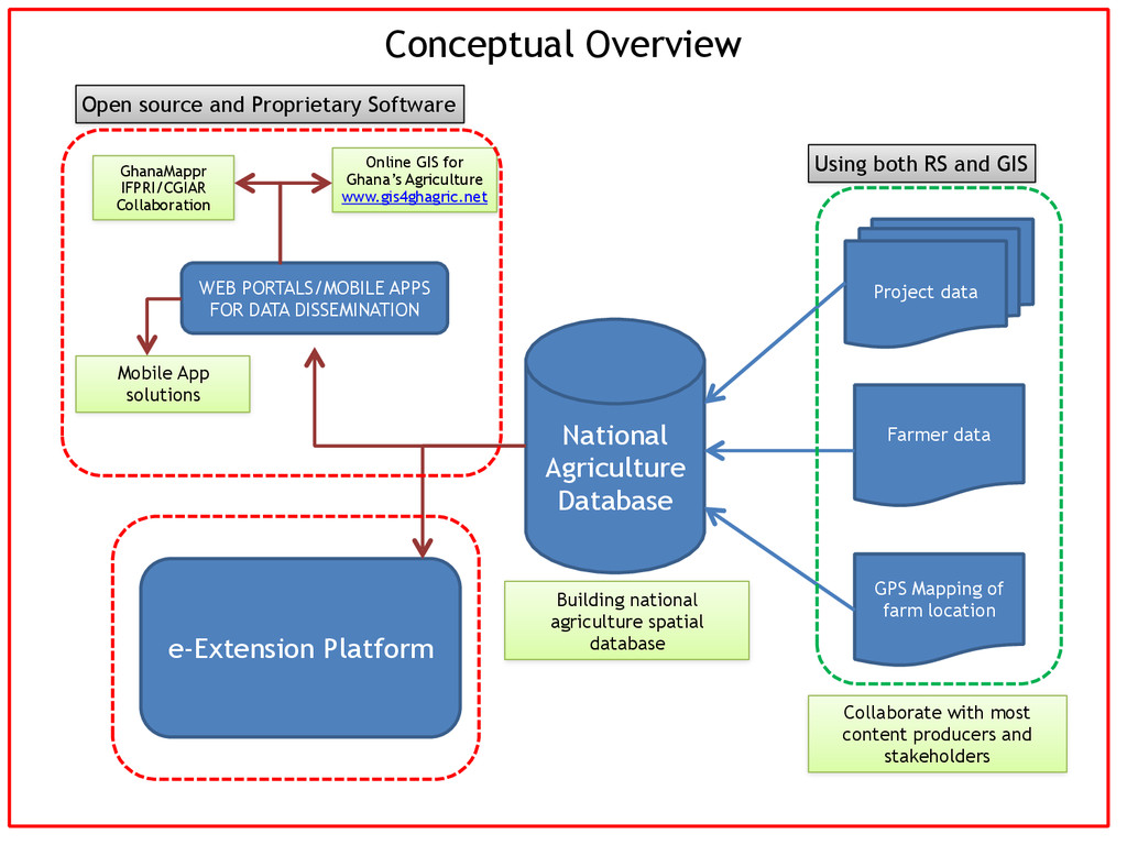
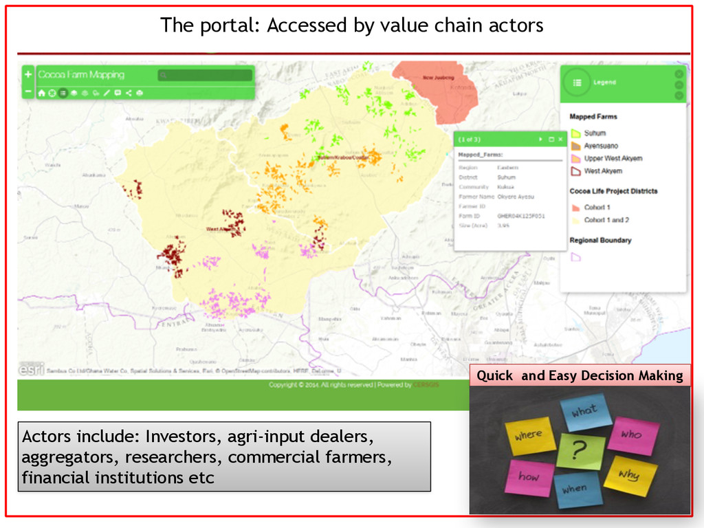
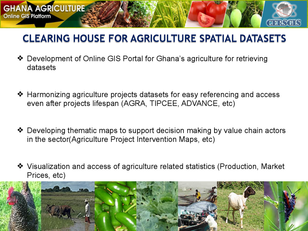
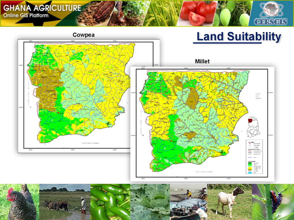
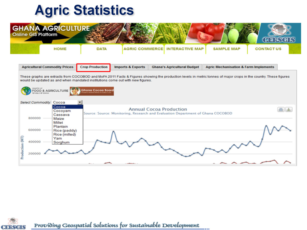
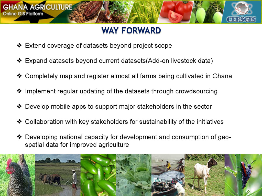
    GIS Portal for Ghana’s agriculture for retrieving datasets ! ! ❖ Harmonizing agriculture projects datasets for easy referencing and access even after projects lifespan (AGRA, TIPCEE, ADVANCE, etc) ! ! ❖ Developing thematic maps to support decision making by value chain actors in the sector(Agriculture Project Intervention Maps, etc) ! ! ❖ Visualization and access of agriculture related statistics (Production, Market Prices, etc)
  6. AGRICULTURE RELATED GIS APPLICATIONS ! ❖ Spatial analysis as a

    decision support tool for farmers and other stakeholders ! ! ❖ Develop IVR/Mobile e-Xtension application to support farmers access extension support in their local language and also enhance project evaluation
  7. WAY FORWARD ❖ Extend coverage of datasets beyond project scope

    ! ❖ Expand datasets beyond current datasets(Add-on livestock data) ! ❖ Completely map and register almost all farms being cultivated in Ghana ! ❖ Implement regular updating of the datasets through crowdsourcing ! ❖ Develop mobile apps to support major stakeholders in the sector ! ❖ Collaboration with key stakeholders for sustainability of the initiatives ! ❖ Developing national capacity for development and consumption of geo- spatial data for improved agriculture !