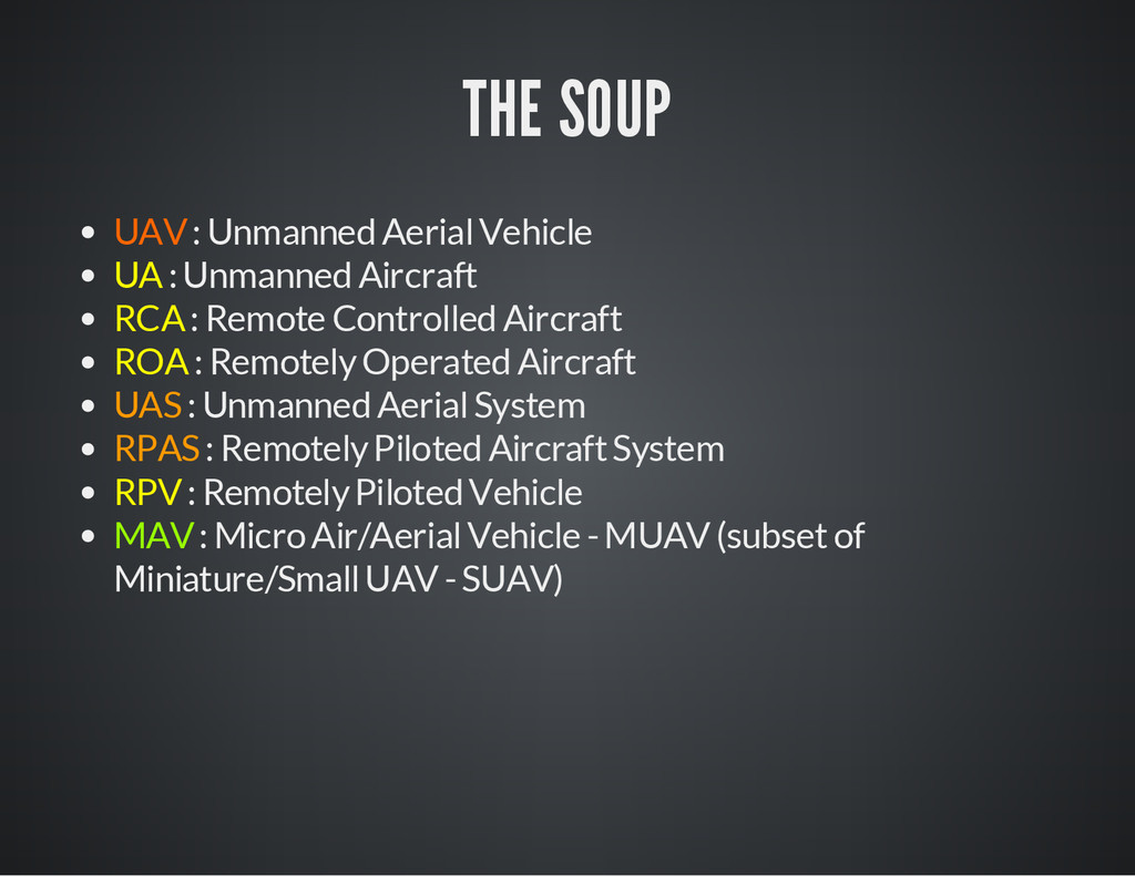
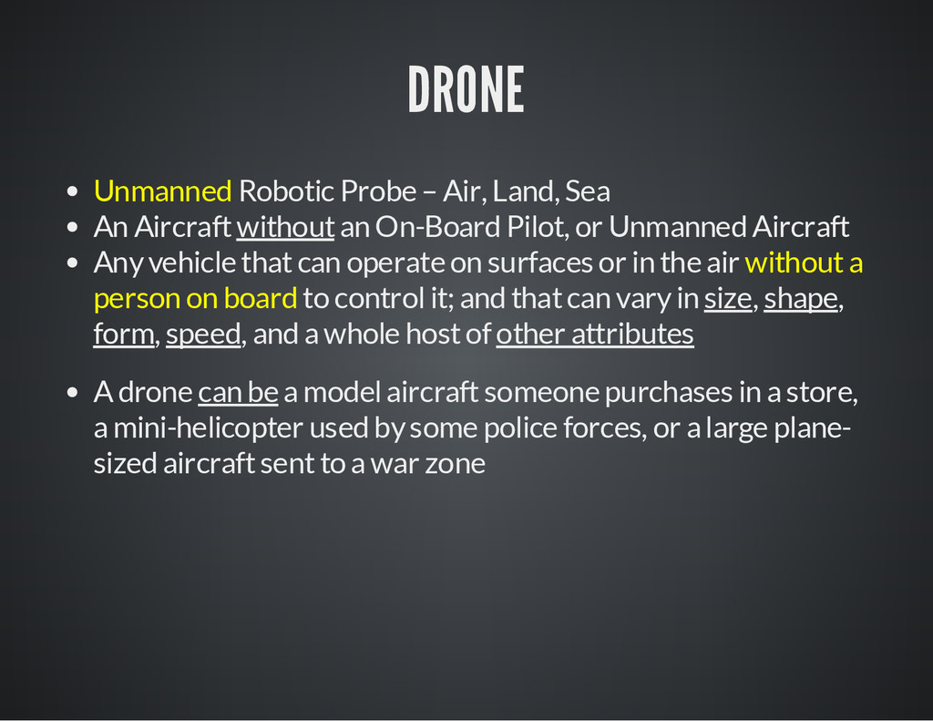
without an On-Board Pilot, or Unmanned Aircraft Any vehicle that can operate on surfaces or in the air without a person on board to control it; and that can vary in size, shape, form, speed, and a whole host of other attributes A drone can be a model aircraft someone purchases in a store, a mini-helicopter used by some police forces, or a large plane- sized aircraft sent to a war zone
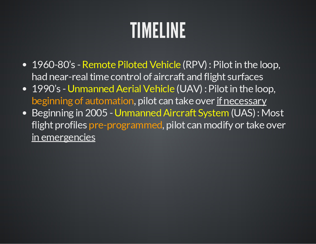
the loop, had near-real time control of aircraft and flight surfaces 1990’s - Unmanned Aerial Vehicle (UAV) : Pilot in the loop, beginning of automation, pilot can take over if necessary Beginning in 2005 - Unmanned Aircraft System (UAS) : Most flight profiles pre-programmed, pilot can modify or take over in emergencies
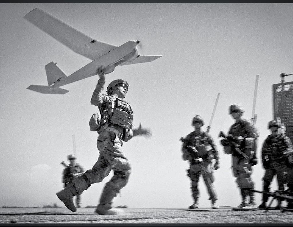
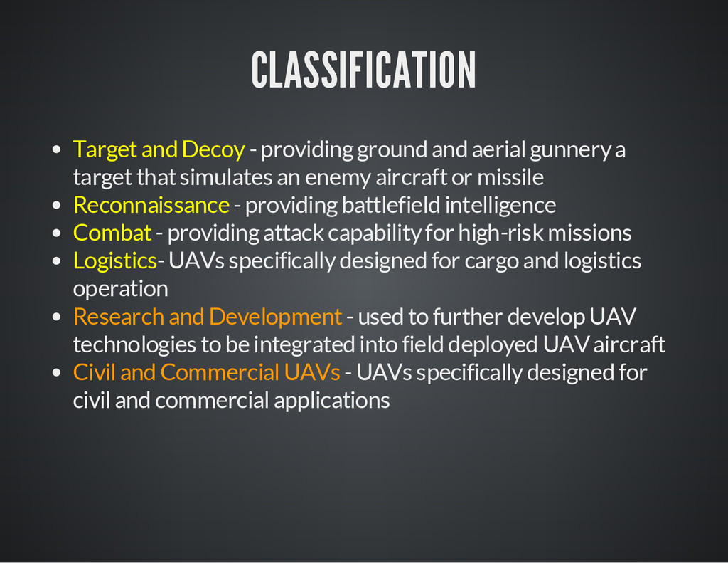
a target that simulates an enemy aircraft or missile Reconnaissance - providing battlefield intelligence Combat - providing attack capability for high-risk missions Logistics- UAVs specifically designed for cargo and logistics operation Research and Development - used to further develop UAV technologies to be integrated into field deployed UAV aircraft Civil and Commercial UAVs - UAVs specifically designed for civil and commercial applications
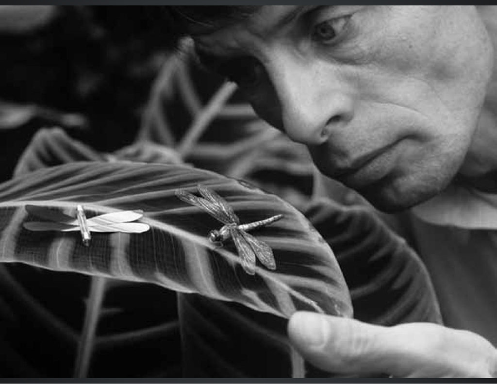
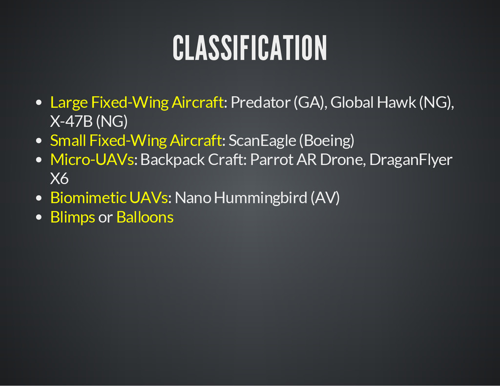
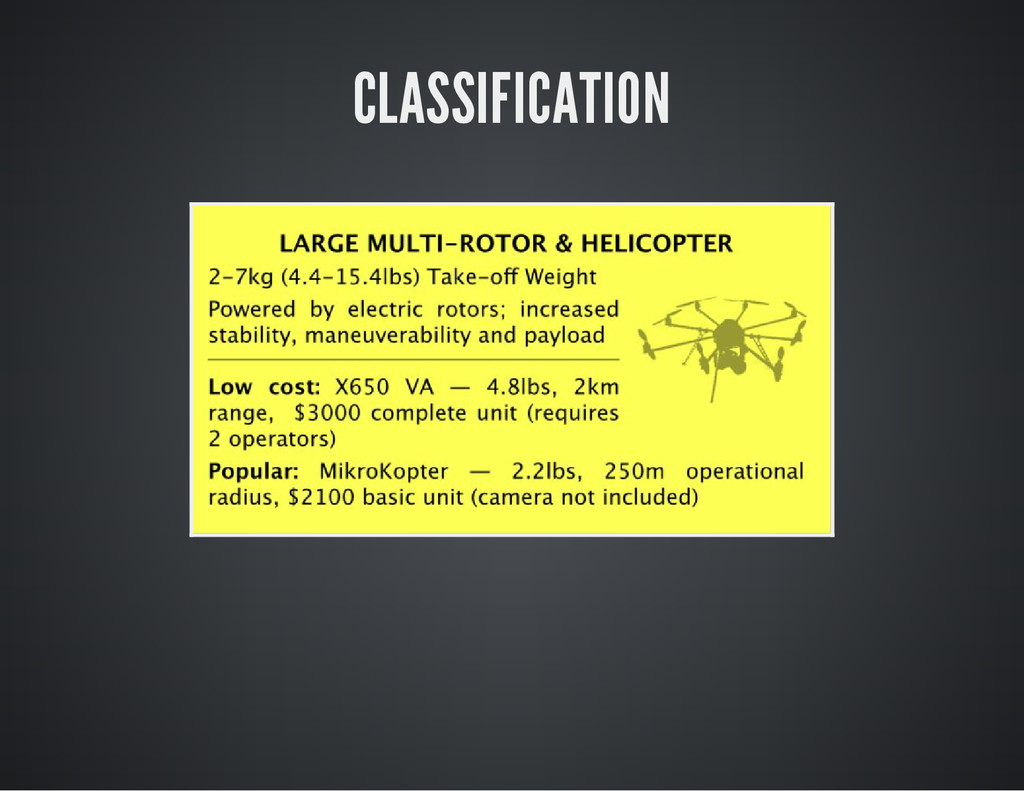
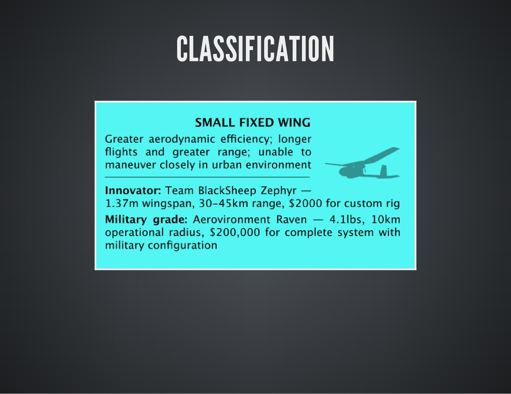
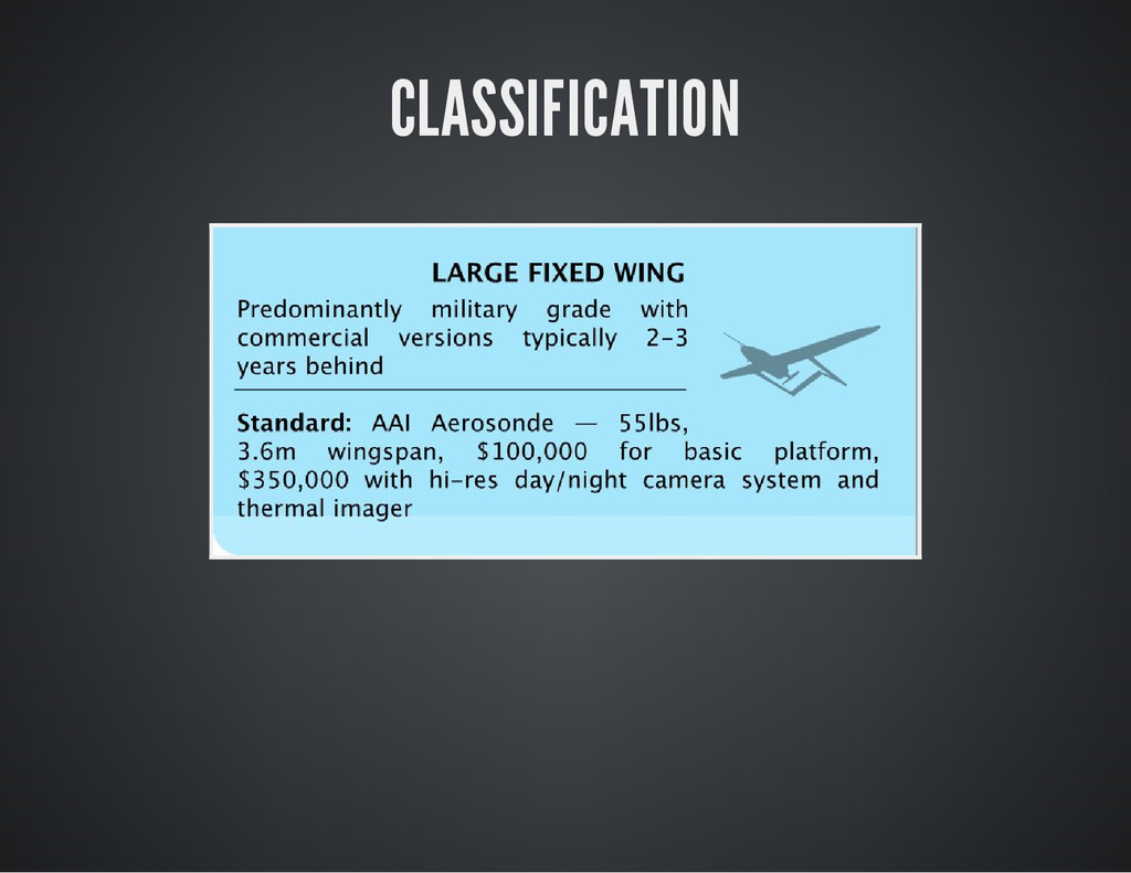
are typically described according to weight, endurance, purpose of use, and altitude of operation. Some look like mini-airplanes with fixed-wings, others are like mini-helicopters, and some even look like birds or other animals. They can be as large as traditional manned aircraft, or small enough to fit in a backpack. Large drones can fly at high altitudes and some can even remain airborne for several days
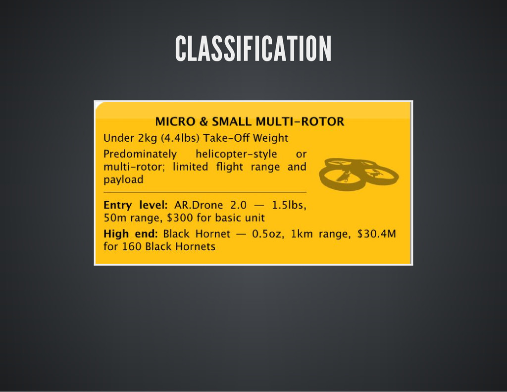
cheaper and smarter. Small drones costing 30K to 50K are almost equivalent to the cost of a police cruiser, and much less expensive than a manned helicopter. Some drones are so small and quiet they could be undetectable to a person being surveilled
the chances of individuals being surveilled from a great distance Night vision, infrared, ultraviolet, thermal imaging, and LIDAR that enables UAVs to detect and enhance detail Radar technologies that can penetrate walls and earth enabling the tracking of individuals even inside buildings, through cloudy conditions and through foliage
rapidly and would be able to recognize and respond to specific people, events and objects, or even flag changes in routines to identify particular movement patterns as suspicious. This could also include things like license plate readers Distributed video, whereby a number of UAVs work in concert with multiple video cameras Facial recognition or other soft biometric recognition that enables the UAV to recognize and track personal attributes such as height, age, gender and skin colour
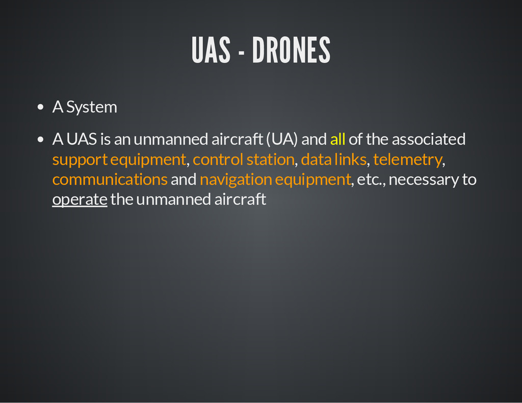
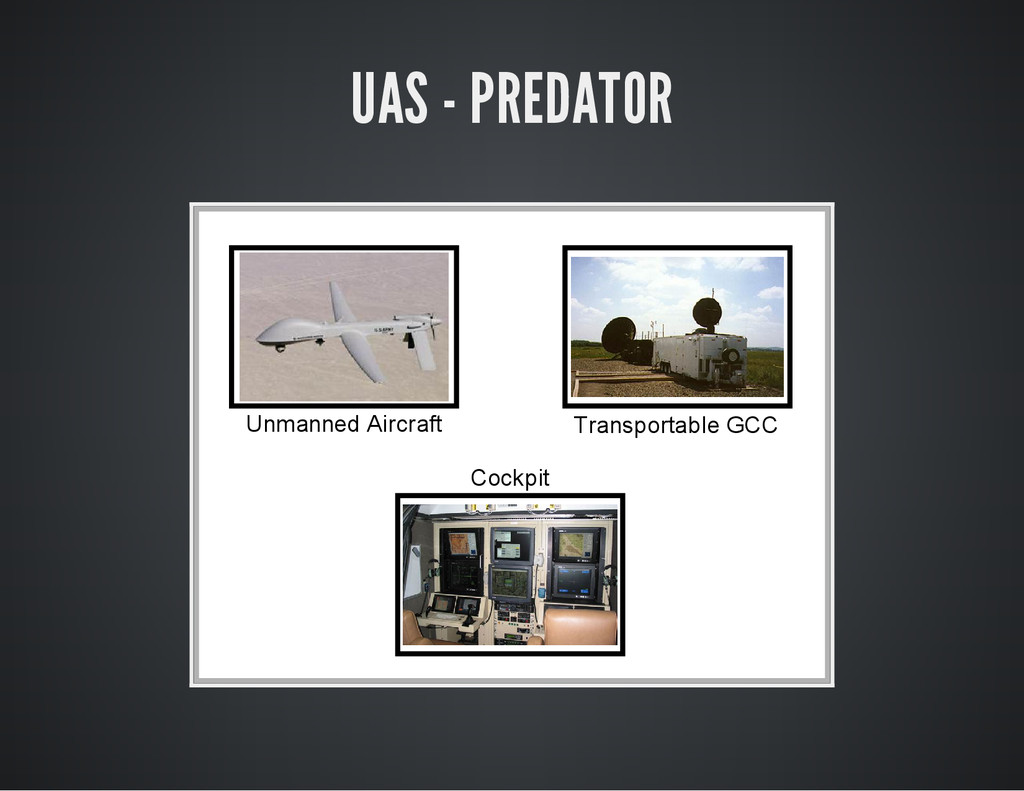
aircraft (UA) and all of the associated support equipment, control station, data links, telemetry, communications and navigation equipment, etc., necessary to operate the unmanned aircraft
government organizations are interested in them, and they are also available to the public Anyone with a smartphone can easily own and operate a small camera-carrying drone for under USD 350. Drones are available for use by the public and private sectors, and for recreational use, so long as they are flown within the current regulatory parameters
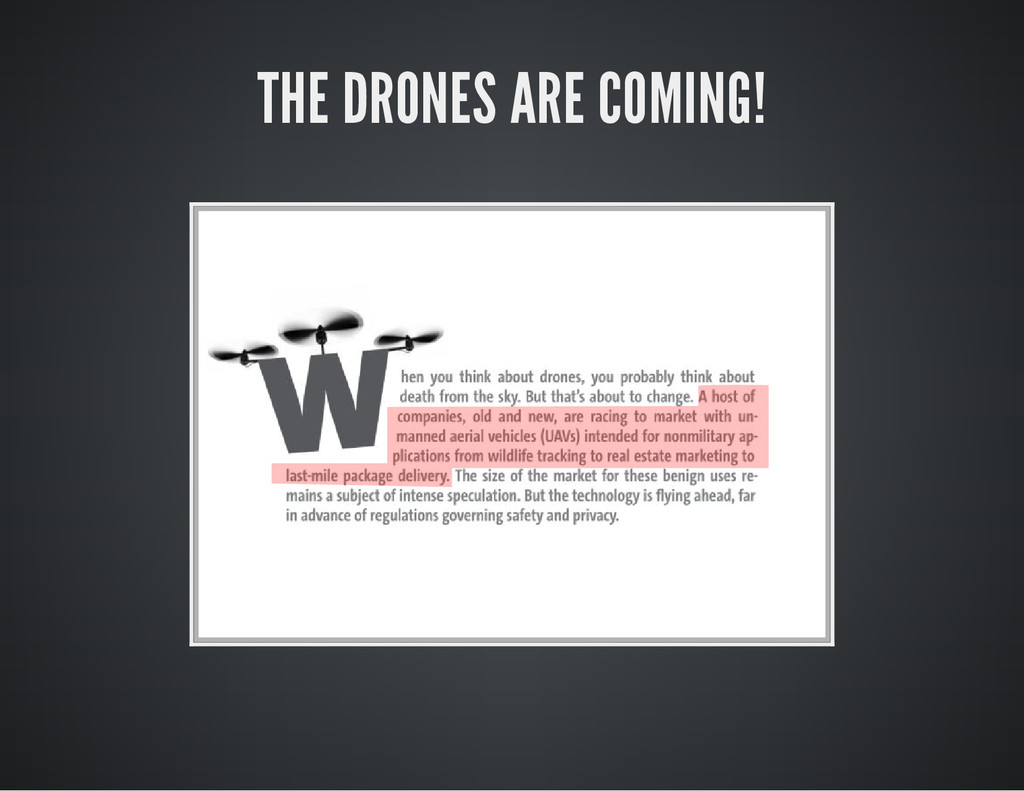
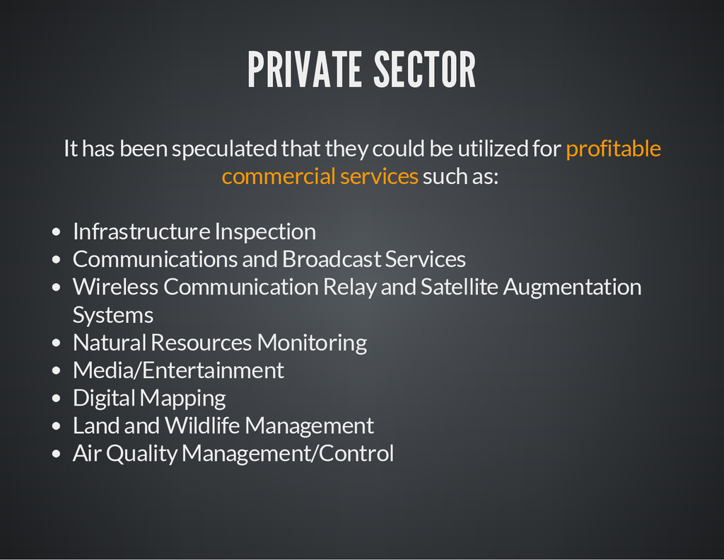
purposes in the context of war abroad. However their use is beginning to expand beyond the original military applications into areas of civil aviation. The current and the speculated uses for drones range quite broadly across the public and private sectors. Government organizations, private sector entities and amateur enthusiasts are all seemingly eager to launch drones in domestic skies for a variety of purposes.
roles, including but not limited to: Atmospheric Research (including weather and atmospheric gas sampling) Scientific Research Oceanographic Research Geophysical Research Mineral Exploration Imaging Spectrometry Telecommunications Relay Platforms
utilized for profitable commercial services such as: Infrastructure Inspection Communications and Broadcast Services Wireless Communication Relay and Satellite Augmentation Systems Natural Resources Monitoring Media/Entertainment Digital Mapping Land and Wildlife Management Air Quality Management/Control
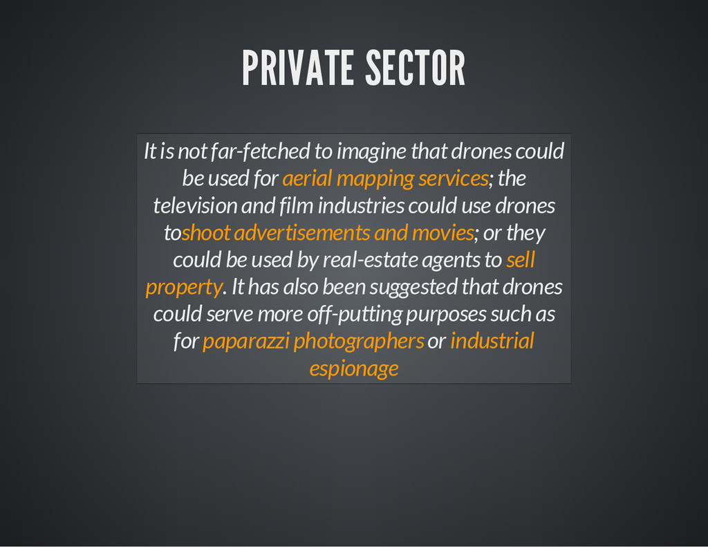
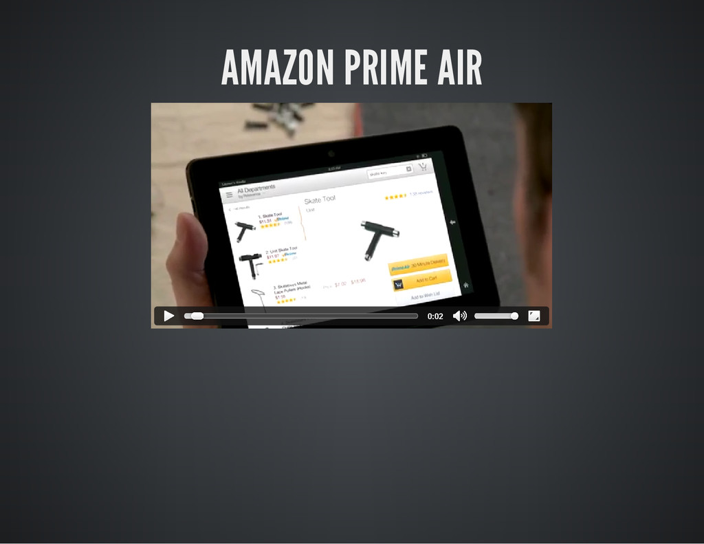
could be used for aerial mapping services; the television and film industries could use drones toshoot advertisements and movies; or they could be used by real-estate agents to sell property. It has also been suggested that drones could serve more off-putting purposes such as for paparazzi photographers or industrial espionage
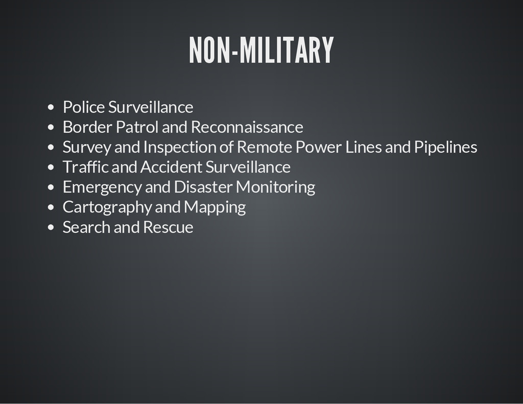
small drones domestically because they offer a simple and cost effective alternative to airborne law enforcement activities (e.g in US,UK,Canada). Some police forces use drones only for specific purposes such as to take aerial photos and videos at traffic collisions or crime scenes and in search-and- rescue operations. Sometimes it requires very strict conditions, e.g. only for photographing crime scenes: no higher than 120 m, must stay within the operator’s line of sight and cannot fly over people not involved in incidents.
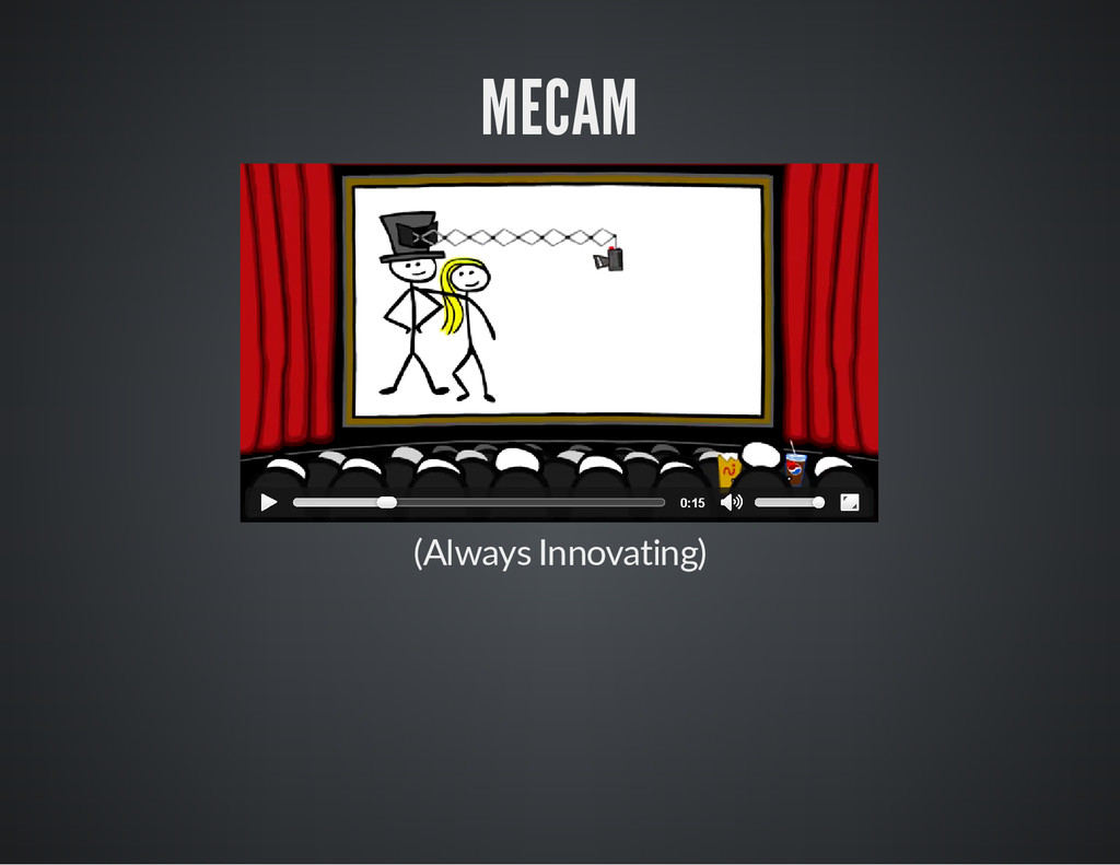
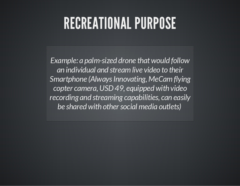
individual and stream live video to their Smartphone (Always Innovating, MeCam flying copter camera, USD 49, equipped with video recording and streaming capabilities, can easily be shared with other social media outlets)
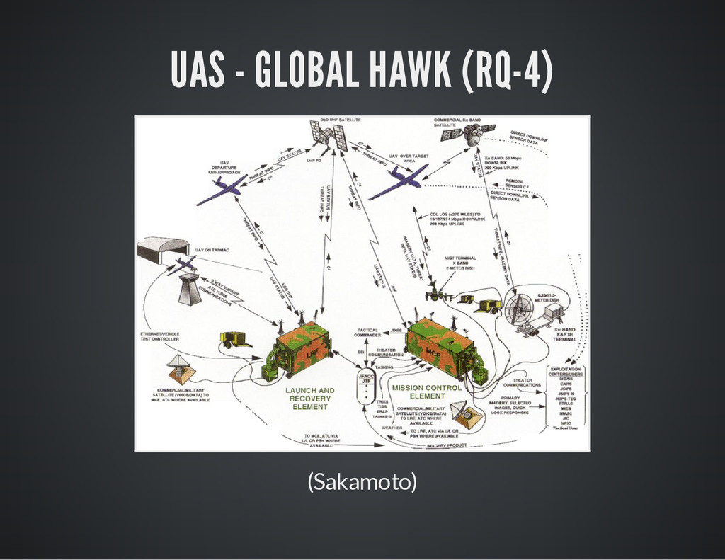
2. Mark N. Lewellen, Comprehensive Overview of Unmanned Aircraft Systems 3. DARC, Drones & Aerial Robotics Conference Law & Policy Guidebook 4. Lawrence M. Fisher, The Drones Are Coming! 5. Norman S. Sakamoto, TUAV Development and History at Northrop Grumman Corporation Ryan Aeronautical Center