Upgrade to Pro — share decks privately, control downloads, hide ads and more …

Geo and BIM does not make a GeoBIM

Francesca Noardo
November 02, 2018

Geo and BIM does not make a GeoBIM

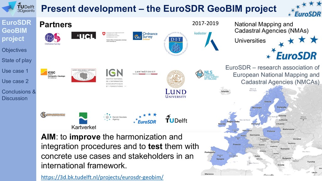
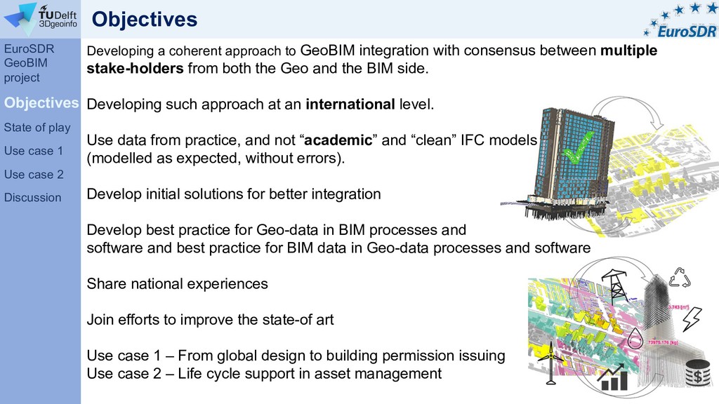
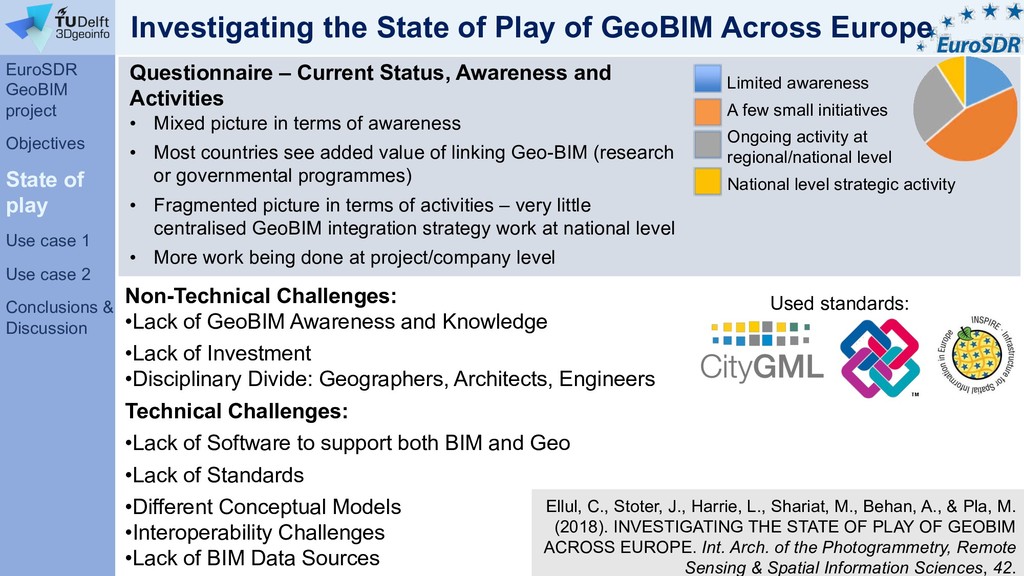
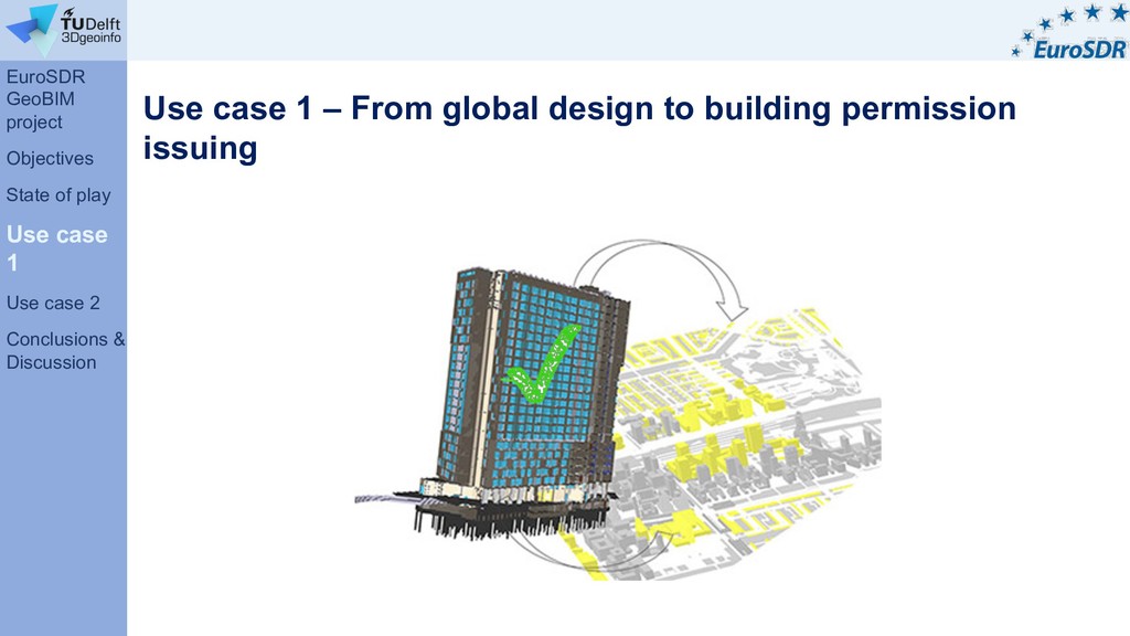
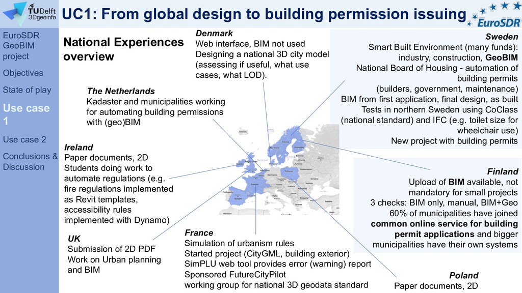
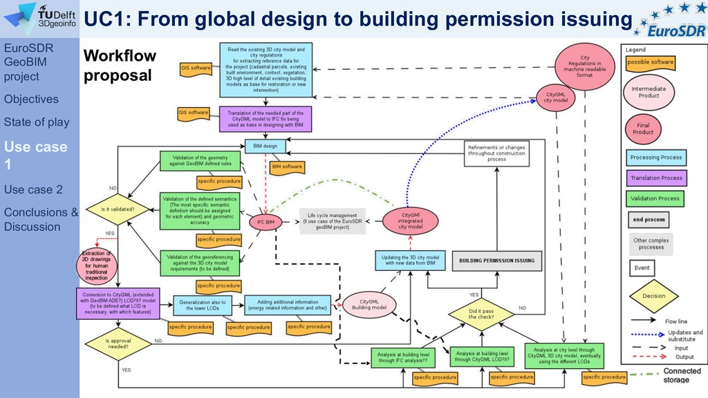
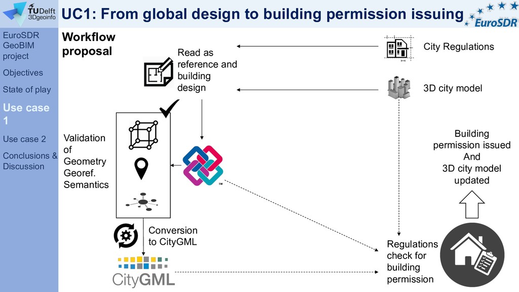
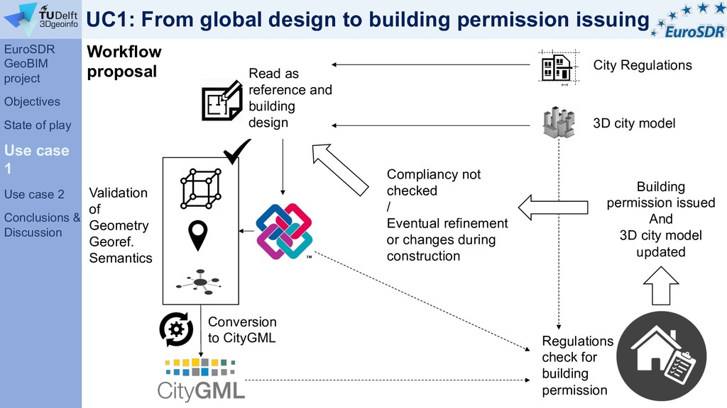
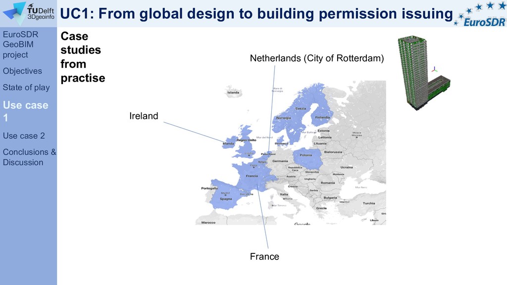
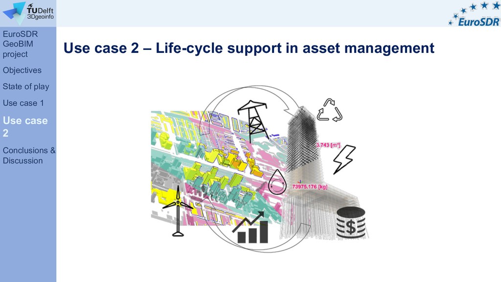
Developing a coherent approach to GeoBIM integration requires consensus between multiple stake-holders from both the Geo and the BIM side and at an international level. Developing such a multi-country and multi-stakeholders approach is the topic of a 2-year EuroSDR (European Spatial Data Research) project on GeoBIM integration that started in November 2017. The general aim of the project is to detail both the needs and the issues of GeoBIM integration, studied from use cases as well as from existing experiences in the participating 11 countries and to develop initial solutions accordingly. We are specifically interested how geospatial data that is produced by governmental agencies like National Mapping and Cadastral Agencies (NMAs) can be better utilised in design and building processes. The studied use case are a) the workflow from global design to a building permit; and b) the workflow of the object life-cycle in asset management.

Francesca Noardo

November 02, 2018
Tweet

More Decks by Francesca Noardo

Other Decks in Research

Transcript

  1. The EuroSDR GeoBIM project Objectives Investigating the state of play

    Use case 1- Building permission issuing Use case 2- life cycle support in asset management Conclusions and Discussion Overview
  2. AIM: to improve the harmonization and integration procedures and to

    test them with concrete use cases and stakeholders in an international framework. National Mapping and Cadastral Agencies (NMAs) Universities Present development – the EuroSDR GeoBIM project EuroSDR GeoBIM project Objectives State of play Use case 1 Use case 2 Conclusions & Discussion https://3d.bk.tudelft.nl/projects/eurosdr-geobim/ 2017-2019 Partners EuroSDR – research association of European National Mapping and Cadastral Agencies (NMCAs)
  3. Objectives Developing a coherent approach to GeoBIM integration with consensus

    between multiple stake-holders from both the Geo and the BIM side. Developing such approach at an international level. Use data from practice, and not “academic” and “clean” IFC models (modelled as expected, without errors). Develop initial solutions for better integration Develop best practice for Geo-data in BIM processes and software and best practice for BIM data in Geo-data processes and software Share national experiences Join efforts to improve the state-of art Use case 1 – From global design to building permission issuing Use case 2 – Life cycle support in asset management EuroSDR GeoBIM project Objectives State of play Use case 1 Use case 2 Discussion
  4. Investigating the State of Play of GeoBIM Across Europe Questionnaire

    – Current Status, Awareness and Activities • Mixed picture in terms of awareness • Most countries see added value of linking Geo-BIM (research or governmental programmes) • Fragmented picture in terms of activities – very little centralised GeoBIM integration strategy work at national level • More work being done at project/company level Non-Technical Challenges: •Lack of GeoBIM Awareness and Knowledge •Lack of Investment •Disciplinary Divide: Geographers, Architects, Engineers Technical Challenges: •Lack of Software to support both BIM and Geo •Lack of Standards •Different Conceptual Models •Interoperability Challenges •Lack of BIM Data Sources Ellul, C., Stoter, J., Harrie, L., Shariat, M., Behan, A., & Pla, M. (2018). INVESTIGATING THE STATE OF PLAY OF GEOBIM ACROSS EUROPE. Int. Arch. of the Photogrammetry, Remote Sensing & Spatial Information Sciences, 42. Limited awareness A few small initiatives Ongoing activity at regional/national level National level strategic activity Used standards: EuroSDR GeoBIM project Objectives State of play Use case 1 Use case 2 Conclusions & Discussion
  5. Use case 1 – From global design to building permission

    issuing EuroSDR GeoBIM project Objectives State of play Use case 1 Use case 2 Conclusions & Discussion
  6. UC1: From global design to building permission issuing Sweden Smart

    Built Environment (many funds): industry, construction, GeoBIM National Board of Housing - automation of building permits (builders, government, maintenance) BIM from first application, final design, as built Tests in northern Sweden using CoClass (national standard) and IFC (e.g. toilet size for wheelchair use) New project with building permits The Netherlands Kadaster and municipalities working for automating building permissions with (geo)BIM France Simulation of urbanism rules Started project (CityGML, building exterior) SimPLU web tool provides error (warning) report Sponsored FutureCityPilot working group for national 3D geodata standard UK Submission of 2D PDF Work on Urban planning and BIM Poland Paper documents, 2D National Experiences overview Ireland Paper documents, 2D Students doing work to automate regulations (e.g. fire regulations implemented as Revit templates, accessibility rules implemented with Dynamo) Finland Upload of BIM available, not mandatory for small projects 3 checks: BIM only, manual, BIM+Geo 60% of municipalities have joined common online service for building permit applications and bigger municipalities have their own systems Denmark Web interface, BIM not used Designing a national 3D city model (assessing if useful, what use cases, what LOD). EuroSDR GeoBIM project Objectives State of play Use case 1 Use case 2 Conclusions & Discussion
  7. UC1: From global design to building permission issuing Workflow proposal

    EuroSDR GeoBIM project Objectives State of play Use case 1 Use case 2 Conclusions & Discussion
  8. UC1: From global design to building permission issuing Workflow proposal

    City Regulations 3D city model Validation of Geometry Georef. Semantics Conversion to CityGML Regulations check for building permission Building permission issued And 3D city model updated Read as reference and building design EuroSDR GeoBIM project Objectives State of play Use case 1 Use case 2 Conclusions & Discussion
  9. UC1: From global design to building permission issuing Workflow proposal

    City Regulations 3D city model Read as reference and building design Validation of Geometry Georef. Semantics Conversion to CityGML Regulations check for building permission Building permission issued And 3D city model updated Compliancy not checked / Eventual refinement or changes during construction EuroSDR GeoBIM project Objectives State of play Use case 1 Use case 2 Conclusions & Discussion
  10. UC1: From global design to building permission issuing Research questions

    and next steps Select regulations that benefit from GeoBIM integration e.g. Right of sun; Shading; Zoning; Maximum height; Fire (distance to hydrants, roads, evacuation areas) Based on these: • Distinguish between different types of buildings? • Distinguish between new building or changing buildings? • Metadata issue • Accuracy issue • Georeferencing issue • Level of detail issue • Level of development issue On-going interviews and collaborations with Municipalities and involved stakeholders to answer these (Cities of Den Haag, Rotterdam, Almere) EuroSDR GeoBIM project Objectives State of play Use case 1 Use case 2 Conclusions & Discussion
  11. UC1: From global design to building permission issuing Case studies

    from practise France Netherlands (City of Rotterdam) Ireland EuroSDR GeoBIM project Objectives State of play Use case 1 Use case 2 Conclusions & Discussion
  12. Use case 2 – Life-cycle support in asset management EuroSDR

    GeoBIM project Objectives State of play Use case 1 Use case 2 Conclusions & Discussion
  13. Sweden On-going projects Interaction with Product Life Cycle support (PLCS)

    standard ISO 10303-239 UK UK PAS (Publically Accessible Standard) for build and operation phases - asset management Large infrastructure projects Management = operation and maintenance during life cycle of project National Experiences overview Use case 2 – Life-cycle support in asset management EuroSDR GeoBIM project Objectives State of play Use case 1 Use case 2 Conclusions & Discussion
  14. Workflow proposal Specific asset management action Validation of geometric data

    quality Analysis of the needed requirements of specifics assets (energy/ storage/maintenance/ ownership…) to be managed for the specific selected object (building, roads, infrastructure…) Validation of semantic data quality Validation of georeferencing quality BIM Geoinfo Translation to ISO standard Product Lifecycle Support (PLCS) useful model Is it validated ? New data generation from BIM + Storage of previous versions BIM processing PLCS model BIM updating + Storage of previous versions YES NO Use case 2 – Life-cycle support in asset management EuroSDR GeoBIM project Objectives State of play Use case 1 Use case 2 Discussion BIM Geoinformation ISO standard Product Lifecycle Support (PLCS) Semantic mapping
  15. Still preliminary questions: • What data asset managers need? •

    Need they information about others’ assets (eg neighbours)? • How to incentivise asset managers to share data? • Can be geoinformation the link between different asset managers? • … Research questions and next steps EuroSDR GeoBIM project Objectives State of play Use case 1 Use case 2 Conclusions & Discussion Use case 2 – Life-cycle support in asset management
  16. Conclusions Common requirements enabling the interoperability: • Valid Geometry •

    Valid topology • Valid Georeferencing • Standardised and complete semantics Common Issues: • Software • Georeferencing and CRS (especially for BIM/IFC) • Standard versions • problems with large datasets Linked to the use case 1 specifically: Many different institutions giving different permissions Regulations have to be translated into digital (spatial) format Need to promote the solution finding benefits for stakeholders to comply to standards: • We can then accelerate the planning process and permission issuing • Enhance objectivity in the evaluations Specific tools / guidelines are needed (https://3d.bk.tudelft.nl/projects/geobim/) EuroSDR GeoBIM project Objectives State of play Use case 1 Use case 2 Conclusion & Discussion
  17. Questions and discussion EuroSDR GeoBIM project Objectives State of play

    Use case 1 Use case 2 Conclusion & Discussion