Upgrade to Pro
— share decks privately, control downloads, hide ads and more …
Speaker Deck
Features
Speaker Deck
PRO
Sign in
Sign up for free
Search
Search
FOSS4G 2015 Tokyo Vector Tiles Pt. 3
Search
Hidenori FUJIMURA
October 09, 2015
150
0
Share
Embed
Copy iframe code
Copy JS code
Copy link
Start on current slide
FOSS4G 2015 Tokyo Vector Tiles Pt. 3
Hidenori FUJIMURA
October 09, 2015
More Decks by Hidenori FUJIMURA
See All by Hidenori FUJIMURA
みんなに伝わる防災マップ
hfu
0
170
未来の繁栄のためのスマート地図
hfu
0
190
Smart Maps for the prosperity in the future
hfu
0
280
Smart Maps and Bazaar
hfu
0
210
Sensemaking with Smart Maps
hfu
0
140
Smart Maps for the United Nations, with the United Nations
hfu
0
190
UN Smart Maps
hfu
0
230
スマート地図バザールによる地図XMLのタイル配信
hfu
0
140
国土地理院におけるベース・レジストリの整備とDX推進への取り組み
hfu
0
330
Featured
See All Featured
Producing Creativity
orderedlist
PRO
348
40k
Efficient Content Optimization with Google Search Console & Apps Script
katarinadahlin
PRO
1
670
Bridging the Design Gap: How Collaborative Modelling removes blockers to flow between stakeholders and teams @FastFlow conf
baasie
0
610
Automating Front-end Workflow
addyosmani
1370
210k
XXLCSS - How to scale CSS and keep your sanity
sugarenia
250
1.3M
Understanding Cognitive Biases in Performance Measurement
bluesmoon
32
3k
How People are Using Generative and Agentic AI to Supercharge Their Products, Projects, Services and Value Streams Today
helenjbeal
1
230
Navigating Weather and Climate Data
rabernat
0
280
JAMstack: Web Apps at Ludicrous Speed - All Things Open 2022
reverentgeek
1
490
Fireside Chat
paigeccino
42
4k
[RailsConf 2023] Rails as a piece of cake
palkan
59
6.7k
sira's awesome portfolio website redesign presentation
elsirapls
0
300
Transcript
Ministry of Land, Infrastructure, Transport and Tourism Geospatial Information Authority
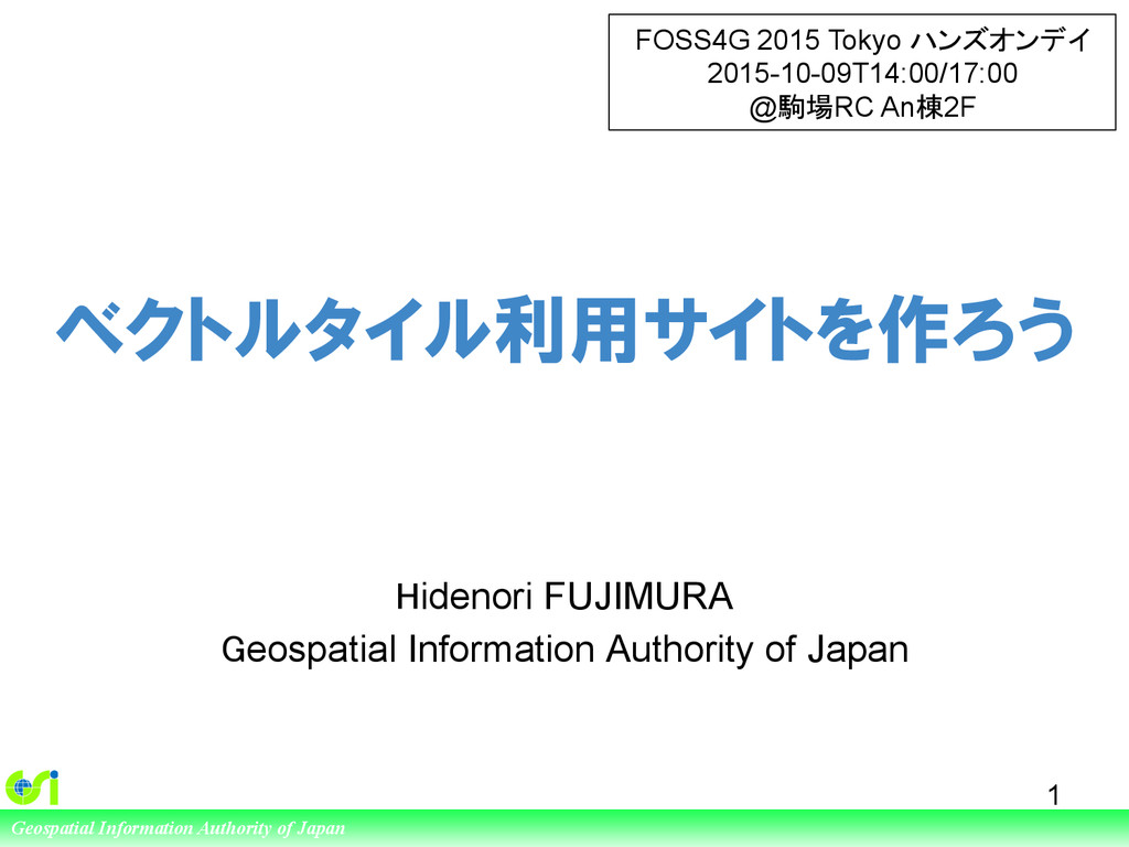
of Japan ベクトルタイル利用サイトを作ろう Hidenori FUJIMURA Geospatial Information Authority of Japan 1 FOSS4G 2015 Tokyo ハンズオンデイ 2015-10-09T14:00/17:00 @駒場RC An棟2F
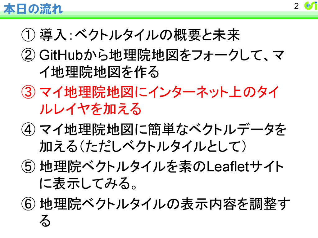
本日の流れ ① 導入:ベクトルタイルの概要と未来 ② GitHubから地理院地図をフォークして、マ イ地理院地図を作る ③ マイ地理院地図にインターネット上のタイ ルレイヤを加える ④ マイ地理院地図に簡単なベクトルデータを 加える(ただしベクトルタイルとして) ⑤ 地理院ベクトルタイルを素のLeafletサイト に表示してみる。
⑥ 地理院ベクトルタイルの表示内容を調整す る 2
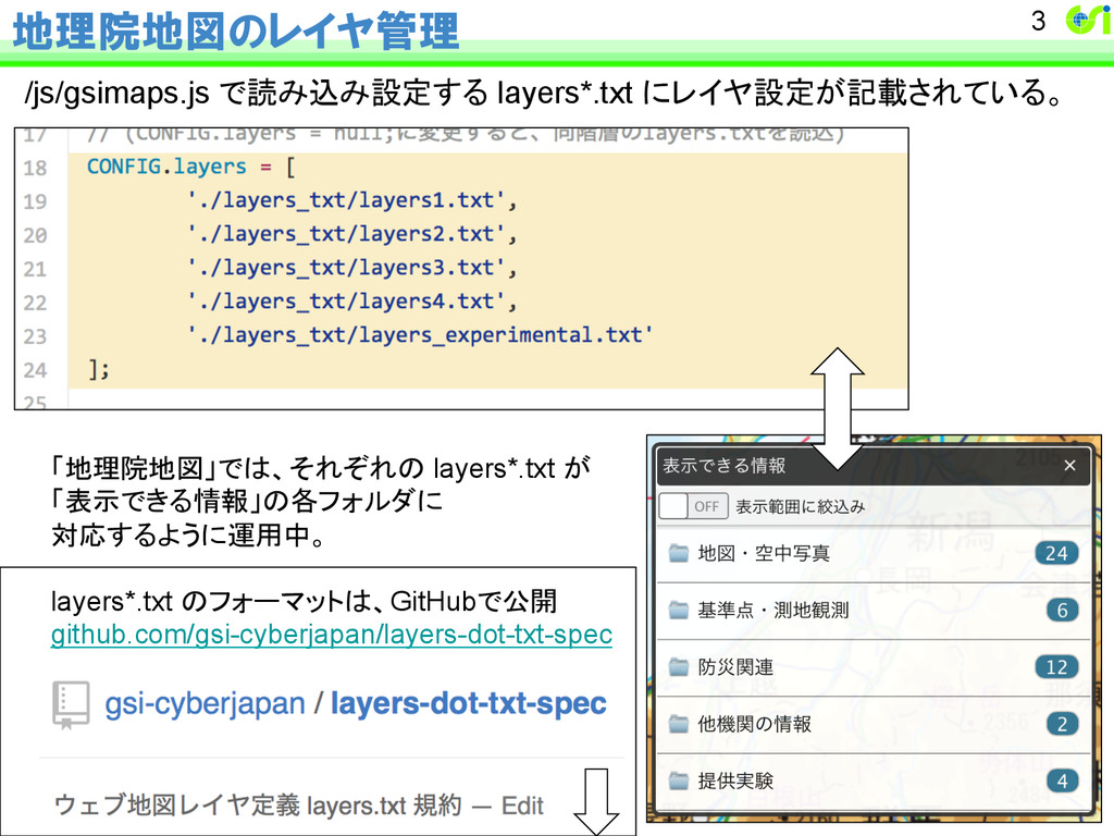
地理院地図のレイヤ管理 /js/gsimaps.js で読み込み設定する layers*.txt にレイヤ設定が記載されている。 3 「地理院地図」では、それぞれの layers*.txt が 「表示できる情報」の各フォルダに
対応するように運用中。 layers*.txt のフォーマットは、GitHubで公開 github.com/gsi-cyberjapan/layers-dot-txt-spec
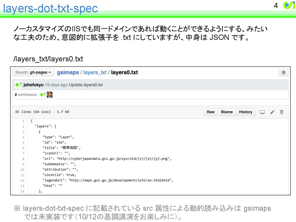
layers-dot-txt-spec ノーカスタマイズのIISでも同一ドメインであれば動くことができるようにする、みたい な工夫のため、意図的に拡張子を .txt にしていますが、中身は JSON です。 /layers_txt/layers0.txt ※ layers-dot-txt-spec
に記載されている src 属性による動的読み込みは gsimaps では未実装です(10/12の基調講演をお楽しみに)。 4
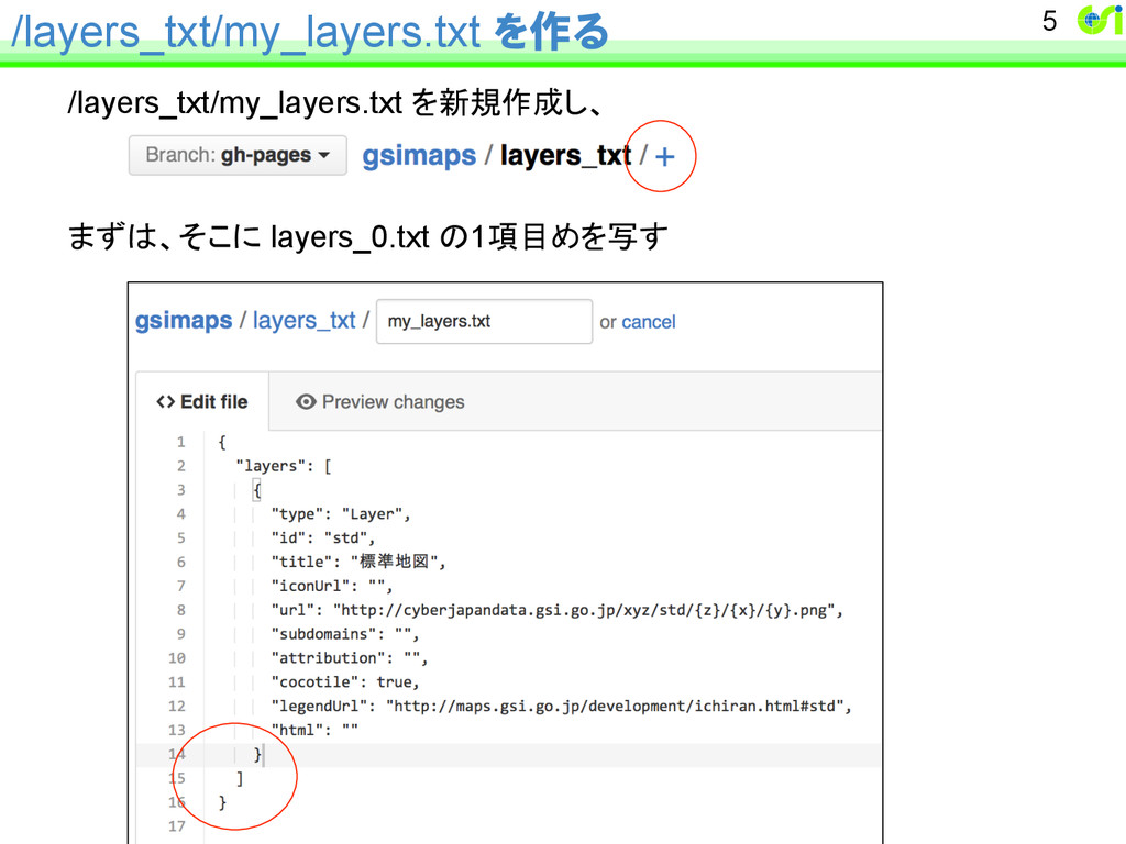
/layers_txt/my_layers.txt を作る /layers_txt/my_layers.txt を新規作成し、 まずは、そこに layers_0.txt の1項目めを写す 5
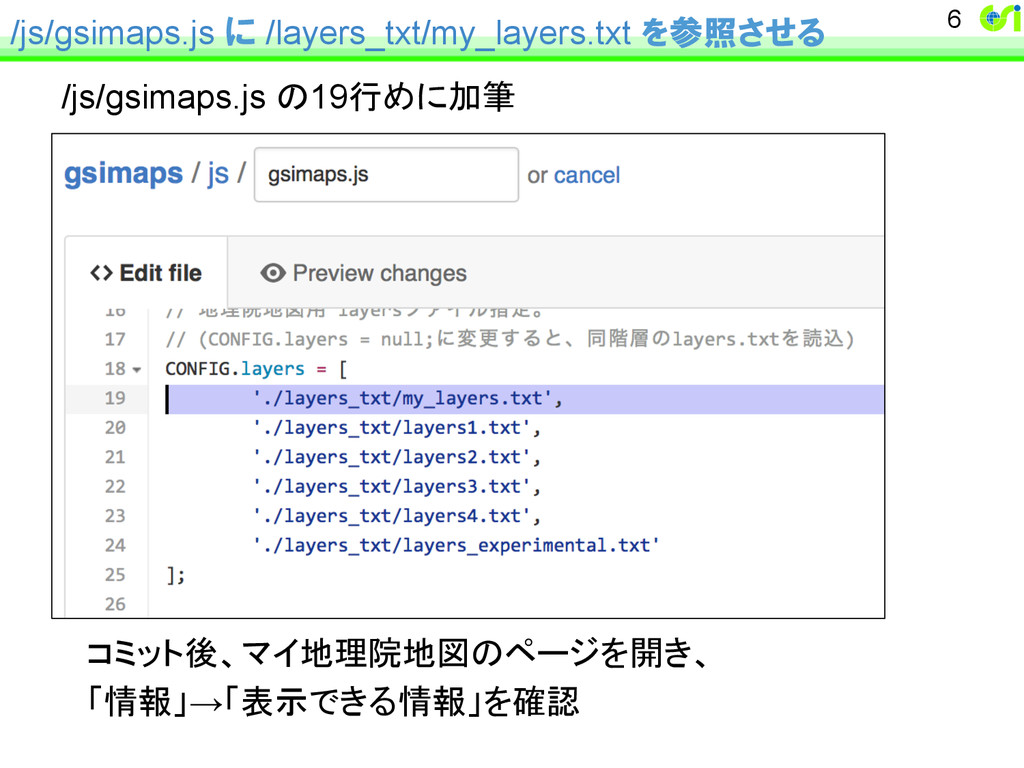
/js/gsimaps.js に /layers_txt/my_layers.txt を参照させる /js/gsimaps.js の19行めに加筆 6 コミット後、マイ地理院地図のページを開き、 「情報」→「表示できる情報」を確認
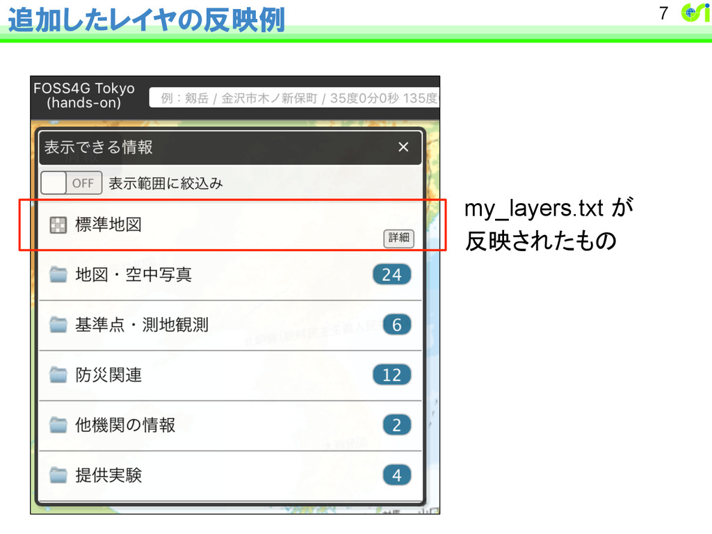
追加したレイヤの反映例 7 my_layers.txt が 反映されたもの
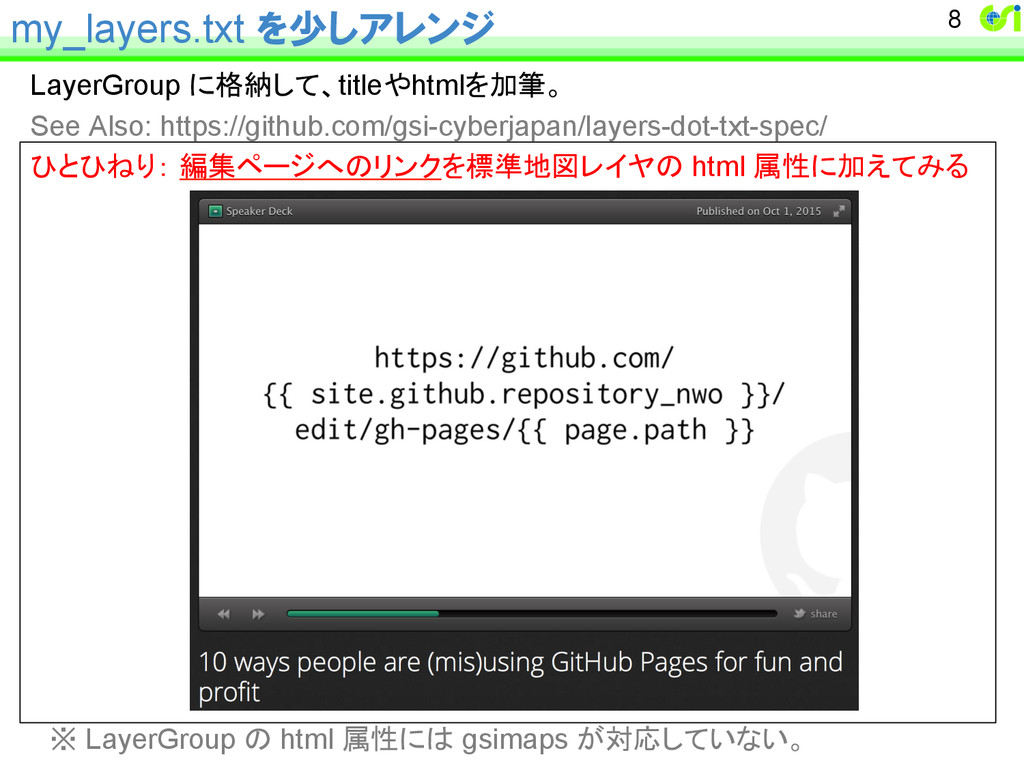
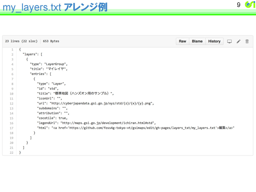
my_layers.txt を少しアレンジ LayerGroup に格納して、titleやhtmlを加筆。 See Also: https://github.com/gsi-cyberjapan/layers-dot-txt-spec/ ひとひねり: 編集ページへのリンクを標準地図レイヤの html
属性に加えてみる ※ LayerGroup の html 属性には gsimaps が対応していない。 8
my_layers.txt アレンジ例 9
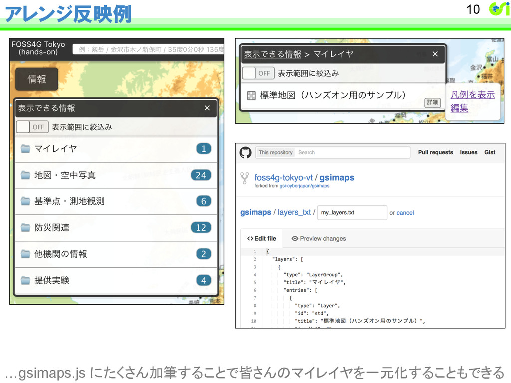
アレンジ反映例 10 …gsimaps.js にたくさん加筆することで皆さんのマイレイヤを一元化することもできる
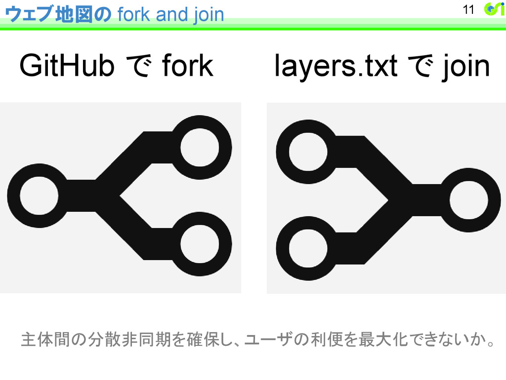
ウェブ地図の fork and join 11 GitHub で fork layers.txt で
join 主体間の分散非同期を確保し、ユーザの利便を最大化できないか。
(実習) いろいろなレイヤを加えてみよう ① いろいろなタイルレイヤを加えてみる 例)日本シームレス地質図WMTS配信サービス https://gbank.gsj.jp/seamless/wmts/wmts.html ② マイ地理院地図のリンク集を作る https://github.com/foss4g-tokyo-vt/living-room/ edit/master/links.md にプルリクエスト 12
ヒント: JSON の文法チェック http://jsonlint.com
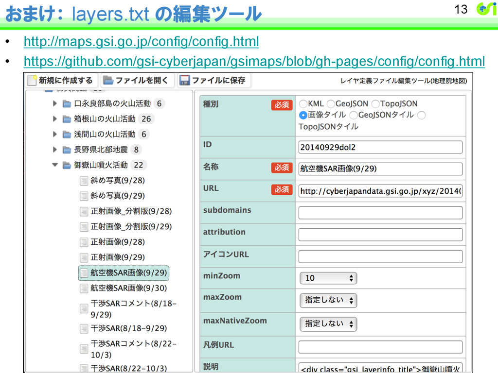
おまけ: layers.txt の編集ツール • http://maps.gsi.go.jp/config/config.html • https://github.com/gsi-cyberjapan/gsimaps/blob/gh-pages/config/config.html 13