Upgrade to Pro — share decks privately, control downloads, hide ads and more …

Improving transit operations with innovative ve...

Joffrey Lauthier
July 24, 2022
81

Improving transit operations with innovative vehicle positioning technologies

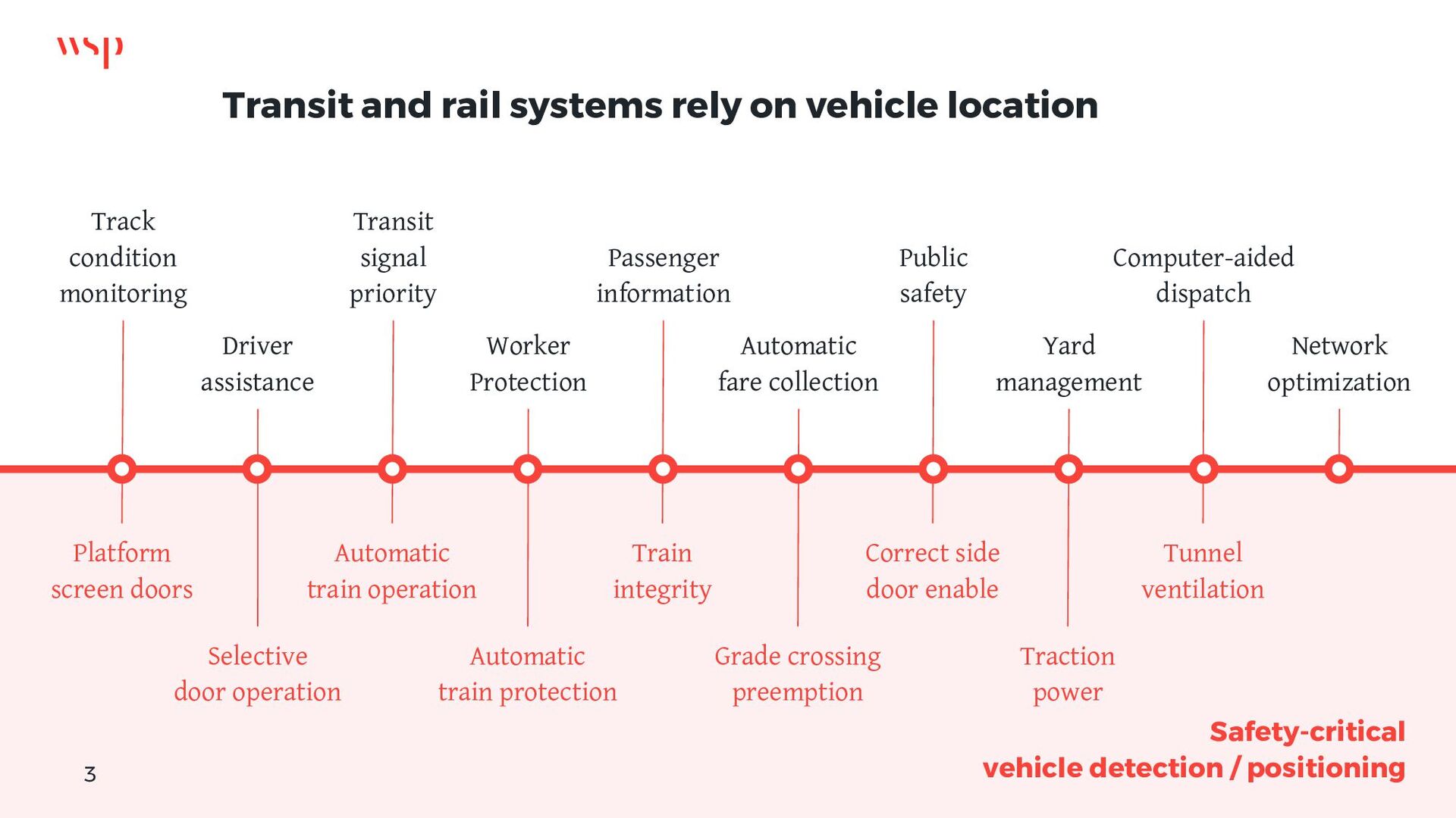
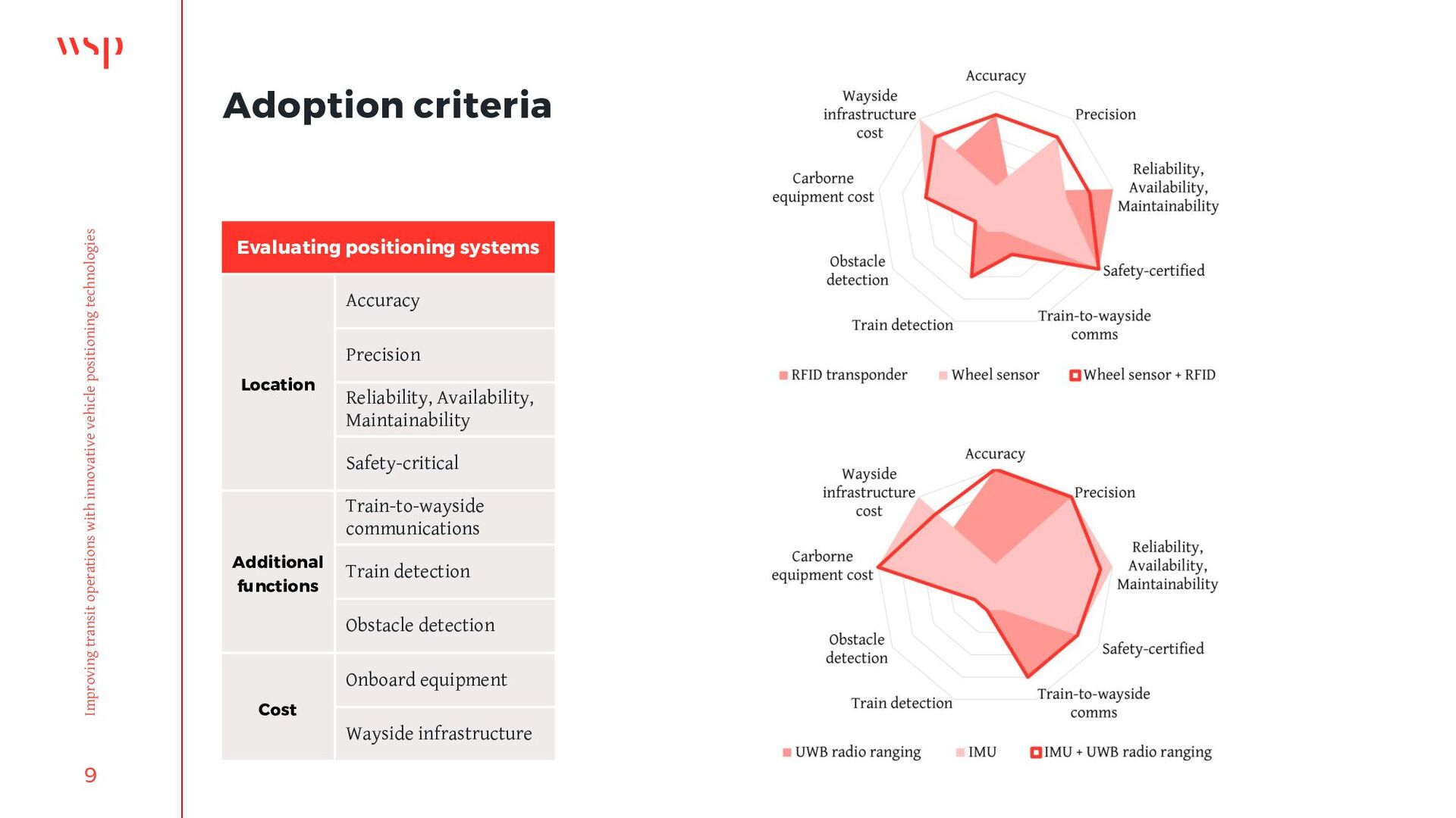
Leveraging new sensors to provide safety-critical vehicle location.
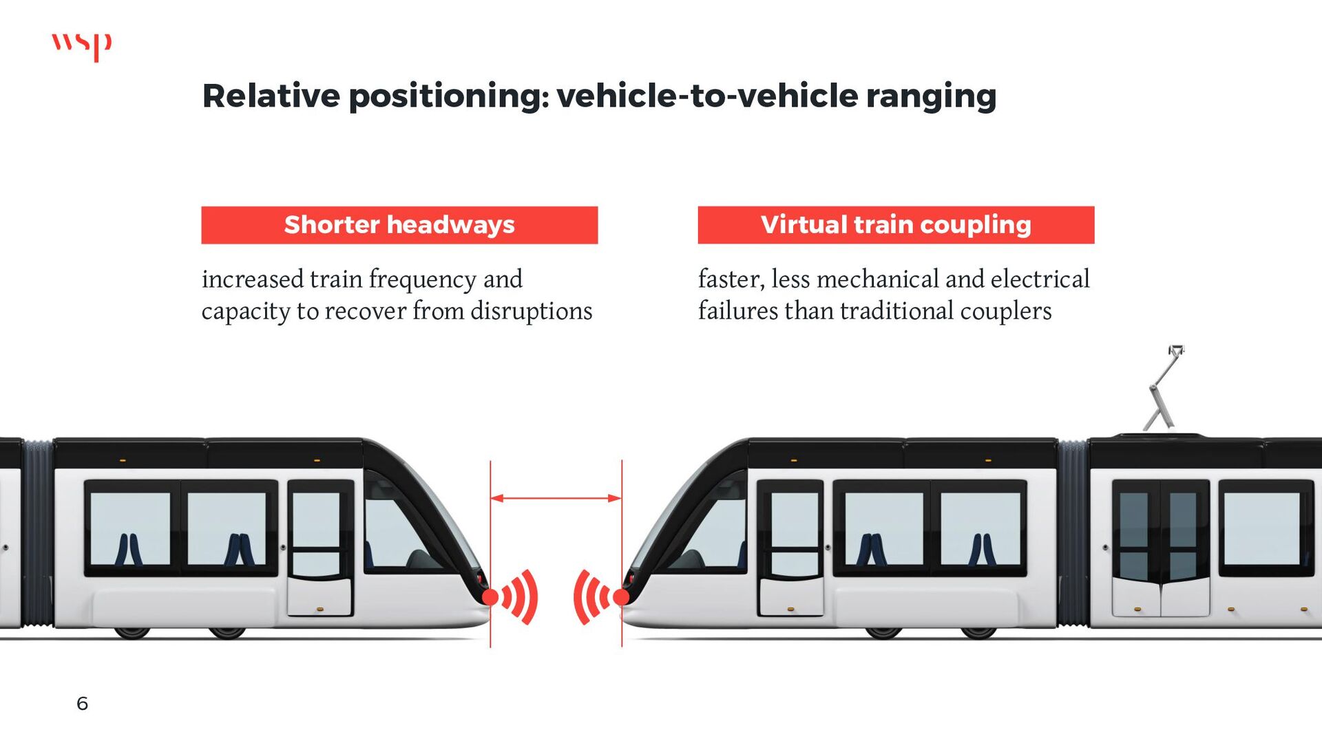
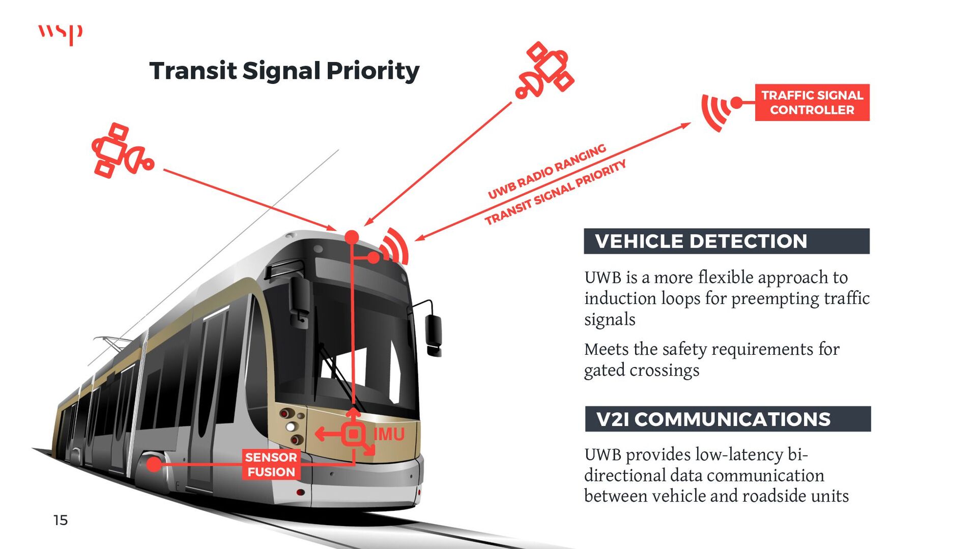
Improving transit signal preemption through ultra-wideband radio ranging.
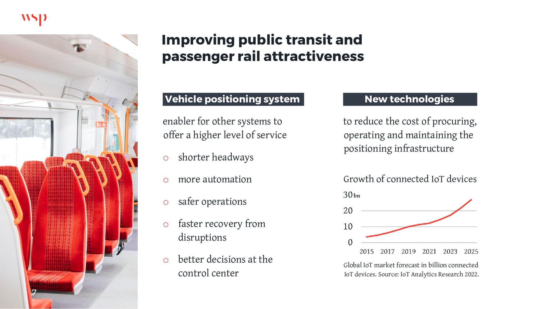
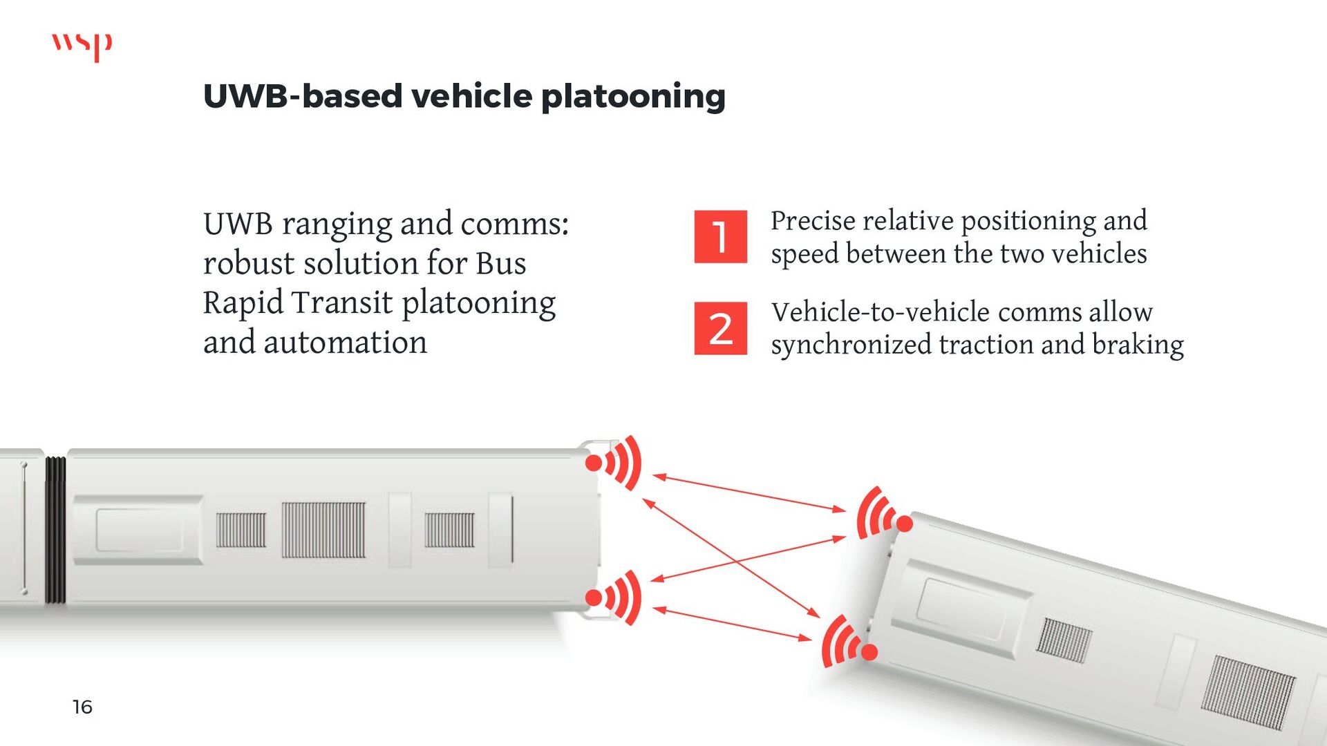
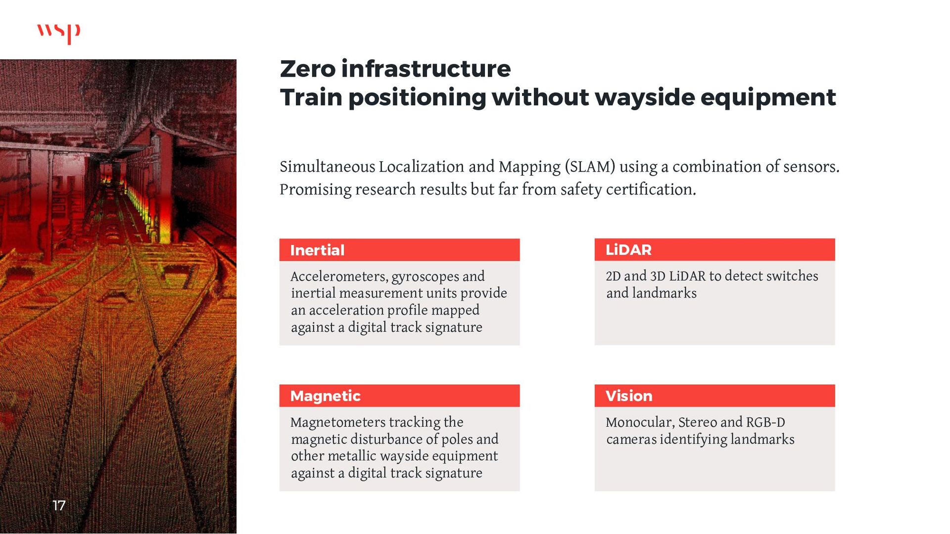
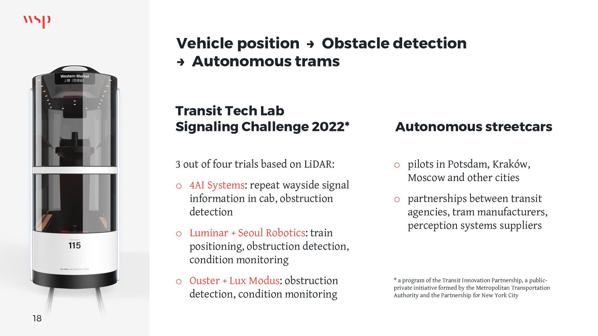
Seizing the opportunity to automate transit operations.

APTAtech 2022, American Public Transportation Association
August 16, 2022 - Denver, Colorado

Joffrey Lauthier

July 24, 2022
Tweet

More Decks by Joffrey Lauthier

Transcript

  1. Improving transit operations with innovative vehicle positioning technologies Agenda Making

    transit more attractive Positioning technology choices Satellite-based augmentation Ultra-wideband radio ranging Zero-infrastructure localization Beyond positioning: obstacle detection 2
  2. Transit and rail systems rely on vehicle location Track condition

    monitoring Driver assistance Transit signal priority Worker Protection Passenger information Automatic fare collection Public safety Yard management Computer-aided dispatch Network optimization Safety-critical vehicle detection / positioning Platform screen doors Selective door operation Automatic train operation Automatic train protection Train integrity Grade crossing preemption Correct side door enable Traction power Tunnel ventilation 3
  3. Precision stops for platform screen doors Accurate position, speed, acceleration

    o faster approach to the station – reduced trip time o improved ability to recover from wheel slides – steeper braking profiles o better stopping accuracy Narrower door openings o lighter doors close faster, reducing headway and dwell time o cheaper to procure, install and maintain 4
  4. Optimizing transit signal priority Requires fail-safe train position, speed, acceleration.

    Driver assistance system indicating the recommended speed. Improving grade crossing activation traffic signal preemption o less travel time variability o better schedule adherence o CAPEX savings from running less trains o OPEX savings from more efficient operations 15% o reduction in travel time 5
  5. Relative positioning: vehicle-to-vehicle ranging Shorter headways increased train frequency and

    capacity to recover from disruptions Virtual train coupling faster, less mechanical and electrical failures than traditional couplers 6
  6. Improving public transit and passenger rail attractiveness Vehicle positioning system

    enabler for other systems to offer a higher level of service o shorter headways o more automation o safer operations o faster recovery from disruptions o better decisions at the control center New technologies to reduce the cost of procuring, operating and maintaining the positioning infrastructure Growth of connected IoT devices Global IoT market forecast in billion connected IoT devices. Source: IoT Analytics Research 2022. bn 7
  7. Localization technologies Vehicle localization subsystem Diversity of sensors to meet

    safety targets Pairing sensors providing continuous relative position with sensors providing absolute location corrections * successfully included in a Safety Integrity Level 4 safety case 8
  8. Adoption criteria Evaluating positioning systems Location Accuracy Precision Reliability, Availability,

    Maintainability Safety-critical Additional functions Train-to-wayside communications Train detection Obstacle detection Cost Onboard equipment Wayside infrastructure Improving transit operations with innovative vehicle positioning technologies 9
  9. Satellite-based train localization Bane NOR – Norway Hybrid odometry to

    replace doppler radars that fail under snow conditions Adding satellite navigation and inertial measurement to train location system Safety-certified, scheduled for revenue operations Network Rail – U.K. Robust Train Positioning System combines data from satellite positioning, inertial sensors, radar and a digital track map to locate the train without the need for lineside equipment Future interface with Train Protection & Warning System 10
  10. Satellite Based Augmentation Systems for railway networks o Augmentation service

    providing safe corrections and integrity data to GNSS receivers o Safe corrections to GPS and Galileo are required for safety-critical use of satellite positioning in train control European Geostationary Navigation Overlay Service (EGNOS) functional architecture. Source: EGNOS User Support, European Satellite Services Provider (ESSP) website. Improving transit operations with innovative vehicle positioning technologies 11 European GNSS Navigation Safety Service for Rail EGNSS-R
  11. "Terrestrial GPS" Ultra-wideband radio ranging New York MTA pioneering the

    replacement of legacy transponders with UWB radio beacons on future CBTC modernization projects. UWB ranging measures a precise distance between the train and beacons installed along the tracks. Trains compute their position by triangulation with lineside beacons. 12
  12. UWB-based positioning system benefits Vehicle underframe Wheel sensor Transponder antenna

    Between tracks Track transponder Underframe equipment: expensive and time- consuming installation and maintenance Track-mounted transponders: impractical for tuning and maintenance Inside cab Inertial Measurement Unit Ultra-wideband radio Wayside Ultra-wideband radio In-cab installation performed in four hours, accelerating fleetwide upgrades Smaller onboard sensors footprint allows for train control equipment installation on maintenance vehicles Future compatibility with autonomous operations 13
  13. UWB beacons augmenting satellite coverage Open sky o Excellent line

    of sight to satellites at any time o Lower-frequency traffic: greater position uncertainty acceptable Urban canyon o Reduced numbers of satellites in view o GPS coverage varies during the day o UWB beacons where augmented coverage is required Tunnel and station o GPS-denied environment o Positioning relies on line of sight to UWB beacons o Initialization at the start of mission requires high position certainty In sight: GPS satellites and UWB beacons GPS UWB 14
  14. Transit Signal Priority IMU SENSOR FUSION TRAFFIC SIGNAL CONTROLLER VEHICLE

    DETECTION 15 V2I COMMUNICATIONS UWB is a more flexible approach to induction loops for preempting traffic signals Meets the safety requirements for gated crossings UWB provides low-latency bi- directional data communication between vehicle and roadside units
  15. UWB-based vehicle platooning UWB ranging and comms: robust solution for

    Bus Rapid Transit platooning and automation Precise relative positioning and speed between the two vehicles Vehicle-to-vehicle comms allow synchronized traction and braking 1 2 16
  16. Zero infrastructure Train positioning without wayside equipment Simultaneous Localization and

    Mapping (SLAM) using a combination of sensors. Promising research results but far from safety certification. Accelerometers, gyroscopes and inertial measurement units provide an acceleration profile mapped against a digital track signature 2D and 3D LiDAR to detect switches and landmarks Magnetometers tracking the magnetic disturbance of poles and other metallic wayside equipment against a digital track signature Monocular, Stereo and RGB-D cameras identifying landmarks Inertial LiDAR Magnetic Vision 17
  17. Vehicle position → Obstacle detection → Autonomous trams Transit Tech

    Lab Signaling Challenge 2022* 3 out of four trials based on LiDAR: o 4AI Systems: repeat wayside signal information in cab, obstruction detection o Luminar + Seoul Robotics: train positioning, obstruction detection, condition monitoring o Ouster + Lux Modus: obstruction detection, condition monitoring * a program of the Transit Innovation Partnership, a public- private initiative formed by the Metropolitan Transportation Authority and the Partnership for New York City Autonomous streetcars o pilots in Potsdam, Kraków, Moscow and other cities o partnerships between transit agencies, tram manufacturers, perception systems suppliers 18