Upgrade to Pro
— share decks privately, control downloads, hide ads and more …
Speaker Deck
Sign up for free
Menu
Search
Features
All features
Private URLs
Password Protection
Custom URLS
Scheduled publishing
Remove Branding
Restrict embedding
Deck Collections
Notes
Features
All features
Private URLs
Password Protection
Custom URLS
Scheduled publishing
Remove Branding
Restrict embedding
Deck Collections
Notes
Explore
Featured decks
Featured speakers
Programming
Technology
Storyboards
Explore
Featured decks
Featured speakers
Programming
Technology
Storyboards
Pricing
Search
Sign in
Sign up for free
Geospatial applications on Rails
Search
Sergey Nartimov
June 01, 2013
Programming
450
8
Share
Embed
Copy iframe code
Copy JS code
Copy link
Start on current slide
Geospatial applications on Rails
Sergey Nartimov
June 01, 2013
More Decks by Sergey Nartimov
See All by Sergey Nartimov
PubSub at Rails
lest
0
150
Rails in production - RubyConfBY 22 Mar 2015
lest
1
170
Sequel - BRUG 21 Feb 2015
lest
0
110
Elixir – Belarus Ruby User Group 25 Jan 2014
lest
3
680
Authentication Security – RUBYSPB
lest
2
210
Design patterns – Belarus Ruby on Rails User Group 23 Feb 2013
lest
8
680
Ruby Stdlib – Minsk.rb October 2012
lest
10
430
Background jobs with realtime results – RailsClub'Moscow 2012
lest
5
240
Other Decks in Programming
See All in Programming
Augmenting AI with the Power of Jakarta EE
ivargrimstad
0
190
コーディング自動化の次へ。人の介入をゼロにするファクトリーとサポートAIによる実践
timakin
5
3.6k
Optunaを作ったときにやりたかったこと、その後 (2026/10/16, Optuna Meetup #3)
iwiwi
1
430
FactoryBotをやめればRSpecは速くなるのか?
yuta_onishi_97
0
410
contenteditable と日本語入力に向き合う
colorful12
0
200
JAWS-UG 東京支部が始める、JAWS-UG支部コラボ / JAWS-UG lunchtime LT Collaboration
y0hgi
0
280
AIに “答え“を書かせるのを やめてみた
___akari11
0
120
ジョジョの世界をXRで再現する
mofurune
0
160
R8 の設定見直しでアプリサイズ削減
andpad
0
220
When benchmarks go bad - what I learned from measuring performance wrong
hollycummins
0
220
[2026-09-26]空論ジェネリックプロセス~テスト資産とAIで紡ぐ、再現可能なパフォーマンスチューニングの話~
tosite
0
270
Kotlinの15年とServer-Side Kotlin
n_takehata
1
150
Featured
See All Featured
ピンチをチャンスに:未来をつくるプロダクトロードマップ #pmconf2020
aki_iinuma
128
56k
Primal Persuasion: How to Engage the Brain for Learning That Lasts
tmiket
0
500
Navigating the Design Leadership Dip - Product Design Week Design Leaders+ Conference 2024
apolaine
2
480
Unsuck your backbone
ammeep
672
58k
エンジニアに許された特別な時間の終わり
watany
109
250k
Designing Experiences People Love
moore
143
24k
Building Adaptive Systems
keathley
44
3.2k
How People are Using Generative and Agentic AI to Supercharge Their Products, Projects, Services and Value Streams Today
helenjbeal
2
360
Exploring the Power of Turbo Streams & Action Cable | RailsConf2023
kevinliebholz
37
6.6k
How to build a perfect <img>
jonoalderson
1
6.1k
Exploring anti-patterns in Rails
aemeredith
4
540
Fight the Zombie Pattern Library - RWD Summit 2016
marcelosomers
234
18k
Transcript
Geospatial applications on Rails Sergey Nartimov Brainspec https://github.com/lest twitter: @just_lest
About • Rails, Rubinius, Elixir contributor • Software engineer at
Brainspec Sergey Nartimov Brainspec https://github.com/lest twitter: @just_lest
Geospatial data
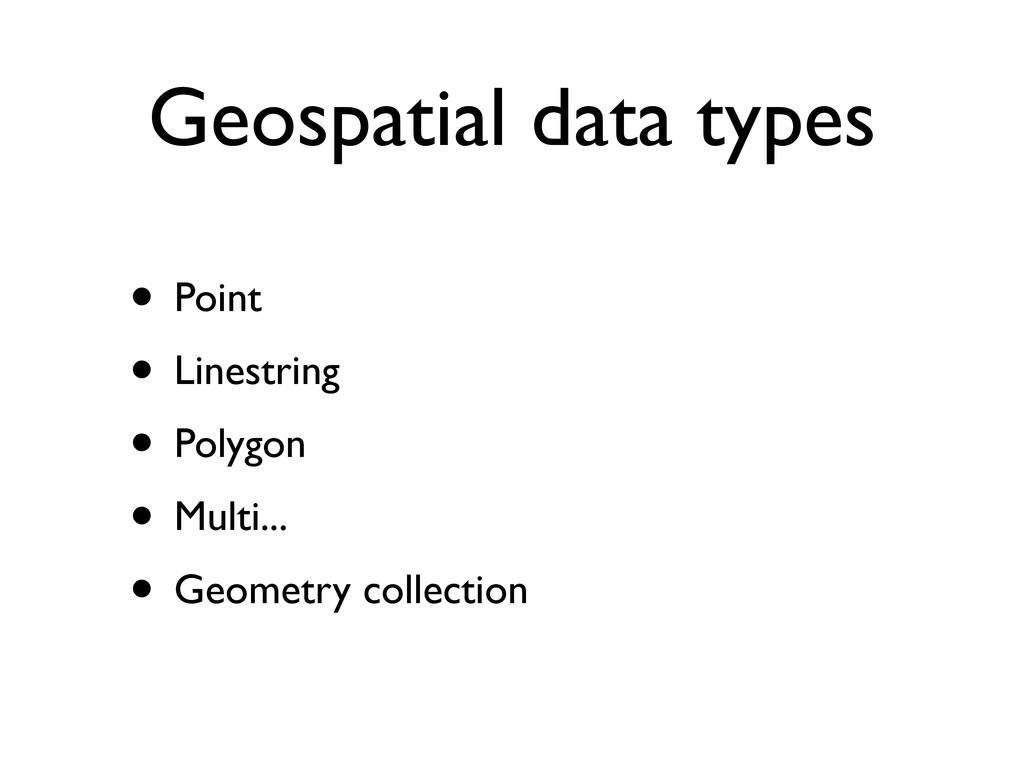
Geospatial data types • Point • Linestring • Polygon •
Multi... • Geometry collection
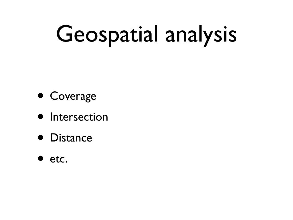
Geospatial analysis • Coverage • Intersection • Distance • etc.
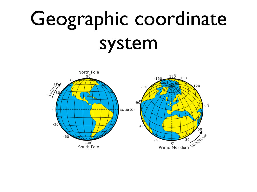
Geographic coordinate system
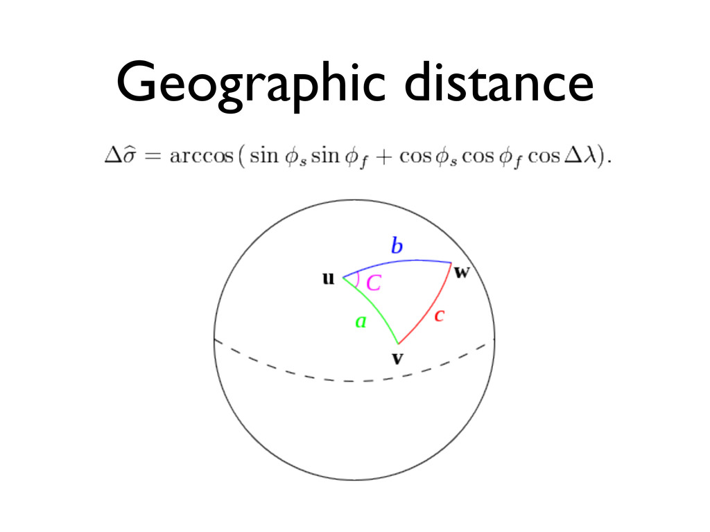
Geographic distance
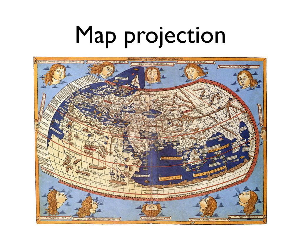
Map projection
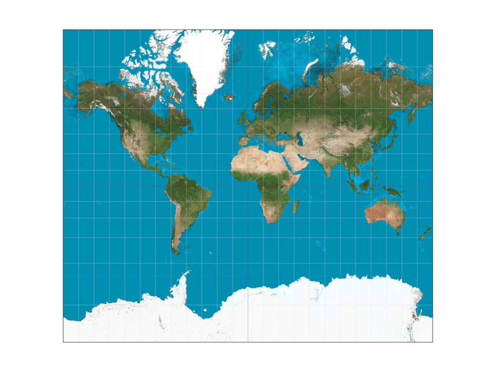
Mercator projection
None
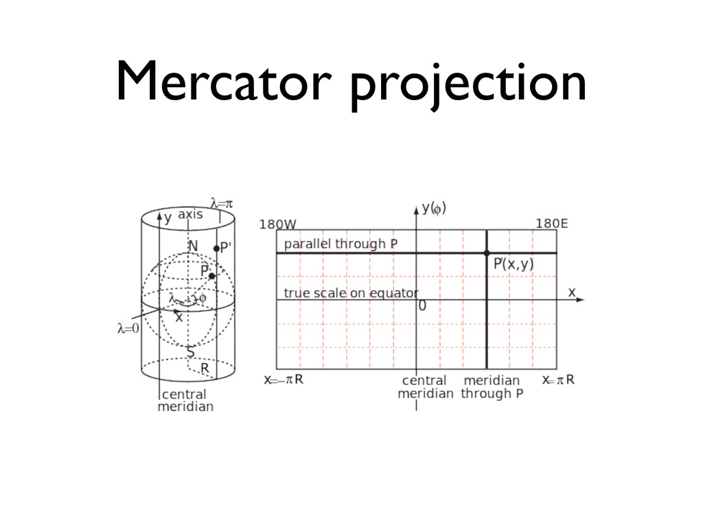
Mercator projection
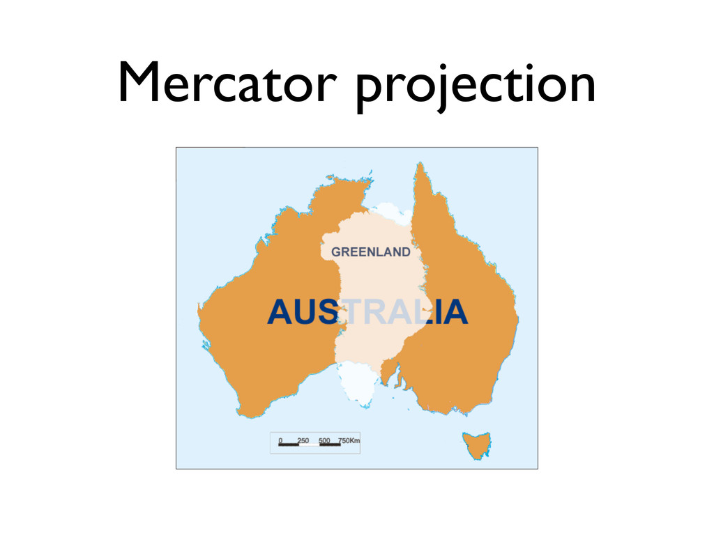
Mercator projection
Geospatial support
Geospatial support • MySQL • http://dev.mysql.com/doc/refman/5.5/en/ spatial-extensions.html
Geospatial support • MongoDB • http://www.mongodb.org/display/DOCS/ Geospatial+Indexing
Geospatial support • SpatiaLite • http://www.gaia-gis.it/gaia-sins/splite- doxy-4.0.0/index.html
Geospatial support • PostGIS • http://postgis.org/docs/
Rails & PostGIS
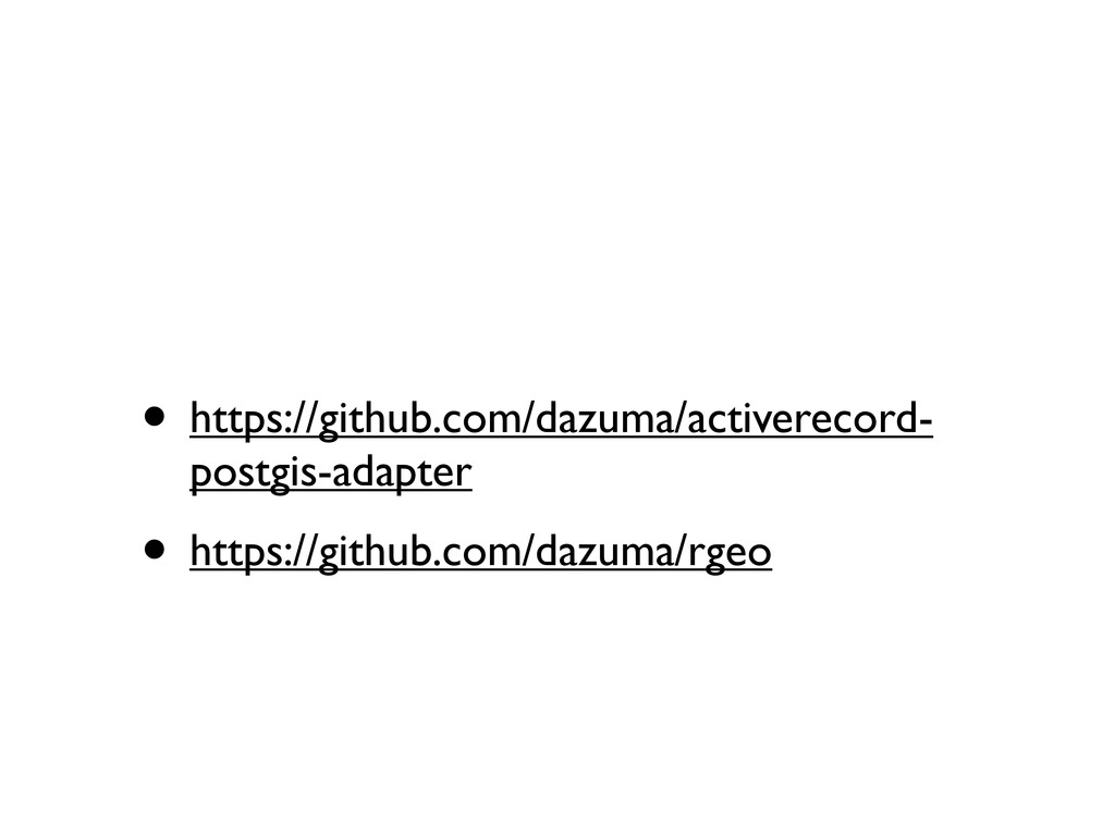
• https://github.com/dazuma/activerecord- postgis-adapter • https://github.com/dazuma/rgeo
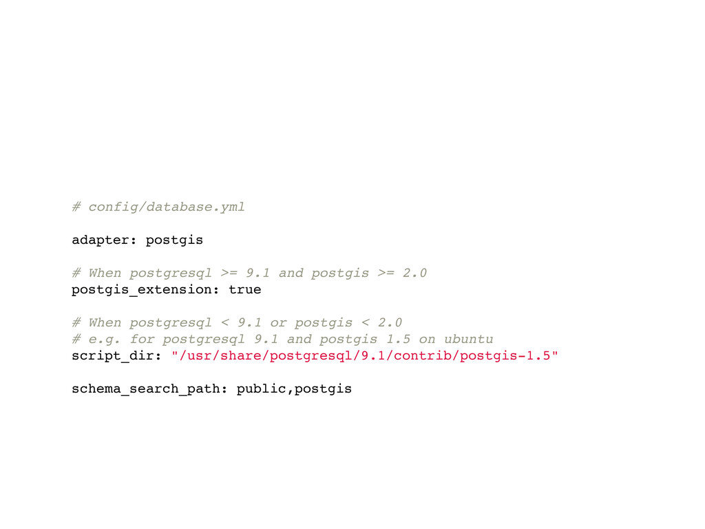
# config/database.yml adapter: postgis # When postgresql >= 9.1 and
postgis >= 2.0 postgis_extension: true # When postgresql < 9.1 or postgis < 2.0 # e.g. for postgresql 9.1 and postgis 1.5 on ubuntu script_dir: "/usr/share/postgresql/9.1/contrib/postgis-1.5" schema_search_path: public,postgis
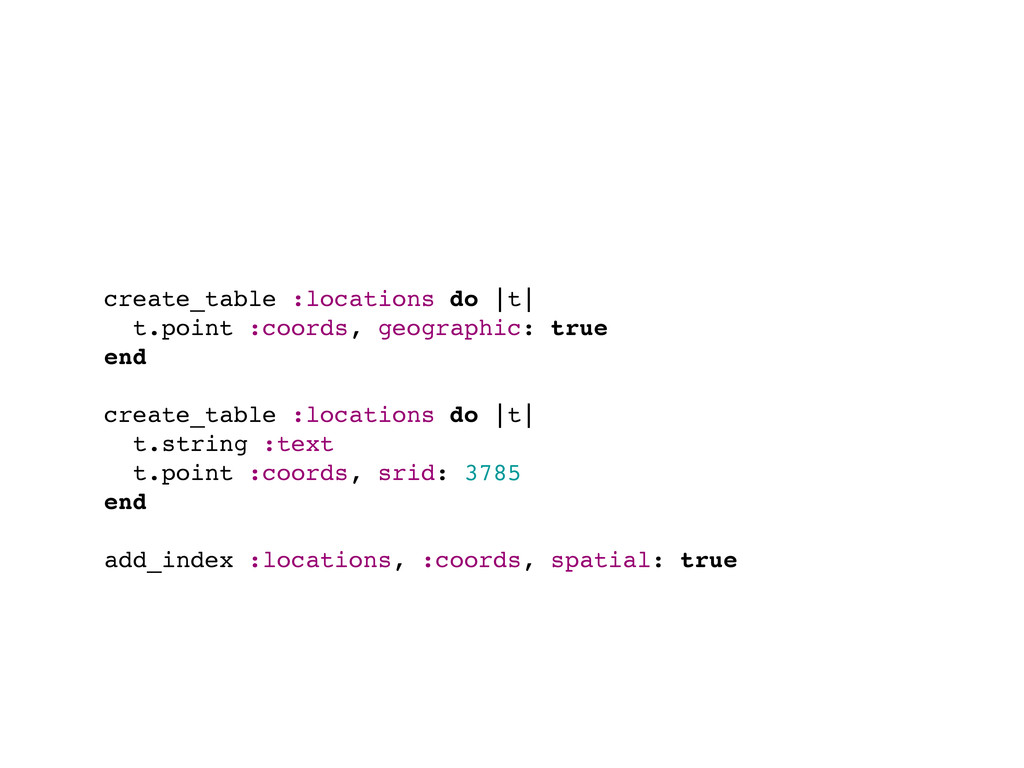
create_table :locations do |t| t.point :coords, geographic: true end create_table
:locations do |t| t.string :text t.point :coords, srid: 3785 end add_index :locations, :coords, spatial: true
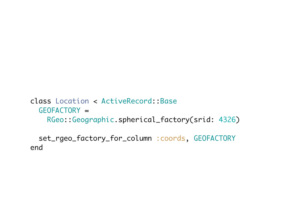
class Location < ActiveRecord::Base GEOFACTORY = RGeo::Geographic.spherical_factory(srid: 4326) set_rgeo_factory_for_column :coords,
GEOFACTORY end
Points in radius
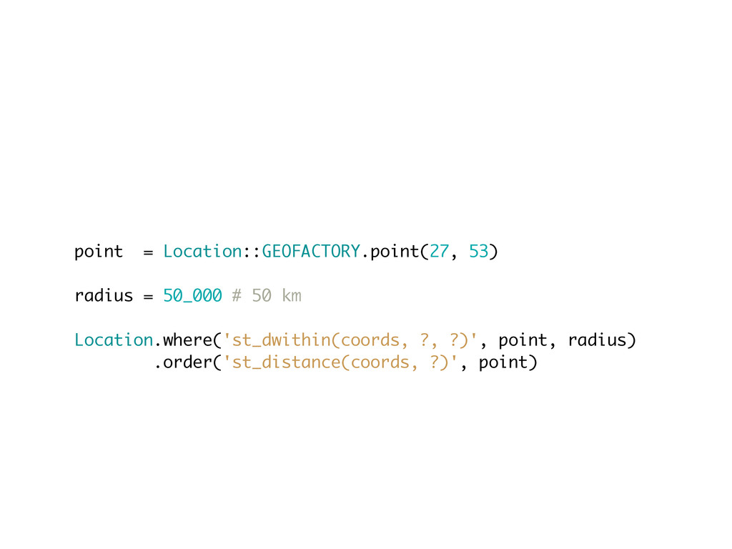
point = Location::GEOFACTORY.point(27, 53) radius = 50_000 # 50 km
Location.where('st_dwithin(coords, ?, ?)', point, radius) .order('st_distance(coords, ?)', point)
Squeel • https://github.com/ernie/squeel
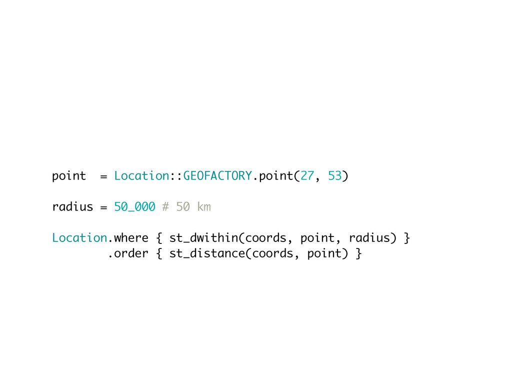
point = Location::GEOFACTORY.point(27, 53) radius = 50_000 # 50 km
Location.where { st_dwithin(coords, point, radius) } .order { st_distance(coords, point) }
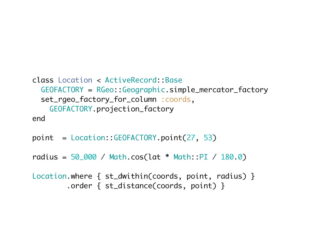
class Location < ActiveRecord::Base GEOFACTORY = RGeo::Geographic.simple_mercator_factory set_rgeo_factory_for_column :coords, GEOFACTORY.projection_factory
end point = Location::GEOFACTORY.point(27, 53) radius = 50_000 / Math.cos(lat * Math::PI / 180.0) Location.where { st_dwithin(coords, point, radius) } .order { st_distance(coords, point) }
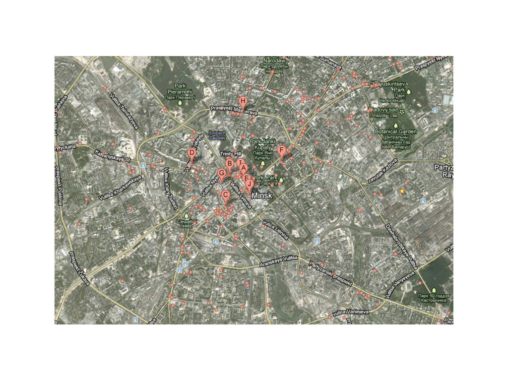
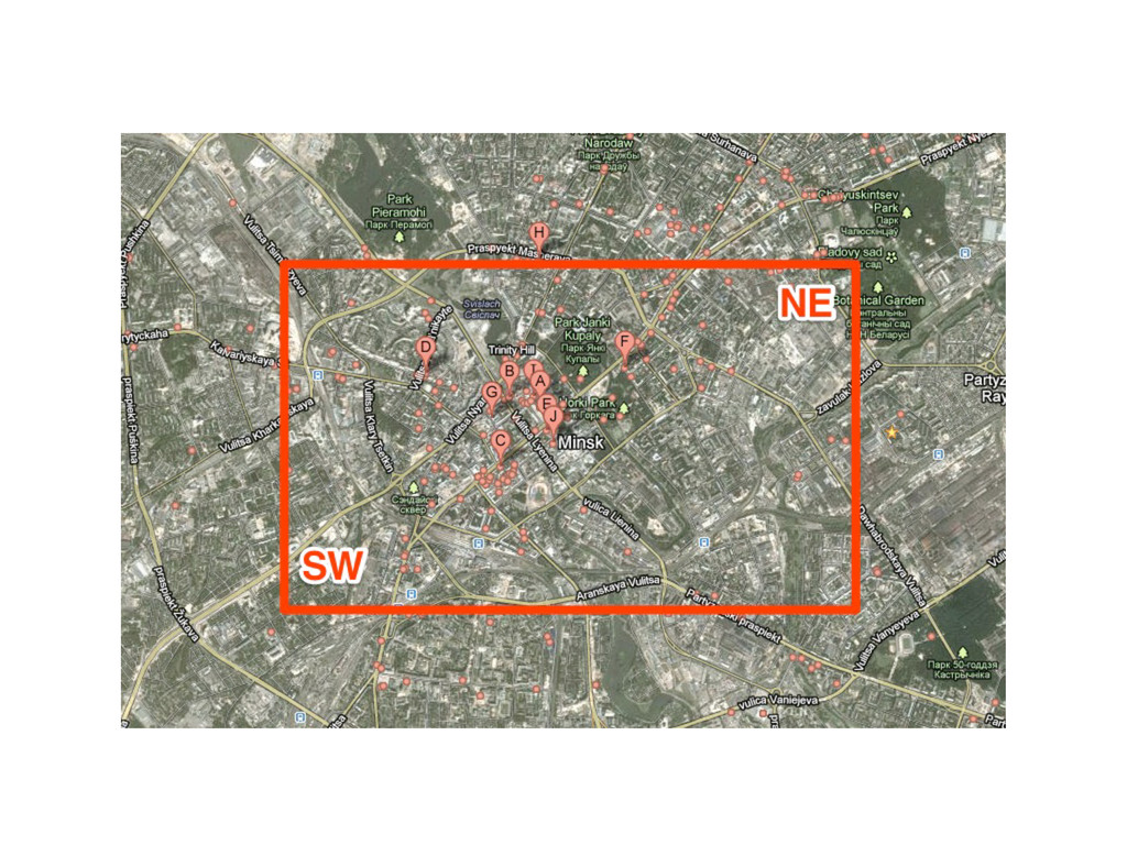
Points in bounding box
None
None
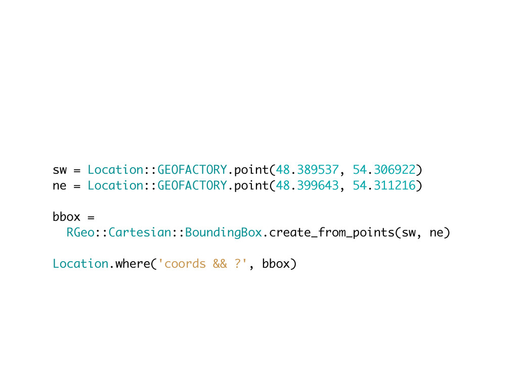
sw = Location::GEOFACTORY.point(48.389537, 54.306922) ne = Location::GEOFACTORY.point(48.399643, 54.311216) bbox =
RGeo::Cartesian::BoundingBox.create_from_points(sw, ne) Location.where('coords && ?', bbox)
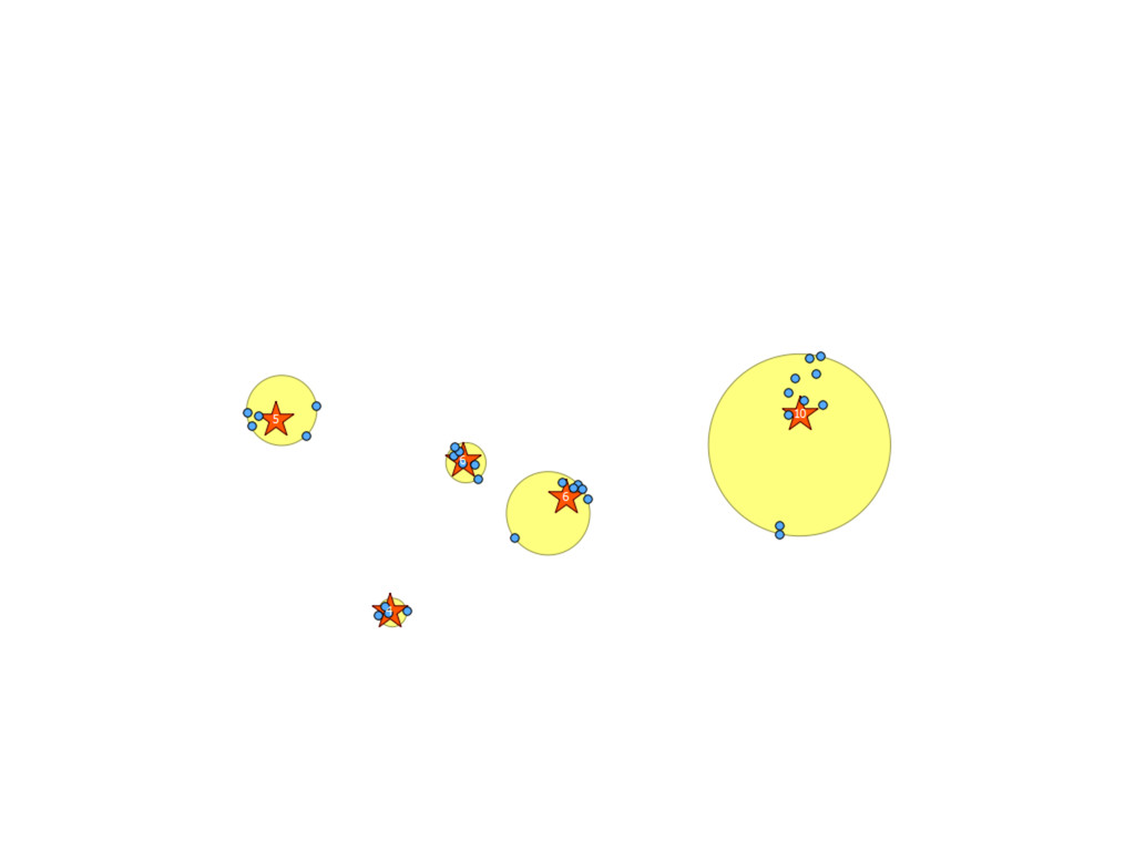
Clustering • http://pgxn.org/dist/kmeans/ • http://postgis.refractions.net/docs/ ST_SnapToGrid.html
None
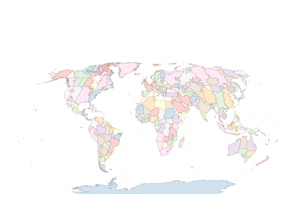
Time zones example
• http://efele.net/maps/tz/world/
None
• https://github.com/dazuma/rgeo-shapefile
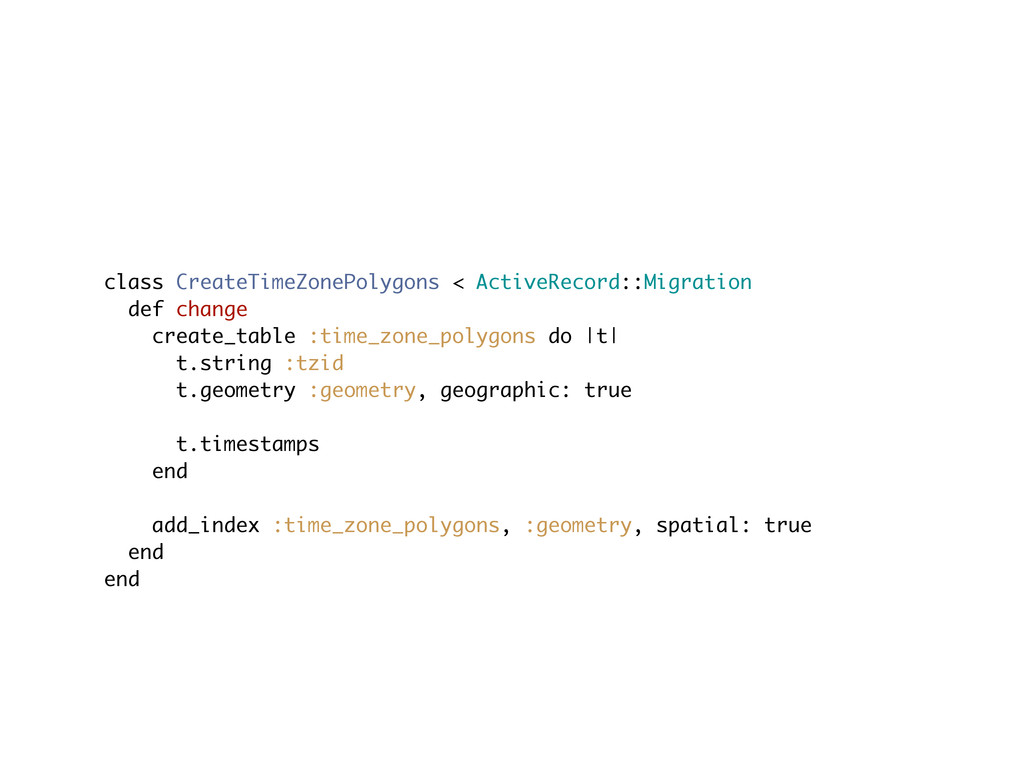
class CreateTimeZonePolygons < ActiveRecord::Migration def change create_table :time_zone_polygons do |t|
t.string :tzid t.geometry :geometry, geographic: true t.timestamps end add_index :time_zone_polygons, :geometry, spatial: true end end
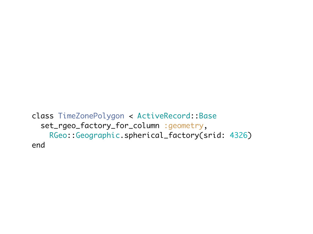
class TimeZonePolygon < ActiveRecord::Base set_rgeo_factory_for_column :geometry, RGeo::Geographic.spherical_factory(srid: 4326) end
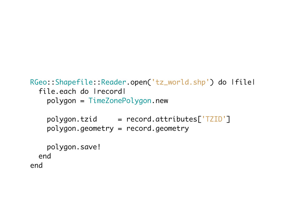
RGeo::Shapefile::Reader.open('tz_world.shp') do |file| file.each do |record| polygon = TimeZonePolygon.new polygon.tzid
= record.attributes['TZID'] polygon.geometry = record.geometry polygon.save! end end
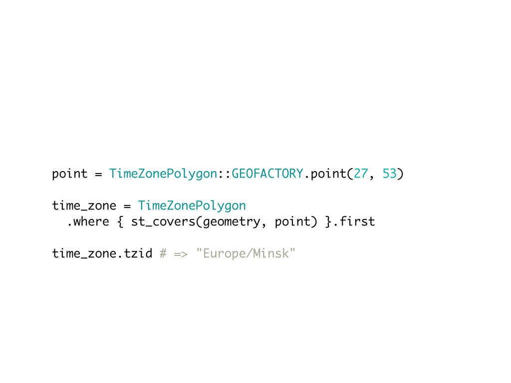
point = TimeZonePolygon::GEOFACTORY.point(27, 53) time_zone = TimeZonePolygon .where { st_covers(geometry,
point) }.first time_zone.tzid # => "Europe/Minsk"
• Further improvements
Thanks <3 Sergey Nartimov Brainspec https://github.com/lest twitter: @just_lest


 lest
lest
 ivargrimstad
 timakin
 iwiwi
iwiwi
 yuta_onishi_97
 colorful12
 y0hgi
y0hgi
 ___akari11
 mofurune
 andpad
 hollycummins
 tosite
 n_takehata
 aki_iinuma
 tmiket
 apolaine
 ammeep
 watany
 moore
moore
 keathley
.png) helenjbeal
helenjbeal
 kevinliebholz
 jonoalderson
 aemeredith
 marcelosomers