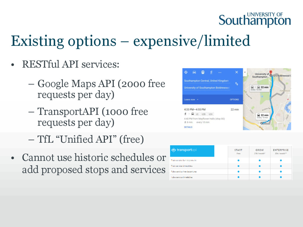
Maps API (2000 free requests per day) – TransportAPI (1000 free requests per day) – TfL “Unified API” (free) • Cannot use historic schedules or add proposed stops and services
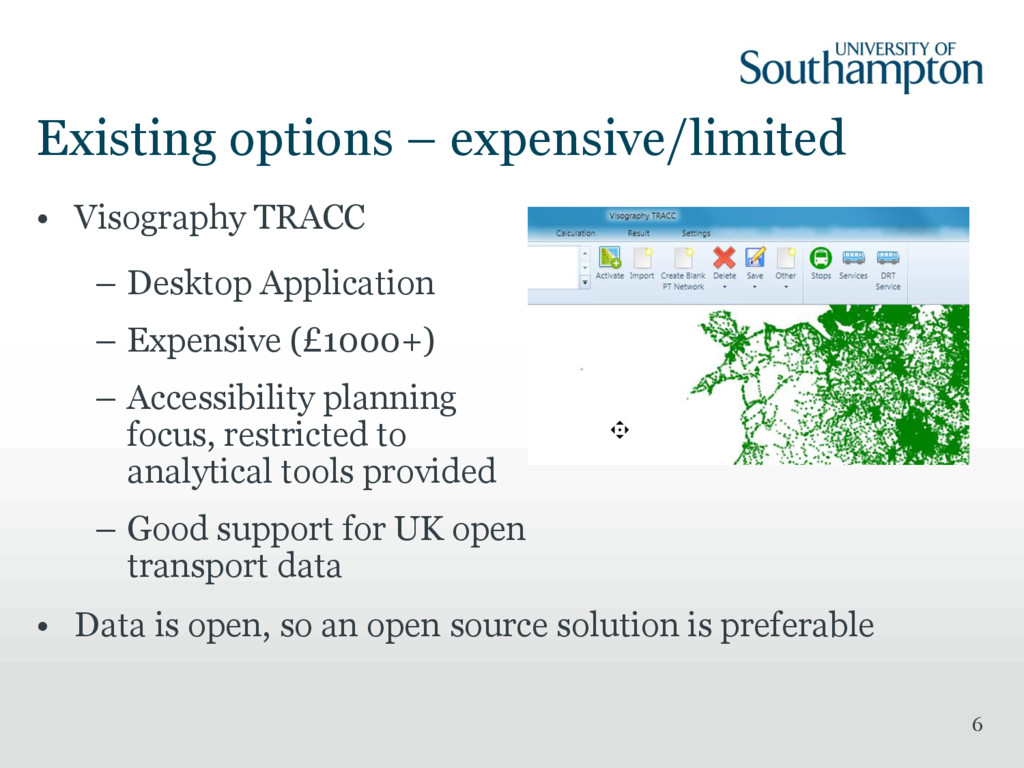
Application – Expensive (£1000+) – Accessibility planning focus, restricted to analytical tools provided – Good support for UK open transport data • Data is open, so an open source solution is preferable
JAVA • Web front-end, sophisticated routing API • Data requirements: – OpenStreetMap (OSM) - PBF or XML – GTFS feeds (multiple) – Digital elevation model (optional)
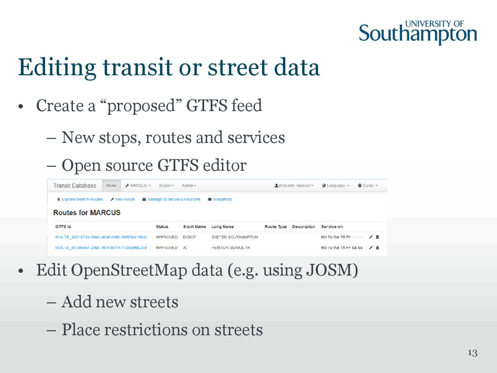
GTFS feed – New stops, routes and services – Open source GTFS editor • Edit OpenStreetMap data (e.g. using JOSM) – Add new streets – Place restrictions on streets
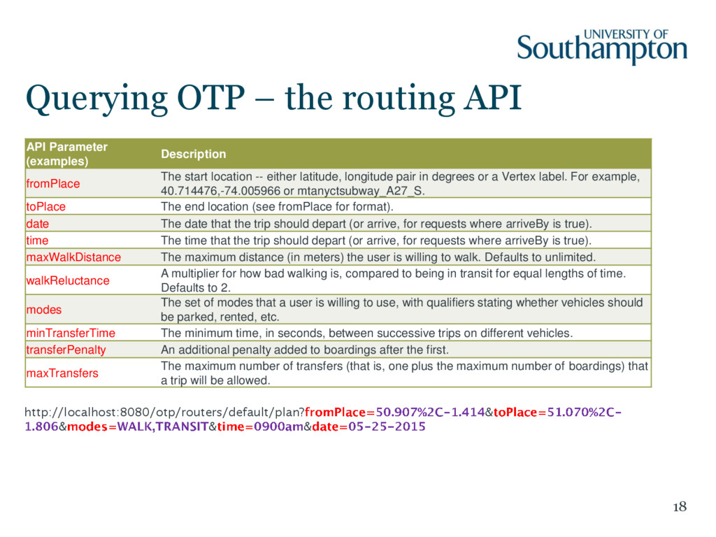
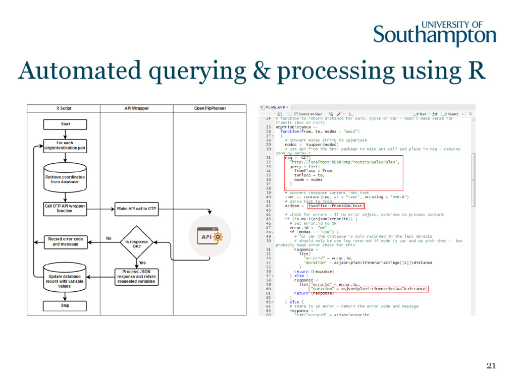
Description fromPlace The start location -- either latitude, longitude pair in degrees or a Vertex label. For example, 40.714476,-74.005966 or mtanyctsubway_A27_S. toPlace The end location (see fromPlace for format). date The date that the trip should depart (or arrive, for requests where arriveBy is true). time The time that the trip should depart (or arrive, for requests where arriveBy is true). maxWalkDistance The maximum distance (in meters) the user is willing to walk. Defaults to unlimited. walkReluctance A multiplier for how bad walking is, compared to being in transit for equal lengths of time. Defaults to 2. modes The set of modes that a user is willing to use, with qualifiers stating whether vehicles should be parked, rented, etc. minTransferTime The minimum time, in seconds, between successive trips on different vehicles. transferPenalty An additional penalty added to boardings after the first. maxTransfers The maximum number of transfers (that is, one plus the maximum number of boardings) that a trip will be allowed. http://localhost:8080/otp/routers/default/plan? & & & &
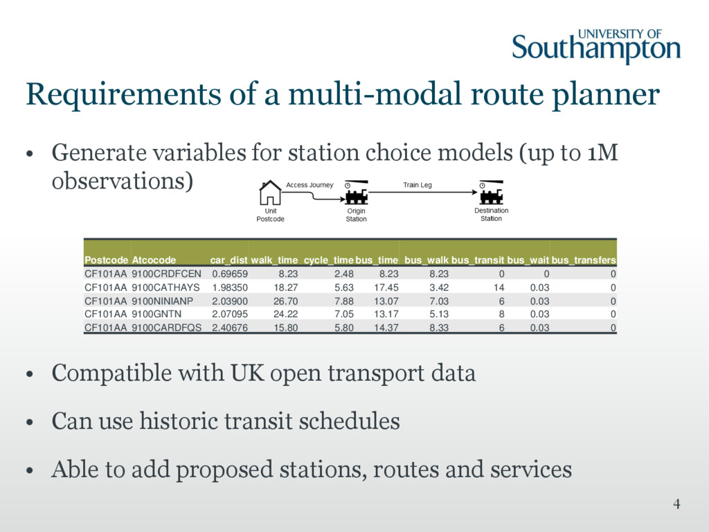
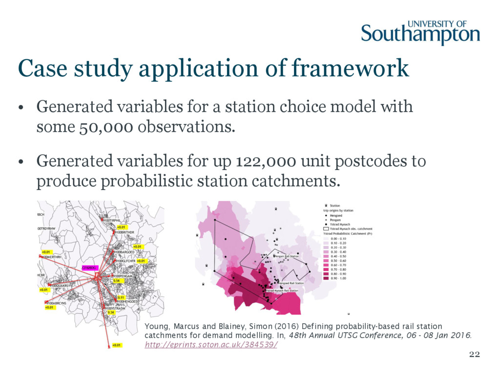
a station choice model with some 50,000 observations. • Generated variables for up 122,000 unit postcodes to produce probabilistic station catchments. Young, Marcus and Blainey, Simon (2016) Defining probability-based rail station catchments for demand modelling. In, 48th Annual UTSG Conference, 06 - 08 Jan 2016. http://eprints.soton.ac.uk/384539/
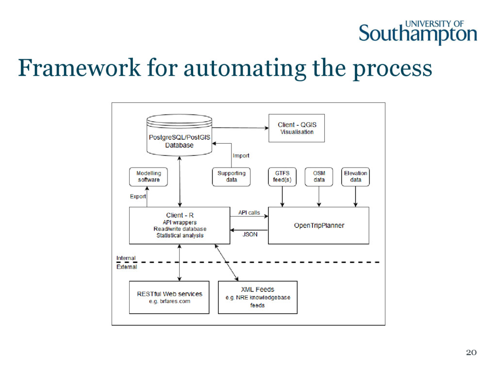
planner for GB and a framework to automate querying, processing and storage - using open source tools and open data • Main limitation: – Using TRACC to convert Traveline/TfL data to GTFS • Future plans: – Larger survey datasets – generating variables for up to 1M observations. – Contribute an OTP API wrapper R Package