Upgrade to Pro — share decks privately, control downloads, hide ads and more …

PntTrax @ WAURISA 2013

PntTrax @ WAURISA 2013

A GeoDjango project designed to store field collected data for the Seattle-based Environmental Engineering firm, RIDOLFI Inc.

Presented at the 2013 WAURISA conference.

Matthew Kenny

May 07, 2013
Tweet

More Decks by Matthew Kenny

Other Decks in Programming

Transcript

  1. PntTrax:  An  Open-­‐Source  Field   Data  Management  Tool   Ma;

     Kenny,  RIDOLFI  Inc.   May  7th,  2013  
  2. The  Problem   •  Where  is  it  on  our  file

     system?   – AcKve  Projects?   – InacKve  Projects?   •  Lack  of  insKtuKonal  knowledge.   – Data  oXen  pre-­‐date  my  Kme  at  RIDOLFI   7  
  3. The  Problem   •  Loss  of  efficiency.   •  Ge]ng

     the  data  to  the  client  requires  more   effort  from  both  the  project  manager,  and  the   GIS  staff.   10  
  4. The  Goal   •  Empower  data  users  (PMs  and  Clients)

     to   directly  access  the  data  they  need.   •  Remove  myself  from  the  data  fulfillment  of   the  data  request.   •  Focus  on  cleaning  and  maintaining  high-­‐ quality  data.   11  
  5. A  Simple  Design   12   Users   (Logins)  

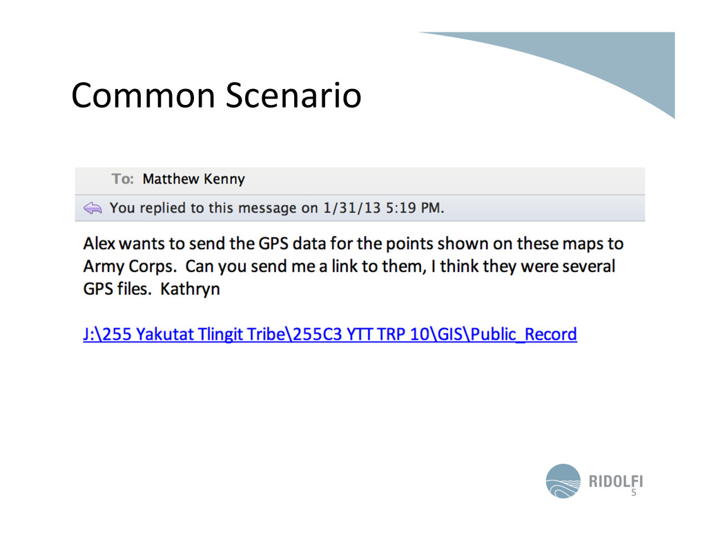
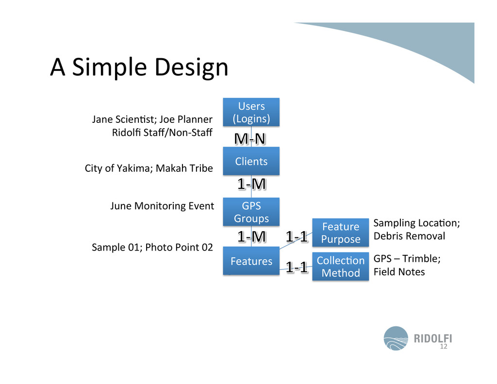
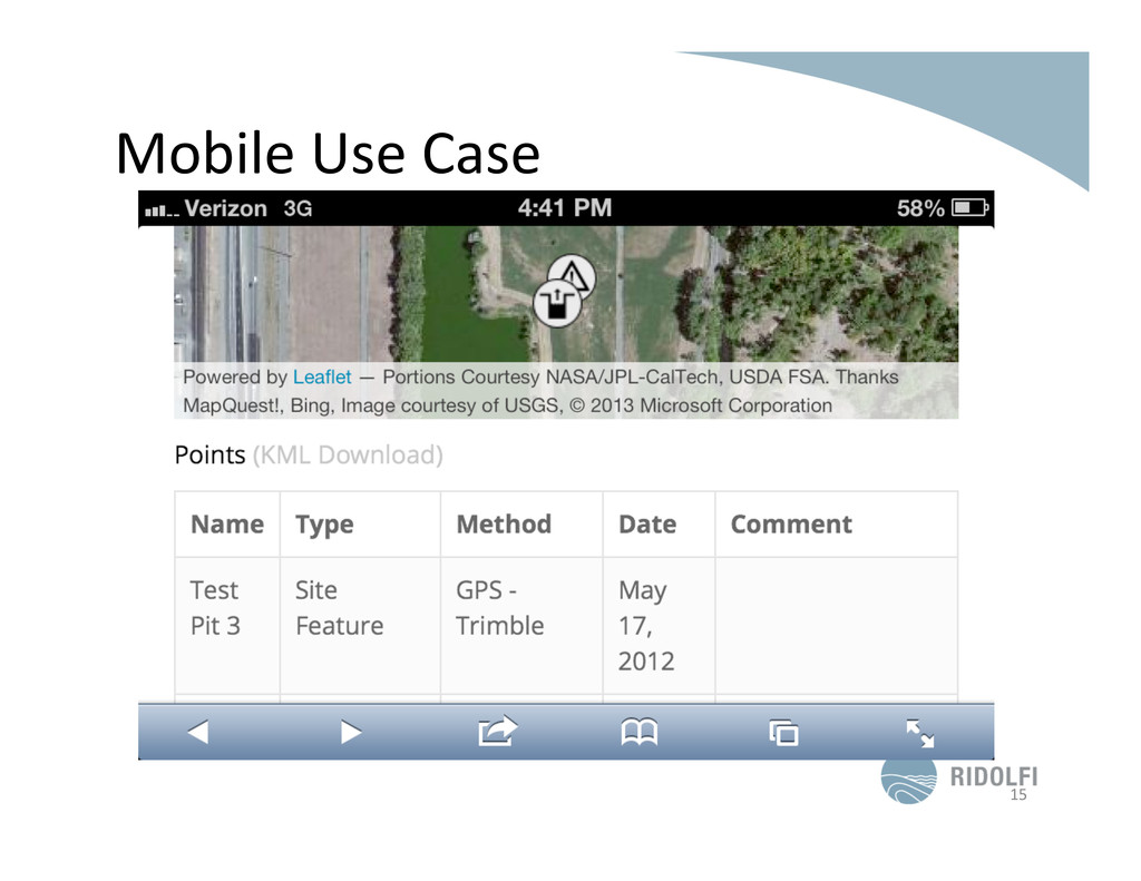
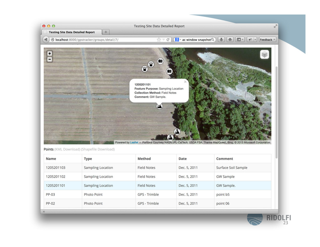
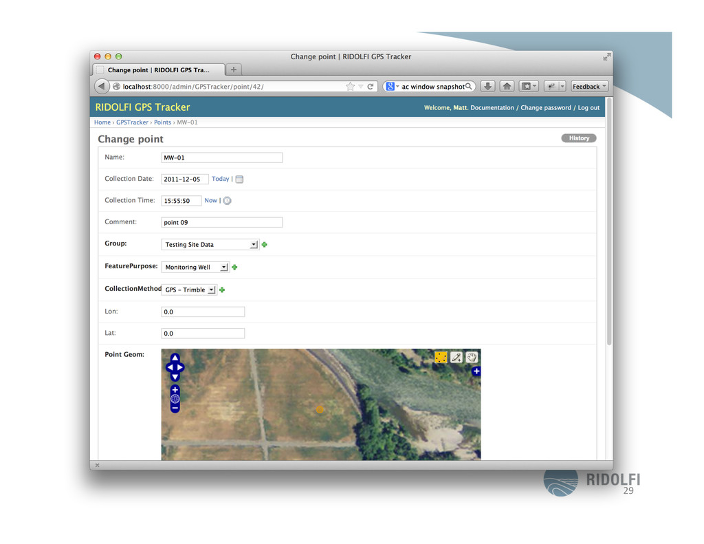
    Clients   GPS   Groups   Features   CollecKon   Method   Feature   Purpose   Jane  ScienKst;  Joe  Planner   Ridolfi  Staff/Non-­‐Staff   City  of  Yakima;  Makah  Tribe   June  Monitoring  Event   Sample  01;  Photo  Point  02   GPS  –  Trimble;   Field  Notes   Sampling  LocaKon;   Debris  Removal  
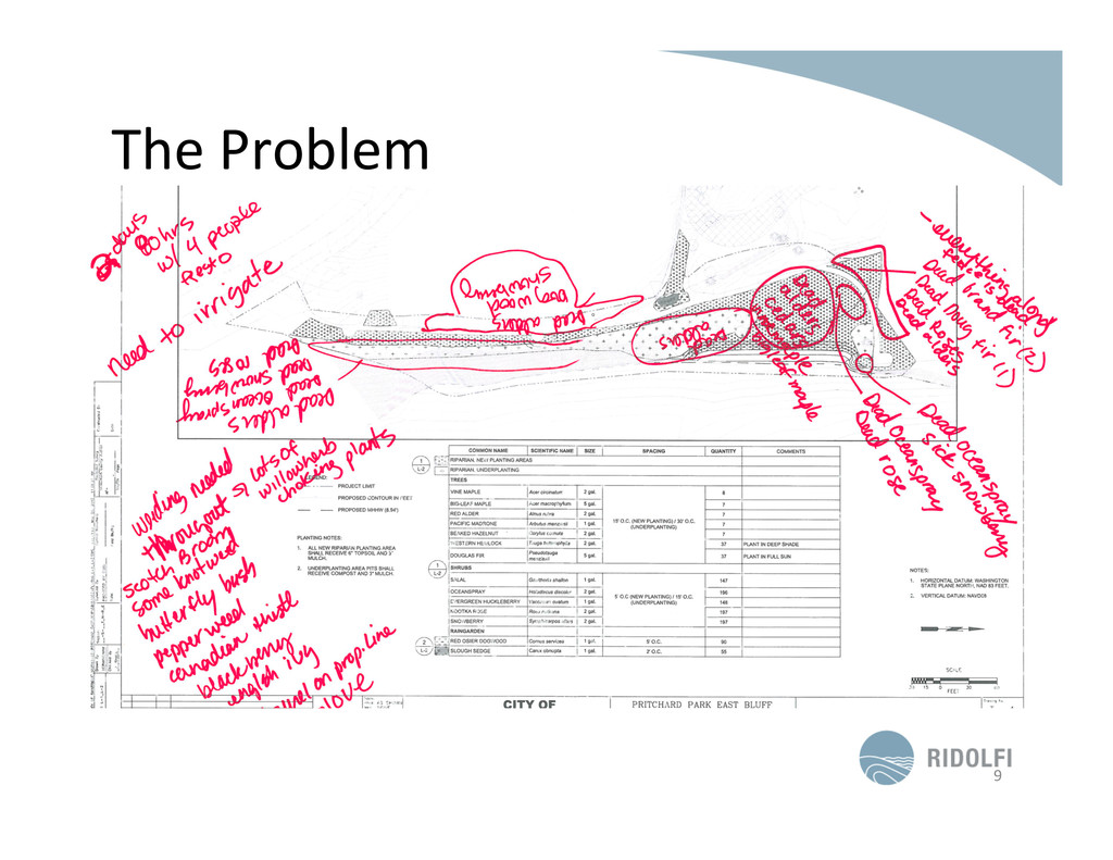
  6. In  Conclusion   •  See  a  simple  (or  complex),  repe$$ve

     task?   Automate  it.   •  Try  Open  Source  Tools.  They’re  free.   •  Python  is  powerful.  Use  it  to  write  both   simple  scripts  and  complex  applica$ons.   17  
  7. Thanks   •  Have  Ideas?  Contribute!   •  Source  Code:

      h;p://github.com/ma;makesmaps/PntTrax   •  E-­‐mail:  ma;@ridolfi.com   •  Twi;er:  @ma;makesmaps   18