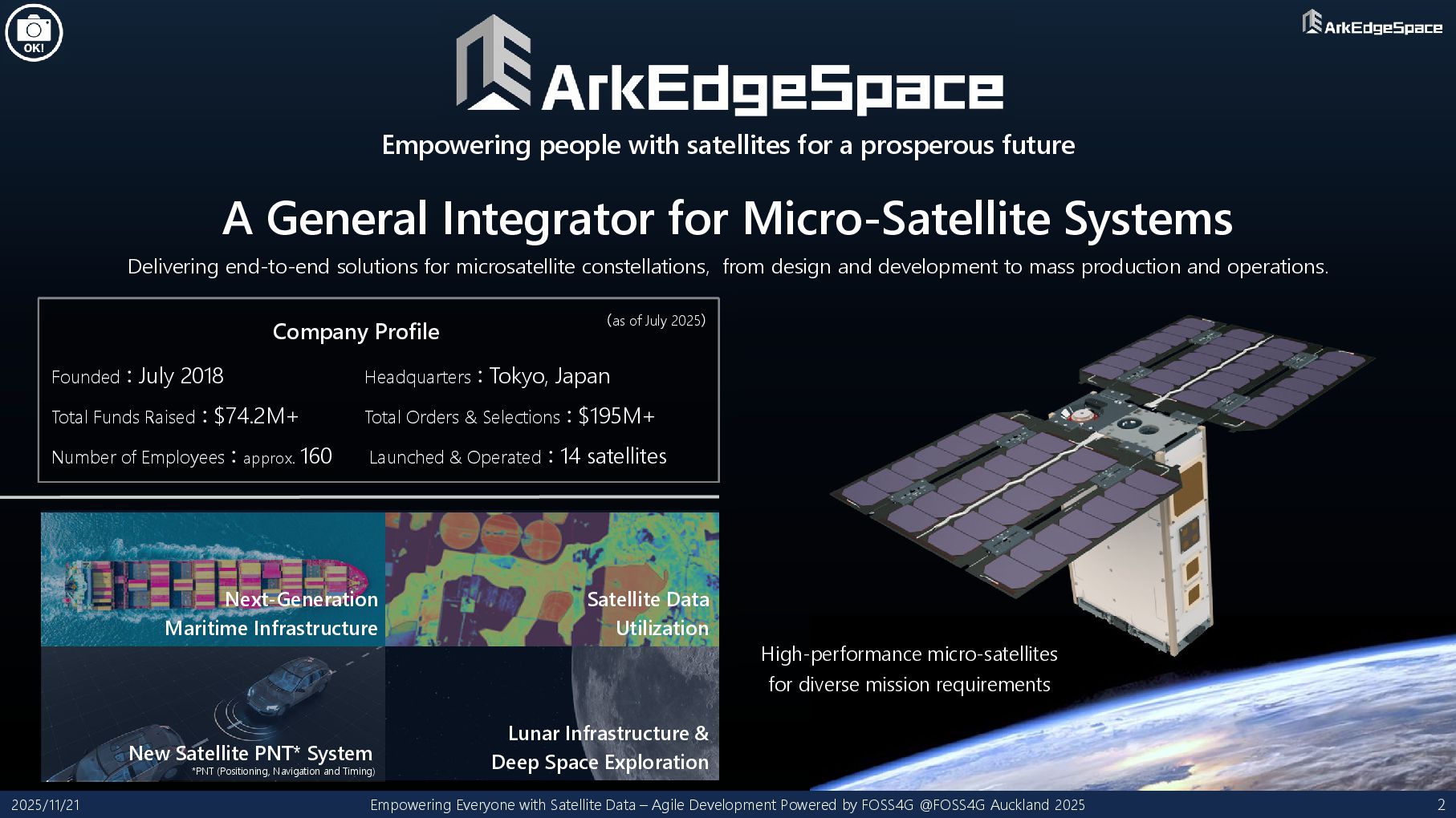
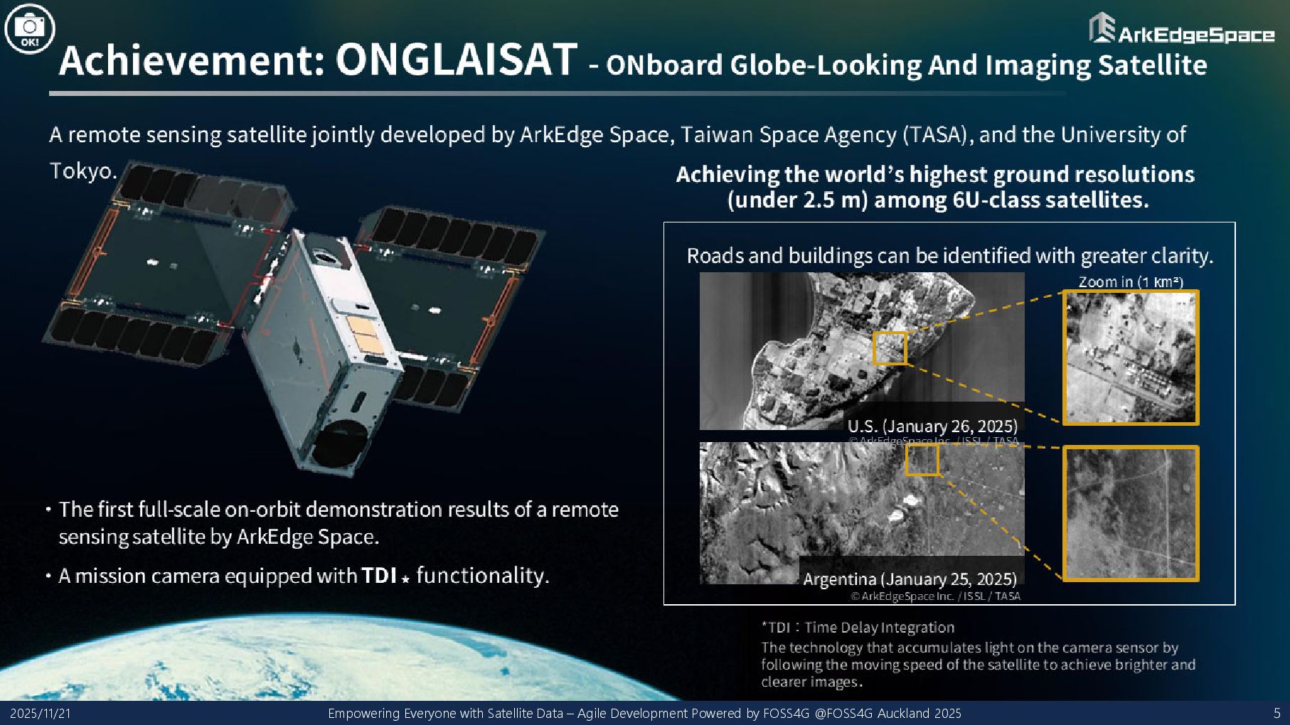
by FOSS4G @FOSS4G Auckland 2025 2 High-performance micro-satellites for diverse mission requirements A General Integrator for Micro-Satellite Systems Empowering people with satellites for a prosperous future Delivering end-to-end solutions for microsatellite constellations, from design and development to mass production and operations. Headquarters:Tokyo, Japan Total Orders & Selections:$195M+ Launched & Operated:14 satellites Next-Generation Maritime Infrastructure Satellite Data Utilization New Satellite PNT* System Lunar Infrastructure & Deep Space Exploration Company Profile Founded:July 2018 Total Funds Raised:$74.2M+ Number of Employees:approx. 160 (as of July 2025) *PNT (Positioning, Navigation and Timing)
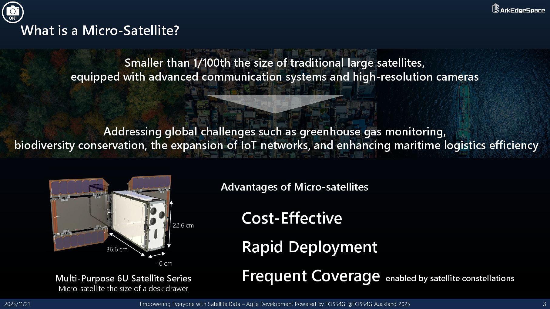
– Agile Development Powered by FOSS4G @FOSS4G Auckland 2025 3 22.6 cm 36.6 cm 10 cm Multi-Purpose 6U Satellite Series Micro-satellite the size of a desk drawer Cost-Effective Rapid Deployment Frequent Coverage enabled by satellite constellations Advantages of Micro-satellites Smaller than 1/100th the size of traditional large satellites, equipped with advanced communication systems and high-resolution cameras Addressing global challenges such as greenhouse gas monitoring, biodiversity conservation, the expansion of IoT networks, and enhancing maritime logistics efficiency
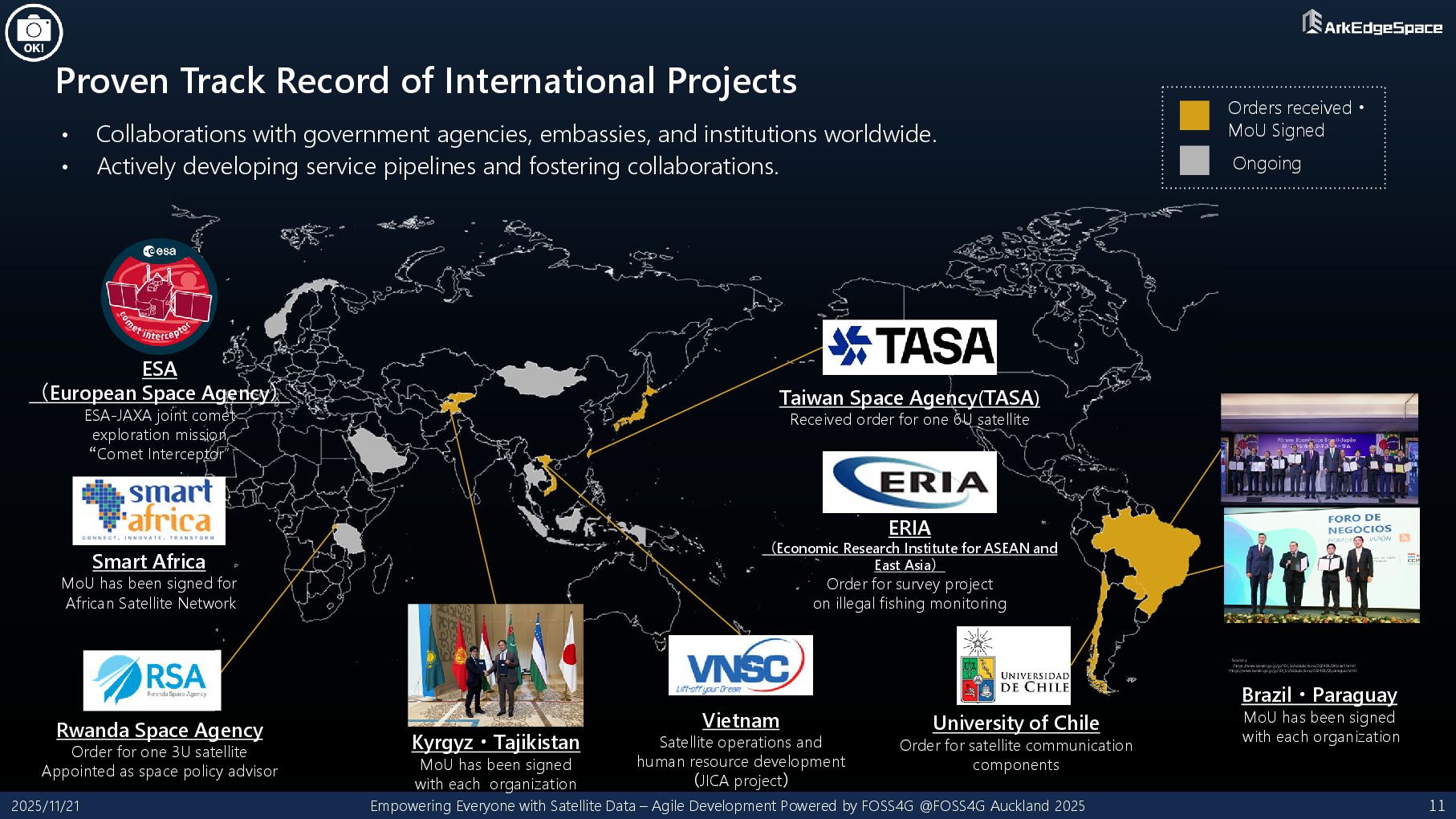
Satellite Data – Agile Development Powered by FOSS4G @FOSS4G Auckland 2025 11 • Collaborations with government agencies, embassies, and institutions worldwide. • Actively developing service pipelines and fostering collaborations. Orders received・ MoU Signed Ongoing Brazil・Paraguay MoU has been signed with each organization Kyrgyz・Tajikistan MoU has been signed with each organization ESA (European Space Agency) ESA-JAXA joint comet exploration mission “Comet Interceptor” Source: (https://www.kantei.go.jp/jp/101_kishida/actions/202405/04brazil.html) (https://www.kantei.go.jp/jp/101_kishida/actions/202405/03paraguai.html) Vietnam Satellite operations and human resource development (JICA project) University of Chile Order for satellite communication components ERIA (Economic Research Institute for ASEAN and East Asia) Order for survey project on illegal fishing monitoring Taiwan Space Agency(TASA) Received order for one 6U satellite Rwanda Space Agency Order for one 3U satellite Appointed as space policy advisor Smart Africa MoU has been signed for African Satellite Network
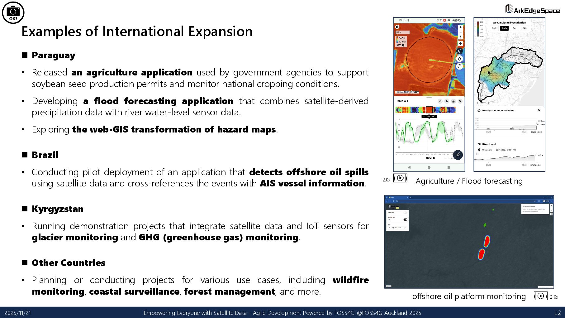
application used by government agencies to support soybean seed production permits and monitor national cropping conditions. • Developing a flood forecasting application that combines satellite-derived precipitation data with river water-level sensor data. • Exploring the web-GIS transformation of hazard maps. Brazil • Conducting pilot deployment of an application that detects offshore oil spills using satellite data and cross-references the events with AIS vessel information. Kyrgyzstan • Running demonstration projects that integrate satellite data and IoT sensors for glacier monitoring and GHG (greenhouse gas) monitoring. Other Countries • Planning or conducting projects for various use cases, including wildfire monitoring, coastal surveillance, forest management, and more. 2025/11/21 Empowering Everyone with Satellite Data – Agile Development Powered by FOSS4G @FOSS4G Auckland 2025 12 Agriculture / Flood forecasting offshore oil platform monitoring 2.0x 2.0x
Countries • Many countries do not have sufficient financial resources. • Applications must remain usable even after external support or development projects end. Issues with Satellite and Other Geospatial Data • Data licensing restrictions may prevent secondary use or limit who can access the data, resulting in poor data reach and limited practical use. • Large data sizes and complex formats may require expensive and complex GIS software or specialized expertise, making them difficult for local users to handle. • Satellite data alone, as observations from far away in space, often suffer from technical limitations such as low accuracy, coarse spatial resolution, and poor temporal resolution. 2025/11/21 Empowering Everyone with Satellite Data – Agile Development Powered by FOSS4G @FOSS4G Auckland 2025 13
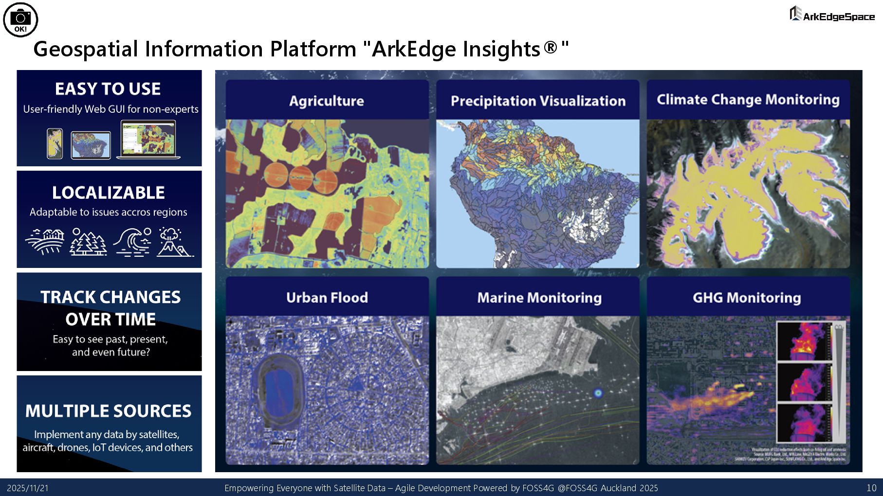
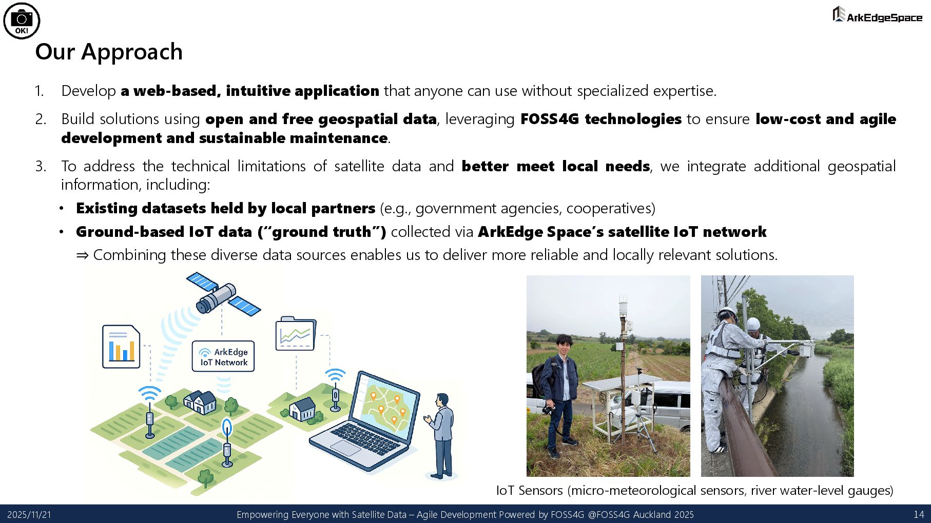
can use without specialized expertise. 2. Build solutions using open and free geospatial data, leveraging FOSS4G technologies to ensure low-cost and agile development and sustainable maintenance. 3. To address the technical limitations of satellite data and better meet local needs, we integrate additional geospatial information, including: • Existing datasets held by local partners (e.g., government agencies, cooperatives) • Ground-based IoT data (“ground truth”) collected via ArkEdge Space’s satellite IoT network ⇒ Combining these diverse data sources enables us to deliver more reliable and locally relevant solutions. 2025/11/21 Empowering Everyone with Satellite Data – Agile Development Powered by FOSS4G @FOSS4G Auckland 2025 14 IoT Sensors (micro-meteorological sensors, river water-level gauges)
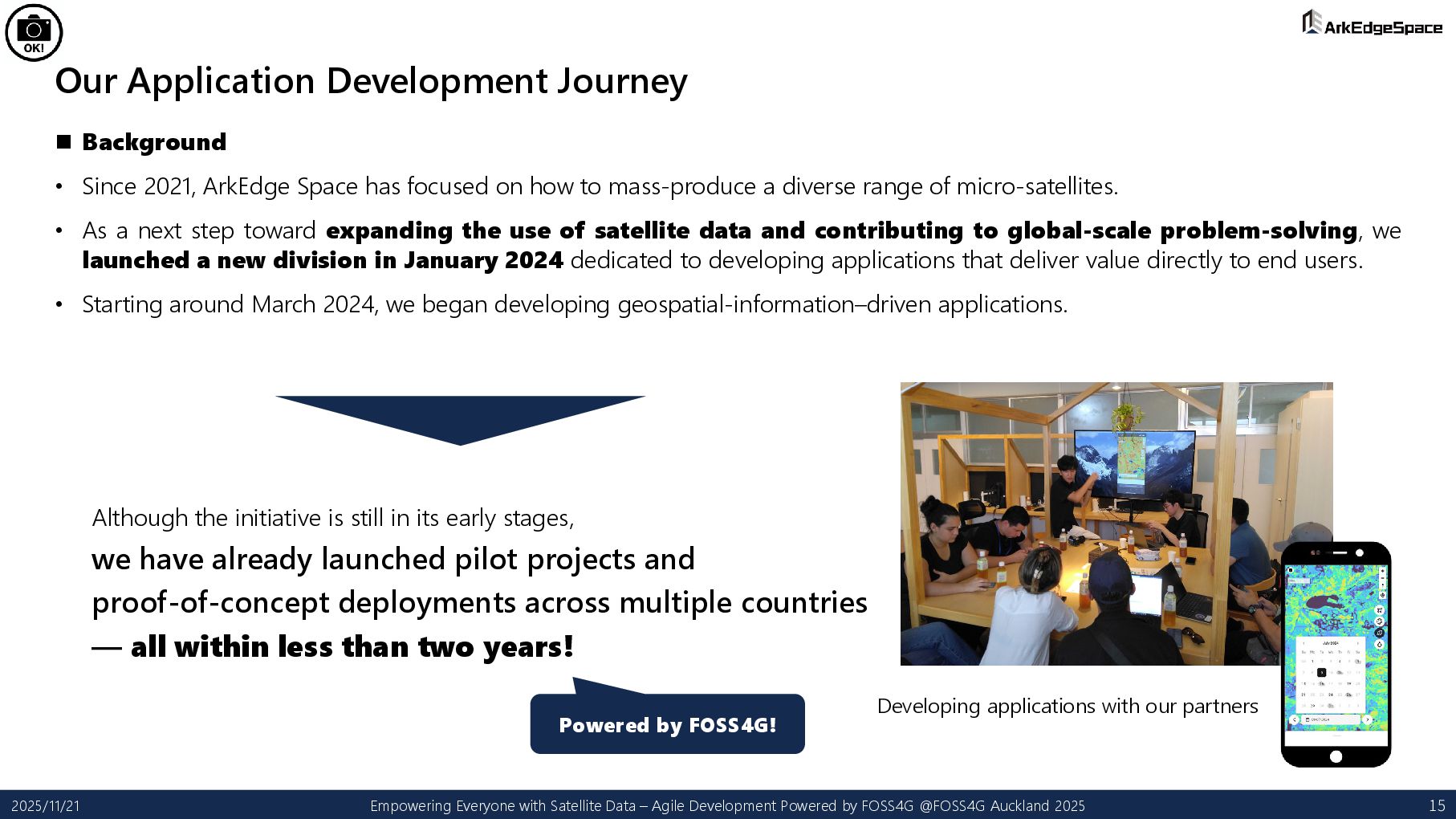
Space has focused on how to mass-produce a diverse range of micro-satellites. • As a next step toward expanding the use of satellite data and contributing to global-scale problem-solving, we launched a new division in January 2024 dedicated to developing applications that deliver value directly to end users. • Starting around March 2024, we began developing geospatial-information–driven applications. Although the initiative is still in its early stages, we have already launched pilot projects and proof-of-concept deployments across multiple countries — all within less than two years! 2025/11/21 Empowering Everyone with Satellite Data – Agile Development Powered by FOSS4G @FOSS4G Auckland 2025 15 Powered by FOSS4G! Developing applications with our partners
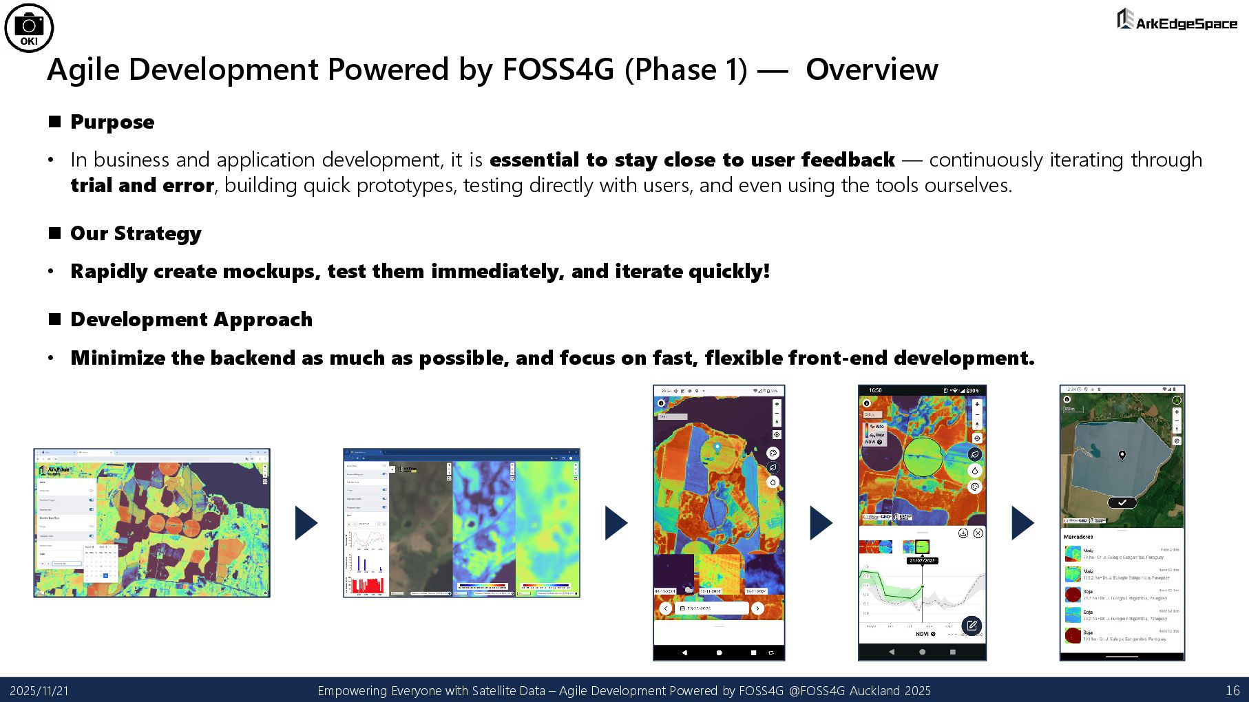
Purpose • In business and application development, it is essential to stay close to user feedback — continuously iterating through trial and error, building quick prototypes, testing directly with users, and even using the tools ourselves. Our Strategy • Rapidly create mockups, test them immediately, and iterate quickly! Development Approach • Minimize the backend as much as possible, and focus on fast, flexible front-end development. 2025/11/21 Empowering Everyone with Satellite Data – Agile Development Powered by FOSS4G @FOSS4G Auckland 2025 16
SPA Hosted on GitHub Pages • We adopted a Single Page Application (SPA) architecture to rapidly develop map-centric mockups. • Hosting on GitHub Pages allows development to be completed entirely within GitHub, without worrying about infrastructure. • Access control is easy, and deployments are instantaneous. 2. PMTiles Delivered via Amazon S3 + CloudFront • Satellite data is large, but PMTiles, being cloud-optimized and tile-based, are ideal for efficient satellite-data delivery. • PMTiles can deliver not only raster tiles but also vector tiles, enabling distribution of both satellite imagery and other geospatial datasets. • For mockup applications, we mainly deliver pre-processed static data stored in Amazon S3 and distributed through CloudFront. 3. Protomaps Basemap / Amazon Location Service • Initially, we downloaded the necessary regional basemap data from Protomaps Basemap and self-hosted it. • As we shifted toward applications that must work globally, we transitioned to Amazon Location Service for scalable basemap delivery. 2025/11/21 Empowering Everyone with Satellite Data – Agile Development Powered by FOSS4G @FOSS4G Auckland 2025 17
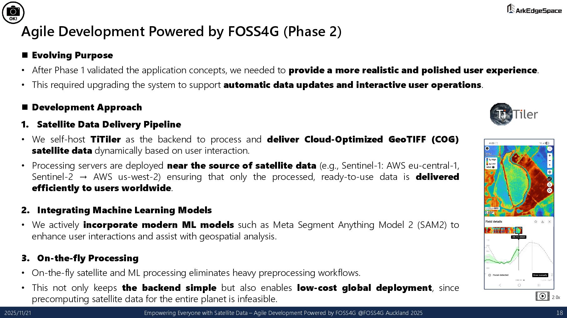
• After Phase 1 validated the application concepts, we needed to provide a more realistic and polished user experience. • This required upgrading the system to support automatic data updates and interactive user operations. 2025/11/21 Empowering Everyone with Satellite Data – Agile Development Powered by FOSS4G @FOSS4G Auckland 2025 18 Development Approach 1. Satellite Data Delivery Pipeline • We self-host TiTiler as the backend to process and deliver Cloud-Optimized GeoTIFF (COG) satellite data dynamically based on user interaction. • Processing servers are deployed near the source of satellite data (e.g., Sentinel-1: AWS eu-central-1, Sentinel-2 → AWS us-west-2) ensuring that only the processed, ready-to-use data is delivered efficiently to users worldwide. 2. Integrating Machine Learning Models • We actively incorporate modern ML models such as Meta Segment Anything Model 2 (SAM2) to enhance user interactions and assist with geospatial analysis. 3. On-the-fly Processing • On-the-fly satellite and ML processing eliminates heavy preprocessing workflows. • This not only keeps the backend simple but also enables low-cost global deployment, since precomputing satellite data for the entire planet is infeasible. 2.0x
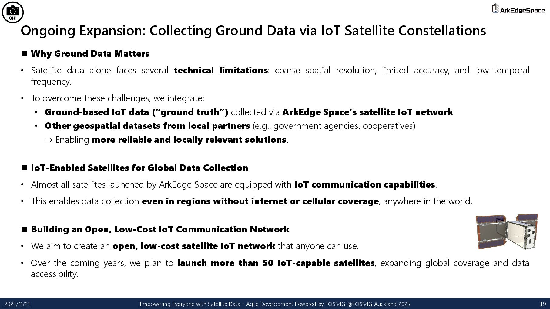
Why Ground Data Matters • Satellite data alone faces several technical limitations: coarse spatial resolution, limited accuracy, and low temporal frequency. • To overcome these challenges, we integrate: • Ground-based IoT data (“ground truth”) collected via ArkEdge Space’s satellite IoT network • Other geospatial datasets from local partners (e.g., government agencies, cooperatives) ⇒ Enabling more reliable and locally relevant solutions. IoT-Enabled Satellites for Global Data Collection • Almost all satellites launched by ArkEdge Space are equipped with IoT communication capabilities. • This enables data collection even in regions without internet or cellular coverage, anywhere in the world. Building an Open, Low-Cost IoT Communication Network • We aim to create an open, low-cost satellite IoT network that anyone can use. • Over the coming years, we plan to launch more than 50 IoT-capable satellites, expanding global coverage and data accessibility. 2025/11/21 Empowering Everyone with Satellite Data – Agile Development Powered by FOSS4G @FOSS4G Auckland 2025 19
Sharing Tools and Source Code with Academia & Industry • ArkEdge Space has strong expertise in satellite data and IoT, but we are not experts in all the critical domains — agriculture, disaster management, hydrology, environment, and many others. • By providing tools and source code that make satellite data easy to use, domain specialists (e.g., agricultural experts, environmental researchers) can work directly with satellite data. ⇒ This leads to deeper collaboration and benefits both partners and ArkEdge Space. ⇒ It also contributes to capacity building and local skill development. • When deploying our platform in Global South countries, enabling access to our tools and code allows local teams to operate, maintain, and even improve the applications themselves. ⇒ Supporting long-term sustainability and local empowerment. Opening the Platform to Web/IT Companies • Traditionally, satellite data has been difficult to use for ordinary IT companies. • By sharing our platform, tools, and know-how, we enable general web/IT engineers to also work with satellite data. ⇒ This expands the adoption, innovation, and real-world use of satellite data across many use cases. 2025/11/21 Empowering Everyone with Satellite Data – Agile Development Powered by FOSS4G @FOSS4G Auckland 2025 20
“Global-Only” Thinking • Although we develop satellites and geospatial applications, we are not building everything from inside an office. • When working only with satellites, satellite data, or related software, our thinking tends to become too global and detached from real-world conditions. • To avoid this, we believe it is essential to walk the field ourselves — observe, listen, feel — and stay grounded in on- the-ground realities throughout satellite development and geospatial application design. The Importance of Direct Engagement with Local Communities • To achieve this, we actively visit project sites, build trust with local communities, and collect data, analyze challenges, and design solutions together. • This field-driven, collaborative approach is vital for understanding true user needs and creating applications that have real impact. 2025/11/21 Empowering Everyone with Satellite Data – Agile Development Powered by FOSS4G @FOSS4G Auckland 2025 21
• We would love to bring our geospatial platform / applications to more regions around the world — together with you! Your Support in Collecting Valuable Local Data • To unlock the full potential of satellite data, we truly need your help in gathering local datasets such as weather observations, river water levels, soil moisture, air-quality data, landslide-monitoring data, and more! Co-Developing Solutions with Domain Experts • ArkEdge Space has strong expertise in satellite data and IoT, but we are not experts in all the critical domains — agriculture, disaster management, hydrology, environment, and many others. Let’s Grow the FOSS4G Community Together • And of course — we want to continue growing and energizing the FOSS4G community together with all of you! This is why collaboration with experts like you is so important for creating meaningful and impactful applications! 2025/11/21 Empowering Everyone with Satellite Data – Agile Development Powered by FOSS4G @FOSS4G Auckland 2025 22
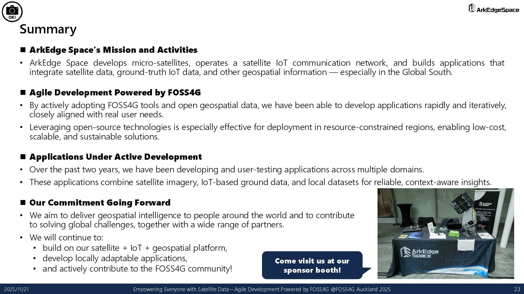
develops micro-satellites, operates a satellite IoT communication network, and builds applications that integrate satellite data, ground-truth IoT data, and other geospatial information — especially in the Global South. Agile Development Powered by FOSS4G • By actively adopting FOSS4G tools and open geospatial data, we have been able to develop applications rapidly and iteratively, closely aligned with real user needs. • Leveraging open-source technologies is especially effective for deployment in resource-constrained regions, enabling low-cost, scalable, and sustainable solutions. Applications Under Active Development • Over the past two years, we have been developing and user-testing applications across multiple domains. • These applications combine satellite imagery, IoT-based ground data, and local datasets for reliable, context-aware insights. Our Commitment Going Forward • We aim to deliver geospatial intelligence to people around the world and to contribute to solving global challenges, together with a wide range of partners. • We will continue to: • build on our satellite + IoT + geospatial platform, • develop locally adaptable applications, • and actively contribute to the FOSS4G community! 2025/11/21 Empowering Everyone with Satellite Data – Agile Development Powered by FOSS4G @FOSS4G Auckland 2025 23 Come visit us at our sponsor booth!