Upgrade to Pro — share decks privately, control downloads, hide ads and more …

The Role of Volunteered Geographic Information in Disaster Management Platforms

The Role of Volunteered Geographic Information in Disaster Management Platforms

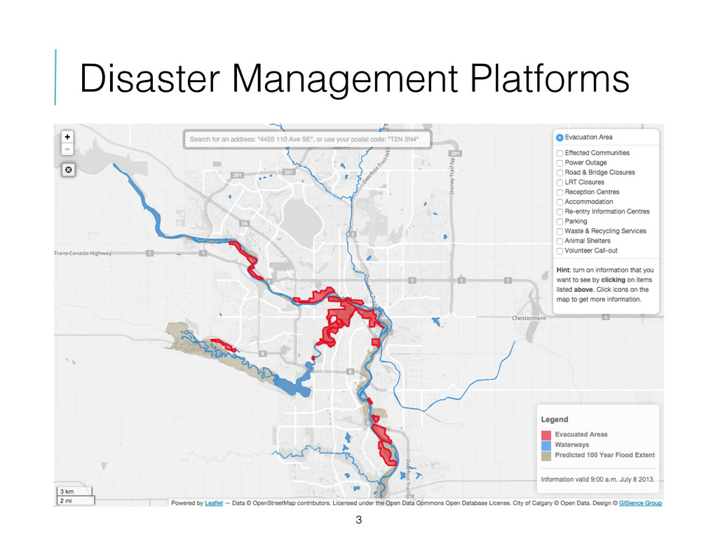
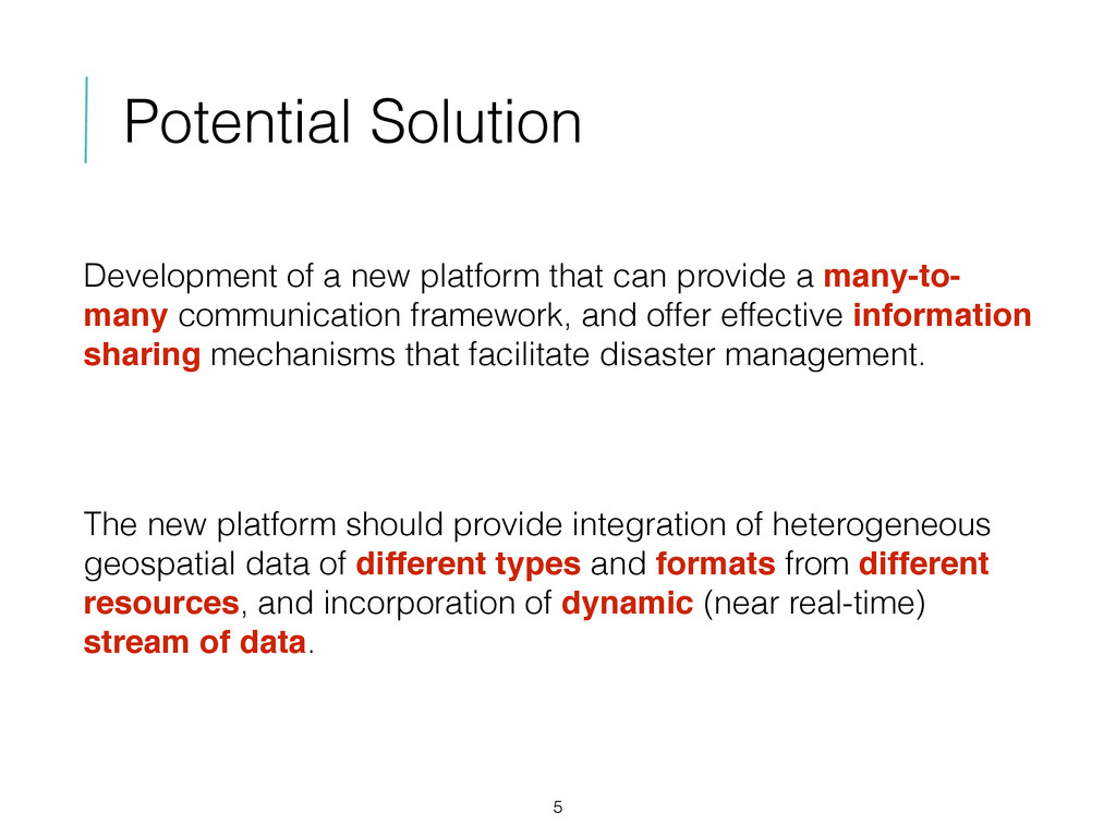
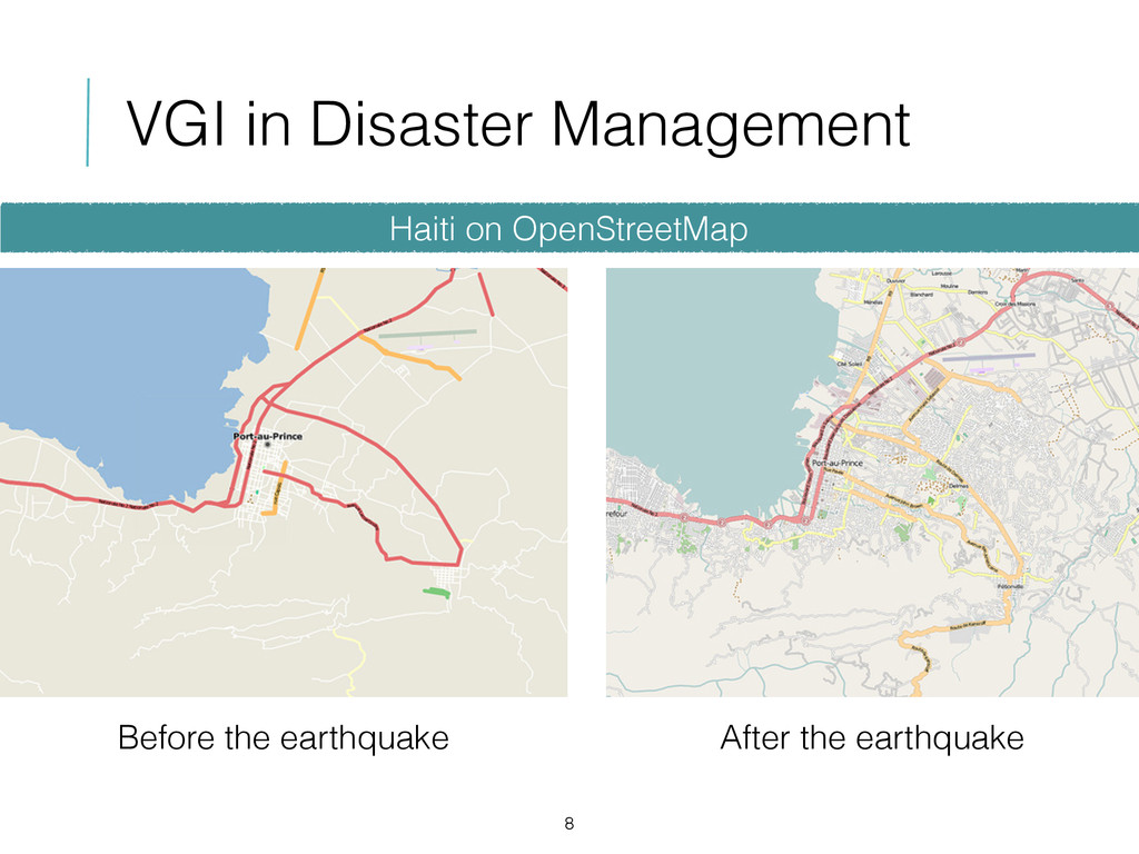
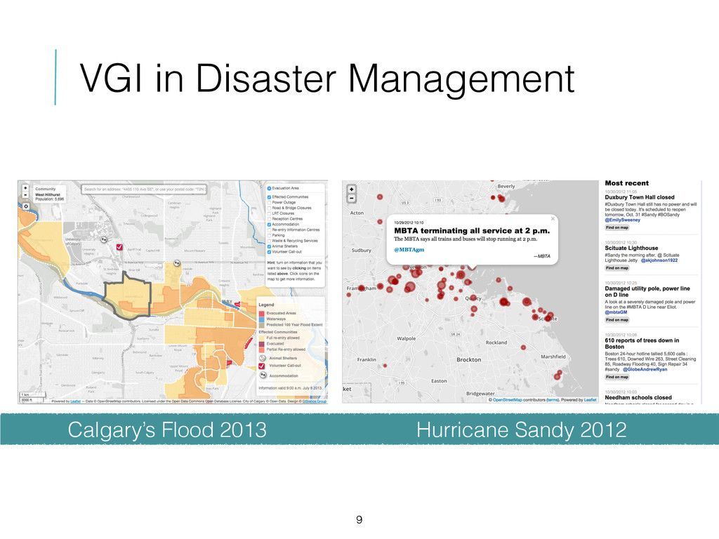
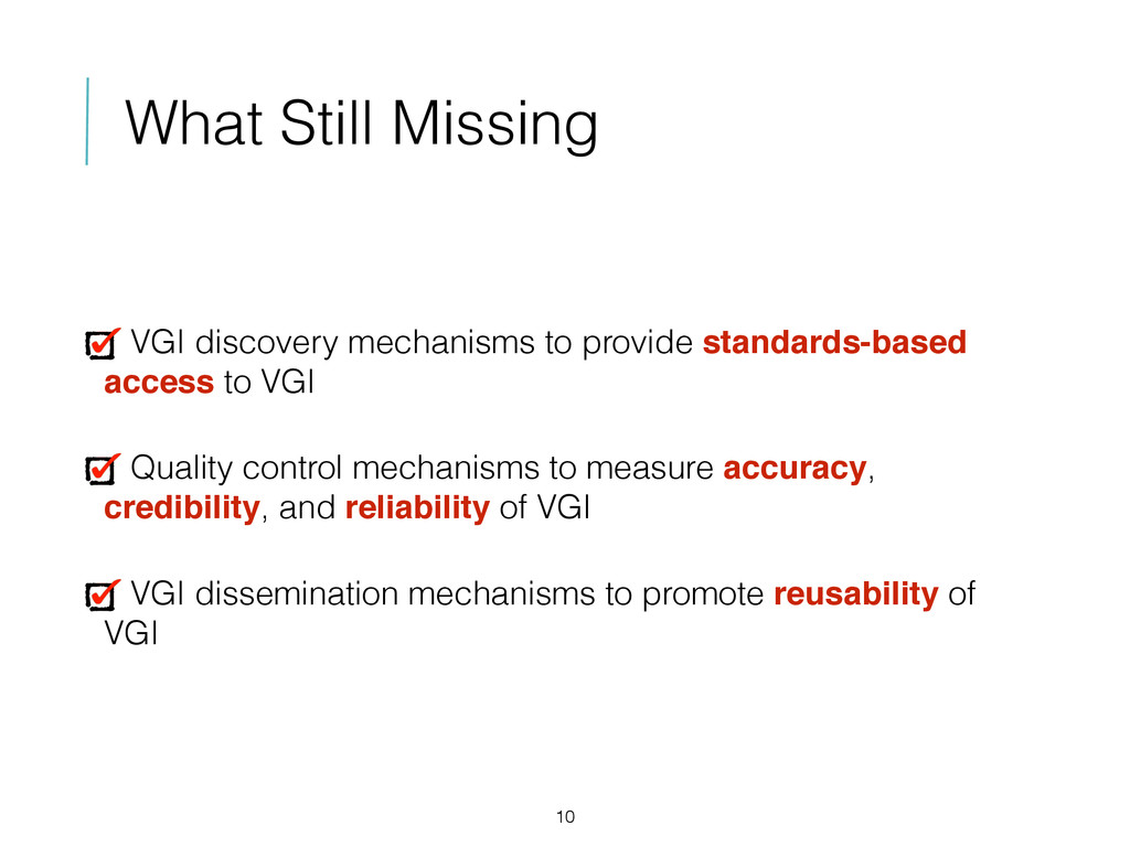
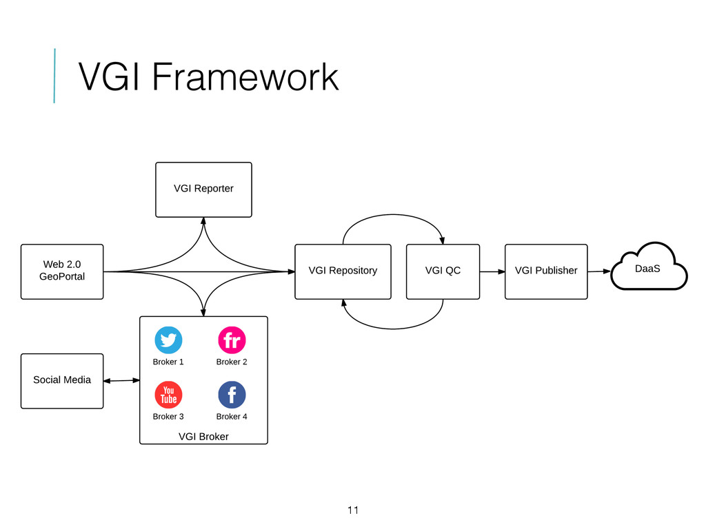
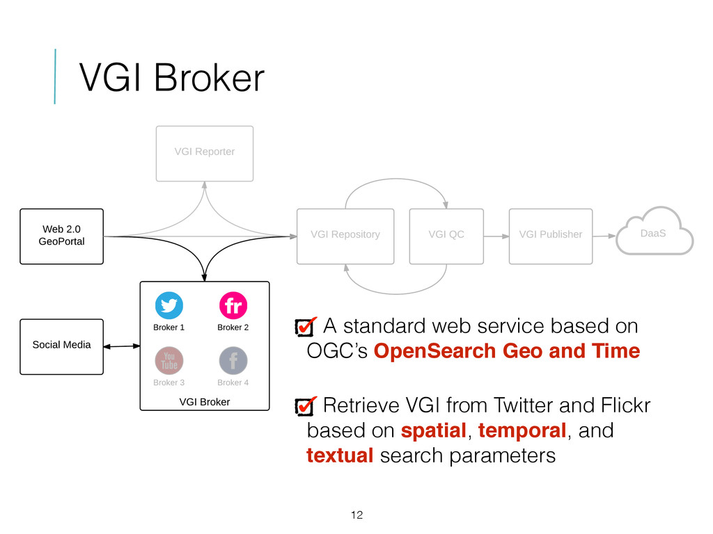
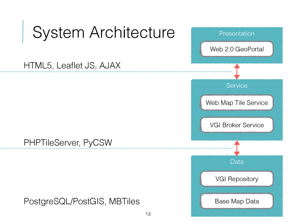
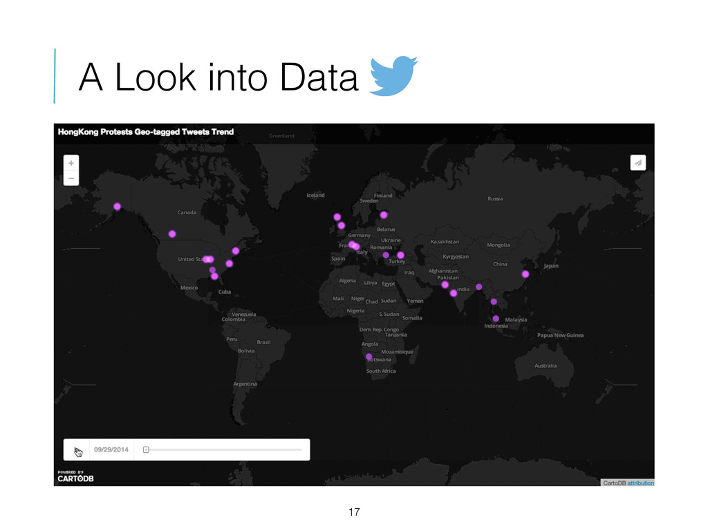
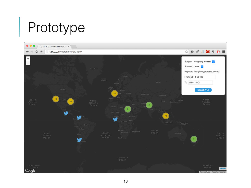
Recent disasters, such as the 2010 Haiti earthquake, have drawn attention to the potential role of citizens as active information producers, who use location-aware devices such as smartphones to collect geographic information (i.e., geo-tagged text, photos, or videos) and share it through online social media such as Twitter. The use of geographic information created by citizens, known as Volunteered Geographic Information (VGI), has four main benefits in disaster management: it significantly decreases the time required to collect crisis information, (ii) it often has comparable accuracy to authoritative sources, (iii) its update and refresh rates are generally very rapid, especially for the affected area, and (iv) as the data is open and freely accessible, crisis mapping platforms can discover, process, and publish them. In this paper, we present a VGI brokering approach that enables discovery and use of VGI in disaster management platforms. To provide an effective, flexible, and interoperable VGI discovery mechanism, we used Open Geospatial Consortium’s OpenSearch Geo and Time (OGC’s OSGT) specification to develop a standard web service that is able to retrieve VGI from multiple resources (i.e. Twitter and Flickr) based on spatiotemporal search parameters. We also developed a map-based reporting tool that enables citizens not only to explore their surrounding area but also to report their observations and contribute to the platform. We employed a FOSS (Free and Open Source Software) strategy to implement the client-side and server-side components. On the client-side, we used Leaflet’s API to develop the map component and map-based interactions. Web client technologies HTML5, CSS3, and AJAX were used to rapidly develop a flexible and interactive mapping solution. On the server-side, WMTS (Web Map Tile Service) technology was used to provide the base map tiles, which were created in TileMill with data from OpenStreetMap. The VGI discovery service was implemented using Python and exposed as a standard OSGT service. We also used PostgreSQL/PostGIS as a database to manage user’s contributions (through the map-based reporting tool). This framework can facilitate discovery and use of up-to-date crisis information to support disaster management activities in different phases, which will allow decision makers to grasp the scope of a crisis and make informed policy choices that could save lives, meet basic humanitarian needs earlier, and limit environmental and economic damage.

Ebrahim Poorazizi

October 28, 2014
Tweet

More Decks by Ebrahim Poorazizi

Other Decks in Research

Transcript

  1. The Role of VGI in Disaster Management Platforms GIScienceGroup.UCalgary.ca Ebrahim

    Poorazizi, Andrew Hunter OpenStreetMap GPS trace density in Europe © Eric Fischer
  2. Disaster Management 2 “… management of resources and responsibilities for

    dealing with all humanitarian aspects of emergencies, in particular preparedness, response and recovery in order to lessen the impact of disasters.” © Dave Smith
  3. Challenges 4 Lack of community-wide information sharing and communication needs

    to all stakeholders (e.g., jurisdictional authorities, emergency respondents, and citizens) The reasons are: The amount of information published by disaster management platforms is limited and often outdated As they provide one-way information flow, their level of interaction is low
  4. Potential Solution 5 Development of a new platform that can

    provide a many-to- many communication framework, and offer effective information sharing mechanisms that facilitate disaster management. The new platform should provide integration of heterogeneous geospatial data of different types and formats from different resources, and incorporation of dynamic (near real-time) stream of data.
  5. VGI in Disaster Management 7 It significantly decreases the time

    required to collect crisis information It often has comparable accuracy to authoritative sources Its update and refresh rates are generally very rapid, especially for the affected area As the data is open and freely accessible, crisis mapping platforms can discover, process, and publish them
  6. What Still Missing 10 VGI discovery mechanisms to provide standards-based

    access to VGI Quality control mechanisms to measure accuracy, credibility, and reliability of VGI VGI dissemination mechanisms to promote reusability of VGI
  7. VGI Broker 12 A standard web service based on OGC’s

    OpenSearch Geo and Time Retrieve VGI from Twitter and Flickr based on spatial, temporal, and textual search parameters
  8. System Architecture 13 Presentation Web 2.0 GeoPortal Service Web Map

    Tile Service VGI Broker Service Data VGI Repository Base Map Data HTML5, Leaflet JS, AJAX PHPTileServer, PyCSW PostgreSQL/PostGIS, MBTiles
  9. A Case Study 14 Japan Volcano Eruption (Natural Distaster) HongKong

    Protests (Political Crisis) © o.canada.com © hongkong.coconuts.co #Japan, #Volcano, #MountOntake, Japanese Volcano Eruption #HongKong, #HongKongProtests, #HongKongDemocracy, OccupyHongKong, OccupyCentral Japan, Volcano, MountOntake, Japanese Volcano Eruption HongKongProtests, HongKongDemocracy, OccupyHongKong, OccupyCentral September 27 2014 - October 9 2014
  10. A Look into Data 16 33% 5% 7% 13% 17%

    26% twitter.com iPhone Android TweetDeck Other Websites Others 96.6% 3.4% Verified Users Others 98.6% 1.4% 24% 4% 6% 15% 21% 29% twitter.com iPhone Android iPad TweetDeck Others #JapanVolcano #HongKongProtests
  11. Conclusion & Future Work 19 VGI is a rich and

    complementary source of information for authoritative data, especially in the context of disaster management Quality control mechanisms to measure accuracy, credibility, and reliability of VGI VGI dissemination mechanisms to promote reusability of VGI
  12. THANK YOU ANY QUESTION? GIScienceGroup.UCalgary.ca OpenStreetMap GPS trace density in

    Europe © Eric Fischer Ebrahim Poorazizi! [email protected]! ebrahim.planyourplace.ca! Andrew Hunter! [email protected]! gisciencegroup.ucalgary.ca!