and Planning CO2 Emissions and Home to School Travel @nickbearmanuk hDp://www.fotolog.com/luckyshot/41568423/ hDps://twiDer.com/Peter_Tennant/status/444404118330044416
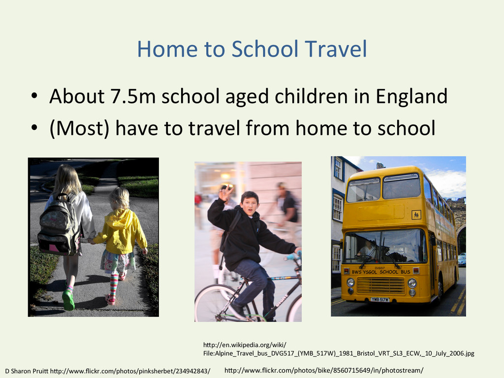
children in England • (Most) have to travel from home to school D Sharon PruiD hDp://www.flickr.com/photos/pinksherbet/234942843/ hDp://www.flickr.com/photos/bike/8560715649/in/photostream/ hDp://en.wikipedia.org/wiki/ File:Alpine_Travel_bus_DVG517_(YMB_517W)_1981_Bristol_VRT_SL3_ECW,_10_July_2006.jpg
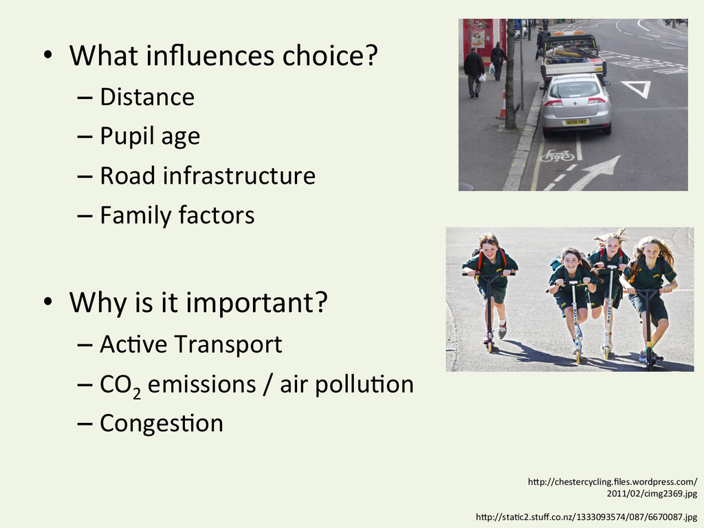
emissions / air polluYon – CongesYon Data sources • School Census – Pupil home postcode – “Usual” mode of travel (11 opYons) hDp://chestercycling.files.wordpress.com/ 2011/02/cimg2369.jpg hDp://staYc2.stuff.co.nz/1333093574/087/6670087.jpg
EU, ideally UK – Data Protec*on & Dept. of Edu. • Can’t though -‐ “No guarantee that your data at rest is kept only in that region” (then 15/03/2014) • 4.1 Data Storage. … may determine .. data .. stored permanently, at rest, in either the United States or the European Union…. • 4.2 Transient Storage. … may be stored transiently or cached in any country in which Google or its agents maintain faciliYes (now 05/01/2015) hDps://cloud.google.com/terms/service-‐terms hDps://developers.google.com/compute/docs/faq#selectedcountries
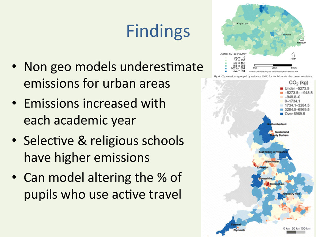
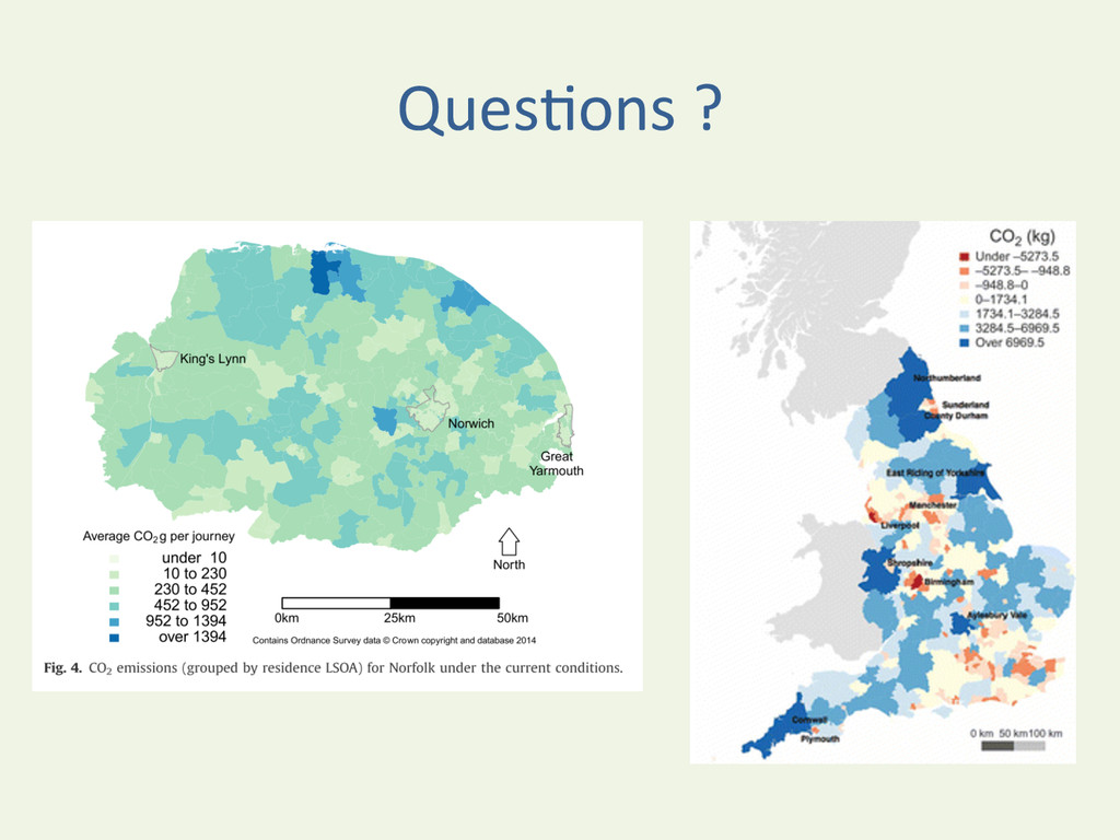
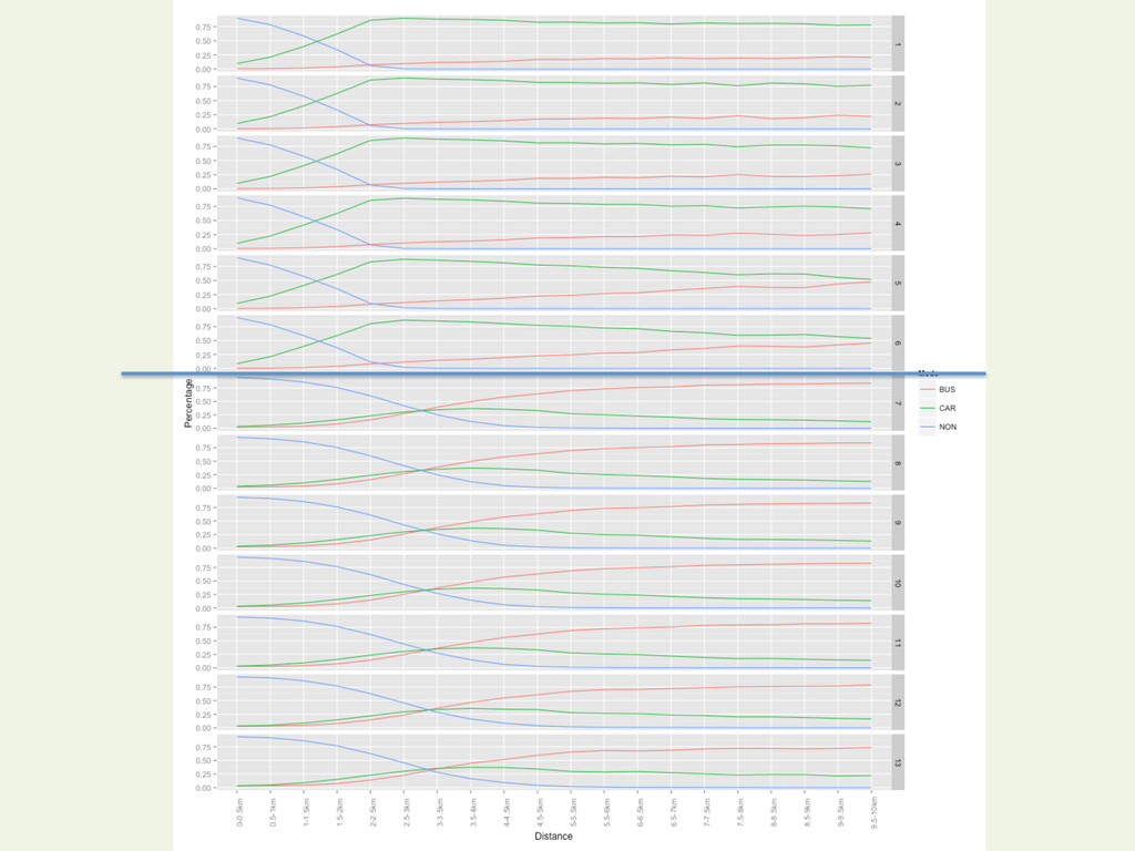
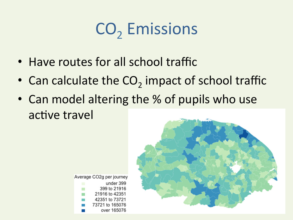
urban areas • Emissions increased with each academic year • SelecYve & religious schools have higher emissions • Can model altering the % of pupils who use acYve travel
N. & Singleton, A.D. (2014) Modelling the potenYal impact on CO2 emissions of an increased uptake of acYve travel for the home to school commute using individual level data, Journal of Transport & Health, 1(4) p. 295–304. doi:10.1016/j.jth.2014.09.009, Open Access
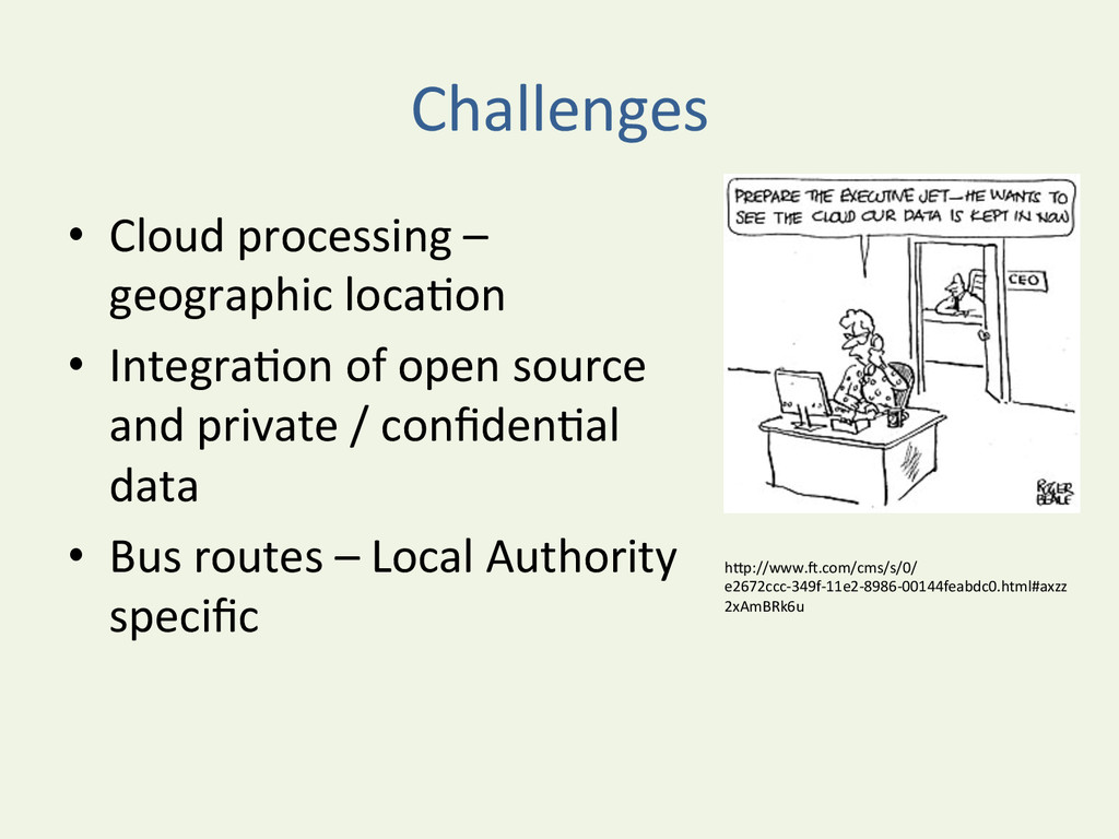
• IntegraYon of open source and private / confidenYal data • Bus routes – Local Authority specific hDp://www.u.com/cms/s/0/ e2672ccc-‐349f-‐11e2-‐8986-‐00144feabdc0.html#axzz 2xAmBRk6u
higher resoluYon • Methodology developed can be applied across many types of transport and many areas (inc. health access) • All code in public domain, applicaYon to assist this analysis at LA level could be developed.
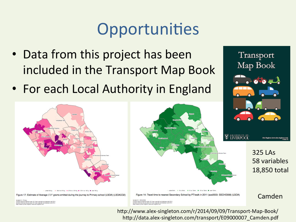
included in the Transport Map Book • For each Local Authority in England hDp://www.alex-‐singleton.com/r/2014/09/09/Transport-‐Map-‐Book/ hDp://data.alex-‐singleton.com/transport/E09000007_Camden.pdf Camden 325 LAs 58 variables 18,850 total
processing • EducaYon of data suppliers – they are the gatekeepers • Reduce / remove academic usage limits • Promote tools through academic channels “We provide digital soluYons for UK educaYon and research”
of Glasgow on 18th April 2014 • hDp://www.nickbearman.me.uk/2014/04/ modelling-‐home-‐to-‐school-‐travel-‐for-‐state-‐ pupils-‐in-‐england-‐2008-‐2011/
Planning Modelling home to school travel for state pupils in England, 2008-‐2011 @nickbearmanuk hDp://www.fotolog.com/luckyshot/41568423/ hDps://twiDer.com/Peter_Tennant/status/444404118330044416
children in England • (Most) have to travel from home to school D Sharon PruiD hDp://www.flickr.com/photos/pinksherbet/234942843/ hDp://www.flickr.com/photos/bike/8560715649/in/photostream/ hDp://en.wikipedia.org/wiki/ File:Alpine_Travel_bus_DVG517_(YMB_517W)_1981_Bristol_VRT_SL3_ECW,_10_July_2006.jpg
– Road infrastructure – Family factors • Why is it important? – AcYve Transport – CO2 emissions / air polluYon – CongesYon hDp://chestercycling.files.wordpress.com/ 2011/02/cimg2369.jpg hDp://staYc2.stuff.co.nz/1333093574/087/6670087.jpg
– Pupil home postcode – “Usual” mode of travel (11 opYons) – Data for each year – State schools only (Independent schools ~ 7%) • Edubase -‐ school informaYon • CO2 emissions by travel mode
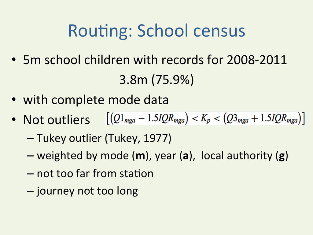
for 2008-‐2011 3.8m (75.9%) • with complete mode data • Not outliers – Tukey outlier (Tukey, 1977) – weighted by mode (m), year (a), local authority (g) – not too far from staYon – journey not too long
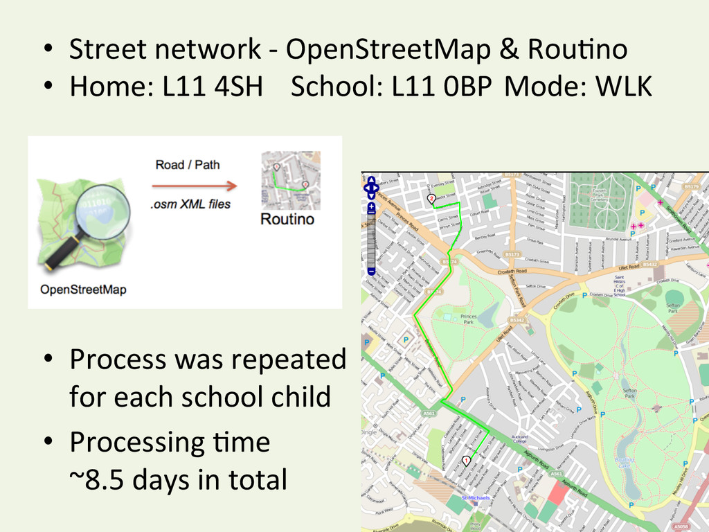
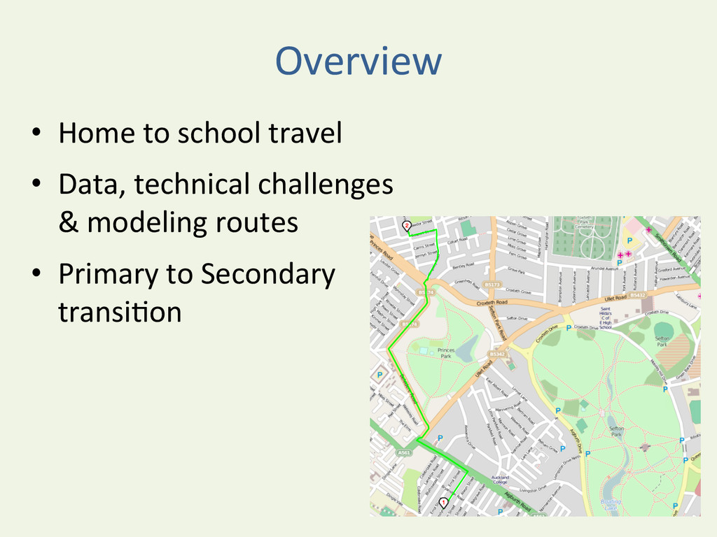
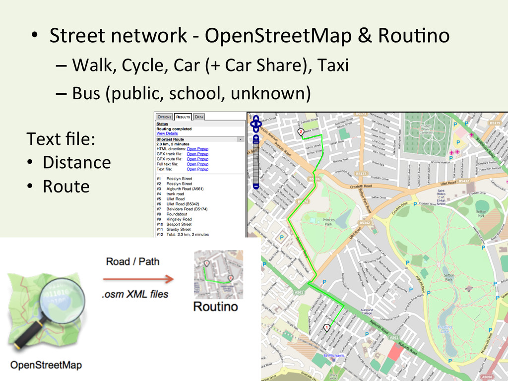
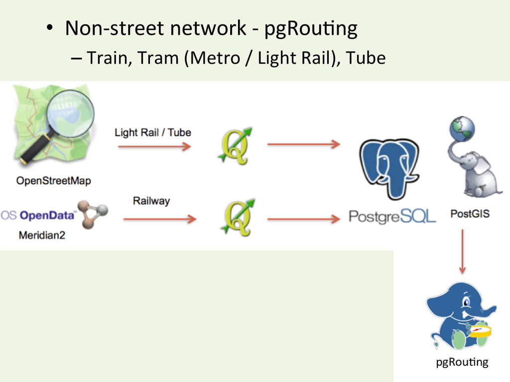
• R then called RouYno or pgRouYng • Process was repeated for each school child • And for each year (2008-‐2011) – If either Mode, Start postcode or End postcode were different • Processing Yme ~8.5 days in total
geyng street based routes • pgRouYng – Routes for custom networks • R -‐ Open Source – can handle big data (o/n running) • OS X & R – good command line interface – stable (?)
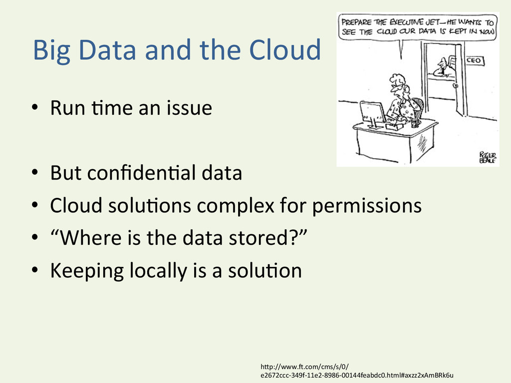
issue • But confidenYal data • Cloud soluYons complex for permissions • “Where is the data stored?” • Keeping locally is a soluYon hDp://www.u.com/cms/s/0/ e2672ccc-‐349f-‐11e2-‐8986-‐00144feabdc0.html#axzz2xAmBRk6u
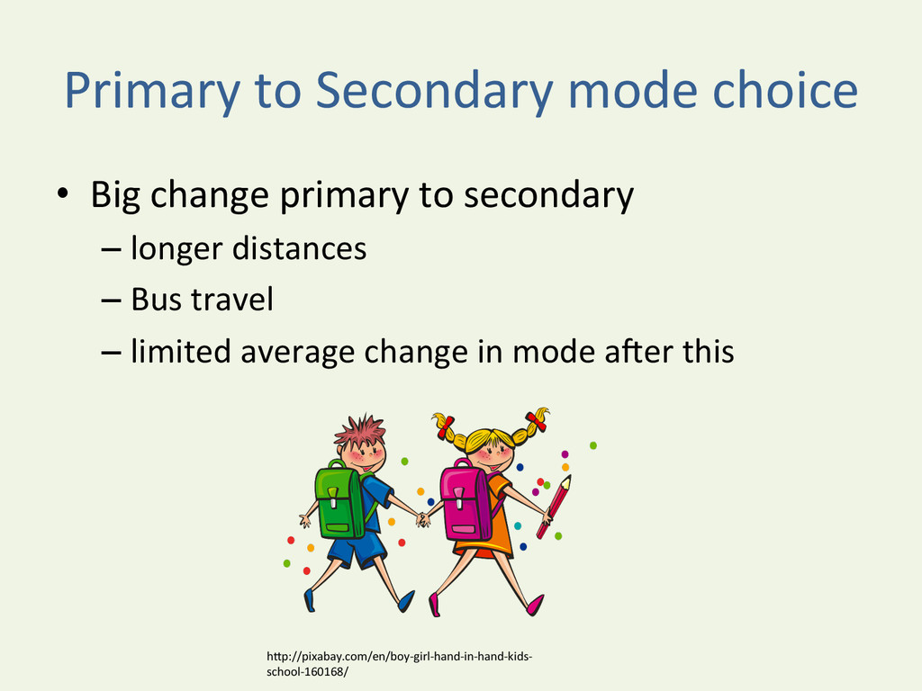
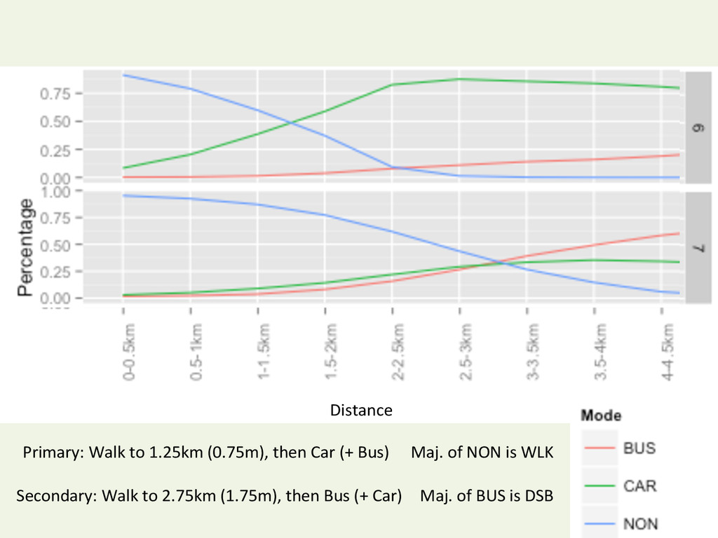
to secondary – longer distances – Bus travel – limited average change in mode auer this hDp://pixabay.com/en/boy-‐girl-‐hand-‐in-‐hand-‐kids-‐ school-‐160168/