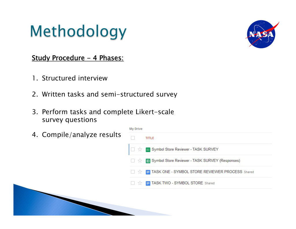
users successfully categorize symbols? • Can users successfully add metadata to symbols? • Can users successfully review symbols after they have been uploaded? • Can users identify usability/utility issues with the tool? Task Analysis Study to Determine: • Error/Success Metrics • Subjective Ratings of the Symbol Store
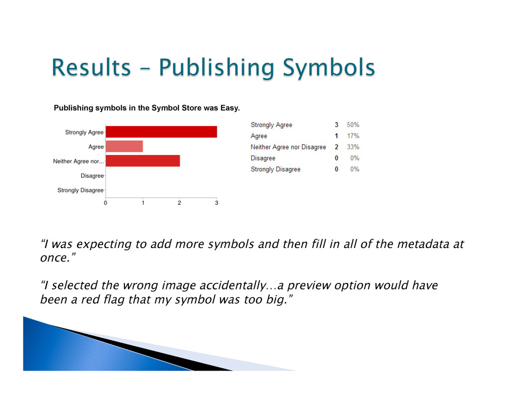
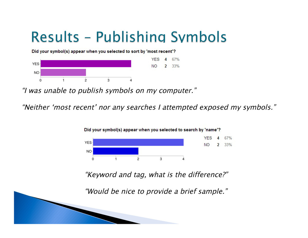
expecting to add more symbols and then fill in all of the metadata at once.” “I selected the wrong image accidentally…a preview option would have been a red flag that my symbol was too big.”
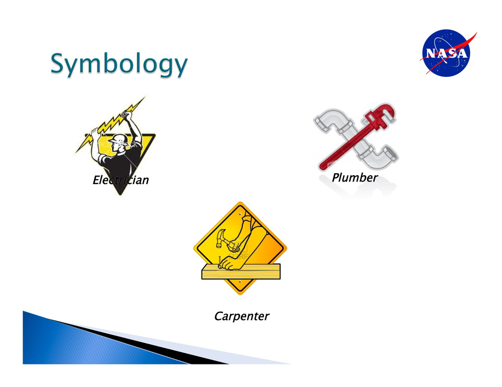
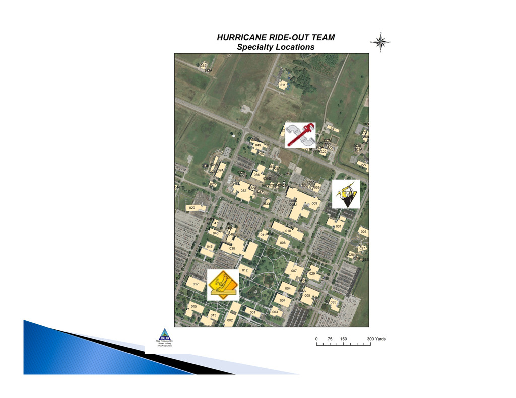
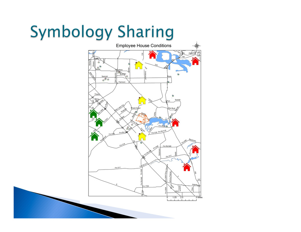
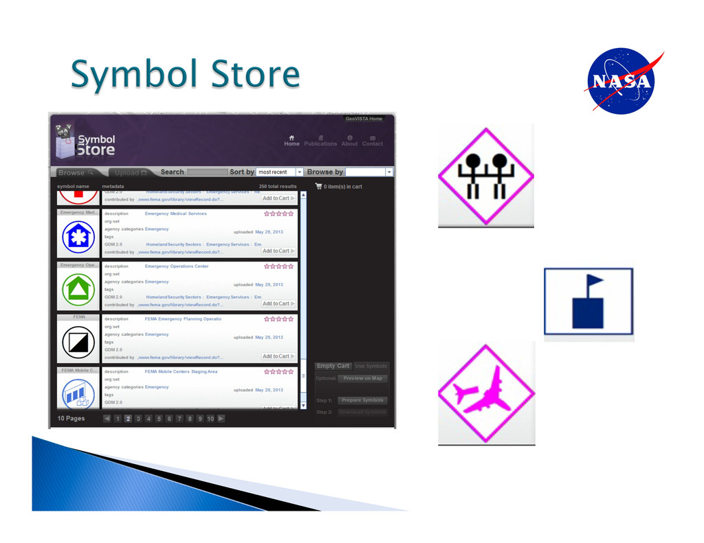
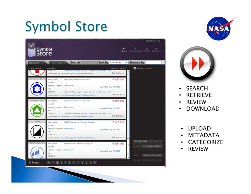
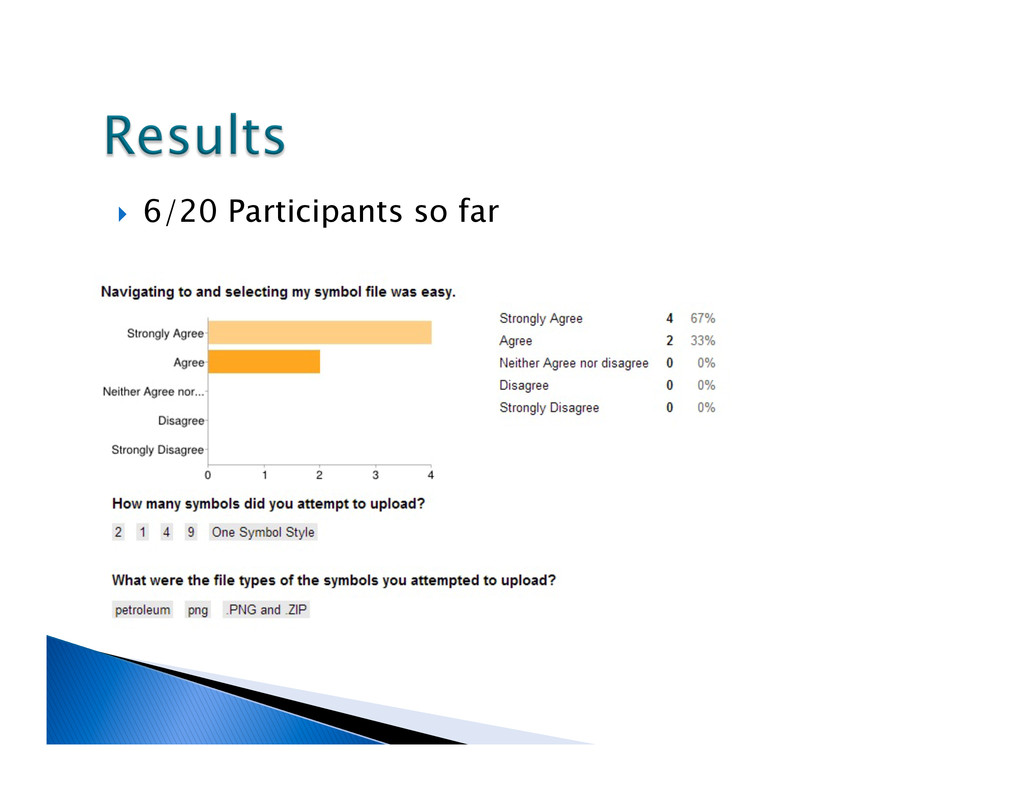
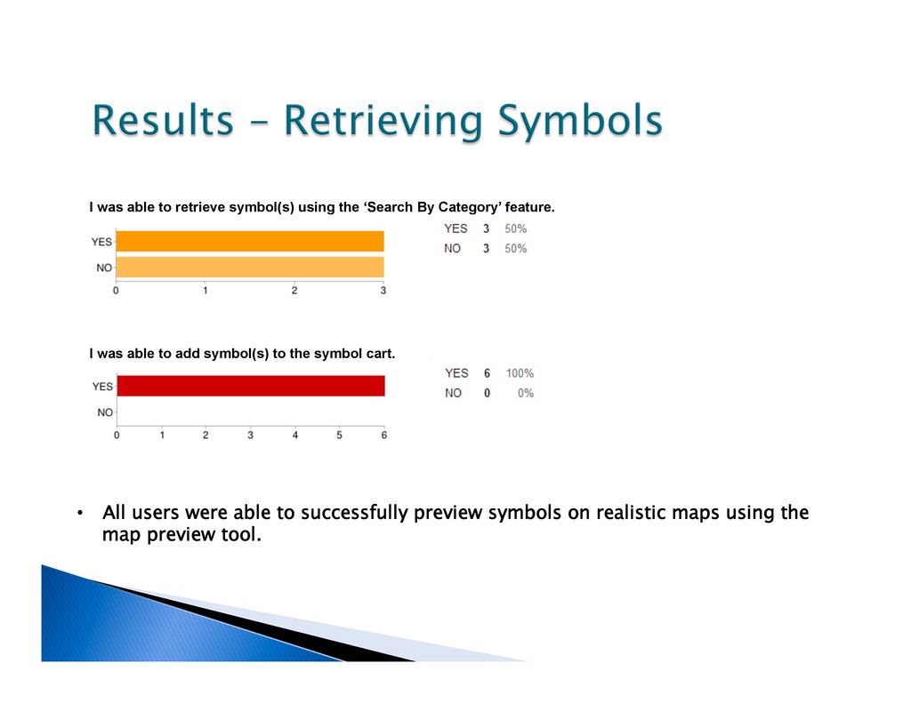
realistic maps using the map preview tool. I was able to retrieve symbol(s) using the ‘Search By Category’ feature. I was able to add symbol(s) to the symbol cart.
Symbols: Clarifying Communication” Cartography and Geographic Information Science, Vol. 36, No.1, pp. 19-28. Dymon, Ute J., et.al (2011). “Preparing an ANSI Standard for Emergency and Hazard Mapping Symbology”. Department of Geography, Kent State University. Federal Geographic Data Committee (2013) “The Federal Geographic Data Committee” http://www.fgdc.gov accessed June, 2013 Pierce College (2013) “Homeland Security Emergency Management” http://wp.pierce.ctc.edu/blog/coe/2012/08/19/the-symbol-store-over-1200-map-symbols/ accessed June, 2013 Robinson, Anthony, et.al (2010) “Challenges for Map Symbol Standardization in Crisis Management” Proceedings of the 7th International ISCRAM Conference, Seattle WA, May 2010. Robinson, Anthony, et.al (2011) “Understanding User Needs for Map Symbol Standards in Emergency Management” Journal of Homeland Security and Emergency Management: Vol. 8: Iss. 1, Article 33. DOI: 10.2202/1547-7355.1811 Robinson, Anthony, et.al (2012) “Developing map symbol standards through an iterative collaboration process” Environment and Planning B: Planning and Design 2012, volume 39, pages 1034-1048. Robinson, Anthony, et. al (2013) “Symbol Store: sharing map symbols for emergency management” Cartography and Geographic Information Science, DOI: 10.1080/15230406.2013.803833 Symbol Store: www.symbolstore.org API for Symbol Store: https://github.com/RyanMullins/Tutorial-LeafletAndSymbolStoreAPI