Upgrade to Pro
— share decks privately, control downloads, hide ads and more …
Speaker Deck
Features
Speaker Deck
PRO
Sign in
Sign up for free
Search
Search
Real-time Tracking and Mapping of Geographic Ob...
Search
PyCon 2013
March 17, 2013
Technology
690
4
Share
Real-time Tracking and Mapping of Geographic Objects by Ragi Burhum
PyCon 2013
March 17, 2013
More Decks by PyCon 2013
See All by PyCon 2013
Bayesian statistics made simple by Allen Downey
pyconslides
32
6.7k
Python for Humans
pyconslides
40
6.9k
Contribute with me! Getting started with the tools of free software development by Jessica McKellar
pyconslides
11
2.1k
ApplePy: An Apple ][ emulator in Python by James Tauber
pyconslides
3
1.7k
Use curses, don't swear by Sean Zicari
pyconslides
2
1.6k
Namespaces in Python by Eric Snow
pyconslides
9
2k
Internationalization and Localization Done Right by Ruchi Varshney
pyconslides
9
1.2k
"Good Enough" is good enough! by Alex Martelli
pyconslides
13
2.6k
Plover: Thought to Text at 240 WPM by Mirabai Knight
pyconslides
1
1.3k
Other Decks in Technology
See All in Technology
React、まだ楽しくて草
uhyo
7
3.8k
JEP 522 Deep Dive - G1 GC同期コスト削減によるスループット向上を徹底検証&解説
tabatad
1
590
Diagnosing performance problems without the guesswork
elenatanasoiu
0
150
AI Engineering Summit Tokyo 2026 AIの前に、やることがある 〜医療データ企業の4フェーズ〜
dtaniwaki
0
500
Terraformモジュールは、なぜ「魔境」化するのか
hayama17
1
150
「嘘をつくテスト」の失敗例から学ぶ 良いテストコード #frontend_phpcon_do
asumikam
0
140
サプライチェーンセキュリティの空白地帯 - 信頼できる”依存性”の未来を考える
rung
PRO
2
620
Kiro CLI v2.0.0がやってきた!
kentapapa
0
260
Sony_KMP_Journey_KotlinConf2026
sony
2
200
JJUG CCC 2026 Spring AI時代の開発こそ標準化を武器に! ― 方式・プロセス・プラットフォームの標準化
s27watanabe
2
660
Platform engineering for developers, architects & the rest of us (AI agents)
danielbryantuk
0
170
Claude Codeを組織で使いこなす— サーバサイドAIエージェント運用の実践知
techtekt
PRO
0
160
Featured
See All Featured
A better future with KSS
kneath
240
18k
実際に使うSQLの書き方 徹底解説 / pgcon21j-tutorial
soudai
PRO
200
74k
The agentic SEO stack - context over prompts
schlessera
0
790
Navigating Weather and Climate Data
rabernat
0
210
ピンチをチャンスに:未来をつくるプロダクトロードマップ #pmconf2020
aki_iinuma
128
55k
30 Presentation Tips
portentint
PRO
1
310
Principles of Awesome APIs and How to Build Them.
keavy
128
17k
Fashionably flexible responsive web design (full day workshop)
malarkey
408
66k
Become a Pro
speakerdeck
PRO
31
6k
B2B Lead Gen: Tactics, Traps & Triumph
marketingsoph
0
130
HTML-Aware ERB: The Path to Reactive Rendering @ RubyCon 2026, Rimini, Italy
marcoroth
1
130
A Tale of Four Properties
chriscoyier
163
24k
Transcript
Real-time Tracking and Mapping of Geographic Objects Ragi Burhum @rburhum
[email protected]
AmigoCloud We Synchronize Map Data - offline/online - edit
If you have tried this before, this may seem familiar…
Licensing Issues - Password-protected Site - Asset Tracking or similar
- Map Data Provider’s (Navteq, TomTom/TeleAtlas, etc) Business Model
None
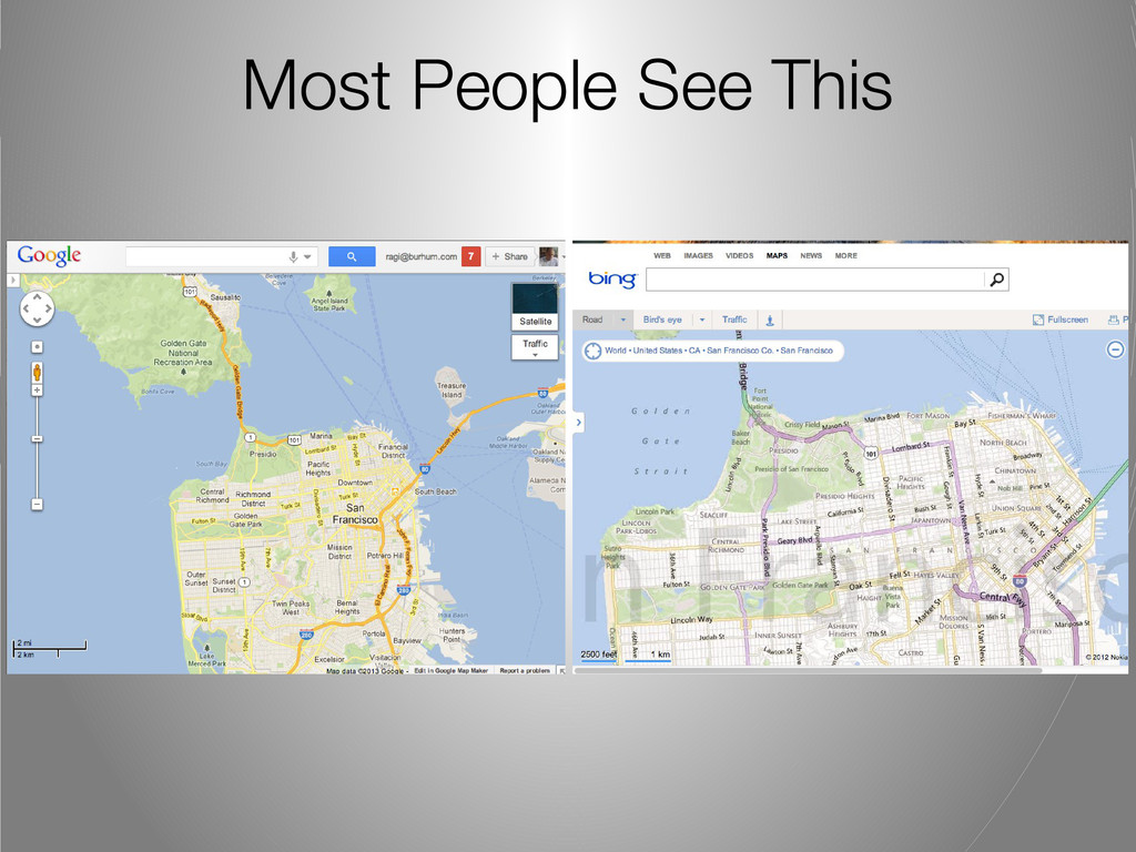
Most People See This
None
None
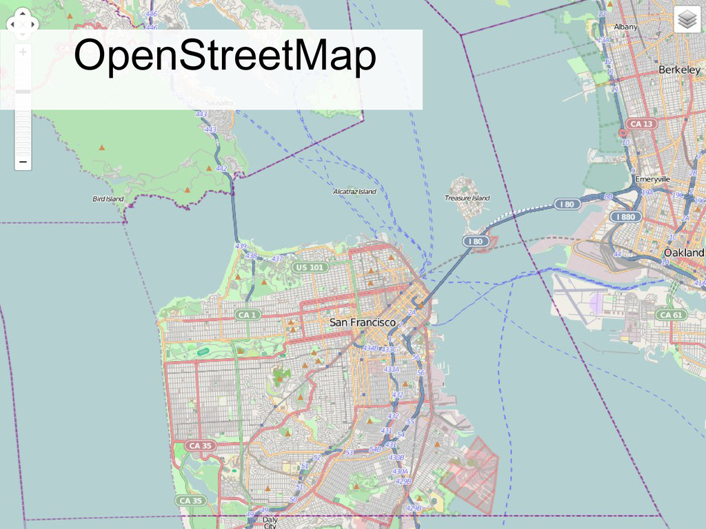
Examples of Free/Open Datasets Out There
OpenStreetMap
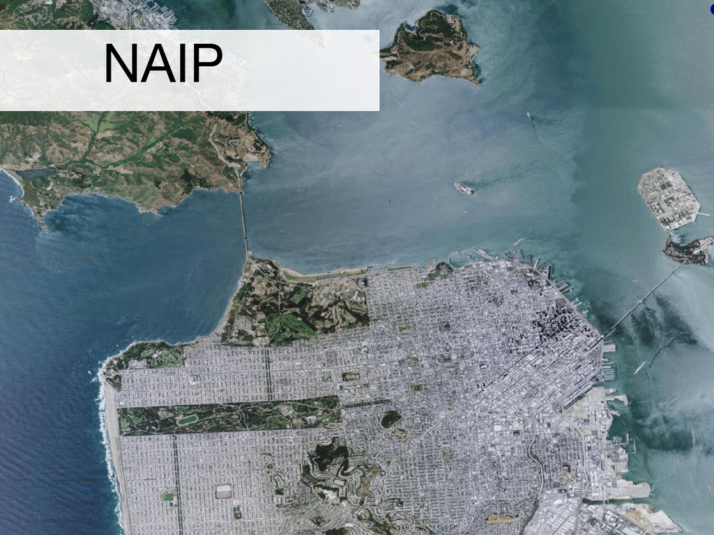
NAIP
SRTM
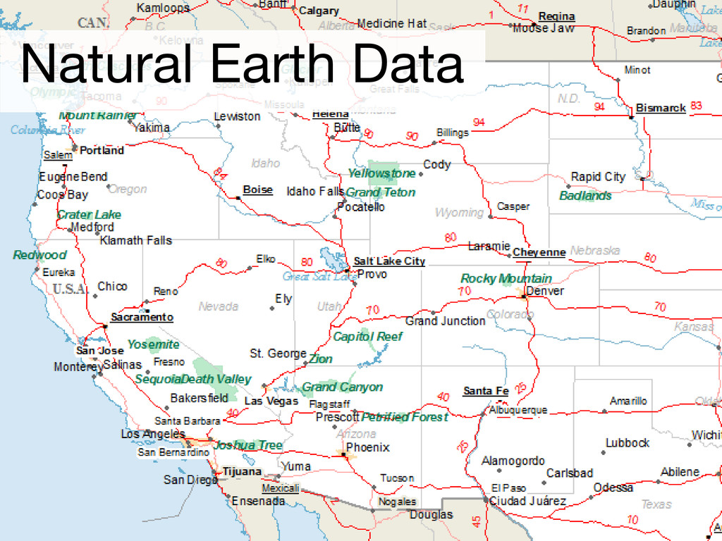
Natural Earth Data
Map Renderers (Mapnik, MapServer, GeoServer) + Style File
None
Client-side Map JS Library
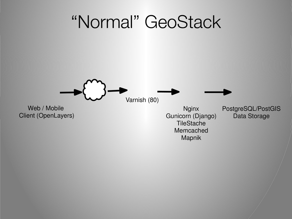
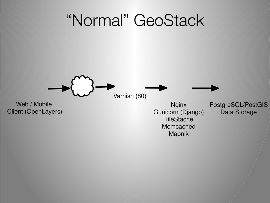
“Normal” GeoStack Nginx Gunicorn (Django) TileStache Memcached Mapnik PostgreSQL/PostGIS Data
Storage Web / Mobile Client (OpenLayers) Varnish (80)
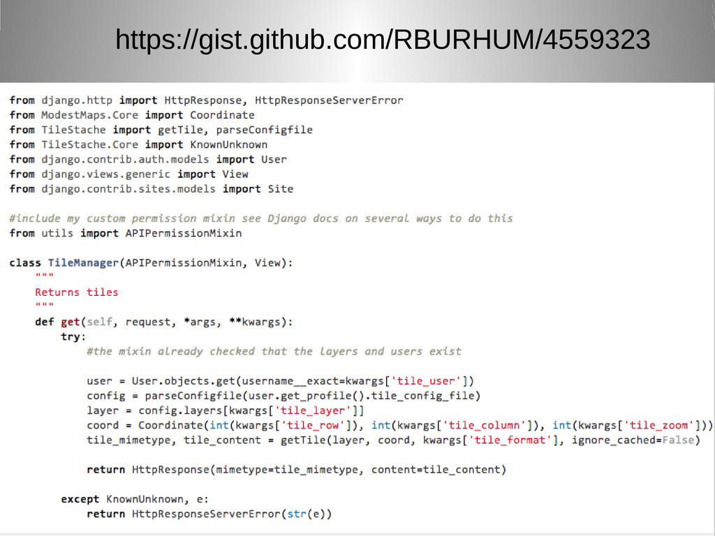
https://gist.github.com/RBURHUM/4559323
http://tilestache.org/doc/
None
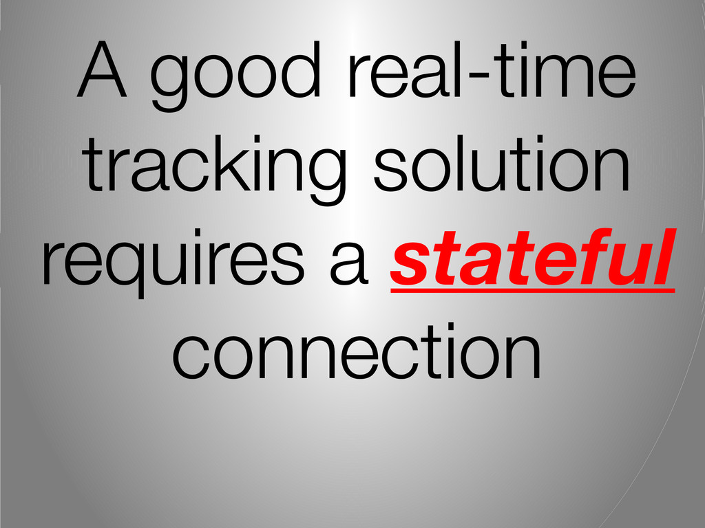
A good real-time tracking solution requires a stateful connection
Polling is BAD
Server-Side Events Instead of having [N] clients polling every [X]
time interval, how about the server notifying you
None
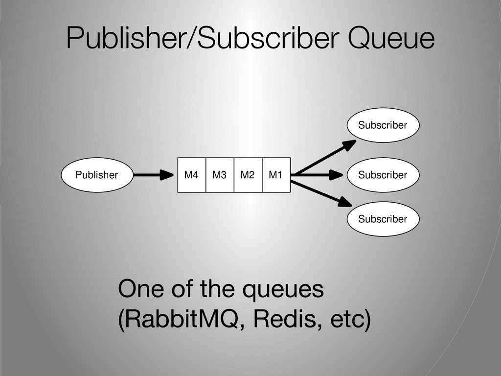
Publisher/Subscriber Queue One of the queues (RabbitMQ, Redis, etc) M3
M2 M1 M4 Publisher Subscriber Subscriber Subscriber
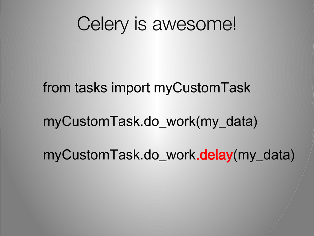
Celery is awesome! from tasks import myCustomTask myCustomTask.do_work(my_data) myCustomTask.do_work.delay(my_data)
“Normal” GeoStack Nginx Gunicorn (Django) TileStache Memcached Mapnik PostgreSQL/PostGIS Data
Storage Web / Mobile Client (OpenLayers) Varnish (80)
“Real-time” GeoStack Nginx Gunicorn (Django) TileStache Memcached Mapnik PostgreSQL/PostGIS Data
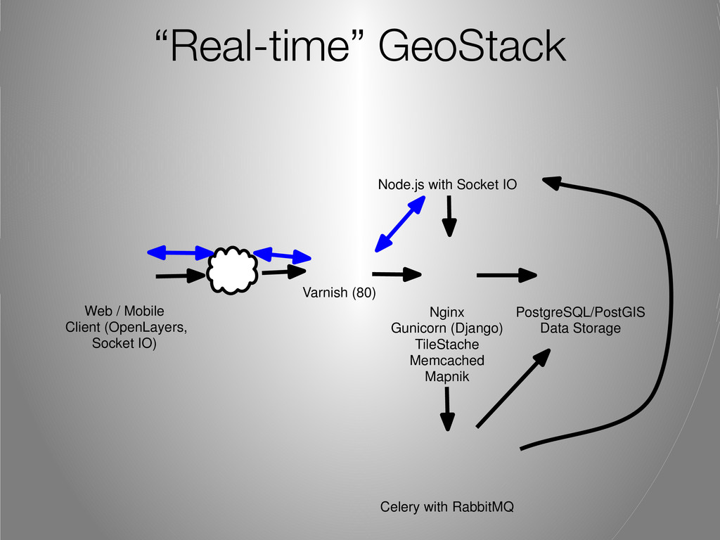
Storage Web / Mobile Client (OpenLayers, Socket IO) Varnish (80) Celery with RabbitMQ Node.js with Socket IO
Demo http://abuse.amigocloud.com
None
Ragi Burhum @rburhum
[email protected]
m If you are in the
Bay Area and like Geo: http://www.meetup.com/geomeetup
![Server-Side Events Instead of having [N] clients polling every [X]](https://files.speakerdeck.com/presentations/23a28f907162013061df1231381d50e5/slide_22.jpg)
![Ragi Burhum @rburhum [email protected] m If you are in the](https://files.speakerdeck.com/presentations/23a28f907162013061df1231381d50e5/slide_30.jpg)