Upgrade to Pro — share decks privately, control downloads, hide ads and more …

SciPy 2015 Presentation

SciPy 2015 Presentation

A Distributed, Standards-Based Framework for Searching, Accessing, Analyzing and Visualizing Met-Ocean Data: Application to Hurricane Sandy

Rich Signell

July 10, 2015
Tweet

More Decks by Rich Signell

Other Decks in Science

Transcript

  1. A Distributed, Standards-Based Framework for Searching, Accessing, Analyzing and Visualizing

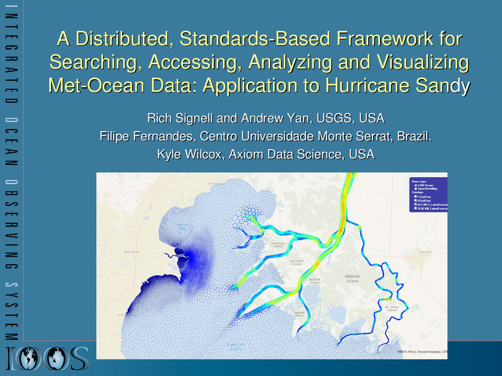
    Met-Ocean Data: Application to Hurricane Sandy Rich Signell and Andrew Yan, USGS, USA Filipe Fernandes, Centro Universidade Monte Serrat, Brazil. Kyle Wilcox, Axiom Data Science, USA
  2. Ocean grids are often not regularly spaced! Stretched surface and

    terrain following vertical coordinates Curvilinear orthogonal horizontal coordinates
  3. CF Conventions for met/ocean models Groups using CF: OGC: Open

    Geospatial Consortium GO-ESSP: Global Organization for Earth System Science Portal IOOS: Integrated Ocean Observing System float temp(ocean_time, s_rho, eta_rho, xi_rho) ; temp: standard_name = “sea_water_potential_temperature" ; temp: units = "Celsius" ; temp: coordinates = "lon_rho lat_rho s_rho ocean_time" ; double s_rho(s_rho) ; s_rho: long_name = "S-coordinate at RHO-points" ; s_rho: positive = "up" ; s_rho: standard_name = "ocean_s_coordinate_g1" ; s_rho: formula_terms = "s: s_rho C: Cs_r eta: zeta depth: h depth_c: hc "
  4. IOOS Recommended Web Services and Data Encodings In-situ data (buoys,

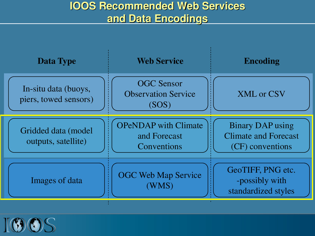
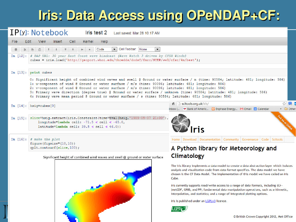
    piers, towed sensors) Gridded data (model outputs, satellite) OGC Sensor Observation Service (SOS) OPeNDAP with Climate and Forecast Conventions XML or CSV Binary DAP using Climate and Forecast (CF) conventions Images of data OGC Web Map Service (WMS) GeoTIFF, PNG etc. -possibly with standardized styles Data Type Web Service Encoding
  5. IOOS Data Infrastructure Diagram ROMS ADCIRC HYCOM SELFE NCOM NcML

    NcML NcML NcML NcML Common Data Model OPeNDAP+CF WCS NetCDF Subset THREDDS Data Server Standardized (CF-1.6, UGRID-0.9) Virtual Datasets Nonstandard Model Output Data Files Web Services Matlab Panoply IDV Clients NetCDF -Java Library or Broker WMS ncISO ArcGIS NetCDF4 -Python FVCOM Python ERDDAP NetCDF-Java SOS Geoportal Server GeoNetwork GI-CAT Observed data (buoy, gauge, ADCP, glider) Godiva2 CKAN-pyCSW NcML Grid Ugrid TimeSeries Profile Trajectory TimeSeriesProfile Nonstandard Data Files Catalog Services
  6. Browse with Github.com/TerriaJS Consumes: WMS, ESRI Rest, OSM, KML, GeoJSON,

    GPX, even CSV files Can search CKAN to build dynamic catalog Supports both 3D and 2D in browser
  7. Summary • We have now a complete open source framework

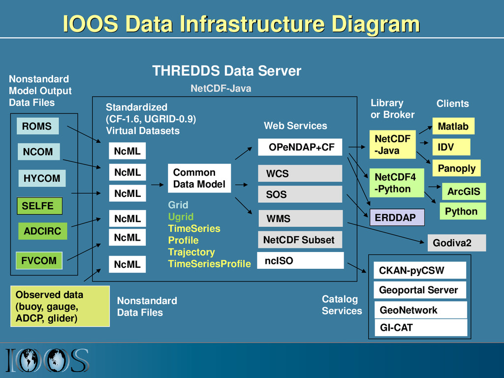
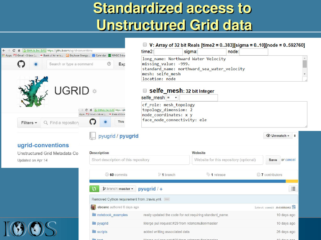
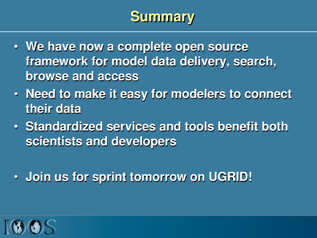
    for model data delivery, search, browse and access • Need to make it easy for modelers to connect their data • Standardized services and tools benefit both scientists and developers • Join us for sprint tomorrow on UGRID!
  8. Client Software Stack • Environment: – IPython Notebooks, Anaconda, Binstar,

    Github • Delivery – THREDDS Data Server, – OPeNDAP +CF +UGRID +SGRID • Access – Iris, pyugrid, pysgrid • Search – CSW using pycsw (server) & OWSLib (client) • Browse – Sciwms (server) & terriaJS (client)