Upgrade to Pro — share decks privately, control downloads, hide ads and more …

Mapstore - Modern Webmapping

Mapstore - Modern Webmapping

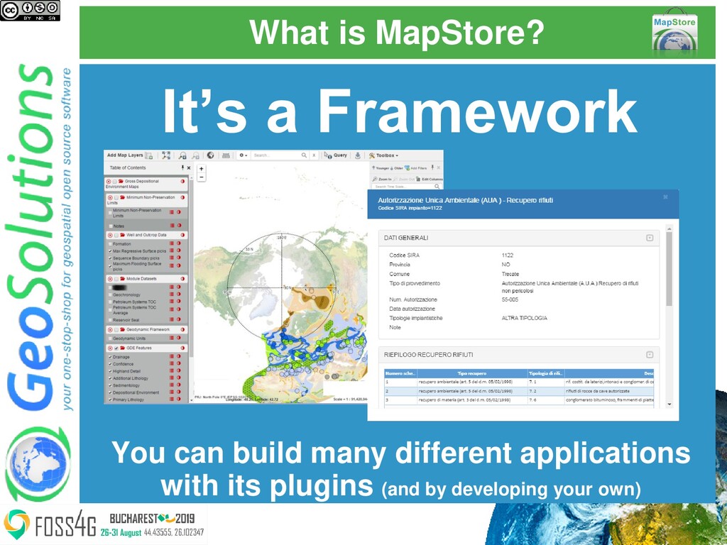
This presentation provides an introduction to MapStore covering the work done so far, with a special focus on the latest features, as well as on the work in progress.

Simone Giannecchini
PRO

August 01, 2019
Tweet

More Decks by Simone Giannecchini

Other Decks in Technology

Transcript

  1. MapStore
    Modern webmapping with React
    Ing. Mauro Bartolomeoli
    Dott. Lorenzo Natali
    GeoSolutions

    View Slide

  2. GeoSolutions

    Founded in Italy in late 2006

    Expertise
    • Image Processing, GeoSpatial Data Fusion
    • Java, Java Enterprise, C++, Python
    • JPEG2000, JPIP, Advanced 2D visualization

    Supporting/Developing FOSS4G projects

    GeoServer, MapStore

    GeoNetwork, GeoNode, Ckan

    Clients

    Public Agencies

    Private Companies

    http://www.geo-solutions.it

    View Slide

  3. Contents

    What is MapStore?

    What did we do last year?

    Where is MapStore going?

    View Slide

  4. What is MapStore?

    View Slide

  5. What is MapStore?
    MapStore
    https://mapstore.geo-solutions.it/mapstore/

    View Slide

  6. What is MapStore?
    It’s a Framework
    You can build many different applications
    with its plugins (and by developing your own)

    View Slide

  7. What is MapStore?
    It’s a Framework
    So you need to 
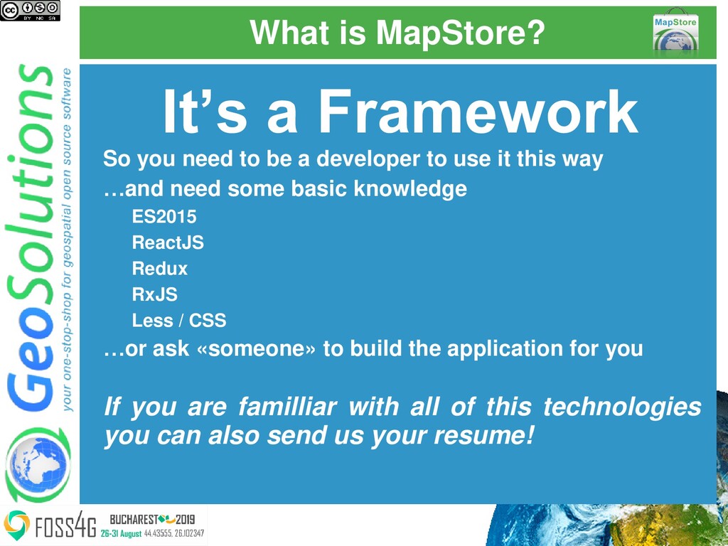
be a developer to use it this way
    …and need some basic knowledge
    ES2015
    ReactJS
    Redux
    RxJS
    Less / CSS
    …or ask «someone» to build the application for you
    If you are familliar with all of this technologies
    you can also send us your resume!

    View Slide

  8. What is MapStore?
    It is also a Product
    Use it as is or slightly modifying the look&feel

    View Slide

  9. What is MapStore?
    It is also a Product
    So you DON’T need to be a developer to use it this way
    …just edit some configuration
    …and basic css
    …using the documentation (we are improving this)
    …and ask on the mailing list when in doubt

    View Slide

  10. What did we do last year?

    View Slide

  11. Recent Improvements

    Dimensions handling

    Time

    Elevation

    Projections Selector

    Annotations

    No Stress Services Integration

    View Slide

  12. Recent Improvements

    GeoNode Integration

    Styler

    Templates

    CSS / SLD Editor

    Widgets Tray

    New Documentation WebSite

    View Slide

  13. Elevation Dimension
    • Connect to WMS layers that have Elevation 
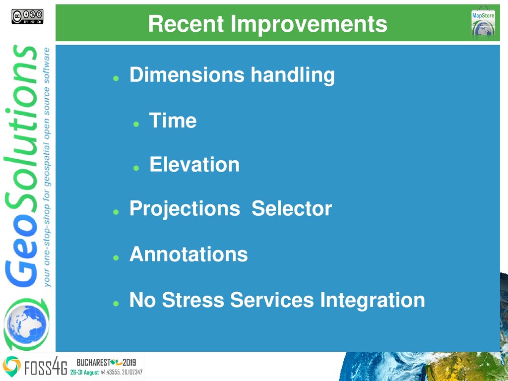
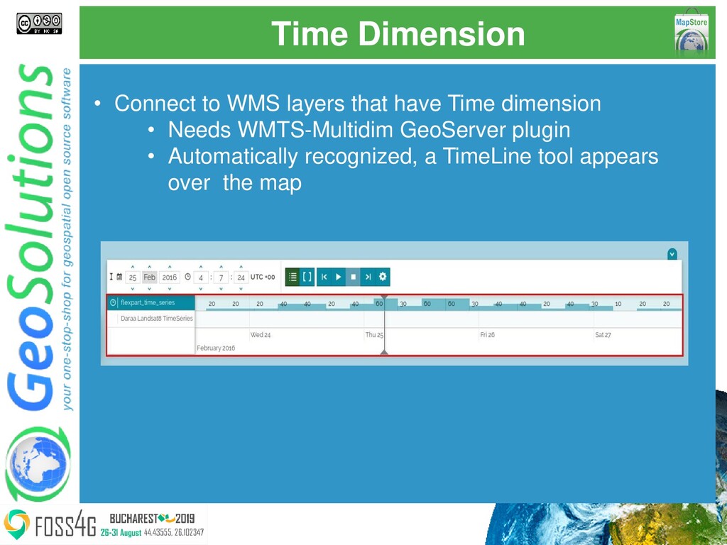
dimension
    • Automatically recognized, panel in the Layers
    Settings
    • DTM for MousePosition and CesiumJS
    (useForElevation)
    • You need GeoServer DDS plugin

    View Slide

  14. Time Dimension
    • Connect to WMS layers that have Time dimension
    • Needs WMTS-Multidim GeoServer plugin
    • Automatically recognized, a TimeLine tool appears
    over the map

    View Slide

  15. Time Dimension
    • Move into the timeline of your data and play animations

    View Slide

  16. Projection Selector
    • What if the world is flat?
    https://theflatearthsociety.org/home/

    View Slide

  17. Projection Selector
    • Unrfotunately I don’t believe it is…
    • But usually (unless we do 3D) a map IS flat
    • So we have to deal with projections

    View Slide

  18. Projection Selector
    • And this is not the easiest thing in the world
    • A lot of projections exist, with many variants and a lot of
    weird things can happen using some of them

    View Slide

  19. Projection Selector
    • We have libraries for the frontend (e.g. proj4js and
    OpenLayers) that can work with them
    • We have backend services that handle them (e.g.
    GeoServer)
    • But… prepare for some pain

    View Slide

  20. Projection Selector
    • Add your preferred projection(s) (with caution!)
    "projectionDefs": [{
    "code": "EPSG:54029",
    "def": "+proj=vandg +lon_0=0 +x_0=0 +y_0=0 +R_A
    +ellps=WGS84 +datum=WGS84 +units=m no_defs",
    "extent": [
    -20003999.8508586,
    -20003989.8508586,
    20003989.8508586,
    20003990.8508586
    ],
    "worldExtent": [
    -179.99999,
    -89.99999,
    179.9999,
    89.99999
    ]
    }]

    View Slide

  21. Projection Selector
    • Enable them in your plugins
    {
    "name": "CRSSelector",
    "cfg": {
    "additionalCRS": {
    "EPSG:54029": {
    "label": "Van Der Grinten I"
    }
    },
    "filterAllowedCRS": [
    "EPSG:4326",
    "EPSG:3857",
    "EPSG:54029"
    ],
    "allowedRoles": ["ALL"]

    }
    }

    View Slide

  22. Projection Selector
    • Enable them in your plugins
    {
    "name": "MousePosition",
    "cfg": {

    "filterAllowedCRS": ["EPSG:4326", "EPSG:3857",
    "EPSG:54029"],
    "additionalCRS": {
    "EPSG:54009": {
    "label": "Van Der Grinten I"
    }
    }
    }
    }

    View Slide

  23. MapAnnotations
    • Draw and save points, lines, polygons, circles and text on
    your maps

    View Slide

  24. StyleEditor
    • Switch between the different layers styles

    View Slide

  25. StyleEditor
    • Enable style editing in localConfig.json (only for ADMINs)
    • Or (for everybody)
    {
    "name": "StyleEditor",
    "cfg": {
    "editingAllowedRoles": ["ADMIN"]
    }
    }
    {
    "name": "StyleEditor",
    "cfg": {
    "editingAllowedRoles": null
    }
    }

    View Slide

  26. StyleEditor
    • Create new styles or edit existing ones

    View Slide

  27. StyleEditor
    • Choose a sample style to start from and immediately apply it

    View Slide

  28. StyleEditor
    • Edit the style using a smart editor
    • Syntax highlighting
    • Support for SLD and CSS

    View Slide

  29. StyleEditor
    • Edit the style using a smart editor
    • Helper tools (e.g. color picker)
    • Autocomplete and validation

    View Slide

  30. StyleEditor
    • Requirements:
    • User needs FULL access to GeoServer REST services
    • Properly configured CORS in GeoServer

    View Slide

  31. Widgets Tray
    • Minimize the widgets when not needed

    View Slide

  32. Layer Filters
    • Persisted with layer configuration
    • Used by every tool

    View Slide

  33. GeoNode Integration – from 2.10

    View Slide

  34. GeoNode Integration - Layer & Map
    Preview
    Layer and Map previews provide navigation
    tools and give access to advanced
    functionalities

    View Slide

  35. GeoNode Integration - Info and Print
    Get information from layers and print the
    previewed map inside the Map Viewer of
    MapStore

    View Slide

  36. GeoNode Integration - Edit Data
    Attribute table give to users the access of
    each feature of a layer and provides a set of
    tools to edit, filter, query and draw data

    View Slide

  37. GeoNode Integration - Time Slider
    Navigate in the time dimension with the Time
    Slider

    View Slide

  38. GeoNode Integration - Style Editor
    Select, edit and create styles in SLD or
    GeoCSS

    View Slide

  39. GeoNode Integration - Charts and
    Widgets
    Create charts, tables, counters and text
    widgets to add them on the map

    View Slide

  40. GeoNode Integration - Map Viewer
    Create and edit maps inside the Map Viewer.
    Add new layers with the Catalog tool

    View Slide

  41. No Stress Integration
    "proxyUrl": {
    "url": "proxy/?url=",
    "autoDetectCORS": true
    }
    • Connect to external servers seamlessly
    • Automatically uses a proxy when needed
    • Use with care, still experimental

    View Slide

  42. Documentation
    • Using Read the Docs
    • https://mapstore.readthedocs.io/en/latest/

    View Slide

  43. Future

    View Slide

  44. Time and Elevation
    • TimeSlider should work also without the 
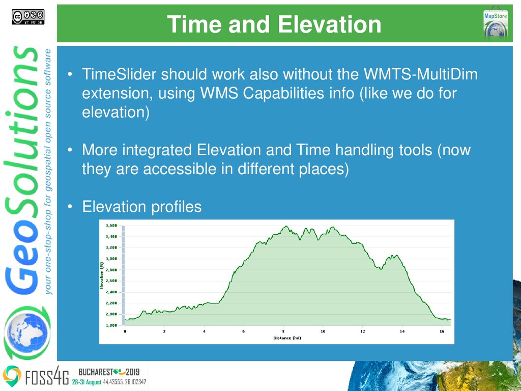
WMTS-MultiDim
    extension, using WMS Capabilities info (like we do for
    elevation)
    • More integrated Elevation and Time handling tools (now
    they are accessible in different places)
    • Elevation profiles

    View Slide

  45. StyleEditor
    • Visual Editor

    View Slide

  46. Vector Tiles
    • Sources
    • WMS
    • WMTS
    • WFS3
    • Formats
    • MapBox MVT
    • GeoJSON
    • TopoJSON
    • Styling
    • SLD
    • CSS
    • MapBox styles

    View Slide

  47. GeoStory
    like storymaps but better
    Q12020

    View Slide

  48. Others
    • Projections
    • Bug fixing and extended support in the various
    plugins
    • CORS Automatic Detection
    • Improve CORS error detection (not easy!)

    View Slide

  49. Resources

    MapStore documentation
    https://mapstore.readthedocs.io/en/latest/

    Developing in MapStore
    https://docs.google.com/presentation/d/13eCrCdOBiorICPM1MTfsPP8QV9xMsFS2bR
    REb4QHCJ0/edit?usp=sharingMore

    Use ReactJS, Redux and RxJS
    documentation too

    View Slide

  50. That’s all folks!
    Questions?
    [email protected]

    View Slide