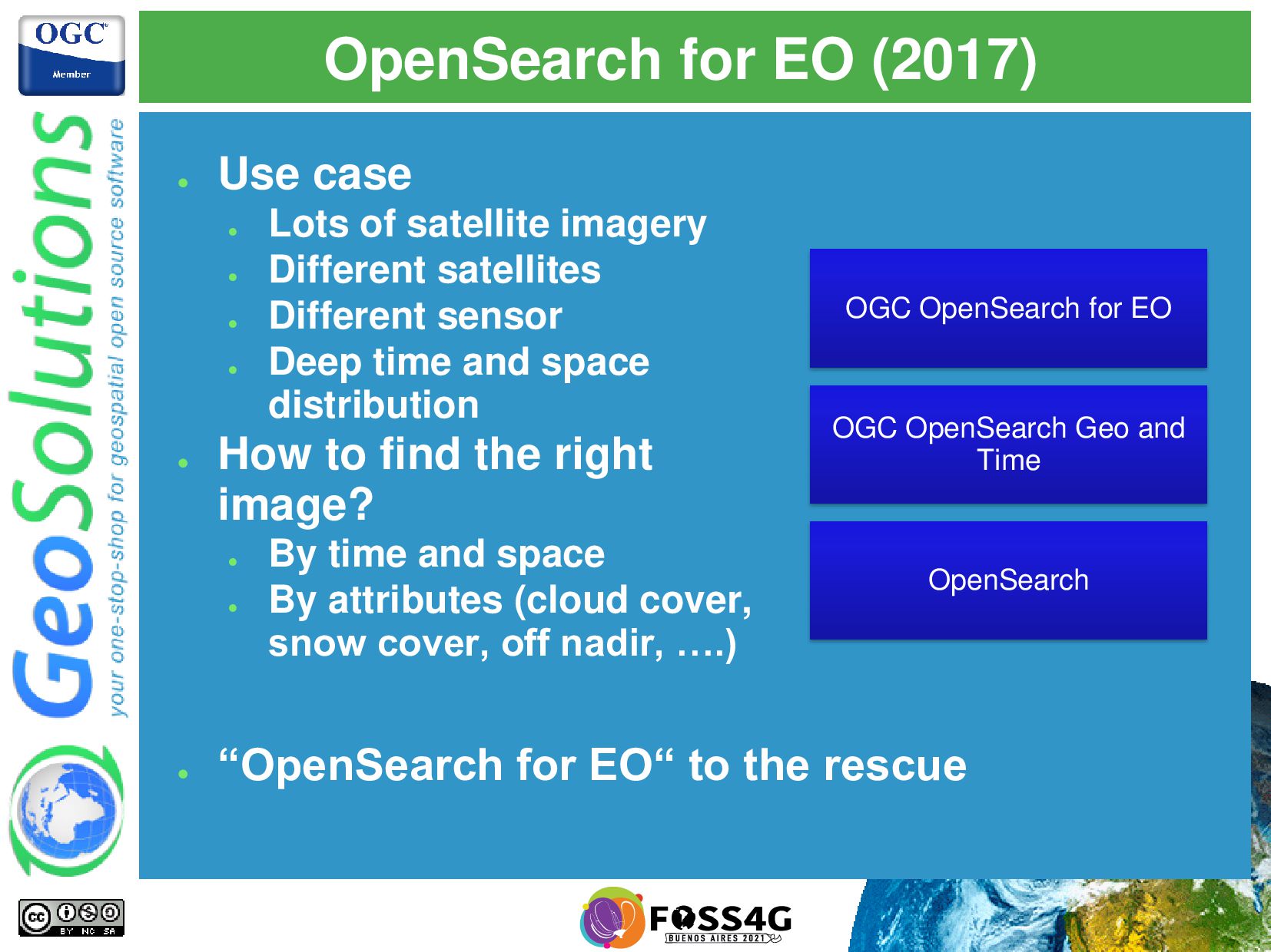
satellite imagery • Different satellites • Different sensor • Deep time and space distribution • How to find the right image? • By time and space • By attributes (cloud cover, snow cover, off nadir, ….) OpenSearch OGC OpenSearch Geo and Time OGC OpenSearch for EO • “OpenSearch for EO“ to the rescue
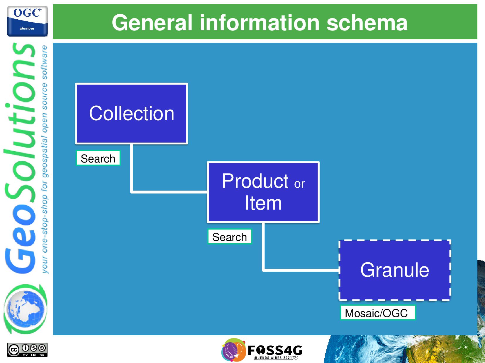
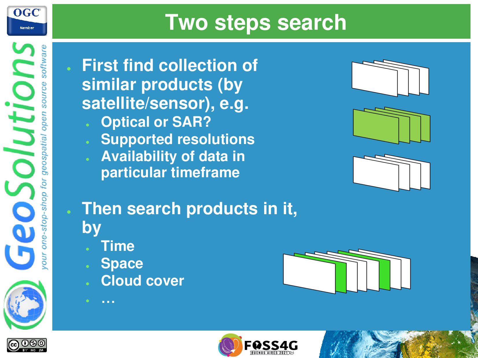
(by satellite/sensor), e.g. • Optical or SAR? • Supported resolutions • Availability of data in particular timeframe • Then search products in it, by • Time • Space • Cloud cover • …
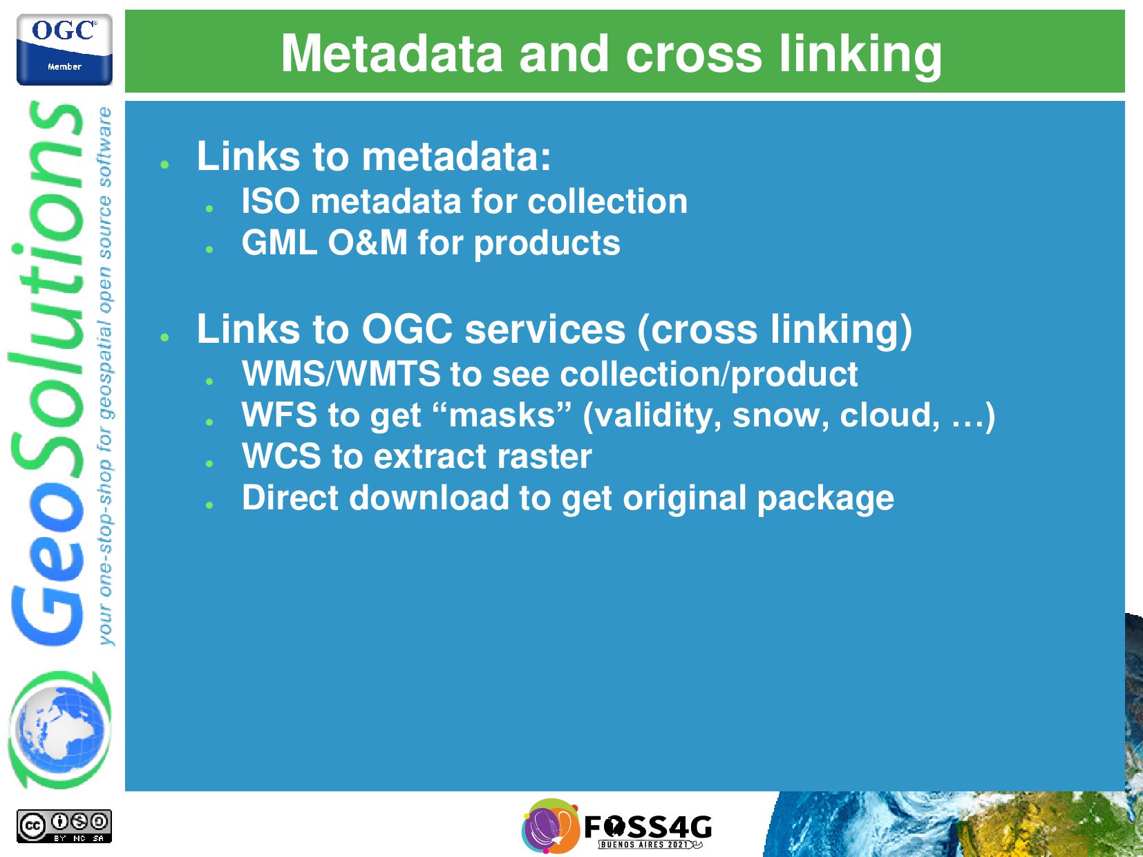
metadata for collection • GML O&M for products • Links to OGC services (cross linking) • WMS/WMTS to see collection/product • WFS to get “masks” (validity, snow, cloud, …) • WCS to extract raster • Direct download to get original package
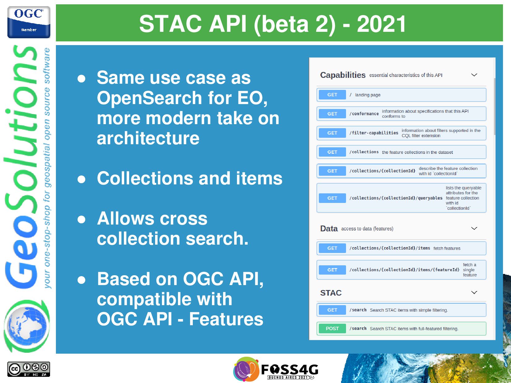
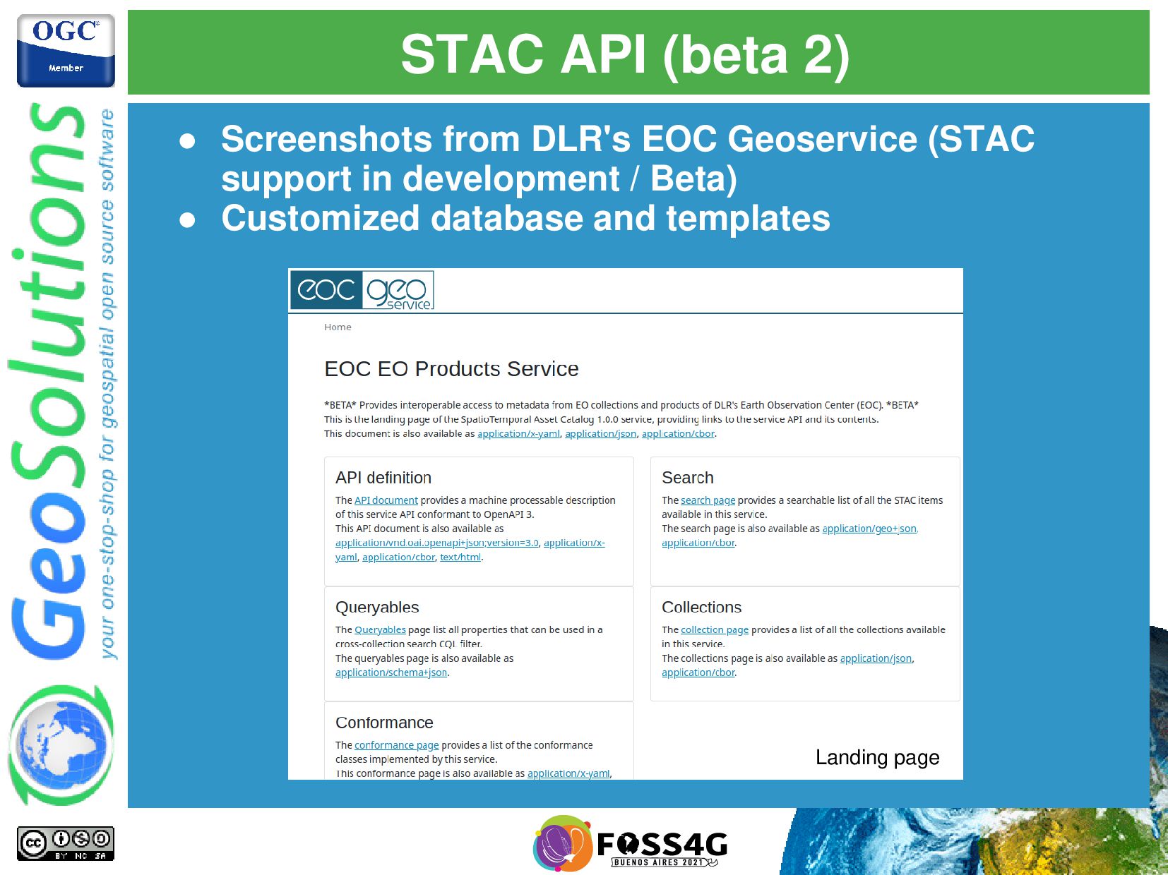
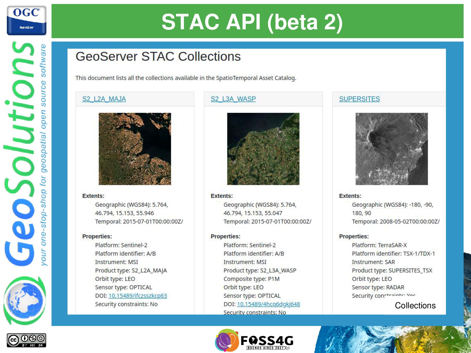
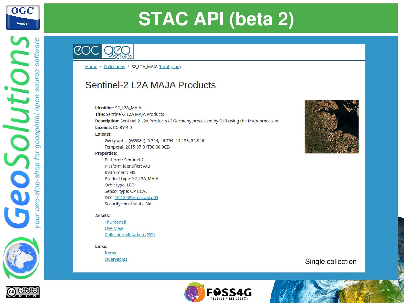
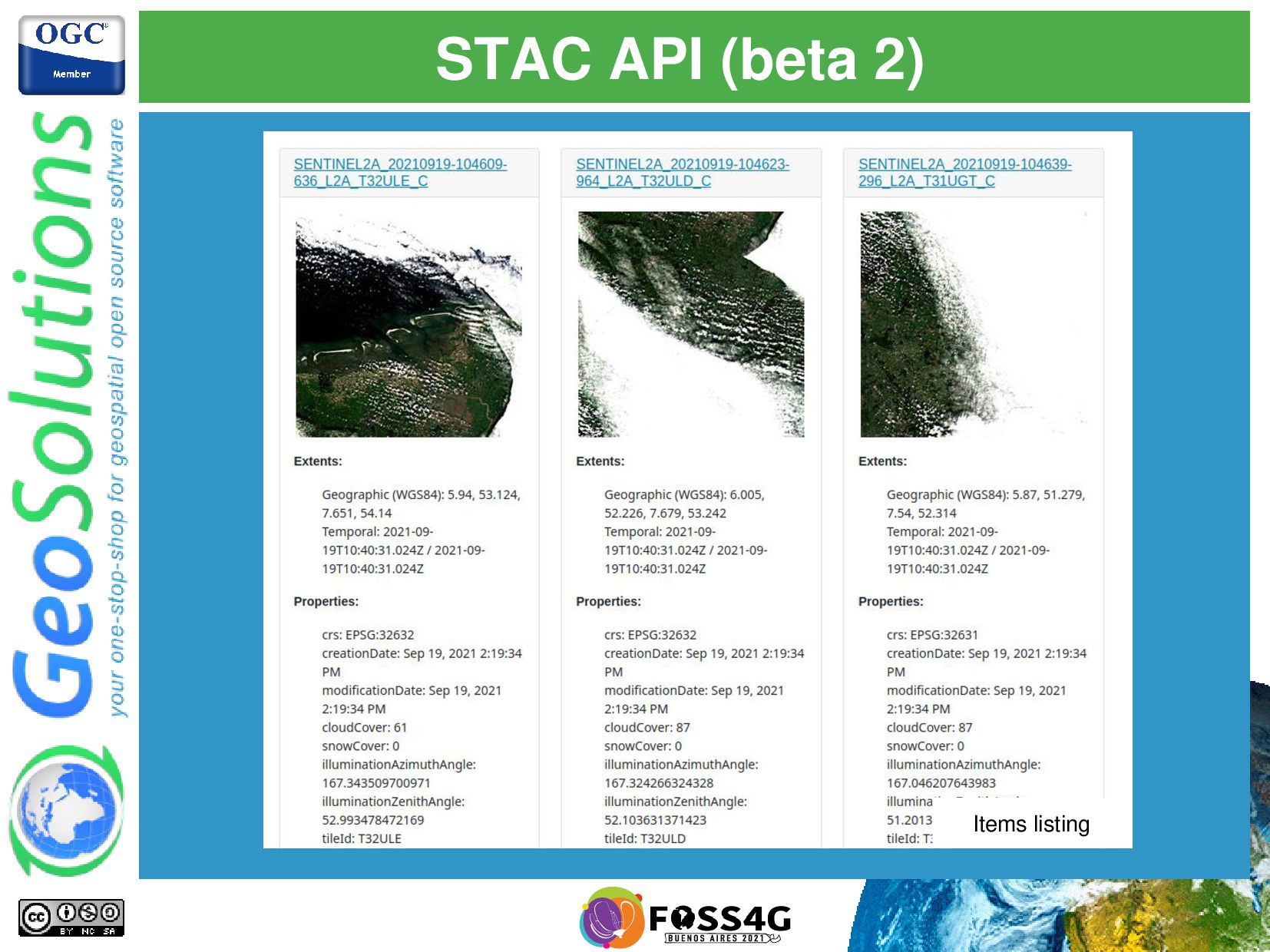
as OpenSearch for EO, more modern take on architecture • Collections and items • Allows cross collection search. • Based on OGC API, compatible with OGC API - Features
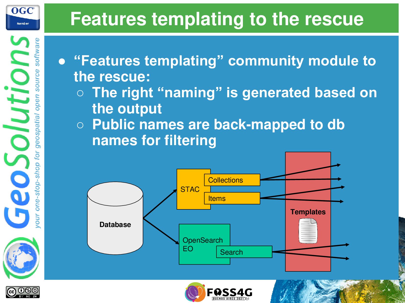
◦ Database ◦ OpenSearch EO ▪ GeoRSS ▪ GeoJSON ◦ STAC • They express the same information with different names OpenSearch EO GeoRSS OpenSearch EO GeoJSON STAC collections/items Database
to the rescue: ◦ The right “naming” is generated based on the output ◦ Public names are back-mapped to db names for filtering Database STAC Collections Items OpenSearch EO Search Templates
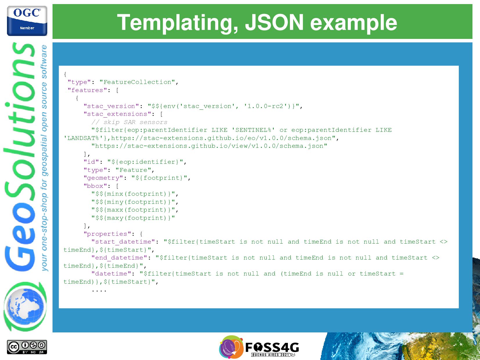
"$${env('stac_version', '1.0.0-rc2')}", "stac_extensions": [ // skip SAR sensors "$filter{eop:parentIdentifier LIKE 'SENTINEL%' or eop:parentIdentifier LIKE 'LANDSAT%'},https://stac-extensions.github.io/eo/v1.0.0/schema.json", "https://stac-extensions.github.io/view/v1.0.0/schema.json" ], "id": "${eop:identifier}", "type": "Feature", "geometry": "${footprint}", "bbox": [ "$${minx(footprint)}", "$${miny(footprint)}", "$${maxx(footprint)}", "$${maxy(footprint)}" ], "properties": { "start_datetime": "$filter{timeStart is not null and timeEnd is not null and timeStart <> timeEnd},${timeStart}", "end_datetime": "$filter{timeStart is not null and timeEnd is not null and timeStart <> timeEnd},${timeEnd}", "datetime": "$filter{timeStart is not null and (timeEnd is null or timeStart = timeEnd)},${timeStart}", ....
the imagery files • OpenSearch can point to the raw package, and the “granules” table allow to get to the single images • Where can they be located? ◦ Local file system (classic approach) ◦ HTTP server ◦ S3 or other blob storage
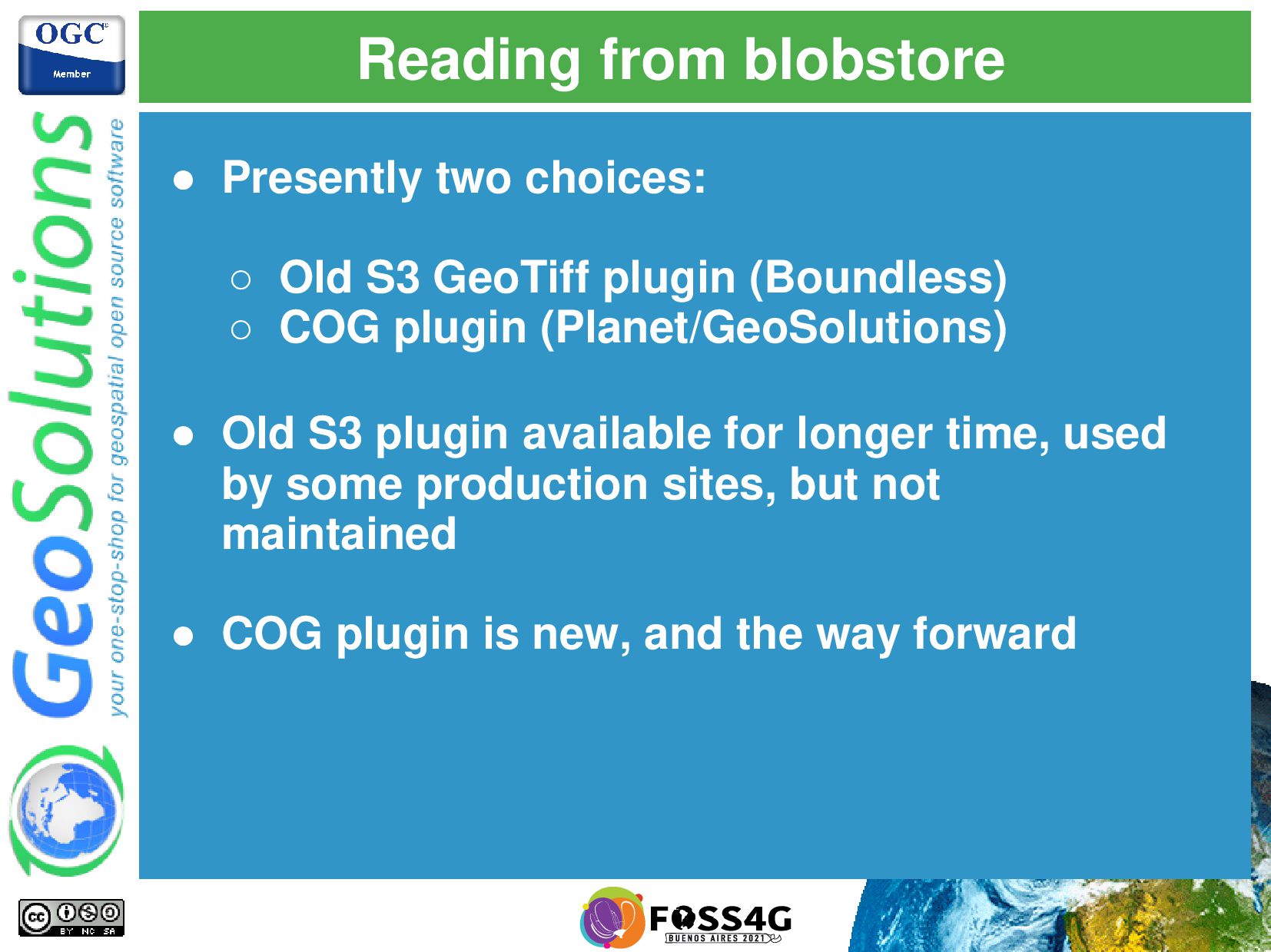
GeoTiff plugin (Boundless) ◦ COG plugin (Planet/GeoSolutions) • Old S3 plugin available for longer time, used by some production sites, but not maintained • COG plugin is new, and the way forward
blocks (configurable) • Read the full block even a small part of it is used • Eventual local memory/disk cache • Works best for smaller files and strong locality • Can read any GeoTIFF 5MB 5MB 5MB
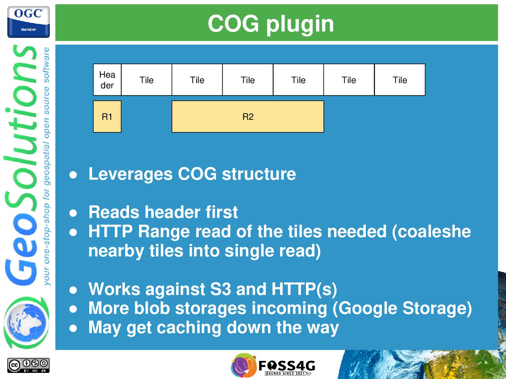
header first • HTTP Range read of the tiles needed (coaleshe nearby tiles into single read) • Works against S3 and HTTP(s) • More blob storages incoming (Google Storage) • May get caching down the way Tile Tile Tile Tile Tile Tile R1 R2
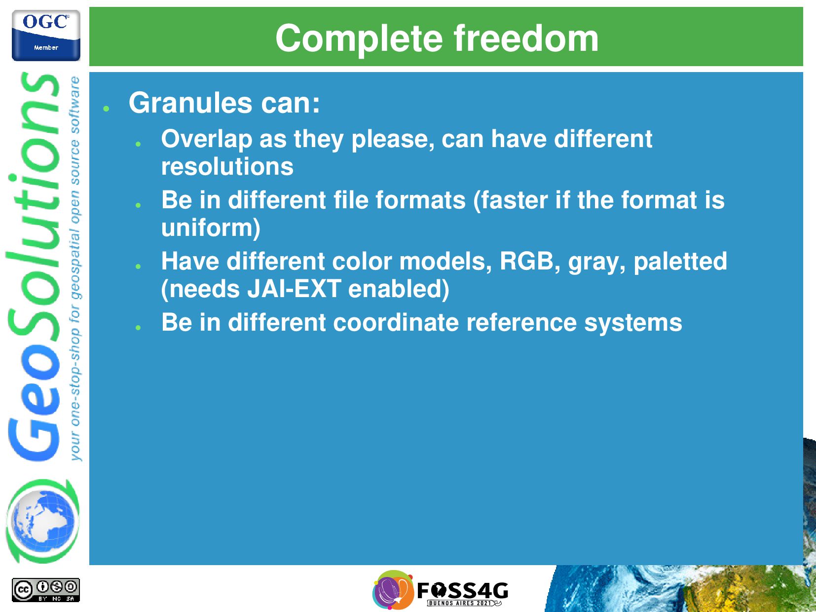
can have different resolutions • Be in different file formats (faster if the format is uniform) • Have different color models, RGB, gray, paletted (needs JAI-EXT enabled) • Be in different coordinate reference systems
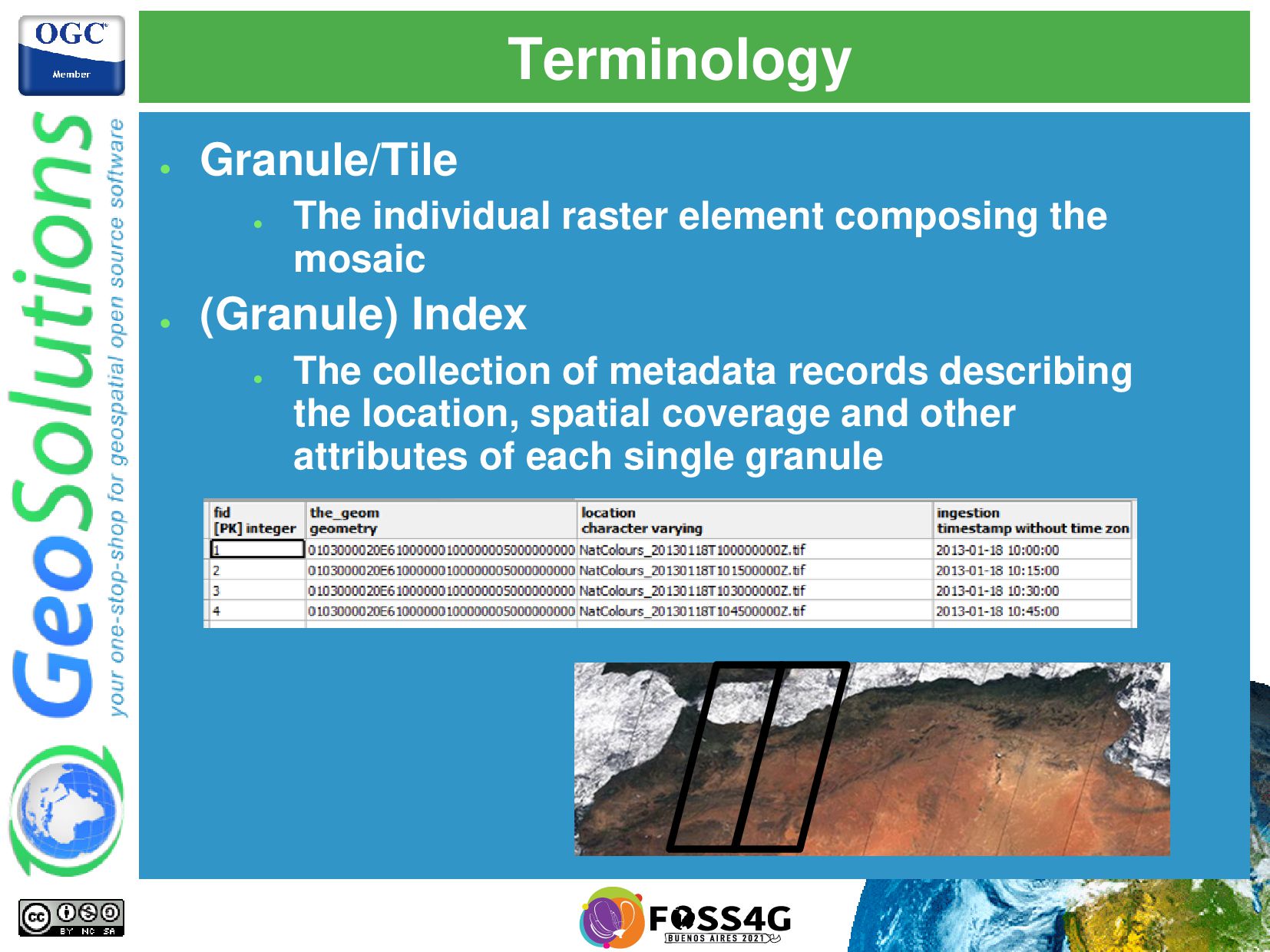
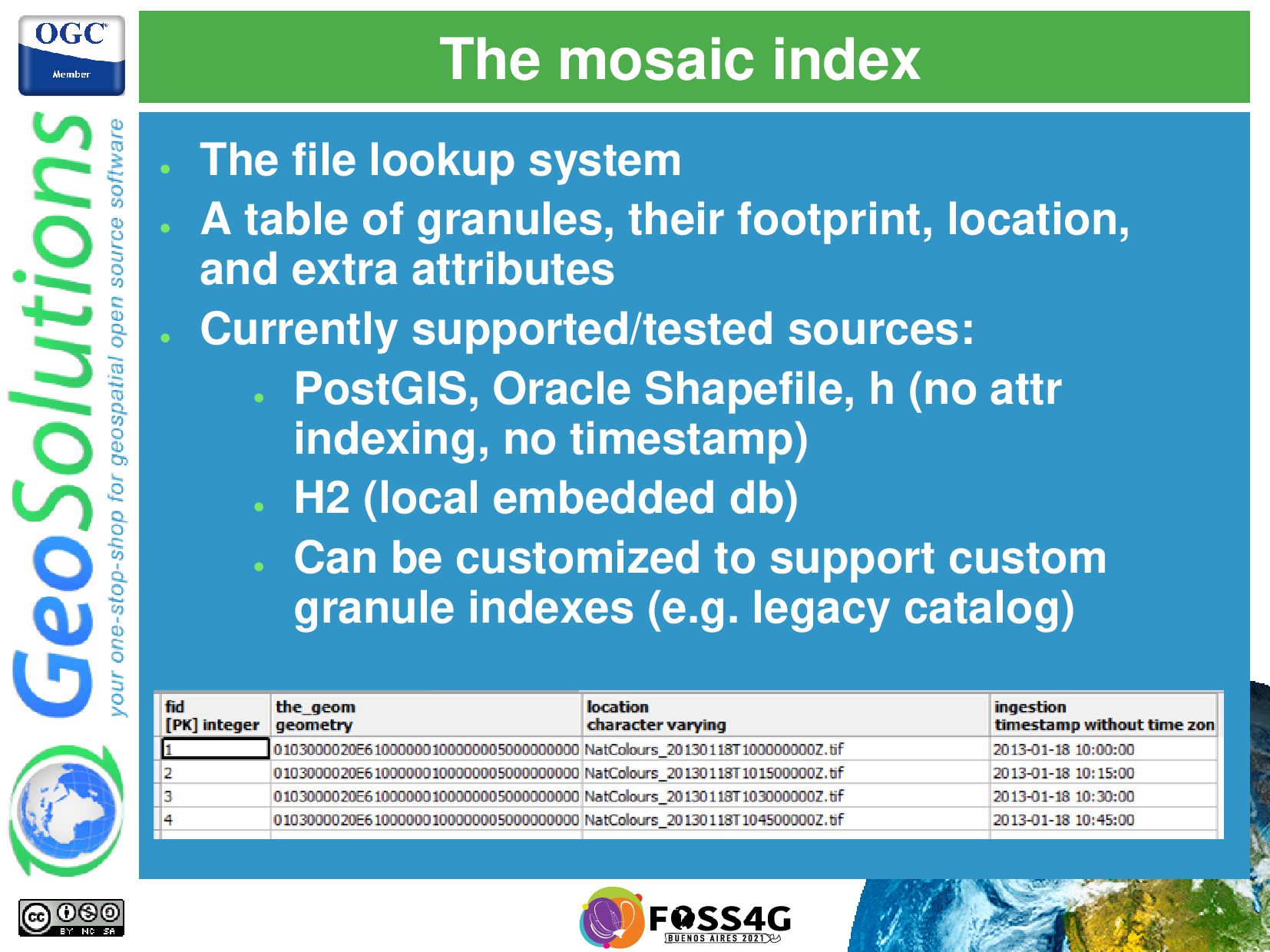
table of granules, their footprint, location, and extra attributes • Currently supported/tested sources: • PostGIS, Oracle Shapefile, h (no attr indexing, no timestamp) • H2 (local embedded db) • Can be customized to support custom granule indexes (e.g. legacy catalog)
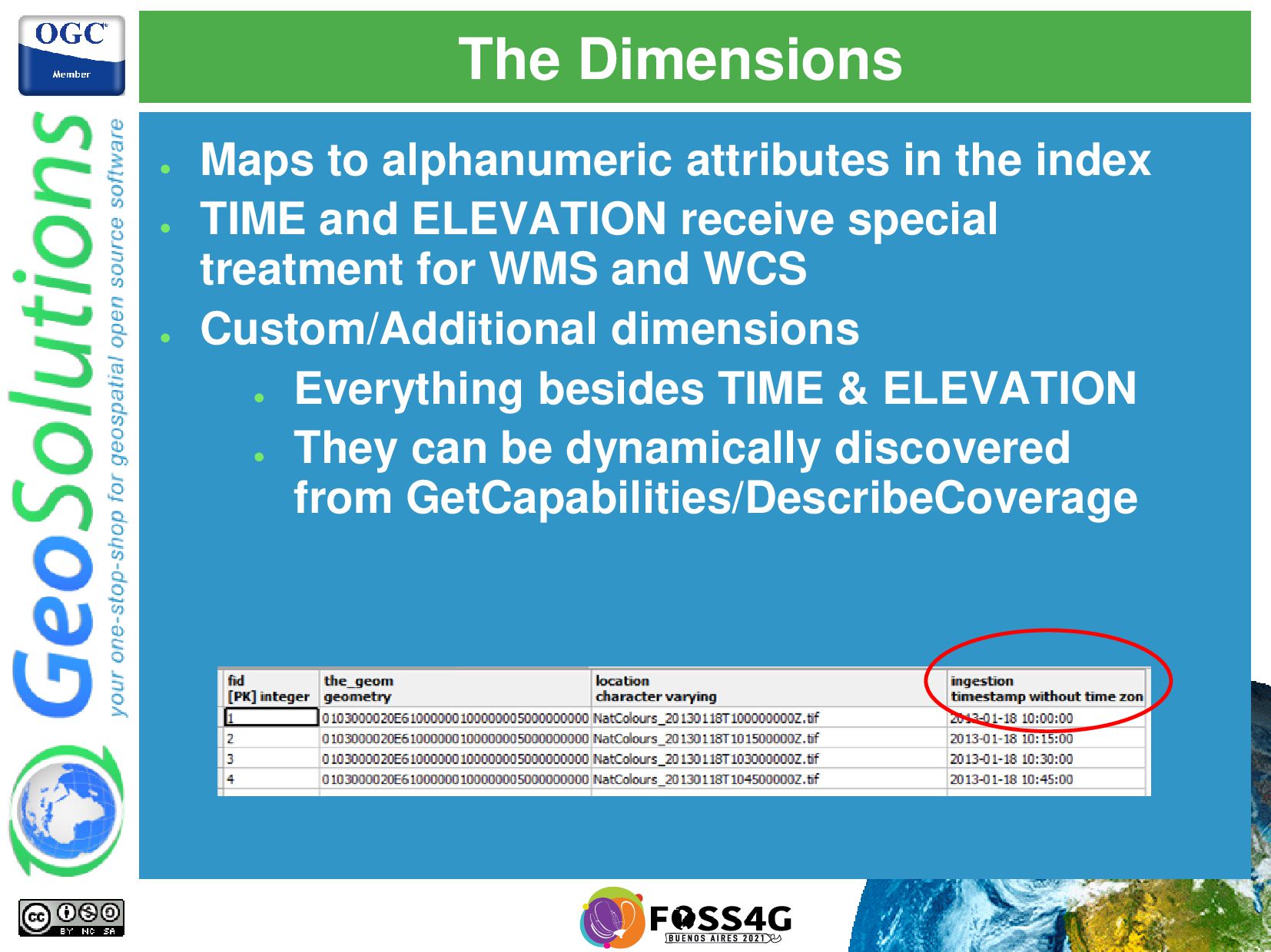
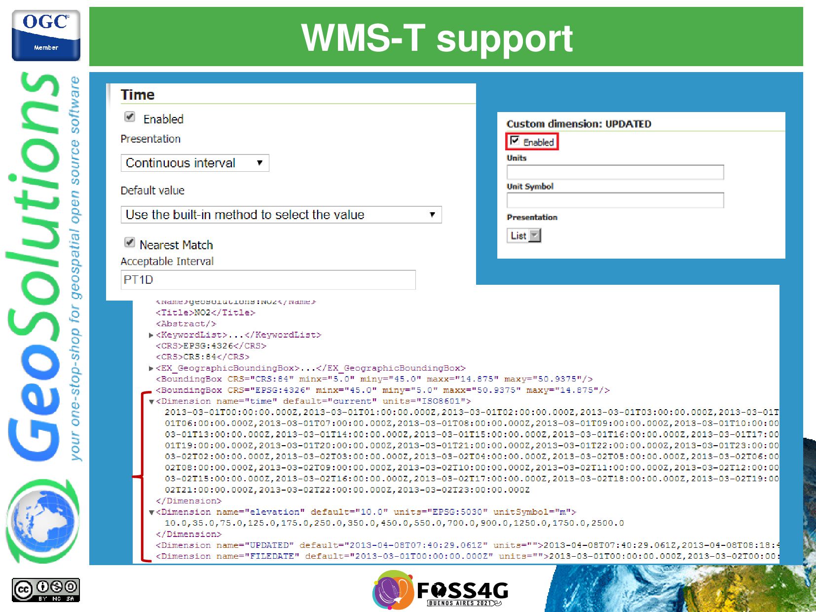
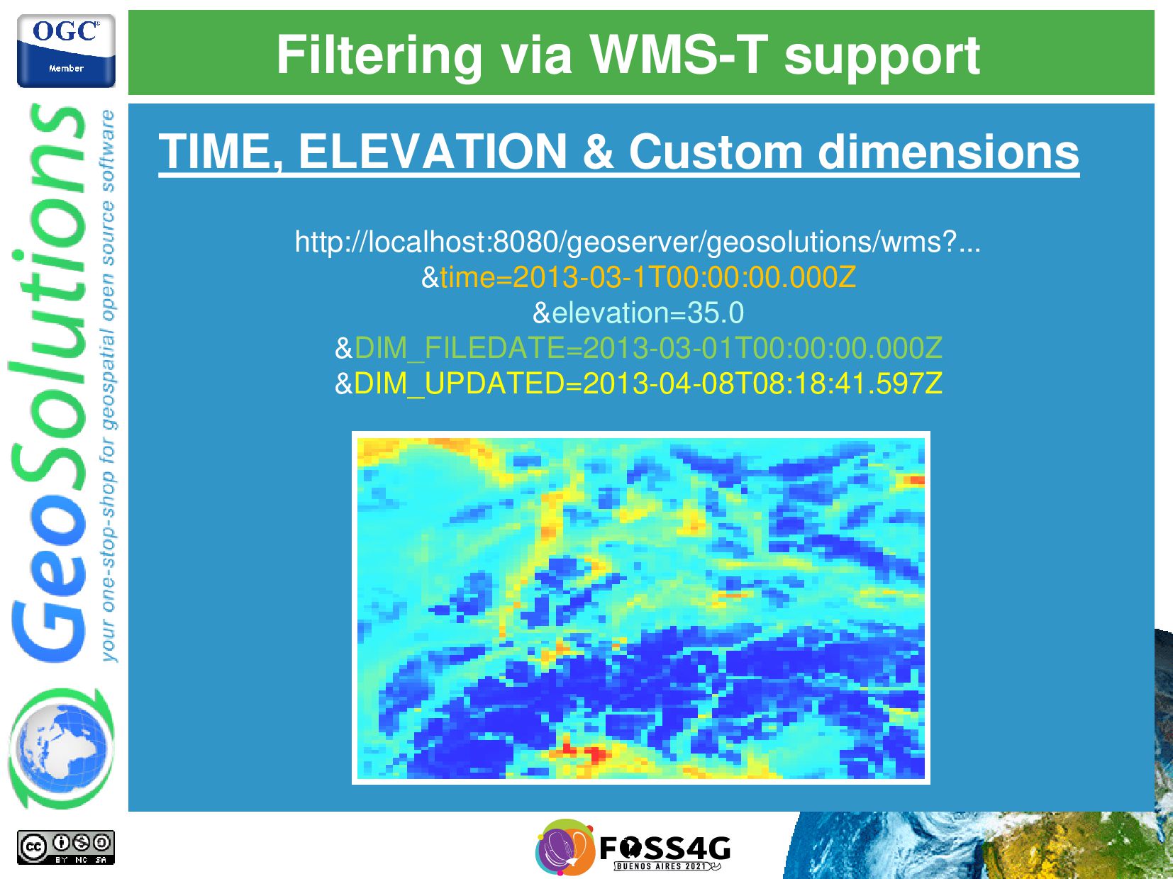
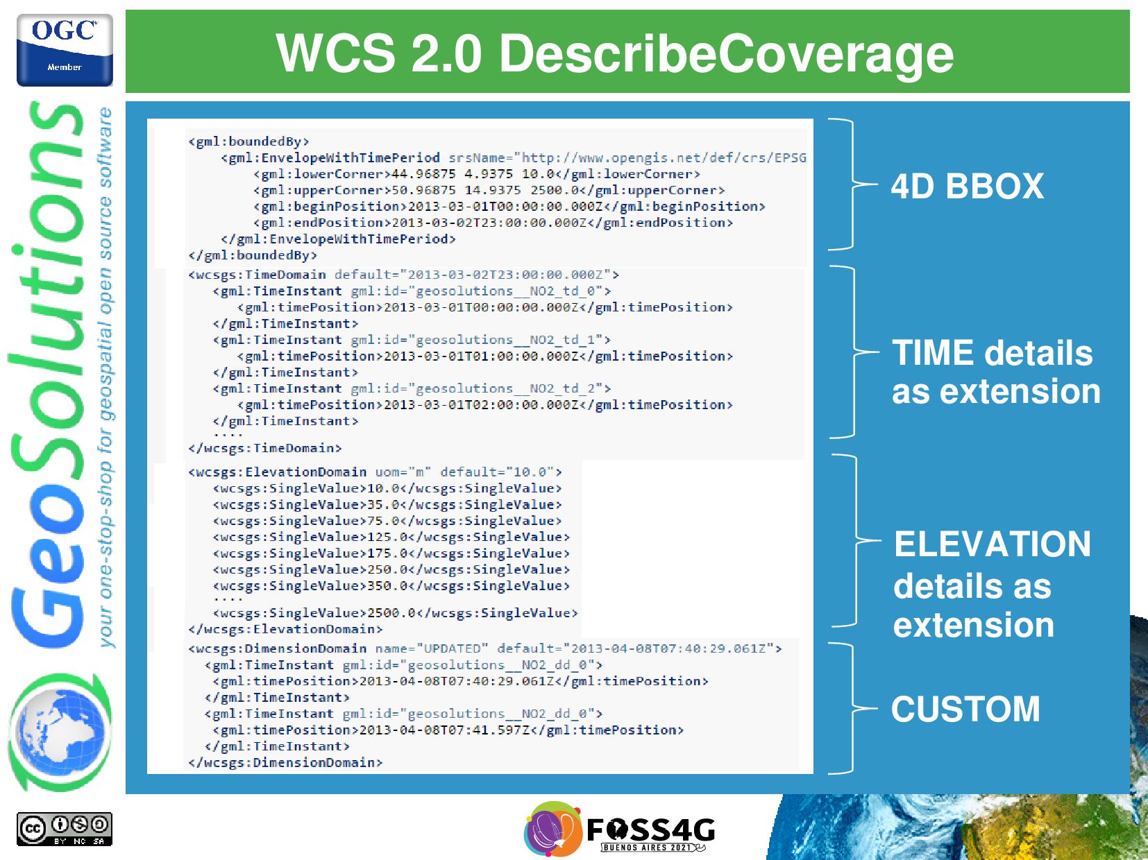
• TIME and ELEVATION receive special treatment for WMS and WCS • Custom/Additional dimensions • Everything besides TIME & ELEVATION • They can be dynamically discovered from GetCapabilities/DescribeCoverage
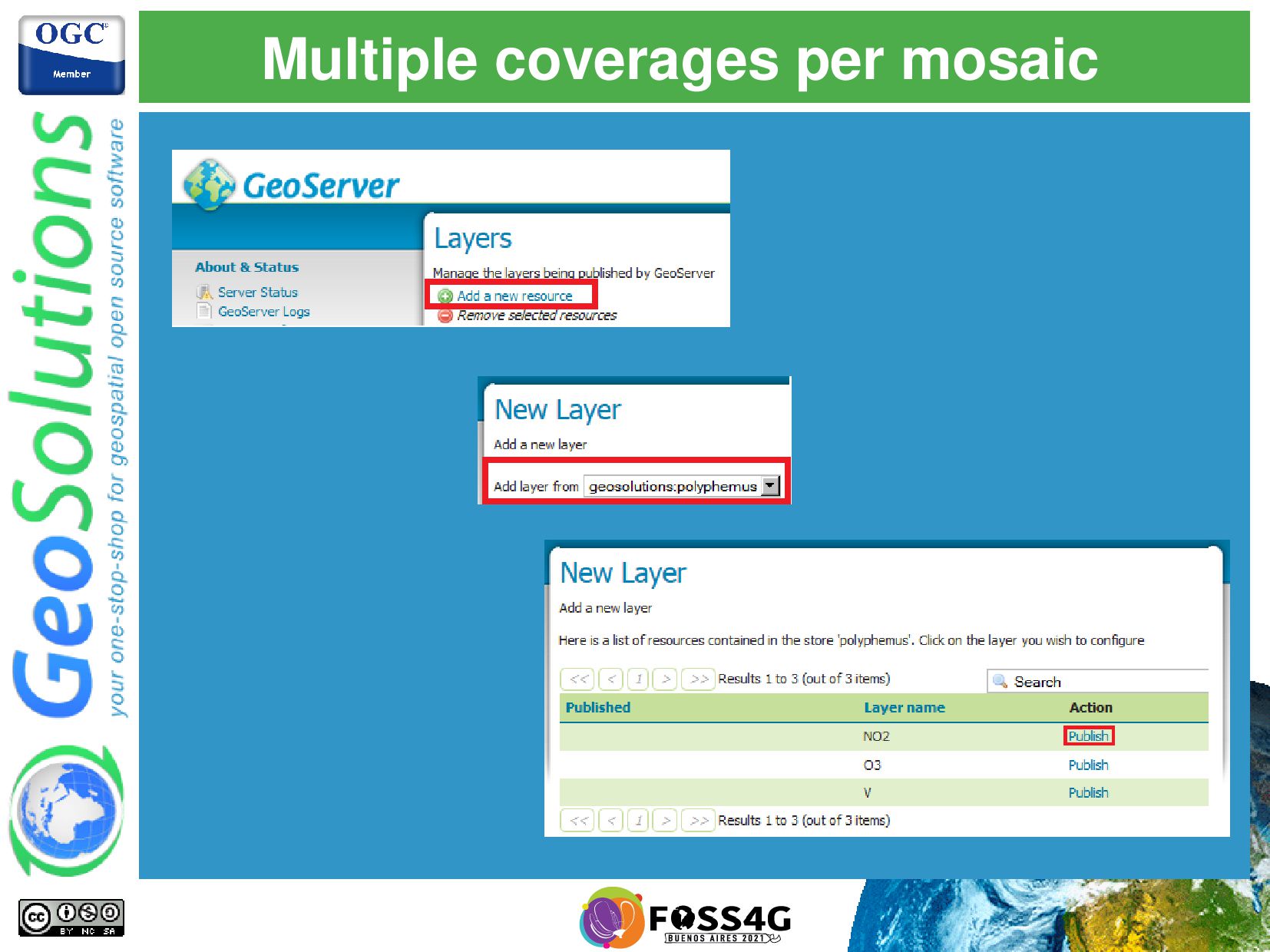
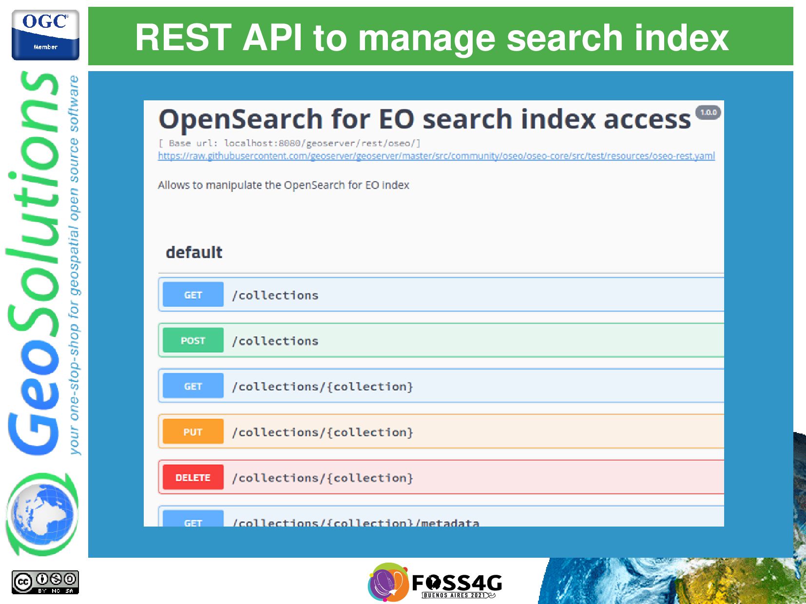
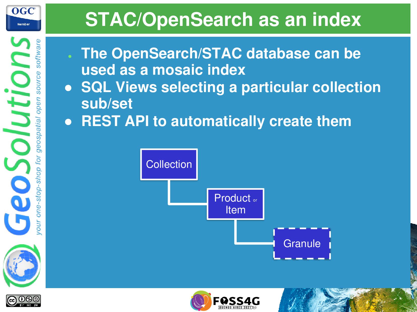
used as a mosaic index • SQL Views selecting a particular collection sub/set • REST API to automatically create them Collection Product or Item Granule
to create a mosaic out of a STAC API • Filter to establish which items take part • https://github.com/joshfix/imagemosaic-stac • Outdated code, but promising concept • Needs STAC API to settle down (beta/changes in filtering) STAC API ImageMosaic STAC GeoTools ImageMosaic
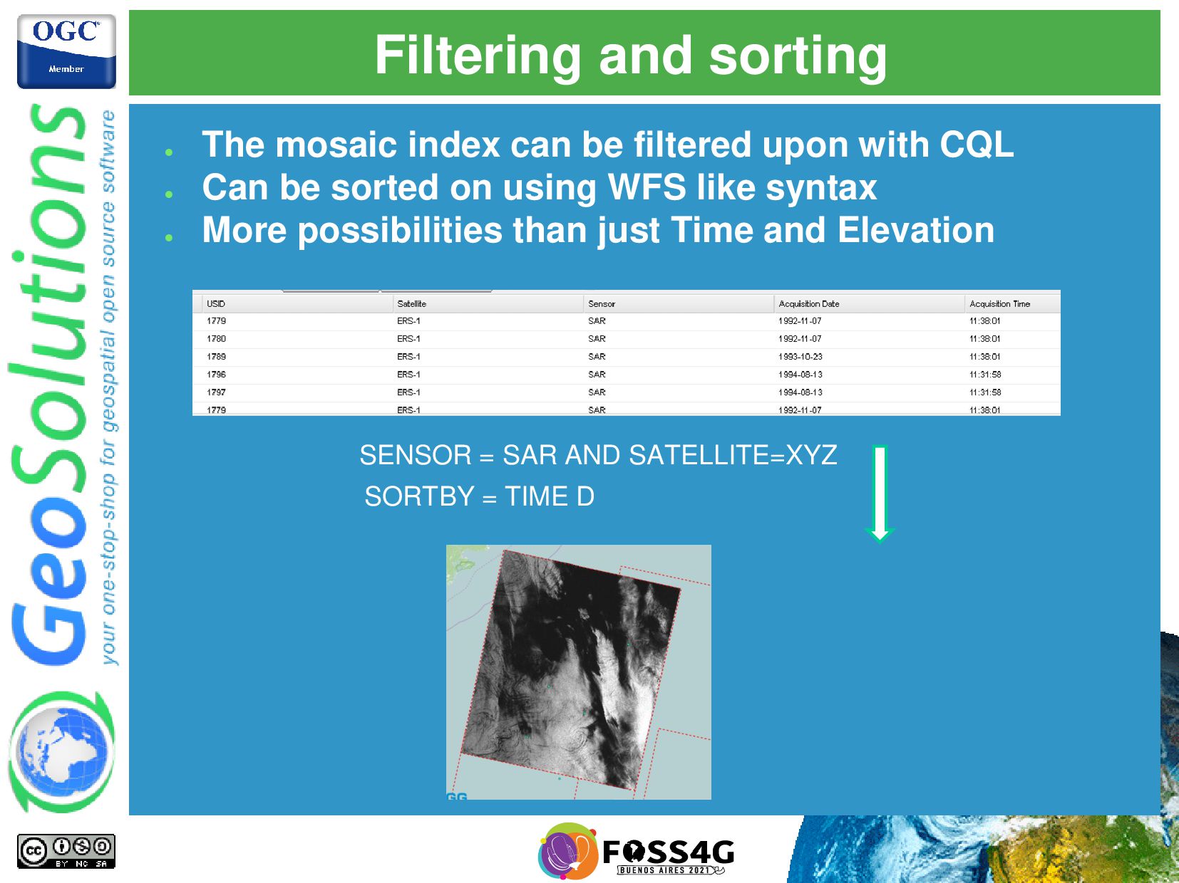
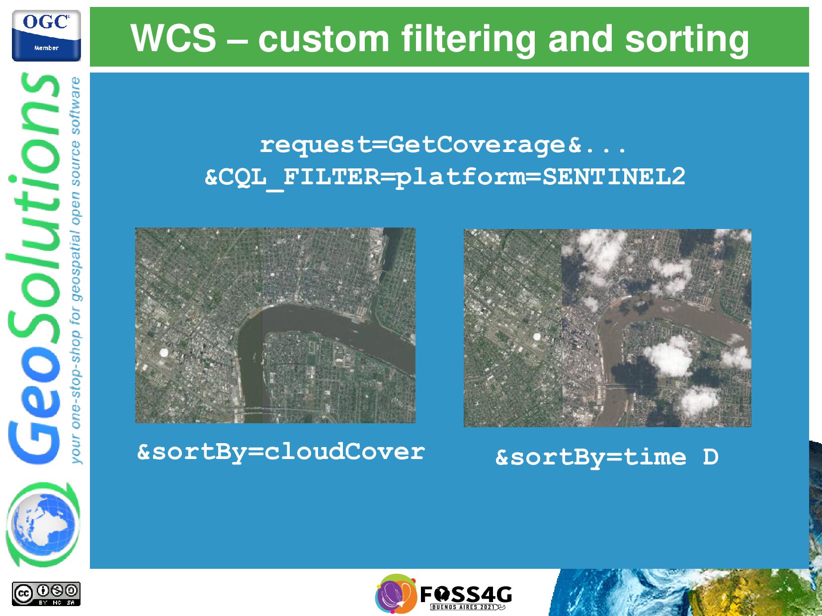
upon with CQL • Can be sorted on using WFS like syntax • More possibilities than just Time and Elevation SENSOR = SAR AND SATELLITE=XYZ SORTBY = TIME D
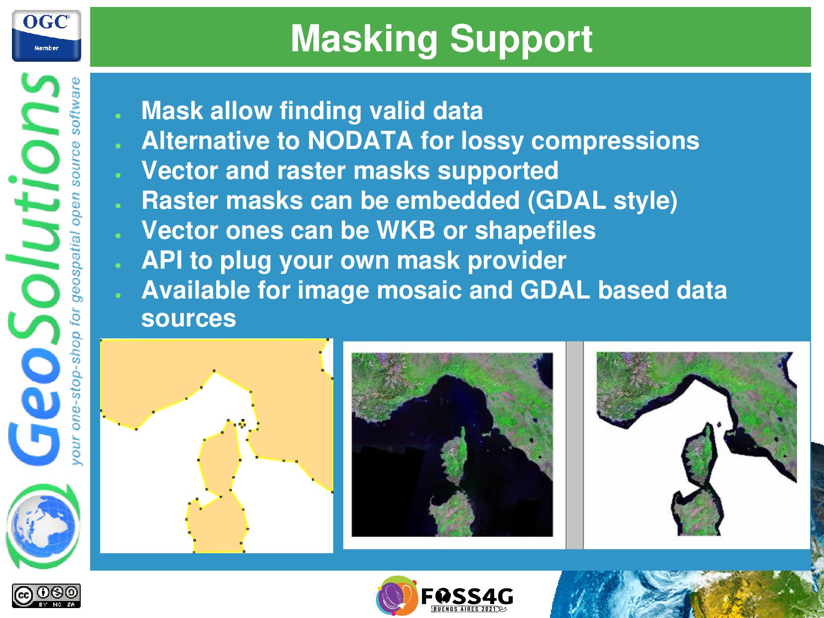
to NODATA for lossy compressions • Vector and raster masks supported • Raster masks can be embedded (GDAL style) • Vector ones can be WKB or shapefiles • API to plug your own mask provider • Available for image mosaic and GDAL based data sources
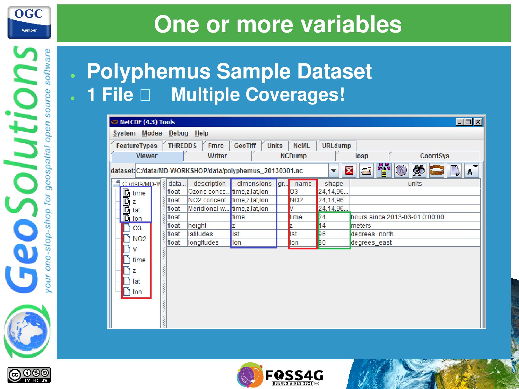
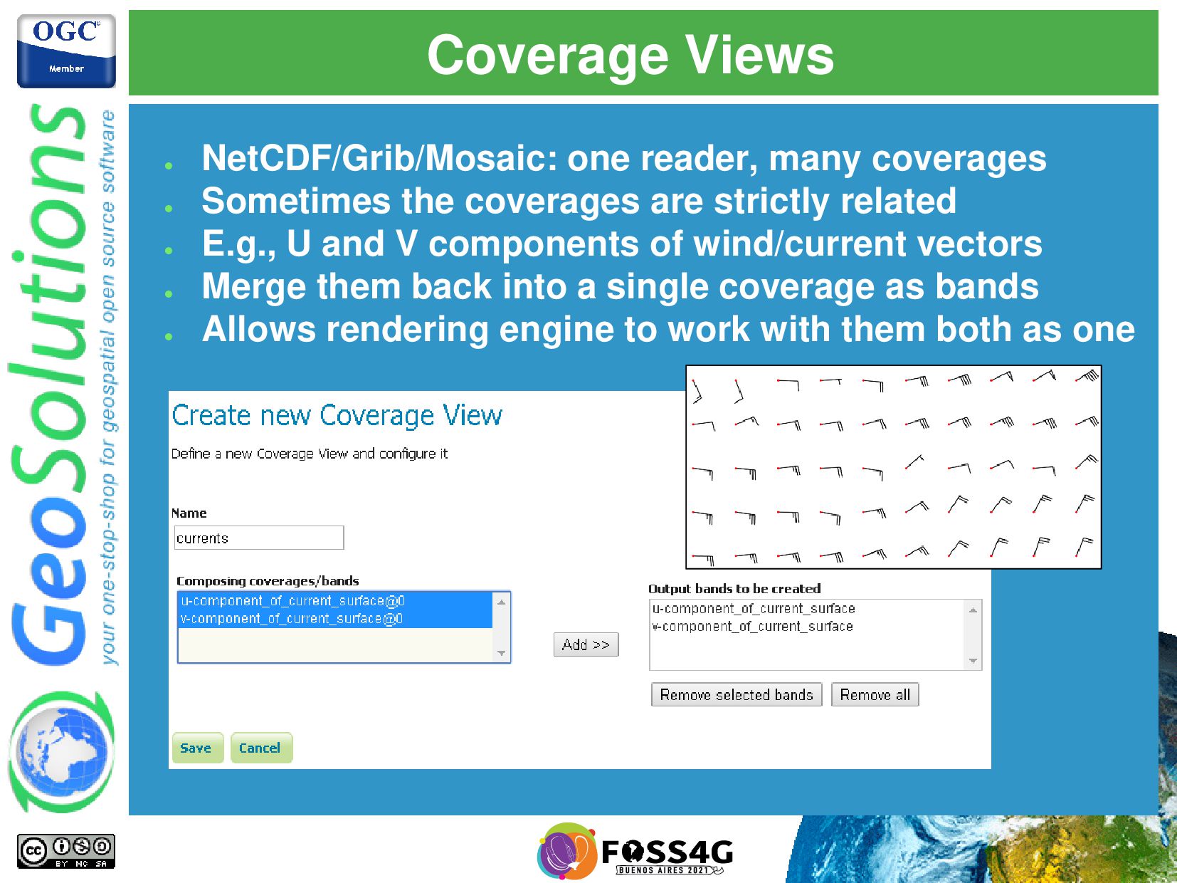
the coverages are strictly related • E.g., U and V components of wind/current vectors • Merge them back into a single coverage as bands • Allows rendering engine to work with them both as one
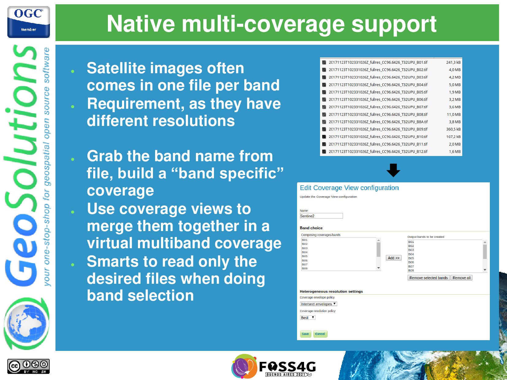
file per band • Requirement, as they have different resolutions • Grab the band name from file, build a “band specific” coverage • Use coverage views to merge them together in a virtual multiband coverage • Smarts to read only the desired files when doing band selection
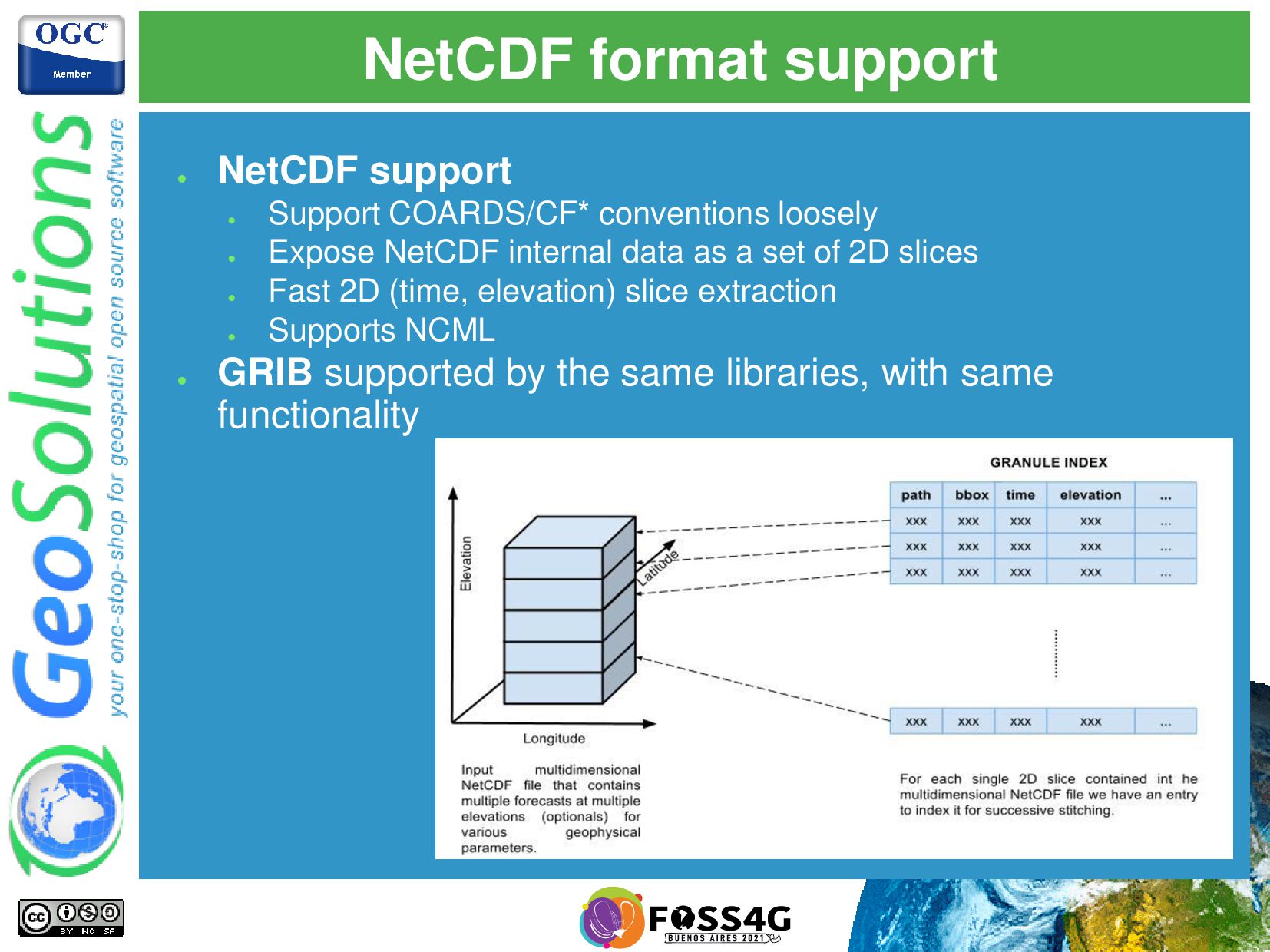
loosely • Expose NetCDF internal data as a set of 2D slices • Fast 2D (time, elevation) slice extraction • Supports NCML • GRIB supported by the same libraries, with same functionality
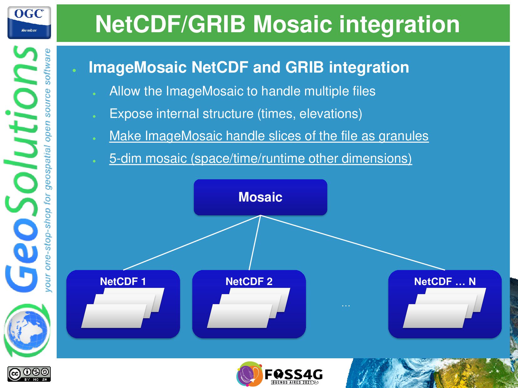
Allow the ImageMosaic to handle multiple files • Expose internal structure (times, elevations) • Make ImageMosaic handle slices of the file as granules • 5-dim mosaic (space/time/runtime other dimensions) Mosaic NetCDF 1 NetCDF 2 NetCDF … N …
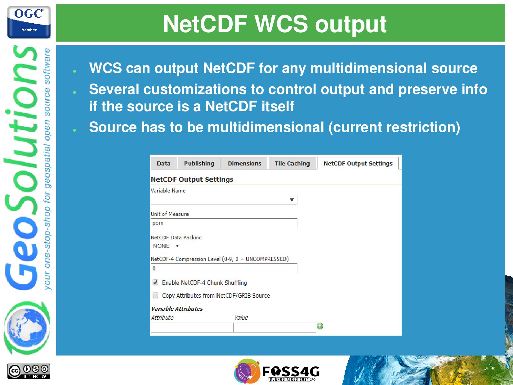
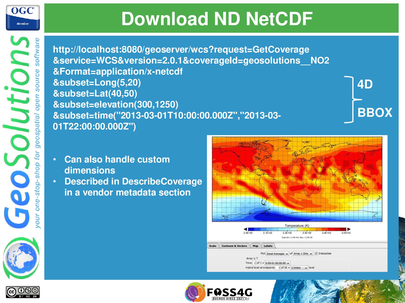
multidimensional source • Several customizations to control output and preserve info if the source is a NetCDF itself • Source has to be multidimensional (current restriction)
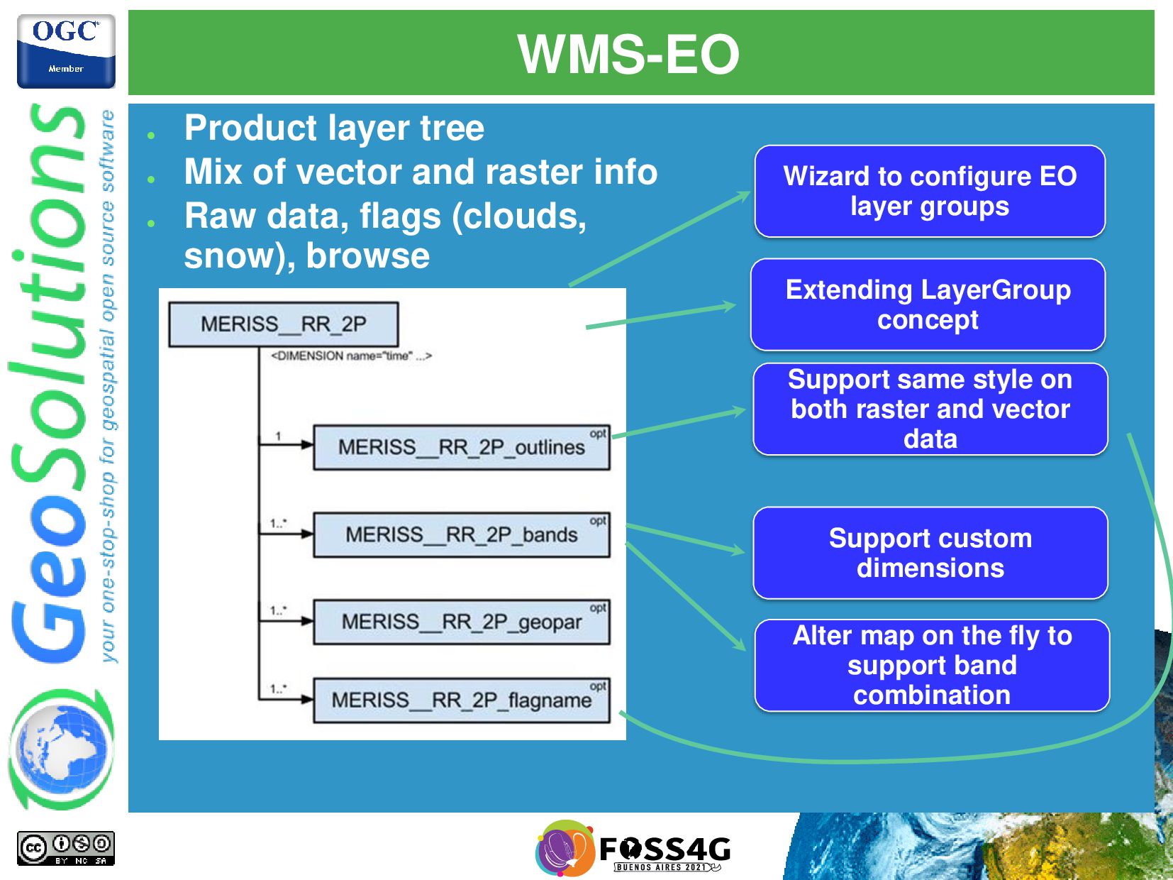
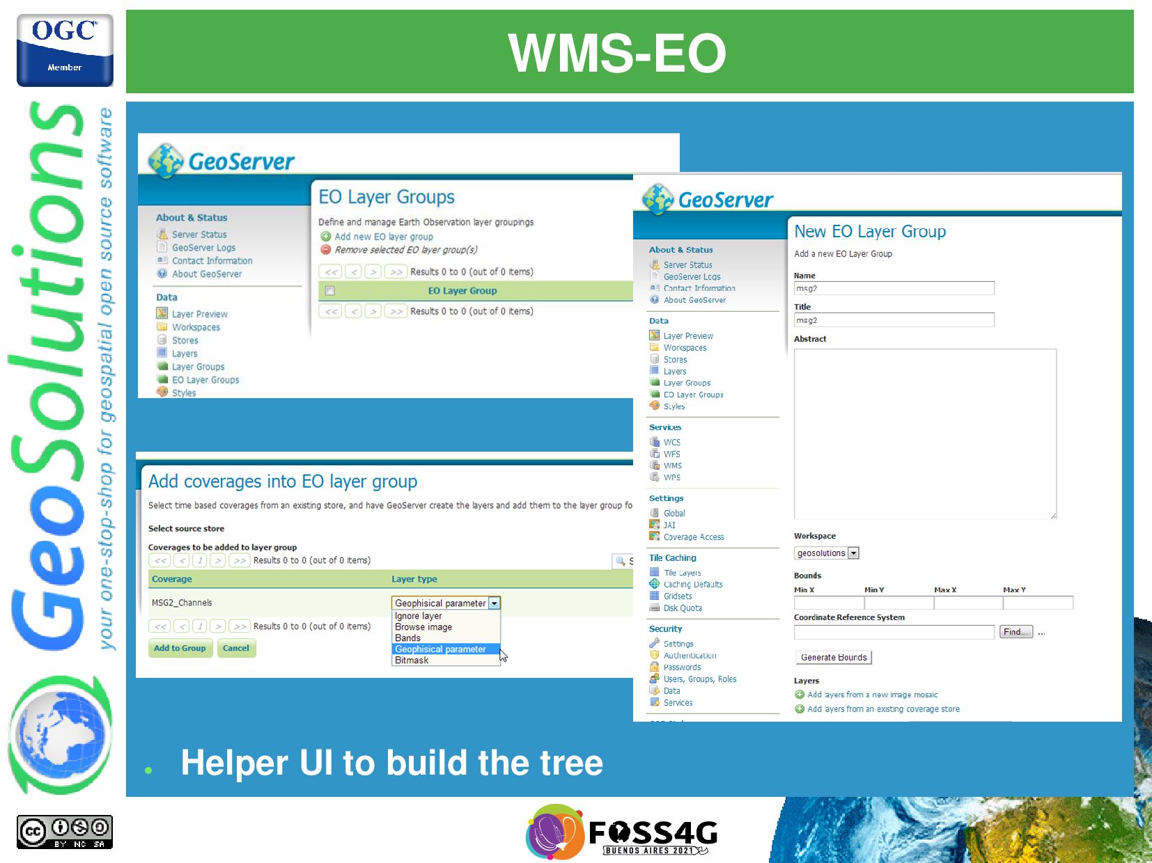
and vector data Support custom dimensions Alter map on the fly to support band combination Wizard to configure EO layer groups • Product layer tree • Mix of vector and raster info • Raw data, flags (clouds, snow), browse
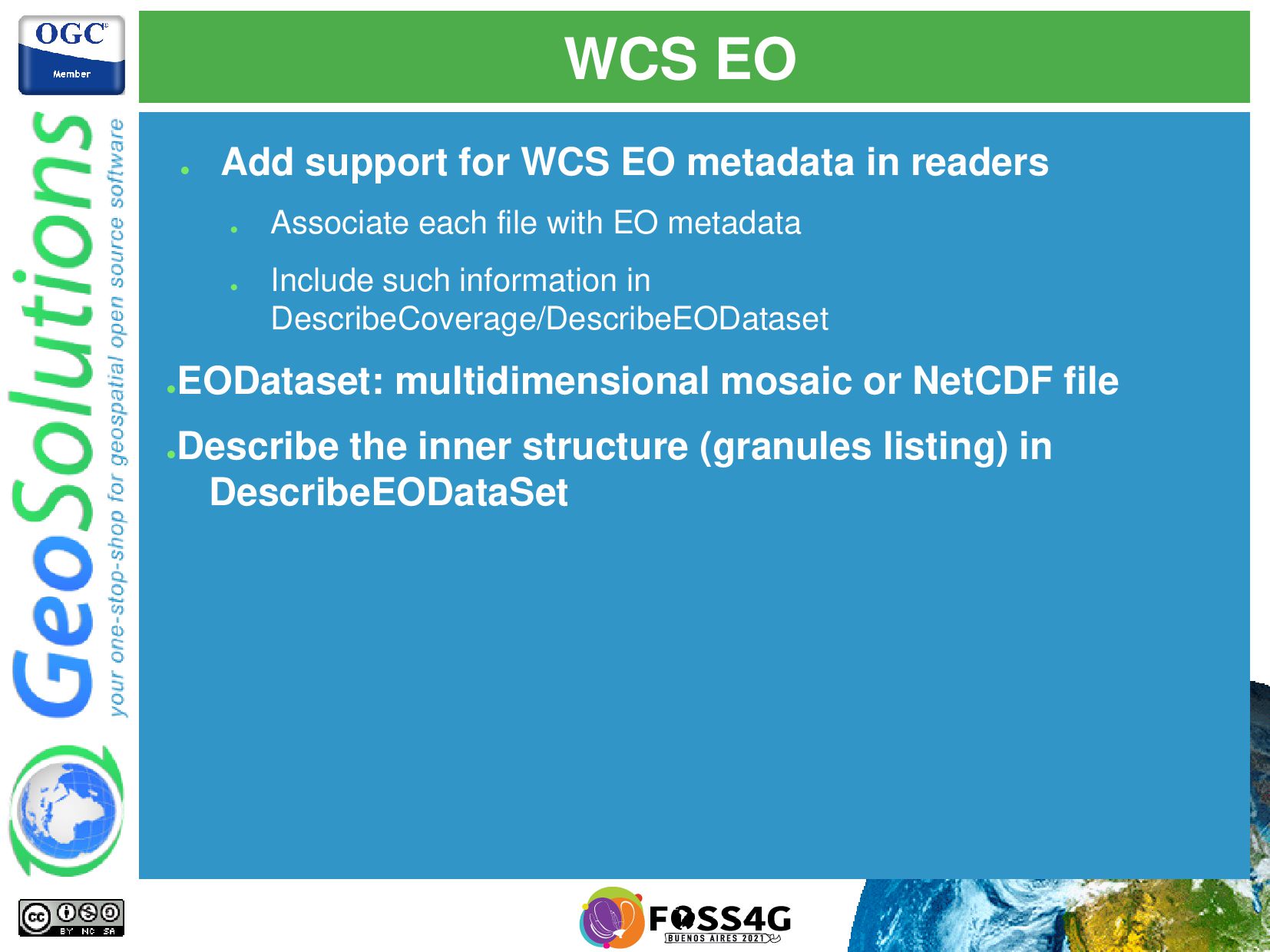
readers • Associate each file with EO metadata • Include such information in DescribeCoverage/DescribeEODataset • EODataset: multidimensional mosaic or NetCDF file • Describe the inner structure (granules listing) in DescribeEODataSet
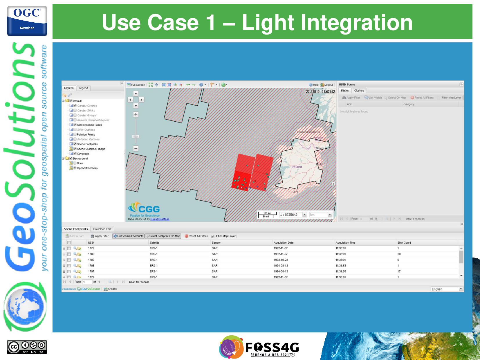
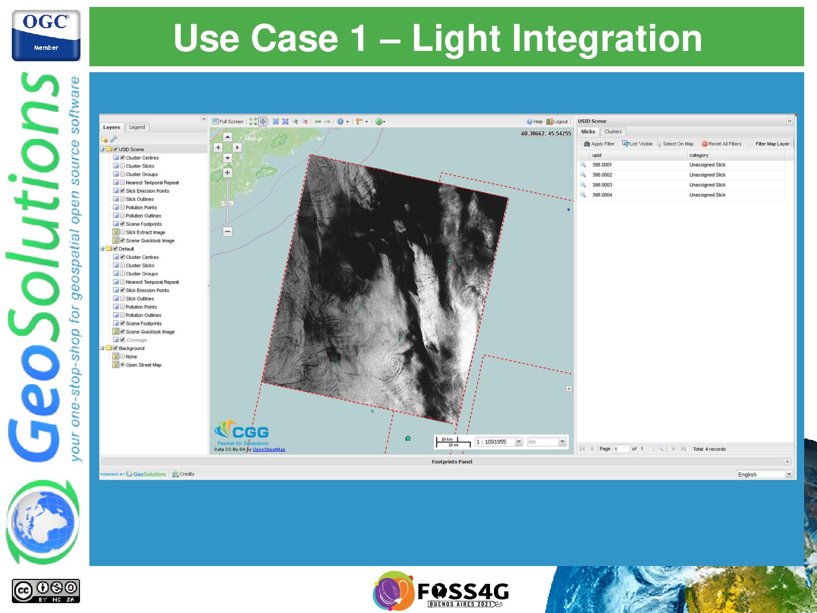
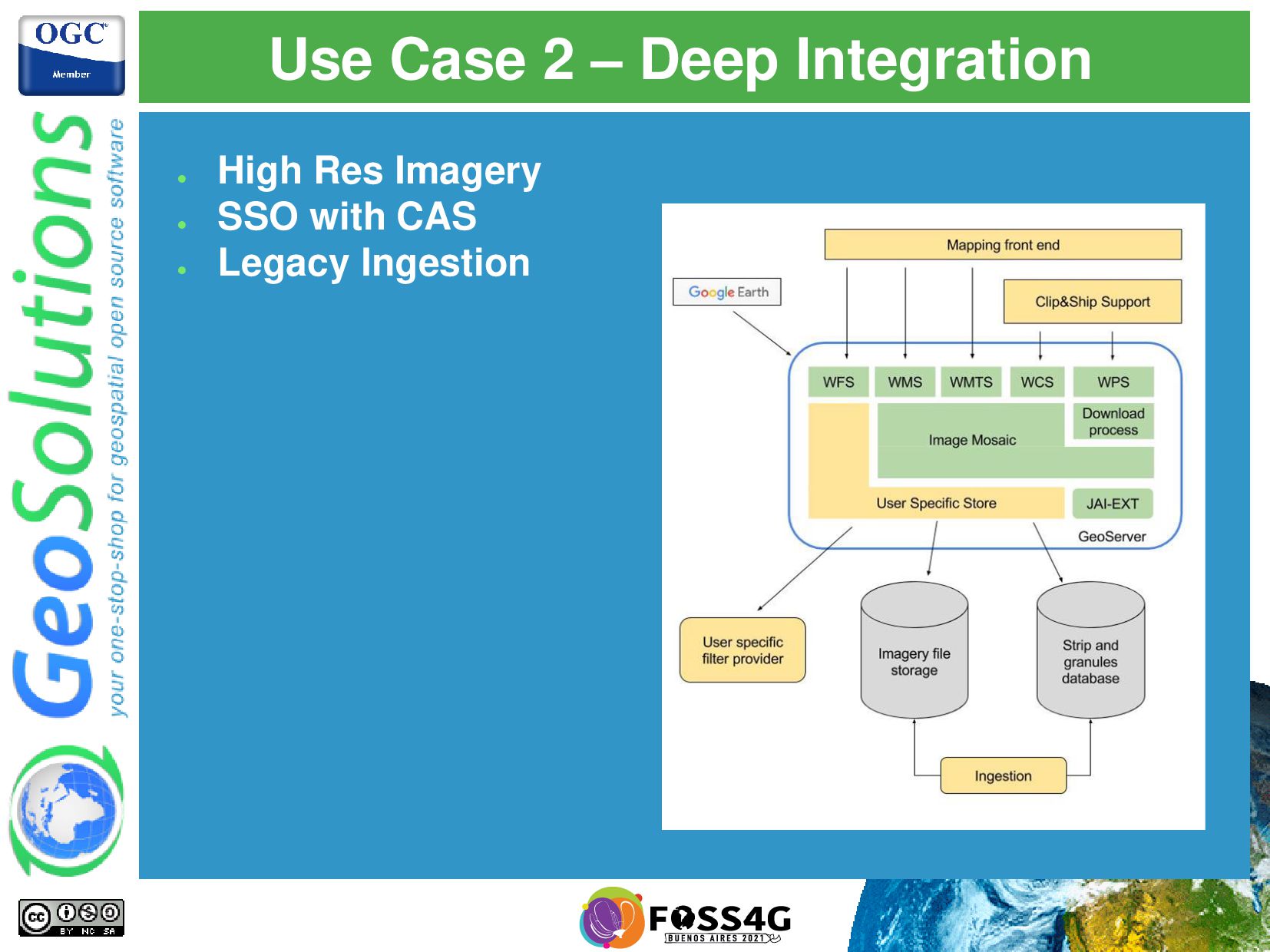
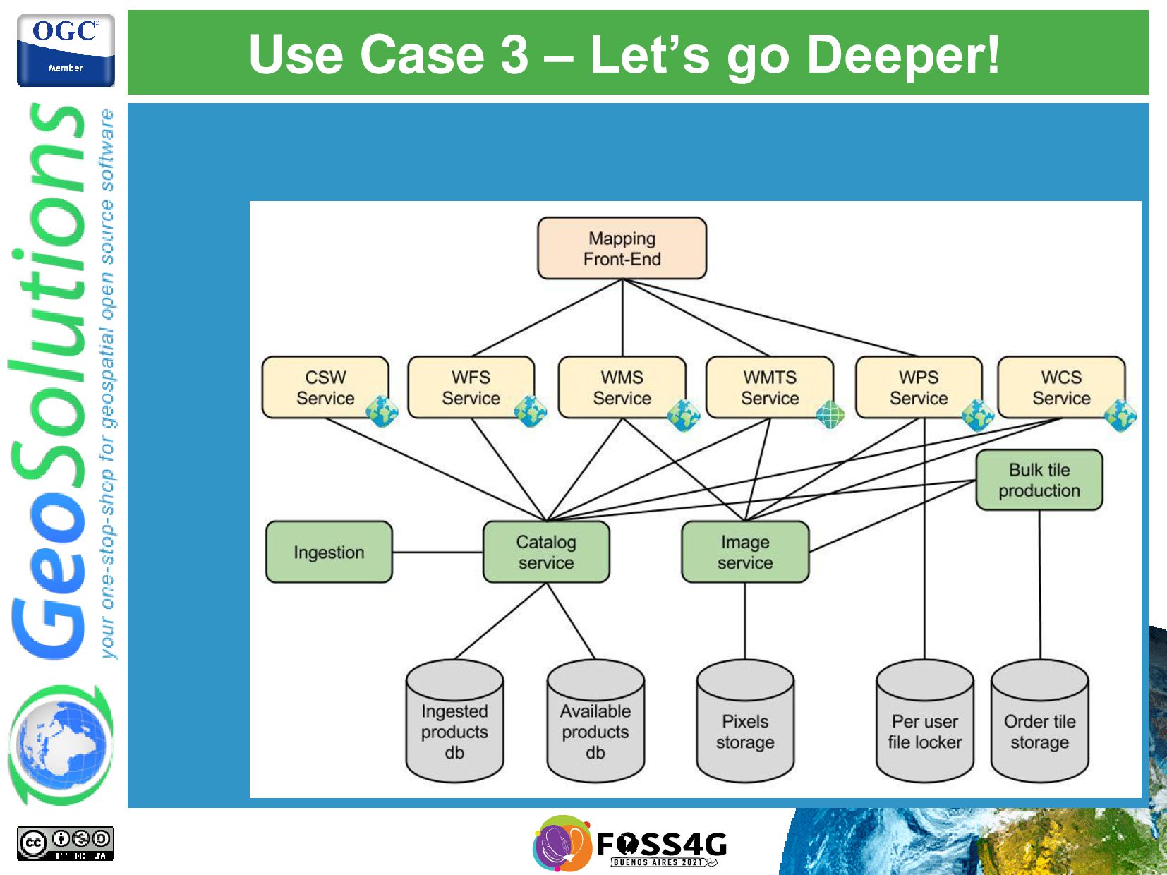
+ Legacy Ingestion • Maritime Data • SAR Time Series • Oil Spill + other vectors • Single Mosaic + CQL + Custom Access Manager • Integrated SSO with MapStore • Precooked Download of Scenes • Fine grain control over data access • Download • Visualization • Clever usage of Mosaic Indexes via WFS
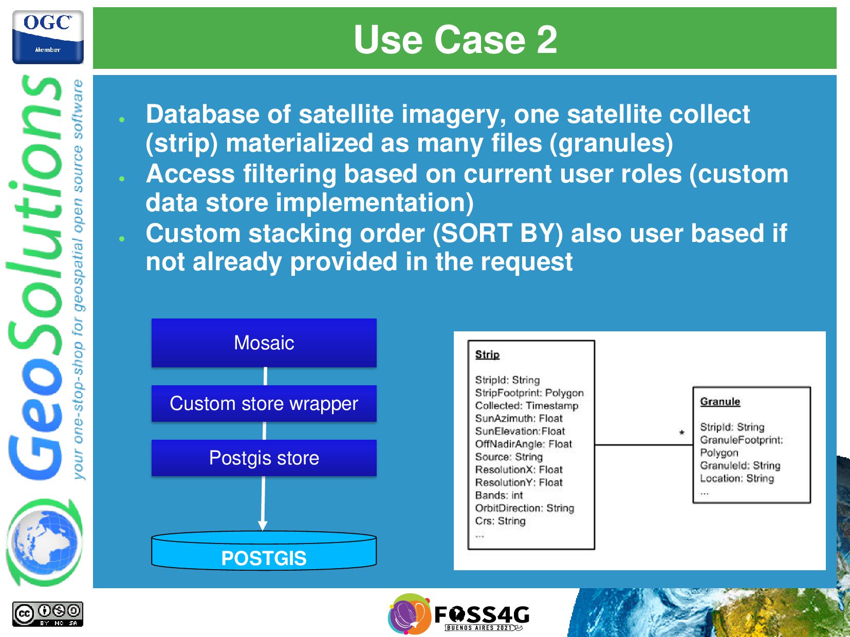
collect (strip) materialized as many files (granules) • Access filtering based on current user roles (custom data store implementation) • Custom stacking order (SORT BY) also user based if not already provided in the request Mosaic POSTGIS Custom store wrapper Postgis store


 simboss
 husengs7
 ennael
 ks91
ks91
 kakakakakku
 dtunkelang
 oracle4engineer
 mkdev10
 toshimaru
 masakiokuda
 ufried
 dada4386
 chriscoyier
 minecr
 aleyda
 eileencodes
 schroneko
 philnash
 wjessup
 mkilby
 stephaniewalter
 akademiya2063
 lfama
lfama


![Sample search • http://cloudsdi. geo-solutions.it/ • geoserver/oseo/search? parentId=SENTINEL2 &cloudCover=30] •](https://files.speakerdeck.com/presentations/6bace22f3fa44d6385e01800474765a3/slide_8.jpg)






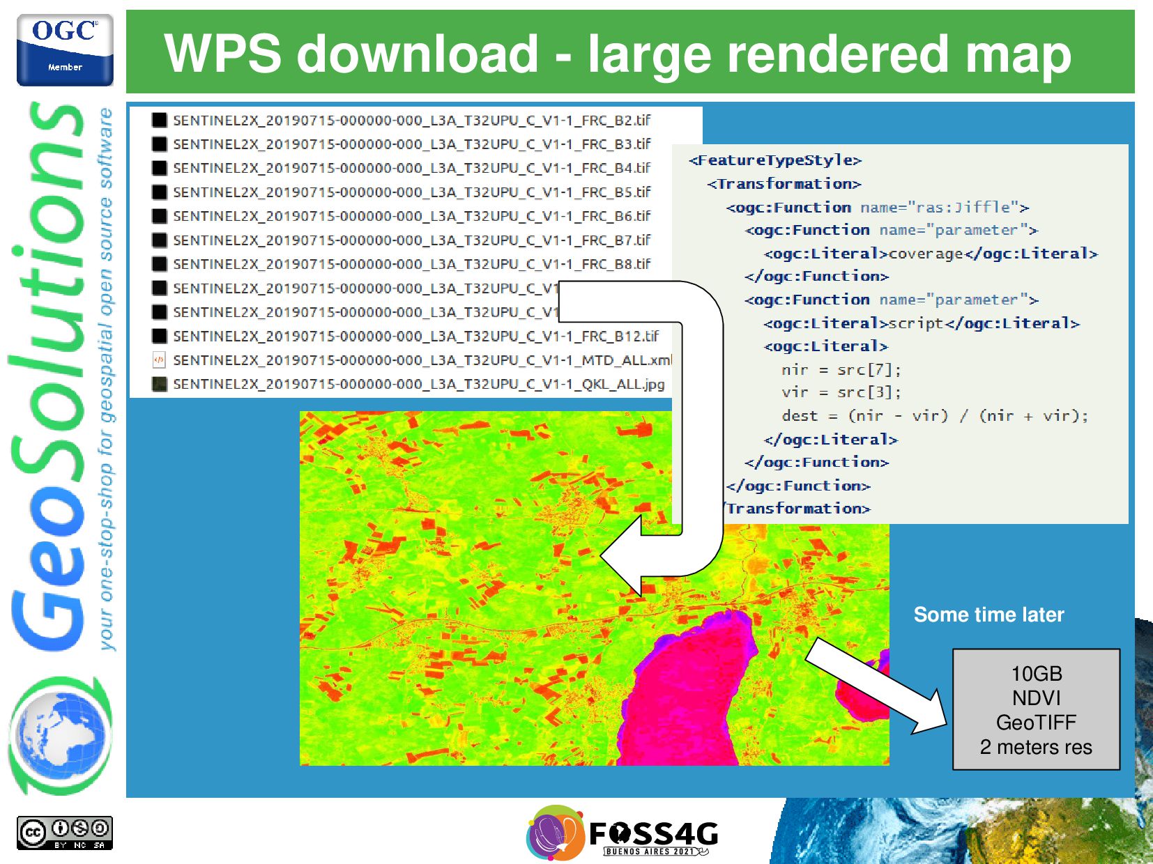
![On the fly map algebra with Jiffle nir = src[7];](https://files.speakerdeck.com/presentations/6bace22f3fa44d6385e01800474765a3/slide_45.jpg)
![That’s all folks! Questions? [email protected]](https://files.speakerdeck.com/presentations/6bace22f3fa44d6385e01800474765a3/slide_56.jpg)