then lived in Chicago until 2015. › Comms professional-turned-Techie › Previously: Over a decade of work experience across the spectrum of Media Comms: media relations, social media, marketing comms, customer comms, feature writing, newspaper/online editing, copywriting and copy editing. › Now: Front-End Dev bootcamp grad; CS/Coding Instructor; STEM Workshop + College Success Workshop Facilitator; Developer Relations Intern. › Passionate about: › Tech Literacy › CS Education › Public speaker. Topics include: › Algorithmic Bias in AI & The Ethical Responsibilities of Software Developers › The Digital Divide
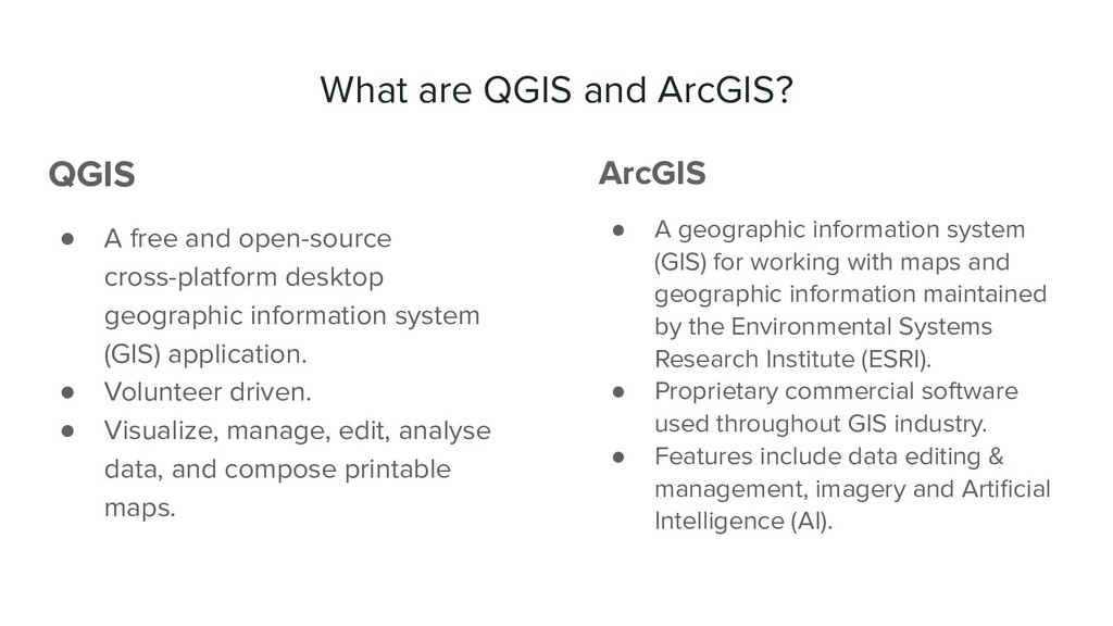
open-source cross-platform desktop geographic information system (GIS) application. • Volunteer driven. • Visualize, manage, edit, analyse data, and compose printable maps. ArcGIS • A geographic information system (GIS) for working with maps and geographic information maintained by the Environmental Systems Research Institute (ESRI). • Proprietary commercial software used throughout GIS industry. • Features include data editing & management, imagery and Artificial Intelligence (AI).
Add-In & QGIS Plugin V1.0 were released in December 2019 and enabled customers to search for, preview, and download Planet imagery & Basemaps directly within ArcGIS Pro and QGIS desktop. These integration products make it easier for GIS users to: • Discover and apply imagery in their preferred mapping and analysis tools. • Enrich applications and projects with more frequent satellite imagery. The update to 2.0 both strengthens these existing features and adds new capabilities to augment users’ imagery workflows in their GIS. (SOURCE: Asa Strong, Planet Releases ArcGIS Add-In & QGIS Plugin V2.0)
NICFI basemaps to detect illegal deforestation within a protected area, and task a high-res satellite for more detail. Key Capabilities & Data to Highlight • NICFI Basemaps ◦ PS Tropical Normalized Analytic Biannual Archive ◦ PS Tropical Normalized Analytic Monthly Monitoring • New QGIS Basemap tools & high-res tasking within GIS ◦ Stream subset of a basemap series in false color and animate over time ◦ Identify contributing scene image in a basemap using Inspector ◦ Download basemap quads of a basemap series by subset AOI
Focused: who would benefit the most from the use case presented in the tutorial? • Target User Personas: ◦ NGOs (Ex: World Resources Institute Global Forest Watch project, Conservation International, Jane Goodall Institute, Trase, Global Environmental Facility) ◦ Intergovernmental organizations (Ex: UNFAO) ◦ Agricultural Commodity companies (Ex: Cargill, Unilever) • The goal is to spark curiosity about the QGIS/ArcGIS PlanetSchool tutorials!