Upgrade to Pro — share decks privately, control downloads, hide ads and more …

Integrating Autocad and GIS into a Preventative Maintenance Plan for Roadways

Integrating Autocad and GIS into a Preventative Maintenance Plan for Roadways

Adrian Garcia and Ernie Martinez - The City of Fair Oaks Ranch, Texas

More Decks by Texas Natural Resources Information System

Other Decks in Technology

Transcript

  1. Integra(ng  AutoCAD  and   GIS  into  a  Preventa(ve   Maintenance

     Plan  for   Roadways ADRIAN  GARCIA,  CITY  OF  FAIR  OAKS  RANCH  –  ENGINEER  IN  TRAINING ERNIE  MARTINEZ,  CITY  OF  FAIR  OAKS  RANCH  –  GIS  TECHNICIAN
  2. Contents Project  Background  Informa3on   Past  Organiza3on  Issues   Challenges

     to  Improve  Program   Planning  with  AutoCAD     Publishing  with  GIS   Manhole  Maintenance   Results     Gail  D.  Yovanovich  
  3. 74,917   94,869   113,643   124,582   122,230  

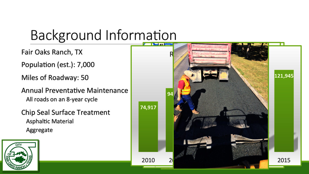
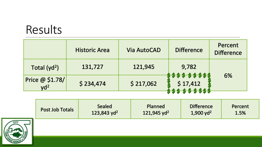
    121,945   2010   2011   2012   2013   2014   2015   Road  Area  Maintenance  (S.Y.)   Background  Informa(on Fair  Oaks  Ranch,  TX   Popula3on  (est.):  7,000   Miles  of  Roadway:  50   Annual  Preventa3ve  Maintenance   All  roads  on  an  8-­‐year  cycle   Chip  Seal  Surface  Treatment   Asphal3c  Material   Aggregate  
  4. Gandy.net   Past  Organiza(on  Issues Main  Spreadsheet   Historic  Area

     Calcula3ons   Blank  Highlighted  Maps   Roads  Overlooked   Wrong  Road  Sealed          
  5. Challenges  to  Improve  Program   Digital  Mapping     Defined  Project  Area

        Area  Verifica3on     Future  Usage     Cosme3c  Issues   Bing  Maps  via  AutoCAD  
  6. Planning  with  AutoCAD   Traced  each  road   from  Aerial  Imagery

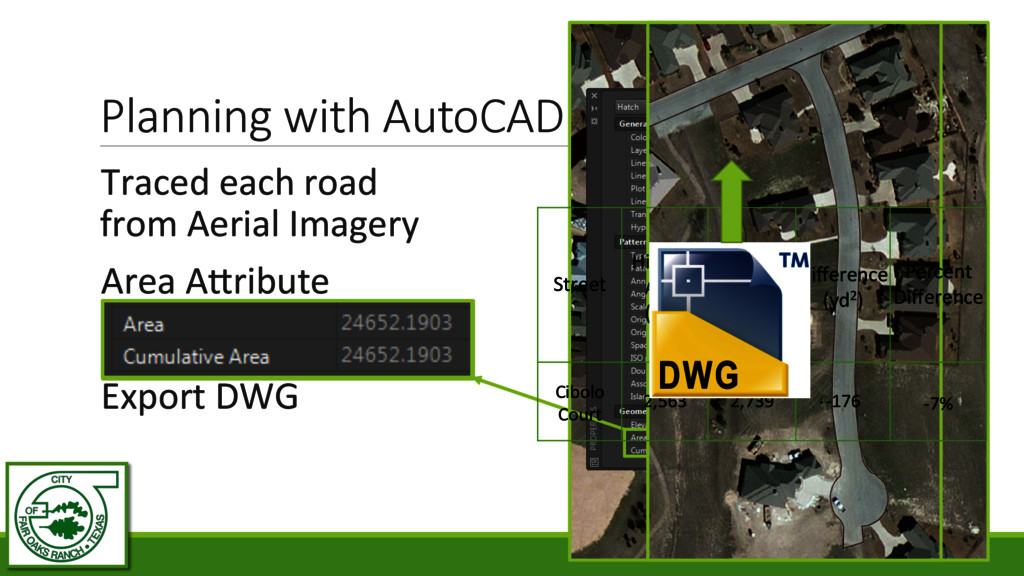
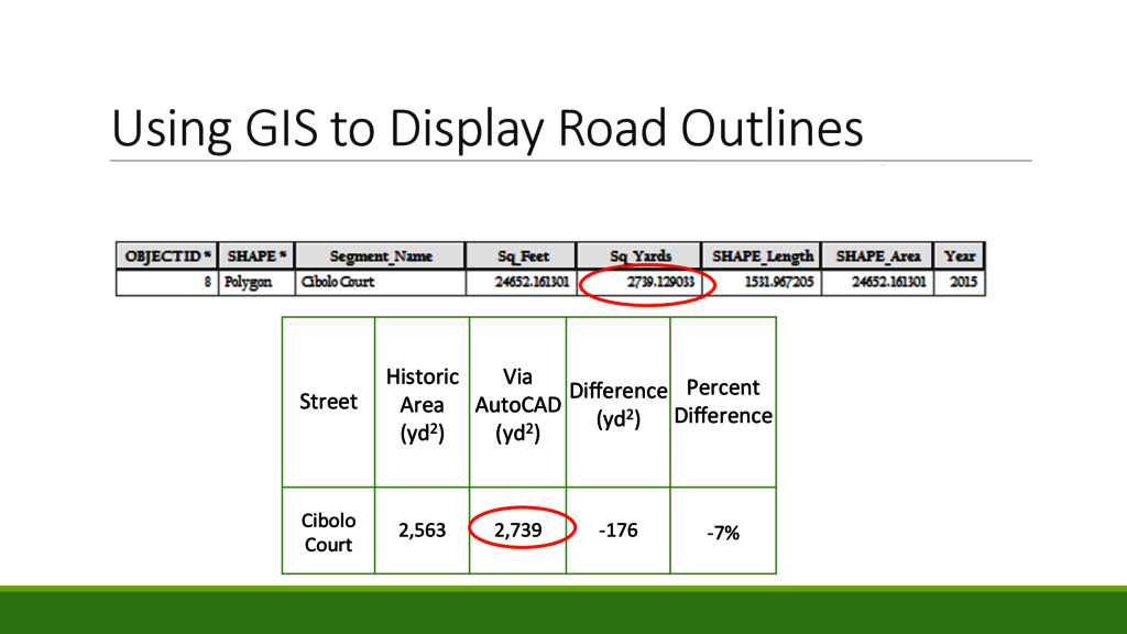
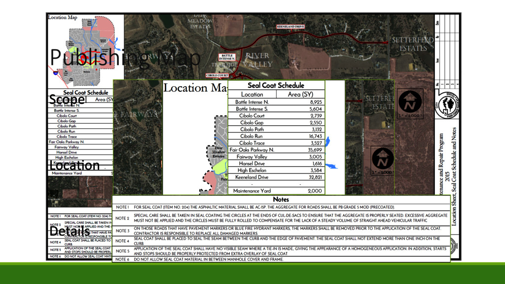
        Area  A]ribute     Compare  to  Historic     Export  DWG   Street   Historic   Area   (yd2)   Via   AutoCAD   (yd2)   Difference   (yd2)   Percent   Difference   Cibolo   Court   2,563   2,739   -­‐176   -­‐7%  
  7. Using  GIS  to  Display  Road  Outlines Street   Historic  

    Area   (yd2)   Via   AutoCAD   (yd2)   Difference   (yd2)   Percent   Difference   Cibolo   Court   2,563   2,739   -­‐176   -­‐7%  
  8. Previous  Maps Blank  Map   Overlaid     Tables  and

     Notes   Prone  to  Mistakes   Unauthorized  Edits  
  9. Manhole  Loca(ons ?   How  Many   Diameter   Project

     Area   Manhole  Maintenance  Program
  10. Collect  with  Exis(ng  SoSware/Devices Accuracy     Relevant    

    Informa3on     Verified   Diameter   Segng   Visibility   Secured   Condi3on     Addi3onal  Comments     ?  
  11. Results Historic  Area   Via  AutoCAD   Difference   Percent

      Difference   Total  (yd2)   131,727   121,945   9,782   6%   Price  @  $1.78/ yd2   $  234,474   $  217,062   $  17,412   Post  Job  Totals   Sealed   123,843  yd2   Planned   121,945  yd2     Difference   1,900  yd2   Percent   1.5%  
  12. Things  we  learned Don’t  Always  trust  “As-­‐Builts”   Effec3ve  Usage

     of  Geoloca3on  devices/  sooware   Accurate  Measurements  from  Aerial  Imagery   Material  Usage  will  differ  from  Road  Area   Many  Manhole  A]ributes      
  13. Future  Goals   All  8  Years  Shown  on  One  Map  

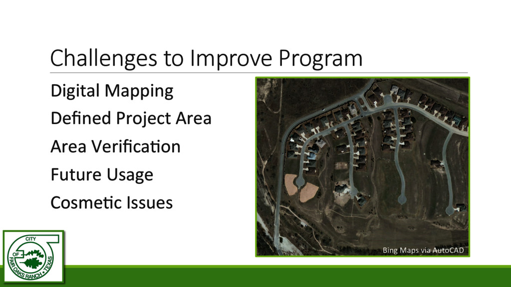
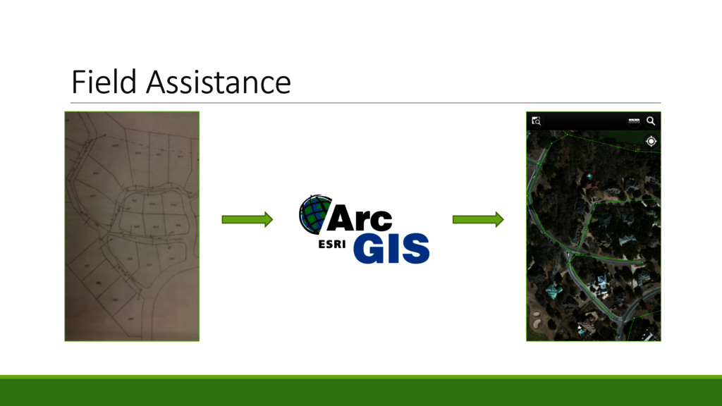
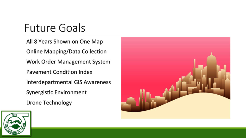
      Online  Mapping/Data  Collec3on     Work  Order  Management  System     Pavement  Condi3on  Index     Interdepartmental  GIS  Awareness     Synergis3c  Environment     Drone  Technology  
  14. Acknowledgements TNRIS  –  Texas  GIS  Forum     Western  Digital

     Systems  –  Trimble       Fair  Oaks  Ranch  –  Public  Works  Department