Upgrade to Pro
— share decks privately, control downloads, hide ads and more …
Speaker Deck
Features
Speaker Deck
PRO
Sign in
Sign up for free
Search
Search
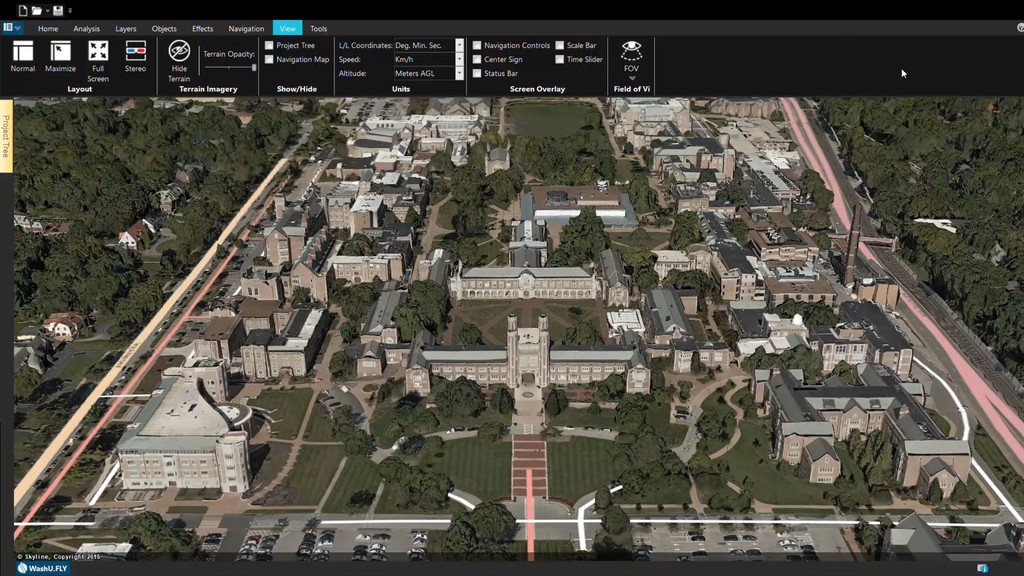
Now Showing in 3-D
Search
Texas Natural Resources Information System
October 24, 2019
Technology
320
0
Share
Embed
Copy iframe code
Copy JS code
Copy link
Start on current slide
Now Showing in 3-D
Texas Natural Resources Information System
October 24, 2019
More Decks by Texas Natural Resources Information System
See All by Texas Natural Resources Information System
The 3rd Quarter GIS Community Meeting of 2020
texasnaturalresourcesinformationsytem
0
200
The 2nd Quarter GIS Community Meeting of 2020
texasnaturalresourcesinformationsytem
0
640
2020 1st Quarter GIS Community Meeting
texasnaturalresourcesinformationsytem
0
760
PLANET OVERVIEW for TNRIS first Quarter Meeting
texasnaturalresourcesinformationsytem
0
650
Hurricane Harvey H-E-B Disaster Response
texasnaturalresourcesinformationsytem
0
530
Improving Community Services by Helping Citizens Find Their Lost Pets
texasnaturalresourcesinformationsytem
0
360
National Address Database (NAD) and NG9-1-1
texasnaturalresourcesinformationsytem
0
280
StratMap Celebrating Successful Public and Private Partnerships
texasnaturalresourcesinformationsytem
1
370
2019 State of the State Town Hall Meeting
texasnaturalresourcesinformationsytem
1
340
Other Decks in Technology
See All in Technology
ゼロをイチにする仕事が終わったあと
smasato
0
310
オブザーバビリティ、本当に活用できてる? 〜API連携×生成AIで成熟度を自動評価〜
dmmsre
0
840
SRE歴2ヶ月でも開発6年の知見を活かして、チームで止まっていた環境改善を前に進めた話
a_ono
1
210
Baseline対応のDOMの型定義を作った
uhyo
3
700
Empower GenAI with Agile - あなたのアジャイルが生成AIのバフになる仕組み
hageyahhoo
0
130
背中から、背中へ /paying forward to community
naitosatoshi
0
220
“ID沼入口” - 基本とセキュリティから始める、考え続けるためのID管理技術勉強会 告知&イントロ
ritou
0
420
NDIAS CTF 2026 問題解説会資料
bata_24
0
180
はじめてのWDM
miyukichi_ospf
1
120
Control Planeで育てるBtoB SaaSの認証基盤 - SRE NEXT 2026
pokohide
1
370
cccccc
moznion
0
1.8k
AIDLC_ヤフーショッピングの取り組み
lycorptech_jp
PRO
0
540
Featured
See All Featured
Ecommerce SEO: The Keys for Success Now & Beyond - #SERPConf2024
aleyda
1
2k
The Mindset for Success: Future Career Progression
greggifford
PRO
0
380
Dealing with People You Can't Stand - Big Design 2015
cassininazir
367
27k
Visual Storytelling: How to be a Superhuman Communicator
reverentgeek
2
580
Stewardship and Sustainability of Urban and Community Forests
pwiseman
0
250
Odyssey Design
rkendrick25
PRO
2
720
Abbi's Birthday
coloredviolet
3
8.5k
Information Architects: The Missing Link in Design Systems
soysaucechin
0
1k
How to Align SEO within the Product Triangle To Get Buy-In & Support - #RIMC
aleyda
2
1.6k
AI in Enterprises - Java and Open Source to the Rescue
ivargrimstad
0
1.4k
Testing 201, or: Great Expectations
jmmastey
46
8.2k
Bootstrapping a Software Product
garrettdimon
PRO
307
120k
Transcript
None
None
None
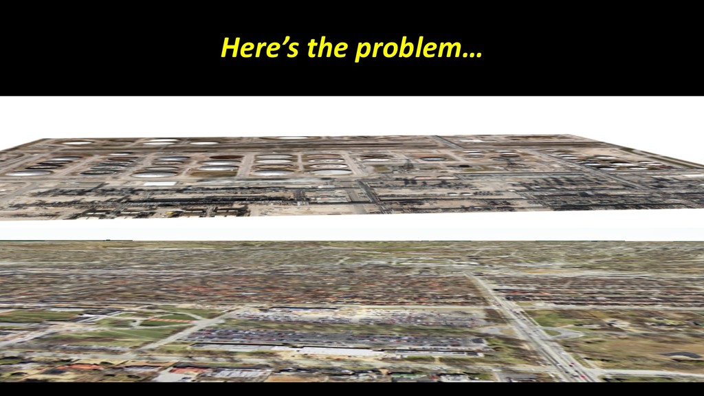
Here’s the problem…
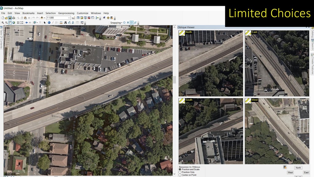
Limited Choices
None
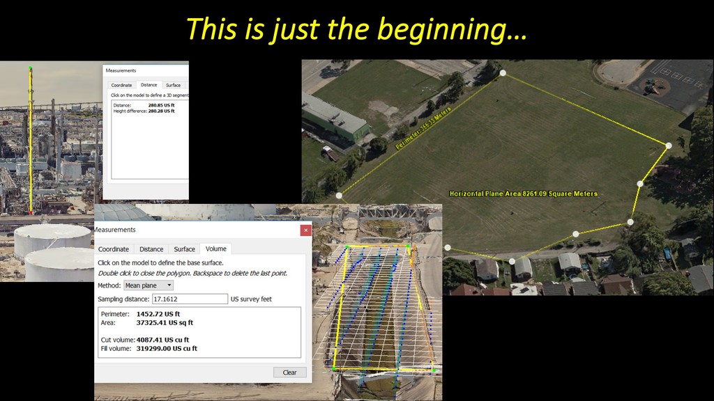
This is just the beginning…
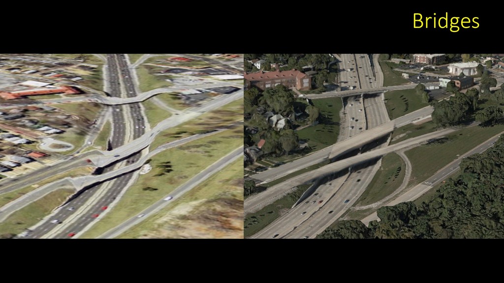
Bridges
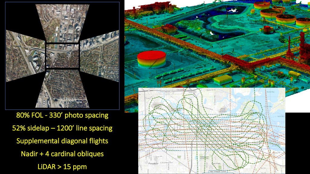
80% FOL - 330’ photo spacing 52% sidelap – 1200’
line spacing Supplemental diagonal flights Nadir + 4 cardinal obliques LiDAR > 15 ppm
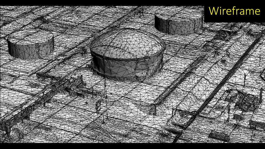
Wireframe
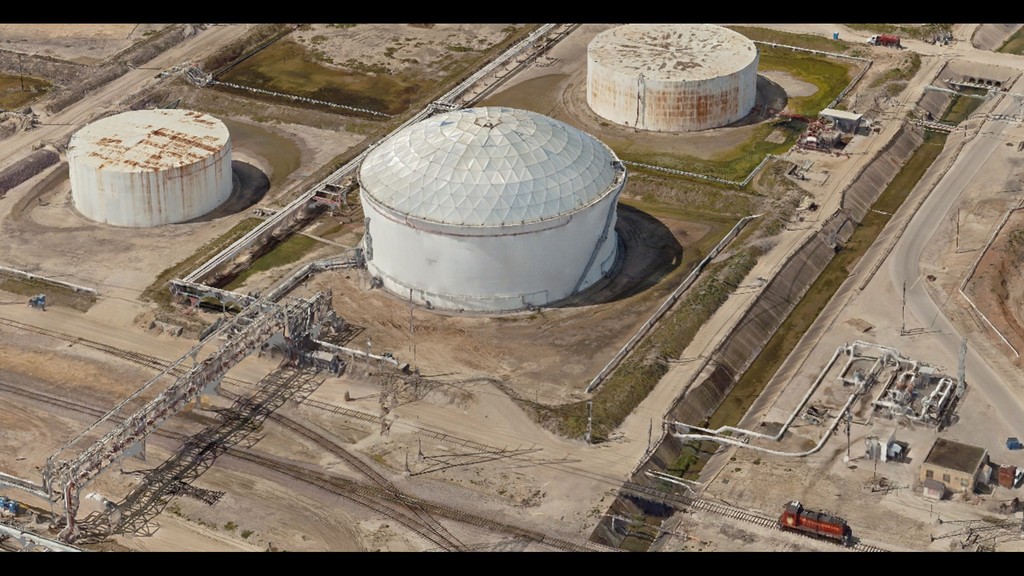
Texture
None
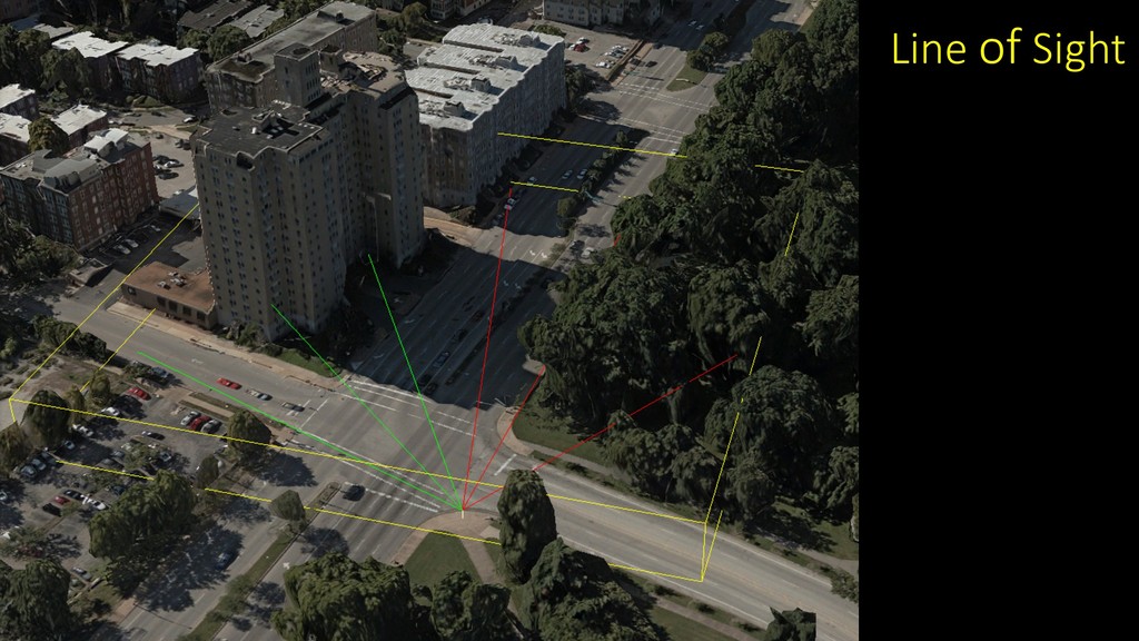
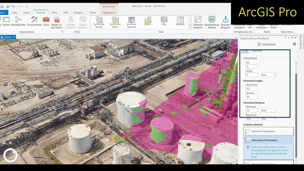
Line of Sight
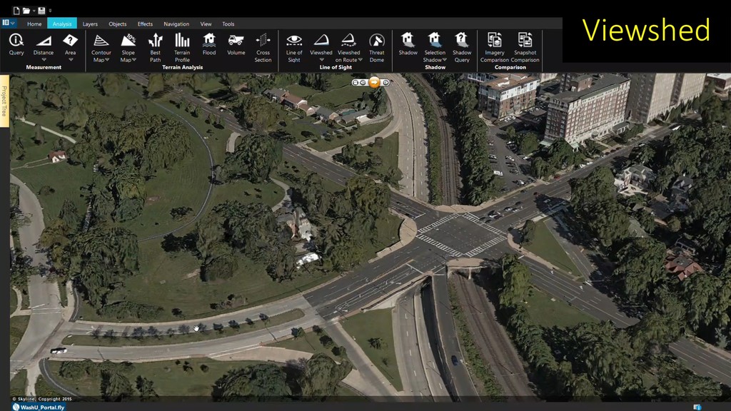
Viewshed
ArcGIS Pro
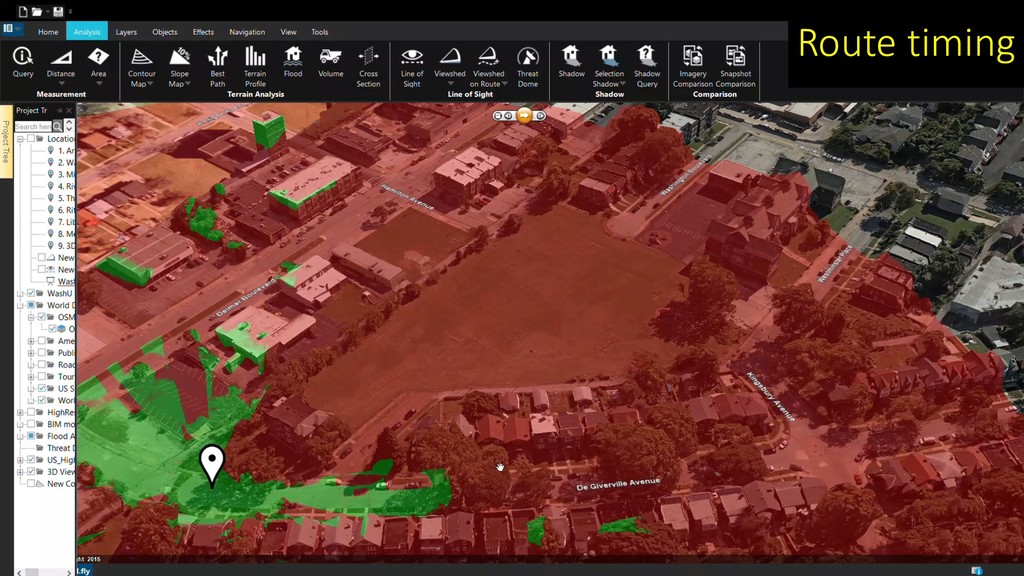
Route timing
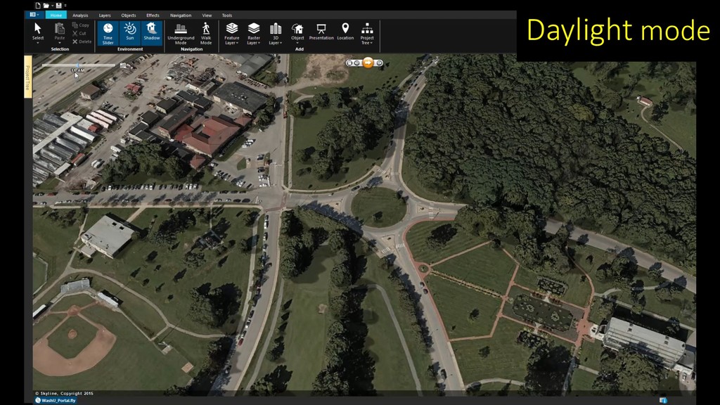
Daylight mode
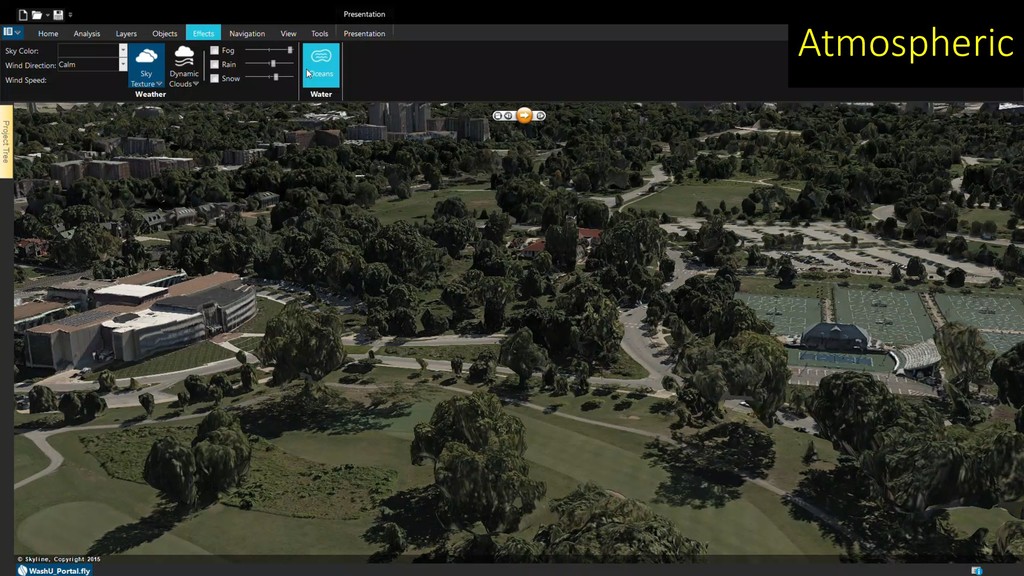
Atmospheric
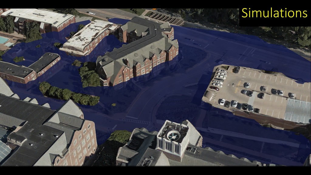
Simulations
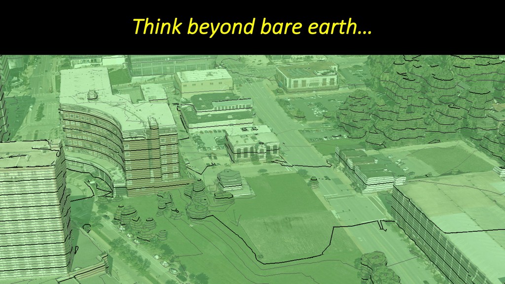
Think beyond bare earth…
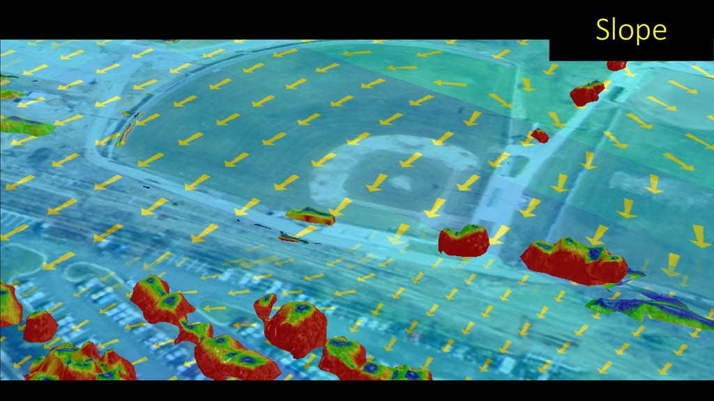
Slope
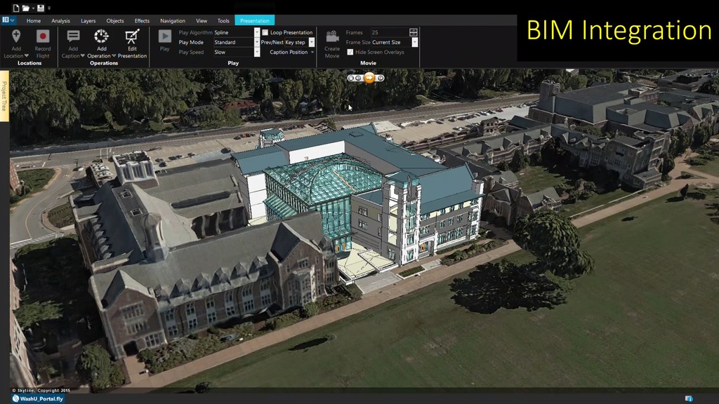
BIM Integration
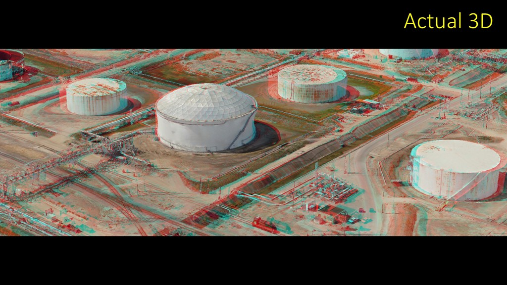
Actual 3D
Utilize All Sources…
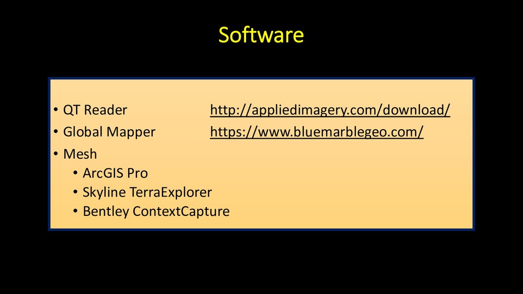
Software • QT Reader http://appliedimagery.com/download/ • Global Mapper https://www.bluemarblegeo.com/ •
Mesh • ArcGIS Pro • Skyline TerraExplorer • Bentley ContextCapture
QUESTIONS? Tim Bohn
[email protected]
314-952-2617
None
![QUESTIONS? Tim Bohn [email protected] 314-952-2617](https://files.speakerdeck.com/presentations/3a8979ea00b6431494ed26838fcd4459/slide_25.jpg)