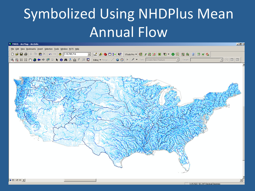
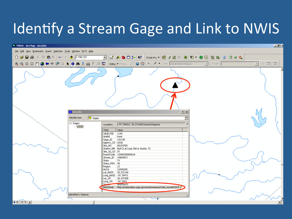
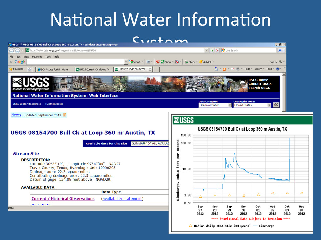
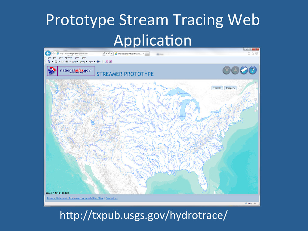
Hydrography Dataset: Data Visualiza'on, Linking to External Data Sources, Tracing Streams in a Web Mapping Applica'on Florence Thompson, USGS Texas Water Science Center
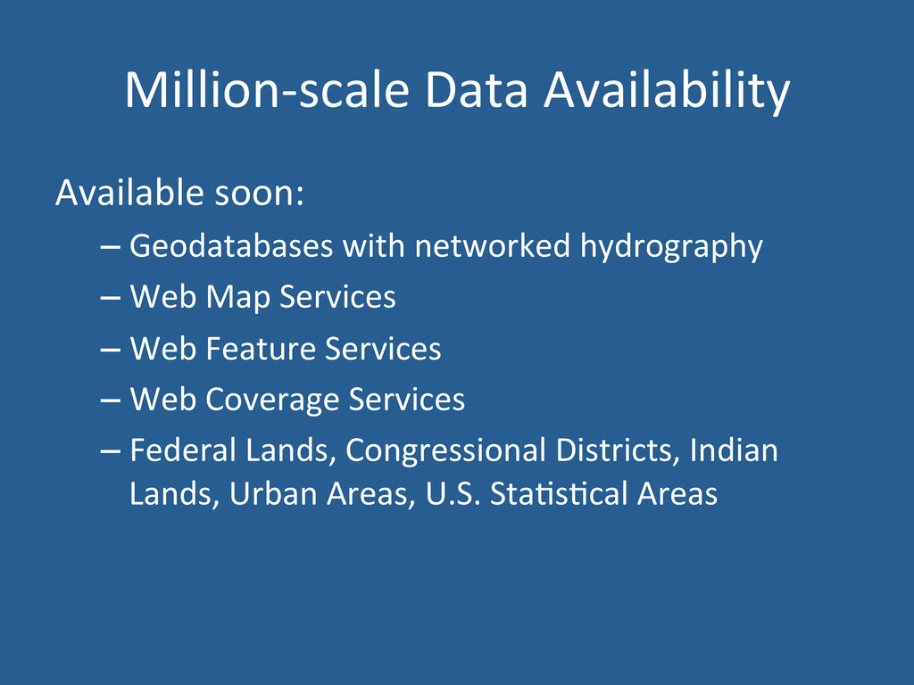
hydrography – Web Map Services – Web Feature Services – Web Coverage Services – Federal Lands, Congressional Districts, Indian Lands, Urban Areas, U.S. Sta's'cal Areas
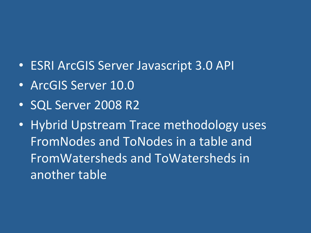
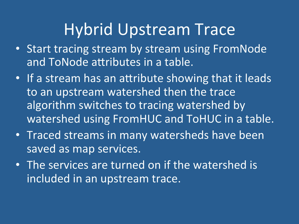
Server 10.0 • SQL Server 2008 R2 • Hybrid Upstream Trace methodology uses FromNodes and ToNodes in a table and FromWatersheds and ToWatersheds in another table
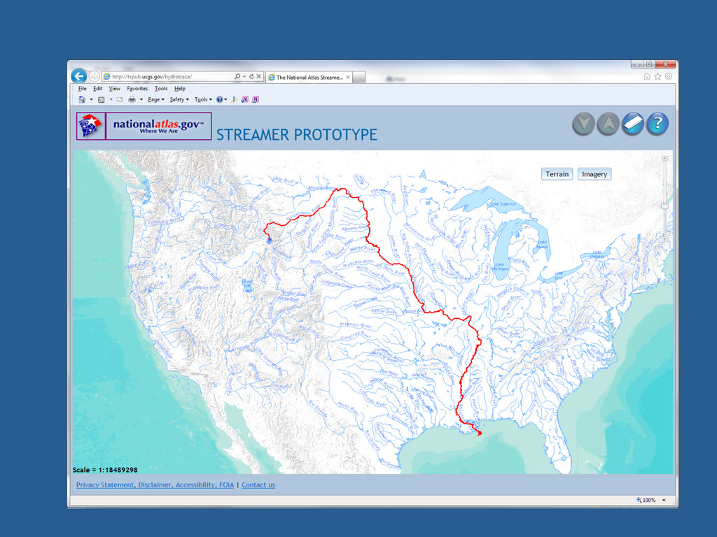
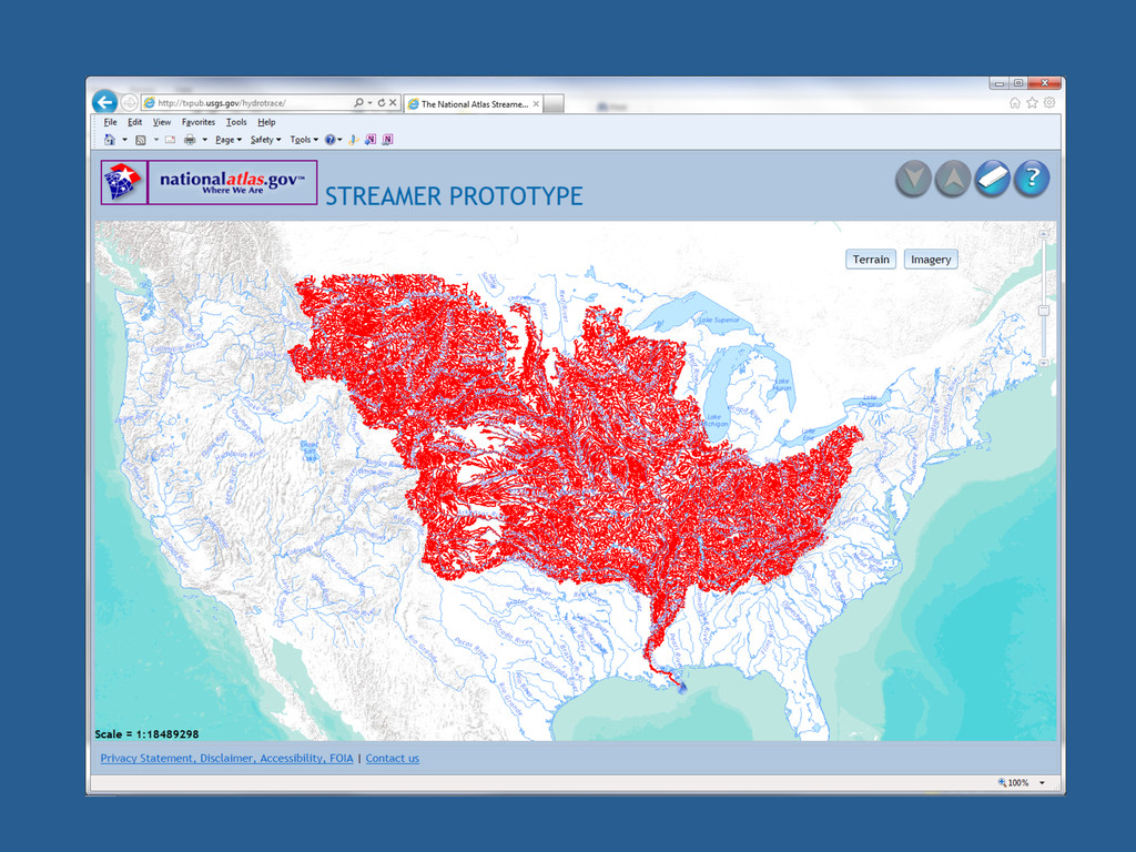
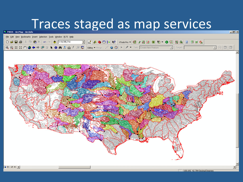
using FromNode and ToNode aZributes in a table. • If a stream has an aZribute showing that it leads to an upstream watershed then the trace algorithm switches to tracing watershed by watershed using FromHUC and ToHUC in a table. • Traced streams in many watersheds have been saved as map services. • The services are turned on if the watershed is included in an upstream trace.
![Florence Thompson, [email protected] hZp://txpub.usgs.gov/hydrotrace/ www.na'onalatlas.gov](https://files.speakerdeck.com/presentations/509058137536e50002019cfb/slide_23.jpg)