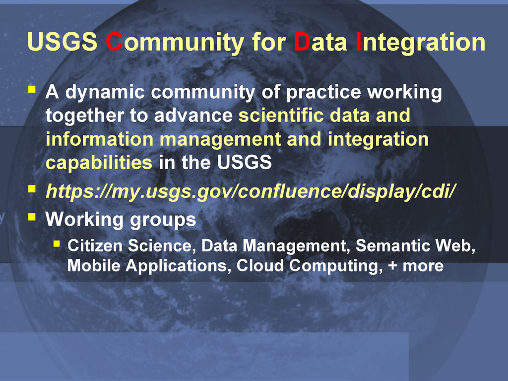
practice working together to advance scientific data and information management and integration capabilities in the USGS § https://my.usgs.gov/confluence/display/cdi/ § Working groups § Citizen Science, Data Management, Semantic Web, Mobile Applications, Cloud Computing, + more
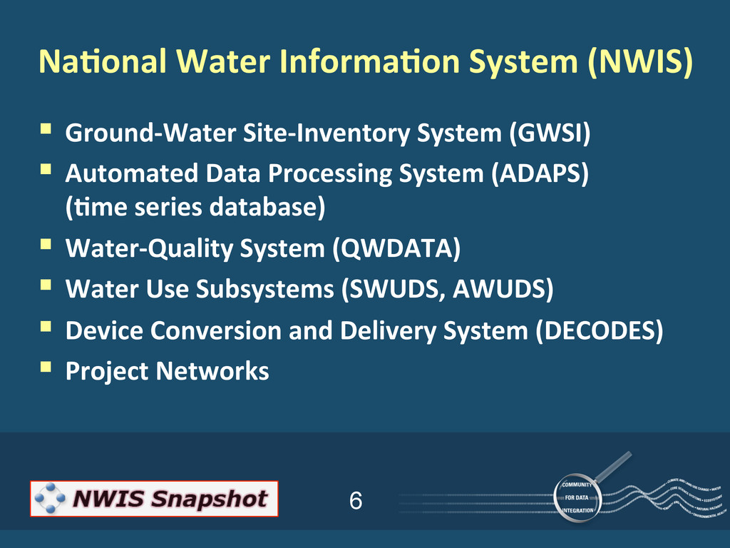
Processing System (ADAPS) (;me series database) § Water-‐Quality System (QWDATA) § Water Use Subsystems (SWUDS, AWUDS) § Device Conversion and Delivery System (DECODES) § Project Networks Na;onal Water Informa;on System (NWIS)
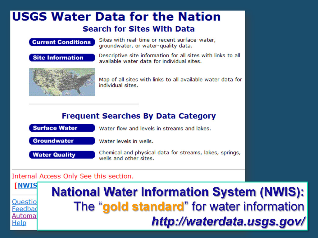
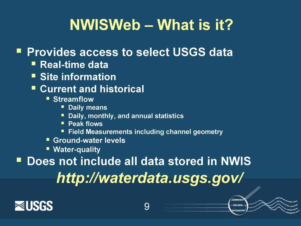
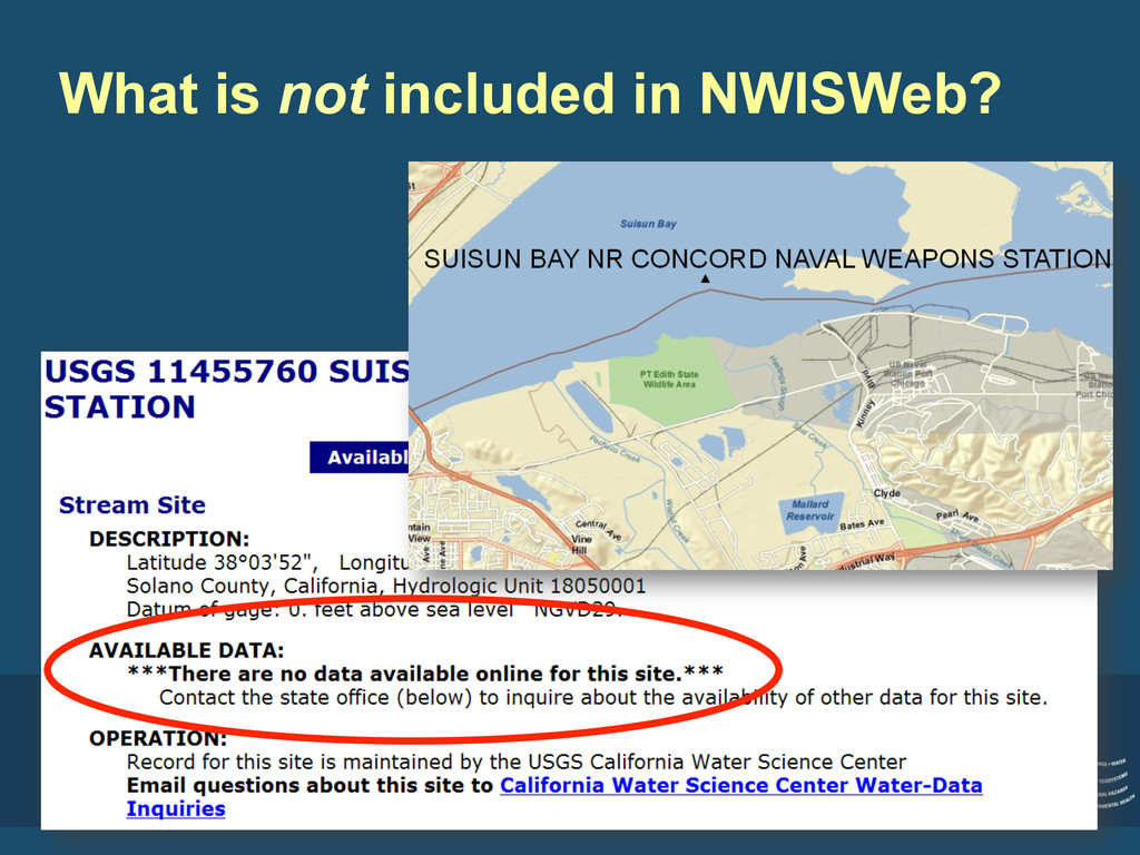
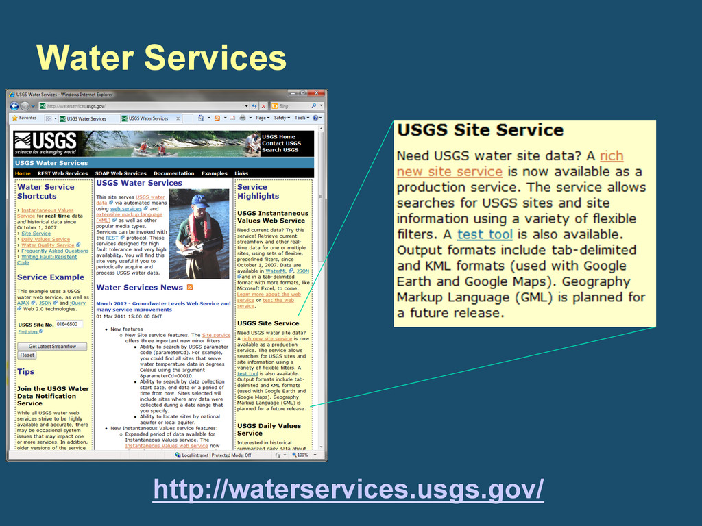
select USGS data § Real-time data § Site information § Current and historical § Streamflow § Daily means § Daily, monthly, and annual statistics § Peak flows § Field Measurements including channel geometry § Ground-water levels § Water-quality § Does not include all data stored in NWIS http://waterdata.usgs.gov/
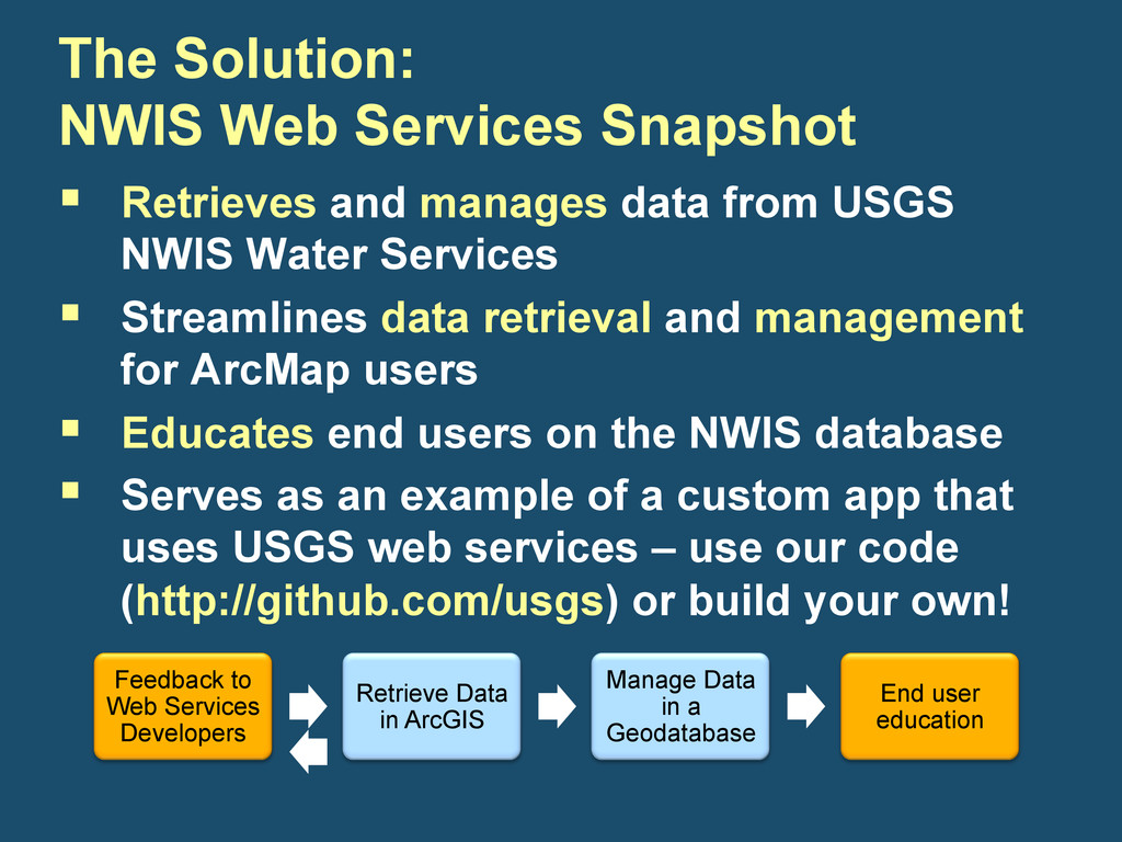
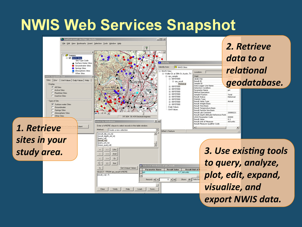
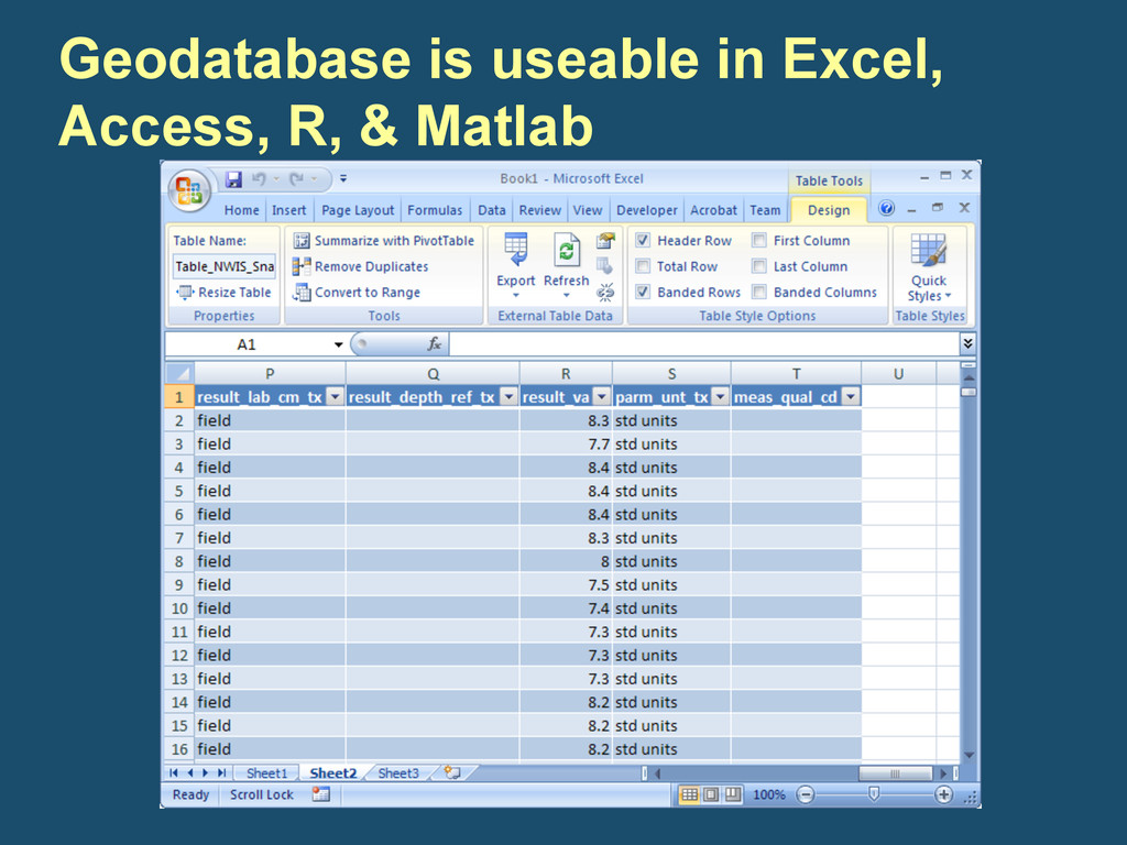
Data in a Geodatabase End user education § Retrieves and manages data from USGS NWIS Water Services § Streamlines data retrieval and management for ArcMap users § Educates end users on the NWIS database § Serves as an example of a custom app that uses USGS web services – use our code (http://github.com/usgs) or build your own! The Solution: NWIS Web Services Snapshot
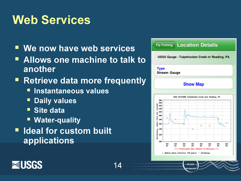
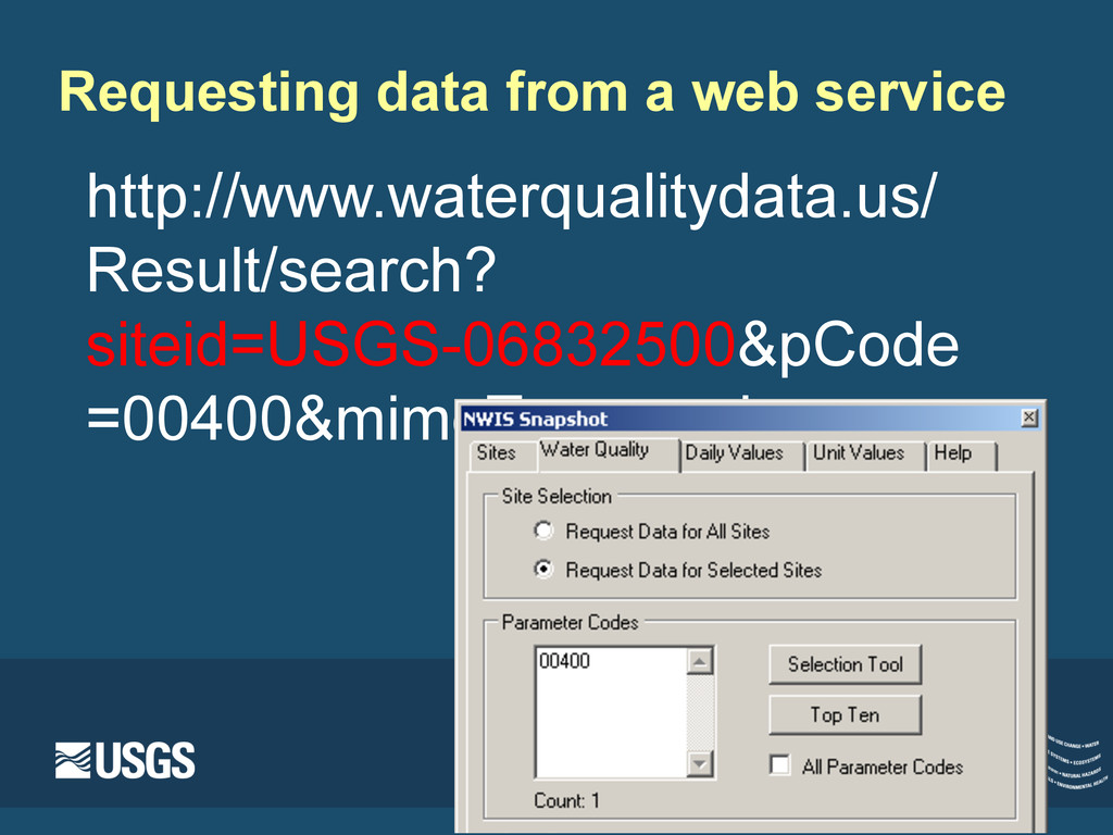
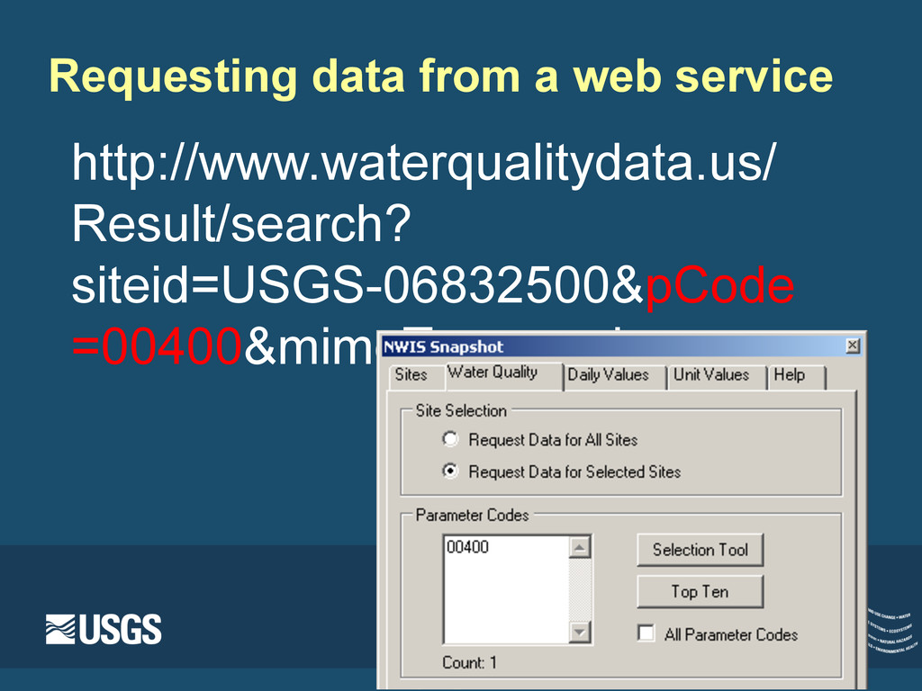
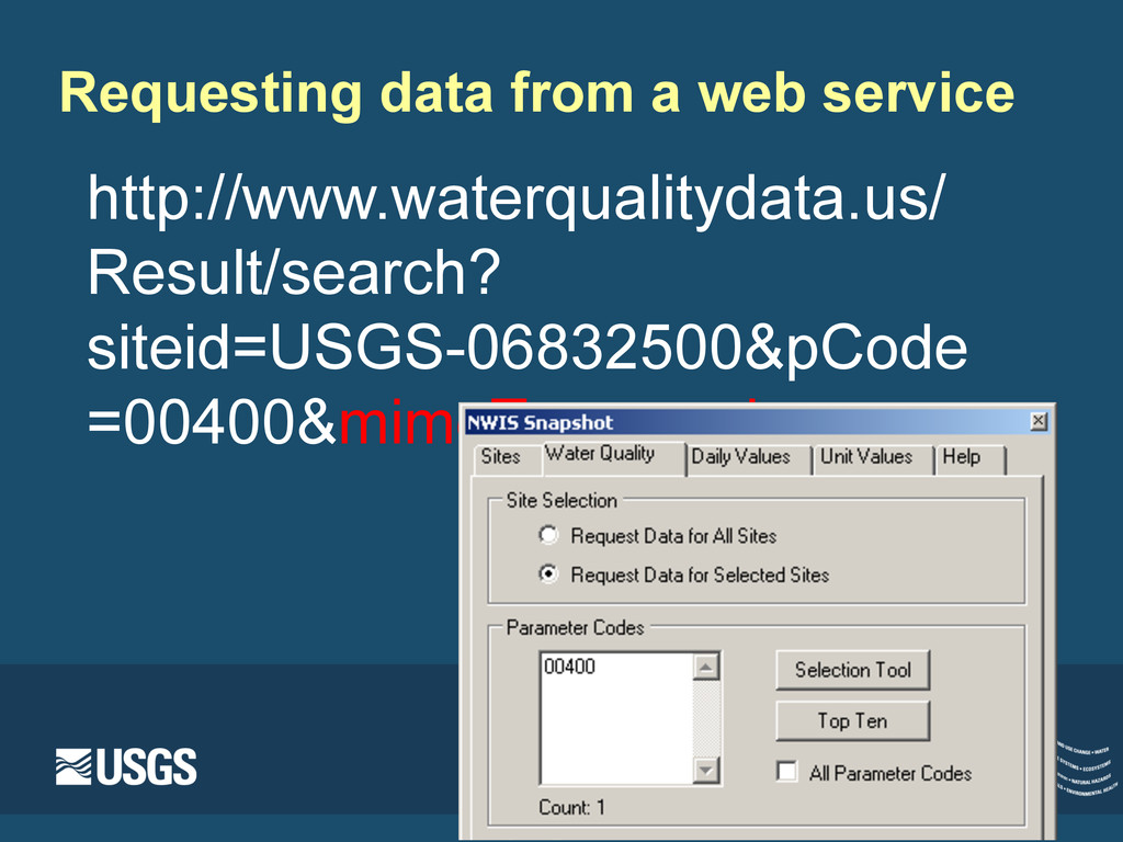
Allows one machine to talk to another § Retrieve data more frequently § Instantaneous values § Daily values § Site data § Water-quality § Ideal for custom built applications
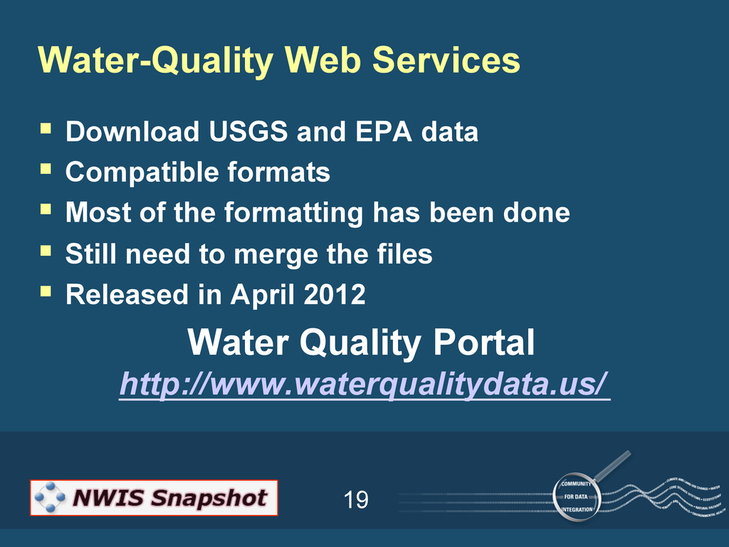
§ Most of the formatting has been done § Still need to merge the files § Released in April 2012 Water Quality Portal http://www.waterqualitydata.us/ Water-Quality Web Services
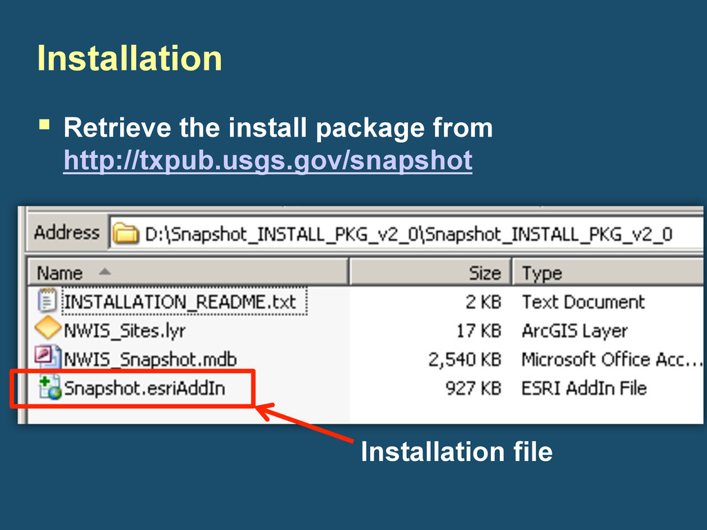
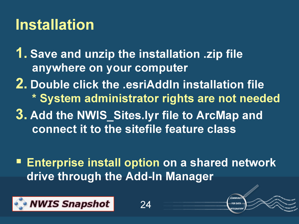
on your computer 2. Double click the .esriAddIn installation file * System administrator rights are not needed 3. Add the NWIS_Sites.lyr file to ArcMap and connect it to the sitefile feature class § Enterprise install option on a shared network drive through the Add-In Manager Installation
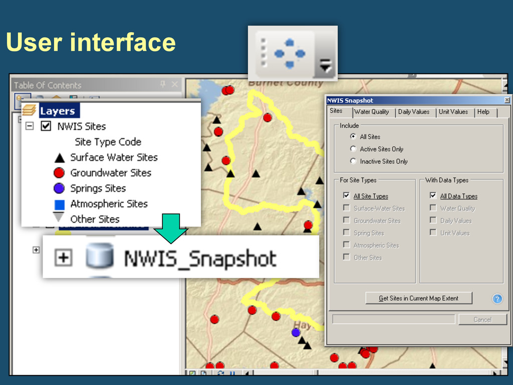
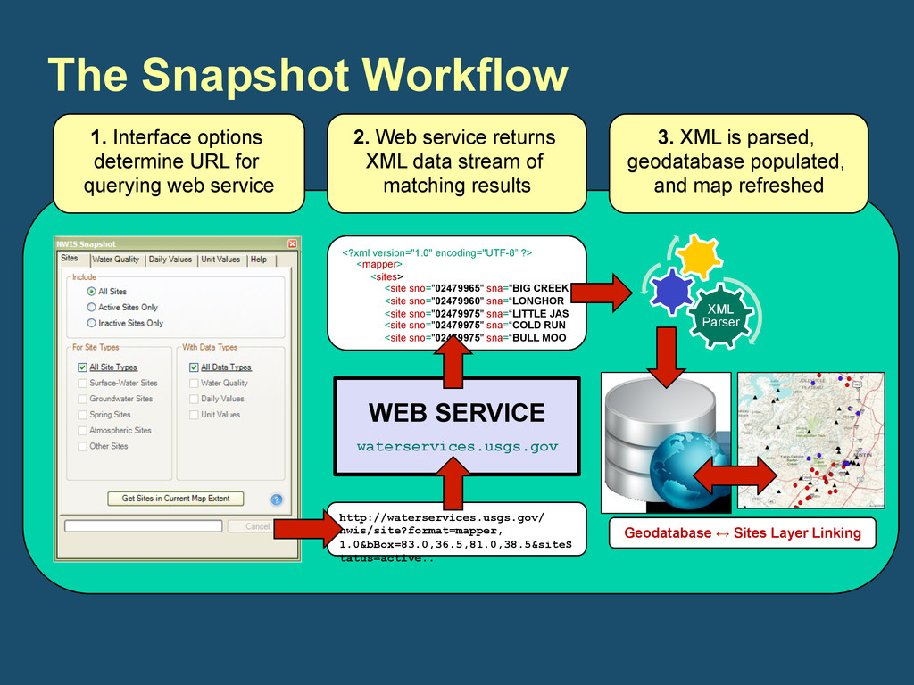
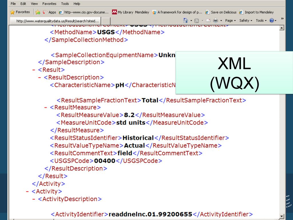
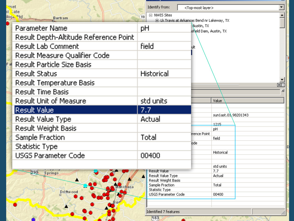
1. Interface options determine URL for querying web service 2. Web service returns XML data stream of matching results <?xml version="1.0" encoding="UTF-8” ?> <mapper> <sites> <site sno="02479965" sna="BIG CREEK <site sno="02479960" sna=“LONGHOR <site sno="02479975" sna=“LITTLE JAS <site sno="02479975" sna=“COLD RUN <site sno="02479975" sna=“BULL MOO 3. XML is parsed, geodatabase populated, and map refreshed XML Parser Geodatabase ↔ Sites Layer Linking
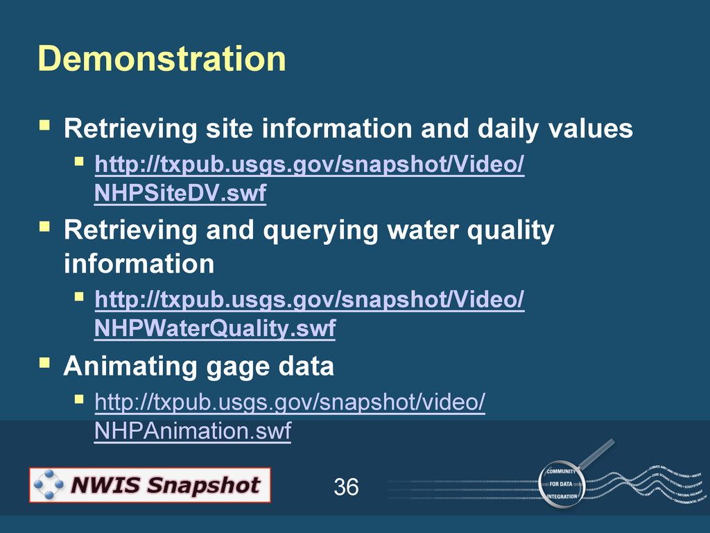
NHPSiteDV.swf § Retrieving and querying water quality information § http://txpub.usgs.gov/snapshot/Video/ NHPWaterQuality.swf § Animating gage data § http://txpub.usgs.gov/snapshot/video/ NHPAnimation.swf Demonstration
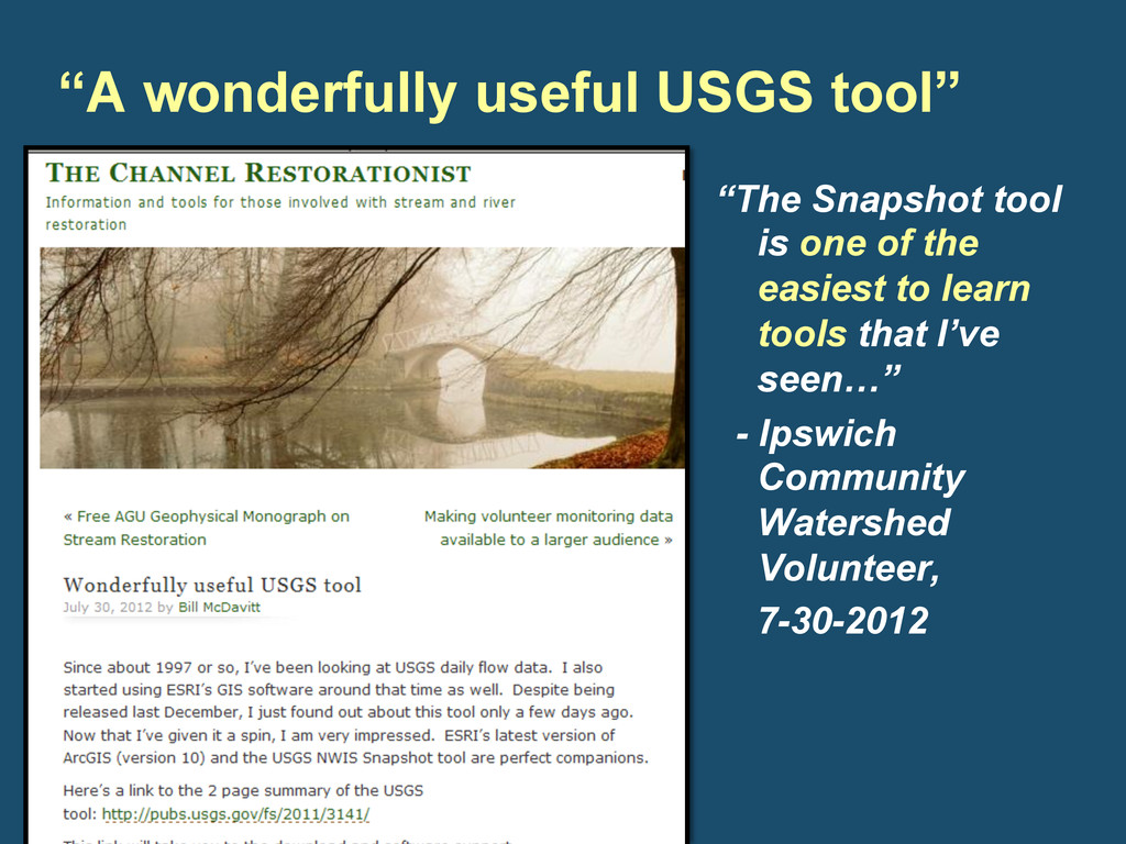
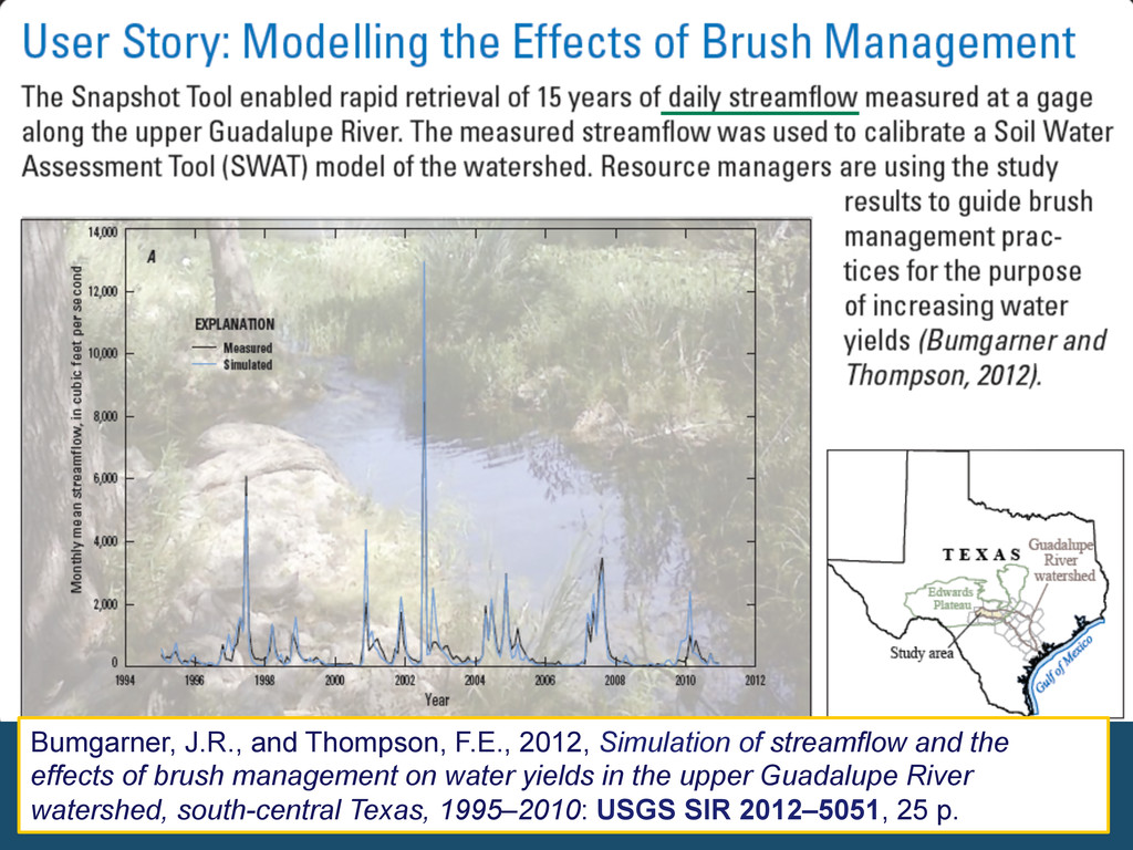
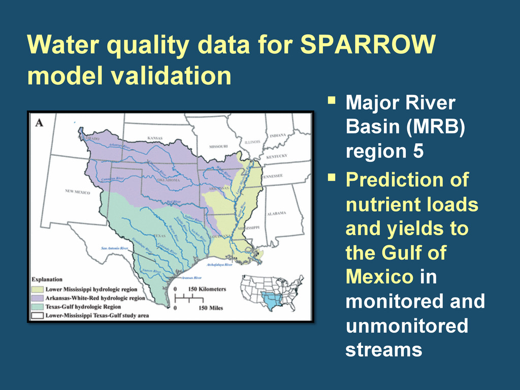
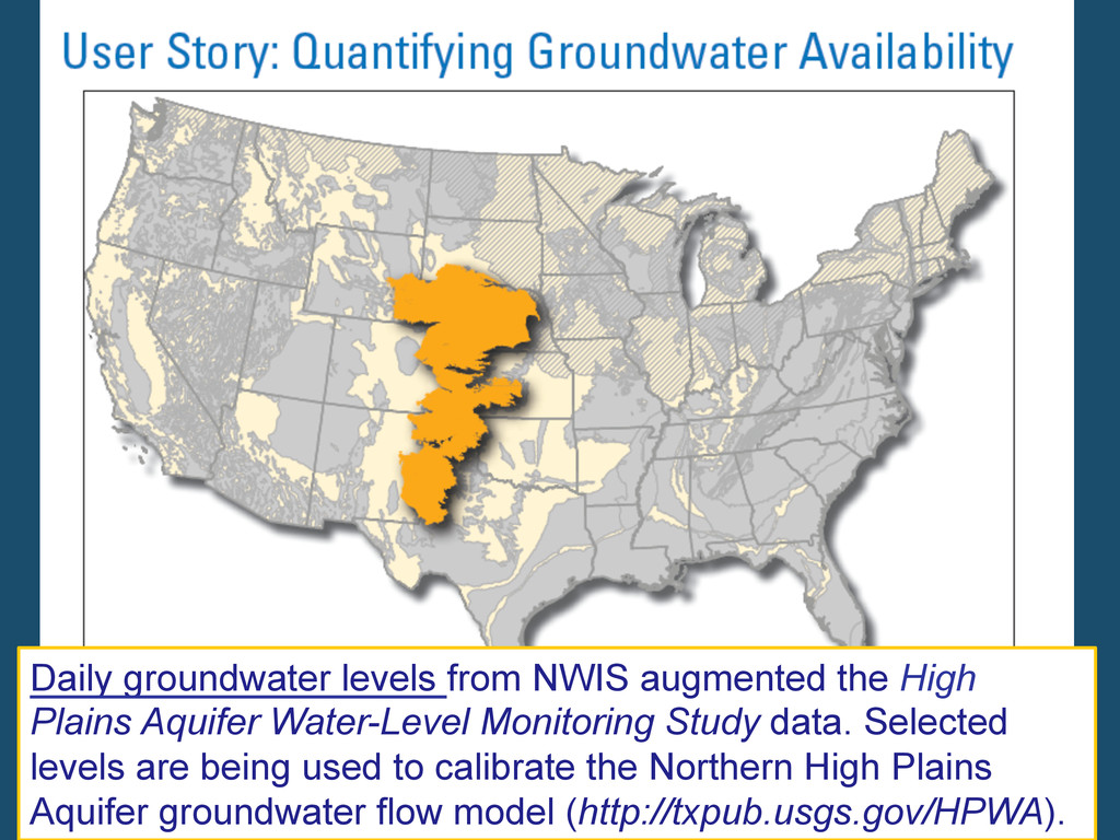
§ ACC GIS Course § Citizen Science § Ipswich community watershed group § USGS Projects § SPARROW model validation in the Gulf region § High Plains groundwater flow model § Upper Guadalupe brush management FY12: Public Release
Water-Level Monitoring Study data. Selected levels are being used to calibrate the Northern High Plains Aquifer groundwater flow model (http://txpub.usgs.gov/HPWA).
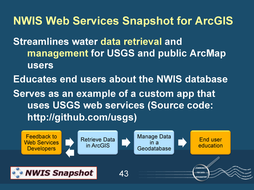
public ArcMap users Educates end users about the NWIS database Serves as an example of a custom app that uses USGS web services (Source code: http://github.com/usgs) NWIS Web Services Snapshot for ArcGIS Feedback to Web Services Developers Retrieve Data in ArcGIS Manage Data in a Geodatabase End user education
Documentation: Florence Thompson Christy-Ann Archuleta Victoria Stengel NWIS Database Expert: Michael Canova Website: Justin Robertson Deanna Terry Project Manager: Sally Holl Project Members
Liz Sellers Jen Carlino Sky Bristol Carma San Juan Sylvia Wilson Michaela Johnson Daniel Pearson Jennifer Lanning- Rush Natalie Latysh Abby Benson Alex Dismore Nate Booth Joe Kalfsbeek John Bumgarner Tim Kern Haylee Schweizer Peter Schell David Maidment Daryll Pope Natalie Houston David Blodgett Susan Buto Toby Welborn Rose Medina Stephanie Kula Nancy Damar Scott Lewein Acknowledgements USGS Community for Data Integration
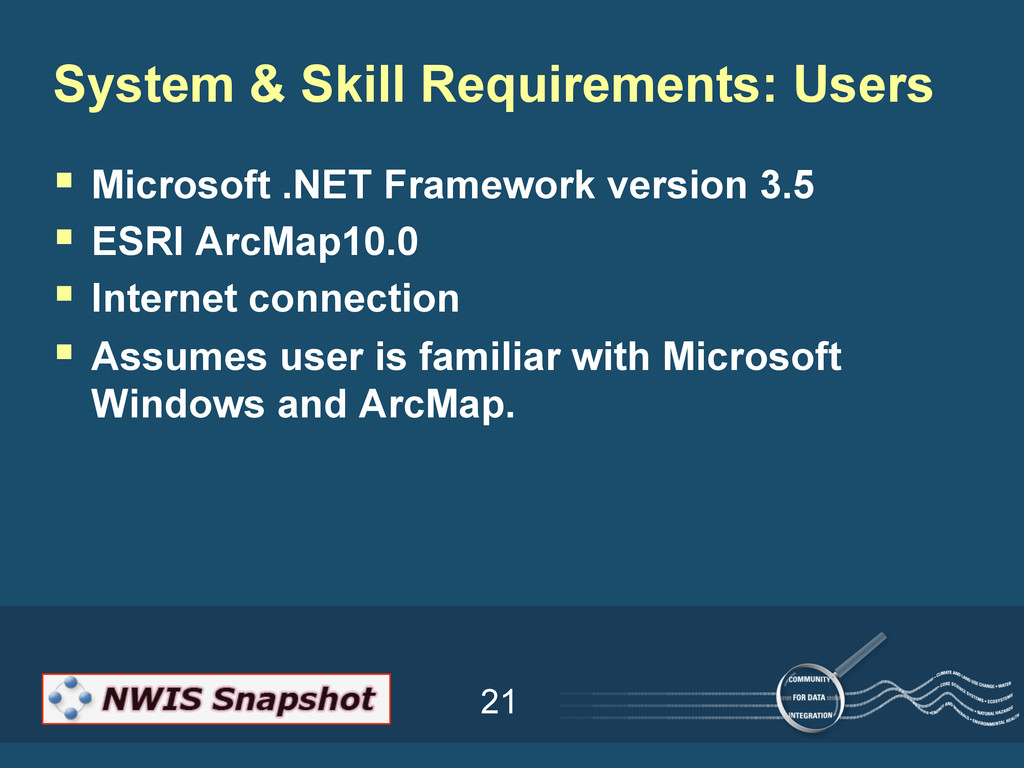
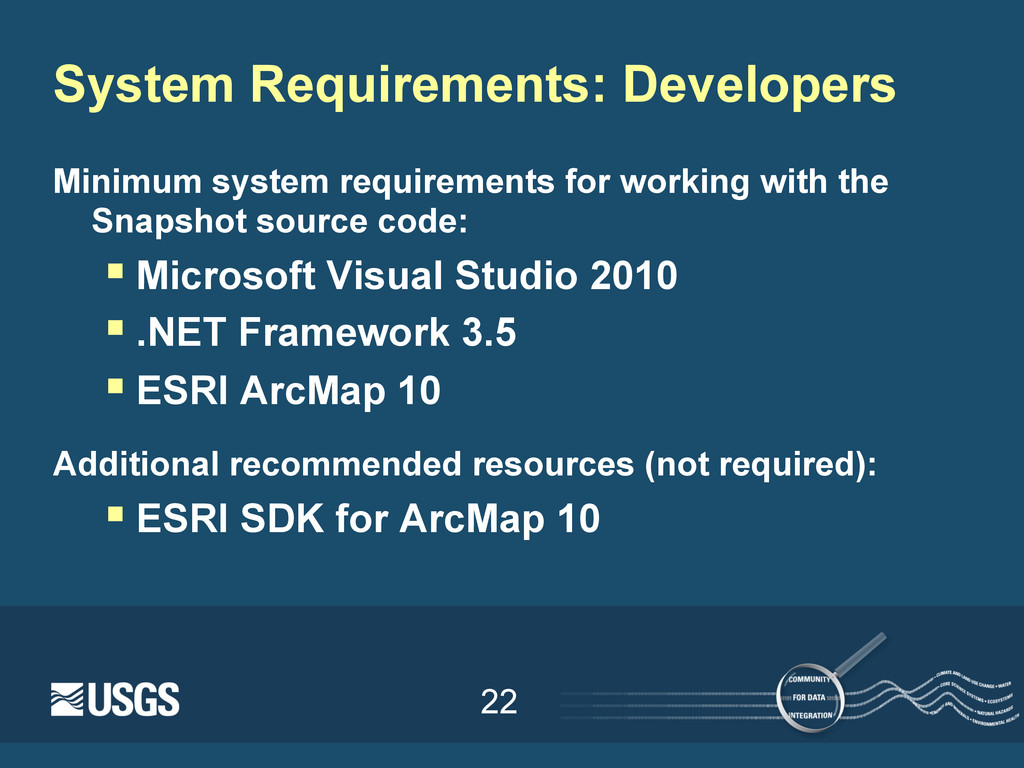
![47 Contact: Sally Holl, [email protected] http://txpub.usgs.gov/snapshot](https://files.speakerdeck.com/presentations/5090465e7536e500020106bb/slide_46.jpg)