be the world’s leading service-provider in the collection and interpretation of data relating to the earth’s surface and sub-surface, and in the support of infrastructure developments on land, at the coast and on the seabed.
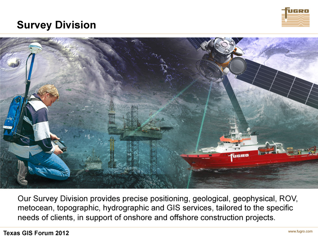
provides precise positioning, geological, geophysical, ROV, metocean, topographic, hydrographic and GIS services, tailored to the specific needs of clients, in support of onshore and offshore construction projects.
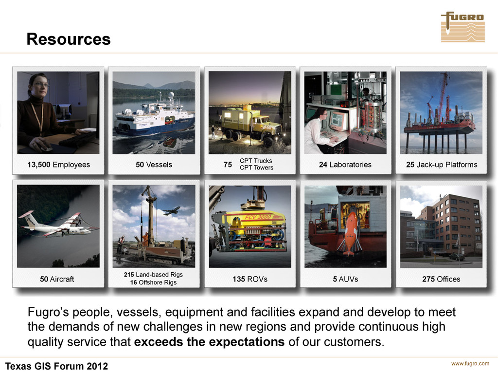
and facilities expand and develop to meet the demands of new challenges in new regions and provide continuous high quality service that exceeds the expectations of our customers. 50 Vessels CPT Trucks CPT Towers 75 24 Laboratories 25 Jack-up Platforms 13,500 Employees 50 Aircraft 215 Land-based Rigs 16 Offshore Rigs 275 Offices 135 ROVs 5 AUVs
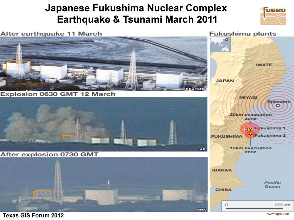
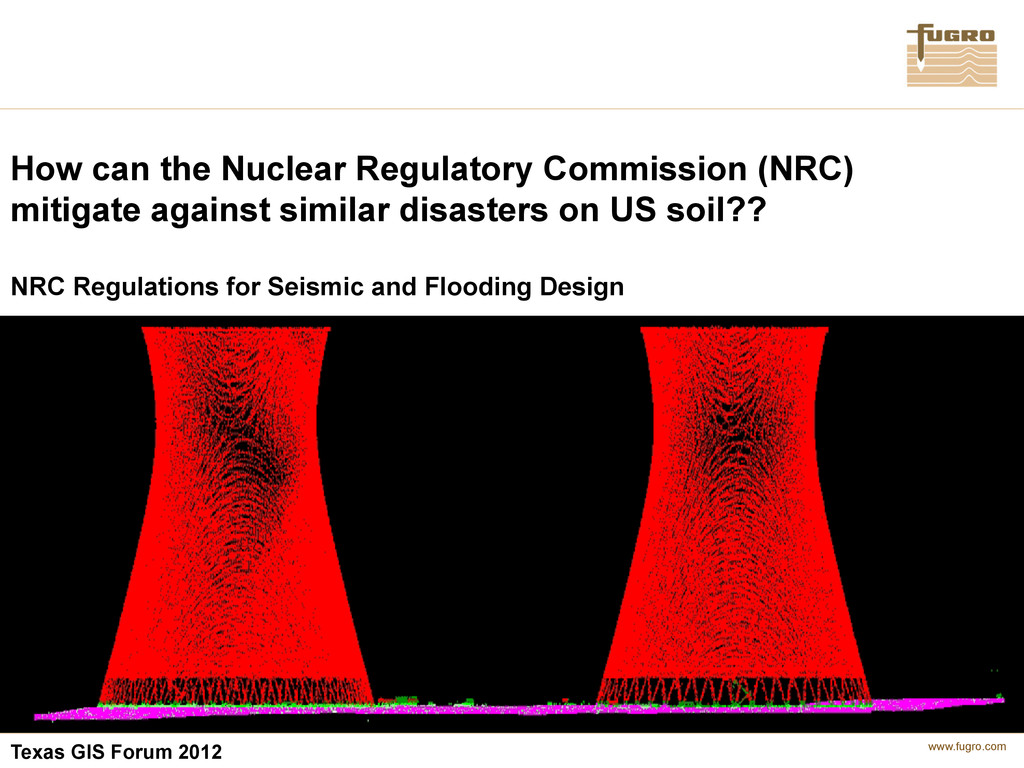
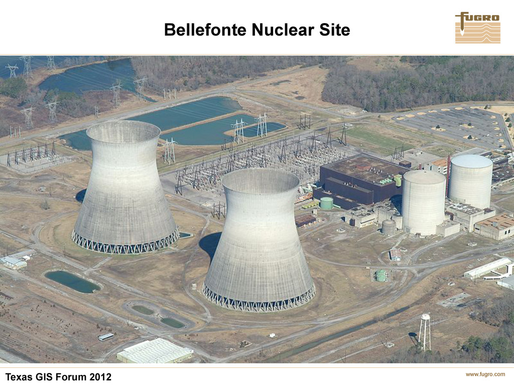
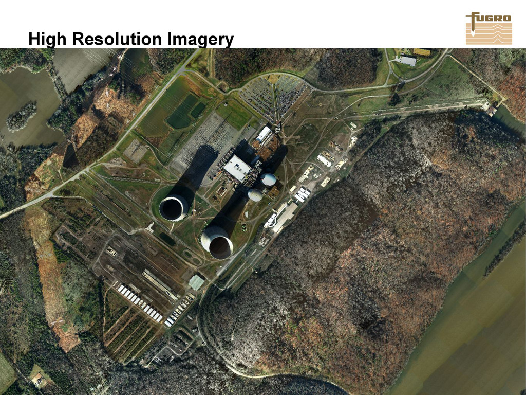
The risk of the US suffering such a devastating combination of earthquake and tsunami is unlikely • However, we must be ready for the most unlikely of events • Initial Nuclear Plant designs were conceived with a built-in margin of safety based on the largest earthquake and flood event known in the region
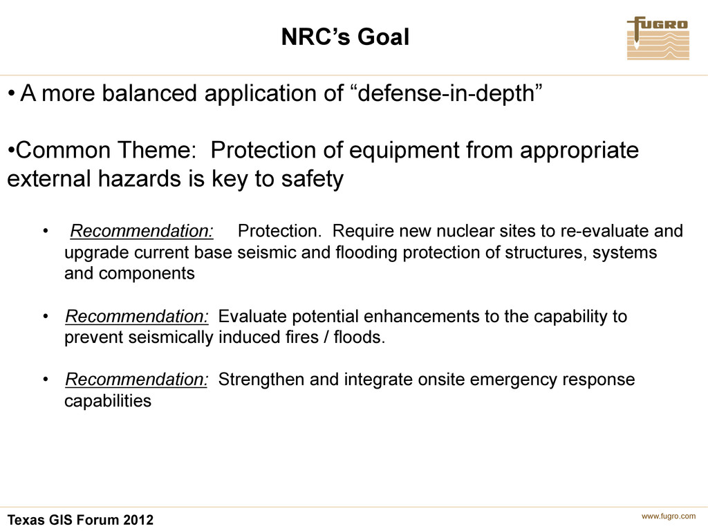
balanced application of “defense-in-depth” • Common Theme: Protection of equipment from appropriate external hazards is key to safety • Recommendation: Protection. Require new nuclear sites to re-evaluate and upgrade current base seismic and flooding protection of structures, systems and components • Recommendation: Evaluate potential enhancements to the capability to prevent seismically induced fires / floods. • Recommendation: Strengthen and integrate onsite emergency response capabilities
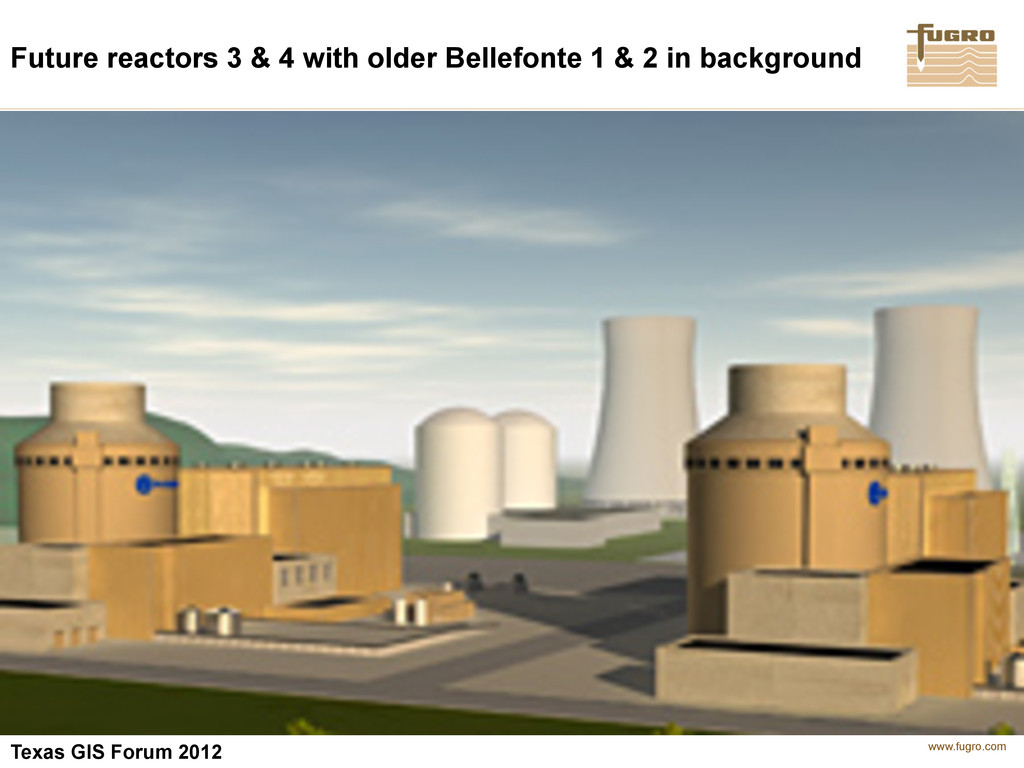
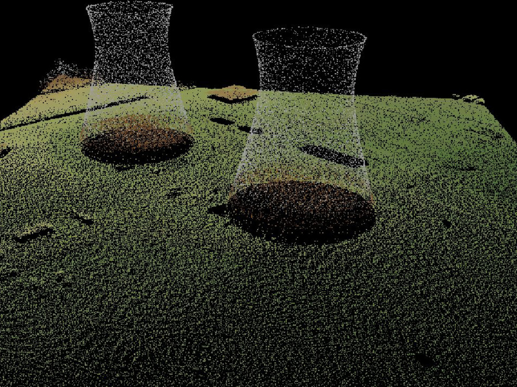
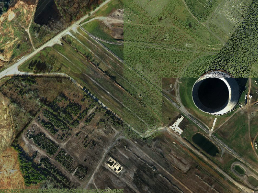
your current seismic and flooding design? • Do you evaluate potential enhancements to your capability to prevent seimically induced fires / floods? • Do you strengthen and integrate onsite emergency response capabilties? By mapping every feature in a 3D environment
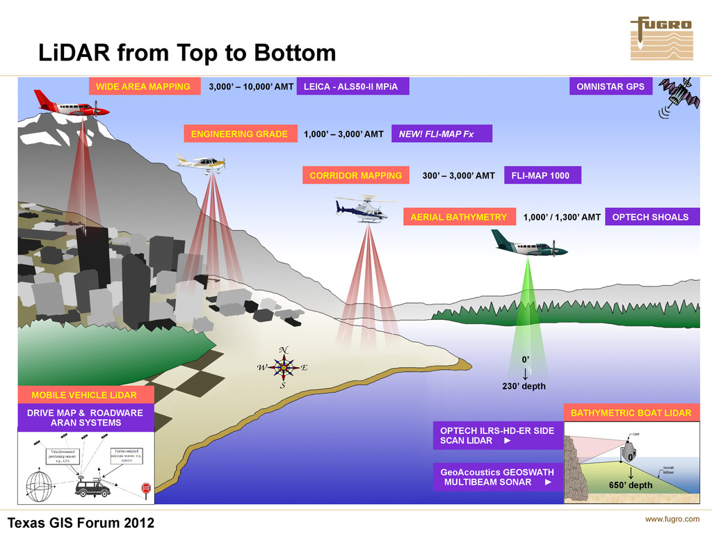
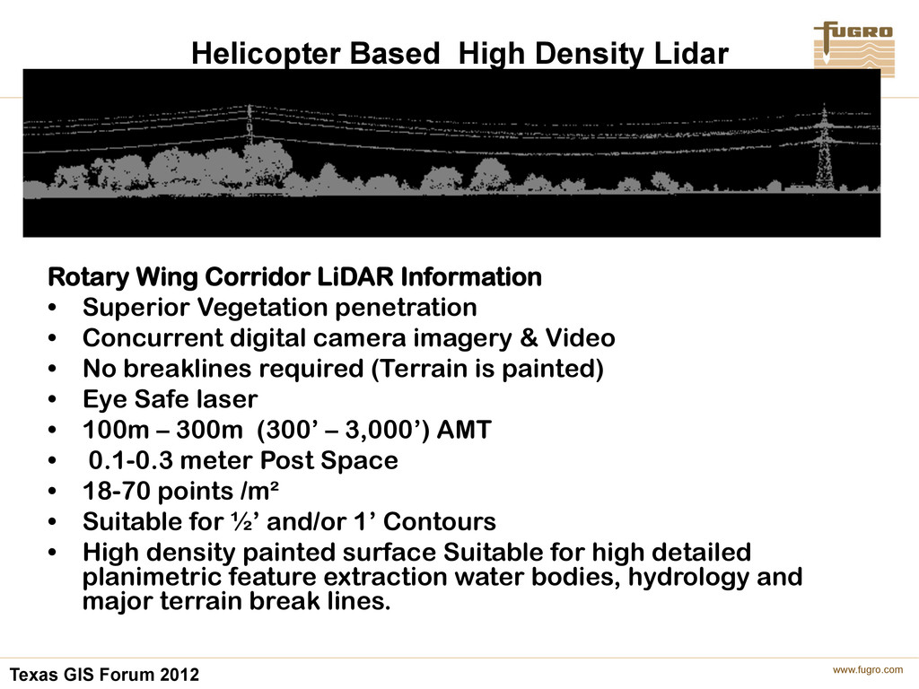
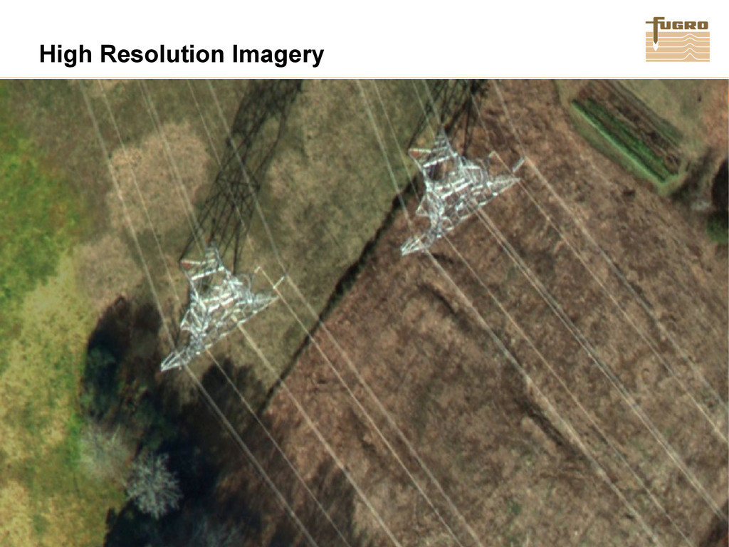
Rotary Wing Corridor LiDAR Information • Superior Vegetation penetration • Concurrent digital camera imagery & Video • No breaklines required (Terrain is painted) • Eye Safe laser • 100m – 300m (300’ – 3,000’) AMT • 0.1-0.3 meter Post Space • 18-70 points /m² • Suitable for ½’ and/or 1’ Contours • High density painted surface Suitable for high detailed planimetric feature extraction water bodies, hydrology and major terrain break lines.
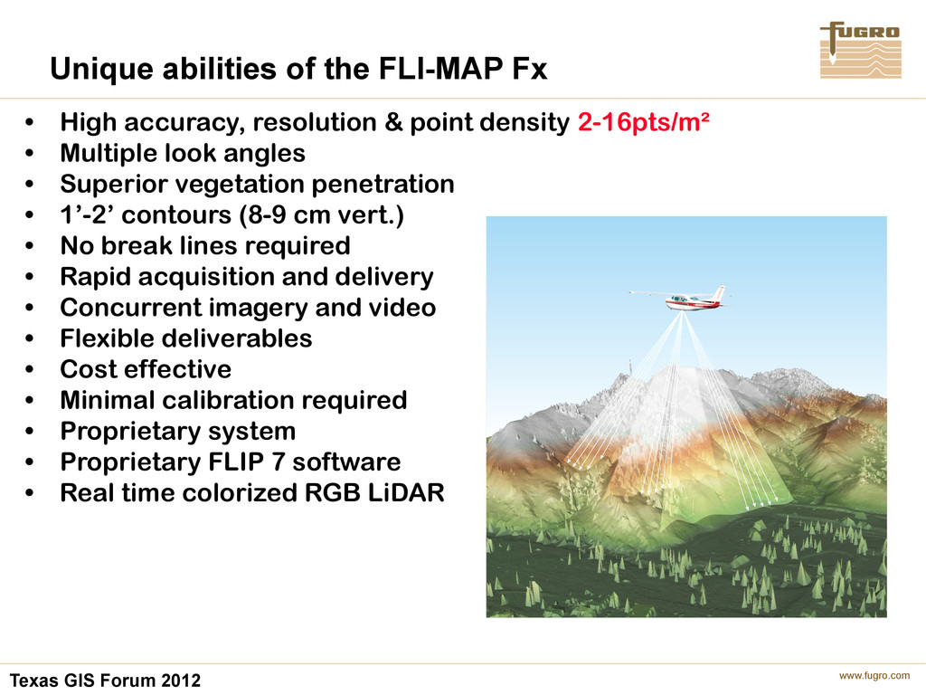
the FLI-MAP Fx • High accuracy, resolution & point density 2-16pts/m² • Multiple look angles • Superior vegetation penetration • 1’-2’ contours (8-9 cm vert.) • No break lines required • Rapid acquisition and delivery • Concurrent imagery and video • Flexible deliverables • Cost effective • Minimal calibration required • Proprietary system • Proprietary FLIP 7 software • Real time colorized RGB LiDAR
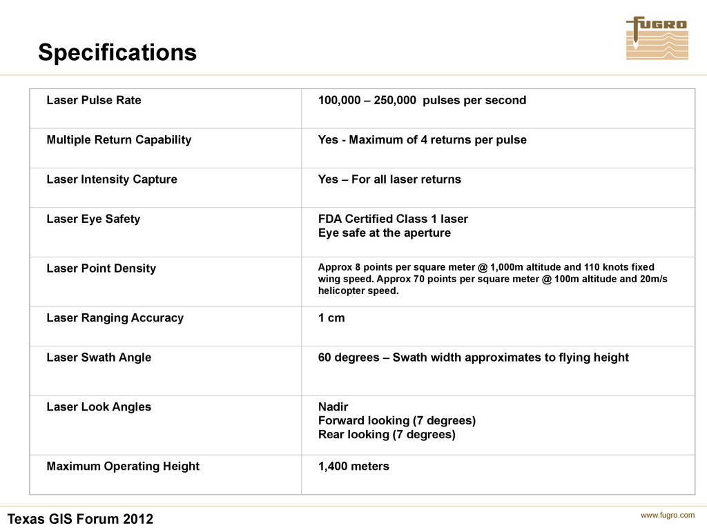
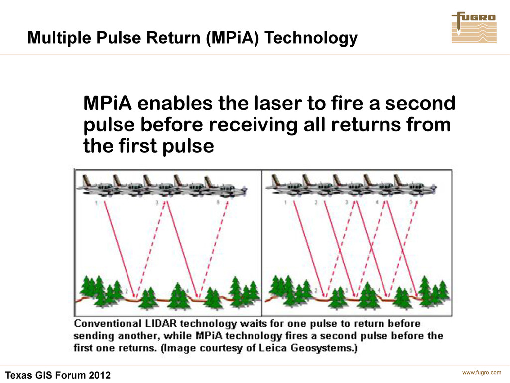
250,000 pulses per second Multiple Return Capability Yes - Maximum of 4 returns per pulse Laser Intensity Capture Yes – For all laser returns Laser Eye Safety FDA Certified Class 1 laser Eye safe at the aperture Laser Point Density Approx 8 points per square meter @ 1,000m altitude and 110 knots fixed wing speed. Approx 70 points per square meter @ 100m altitude and 20m/s helicopter speed. Laser Ranging Accuracy 1 cm Laser Swath Angle 60 degrees – Swath width approximates to flying height Laser Look Angles Nadir Forward looking (7 degrees) Rear looking (7 degrees) Maximum Operating Height 1,400 meters Specifications
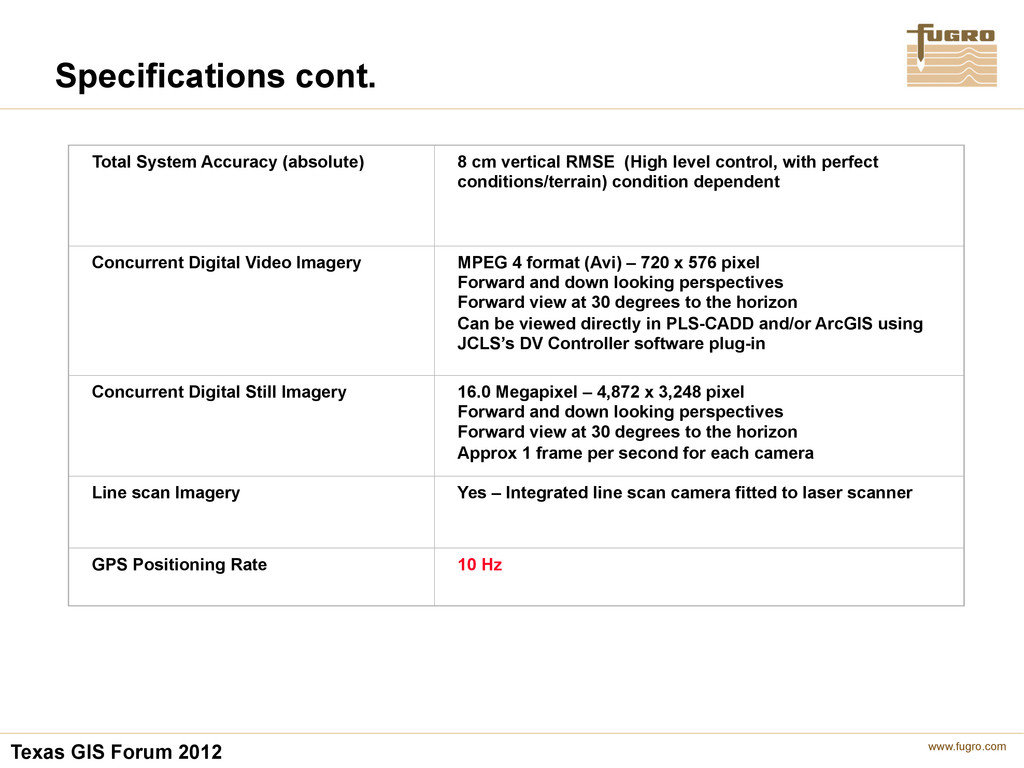
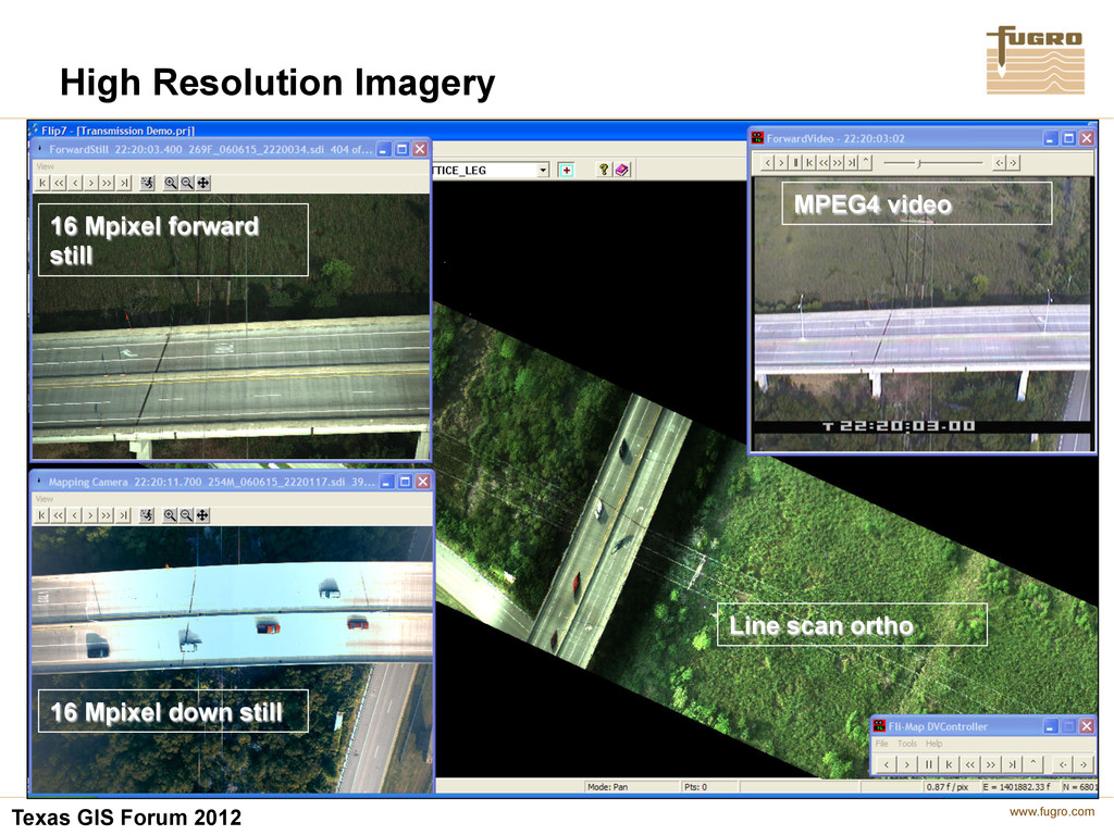
cm vertical RMSE (High level control, with perfect conditions/terrain) condition dependent Concurrent Digital Video Imagery MPEG 4 format (Avi) – 720 x 576 pixel Forward and down looking perspectives Forward view at 30 degrees to the horizon Can be viewed directly in PLS-CADD and/or ArcGIS using JCLS’s DV Controller software plug-in Concurrent Digital Still Imagery 16.0 Megapixel – 4,872 x 3,248 pixel Forward and down looking perspectives Forward view at 30 degrees to the horizon Approx 1 frame per second for each camera Line scan Imagery Yes – Integrated line scan camera fitted to laser scanner GPS Positioning Rate 10 Hz Specifications cont.
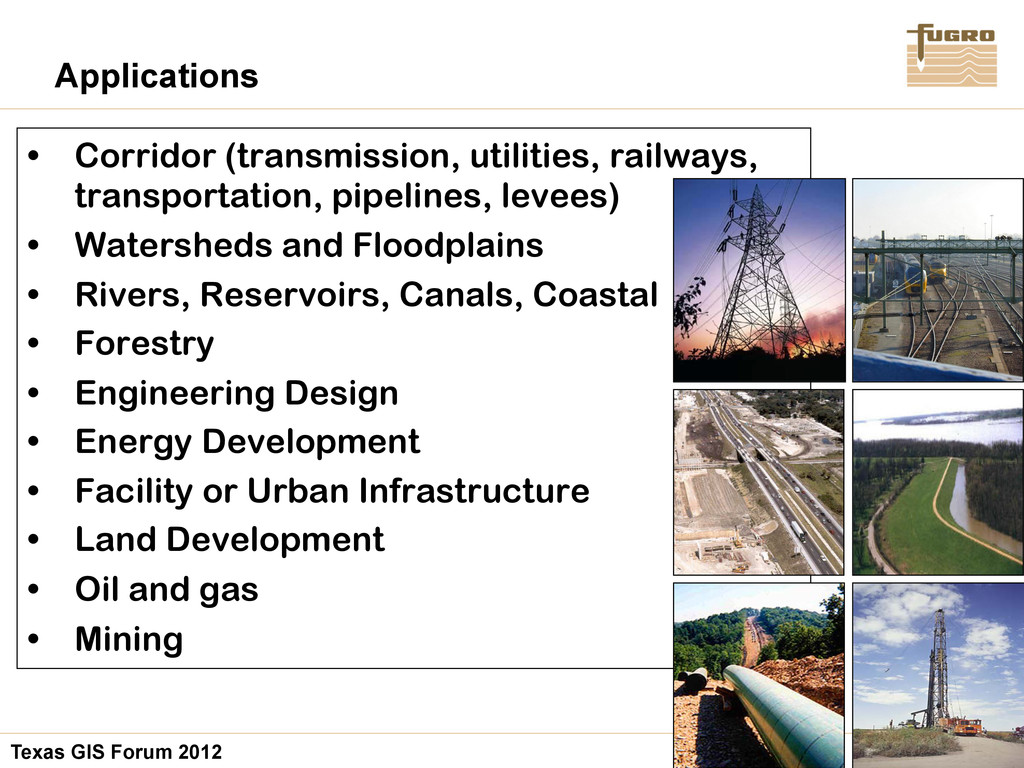
transportation, pipelines, levees) • Watersheds and Floodplains • Rivers, Reservoirs, Canals, Coastal • Forestry • Engineering Design • Energy Development • Facility or Urban Infrastructure • Land Development • Oil and gas • Mining Applications
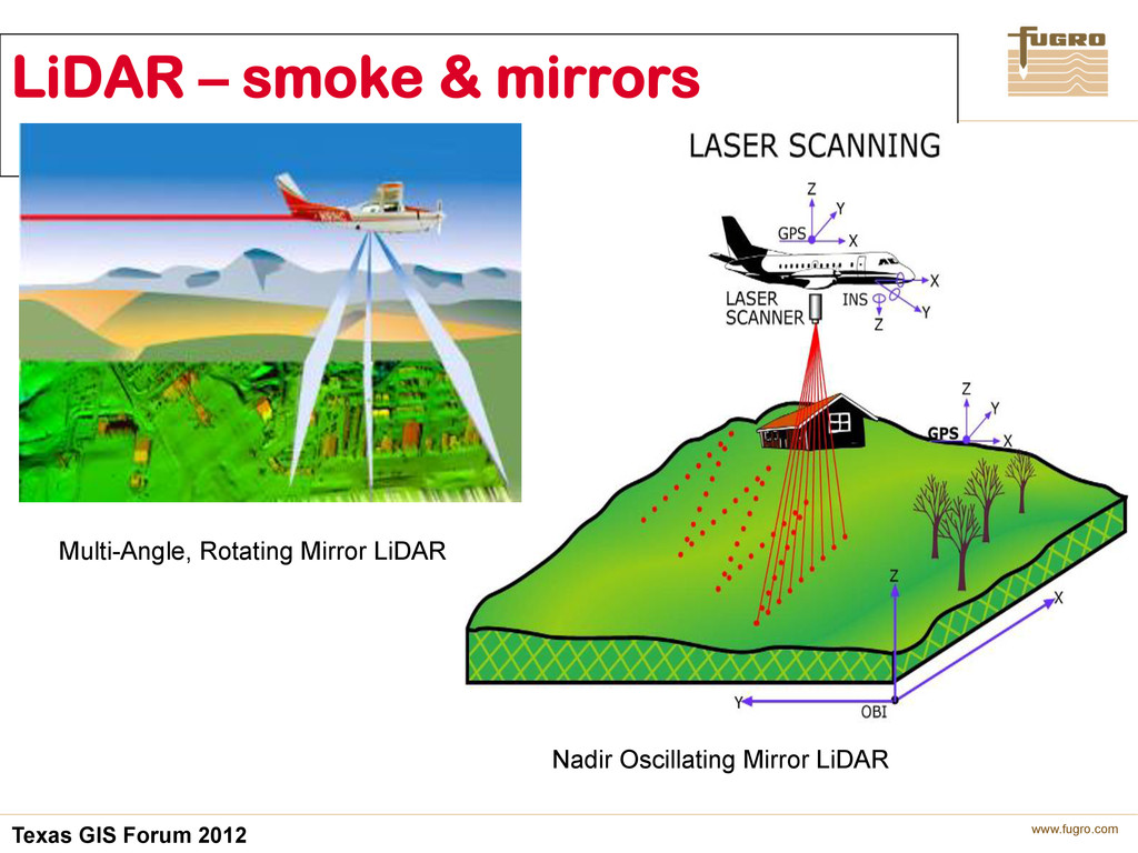
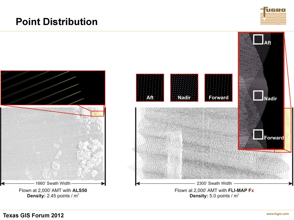
three look angle LIDAR sensor, by it’s design and operational nature, provides more consistent and stable returns, even out to the 80% edges (or 48° )of the total 60° fixed FOV. The USGS ver. 12 specified 30° FOV limitation for an oscillating mirror approach, does not apply to this rotating mirror sensor. As a direct benefit, this sensor strength is in providing more cost effective acquisition solutions (wider more efficient swath width coverage at the same altitude and higher point densities to identify the terrain), while meeting or exceeding the intent of the accuracy and product deliverables. Point density and distribution
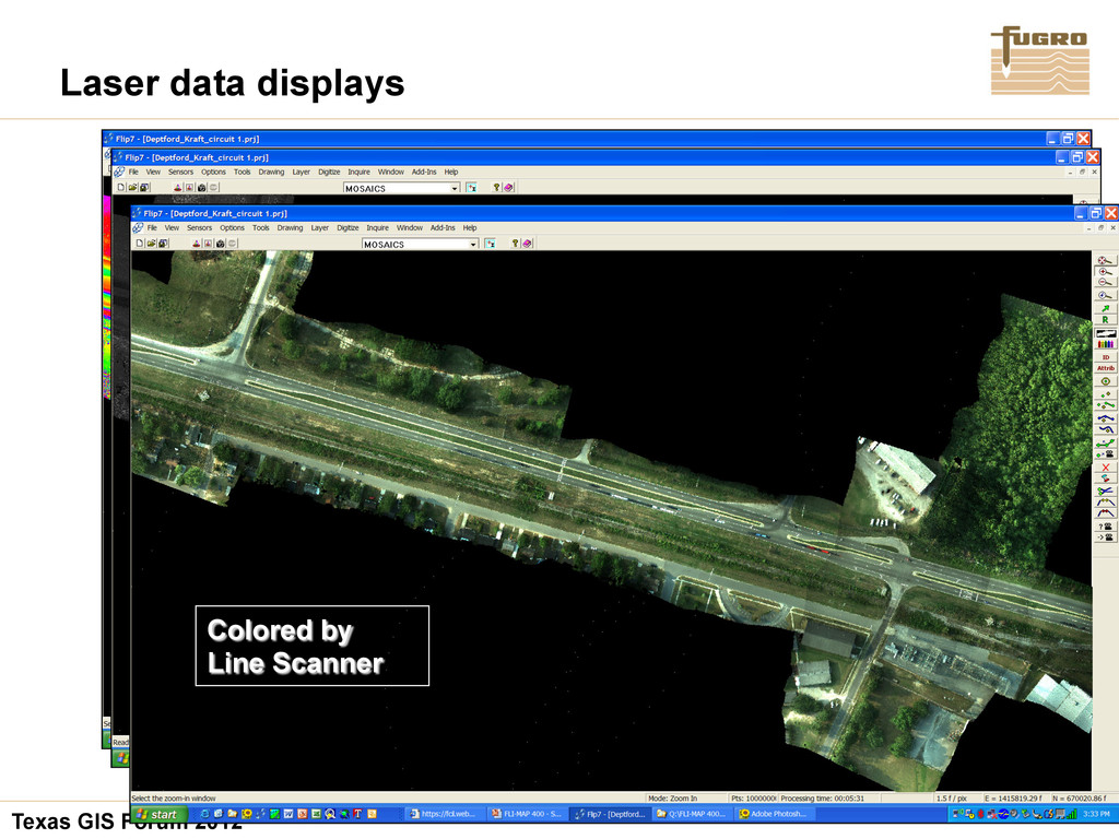
system utilizes a proprietary process to colorize the LiDAR points at the moment of collection. This greatly aides in the classification of LiDAR points, visualization of the data and the calibration of the instrument. 3-D RGB Colorized LiDAR
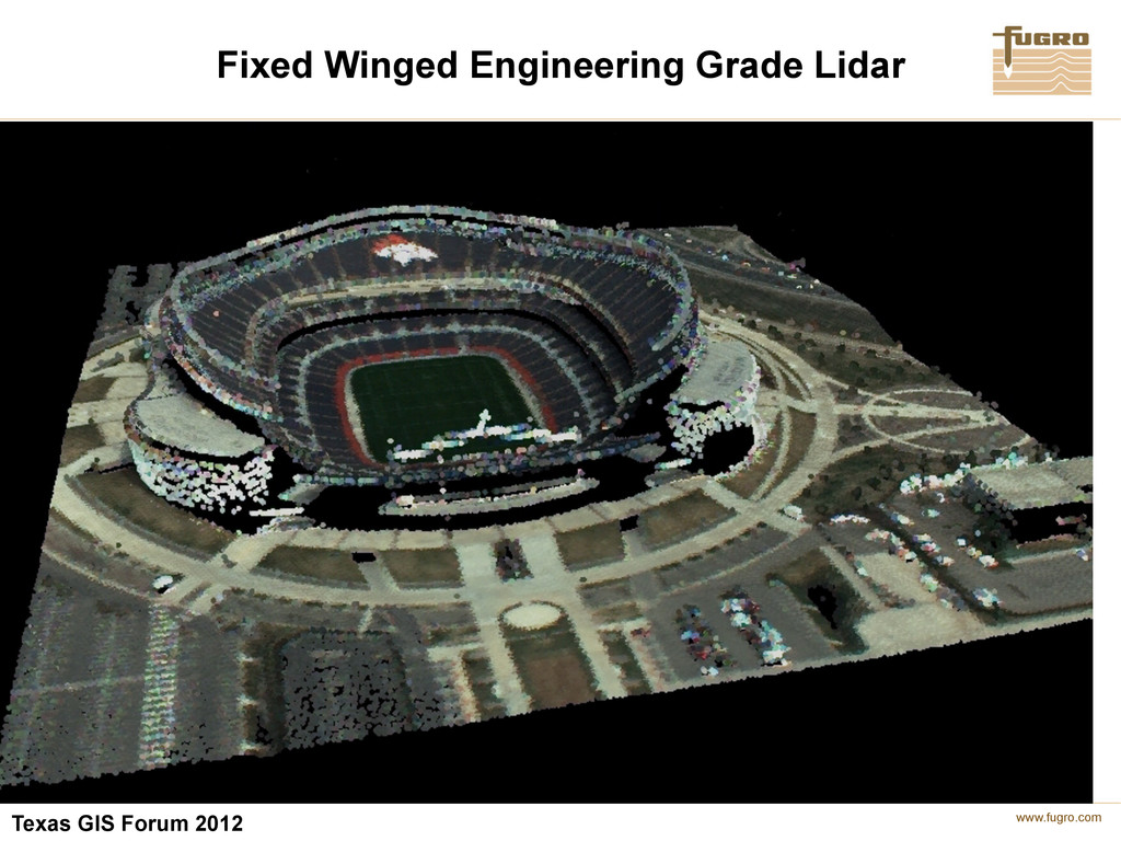
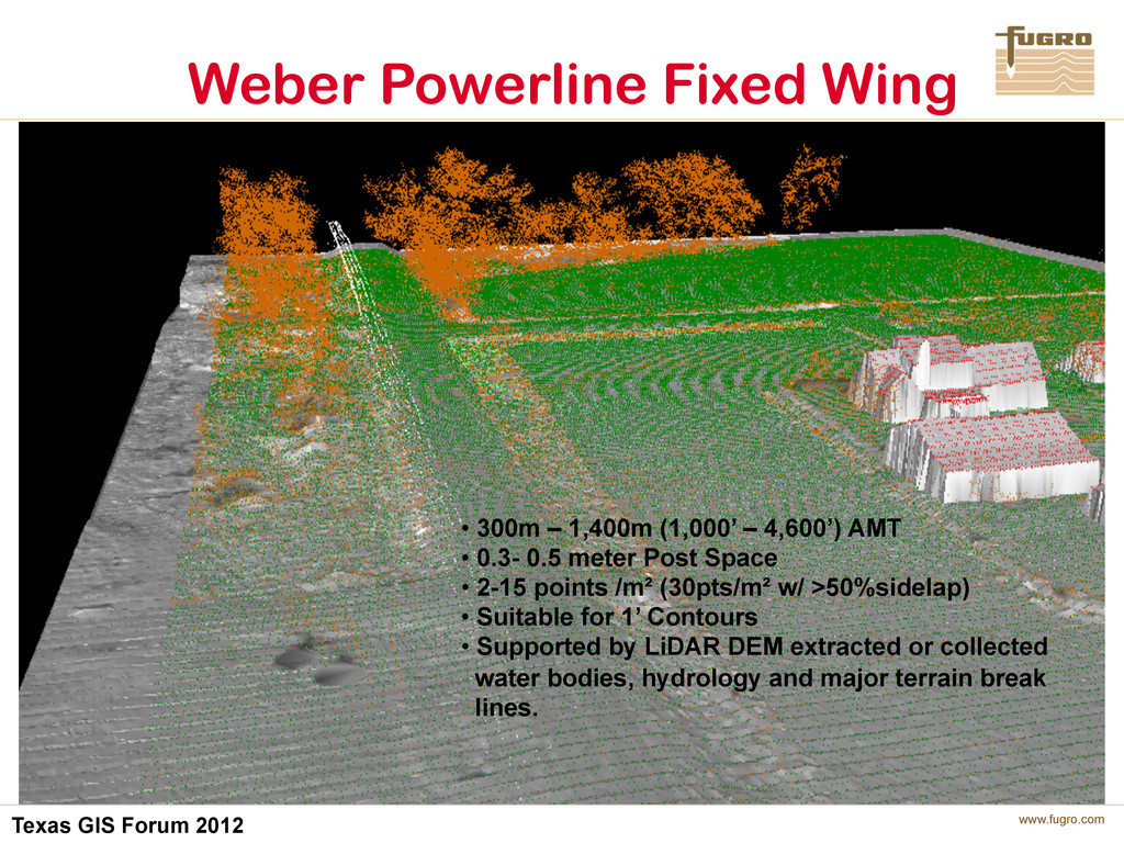
300m – 1,400m (1,000’ – 4,600’) AMT • 0.3- 0.5 meter Post Space • 2-15 points /m² (30pts/m² w/ >50%sidelap) • Suitable for 1’ Contours • Supported by LiDAR DEM extracted or collected water bodies, hydrology and major terrain break lines.