How Astun Technology (http://astuntechnology.com) built a national (Great Britain) web map tile server and WMS using PostgreSQL, PostGIS, MapServer and MapProxy all running on AWS. Presented at OSGIS 2012.(http://www.nottingham.ac.uk/osgis/)
and WMS OS Open (Strategy, Meridian 2, VectorMap District) OS Premium (OS Open + VectorMap Local & OS MasterMap) Smaller areas of Aerial Photography and other base mapping
using OGR • Originally for loading OS GML data (but has been used with other GML and KML data) • Allows the source GML to be prepared and enhanced during loading via Python
OS MasterMap and VectorMap Local data and indexes • 10GB for Meridian, Strategi etc. • Separate tablespace for OSMM data; OSMM index; VML data; VML index
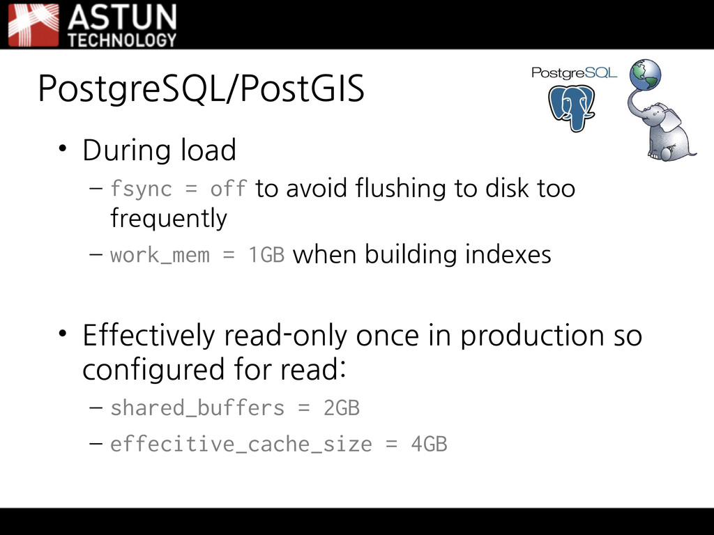
flushing to disk too frequently – work_mem = 1GB when building indexes • Effectively read-only once in production so configured for read: – shared_buffers = 2GB – effecitive_cache_size = 4GB
and VectorMap Local generally styled based on featurecode • Using some attributes derived by Loader for CartoText such as orientdeg and anchorposition for better text placement
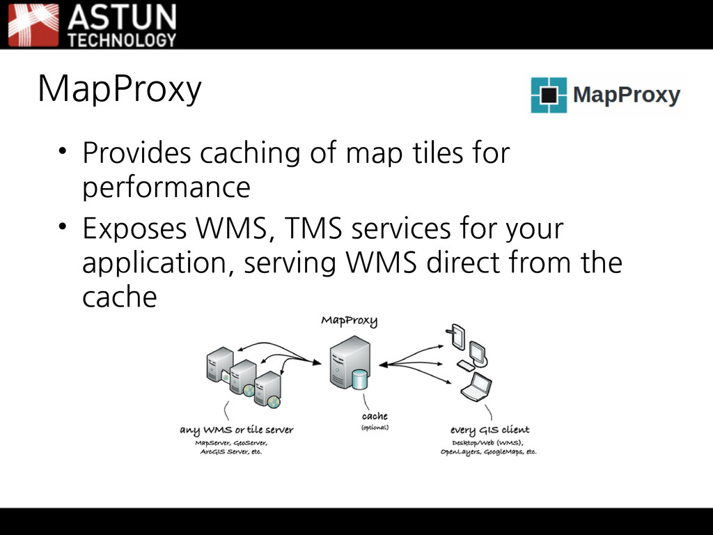
single colour tiles and mixed format caches • Sophisticated cache seeding and management tools • We seed popular areas (urban areas) for our customers and cache is only about 20GB compared to hundreds of GB if pre-seeded
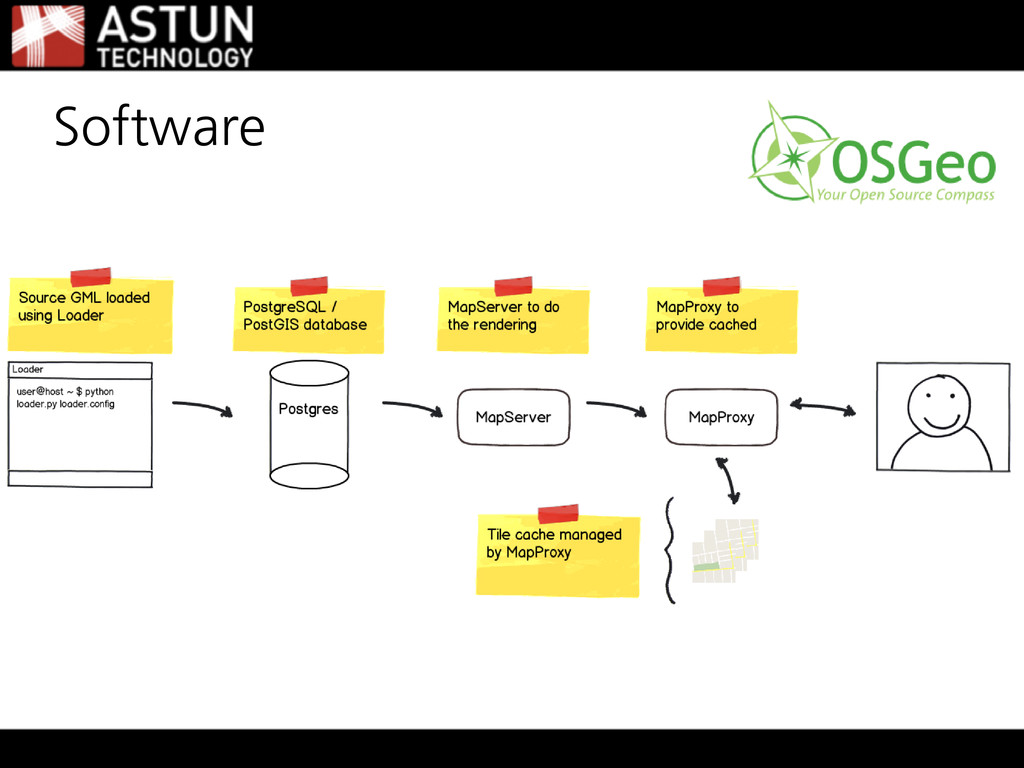
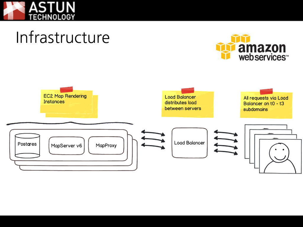
Volumes for PostgreSQL Data, Indexes and Tile Cache • One Load Balancer in front of the production servers • AWS monitoring for health as well as seperate web monitoring Infrastructure
![Building a National Tile Server Matt Walker [email protected] @_walkermatt](https://files.speakerdeck.com/presentations/50571dd06ef0e50002054765/slide_0.jpg)