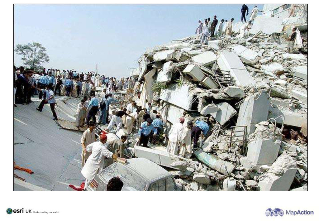
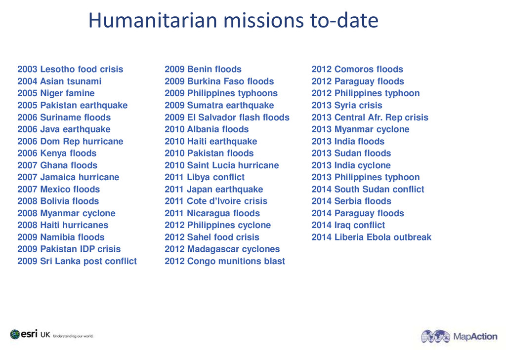
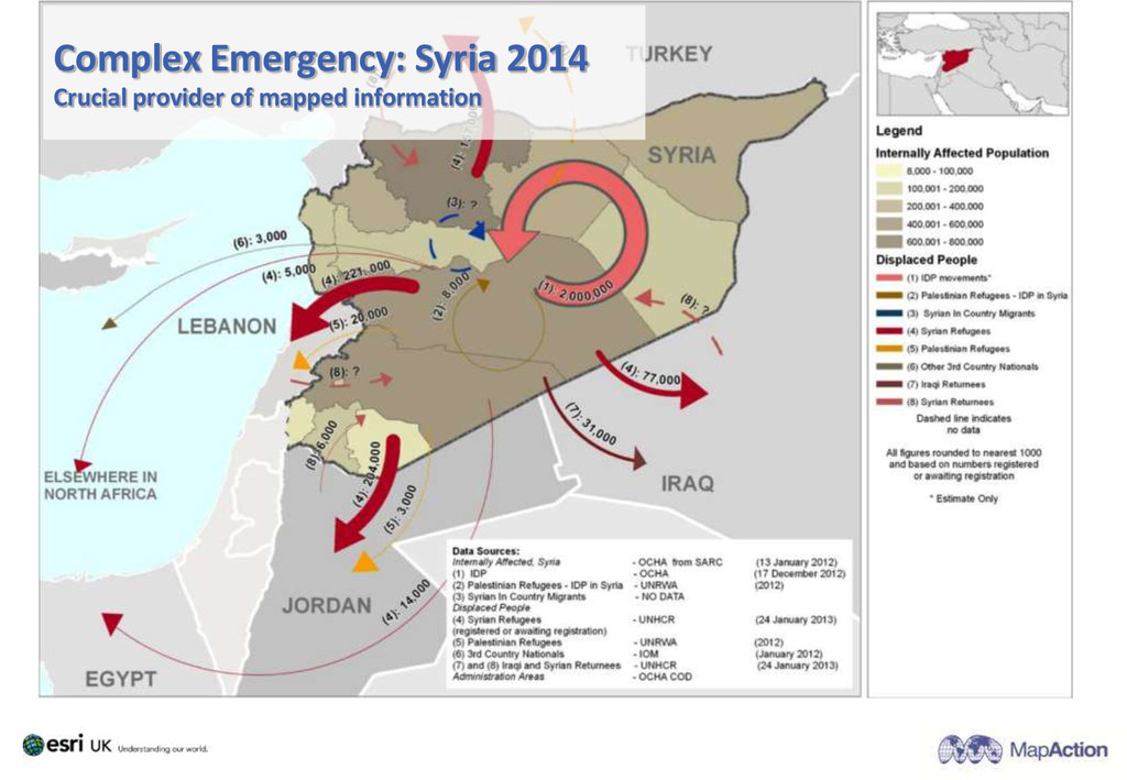
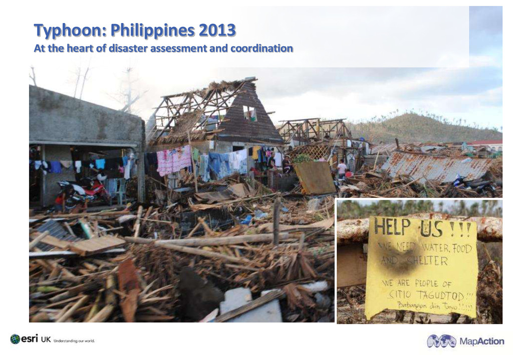
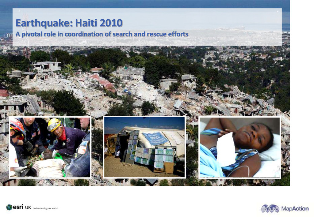
2005 Pakistan earthquake 2006 Suriname floods 2006 Java earthquake 2006 Dom Rep hurricane 2006 Kenya floods 2007 Ghana floods 2007 Jamaica hurricane 2007 Mexico floods 2008 Bolivia floods 2008 Myanmar cyclone 2008 Haiti hurricanes 2009 Namibia floods 2009 Pakistan IDP crisis 2009 Sri Lanka post conflict 2009 Benin floods 2009 Burkina Faso floods 2009 Philippines typhoons 2009 Sumatra earthquake 2009 El Salvador flash floods 2010 Albania floods 2010 Haiti earthquake 2010 Pakistan floods 2010 Saint Lucia hurricane 2011 Libya conflict 2011 Japan earthquake 2011 Cote d’Ivoire crisis 2011 Nicaragua floods 2012 Philippines cyclone 2012 Sahel food crisis 2012 Madagascar cyclones 2012 Congo munitions blast 2012 Comoros floods 2012 Paraguay floods 2012 Philippines typhoon 2013 Syria crisis 2013 Central Afr. Rep crisis 2013 Myanmar cyclone 2013 India floods 2013 Sudan floods 2013 India cyclone 2013 Philippines typhoon 2014 South Sudan conflict 2014 Serbia floods 2014 Paraguay floods 2014 Iraq conflict 2014 Liberia Ebola outbreak Humanitarian missions to-date
![MapAction: [email protected] Esri UK: [email protected] Twitter: wai_ming_lee website: www.mapaction.org](https://files.speakerdeck.com/presentations/4a7cb8d08384013235075efdaec9b123/slide_28.jpg)
![www.mapaction.org [email protected]](https://files.speakerdeck.com/presentations/4a7cb8d08384013235075efdaec9b123/slide_29.jpg)