Upgrade to Pro
— share decks privately, control downloads, hide ads and more …
Speaker Deck
Sign up for free
Menu
Search
Features
All features
Private URLs
Password Protection
Custom URLS
Scheduled publishing
Remove Branding
Restrict embedding
Deck Collections
Notes
Features
All features
Private URLs
Password Protection
Custom URLS
Scheduled publishing
Remove Branding
Restrict embedding
Deck Collections
Notes
Explore
Featured decks
Featured speakers
Programming
Technology
Storyboards
Explore
Featured decks
Featured speakers
Programming
Technology
Storyboards
Pricing
Search
Sign in
Sign up for free
Creating an evacuation planning AI agent using ...
Search
otsuka
October 24, 2026
Technology
58
0
Share
Embed
Copy iframe code
Copy JS code
Copy link
Start on current slide
Creating an evacuation planning AI agent using open data
2026/10/24 JAWS-UG 茨城 #18 祝!2周年記念祭「オープンデータから避難計画AIエージェント作成」
otsuka
October 24, 2026
More Decks by otsuka
See All by otsuka
I ran an automated simulation of fake news spread using OpenClaw.
zzzzico
1
1.3k
Automating my daily information gathering process has given me refreshing mornings.
zzzzico
0
64
I tried making an AI manzai comedy act with "boke" and "tsukkomi" using Strands Agents
zzzzico
1
300
System won't start after reboot
zzzzico
0
76
The story of how I created 25 apps with Claude
zzzzico
1
98
I tried making a solo advent calendar!
zzzzico
0
370
Automatically catch up on the latest information with AI!
zzzzico
1
590
My recent obsession with generative AI usage.
zzzzico
1
110
What lies beyond AWS All Certifications.
zzzzico
4
680
Other Decks in Technology
See All in Technology
僕のハーネスを紹介します
watany
5
1.6k
DevelopersIO2026 -バックアップは“消されないこと”が9割-
yoshida0129
0
380
ガチで放置できるClaude Code実行環境の作り方.pdf
lamaglama39
5
9.4k
Teaching Python with three kinds of AI
reuven
0
110
撮るだけでは終わらない。ソニーが挑むB2Bカメラソリューション開発
sony
0
110
[FECONF-2026] 신대륙을 향한 카카오페이증권 프론트엔드 항해기 (이주승)
l1ghthouse
0
110
AI駆動開発におけるハーネスエンジニアリングの勘所
tsukuboshi
1
670
Adversary Infrastructure Hunting101
disconinja
0
130
Agent × Maestro で始める モバイル E2E 端末準備からテスト実行・結果確認まで
sansantech
PRO
0
180
「エーアイ」をバズワードにしないために RPA 導入経験と Kiro 上での Claude モデル利用経験から
kazzpapa3
0
120
sue445's proposals 2026
sue445
0
140
生成AI時代、PMは事業責任者に進化するともっと面白い〜PMだからこそ事業構造を動かせる時代に〜
kakehashi
PRO
0
750
Featured
See All Featured
Done Done
chrislema
187
17k
Lightning talk: Run Django tests with GitHub Actions
sabderemane
0
300
Google's AI Overviews - The New Search
badams
0
1.6k
Exploring the Power of Turbo Streams & Action Cable | RailsConf2023
kevinliebholz
37
6.6k
Tell your own story through comics
letsgokoyo
1
1.1k
Winning Ecommerce Organic Search in an AI Era - #searchnstuff2025
aleyda
2
2.2k
Between Models and Reality
mayunak
4
500
Design in an AI World
tapps
1
360
[SF Ruby Conf 2025] Rails X
palkan
3
1.5k
The Power of CSS Pseudo Elements
geoffreycrofte
82
6.6k
Bioeconomy Workshop: Dr. Julius Ecuru, Opportunities for a Bioeconomy in West Africa
akademiya2063
PRO
1
420
How to optimise 3,500 product descriptions for ecommerce in one day using ChatGPT
katarinadahlin
PRO
3
3.9k
Transcript
オープンデータから 避難計画AIエージェント作成 JAWS-UG 茨城 #18 祝!2周年記念祭 2026/10/24 大塚 雄仁
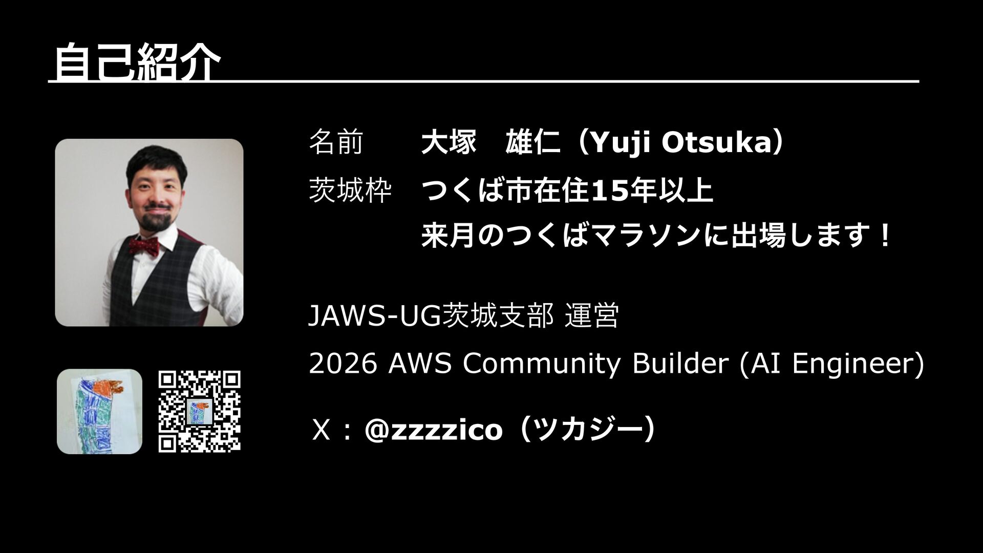
自己紹介 雄仁(Yuji Otsuka) 名前 大塚 茨城枠 つくば市在住15年以上 来月のつくばマラソンに出場します! JAWS-UG茨城支部 運営
2026 AWS Community Builder (AI Engineer) X : @zzzzico(ツカジー)
お話しすること なぜ避難計画AIエージェントを作ったのか? 使用したオープンデータ AWS構成図 Demo 工夫したところ / はまったポイント 今後取り組みたいこと まとめ
なぜ避難計画AIエージェントを作ったのか?
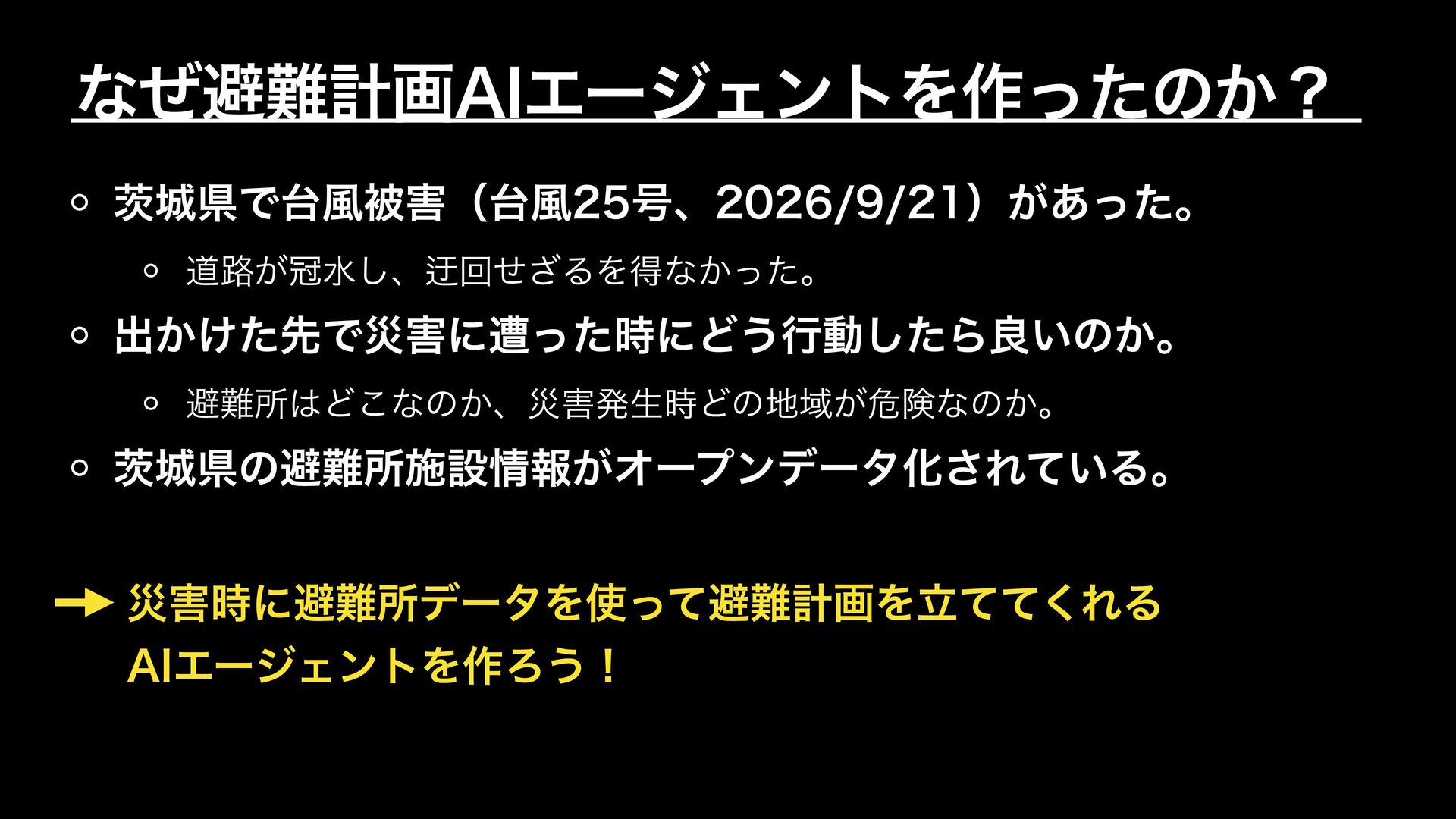
なぜ避難計画AIエージェントを作ったのか? 茨城県で台風被害(台風25号、2026/9/21)があった。 道路が冠水し、迂回せざるを得なかった。 出かけた先で災害に遭った時にどう行動したら良いのか。 避難所はどこなのか、災害発生時どの地域が危険なのか。 茨城県の避難所施設情報がオープンデータ化されている。 災害時に避難所データを使って避難計画を立ててくれる AIエージェントを作ろう!
使用したオープンデータ
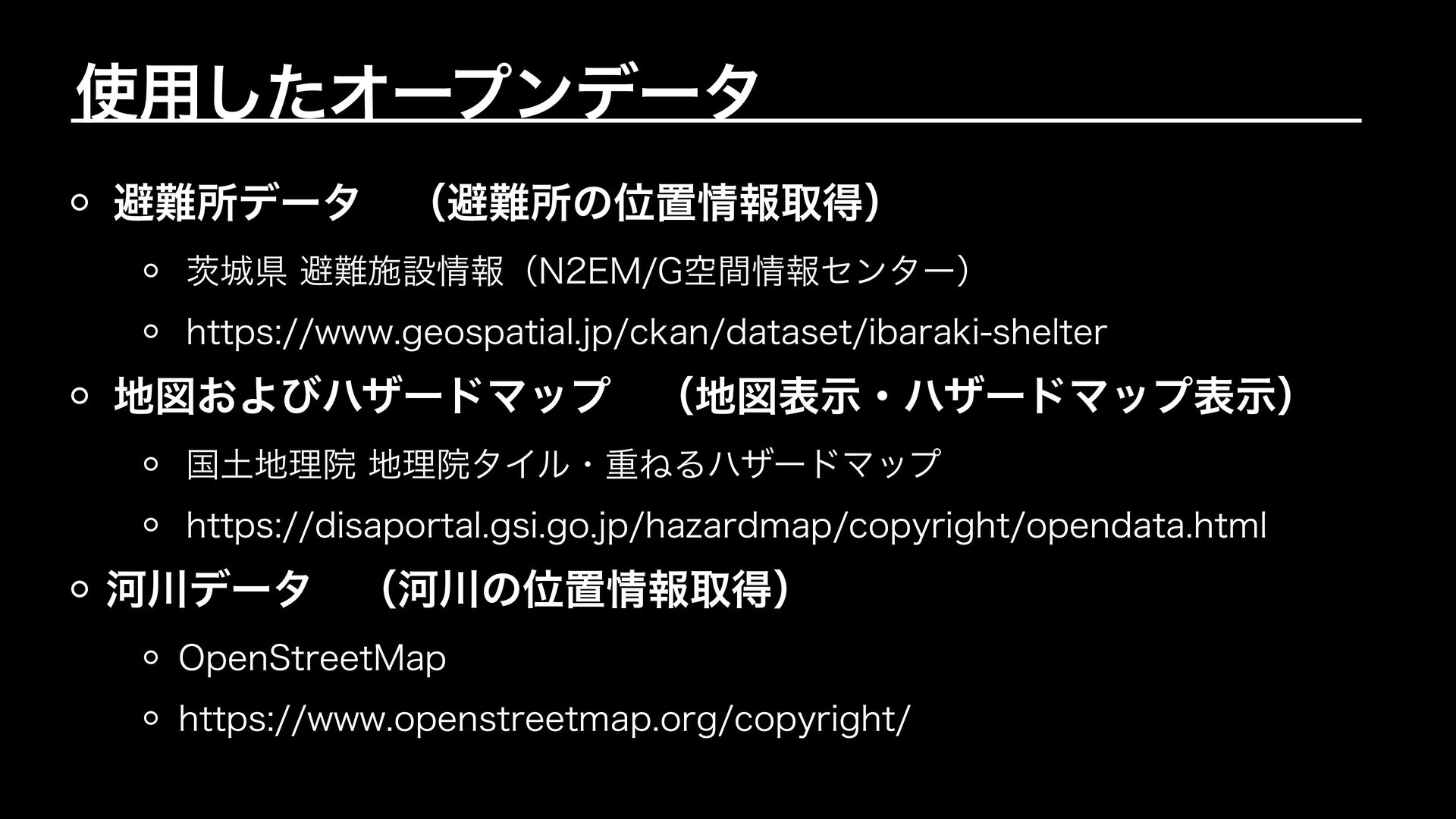
使用したオープンデータ 避難所データ (避難所の位置情報取得) 茨城県 避難施設情報(N2EM/G空間情報センター) https://www.geospatial.jp/ckan/dataset/ibaraki-shelter 地図およびハザードマップ (地図表示・ハザードマップ表示) 国土地理院 地理院タイル・重ねるハザードマップ
https://disaportal.gsi.go.jp/hazardmap/copyright/opendata.html 河川データ (河川の位置情報取得) OpenStreetMap https://www.openstreetmap.org/copyright/
AWS構成図
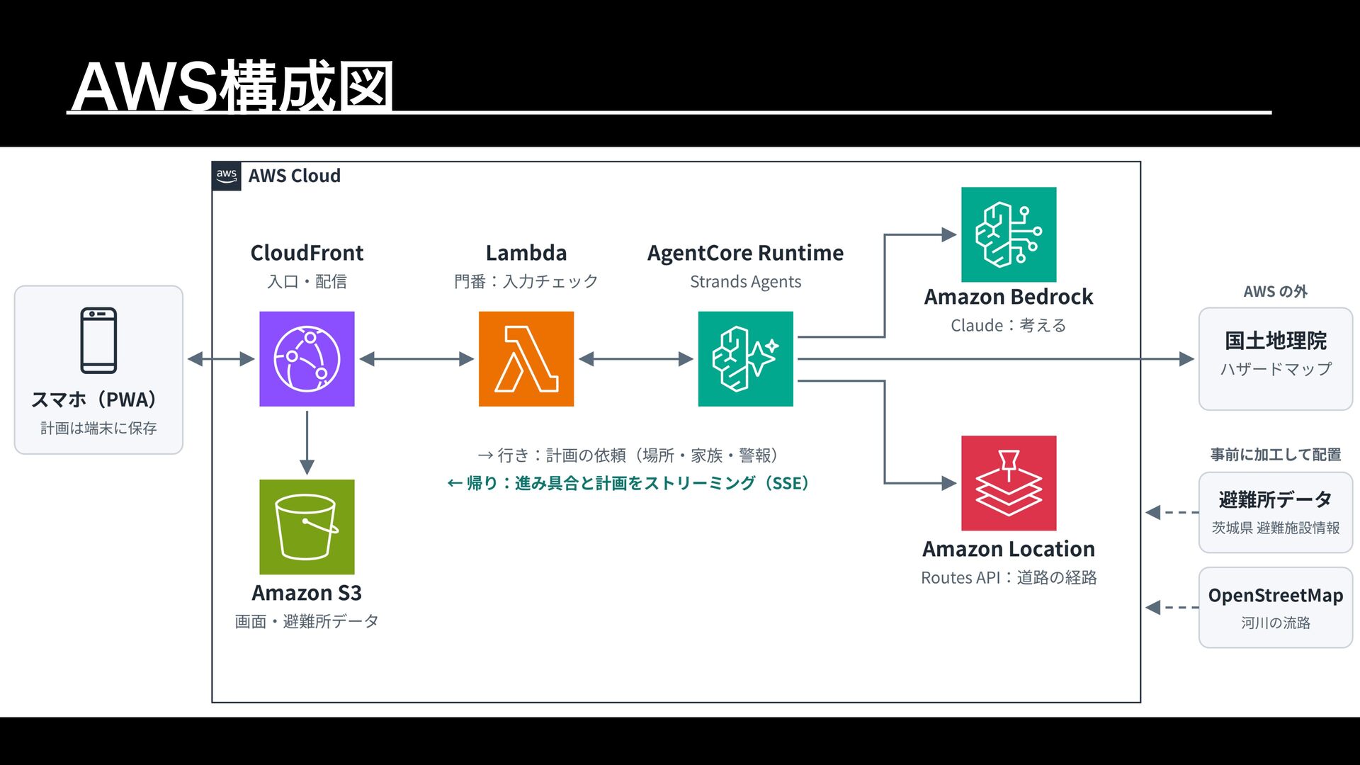
AWS構成図
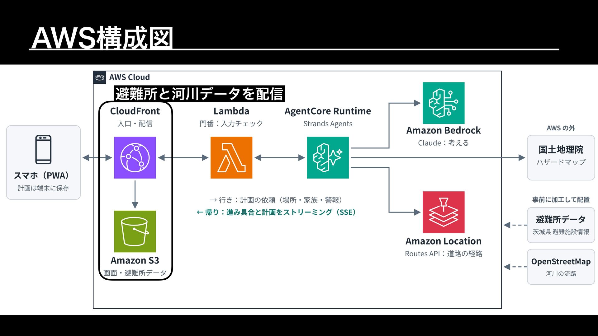
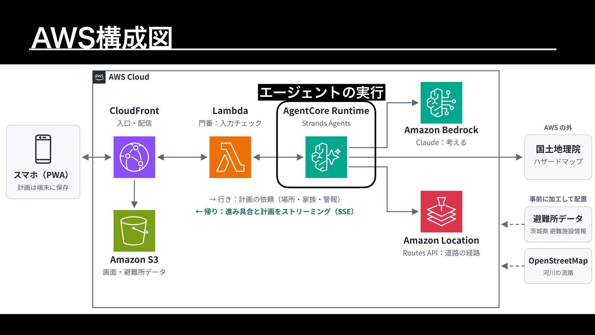
AWS構成図 避難所と河川データを配信
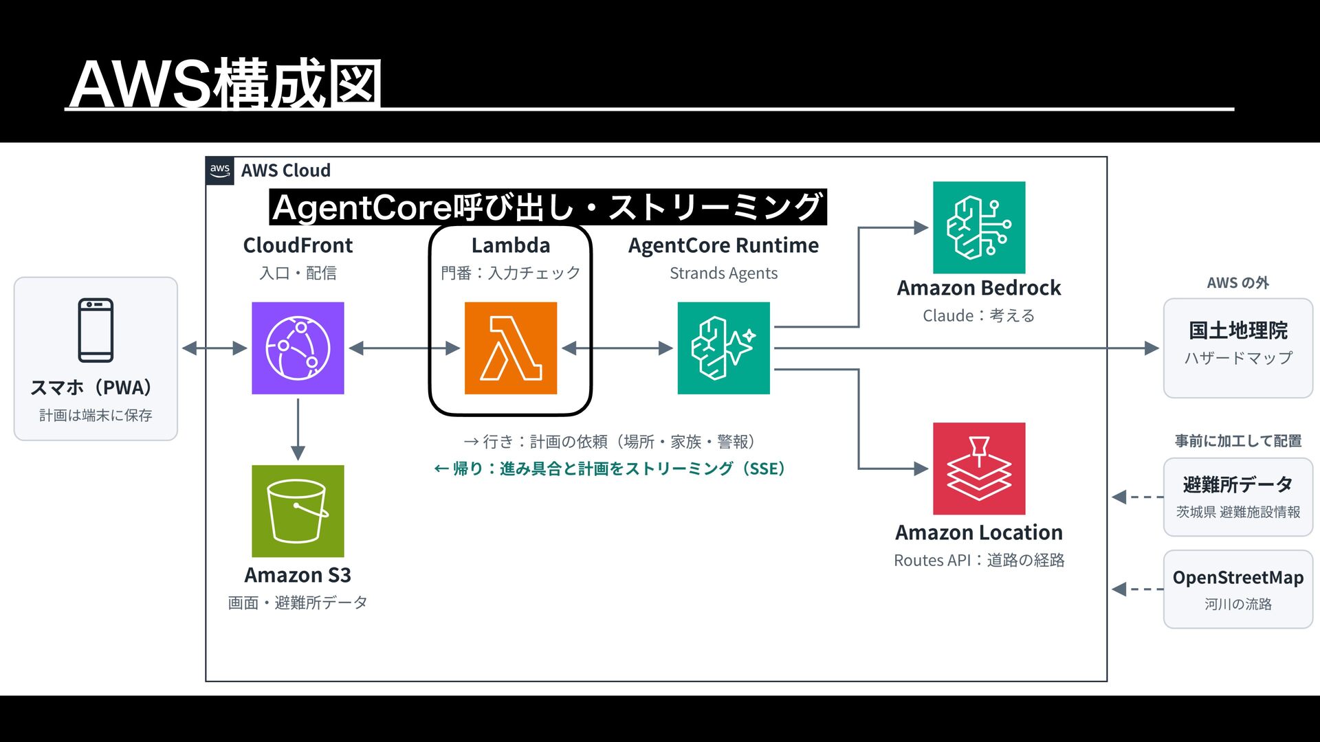
AWS構成図 AgentCore呼び出し・ストリーミング
AWS構成図 エージェントの実行
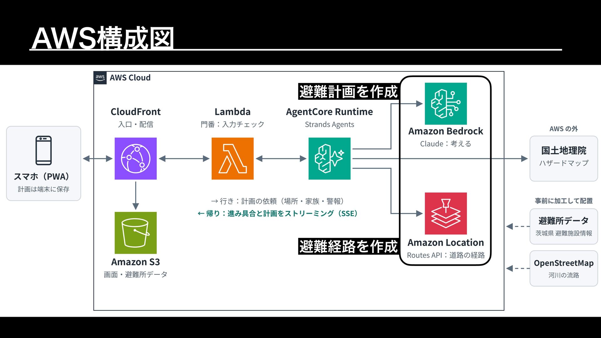
AWS構成図 避難計画を作成 避難経路を作成
Demo
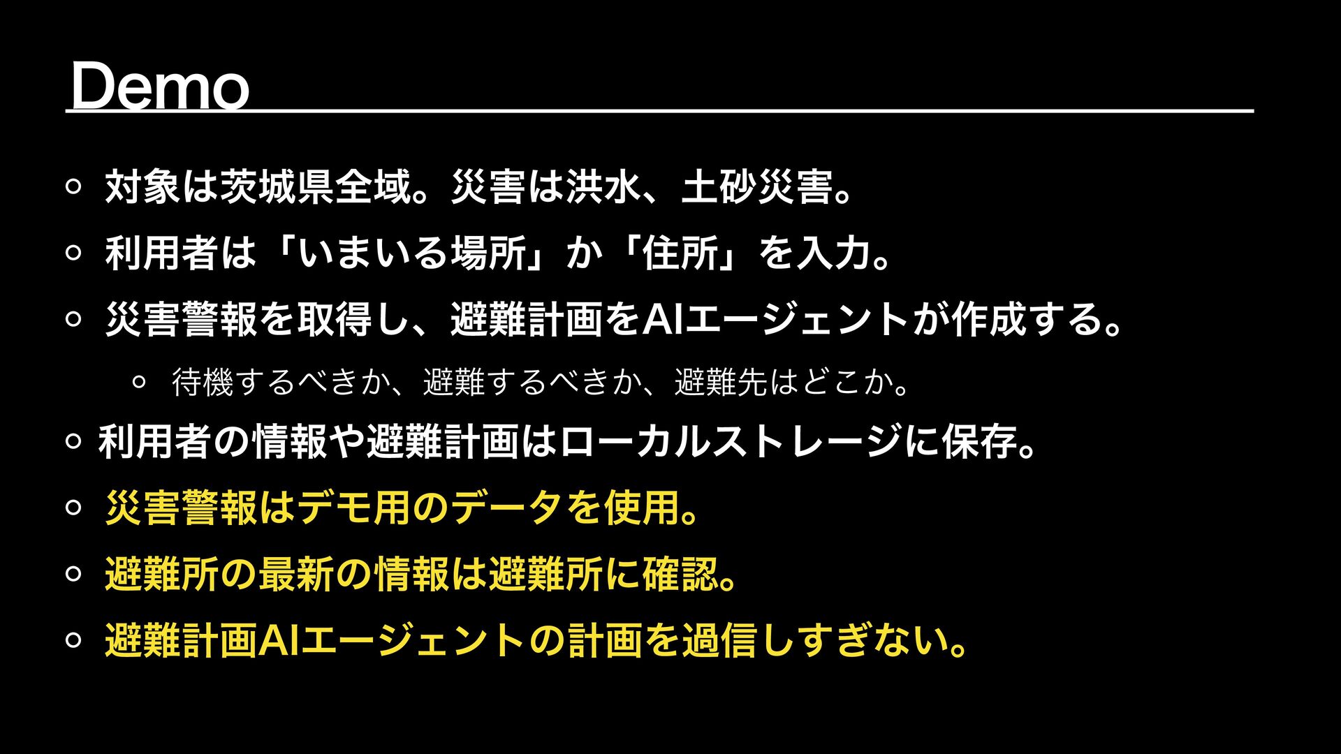
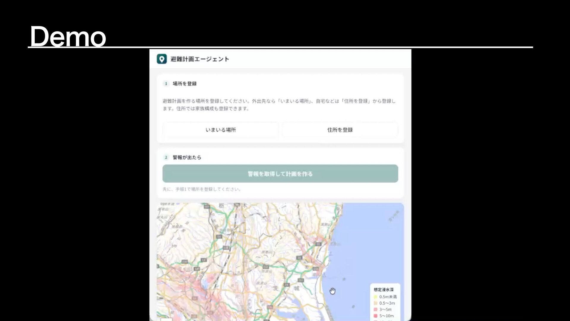
Demo 対象は茨城県全域。災害は洪水、土砂災害。 利用者は「いまいる場所」か「住所」を入力。 災害警報を取得し、避難計画をAIエージェントが作成する。 待機するべきか、避難するべきか、避難先はどこか。 利用者の情報や避難計画はローカルストレージに保存。 災害警報はデモ用のデータを使用。 避難所の最新の情報は避難所に確認。 避難計画AIエージェントの計画を過信しすぎない。
Demo
工夫したところ / はまったポイント
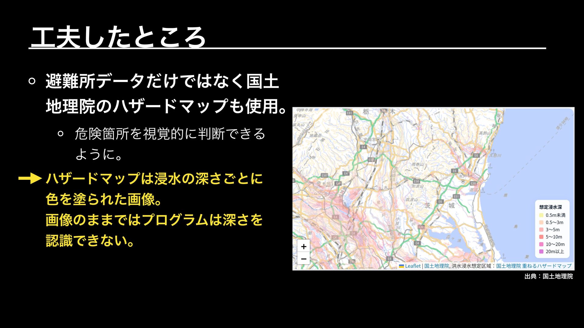
工夫したところ 避難所データだけではなく国土 地理院のハザードマップも使用。 危険箇所を視覚的に判断できる ように。 ハザードマップは浸水の深さごとに 色を塗られた画像。 画像のままではプログラムは深さを 認識できない。 出典:国土地理院
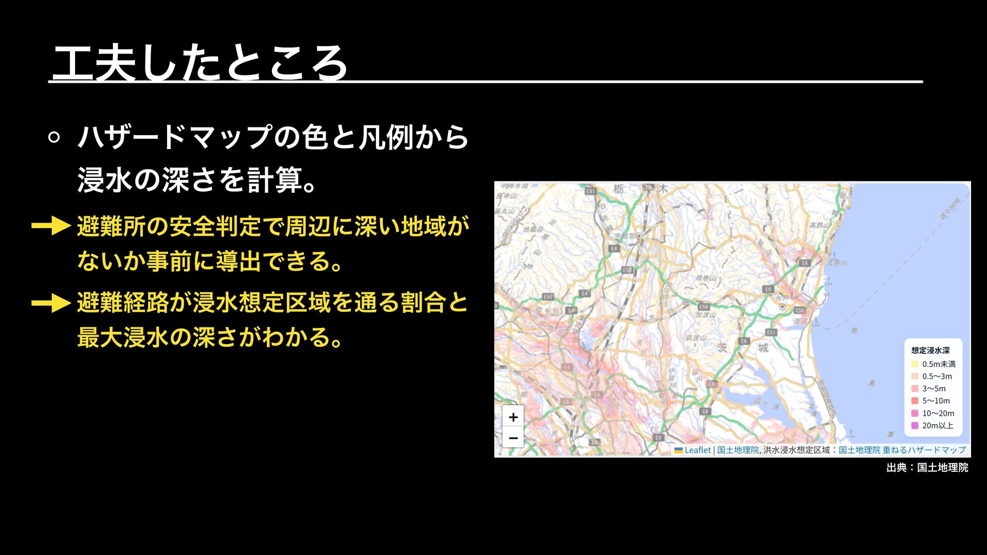
工夫したところ ハザードマップの色と凡例から 浸水の深さを計算。 避難所の安全判定で周辺に深い地域が ないか事前に導出できる。 避難経路が浸水想定区域を通る割合と 最大浸水の深さがわかる。 出典:国土地理院
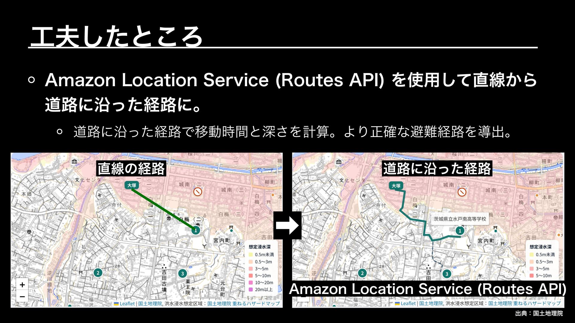
➡︎ 工夫したところ Amazon Location Service (Routes API) を使用して直線から 道路に沿った経路に。 道路に沿った経路で移動時間と深さを計算。より正確な避難経路を導出。
直線の経路 道路に沿った経路 Amazon Location Service (Routes API) 出典:国土地理院
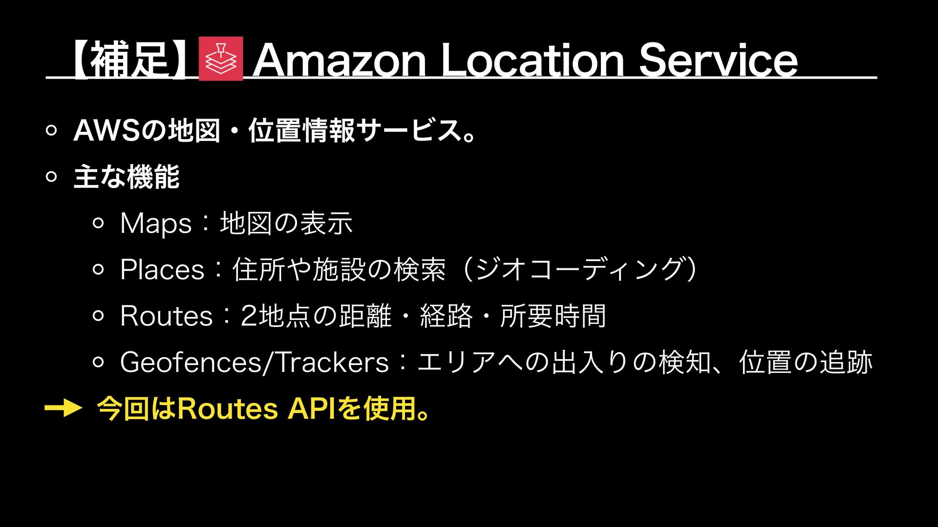
【補足】 Amazon Location Service AWSの地図・位置情報サービス。 主な機能 Maps:地図の表示 Places:住所や施設の検索(ジオコーディング) Routes:2地点の距離・経路・所要時間 Geofences/Trackers:エリアへの出入りの検知、位置の追跡
今回はRoutes APIを使用。
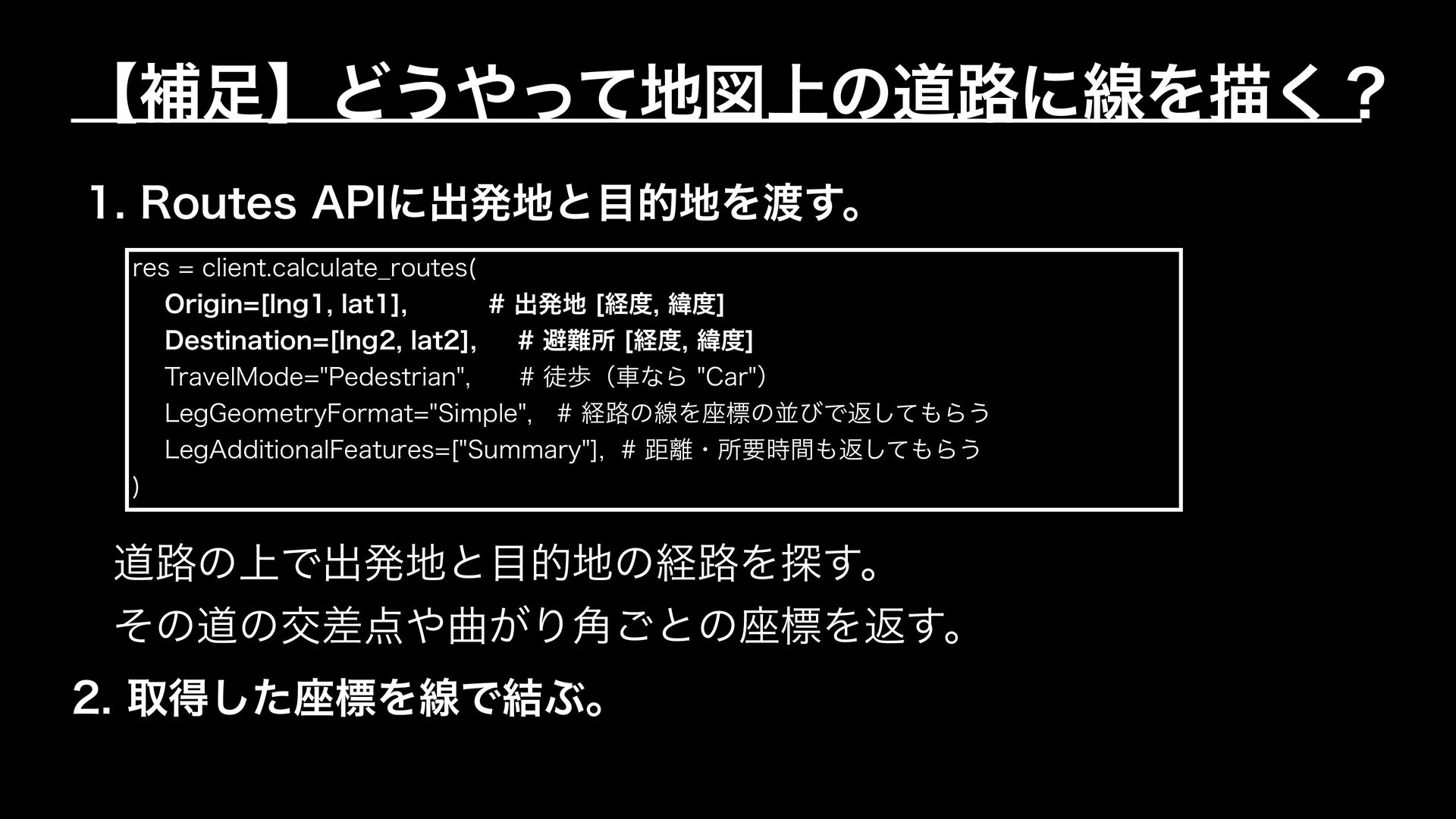
【補足】どうやって地図上の道路に線を描く? 1. Routes APIに出発地と目的地を渡す。 res = client.calculate̲routes( Origin=[lng1, lat1], #
出発地 [経度, 緯度] Destination=[lng2, lat2], # 避難所 [経度, 緯度] TravelMode="Pedestrian", # 徒歩(車なら "Car") LegGeometryFormat="Simple", # 経路の線を座標の並びで返してもらう LegAdditionalFeatures=["Summary"], # 距離・所要時間も返してもらう ) 道路の上で出発地と目的地の経路を探す。 その道の交差点や曲がり角ごとの座標を返す。 2. 取得した座標を線で結ぶ。
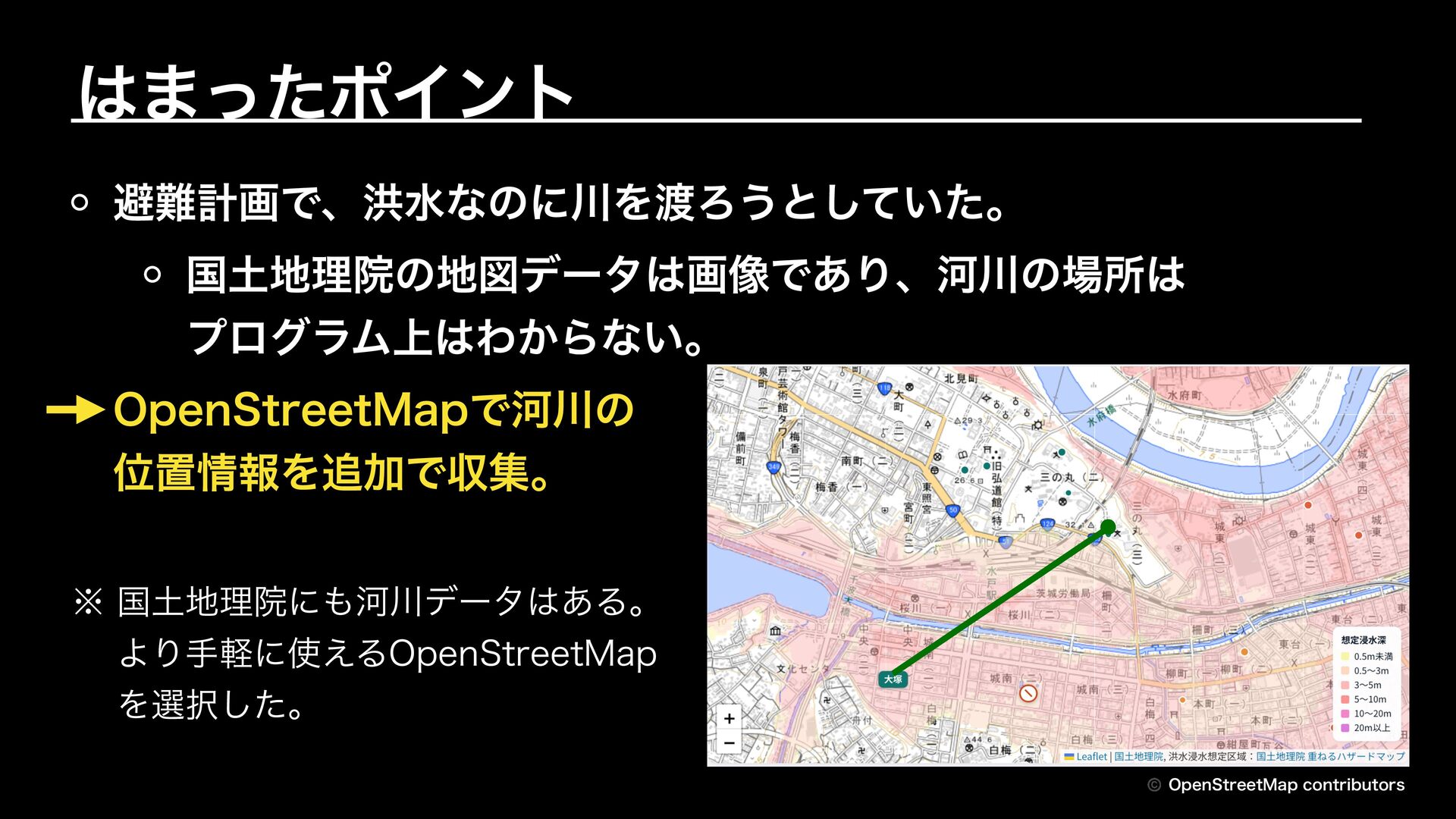
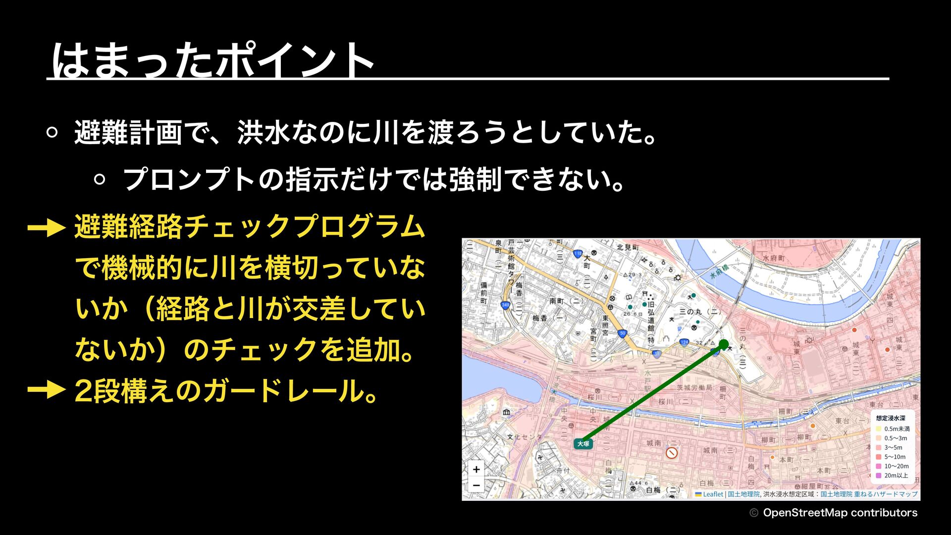
はまったポイント 避難計画で、洪水なのに川を渡ろうとしていた。 国土地理院の地図データは画像であり、河川の場所は プログラム上はわからない。 OpenStreetMapで河川の 位置情報を追加で収集。 ※ 国土地理院にも河川データはある。 より手軽に使えるOpenStreetMap を選択した。
© OpenStreetMap contributors
はまったポイント 避難計画で、洪水なのに川を渡ろうとしていた。 プロンプトの指示だけでは強制できない。 避難経路チェックプログラム で機械的に川を横切っていな いか(経路と川が交差してい ないか)のチェックを追加。 2段構えのガードレール。 © OpenStreetMap
contributors
今後取り組みたいこと
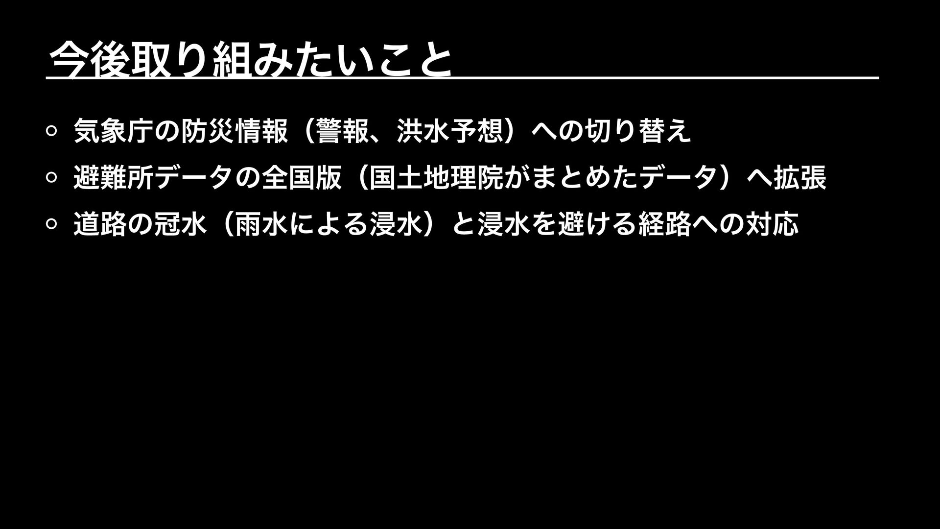
今後取り組みたいこと 気象庁の防災情報(警報、洪水予想)への切り替え 避難所データの全国版(国土地理院がまとめたデータ)へ拡張 道路の冠水(雨水による浸水)と浸水を避ける経路への対応
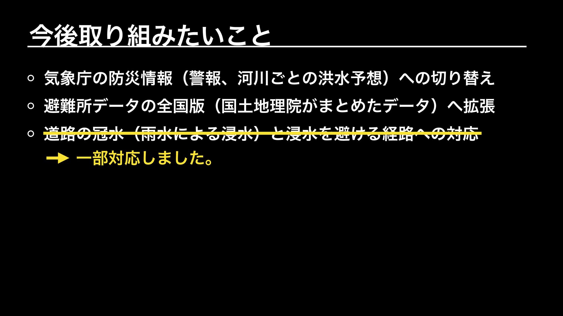
今後取り組みたいこと 気象庁の防災情報(警報、河川ごとの洪水予想)への切り替え 避難所データの全国版(国土地理院がまとめたデータ)へ拡張 道路の冠水(雨水による浸水)と浸水を避ける経路への対応 一部対応しました。
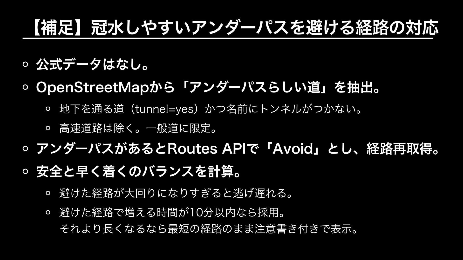
【補足】冠水しやすいアンダーパスを避ける経路の対応 公式データはなし。 OpenStreetMapから「アンダーパスらしい道」を抽出。 地下を通る道(tunnel=yes)かつ名前にトンネルがつかない。 高速道路は除く。一般道に限定。 アンダーパスがあるとRoutes APIで「Avoid」とし、経路再取得。 安全と早く着くのバランスを計算。 避けた経路が大回りになりすぎると逃げ遅れる。 避けた経路で増える時間が10分以内なら採用。
それより長くなるなら最短の経路のまま注意書き付きで表示。
まとめ
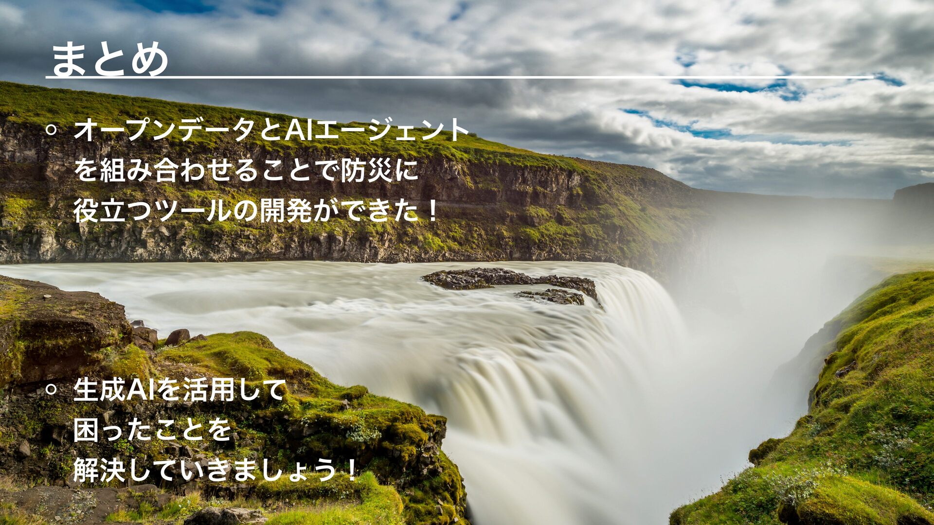
まとめ オープンデータとAIエージェント を組み合わせることで防災に 役立つツールの開発ができた! 生成AIを活用して 困ったことを 解決していきましょう!


 zzzzico
 watany
 yoshida0129
 lamaglama39
 reuven
 sony
 l1ghthouse
 tsukuboshi
 disconinja
 sansantech
 kazzpapa3
 sue445
 kakehashi
 chrislema
 sabderemane
 badams
 kevinliebholz
 letsgokoyo
 aleyda
 mayunak
 tapps
 palkan
 geoffreycrofte
 akademiya2063
 katarinadahlin