I at Geekfest? • The Future of Driving • Sensors • Digital Transportation Infrastructure – Ingesting Data – Mapping Events – Alerting • Safety at Scale – The DevOps Approach • Working in the Cloud – Challenges – Benefits Overview
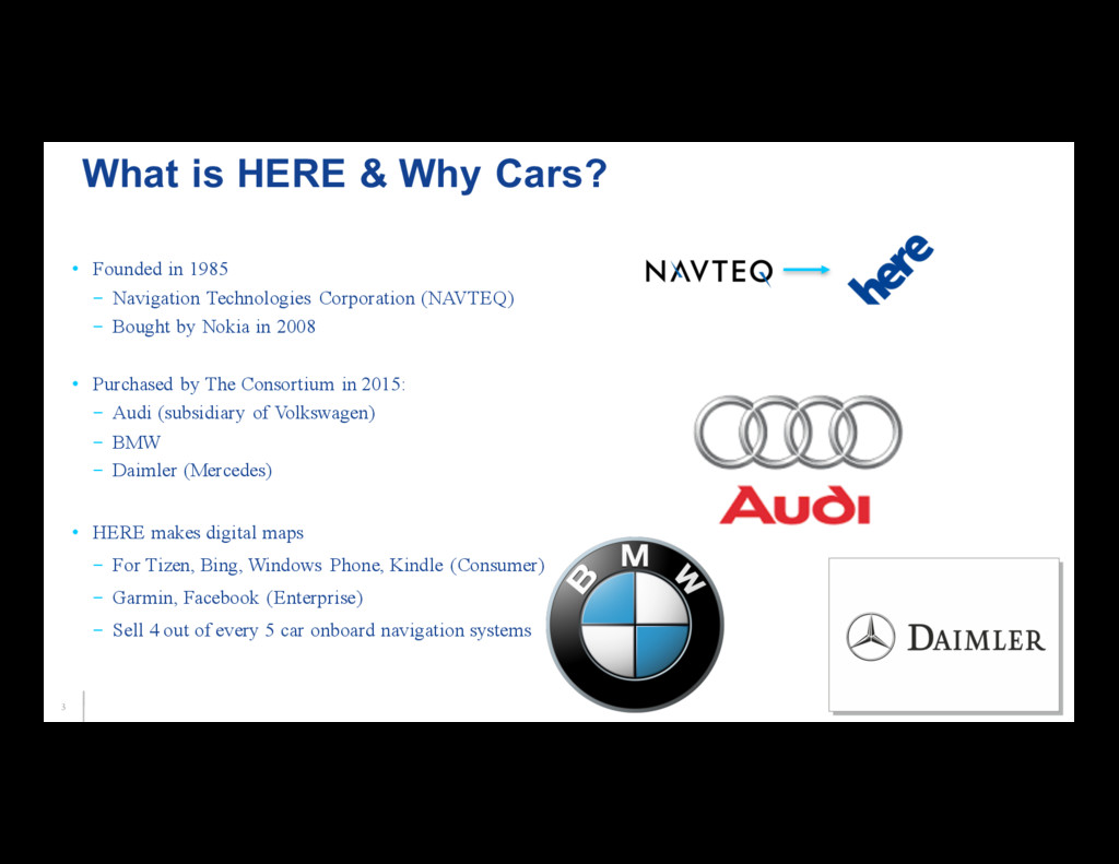
– Bought by Nokia in 2008 • Purchased by The Consortium in 2015: – Audi (subsidiary of Volkswagen) – BMW – Daimler (Mercedes) • HERE makes digital maps – For Tizen, Bing, Windows Phone, Kindle (Consumer) – Garmin, Facebook (Enterprise) – Sell 4 out of every 5 car onboard navigation systems What is HERE & Why Cars?
- Discovered interest in enterprise computing – MBA University of Chicago - Studied Commercializing Innovation – 14 years enterprise computing at Bank of America - Stumbled into DevOps - Automation, testing, continuous delivery • Past 2 years at HERE – In Automotive Cloud Services – Run a DevOps team – Goal: - Create an infrastructure that can provide services for 10 Million cars by 2020 [email protected]
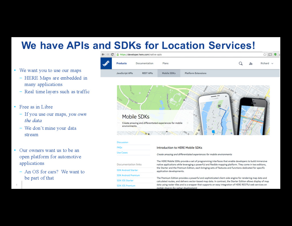
HERE Maps are embedded in many applications – Real time layers such as traffic • Free as in Libre – If you use our maps, you own the data – We don’t mine your data stream • Our owners want us to be an open platform for automotive applications – An OS for cars? We want to be part of that We have APIs and SDKs for Location Services!
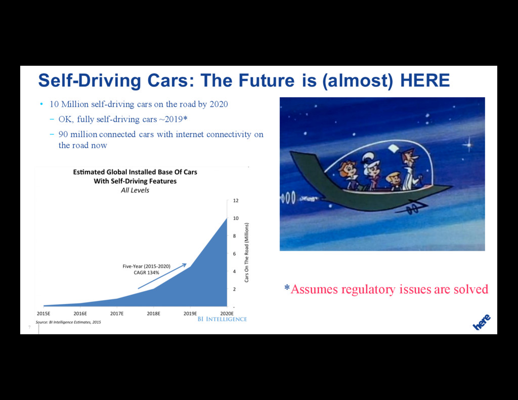
2020 – OK, fully self-driving cars ~2019* – 90 million connected cars with internet connectivity on the road now Self-Driving Cars: The Future is (almost) HERE *Assumes regulatory issues are solved
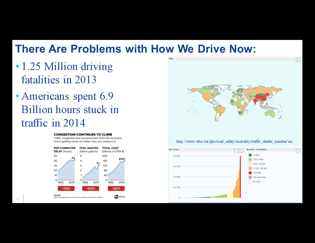
spent 6.9 Billion hours stuck in traffic in 2014 There Are Problems with How We Drive Now: http://www.who.int/gho/road_safety/mortality/traffic_deaths_number/en/
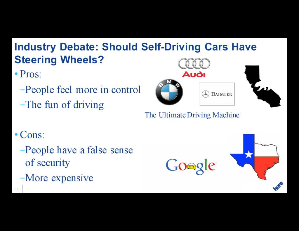
of driving • Cons: –People have a false sense of security –More expensive Industry Debate: Should Self-Driving Cars Have Steering Wheels? The Ultimate Driving Machine
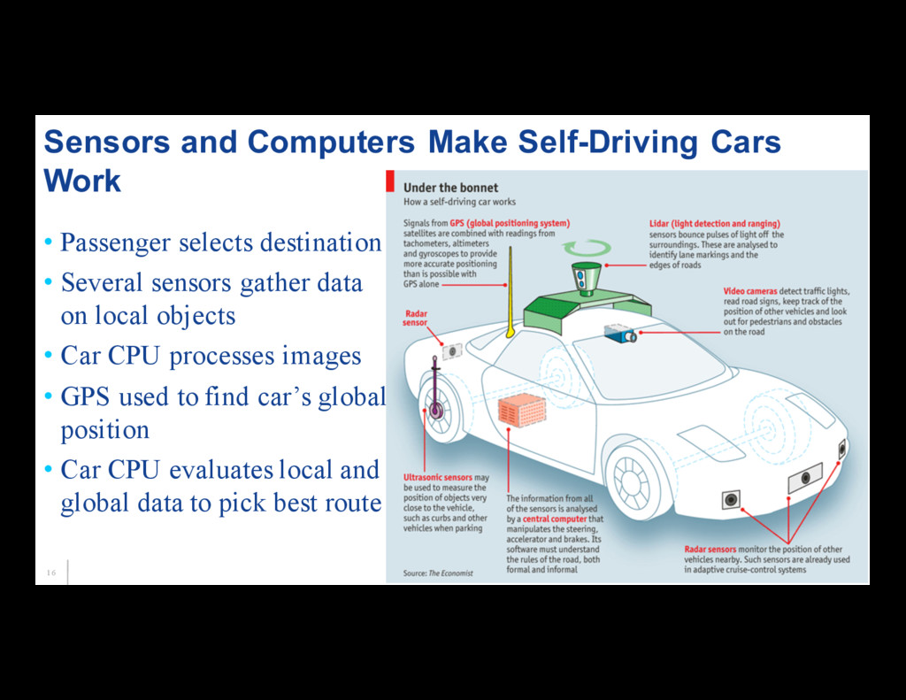
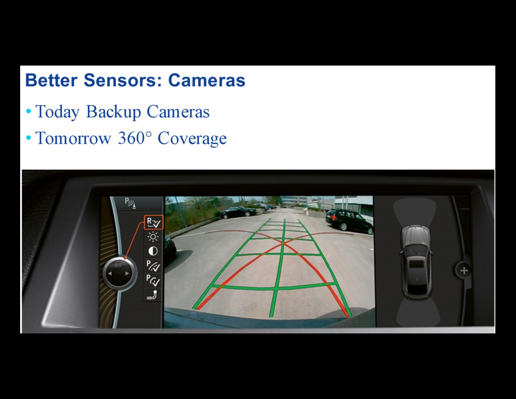
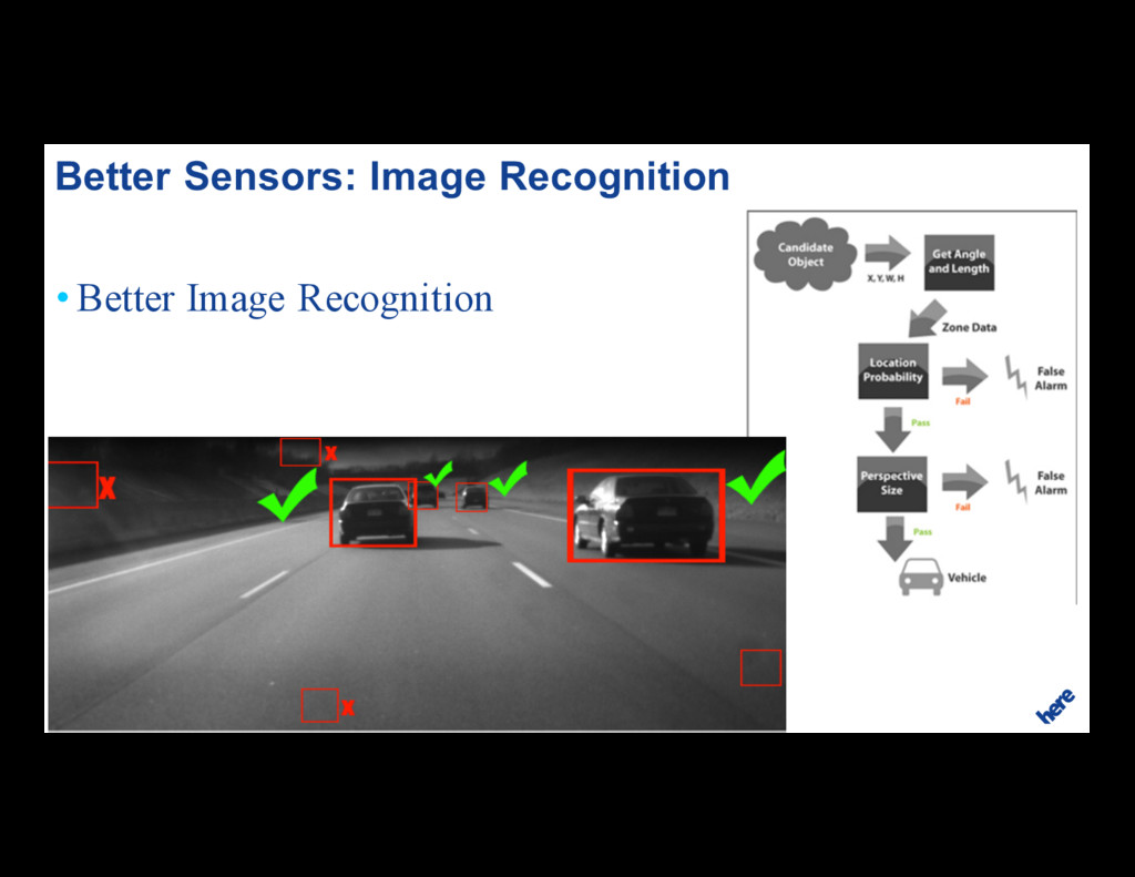
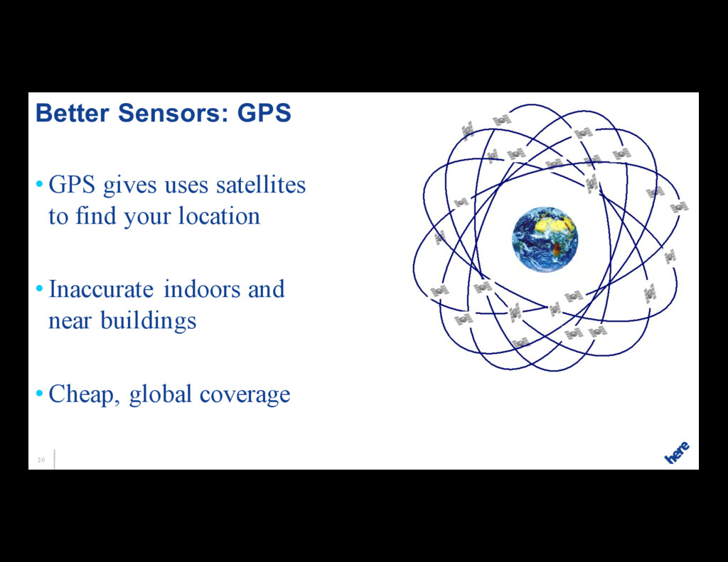
on local objects • Car CPU processes images • GPS used to find car’s global position • Car CPU evaluates local and global data to pick best route Sensors and Computers Make Self-Driving Cars Work
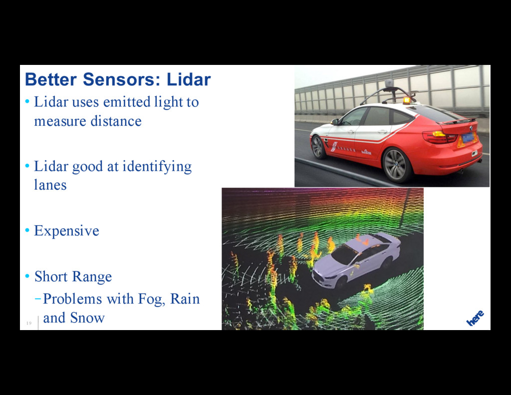
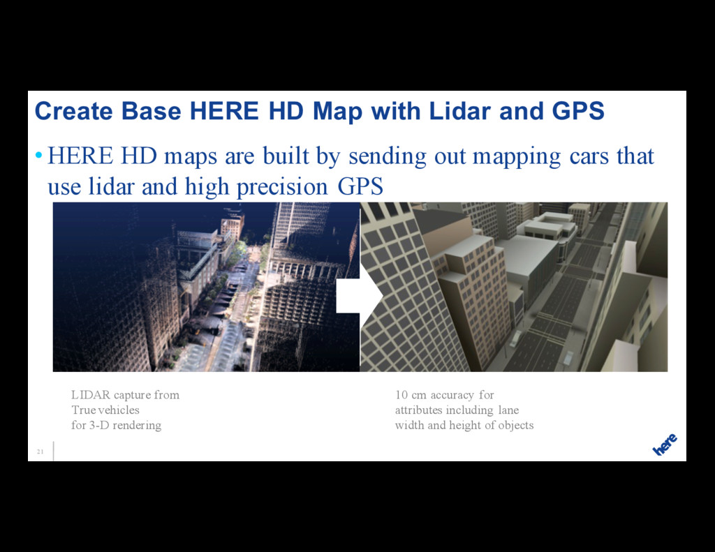
mapping cars that use lidar and high precision GPS Create Base HERE HD Map with Lidar and GPS 1 LIDAR capture from True vehicles for 3-D rendering 10 cm accuracy for attributes including lane width and height of objects
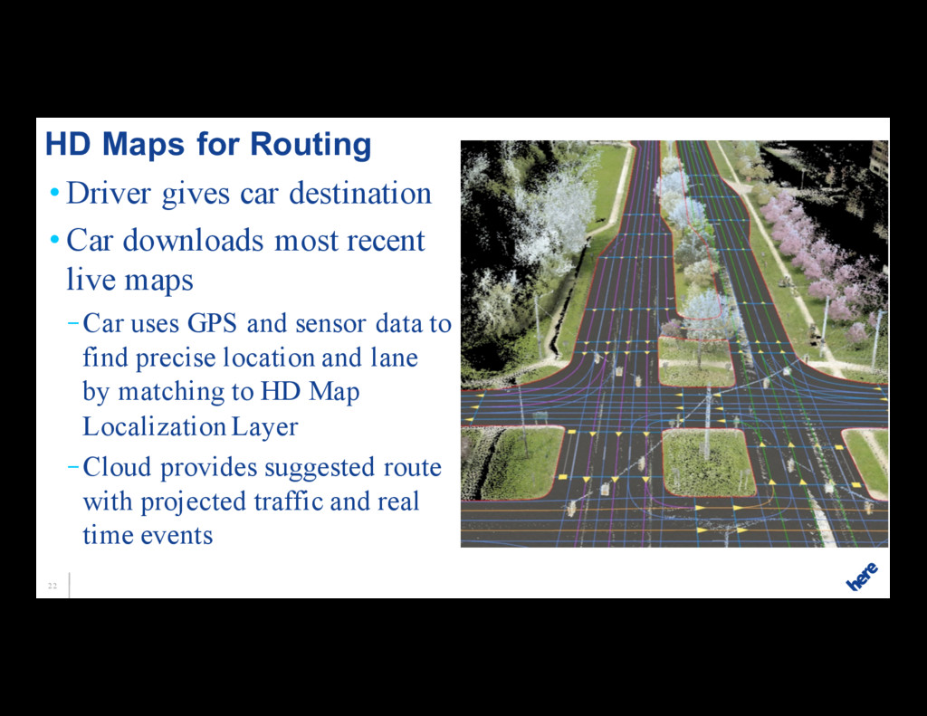
recent live maps –Car uses GPS and sensor data to find precise location and lane by matching to HD Map Localization Layer –Cloud provides suggested route with projected traffic and real time events HD Maps for Routing
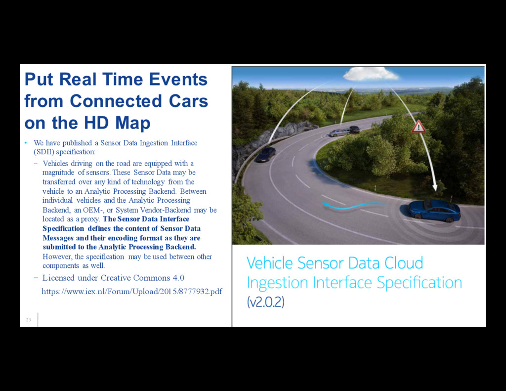
(SDII) specification: – Vehicles driving on the road are equipped with a magnitude of sensors. These Sensor Data may be transferred over any kind of technology from the vehicle to an Analytic Processing Backend. Between individual vehicles and the Analytic Processing Backend, an OEM-, or System Vendor-Backend may be located as a proxy. The Sensor Data Interface Specification defines the content of Sensor Data Messages and their encoding format as they are submitted to the Analytic Processing Backend. However, the specification may be used between other components as well. – Licensed under Creative Commons 4.0 Put Real Time Events from Connected Cars on the HD Map https://www.iex.nl/Forum/Upload/2015/8777932.pdf
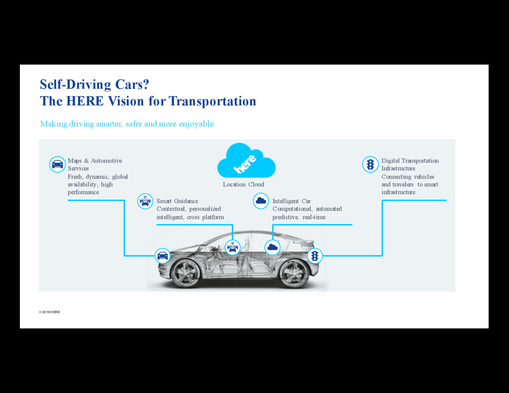
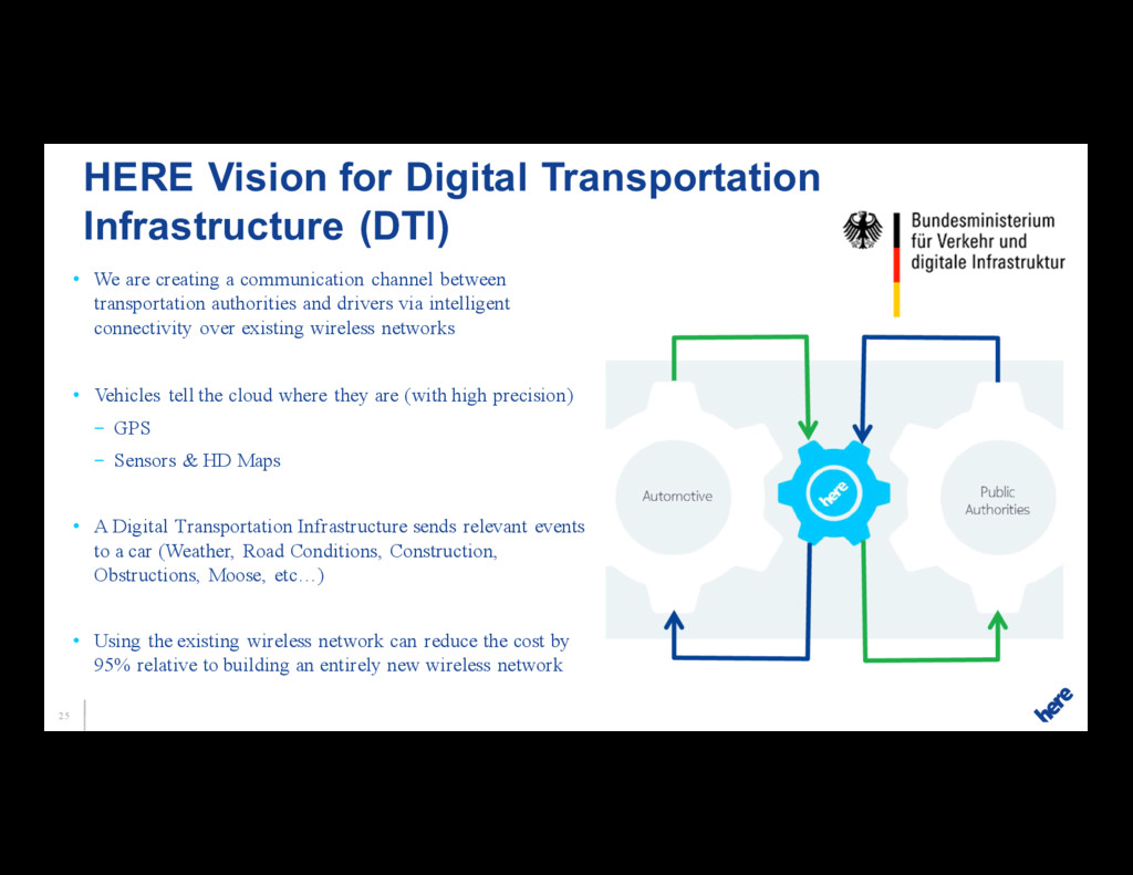
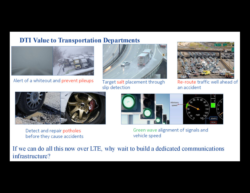
authorities and drivers via intelligent connectivity over existing wireless networks • Vehicles tell the cloud where they are (with high precision) – GPS – Sensors & HD Maps • A Digital Transportation Infrastructure sends relevant events to a car (Weather, Road Conditions, Construction, Obstructions, Moose, etc…) • Using the existing wireless network can reduce the cost by 95% relative to building an entirely new wireless network HERE Vision for Digital Transportation Infrastructure (DTI)
cloud? HERE is network agnostic • There are also proposals for car-to-car communications (DSRC/WAVE) • And infrastructure to car communications (say car to traffic light) • There are a lot of Internet of Things proposals for transportation improvements that require building out a new network • We are piloting our next generation system using 4G in Finland today Industry Debate: Use Cell Networks or Dedicated Network
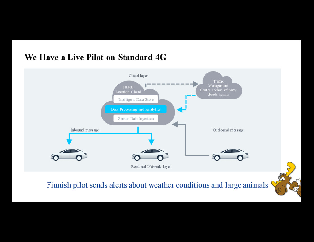
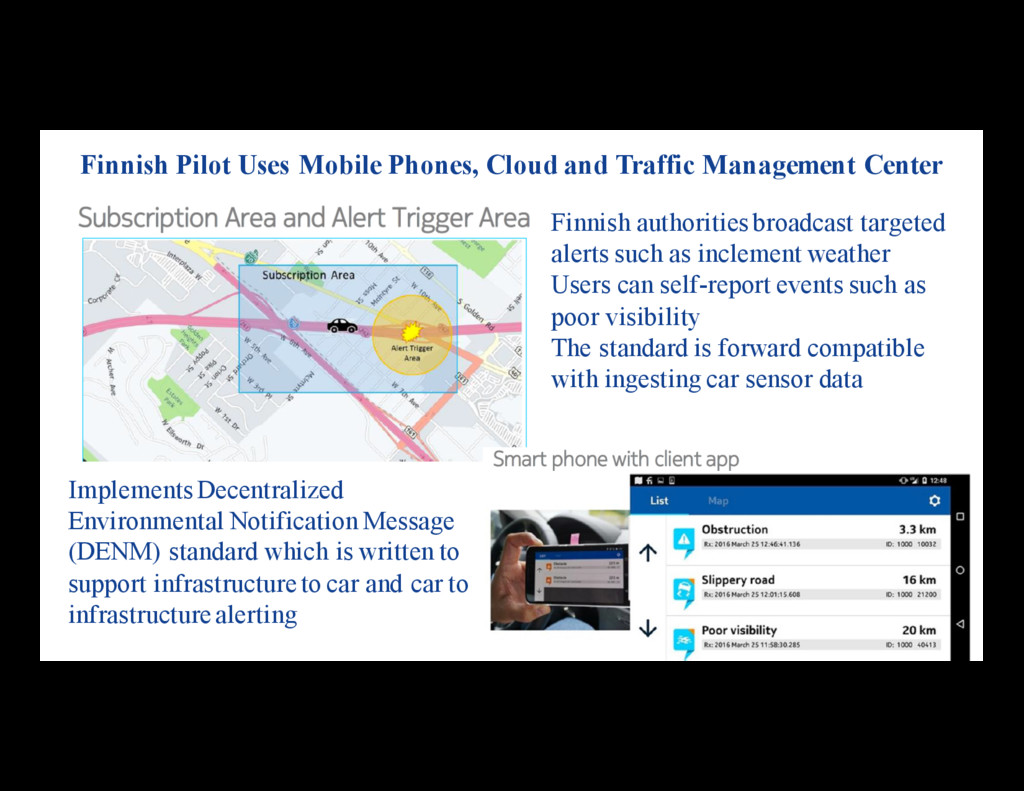
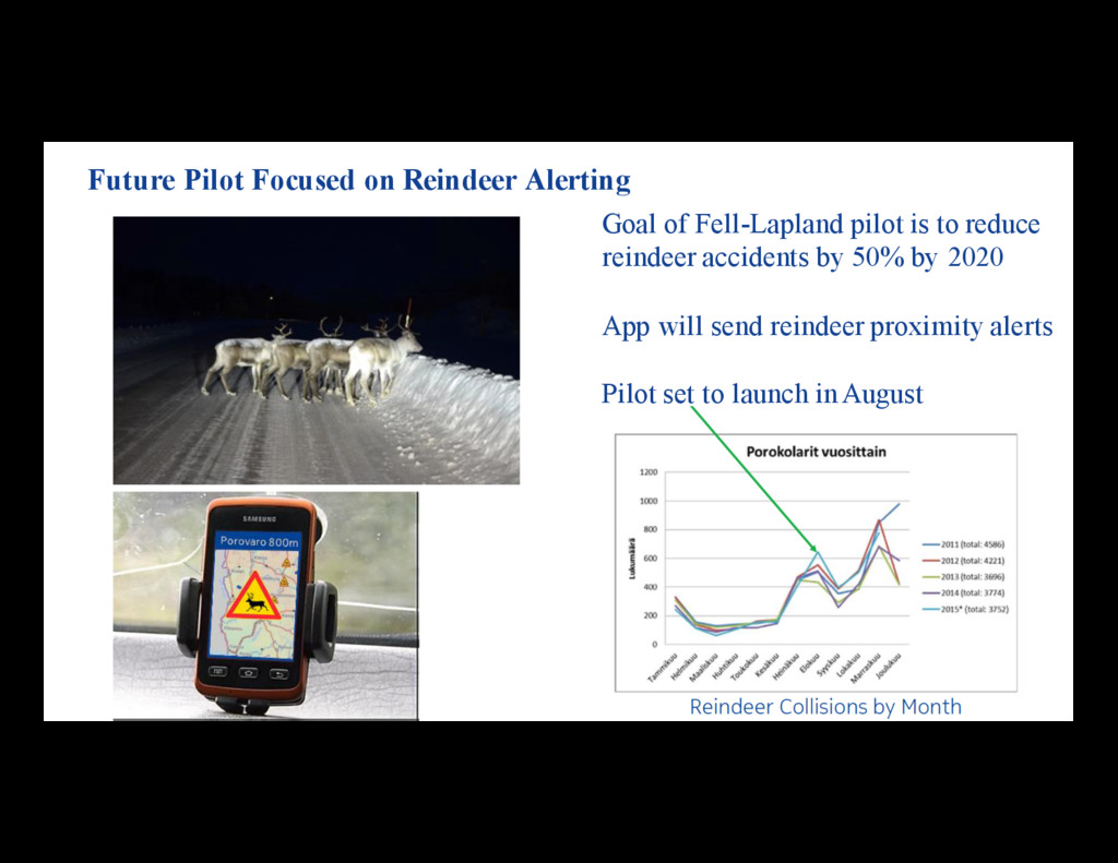
Network layer Cloud layer Outbound message Inbound message Traffic Management Center / other 3rd party clouds (optional) HERE Location Cloud Data Processing and Analytics Sensor Data Ingestion Intelligent Data Store Finnish pilot sends alerts about weather conditions and large animals
can self-report events such as poor visibility The standard is forward compatible with ingesting car sensor data Finnish Pilot Uses Mobile Phones, Cloud and Traffic Management Center Implements Decentralized Environmental Notification Message (DENM) standard which is written to support infrastructure to car and car to infrastructure alerting
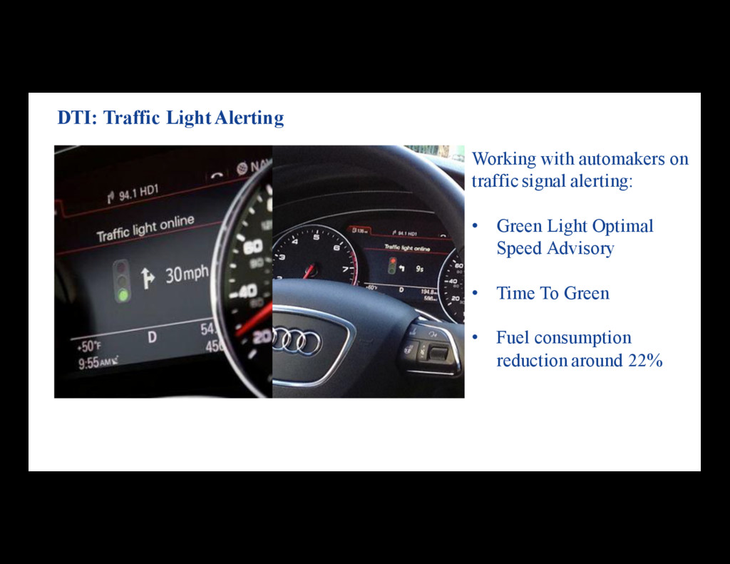
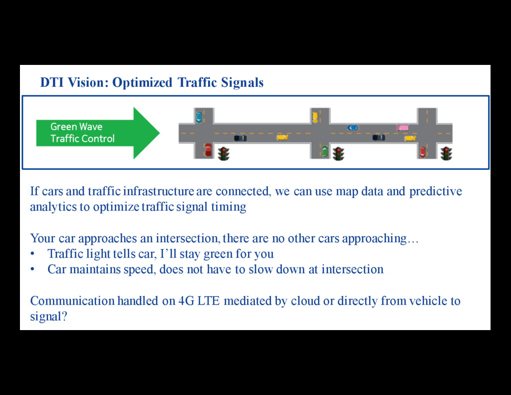
map data and predictive analytics to optimize traffic signal timing Your car approaches an intersection, there are no other cars approaching… • Traffic light tells car, I’ll stay green for you • Car maintains speed, does not have to slow down at intersection Communication handled on 4G LTE mediated by cloud or directly from vehicle to signal? DTI Vision: Optimized Traffic Signals
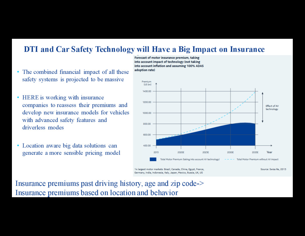
premiums based on location and behavior DTI and Car Safety Technology will Have a Big Impact on Insurance • The combined financial impact of all these safety systems is projected to be massive • HERE is working with insurance companies to reassess their premiums and develop new insurance models for vehicles with advanced safety features and driverless modes • Location aware big data solutions can generate a more sensible pricing model
patterns • We can help insurance companies write better policies using data • Data can improve traffic predictions: – A car that left at 3:30 took 30 minutes to get to O’Hare – It is 4 PM now, but cars that leave at 4 PM on a Saturday usually take 1 hour - Historically a lot of cars have gotten on the road at the same time - We run over historic data and use that to improve our projected driving time • We also analyze driving data to determine historic speed profiles over a stretch of road – These profiles are attached as a layer to our HD Map – Self-driving car can drive to match economical, comfortable, or sporty profiles (Adaptive Cruise Control) • We mine the data using batch processes which saves money Driving Analytics in the Cloud
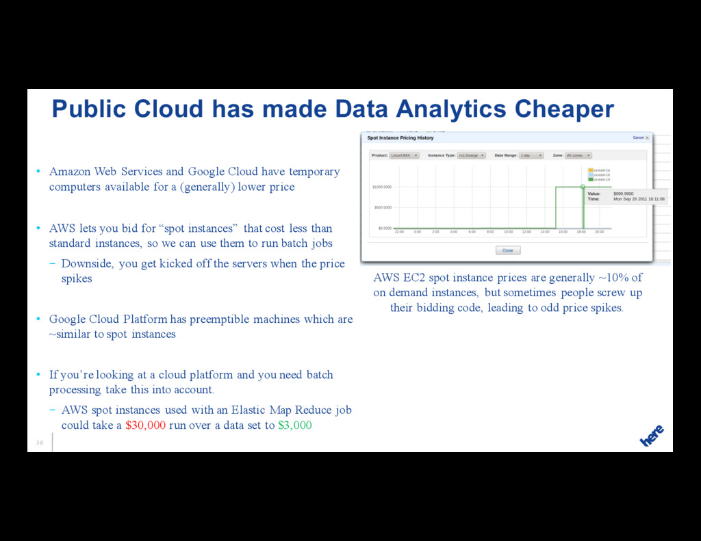
computers available for a (generally) lower price • AWS lets you bid for “spot instances” that cost less than standard instances, so we can use them to run batch jobs – Downside, you get kicked off the servers when the price spikes • Google Cloud Platform has preemptible machines which are ~similar to spot instances • If you’re looking at a cloud platform and you need batch processing take this into account. – AWS spot instances used with an Elastic Map Reduce job could take a $30,000 run over a data set to $3,000 Public Cloud has made Data Analytics Cheaper AWS EC2 spot instance prices are generally ~10% of on demand instances, but sometimes people screw up their bidding code, leading to odd price spikes.
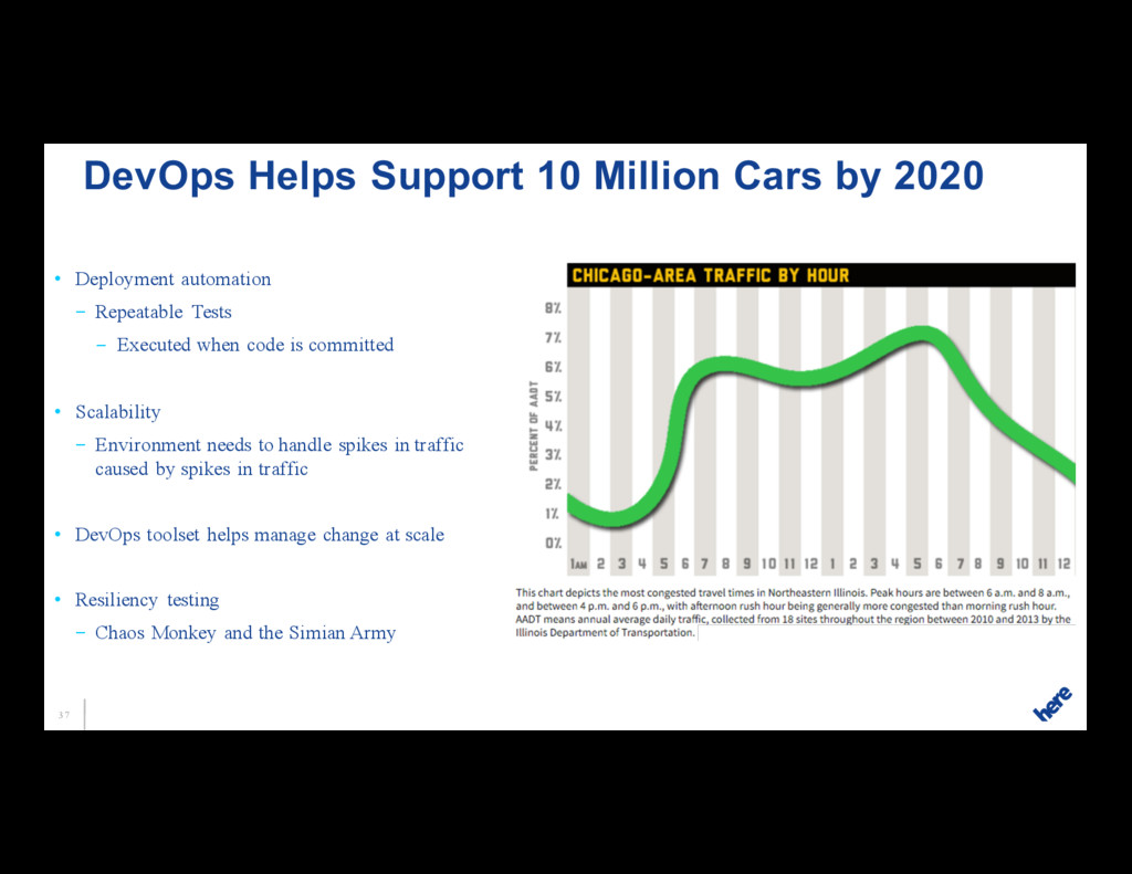
code is committed • Scalability – Environment needs to handle spikes in traffic caused by spikes in traffic • DevOps toolset helps manage change at scale • Resiliency testing – Chaos Monkey and the Simian Army DevOps Helps Support 10 Million Cars by 2020
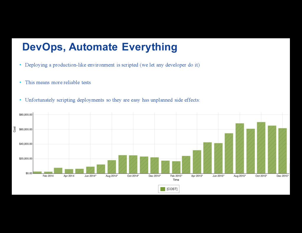
any developer do it) • This means more reliable tests • Unfortunately scripting deployments so they are easy has unplanned side effects: DevOps, Automate Everything
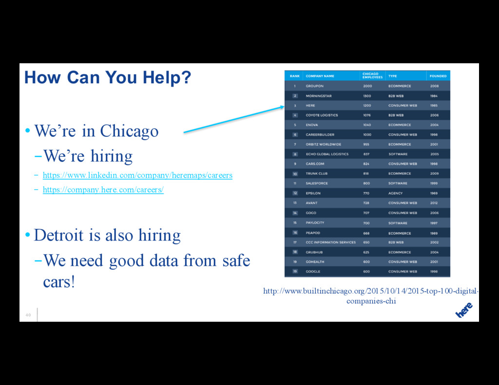
https://company.here.com/careers/ • Detroit is also hiring –We need good data from safe cars! How Can You Help? http://www.builtinchicago.org/2015/10/14/2015-top-100-digital- companies-chi