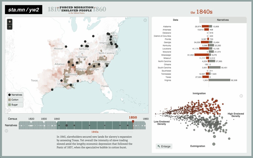
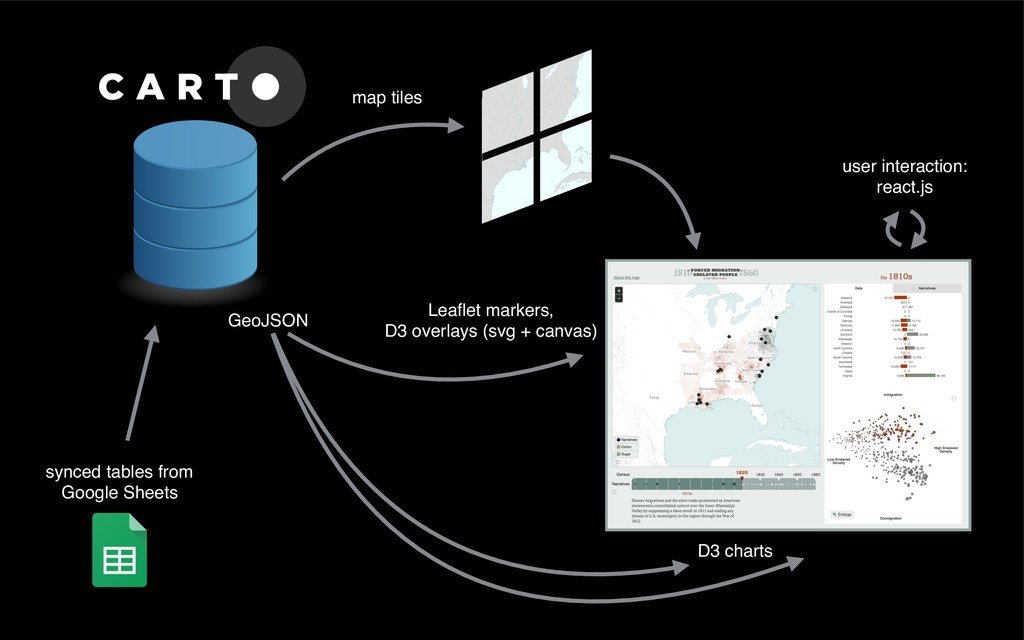
Share
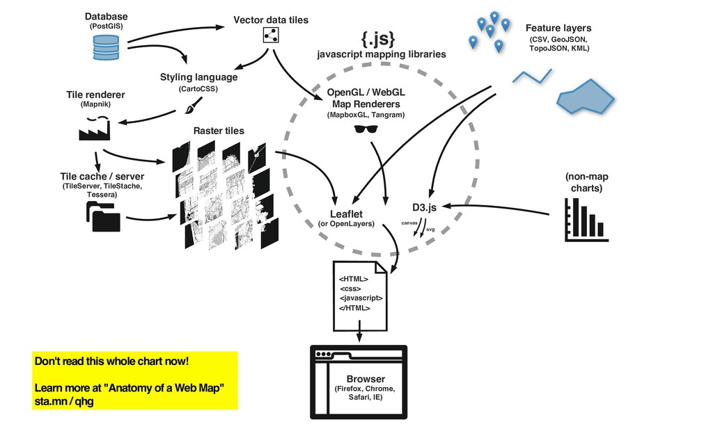
(note, some of these slides are animated GIFs in the original version)
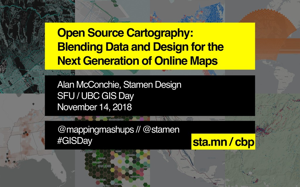
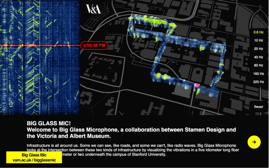
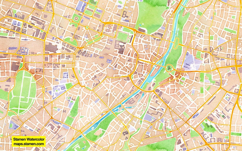
Presented at SFU/UBC GIS Day in Vancouver, BC: https://www.lib.sfu.ca/find/other-materials/data-gis/gis/gis-events/gis-day