Upgrade to Pro
— share decks privately, control downloads, hide ads and more …
Speaker Deck
Features
Speaker Deck
PRO
Sign in
Sign up for free
Search
Search
(NACIS2015) A New Atlas of American History
Search
Alan McConchie
October 15, 2015
Technology
390
4
Share
Embed
Copy iframe code
Copy JS code
Copy link
Start on current slide
(NACIS2015) A New Atlas of American History
Notes and links to animations: sta.mn/6gk
Alan McConchie
October 15, 2015
More Decks by Alan McConchie
See All by Alan McConchie
NACIS 2024: Mapping History Using Digital Tools
almccon
0
77
NACIS 2024: The Past, Present, and Future of Stamen Maps
almccon
0
160
Rebuilding Stamen’s iconic map styles with Stadia Maps
almccon
0
470
2022 Hunter College Seminar in Geoinformatics
almccon
0
68
NACIS 2020: Mapping COVID-19 Coast to Coast, and Around the World
almccon
0
76
NACIS 2019: Cartography and Community in OpenStreetMap: Getting Native Reservations on the Map
almccon
1
490
(GISDay 2018) Open Source Cartography: Blending Data and Design for the Next Generation of Online Maps
almccon
0
250
Stamen Design: recent work
almccon
0
220
Open Source Cartography: Blending Data and Design for the Next Generation of Online Maps
almccon
1
740
Other Decks in Technology
See All in Technology
書籍セキュアAPIについて
riiimparm
0
240
なぜ、あなたのエージェントは言うことを聞かないのか
segavvy
1
370
仕様駆動開発、導入半年。「本当に速くなってるの?」にデータで答える / AICon2026_hirakawa
rakus_dev
0
320
[Droidcon Orlando '26] The Android Lens: Applying Mobile Forensics to AI Performance
amanda_hinchman
1
110
探索・可視化・自動化を一本化 Amazon Quickでデータ活用スピードを上げる方法
koheiyoshikawa
0
170
副作用のある Lambda でも Lambda Power Tuning は使えるのか / lambda-power-tuning-side-effects
koukihosaka
1
140
10年目を迎えた「ABEMA」がどのように AI 活用を推進して、AI 駆動開発にシフトしているのか / How ABEMA, entering its 10th year, is promoting the use of AI and shifting toward AI-driven development
miyukki
0
370
生成 AI 時代にいま一度「問い合わせ」について考えてみる
kazzpapa3
1
130
Oracle Base Database Service 技術詳細
oracle4engineer
PRO
15
110k
ダッシュボード"開発"について 〜使われるダッシュボードのつくりかた〜
kimichan
0
200
CDKで書くECSのベストプラクティス、 改めて考え直す2026 #cdkconf2026
makies
3
940
ファミコンでPHPを動かす / PHP on the Famicom
tomzoh
2
610
Featured
See All Featured
Bash Introduction
62gerente
615
220k
The Web Performance Landscape in 2024 [PerfNow 2024]
tammyeverts
12
1.2k
Applied NLP in the Age of Generative AI
inesmontani
PRO
4
2.4k
The SEO identity crisis: Don't let AI make you average
varn
0
520
JAMstack: Web Apps at Ludicrous Speed - All Things Open 2022
reverentgeek
1
500
Connecting the Dots Between Site Speed, User Experience & Your Business [WebExpo 2025]
tammyeverts
11
970
Navigating Algorithm Shifts & AI Overviews - #SMXNext
aleyda
1
1.5k
A better future with KSS
kneath
240
18k
How to optimise 3,500 product descriptions for ecommerce in one day using ChatGPT
katarinadahlin
PRO
1
3.7k
Navigating the moral maze — ethical principles for Al-driven product design
skipperchong
2
420
Un-Boring Meetings
codingconduct
0
350
The AI Revolution Will Not Be Monopolized: How open-source beats economies of scale, even for LLMs
inesmontani
PRO
3
3.6k
Transcript
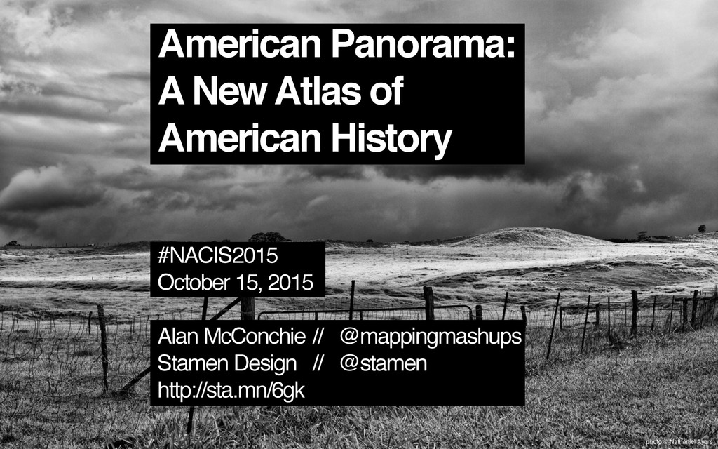
photo © Nathaniel Ayers American Panorama: A New Atlas of
American History #NACIS2015 October 15, 2015 Alan McConchie // @mappingmashups Stamen Design // @stamen http://sta.mn/6gk
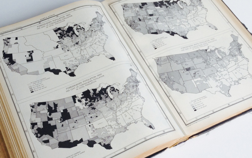
Charles O. Paullin John K. Wright Published 1932
None
None
“The ideal historical atlas might well be a collection of
motion-picture maps, if these could be displayed on the pages of a book without the paraphernalia of projector, reel and screen.” – John K. Wright
None
None
None
None
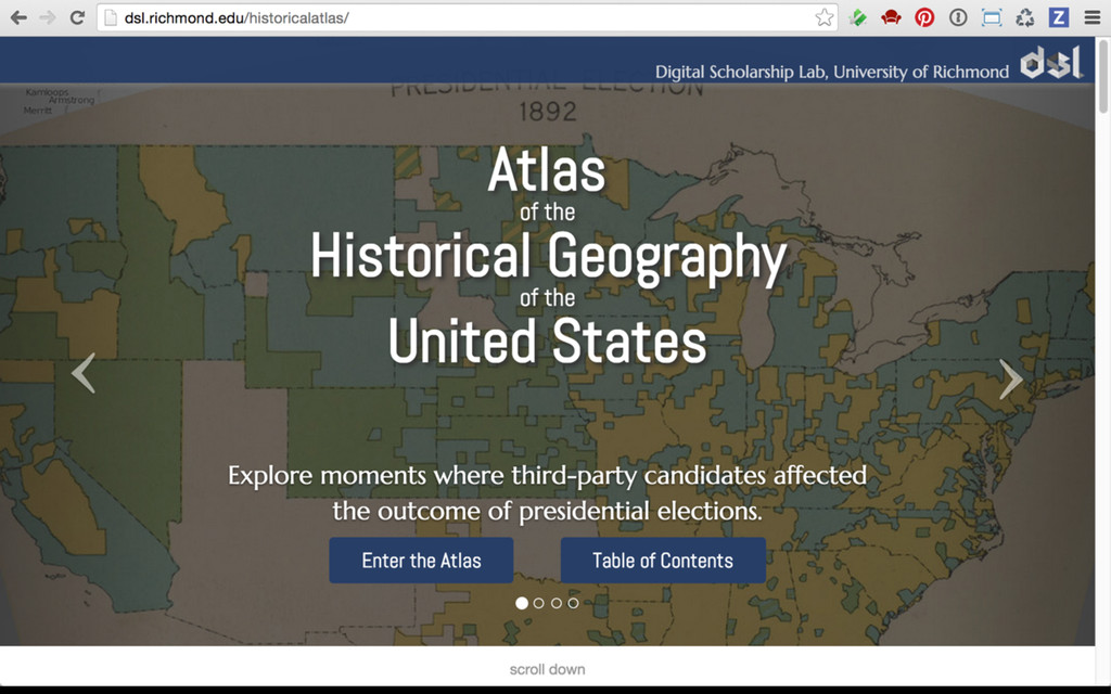
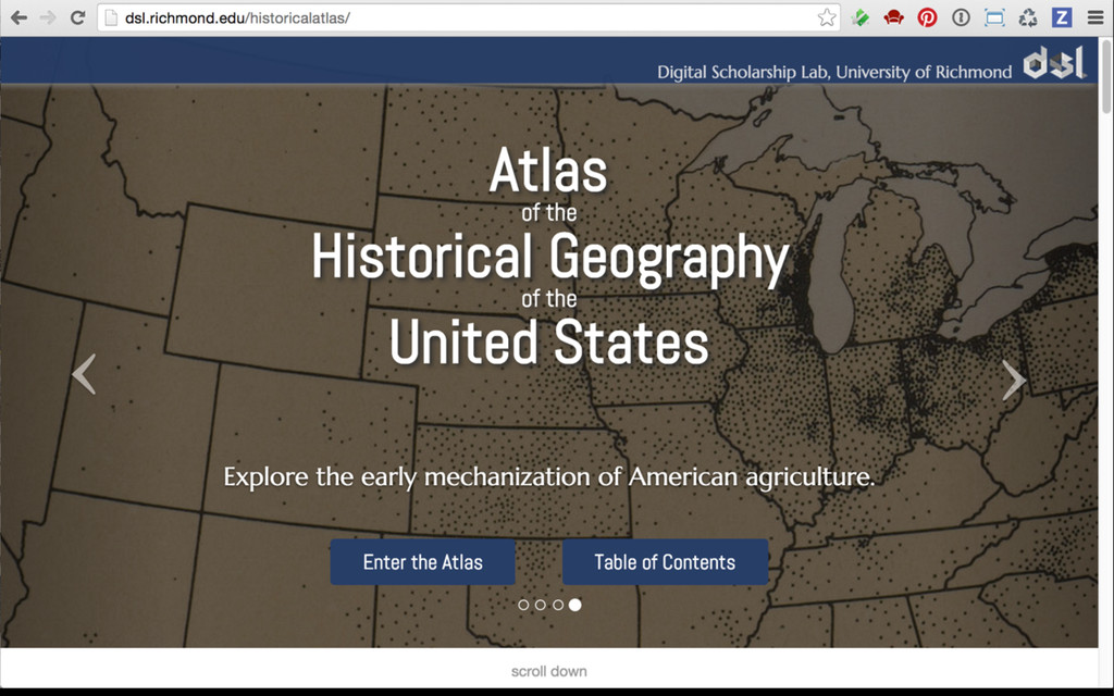
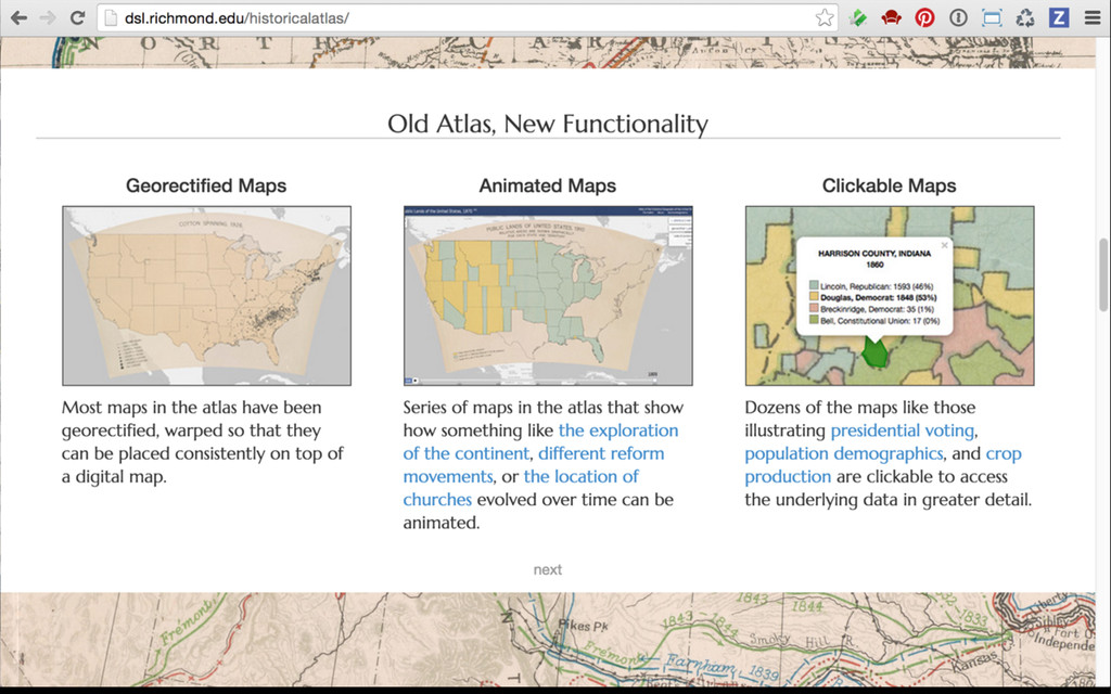
photo © Nathaniel Ayers An Atlas of United States History
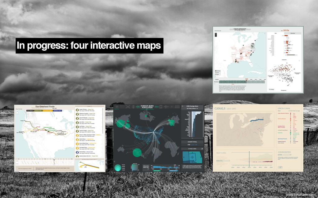
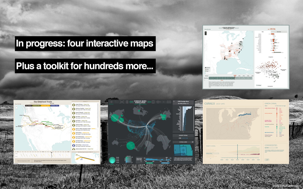
In progress: four interactive maps photo © Nathaniel Ayers
In progress: four interactive maps Plus a toolkit for hundreds
more... photo © Nathaniel Ayers
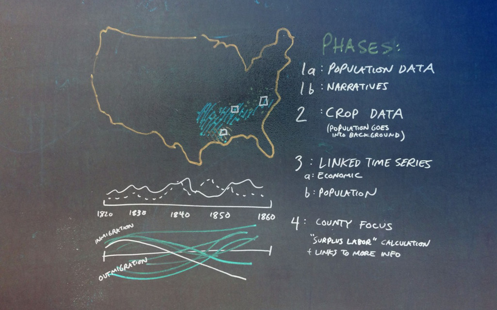
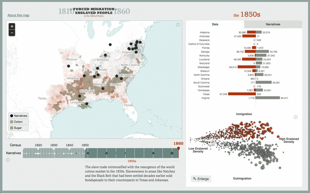
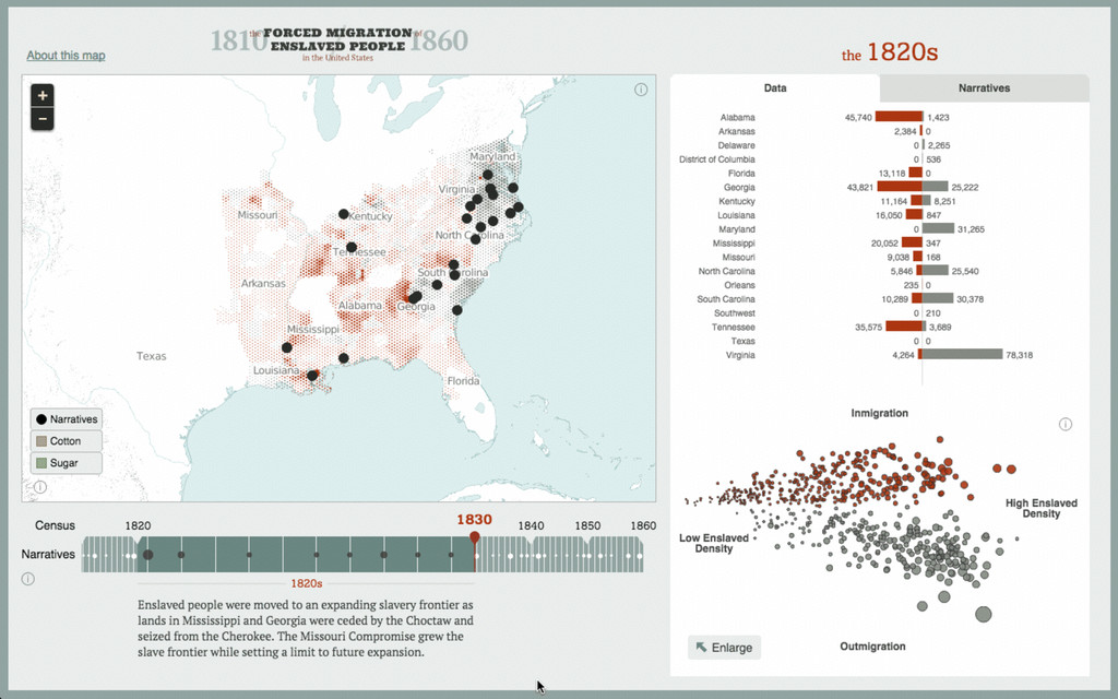
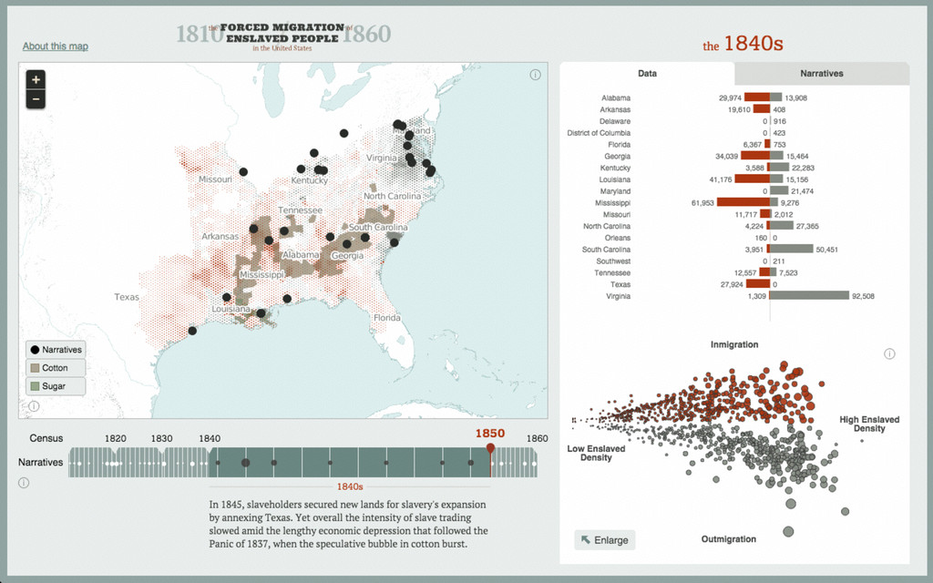
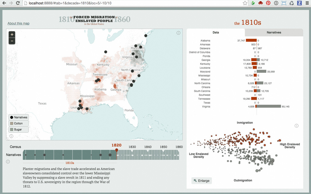
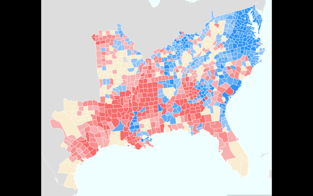
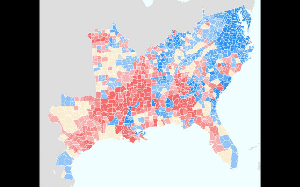
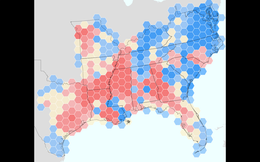
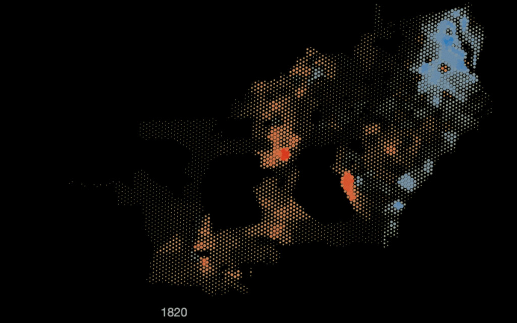
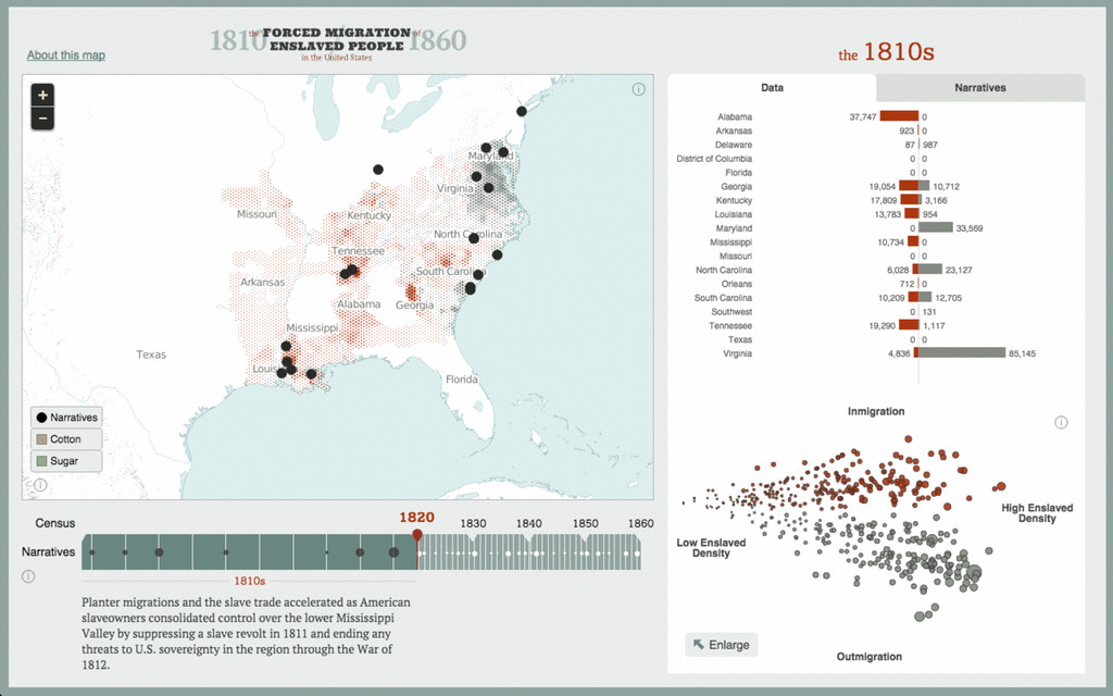
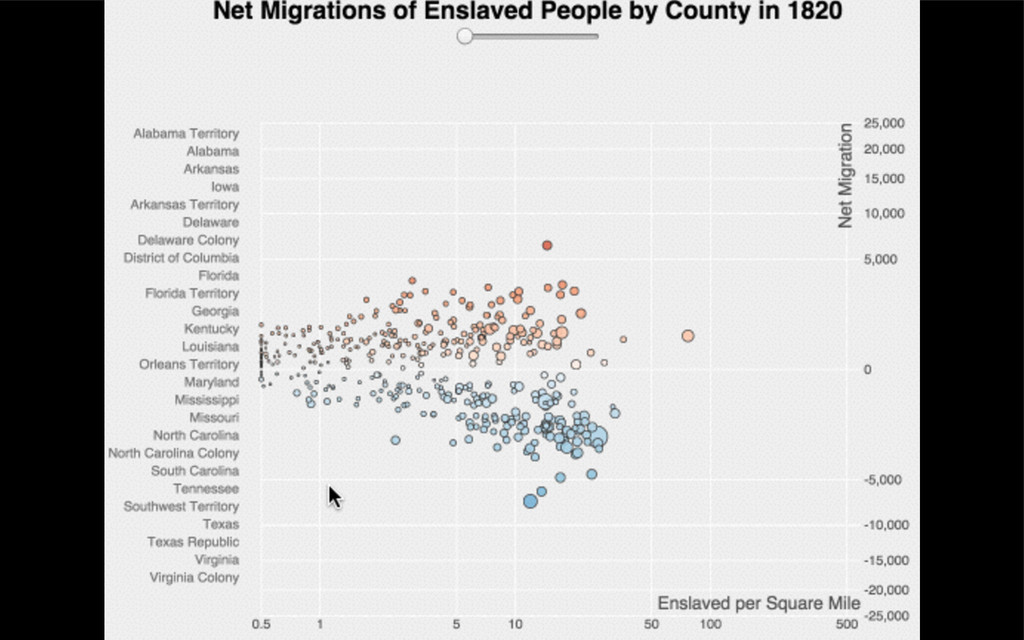
photo © Nathaniel Ayers Forced Migration of Enslaved People in
the United States 1810-1860
None
None
None
None
None
None
None
synced tables from Google Sheets CartoDB GeoJSON D3 charts map
tiles Leaflet markers, D3 overlays (svg + canvas) user interaction: react.js
None
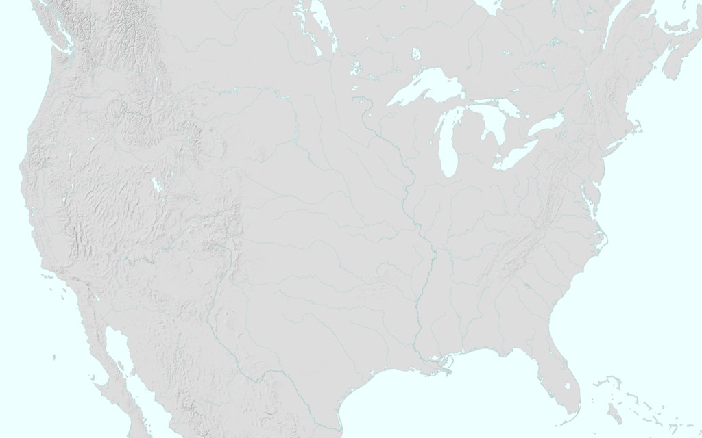
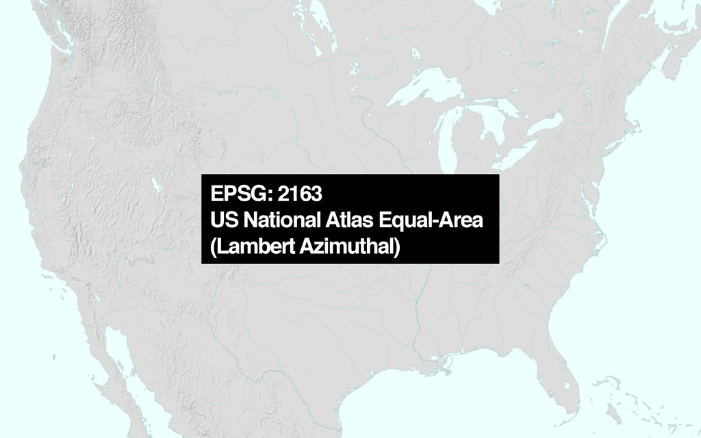
EPSG: 2163 US National Atlas Equal-Area (Lambert Azimuthal)
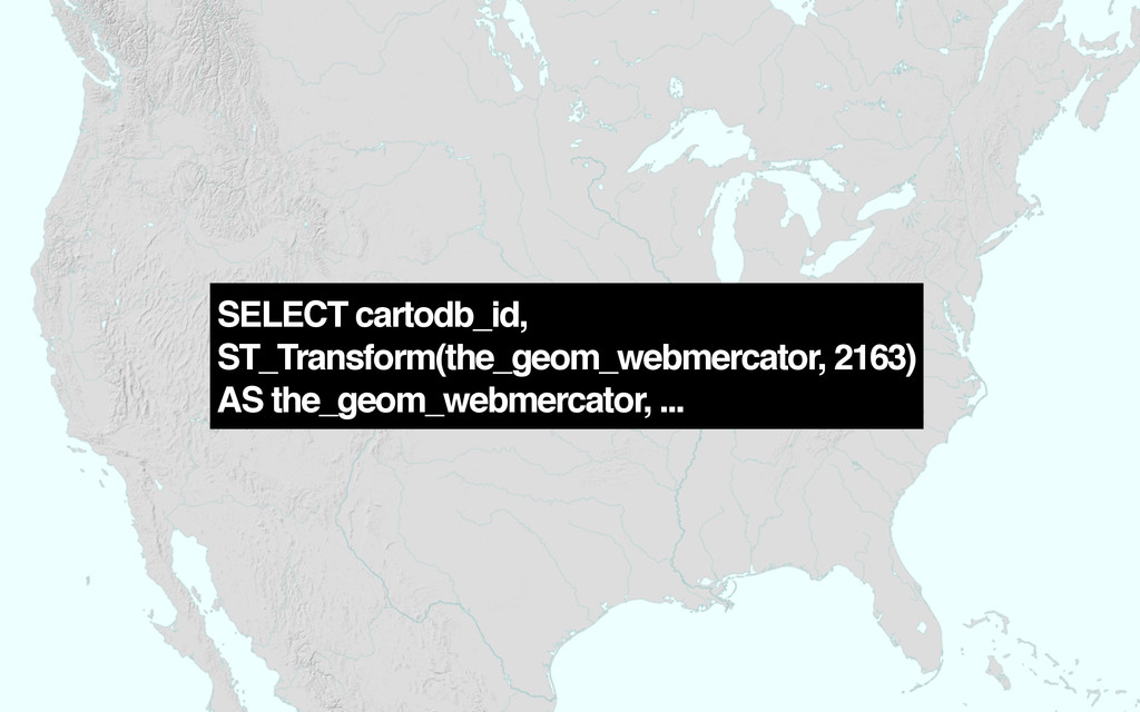
SELECT cartodb_id, ST_Transform(the_geom_webmercator, 2163) AS the_geom_webmercator, ...
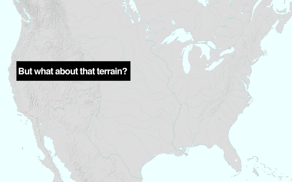
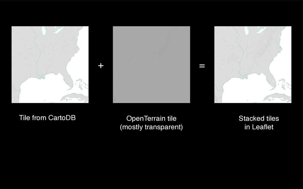
But what about that terrain?
+ Tile from CartoDB OpenTerrain tile (mostly transparent) = Stacked
tiles in Leaflet
None
None
None
None
None
None
None
None
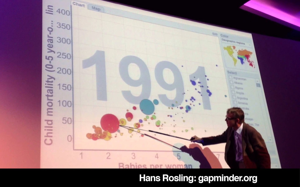
Hans Rosling: gapminder.org
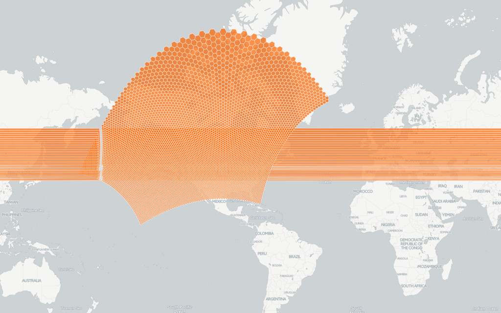
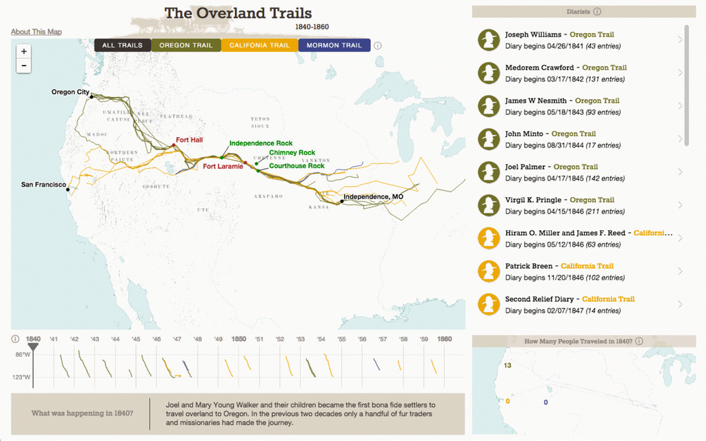
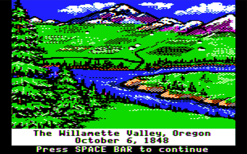
photo © Nathaniel Ayers Overland Trails 1840-1860
None
None
None
None
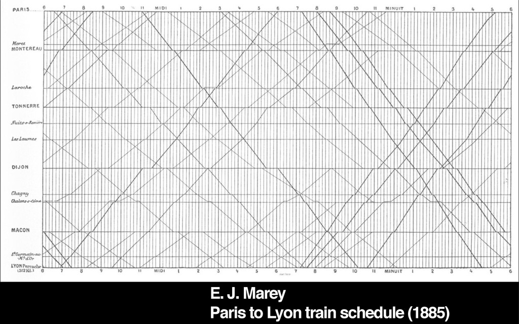
E. J. Marey Paris to Lyon train schedule (1885)
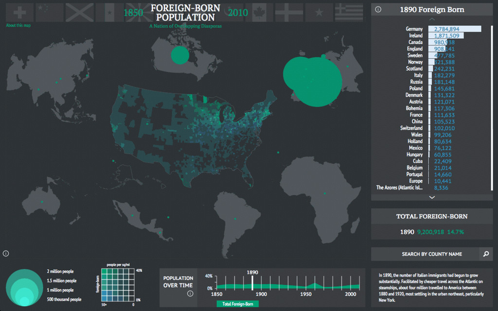
photo © Nathaniel Ayers Foreign-born Population 1850-2010
None
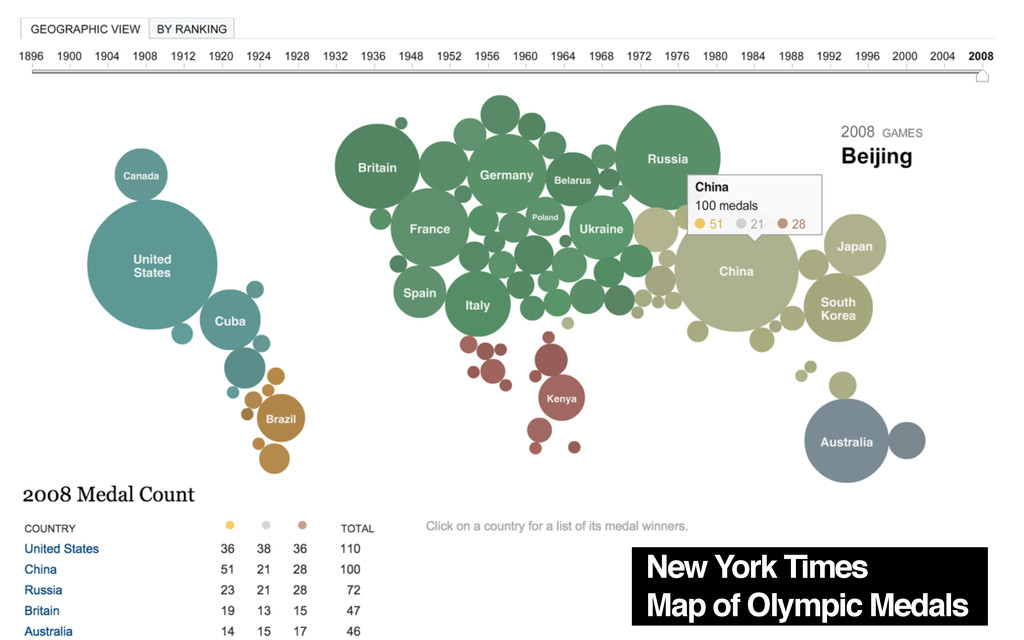
New York Times Map of Olympic Medals
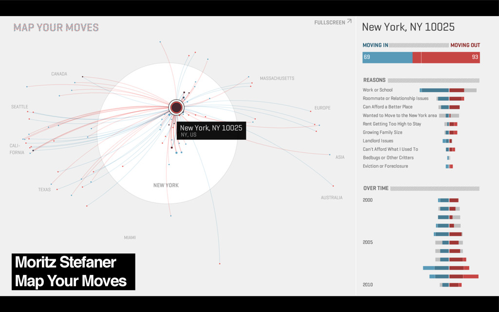
Moritz Stefaner Map Your Moves
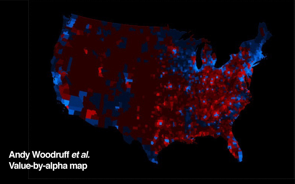
Andy Woodruff et al. Value-by-alpha map
None
None
None
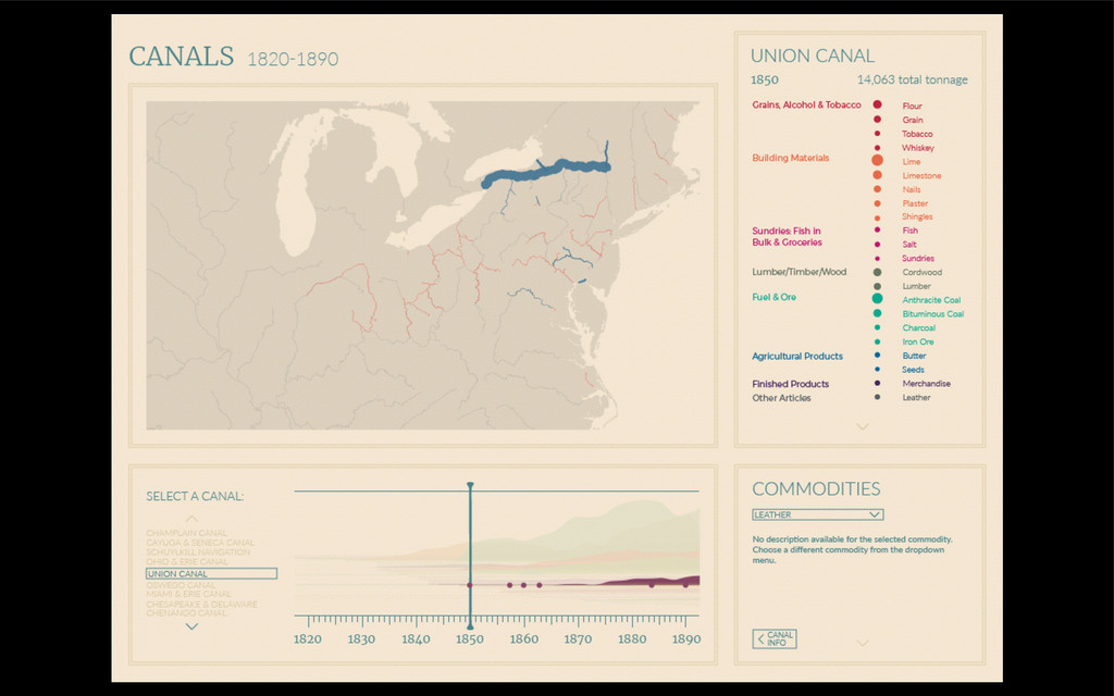
photo © Nathaniel Ayers Canals 1820-1890
None
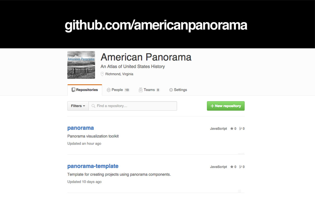
github.com/americanpanorama
Thank you! Alan McConchie // @mappingmashups Stamen Design // @stamen
Digital Scholarship Lab // dsl.richmond.edu Slides, notes, & links // sta.mn/6gk
None