Upgrade to Pro — share decks privately, control downloads, hide ads and more …

NHD and LiDAR, a Case Study in Florence County, South Carolina by Dave Arnold

NHD and LiDAR, a Case Study in Florence County, South Carolina by Dave Arnold

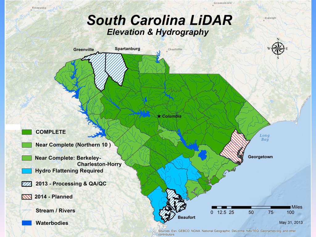
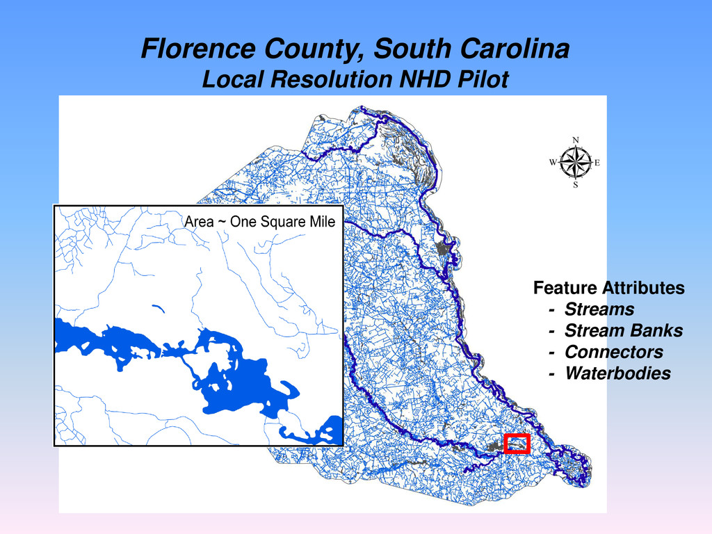
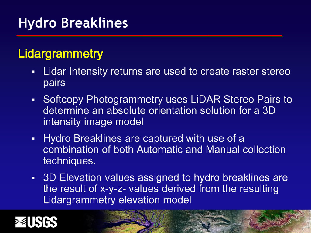
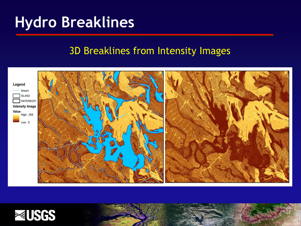
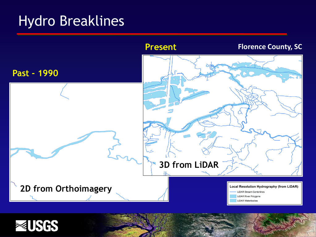
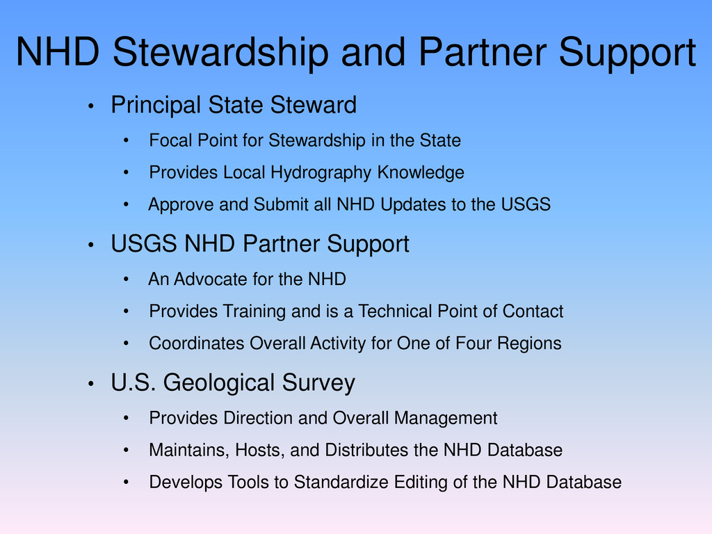
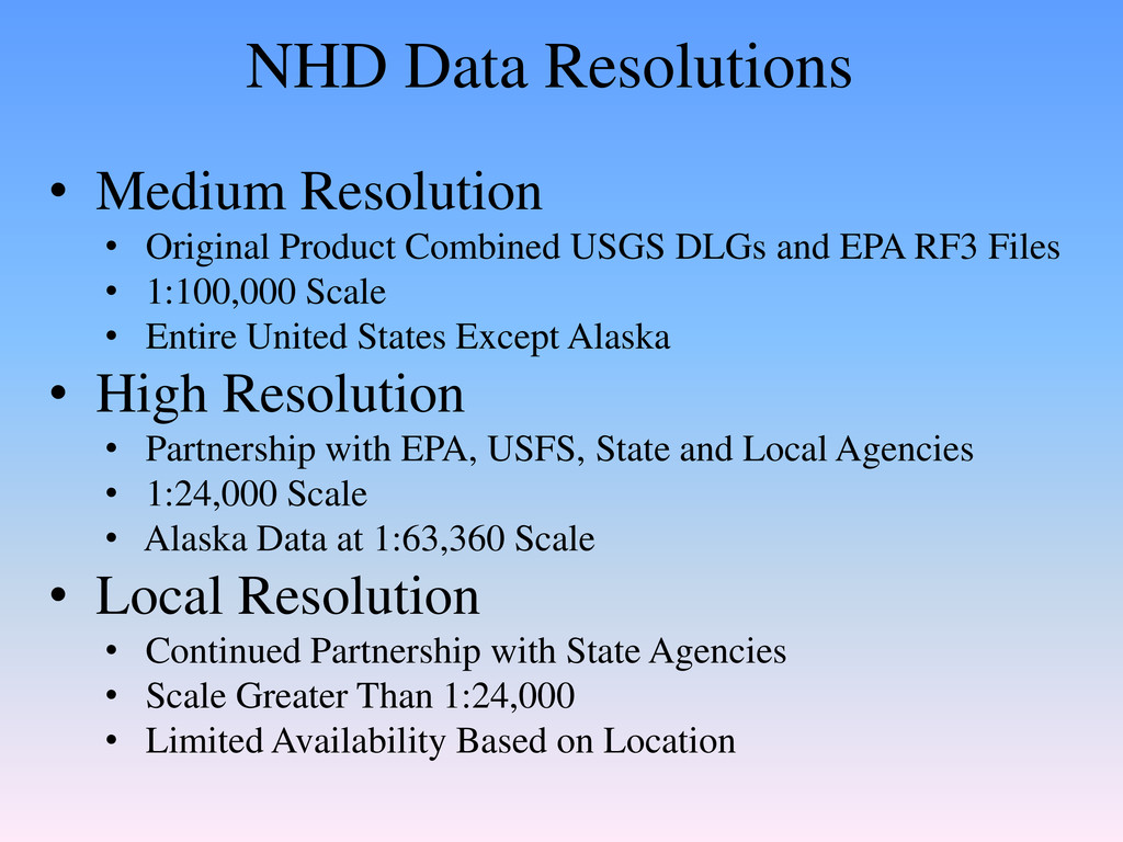
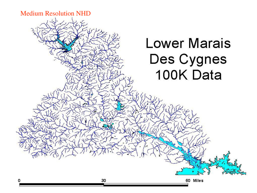
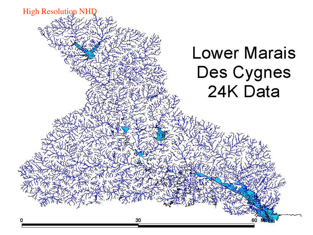
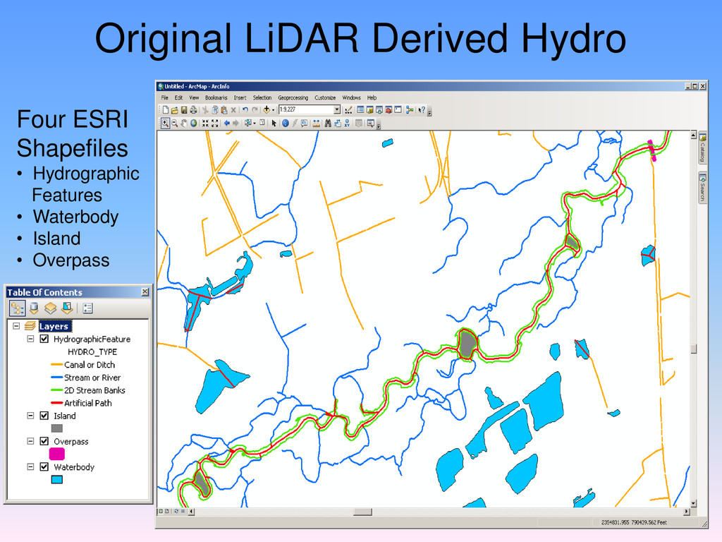
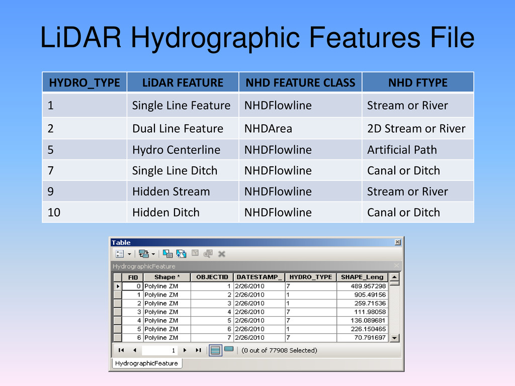
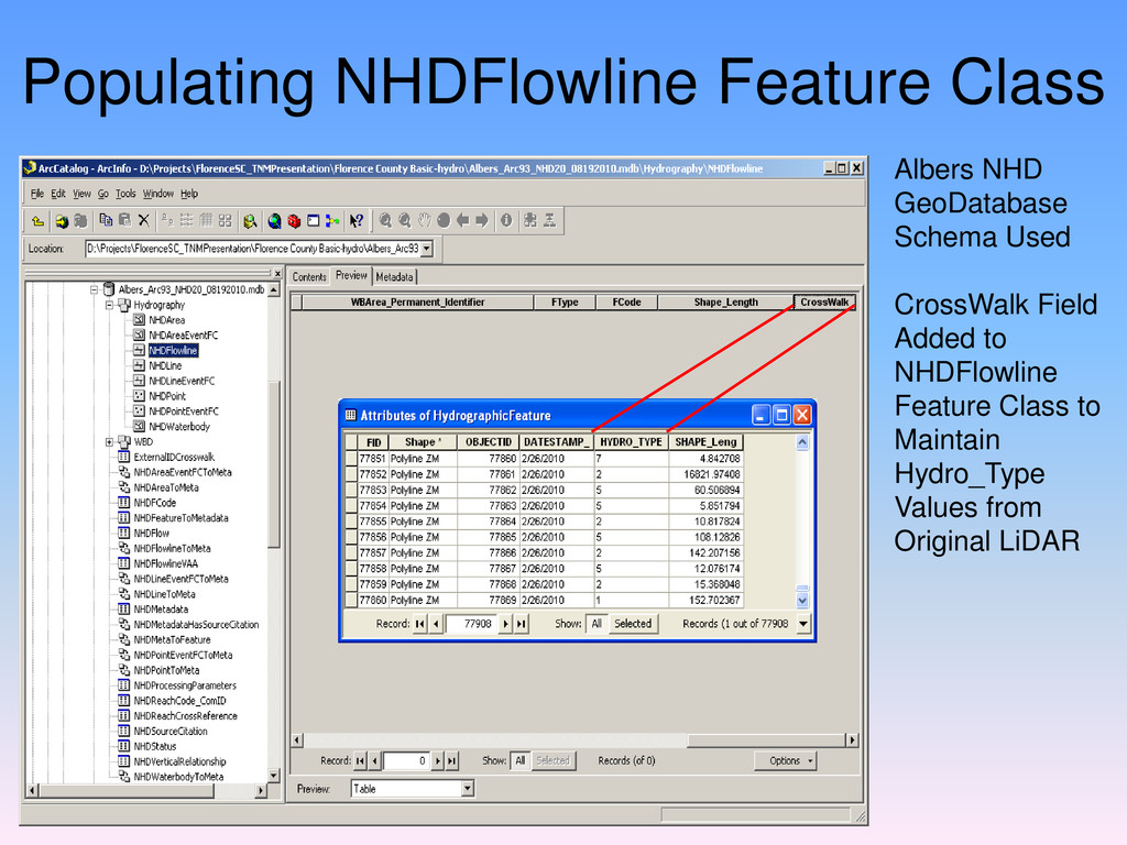
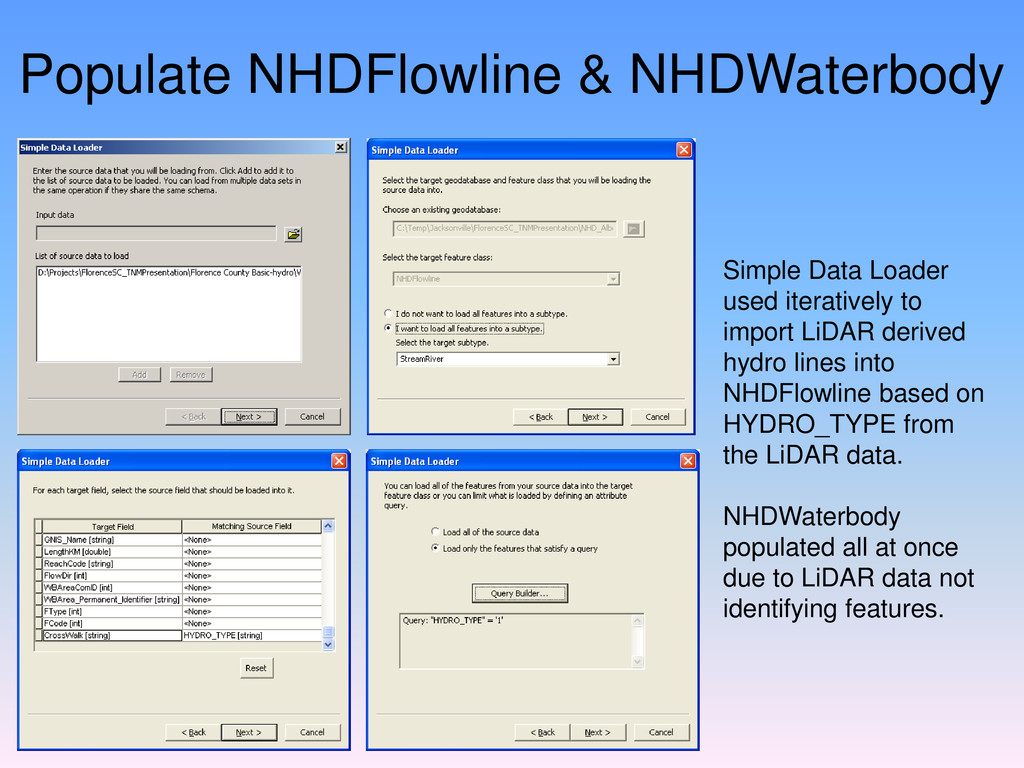
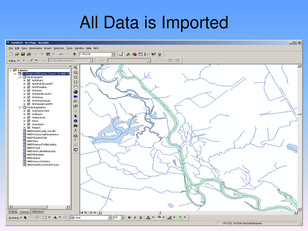
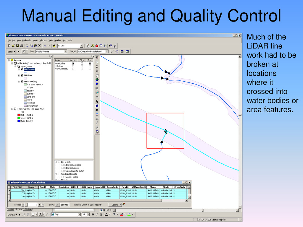
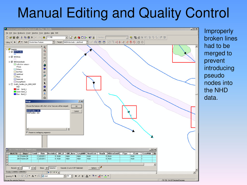
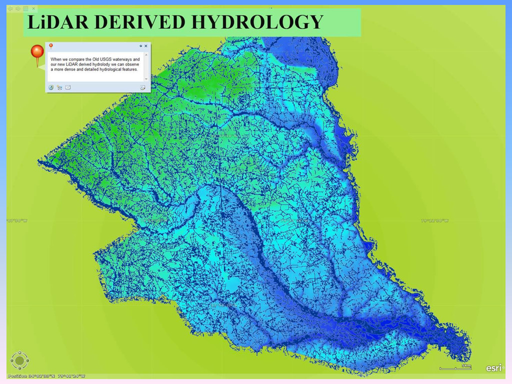
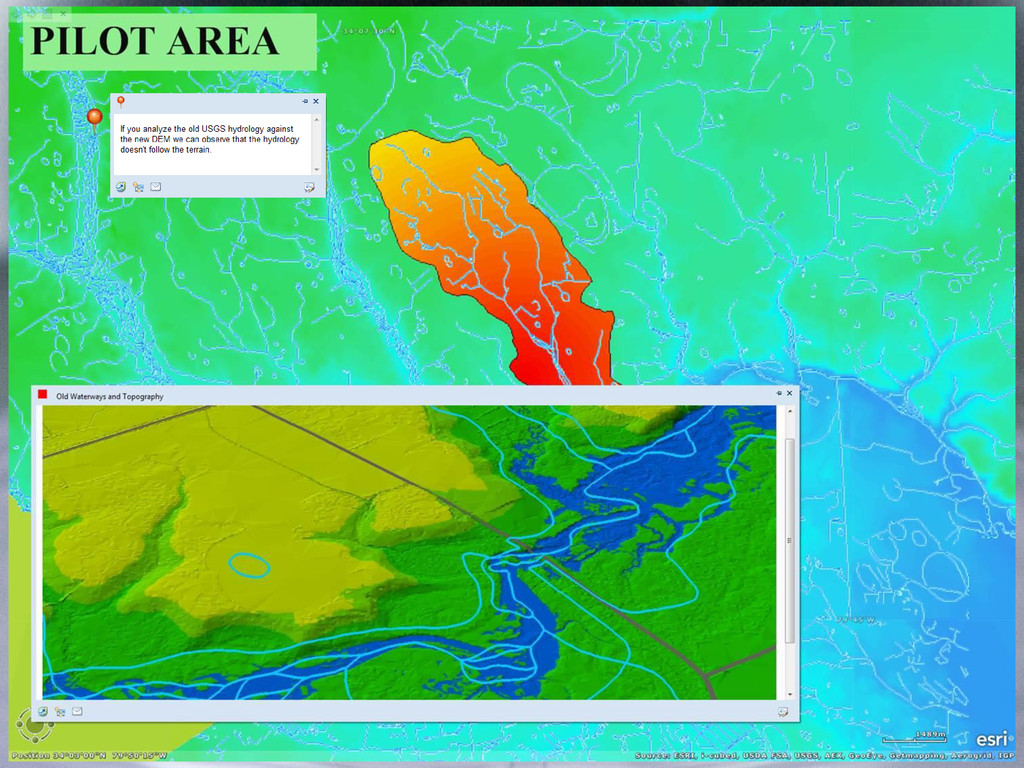
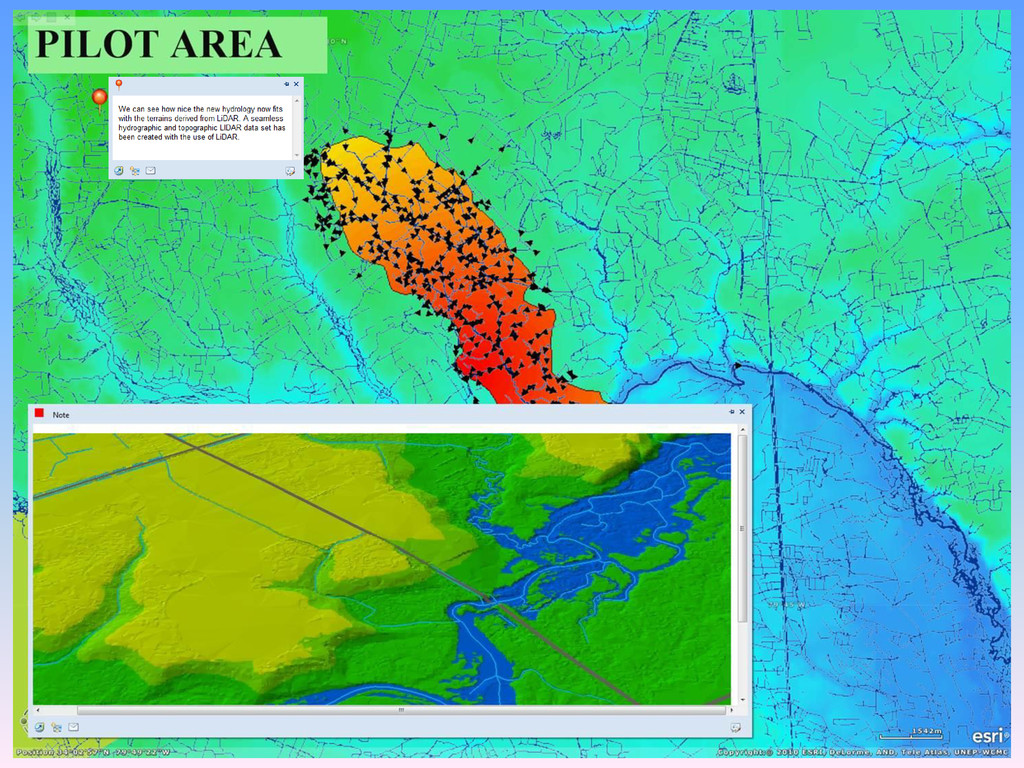
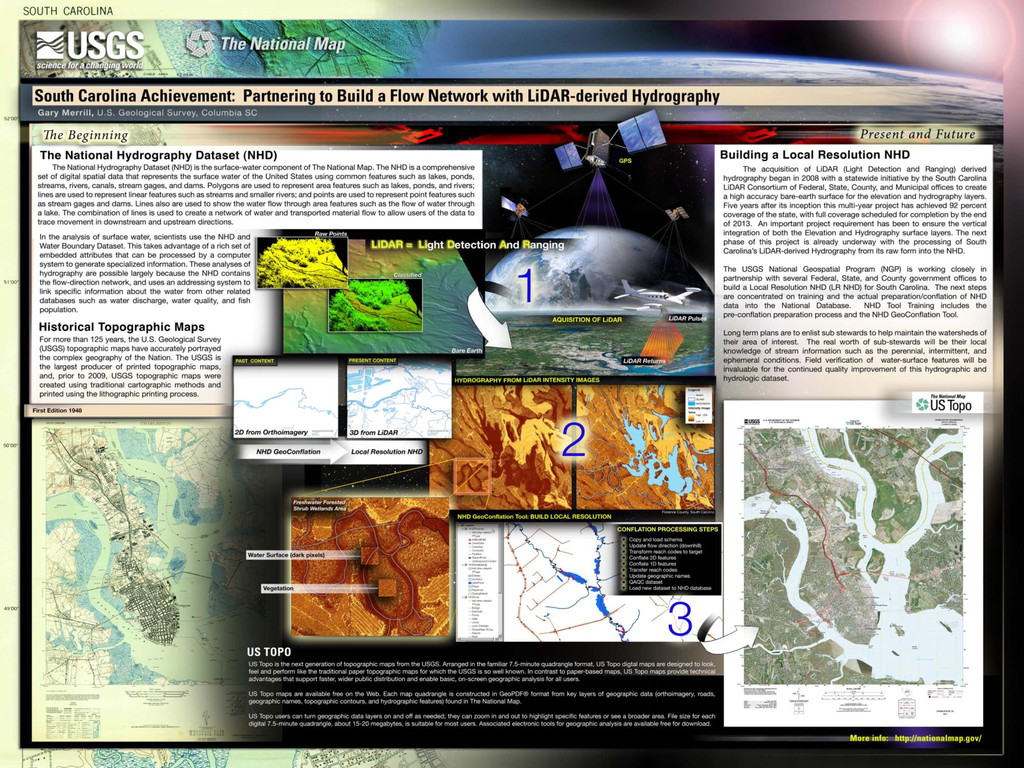
The National Hydrography Dataset (NHD) is a geodatabase representing surface water streams, water bodies, and a number of tables defining relationships and metadata. The hydrographic features are correlated with the certified Watershed Boundary Dataset (WBD). The NHD is maintained and updated via a stewardship process between the United States Geological Survey (USGS) and a principal steward in each state. The NHD was originally created at a scale of 1:100,000 and was later updated to 1:24,000 however, many states are now further increasing the scale, which is broadly defined as local resolution. To create local resolution NHD, Light Detection and Ranging (LiDAR) generated hydrographic break lines are becoming quite common. We will take a look at how state stewards are using LiDAR to update both the NHD and WBD, with a particular emphasis on a pilot project conducted in Florence County, South Carolina in early 2011.

More Decks by Arkansas GIS Users Forum Conference

Other Decks in Technology

Transcript

  1. Creating and Utilizing Local Resolution NHD with LiDAR Derived Hydro

    in Florence County, South Carolina 2013 Arkansas GIS Conference Rogers, AR – September 12, 2013 Dave Arnold, GISP USGS NHD Region 4 Partner Support With Contributions by Gary Merrill, USGS Geospatial Liaison to SC Veronica Moore, South Carolina
  2. Florence County, South Carolina Local Resolution NHD Pilot Feature Attributes

    - Streams - Stream Banks - Connectors - Waterbodies
  3. Hydro Breaklines Lidargrammetry  Lidar Intensity returns are used to

    create raster stereo pairs  Softcopy Photogrammetry uses LiDAR Stereo Pairs to determine an absolute orientation solution for a 3D intensity image model  Hydro Breaklines are captured with use of a combination of both Automatic and Manual collection techniques.  3D Elevation values assigned to hydro breaklines are the result of x-y-z- values derived from the resulting Lidargrammetry elevation model
  4. NHD Stewardship and Partner Support • Principal State Steward •

    Focal Point for Stewardship in the State • Provides Local Hydrography Knowledge • Approve and Submit all NHD Updates to the USGS • USGS NHD Partner Support • An Advocate for the NHD • Provides Training and is a Technical Point of Contact • Coordinates Overall Activity for One of Four Regions • U.S. Geological Survey • Provides Direction and Overall Management • Maintains, Hosts, and Distributes the NHD Database • Develops Tools to Standardize Editing of the NHD Database
  5. NHD Model 2.1 Personal Geodatabase Format • Three Feature Datasets

    • International Hydrography • Hydrography • WBD • 14 Tables • Metadata and Attribute Storage • Relationship Classes • Metadata Related
  6. NHD Data Resolutions • Medium Resolution • Original Product Combined

    USGS DLGs and EPA RF3 Files • 1:100,000 Scale • Entire United States Except Alaska • High Resolution • Partnership with EPA, USFS, State and Local Agencies • 1:24,000 Scale • Alaska Data at 1:63,360 Scale • Local Resolution • Continued Partnership with State Agencies • Scale Greater Than 1:24,000 • Limited Availability Based on Location
  7. LiDAR Hydrographic Features File HYDRO_TYPE LiDAR FEATURE NHD FEATURE CLASS

    NHD FTYPE 1 Single Line Feature NHDFlowline Stream or River 2 Dual Line Feature NHDArea 2D Stream or River 5 Hydro Centerline NHDFlowline Artificial Path 7 Single Line Ditch NHDFlowline Canal or Ditch 9 Hidden Stream NHDFlowline Stream or River 10 Hidden Ditch NHDFlowline Canal or Ditch
  8. Populating NHDFlowline Feature Class Albers NHD GeoDatabase Schema Used CrossWalk

    Field Added to NHDFlowline Feature Class to Maintain Hydro_Type Values from Original LiDAR
  9. Populate NHDFlowline & NHDWaterbody Simple Data Loader used iteratively to

    import LiDAR derived hydro lines into NHDFlowline based on HYDRO_TYPE from the LiDAR data. NHDWaterbody populated all at once due to LiDAR data not identifying features.
  10. Populate NHDArea Feature Class Create temporary line feature class and

    use Simple Data Loader to import 2D streams into it.
  11. Populate NHDArea Feature Class Close open line work and then

    run ‘Feature to Polygon’ to create 2D areas from 1D line work.
  12. Populate NHDArea Feature Class Unwanted island polygons removed using Erase

    function. Features imported into NHDArea feature class.
  13. Manual Editing and Quality Control NHDFlowline features need FType, FCode,

    and FlowDir populated. Incorrect line work flowing from water body into 2D area will cause errors.
  14. Manual Editing and Quality Control Many LiDAR hydro lines needed

    to be specifically broken at confluences in order to conform with the NHD geodatabase schema.
  15. Manual Editing and Quality Control Much of the LiDAR line

    work had to be broken at locations where it crossed into water bodies or area features.
  16. Manual Editing and Quality Control Improperly broken lines had to

    be merged to prevent introducing pseudo nodes into the NHD data.
  17. Contact Information NHD Website – http://nhd.usgs.gov Stewardship Website - http://usgs-mrs.cr.usgs.gov/stewweb/

    Dave Arnold USGS Rolla, Missouri [email protected] Veronica Moore City of Sumter Sumter, South Carolina [email protected] Gary Merrill USGS Columbia, South Carolina [email protected]