Upgrade to Pro — share decks privately, control downloads, hide ads and more …

Transportation Analysis Process – Using Geoprocessing and ArcGIS Model Builder to Evaluate a Road Network for Sustainability by Brian Barnes

Transportation Analysis Process – Using Geoprocessing and ArcGIS Model Builder to Evaluate a Road Network for Sustainability by Brian Barnes

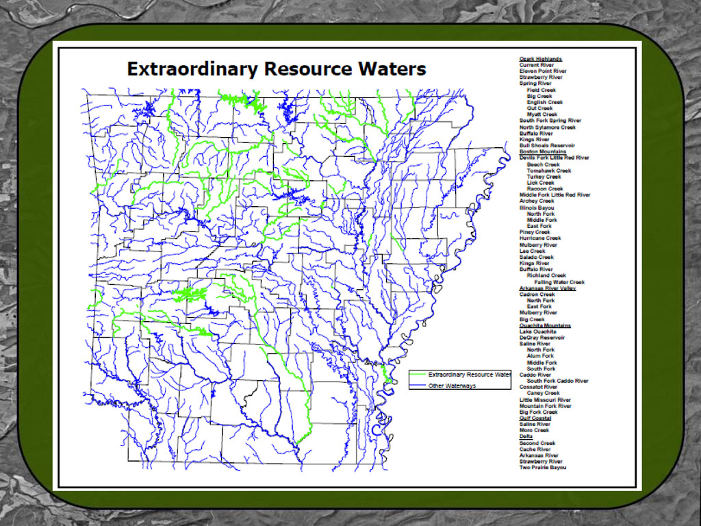
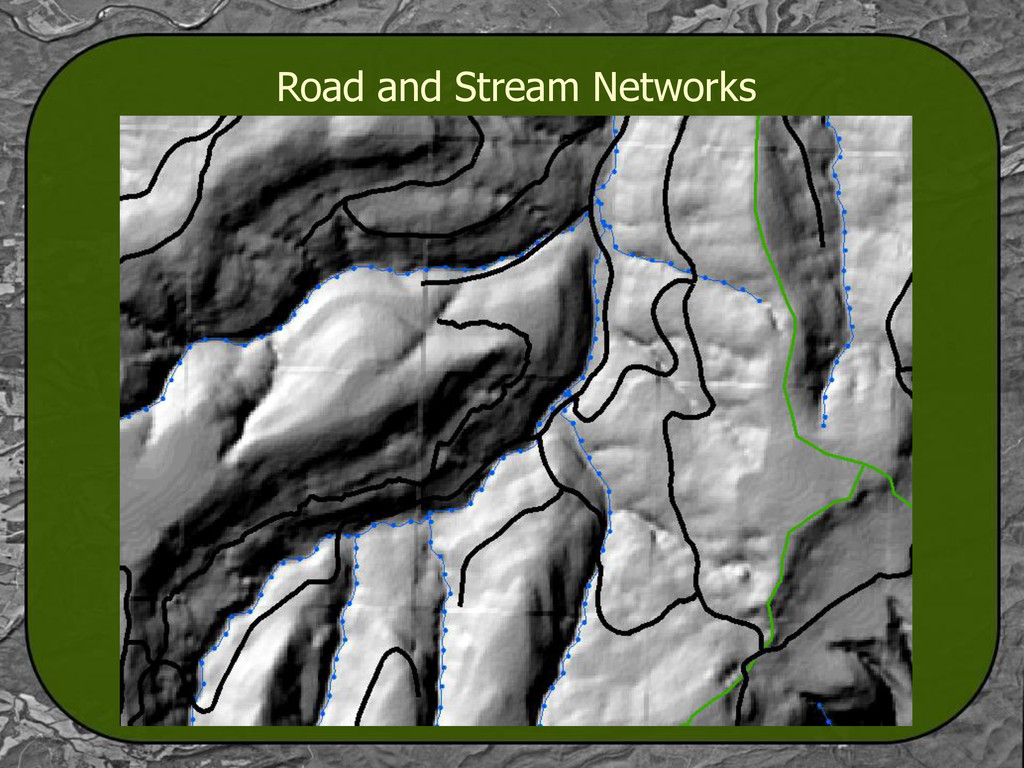
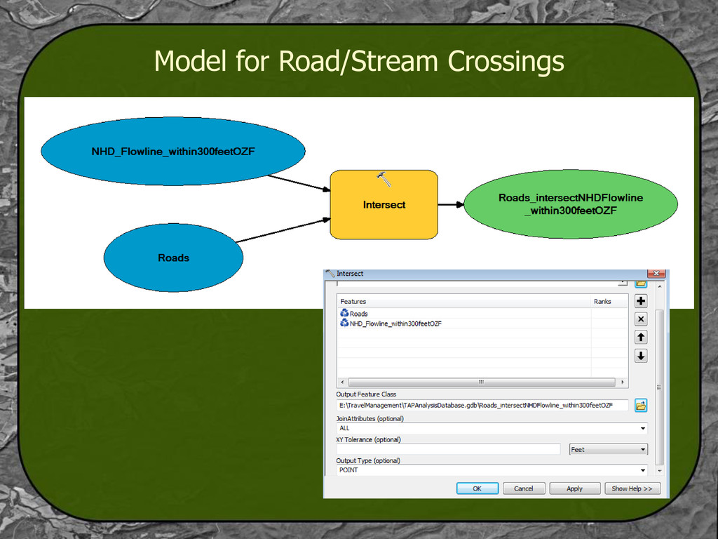
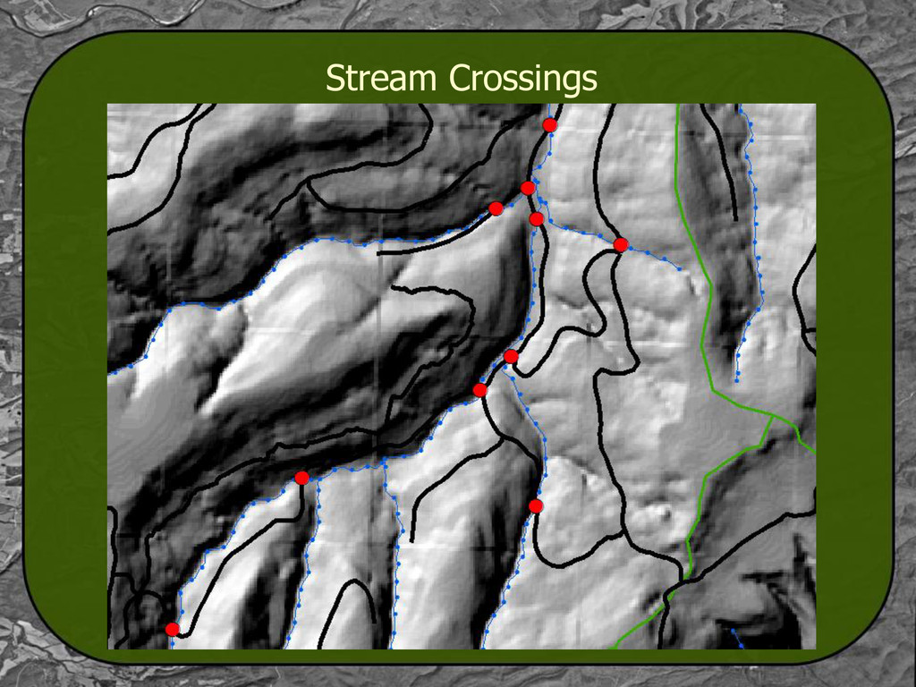
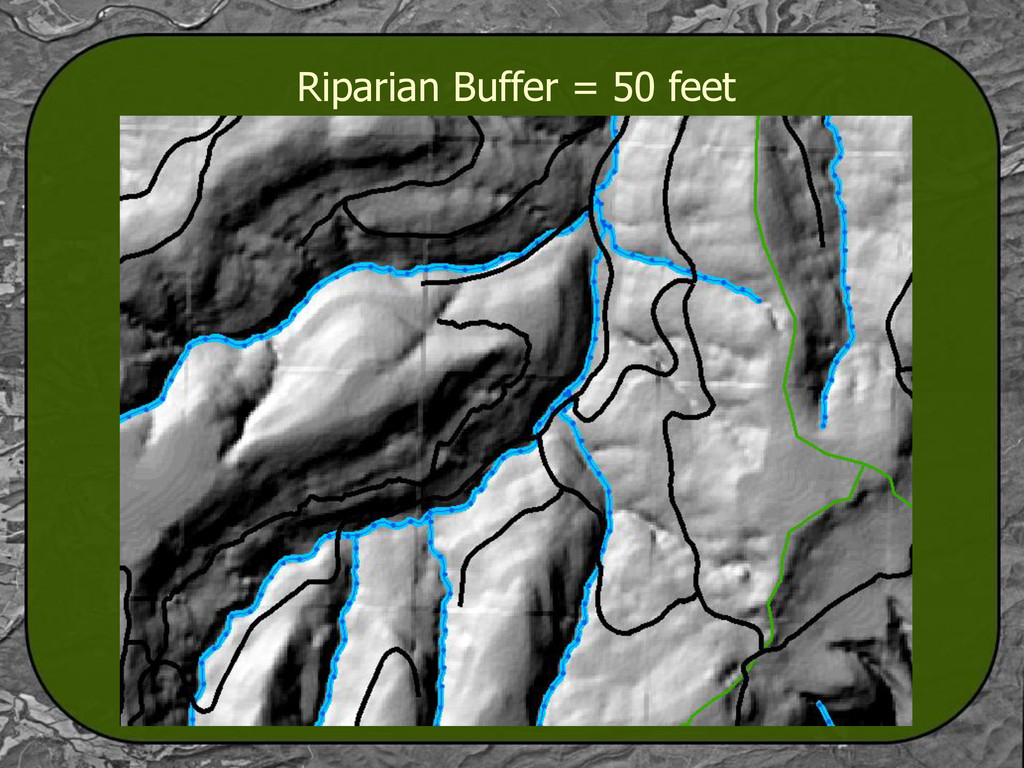
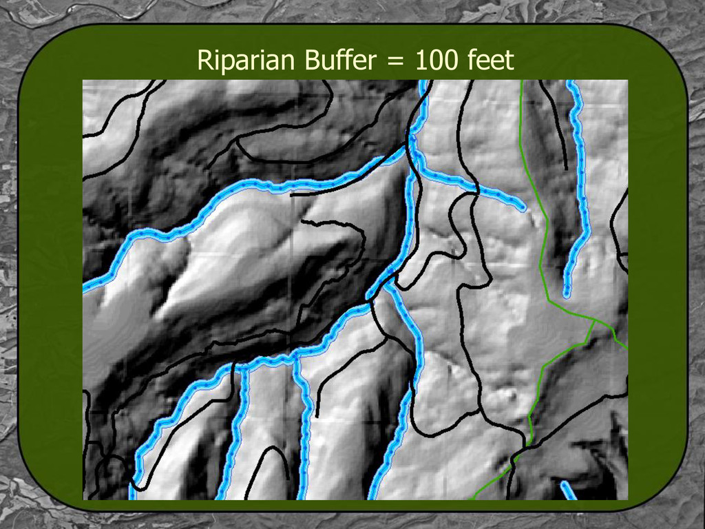
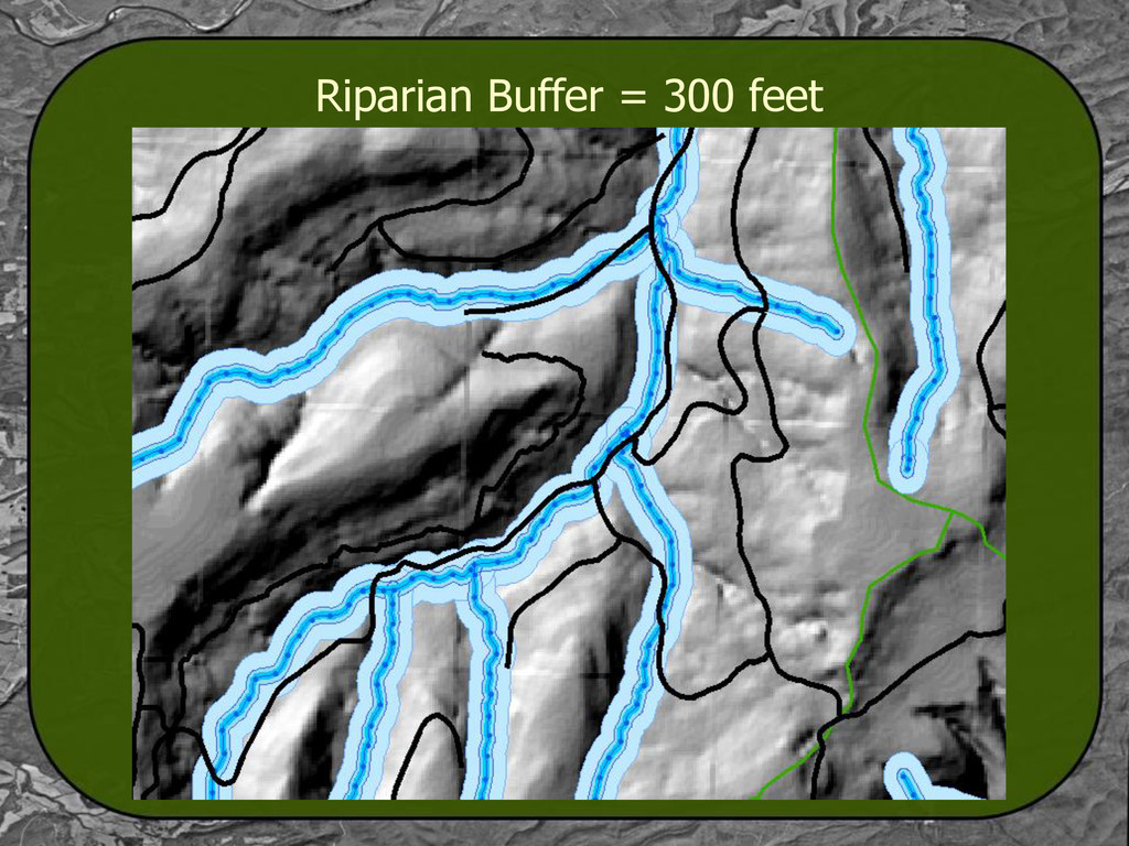
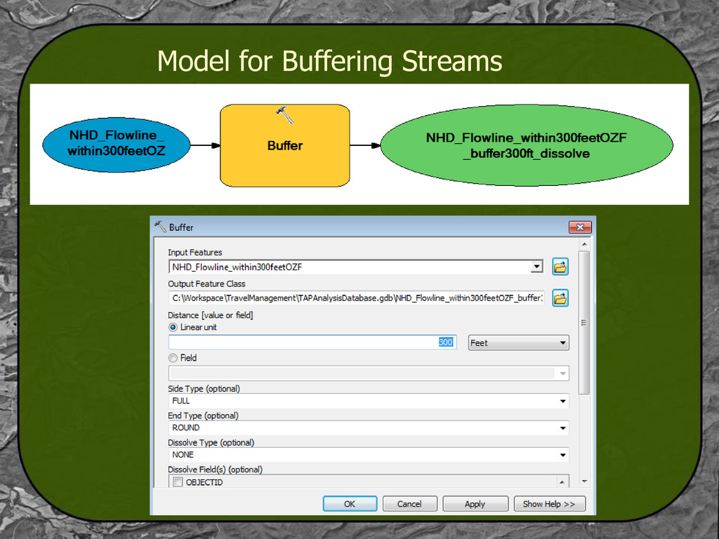
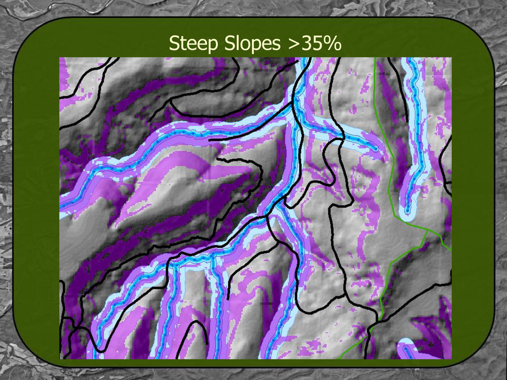
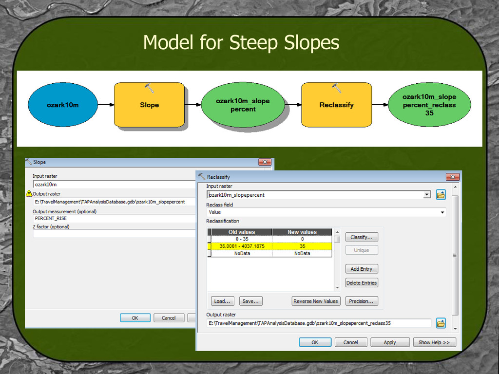
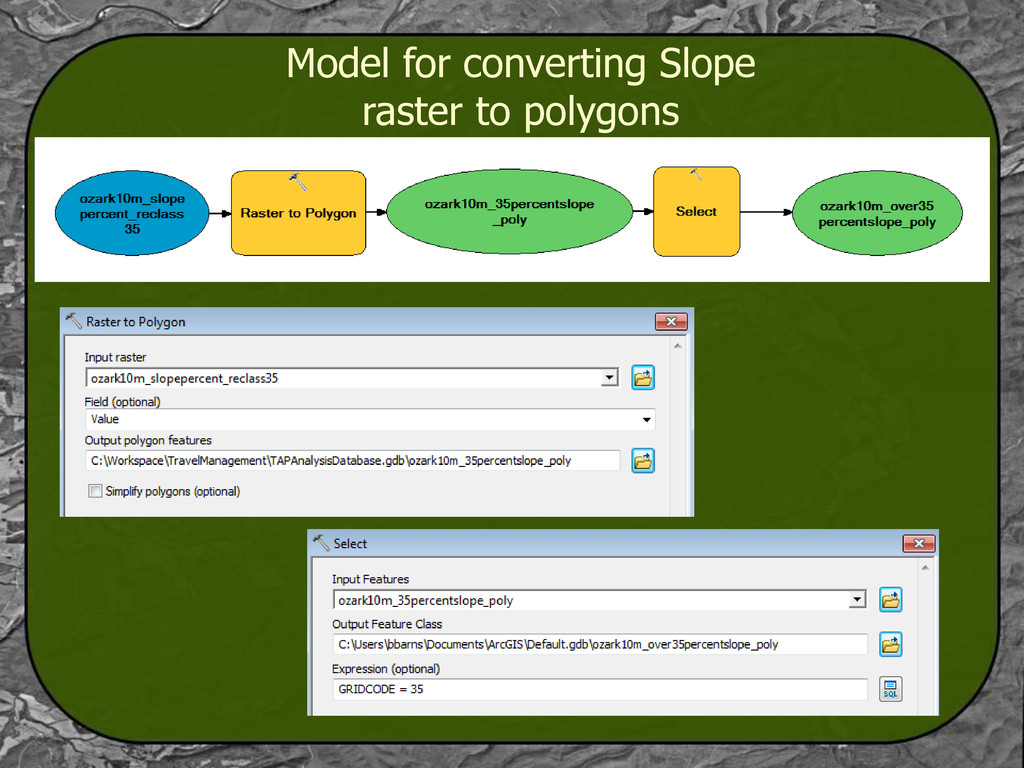
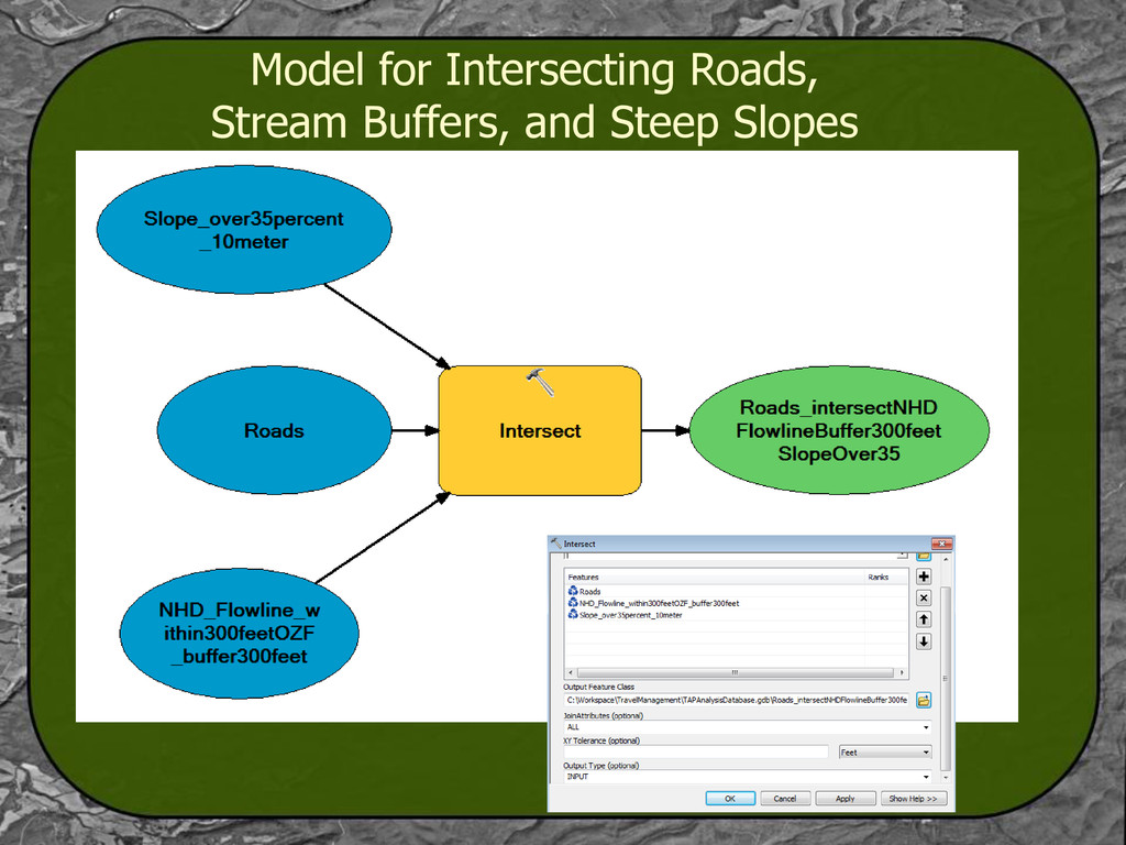
Road networks are important for providing access to communities and resources, and using best management practices, any harmful effects to the environment are minimized. Using the Travel Analysis Process, various indicators are developed by resource specialists, and a report is generated showing recommendations for each road, which can be used to inform future travel management decisions. As an example, one aquatic resource indicator developed for GIS analysis was the proximity of a road to a stream. Using ArcToolbox and Model Builder, the length of road segments within 100 feet of a stream was calculated for each road in the network.

More Decks by Arkansas GIS Users Forum Conference

Other Decks in Technology

Transcript

  1. Forest Transportation Analysis Process - Inform decision makers of road

    related travel management decisions needed Key themes: Public and agency access Achieve forest land and resource management goals Safeguard ecosystem health Minimum transportation facilities needed List of unneeded roads Manage within current and likely funding levels • Orderly improvement and documentation Required for: - Road Construction - Road Reconstruction - Road Decommissioning (Removal) - Adding an existing road to the National Forest System - Acquiring thru purchase/exchange - Changing the allowed vehicle use - Changing the season of use
  2. Integrate the steps from the Watershed Condition Framework with three

    of the six TAP steps: - A list of Key Issues - Risks and Benefits - Opportunities Analyze the existing road system as a whole in order to inform future project planning decisions: - Address user safety and environmental impacts - Provide for an optimum balance of access needs and costs - Reduce Road Density - Some roads are poorly located and should be eliminated, or relocated farther away from streams - Roads are the largest source of sediment on the National Forests
  3. - Riparian Management Areas from the 2005 Revised Land and

    Resource Management Plan “strive to reduce road density in Stream Management Zones based on watershed assessment and the roads analysis process” “identify roads that should be reconstructed or decommissioned to reduce sediment and improve watershed condition within corridors” “to strive to reduce roads to a density of three miles/square” - State law requires the Forest to protect Extraordinary Resource Waterbodies Extraordinary Resource Waters: This beneficial use is a combination of the chemical, physical, and biological characteristics of a waterbody and its watershed which is characterized by scenic beauty, aesthetics, scientific values, broad scope recreation potential, and intangible social values. Identifying roads near ERWs for possible closure will assist in maintaining the valued attributes of the ERW. Listed ERWs that flow thru or have tributaries on NFS lands include Mulberry River, Richland Creek, North Sylamore Creek, Buffalo River, Piney Creek, Hurricane Creek, Falling Water Creek, North Fork Illinois Bayou, Middle Fork Illinois Bayou, East Fork Illinois Bayou, Kings River, and Lee Creek.
  4. Name of Indicator: Number of Stream Crossings Per Road Mile

    Road/stream crossings are the locations were anthropogenic effects are going to be greatest on aquatic ecosystems. By reducing the number of these contact points it would have a positive effect on the aquatic ecosystem. Aquatic organism movement can be limited by artificial structures, and fish passage may become blocked. Data Sources: Road Inventory Streams (National Hydrography Dataset) Processing Steps: Intersect the layers to create a point layer. Divide the # of stream crossings by the miles of road.
  5. Name of Indicator: Road miles within 300 feet of a

    stream with terrain gradient of greater than 35%/overall road miles Roads receiving minimal maintenance have the high likelihood, at least those located relatively low in the watershed, of creating additional siltation impacts. Also, roads near streams contribute to an increase in sunlight reaching the stream, and therefore an increase water temperature. Source Data: ozark10m (Digital Elevation Model) Streams (NHD Flowlines) Road Inventory