Upgrade to Pro — share decks privately, control downloads, hide ads and more …

What did you miss at the 2013 Esri User Conference by Dan Haag

What did you miss at the 2013 Esri User Conference by Dan Haag

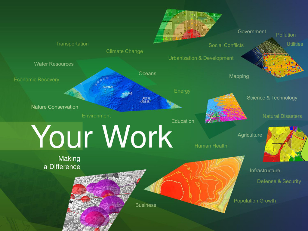
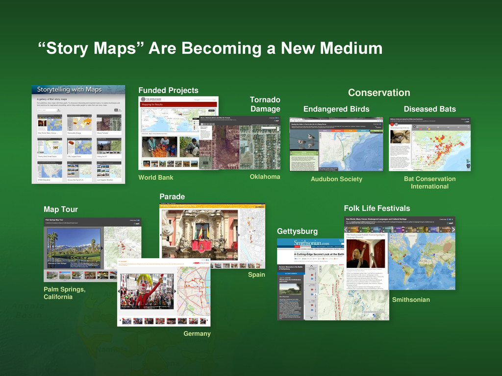
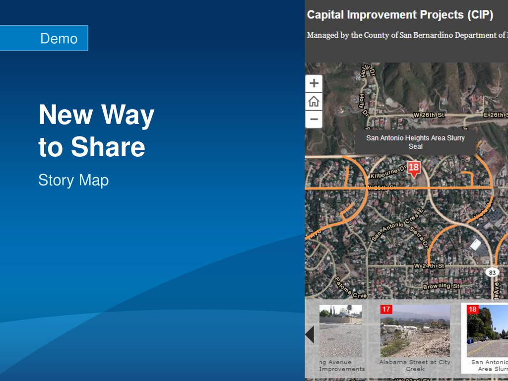
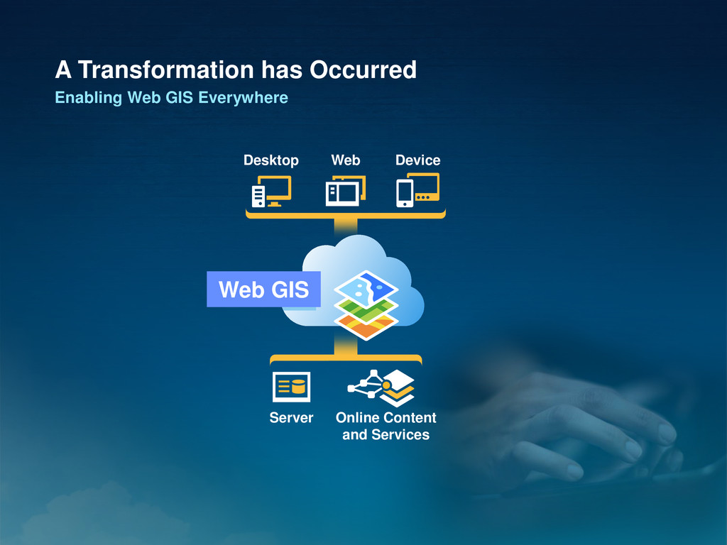
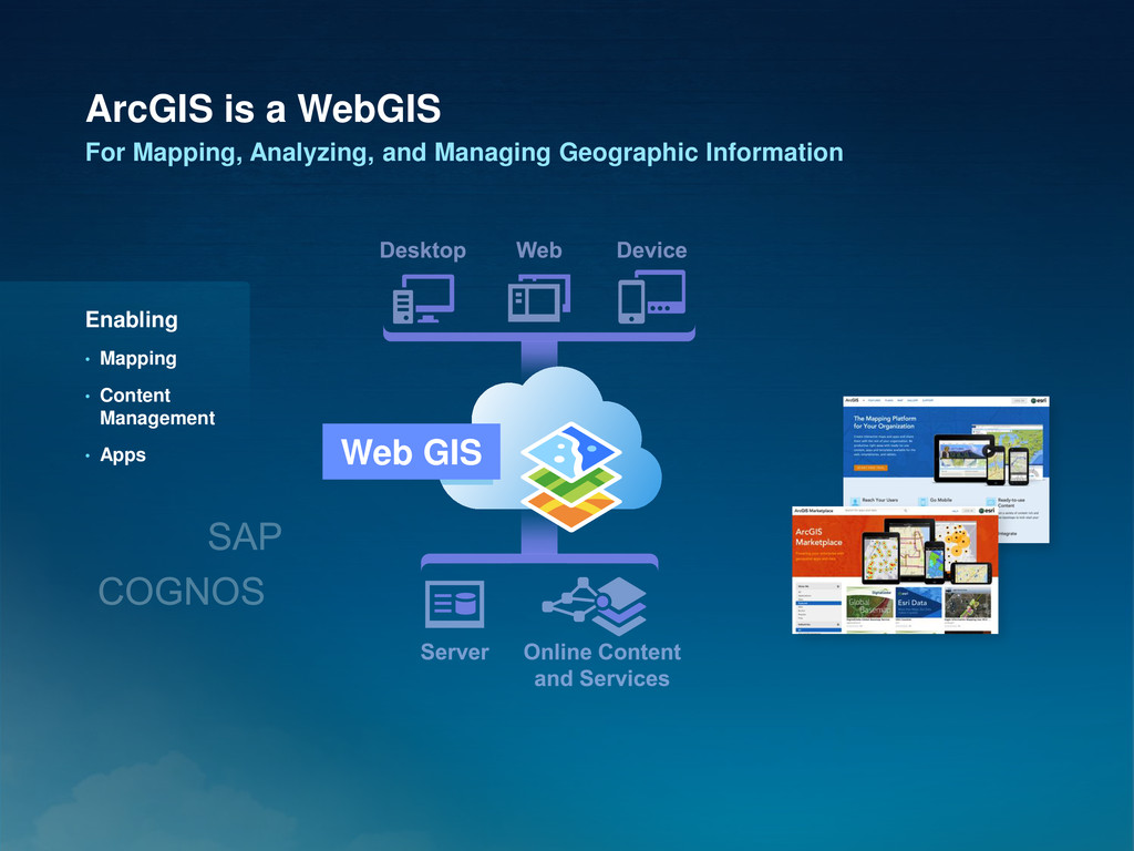
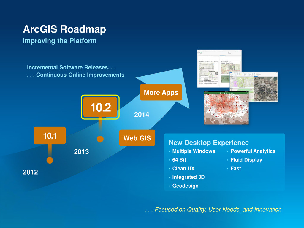
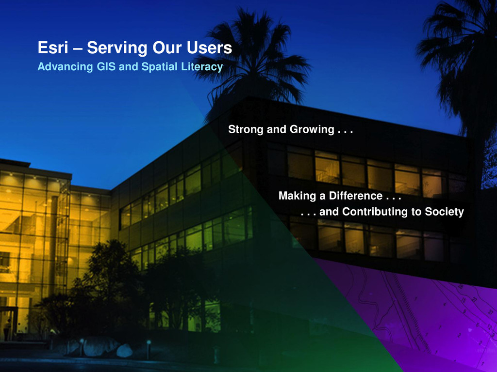
Join us as we share Esri’s vision of Web GIS and ArcGIS as a complete geospatial platform. We’ll explore enhancements in the ArcGIS 10.2 release which support the sharing of content and services on all devices, across the cloud, and on-premise providing transformational opportunities for your organization. We’ll touch on updates to the ArcGIS system which support all users of GIS data regardless of their experience, and discuss our ongoing efforts to support standard ArcGIS for Local and State Government templates.

More Decks by Arkansas GIS Users Forum Conference

Other Decks in Technology

Transcript

  1. What Did You Miss at the Esri User Conference, aka

    What’s New with ArcGIS Dan Haag September 13, 2013
  2. Request for Service CitySourced, California Spain Sports Voting Tour Maps

    US National Arboretum Trekking France Singapore Social Networking History Los Angeles, California Funding Crowdsourcing Budget Transparency Maryland Philippines Disaster Reporting Citizen Engagement and Crowdsourcing Minnesota Polling Place Locator
  3. Citizen Access Northern Ireland Columbus, Ohio USDA NOAA US Geospatial

    Platform Government Infrastructure Open Data Internal Manaus, Brazil INSPIRE Geoportal Geology and Minerals, Peru Verizon Barrick Sherwin-Williams The World Bank Organizational Portals
  4. World Bank Funded Projects Conservation Diseased Bats Bat Conservation International

    Endangered Birds Audubon Society Spain Parade Map Tour Palm Springs, California Gettysburg Smithsonian Folk Life Festivals “Story Maps” Are Becoming a New Medium Germany Tornado Damage Oklahoma
  5. A Transformation has Occurred Enabling Web GIS Everywhere Desktop Web

    Device Server Online Content and Services Web GIS
  6. ArcGIS is a WebGIS For Mapping, Analyzing, and Managing Geographic

    Information Enabling • Mapping • Content Management • Apps Web GIS
  7. Web GIS Can Integrate Anything Linking and Combining Information Mashup

    Visual Overlay Modeling Spatial Analysis Dynamic Linking Hyperlinks
  8. A New Pattern for Delivering GIS Capabilities Leveraging Common Computing

    Architecture File Based Web Centric Server Centric Database Centric • Works seamlessly across all devices • Reduces need for custom applications • Platform for integration with other business systems • Cross organizational collaboration • Ready to use content and services • Content management system
  9. ArcGIS Landscape Content Watersheds Elevation Slope Aspect NHD+ Soils Landforms

    Faults Wetlands Evapotranspiration Physical Geography Critical Habitat Ecological Systems Land Cover Roads Rail Flood Risk Historic Sites Transmission Lines Pipelines Oil Shale Basins Coal Bed Methane Basins Earthquake Risks Cultural Geography Bio-Geography Federal Land Native Land Land Management 500+ Variables
  10. ArcGIS Desktop Gets Better Enhances Quality and Introduces New Capabilities

    Optimized Hot Spot Big Data Generalization Improved Editing Mapping Analysis JSON Excel Geoprocessing Image Caching Security
  11. Desktop Dramatically Improves 3D GIS Integrating Many New Tools .

    . . Transforming How We See the World • Rule-Driven Content • Publish Web Scenes • 3D Modeling • Lidar Performance Web Scenes Rule-Driven Content Lidar 3D City Models City of Portland Rotterdam Sydney Brisbane
  12. ArcGIS Is a Strong Imagery Platform Introduces Intelligent Imagery on

    the Web . . . A Fundamental Part of the System Intelligent Imagery • SPOT 6 • Landsat 8 • Pleiades • DMCii • Chinese (3) Image Table AccuWeather DigitalGlobe RapidEye Search Web Map Web Analysis Pop-Ups New Sensors Premium Services
  13. ArcGIS Server Enhances Capabilities and Enables Web GIS . .

    . Implements Web GIS on Premises • Quality • Security • Administration • Database Support • Real Time Support Portal for ArcGIS Enables • Content Management • Web Maps • Apps Portal Server
  14. Enabling • Big Data • Inline Processing • Geo-Fencing GeoEvent

    Processor Integrates and Exploits Real Time Data Continuous Processing and Analysis JMS GeoEvent Processor ArcGIS Server Streams Messages Rules
  15. ArcGIS Apps Empower Everyone Focused and Easy to Use on

    Any Device Enabling You to Extend the Power of GIS Analysis View / Query Story Maps Collector ArcPad Editing / Collection Dashboard Awareness Office Location Analytics
  16. ArcGIS Online Makes ArcGIS Available in the Cloud Providing GIS

    as SaaS . . . . . . Complementing and Extending Your Existing Systems Enabling • Mapping • Content Management • Apps Introducing • Analytics • GeoEnrichment • Security • New Items (GeoRSS, PDF, Excel . . . ) • Marketplace Portal
  17. Web-Based Analytics Are Now Part of ArcGIS Leverage Cloud Infrastructure

    Enabling New Approaches Aggregate Points Find Hot Spots Drive-Time Areas Enrich Layer
  18. ArcGIS GeoEnables Business Systems Providing Mapping, Spatial Analysis, and Reporting

    Supporting Location Analytics Everywhere Microsoft Office Esri Maps for . . . • Office • IBM Cognos • SharePoint • MicroStrategy • SAP • Salesforce • Dynamics Spreadsheets Enterprise Systems
  19. Utilities Solution Templates Provide Apps, Maps, Data Models, and Tools

    Improving Productivity and Leveraging Best Practices • Free to Users • Easily Configured • Fully Supported • Open Source Military / Security Emergency Management Government
  20. Solution Products Provide Focused Applications GeoPortal Bathymetry Production Mapping and

    Charting Roads and Highways (LRS) Business Analyst Airports Community Analyst
  21. ArcGIS Roadmap Improving the Platform . . . Focused on

    Quality, User Needs, and Innovation 2012 2013 2014 10.1 More Apps 10.2 Web GIS • Multiple Windows • 64 Bit • Clean UX • Integrated 3D • Geodesign • Powerful Analytics • Fluid Display • Fast New Desktop Experience Incremental Software Releases. . . . . . Continuous Online Improvements
  22. Esri Is More Than Software Our Teams Are Committed to

    Your Success Extending Your Capabilities and Knowledge Training Web Classroom Custom Services Rent-a-Tech Jump-Start Packages Enterprise Advantage Program (EEAP) Project Implementation Support Standard Premium Secure Esri Press Training Reference Industry
  23. Digital, Searchable, and Available We are Integrating Our Business System

    . . . . . . and Becoming More Accessible My Esri Portal • Technical Support • Customer Service • Resource Centers Publications • ArcNews • ArcUser • Esri Press Bookstore App
  24. Esri – Serving Our Users Advancing GIS and Spatial Literacy

    Strong and Growing . . . Making a Difference . . . . . . and Contributing to Society