Upgrade to Pro — share decks privately, control downloads, hide ads and more …

Creating an All Public Roads Linear Referencing System by Sharon Hawkins

Creating an All Public Roads Linear Referencing System by Sharon Hawkins

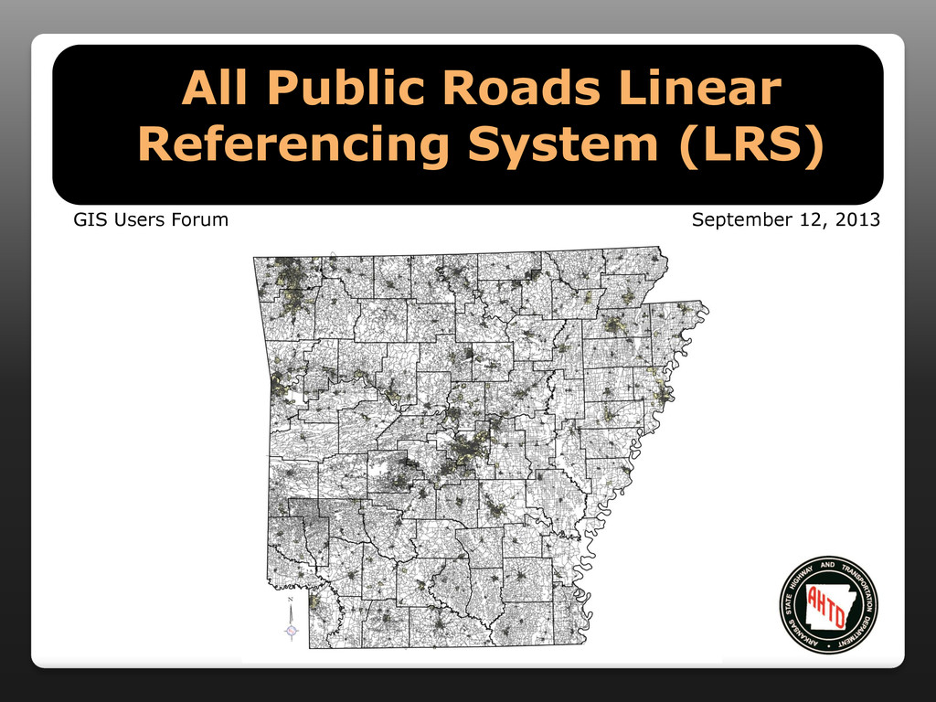
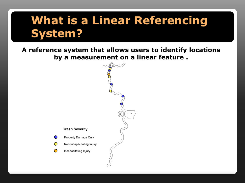
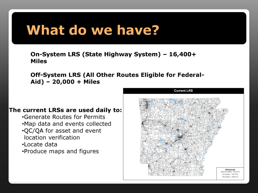
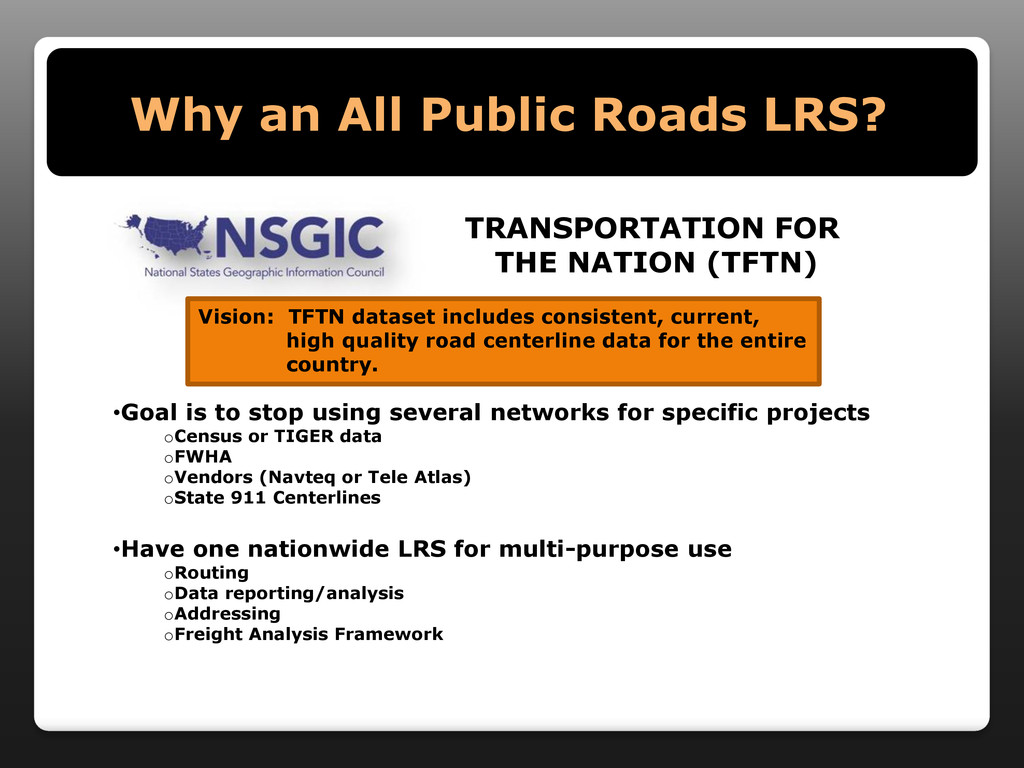
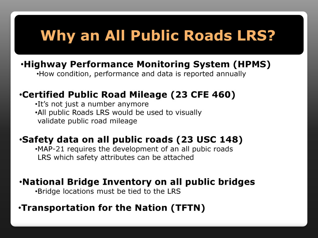
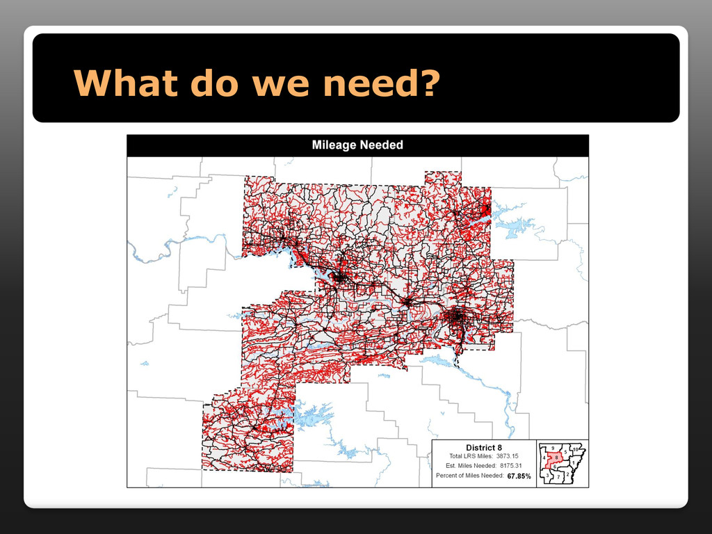
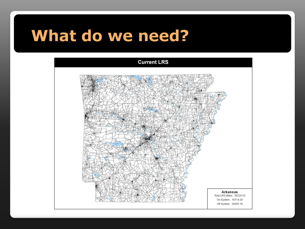
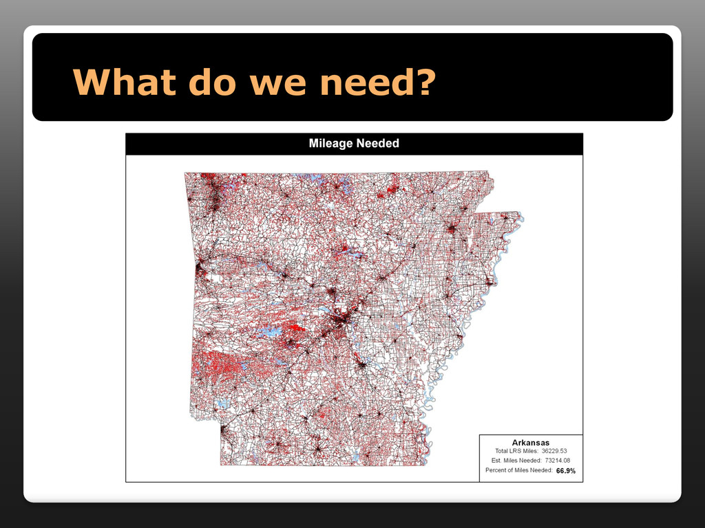
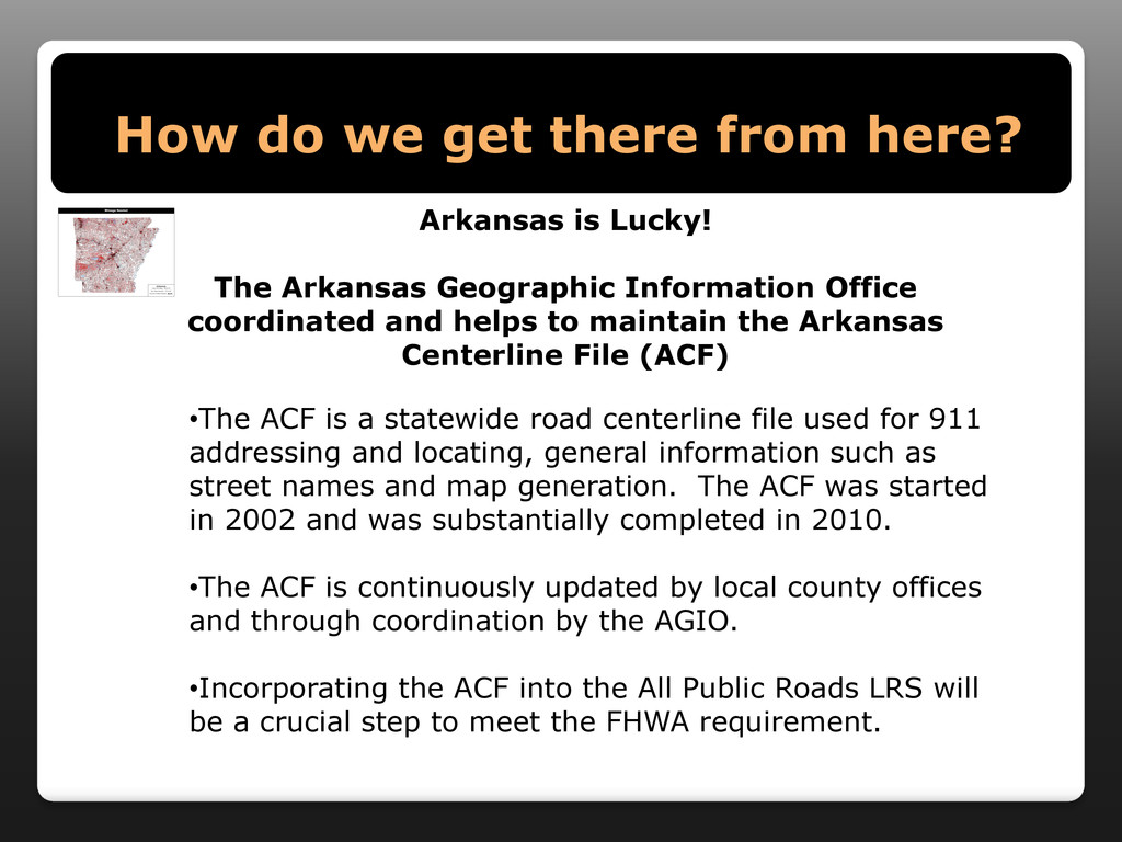
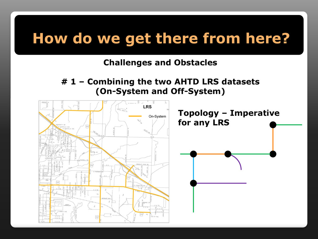
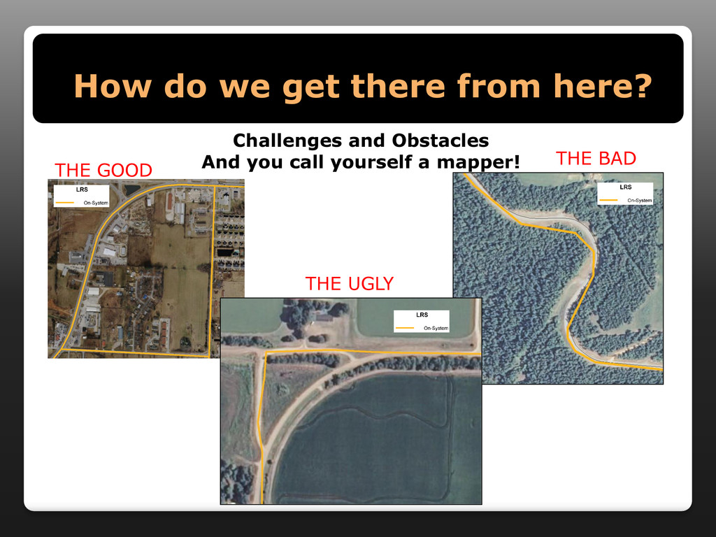
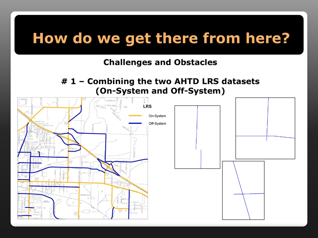
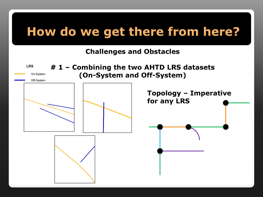
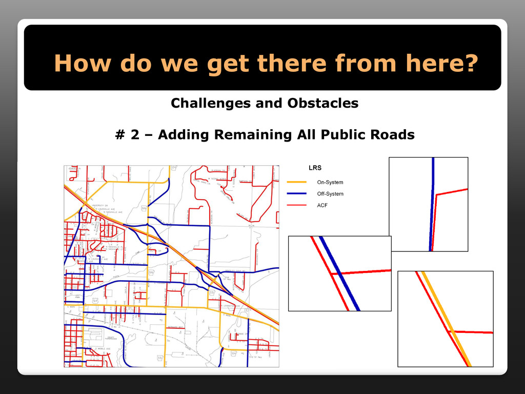
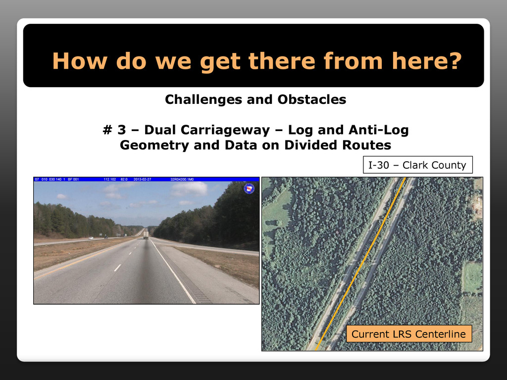
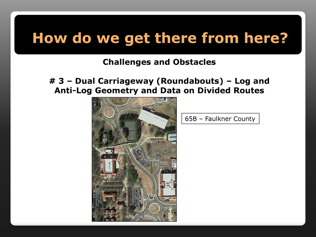
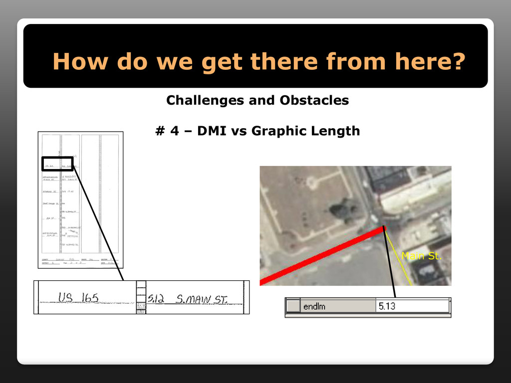
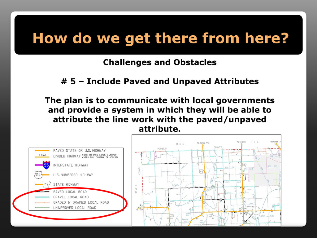
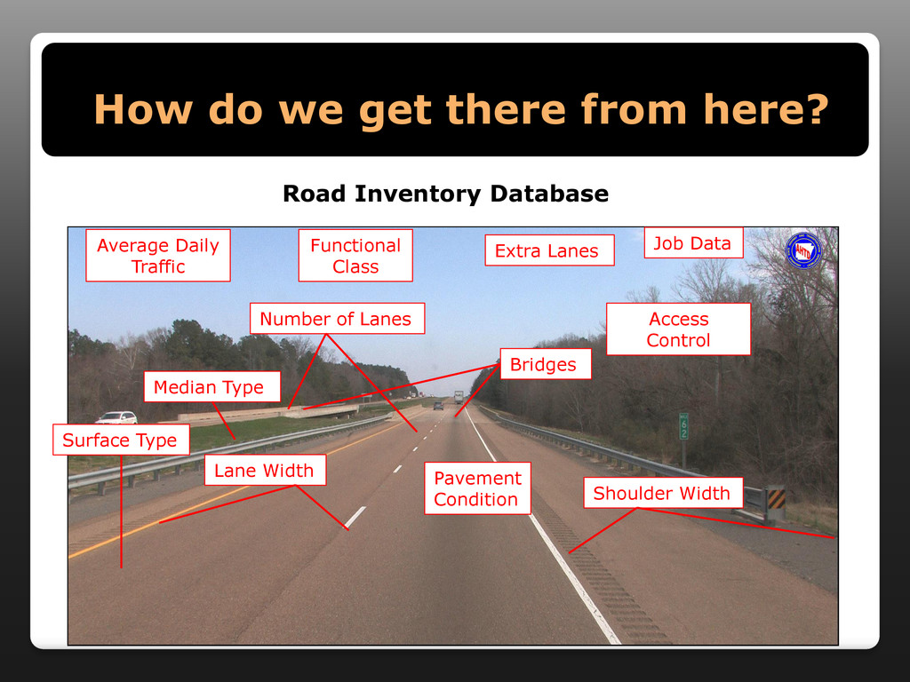
All State Transportation Departments are now required to have a Linear Referencing System (LRS) network for all public roads in their respective state. This presentation will explain the new requirement from the Federal Highway Administration (FHWA), discuss the work already accomplished on the LRS, the challenges and obstacles to meet the requirement and our plans to work closely with the Arkansas Geographic Information Office, other state agencies, counties and cities to complete the requirement. In addition, this presentation will highlight how an All Public Roads LRS will be useful at the national, state, county, city and community levels.

More Decks by Arkansas GIS Users Forum Conference

Other Decks in Technology

Transcript

  1. What is a Linear Referencing System? A reference system that

    allows users to identify locations by a measurement on a linear feature . Begin Log Mile: 0.0 End Log Mile: 18.88 County Number: 58 Route: 7 Section: 16
  2. What is a Linear Referencing System? A reference system that

    allows users to identify locations by a measurement on a linear feature .
  3. What is a Linear Referencing System? A reference system that

    allows users to identify locations by a measurement on a linear feature .
  4. What is a Linear Referencing System? A reference system that

    allows users to identify locations by a measurement on a linear feature .
  5. What is a Linear Referencing System? A reference system that

    allows users to identify locations by a measurement on a linear feature .
  6. What do we have? On-System LRS (State Highway System) –

    16,400+ Miles Off-System LRS (All Other Routes Eligible for Federal- Aid) – 20,000 + Miles The current LRSs are used daily to: •Generate Routes for Permits •Map data and events collected •QC/QA for asset and event location verification •Locate data •Produce maps and figures
  7. Why an All Public Roads LRS? August 7, 2012, Memorandum

    •Joint memo from Federal Highway Administration (FHWA) Offices •Office of Highway Policy Information •Office of Planning •Beginning June 15, 2014 States must: •Include ALL PUBLIC ROADS in LRS networks •Use DUAL CARRIAGEWAY representation for divided routes Initial Reaction
  8. Why an All Public Roads LRS? TRANSPORTATION FOR THE NATION

    (TFTN) Vision: TFTN dataset includes consistent, current, high quality road centerline data for the entire country. •Goal is to stop using several networks for specific projects oCensus or TIGER data oFWHA oVendors (Navteq or Tele Atlas) oState 911 Centerlines •Have one nationwide LRS for multi-purpose use oRouting oData reporting/analysis oAddressing oFreight Analysis Framework
  9. Why an All Public Roads LRS? •Certified Public Road Mileage

    (23 CFE 460) •It’s not just a number anymore •All public Roads LRS would be used to visually validate public road mileage •Safety data on all public roads (23 USC 148) •MAP-21 requires the development of an all pubic roads LRS which safety attributes can be attached •National Bridge Inventory on all public bridges •Bridge locations must be tied to the LRS •Transportation for the Nation (TFTN) •Highway Performance Monitoring System (HPMS) •How condition, performance and data is reported annually
  10. How do we get there from here? Planning and Research

    Division at the AHTD developed a LRS Team to raise awareness of the new requirement, discuss what each representative would need from an all public roads LRS and to develop a plan for including all public roads in the current LRS. Representatives from the following are on the Team: •FHWA (Advisory role) •Arkansas Geographic Information Office •Pulaski County Assessor’s Office •State Aid Division •Bridge Division •Heavy Bridge Maintenance •Maintenance Division •Computer Services Division •Programs and Contracts Division •Planning and Research Division
  11. How do we get there from here? Arkansas is Lucky!

    The Arkansas Geographic Information Office coordinated and helps to maintain the Arkansas Centerline File (ACF) •The ACF is a statewide road centerline file used for 911 addressing and locating, general information such as street names and map generation. The ACF was started in 2002 and was substantially completed in 2010. •The ACF is continuously updated by local county offices and through coordination by the AGIO. •Incorporating the ACF into the All Public Roads LRS will be a crucial step to meet the FHWA requirement.
  12. How do we get there from here? Challenges and Obstacles

    # 1 – Combining the two AHTD LRS datasets (On-System and Off-System) Topology – Imperative for any LRS
  13. How do we get there from here? Challenges and Obstacles

    And you call yourself a mapper! THE GOOD THE BAD THE UGLY
  14. How do we get there from here? Challenges and Obstacles

    # 1 – Combining the two AHTD LRS datasets (On-System and Off-System)
  15. How do we get there from here? Challenges and Obstacles

    # 1 – Combining the two AHTD LRS datasets (On-System and Off-System) Topology – Imperative for any LRS
  16. How do we get there from here? Challenges and Obstacles

    # 2 – Adding Remaining All Public Roads
  17. How do we get there from here? Challenges and Obstacles

    # 3 – Dual Carriageway – Log and Anti-Log Geometry and Data on Divided Routes I-30 – Clark County Current LRS Centerline
  18. How do we get there from here? Challenges and Obstacles

    # 3 – Dual Carriageway (Roundabouts) – Log and Anti-Log Geometry and Data on Divided Routes 65B – Faulkner County
  19. How do we get there from here? Challenges and Obstacles

    # 3 – Dual Carriageway (City Streets/County Roads) Log and Anti-Log Geometry and Data on Divided Routes Bentley Blvd. – Pulaski County
  20. How do we get there from here? Challenges and Obstacles

    # 4 – Distance Measurement Instrument (DMI) vs Graphic Length Hwy. 256 Section 3 Lonoke County
  21. How do we get there from here? Challenges and Obstacles

    # 4 – DMI vs Graphic Length Webb Rd.
  22. How do we get there from here? Challenges and Obstacles

    # 4 – DMI vs Graphic Length Highline Rd.
  23. How do we get there from here? Challenges and Obstacles

    # 4 – DMI vs Graphic Length Main St.
  24. How do we get there from here? Challenges and Obstacles

    # 5 – Include Paved and Unpaved Attributes The plan is to communicate with local governments and provide a system in which they will be able to attribute the line work with the paved/unpaved attribute.
  25. How do we get there from here? Challenges and Obstacles

    # 6 – The Data Behind the Lines DON’T FORGET THE DATA!
  26. How do we get there from here? Bridges Pavement Condition

    Average Daily Traffic Functional Class Extra Lanes Job Data Shoulder Width Surface Type Median Type Number of Lanes Lane Width Access Control Road Inventory Database
  27. How do we get there from here? Challenges and Obstacles

    # 6 – The Data Behind the Lines DON’T FORGET THE DATA! The Road Inventory Database will have to keep up with all the changes and additions for proper HPMS submittal and continuous reference/analysis purposes. The LRS will included addressing attributes! These processes will prove to be the most complex of all the tasks in the development of an All Public Roads LRS
  28. How do we get there from here? Challenges and Obstacles

    # 8 – The Tools Software (Intergraph, ESRI, SQL Server) Aerial Photography – Availability/Resolution Platform for other source attribution Waiting on specific guidelines from FHWA
  29. How do we get there from here? Challenges and Obstacles

    # 9 – Training and Implementation All assets at the AHTD have to tie to the LRS Unify our separate data kingdoms Will improve workflow
  30. More Info: • 30% of the States have an All

    Public Roads LRS in place. •Ohio DOT and Mississippi DOT have shared their data and methodology with us so we can see what they did to implement their All Public Roads LRS. • All surrounding states will be contacted to develop a plan for “edge matching” at State borders with LRS line work. •AHTD and AGIO will work closely together to ensure that the all public roads LRS will reduce duplication of effort and promote partnerships with State and local governments in Arkansas. •Arkansas has been asked to be a member of the FHWA All Public Road Geospatial Representation Study.